Riverside Docklands

Settlement in Lancashire Preston

England

Riverside Docklands

The River Ribble northwest of Nabsack Planting
The River Ribble northwest of Nabsack Planting Credit: Colin Park

Riverside Docklands is a vibrant and scenic area located in Lancashire, England. Situated on the banks of the River Lune, it offers a picturesque setting with stunning views of the water and surrounding countryside. The area is renowned for its rich history, as it was once a bustling commercial dock during the heyday of the British industrial revolution.

Today, Riverside Docklands has transformed into a popular tourist destination, attracting visitors from near and far. The area is home to a variety of attractions and amenities, making it an ideal spot for both leisure and recreation. The docklands feature a charming marina, where visitors can witness a myriad of boats and yachts sailing along the river. It offers a lovely atmosphere for an evening stroll or a picnic by the water's edge.

In addition to its natural beauty, Riverside Docklands boasts several historic landmarks and cultural sites. One of the notable attractions is the Maritime Museum, which showcases the area's maritime heritage through interactive exhibits and displays. Visitors can learn about the dock's significant role in Lancashire's trading history and explore the stories of the people who worked there.

The area also offers a range of dining options, from traditional pubs serving local cuisine to trendy cafes and restaurants. Visitors can indulge in delicious food while enjoying the panoramic views of the river. Additionally, Riverside Docklands is a popular spot for outdoor activities such as fishing, boating, and cycling, with several designated paths and trails available.

Overall, Riverside Docklands is a captivating destination that combines natural beauty, history, and recreational opportunities. Its idyllic setting and diverse attractions make it a must-visit location for anyone exploring Lancashire.

If you have any feedback on the listing, please let us know in the comments section below.

Riverside Docklands Images

Images are sourced within 2km of 53.755046/-2.7446338 or Grid Reference SD5129. Thanks to Geograph Open Source API. All images are credited.

The River Ribble northwest of Nabsack Planting
Marsh Farm from Howick Cross Lane
Track through wasteland south of Riversway Motor Park
Riversway heading towards Preston
By The River Ribble The two sets of power lines are very much part of the landscape here. Viewed on a bright mid-February morning.
By The River Ribble
The two sets of power lines are very much part of the landscape here. Viewed on a bright mid-February morning.
Riverside View Looking upstream from the Ribble Way on the Penwortham side towards the old dock at Preston.
Riverside View
Looking upstream from the Ribble Way on the Penwortham side towards the old dock at Preston.
Beside The Pylons Viewed at a junction of paths right beside one of the power lines that are such a prominent feature of the landscape here.
Beside The Pylons
Viewed at a junction of paths right beside one of the power lines that are such a prominent feature of the landscape here.
Mill Brook Enters The Ribble Viewed from the Ribble Way.
Mill Brook Enters The Ribble
Viewed from the Ribble Way.
The River Ribble Viewed from the Ribble Way where a double power line crosses the river. The power lines are a prominent feature of the landscape here.
The River Ribble
Viewed from the Ribble Way where a double power line crosses the river. The power lines are a prominent feature of the landscape here.
Ribble Shore The northern shore of the River Ribble, approximately 1000 yards downstream of Preston Docks.
Ribble Shore
The northern shore of the River Ribble, approximately 1000 yards downstream of Preston Docks.
Pig & Whistle Public House
Garden Centre Car Park Car Park for a large shop near Preston
Garden Centre Car Park
Car Park for a large shop near Preston
Lea Community Primary School
Waste Land, Meadows, Industrial Buildings and Power Cables! A difficult grid square to pick a representative image of, it includes old buildings from the Preston Dockside railway, waste ground and river meadows. The River Ribble flows behind the buildings to the left. Out of shot to the right is a modern 'Car retail' development.

Probably the only noticeable characteristic of this square is the plethora of power cables and pylons, feeding power from a major power substation near Penwortham to the South Fylde.
Waste Land, Meadows, Industrial Buildings and Power Cables!
A difficult grid square to pick a representative image of, it includes old buildings from the Preston Dockside railway, waste ground and river meadows. The River Ribble flows behind the buildings to the left. Out of shot to the right is a modern 'Car retail' development. Probably the only noticeable characteristic of this square is the plethora of power cables and pylons, feeding power from a major power substation near Penwortham to the South Fylde.
Drinking Water Fountain, Haslam Park, Ashton This fountain was gifted to the park in 1911 - it's no longer in use as a drinking fountain.  Haslam Park covers this square and SD5131. (See <a href="https://www.geograph.org.uk/gridref/SD5131">SD5131</a> for a 21st century sculpture).
Drinking Water Fountain, Haslam Park, Ashton
This fountain was gifted to the park in 1911 - it's no longer in use as a drinking fountain. Haslam Park covers this square and SD5131. (See SD5131 for a 21st century sculpture).
Ashton Community Science College, Preston Complete with wind powered generator.
Ashton Community Science College, Preston
Complete with wind powered generator.
Road & public footpath to the Ribble
A583 looking west
A583 looking west
Show me another place!

Riverside Docklands is located at Grid Ref: SD5129 (Lat: 53.755046, Lng: -2.7446338)

Administrative County: Lancashire

District: Preston

Police Authority: Lancashire

What 3 Words

///slam.acid.hardly. Near Preston, Lancashire

Related Wikis

Penwortham Priory Academy

Penwortham Priory Academy is a coeducational secondary school located in Penwortham in the English county of Lancashire.Previously a community school administered...

Preston Riverside railway station

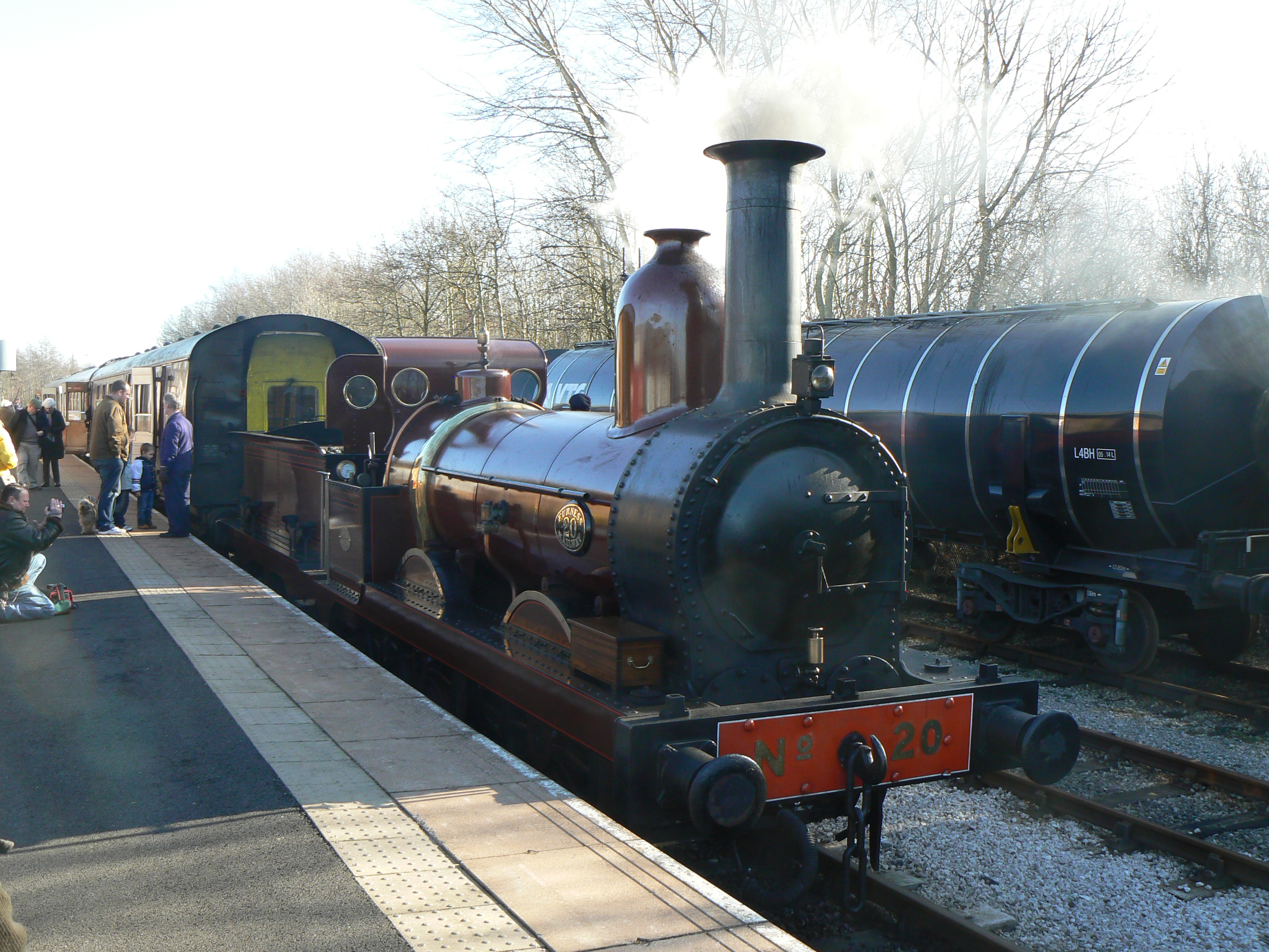
Preston Riverside railway station is the only station on the heritage Ribble Steam Railway, in Riversway, Preston, Lancashire, England. It was built and...

Furness Railway Trust

The Furness Railway Trust is a heritage railway preservation organisation many of whose properties were originally owned by the Furness Railway. It is...

Ribble Steam Railway

The Ribble Steam Railway is a standard gauge preserved railway in Lancashire, in the United Kingdom. It was opened to the public on 17 September 2005...

Preston Dock

Preston Dock (also known as Preston Docklands) was a former maritime dock located on the northern bank of the River Ribble approximately 2.5 km (1.6 mi...

Riversway

Riversway was an electoral ward in Preston, Lancashire, England. The ward was named for its location close to the River Ribble, and the historical links...

Ribble Power Station

Ribble Power Station was a coal-fired electricity generating station on the River Ribble in Penwortham near Preston, Lancashire, England. The station was...

Penwortham Priory

Penwortham Priory was first a Benedictine priory and, after the Dissolution of the Monasteries, a country house in the village of Penwortham, near Preston...

Nearby Amenities

Located within 500m of 53.755046,-2.7446338
Source: PGS
Lat/Long: 53.7579945/-2.750014
Source: PGS
Lat/Long: 53.7580818/-2.7485487
Source: PGS
Lat/Long: 53.757725/-2.7390936
Source: PGS
Lat/Long: 53.7576957/-2.740262
Created By: almien_coastlines
Source: PGS
Lat/Long: 53.7575989/-2.7436628
Source: PGS
Lat/Long: 53.7574733/-2.7454158
Source: PGS
Lat/Long: 53.7574176/-2.7464208
Created By: almien_coastlines
Source: PGS
Lat/Long: 53.7573359/-2.7488518
Created By: almien_coastlines
Source: PGS
Lat/Long: 53.7572829/-2.7497555
Source: PGS
Lat/Long: 53.7572069/-2.7507577
Bus Stop
Public Transport: platform
Lat/Long: 53.7587529/-2.7425904
Crossing Activation: remote
Crossing Barrier: double_half
Crossing Bell: yes
Crossing Light: yes
Mapillary: 607692236816715
Railway: level_crossing
Source: survey
Supervised: yes
Lat/Long: 53.7589885/-2.7434922
Railway: buffer_stop
Lat/Long: 53.7585408/-2.742378
Railway: switch
Lat/Long: 53.7585706/-2.74159
Power: tower
Source: Bing
Lat/Long: 53.7570654/-2.7482236
Power: tower
Source: Bing
Lat/Long: 53.757243/-2.7451551
Power: tower
Source: Bing
Lat/Long: 53.7544139/-2.7490497
Power: tower
Source: Bing
Lat/Long: 53.7565389/-2.7471292
Power: tower
Source: Bing
Lat/Long: 53.7565643/-2.7497578
Power: tower
Source: Bing
Lat/Long: 53.7568243/-2.7473545
Power: tower
Source: Bing
Lat/Long: 53.7570527/-2.7435243
Power: tower
Source: Bing
Lat/Long: 53.7574206/-2.7415824
Power: tower
Source: Bing
Lat/Long: 53.7570083/-2.7403164
Power: tower
Source: Bing
Lat/Long: 53.7545164/-2.7495062
Power: tower
Source: Bing
Lat/Long: 53.7566594/-2.7457237
Entrance: yes
Lat/Long: 53.7594034/-2.7439707
Dock Control
Location: indoor
Operator: Electricity North West
Power: substation
Ref: 417046
Substation: minor_distribution
Lat/Long: 53.759439/-2.7438573
Barrier: lift_gate
Foot: no
Lift Gate Type: double
Lat/Long: 53.7592019/-2.7438126
The data included in this document is from www.openstreetmap.org. The data is made available under ODbL.

Have you been to Riverside Docklands?

Leave your review of Riverside Docklands below (or comments, questions and feedback).