River Bank

Settlement in Cambridgeshire East Cambridgeshire

England

River Bank

The Five Miles Inn at Upware Although there was a public house in Upware until around 1950, this is a completely new late 20th century development. It is largely dependent on motorised visitors, although it does also cater for passing pedestrian and boating traffic. The old pub, the Lord Nelson, was popularly known as 'Five Miles from Anywhere: No Hurry' and this phrase is still used to advertise the modern establishment.
The Five Miles Inn at Upware Credit: Alan Murray-Rust

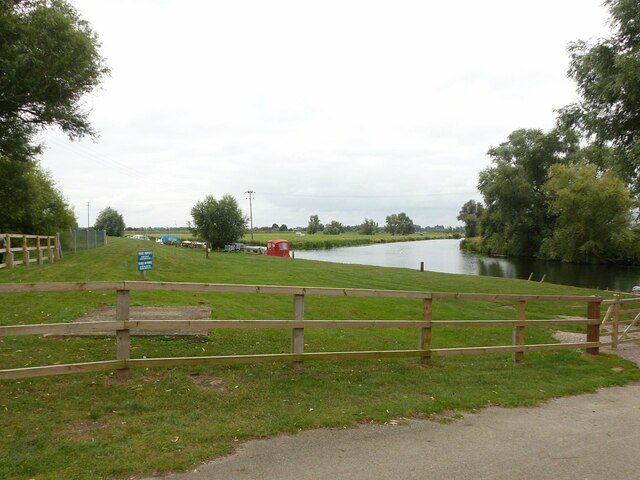
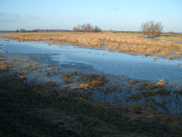
River Bank is a picturesque village located in Cambridgeshire, England. Situated along the banks of the River Great Ouse, the village is known for its stunning views of the river and surrounding countryside. The village is home to a close-knit community of residents who enjoy the peaceful and idyllic setting of River Bank.

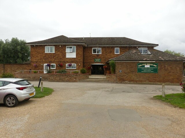
In addition to its natural beauty, River Bank also offers a range of amenities for residents and visitors. The village has a local pub, shops, and restaurants, providing convenient options for dining and entertainment. River Bank is also well-connected to nearby towns and cities, with easy access to major roadways and public transportation.

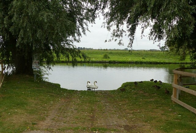
Outdoor enthusiasts will appreciate the opportunities for exploring the surrounding area, with walking and cycling paths along the river and through the countryside. The village is also a popular spot for fishing and boating, with the tranquil waters of the River Great Ouse providing a peaceful setting for outdoor activities.

Overall, River Bank offers a charming and peaceful retreat for those looking to escape the hustle and bustle of city life and immerse themselves in the natural beauty of the Cambridgeshire countryside.

If you have any feedback on the listing, please let us know in the comments section below.
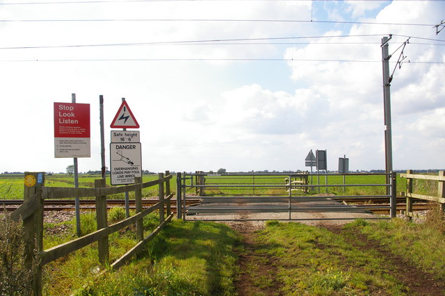
River Bank Images

Images are sourced within 2km of 52.297085/0.244935 or Grid Reference TL5368. Thanks to Geograph Open Source API. All images are credited.

The Five Miles Inn at Upware Although there was a public house in Upware until around 1950, this is a completely new late 20th century development. It is largely dependent on motorised visitors, although it does also cater for passing pedestrian and boating traffic. The old pub, the Lord Nelson, was popularly known as 'Five Miles from Anywhere: No Hurry' and this phrase is still used to advertise the modern establishment.
The Five Miles Inn at Upware
Although there was a public house in Upware until around 1950, this is a completely new late 20th century development. It is largely dependent on motorised visitors, although it does also cater for passing pedestrian and boating traffic. The old pub, the Lord Nelson, was popularly known as 'Five Miles from Anywhere: No Hurry' and this phrase is still used to advertise the modern establishment.
The River Cam at Upware Reach Lode branches to the left.
The River Cam at Upware
Reach Lode branches to the left.
Slipway at Upware There was a ferry here until around 1960.
Slipway at Upware
There was a ferry here until around 1960.
Palatial Potton house in Upware A very comprehensive blog covering the construction of this impressive house can be found here >> <span class="nowrap"><a title="http://upware.house/" rel="nofollow ugc noopener" href="http://upware.house/">Link</a><img style="margin-left:2px;" alt="External link" title="External link - shift click to open in new window" src="https://s1.geograph.org.uk/img/external.png" width="10" height="10"/></span>
Palatial Potton house in Upware
A very comprehensive blog covering the construction of this impressive house can be found here >> LinkExternal link
Houses on Upware Road
Tin Roof Cottages Unusual Tin Roof cottages in Upware.
Tin Roof Cottages
Unusual Tin Roof cottages in Upware.
River Cam at Upware
River Cam at Upware
River Cam, Upware The decking provides a mooring for pleasure craft outside the Five Miles Inn (as in five miles from anywhere) at this remote fenland village.
River Cam, Upware
The decking provides a mooring for pleasure craft outside the Five Miles Inn (as in five miles from anywhere) at this remote fenland village.
River Cam, Upware A boat arrives at the mooring outside the Five Miles Inn at Upware in light rain on a day not conducive to pleasure boating.
River Cam, Upware
A boat arrives at the mooring outside the Five Miles Inn at Upware in light rain on a day not conducive to pleasure boating.
Towards the end of Long Drove, Waterbeach Long Drove runs northwards for three miles from Bottisham Lock.  At the end, it degenerates into this farm track.
Towards the end of Long Drove, Waterbeach
Long Drove runs northwards for three miles from Bottisham Lock. At the end, it degenerates into this farm track.
Adams's level crossing This is a user-worked crossing on a farm road (and public footpath) across the Cambridge-to-Ely railway line.
Adams's level crossing
This is a user-worked crossing on a farm road (and public footpath) across the Cambridge-to-Ely railway line.
Northfen Farm? According to my map, there should be some buildings called "Northfen Farm" here, but all that seem to be left are these weedy depressions in a wheat field.
Northfen Farm?
According to my map, there should be some buildings called "Northfen Farm" here, but all that seem to be left are these weedy depressions in a wheat field.
The Cam at Upware Looking along the River Cam towards Ely - visible in the distance.  Upware is just in front of the wing.  In the foreground is Ducketts Farm and a small flooded area - popular with wildfowl in the winter.  The Cambridge-Ely railway line is visible on the upper left of the photo.  The dark nature of the fenland soil is apparent where last year's crops have been ploughed in.
The Cam at Upware
Looking along the River Cam towards Ely - visible in the distance. Upware is just in front of the wing. In the foreground is Ducketts Farm and a small flooded area - popular with wildfowl in the winter. The Cambridge-Ely railway line is visible on the upper left of the photo. The dark nature of the fenland soil is apparent where last year's crops have been ploughed in.
Instant Irrigation Kit Just add water!
Instant Irrigation Kit
Just add water!
Maize crop on North Fen With the railway line in the background
Maize crop on North Fen
With the railway line in the background
The Five Miles, Upware Its full name is "The Five Miles from Anywhere No Hurry" - who could resist a visit to a pub with a name like that? As long as you aren't in a hurry - although the service was not as laid back as the name threatens.
The Five Miles, Upware
Its full name is "The Five Miles from Anywhere No Hurry" - who could resist a visit to a pub with a name like that? As long as you aren't in a hurry - although the service was not as laid back as the name threatens.
The River Cam at Upware View from the riverside garden of <a href="https://www.geograph.org.uk/photo/1461733">TL5370 : The Five Miles, Upware</a>
The River Cam at Upware
View from the riverside garden of TL5370 : The Five Miles, Upware
The old Burwell Engine house at Upware Former pumping station for the Burwell Fen, originally housing a steam beam engine with scoop wheel on the near side of building (note the different colour of the brickwork). It seems that the engine became redundant around the 1940s when the drainage of the area was consolidated into the Swaffham Internal Drainage Board, which has a small electrically driven pumping station on the opposite side of the road. The building has been converted for residential use.
The old Burwell Engine house at Upware
Former pumping station for the Burwell Fen, originally housing a steam beam engine with scoop wheel on the near side of building (note the different colour of the brickwork). It seems that the engine became redundant around the 1940s when the drainage of the area was consolidated into the Swaffham Internal Drainage Board, which has a small electrically driven pumping station on the opposite side of the road. The building has been converted for residential use.
Show me another place!

River Bank is located at Grid Ref: TL5368 (Lat: 52.297085, Lng: 0.244935)

Administrative County: Cambridgeshire

District: East Cambridgeshire

Police Authority: Cambridgeshire

What 3 Words

///untruth.palm.gliders. Near Waterbeach, Cambridgeshire

Nearby Locations

River Bank

Related Wikis

Upware

Upware is a village in Wicken civil parish, part of East Cambridgeshire, England, lying on the east bank of the River Cam. == History == Situated in the...

Upware South Pit

Upware South Pit is a 1.1-hectare (2.7-acre) geological Site of Special Scientific Interest (SSSI) north of Upware in Cambridgeshire. It is a Geological...

Cam Washes

Cam Washes is a 166.5-hectare (411-acre) biological Site of Special Scientific Interest west of Wicken in Cambridgeshire.This site on the banks of the...

Wicken Fen

Wicken Fen is a 254.5-hectare (629-acre) biological Site of Special Scientific Interest west of Wicken in Cambridgeshire. It is also a National Nature...

Nearby Amenities

Located within 500m of 52.297085,0.244935
Man Made: mast
Lat/Long: 52.2971363/0.2435581
Power: pole
Lat/Long: 52.2955148/0.2444031
Power: pole
Lat/Long: 52.2936512/0.2457469
Power: pole
Lat/Long: 52.294962/0.2447518
Power: pole
Lat/Long: 52.2944026/0.2451621
Power: pole
Lat/Long: 52.2930033/0.2461598
The data included in this document is from www.openstreetmap.org. The data is made available under ODbL.

Have you been to River Bank?

Leave your review of River Bank below (or comments, questions and feedback).