Blackdown

Settlement in Dorset

England

Blackdown

Cuckoo Lane, approaching Chaffeigh Farm
Cuckoo Lane, approaching Chaffeigh Farm Credit: Vieve Forward

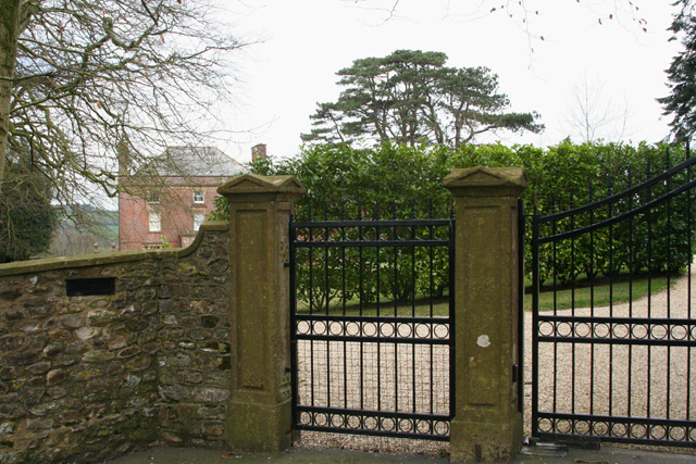
Blackdown is a small village located in the county of Dorset, England. Situated near the A30 road, it lies approximately 3 miles northeast of the town of Crewkerne and about 12 miles southwest of Yeovil. The village is nestled in a rural setting, surrounded by picturesque countryside and rolling hills, providing residents and visitors with a tranquil and scenic environment.

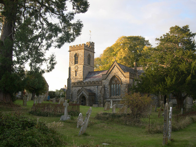
The village itself is characterized by its quaint and charming atmosphere, with a small number of houses and cottages scattered around a central green. Blackdown boasts a close-knit community, where locals often gather for social events and activities. The village also features a historic church, St. Martin's, which dates back to the 13th century and adds to the historical charm of the area.

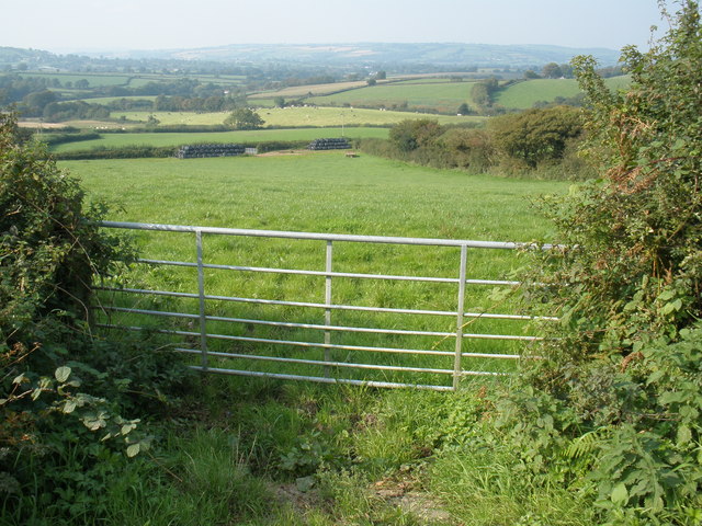
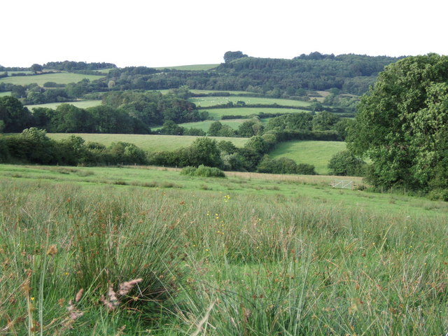
Nature-lovers are drawn to Blackdown due to its proximity to the Blackdown Hills, an Area of Outstanding Natural Beauty. This allows for excellent opportunities for hiking and exploring the surrounding countryside, with various trails and footpaths available for visitors to enjoy.

Although Blackdown is primarily a residential area, there are a few amenities available to its residents, such as a village hall and a local pub. For a wider range of services and amenities, residents can easily access nearby towns and villages, including Crewkerne and Yeovil.

Overall, Blackdown offers a peaceful and idyllic countryside living experience, making it a desirable place for those seeking a slower pace of life and a close connection with nature.

If you have any feedback on the listing, please let us know in the comments section below.

Blackdown Images

Images are sourced within 2km of 50.822596/-2.8572509 or Grid Reference ST3902. Thanks to Geograph Open Source API. All images are credited.

Cuckoo Lane, approaching Chaffeigh Farm
Specket Cottage, Specket Lane
Lowdown Farm
Lowdown Farm
Rusty David Brown tractors, Lowdown Farm
Rusty tractor, Lowdown Farm
The Jubilee Trail above Lowdown Farm The trail is extremely boggy here, especially through the fern forest beyond the gate, where your feet are likely to sink ankle-deep in soggy soil even in midsummer.
The Jubilee Trail above Lowdown Farm
The trail is extremely boggy here, especially through the fern forest beyond the gate, where your feet are likely to sink ankle-deep in soggy soil even in midsummer.
Jubilee Trail crossing Temple Brook near Temple Farm
The Jubilee Trail near Cole's Cross The sign advises that you take the road, as the trail from here to Specket Cottage crosses several springs or brooks and is indeed boggy in places.
The Jubilee Trail near Cole's Cross
The sign advises that you take the road, as the trail from here to Specket Cottage crosses several springs or brooks and is indeed boggy in places.
Lower Synderford Farm
Footpath and stile, Stony Knaps
Primrose Cottage from Blackdown Hill
Holy Trinity Church, Blackdown, Dorset
Blackdown 'Hut' Blackdown village hall, generally known as Blackdown hut.
Blackdown 'Hut'
Blackdown village hall, generally known as Blackdown hut.
Thorncombe: Laymore Farmhouse Now a private house. By the roads from Winsham to Drimpton and to Birdsmoorgate. Looking north-north-west
Thorncombe: Laymore Farmhouse
Now a private house. By the roads from Winsham to Drimpton and to Birdsmoorgate. Looking north-north-west
Cottages near Stony Knaps The Thatch Cottage is nearest camera.
Cottages near Stony Knaps
The Thatch Cottage is nearest camera.
Thorncombe: Kittwhistle Kittwhistle Cottage stands in the fork between the B3165 Crewkerne – Marshwood road and the turning to Childhay
Thorncombe: Kittwhistle
Kittwhistle Cottage stands in the fork between the B3165 Crewkerne – Marshwood road and the turning to Childhay
Blackdown: The Triangle On Blackdown Hill. The main road is the B3165 Crewkerne to Marshwood route.
Blackdown: The Triangle
On Blackdown Hill. The main road is the B3165 Crewkerne to Marshwood route.
Thorncombe: Racedown By the entrance to the estate: Looking north west from the B3165 Crewkerne – Marshwood road
Thorncombe: Racedown
By the entrance to the estate: Looking north west from the B3165 Crewkerne – Marshwood road
Show me another place!

Blackdown is located at Grid Ref: ST3902 (Lat: 50.822596, Lng: -2.8572509)

Unitary Authority: Dorset

Police Authority: Dorset

What 3 Words

///ourselves.rejoin.tinted. Near Crewkerne, Somerset

Related Wikis

Blackdown, Dorset

Blackdown is a small village in western Dorset, England; situated 7 miles (11 km) west of Beaminster. With the creation of the new Dorset Council, Blackdown...

Holy Trinity Church, Blackdown

Holy Trinity Church is a Church of England church in Blackdown, Dorset, England. The church was designed by Edward Ledger Bracebridge and built in 1839...

Blackdown Hill, Dorset

Blackdown Hill is a prominent elevation, 215 metres (705 ft) high, 5 miles (8.0 km) south west of the town of Crewkerne, in the county of Dorset in the...

Thorncombe

Thorncombe is a village and civil parish in the English county of Dorset. It was historically, until 1844, an exclave of Devon. It lies five miles (8...

Payne's Down

Payne's Down is a prominent hill, 211 metres (692 ft) high, some 10 kilometres east-northeast of Axminster and 1 kilometre northwest of Birdsmoorgate,...

Pilsdon Pen

Pilsdon Pen is a 277-metre (909 ft) hill in Dorset in South West England, situated at the north end of the Marshwood Vale, approximately 4.5 miles (7.2...

Burstock

Burstock is a village and civil parish in west Dorset, England, 5 miles (8.0 km) south of Crewkerne. In the 2011 census the parish had 59 dwellings, 49...

Bettiscombe

Bettiscombe is a small village and civil parish in west Dorset, England, situated in the Marshwood Vale four miles (6.4 km) west of Beaminster. Dorset...

Nearby Amenities

Located within 500m of 50.822596,-2.8572509
Power: tower
Source: bing
Lat/Long: 50.8194251/-2.8528365
Power: tower
Source: bing
Lat/Long: 50.8212461/-2.850792
Blackdown
Place: hamlet
Wikidata: Q4922778
Lat/Long: 50.8241761/-2.8580458
Direction: 165
Generator Method: photovoltaic
Generator Output Electricity: yes
Generator Solar Modules: 32
Generator Source: solar
Generator Type: solar_photovoltaic_panel
Location: roof
Power: generator
Lat/Long: 50.8184071/-2.8579782
Post Box
Mapillary: 3435615216724702
Operator: Royal Mail
Operator Wikidata: Q638098
Post Box Mounting: wooden_post
Post Box Type: wall
Royal Cypher: yes
Lat/Long: 50.8240037/-2.8582443
Post Box
Mapillary: 808269586835799
Operator: Royal Mail
Operator Wikidata: Q638098
Post Box Mounting: building
Post Box Type: wall
Lat/Long: 50.818545/-2.8579166
The data included in this document is from www.openstreetmap.org. The data is made available under ODbL.

Have you been to Blackdown?

Leave your review of Blackdown below (or comments, questions and feedback).