Blackdog

Settlement in Aberdeenshire

Scotland

Blackdog

Dune coast at Millden Links The beach and dunes at Blackdog are perfect for dog walking.
Dune coast at Millden Links Credit: Bill Harrison

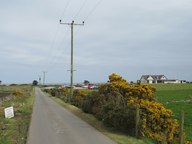
Blackdog is a small coastal village located in Aberdeenshire, Scotland. Situated approximately 12 miles north of Aberdeen, it lies on the North Sea coast, offering stunning views of the ocean. The village is situated within the parish of Belhelvie and falls under the jurisdiction of Aberdeenshire Council.

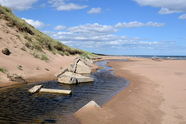
Blackdog is known for its picturesque setting, with sandy beaches and rugged cliffs that attract both locals and tourists. The coastline provides excellent opportunities for coastal walks, bird-watching, and outdoor activities such as fishing and sailing. The nearby Blackdog Woods offer serene woodland walks, adding to the natural beauty of the area.

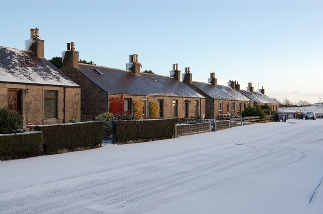
Despite its small size, Blackdog has a close-knit community with a strong sense of community spirit. The village is home to a primary school and has a local pub that serves as a gathering place for residents. There is also a small convenience store to cater to the daily needs of the locals.

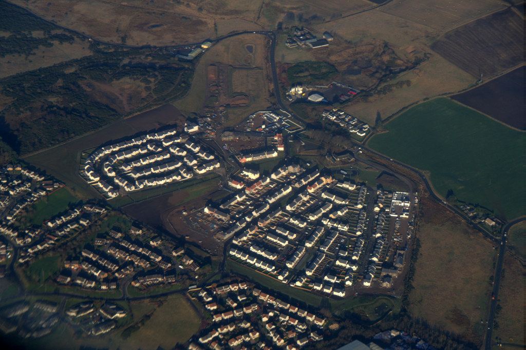
Blackdog's proximity to Aberdeen offers residents easy access to a wide range of amenities and services, including shopping centers, restaurants, and cultural attractions. The city also provides employment opportunities for those commuting from the village.

Overall, Blackdog provides a peaceful coastal retreat while still offering the convenience of nearby urban centers, making it an attractive place to live for those seeking a mix of tranquility and accessibility.

If you have any feedback on the listing, please let us know in the comments section below.

Blackdog Images

Images are sourced within 2km of 57.218877/-2.074312 or Grid Reference NJ9514. Thanks to Geograph Open Source API. All images are credited.

Dune coast at Millden Links The beach and dunes at Blackdog are perfect for dog walking.
Dune coast at Millden Links
The beach and dunes at Blackdog are perfect for dog walking.
Grassy dunes, Blackdog Rifle Range The dunes pictured are some 20 metres high.
Grassy dunes, Blackdog Rifle Range
The dunes pictured are some 20 metres high.
Waste management facility, Easter Hatton
Incoming tide, Blackdog beach
Offshore windfarm... ...as viewed from Blackdog dunes.
Offshore windfarm...
...as viewed from Blackdog dunes.
Edge of the range Boundary fence and warning signs at southern boundary of Blackdog rifle range.  Public access is allowed when the range is not in use.
Edge of the range
Boundary fence and warning signs at southern boundary of Blackdog rifle range. Public access is allowed when the range is not in use.
Blackdog Rifle Range (B Range) MOD land.  Public access allowed when range not in use.
Blackdog Rifle Range (B Range)
MOD land. Public access allowed when range not in use.
North Sea vista Blackdog rifle range and coastal dunes and in the distance part of the Aberdeen Bay offshore wind farm and oil service vessels awaiting their next voyage.
North Sea vista
Blackdog rifle range and coastal dunes and in the distance part of the Aberdeen Bay offshore wind farm and oil service vessels awaiting their next voyage.
Mill of Mundurno? Behind Premier Inn & restaurant bearing that name
Mill of Mundurno?
Behind Premier Inn & restaurant bearing that name
Premier Inn: Bridge of Don Mill of Mundurno restaurant on left
Premier Inn: Bridge of Don
Mill of Mundurno restaurant on left
Not such a black dog Black Dog rock has recently become encrusted with tiny barnacles with its true colour just showing on top of the head of the dog-shaped rock.   The prominent rock is part of the Belhelvie basic intrusion, being igneous bedrock formed between 485.4 and 443.8 million years ago during the Ordovician period.
Not such a black dog
Black Dog rock has recently become encrusted with tiny barnacles with its true colour just showing on top of the head of the dog-shaped rock. The prominent rock is part of the Belhelvie basic intrusion, being igneous bedrock formed between 485.4 and 443.8 million years ago during the Ordovician period.
Burn of Mundurno meets the sea The burn frequently changes course as it reaches the beach and it has recently cut into the adjacent sand dune and unearthed the remains of some buried tank traps.  The burn begins its journey to the sea at Corby Loch.  'Mundurno' means 'stony moor' according to Celtic Place-names in Aberdeenshire by John Milne.
Burn of Mundurno meets the sea
The burn frequently changes course as it reaches the beach and it has recently cut into the adjacent sand dune and unearthed the remains of some buried tank traps. The burn begins its journey to the sea at Corby Loch. 'Mundurno' means 'stony moor' according to Celtic Place-names in Aberdeenshire by John Milne.
Dune landscape with heather The dunes are MOD property but public access is permitted when the ranges are not in use.
Dune landscape with heather
The dunes are MOD property but public access is permitted when the ranges are not in use.
Black dog by Blackdog Burn
Murcar Links Golf Club, near Bridge of Don, Aberdeen The clubhouse at Murcar Links Golf Club, near Aberdeen on Scotland's North Sea coast.
Murcar Links Golf Club, near Bridge of Don, Aberdeen
The clubhouse at Murcar Links Golf Club, near Aberdeen on Scotland's North Sea coast.
Golf club access road near Bridge of Don, Aberdeen An access road leading to a golf club on Scotland's North Sea coast, close to Aberdeen.  The golf club's clubhouse is to the right of the image.

In the foreground, gorse bushes are flowering yellow.
Golf club access road near Bridge of Don, Aberdeen
An access road leading to a golf club on Scotland's North Sea coast, close to Aberdeen. The golf club's clubhouse is to the right of the image. In the foreground, gorse bushes are flowering yellow.
Golf club access road near Bridge of Don, Aberdeen An access driveway leading to a golf club on Balgownie Links, on Scotland's North Sea coast on the outskirts of Aberdeen.  The golf club's club house is visible to the right of the image.  In the foreground, gorse bushes are in flower along both sides of the driveway.
Golf club access road near Bridge of Don, Aberdeen
An access driveway leading to a golf club on Balgownie Links, on Scotland's North Sea coast on the outskirts of Aberdeen. The golf club's club house is visible to the right of the image. In the foreground, gorse bushes are in flower along both sides of the driveway.
Isolated house near Bridge of Don, Aberdeen An isolated house near Bridge of Don, on the northern outskirts of Aberdeen.
Isolated house near Bridge of Don, Aberdeen
An isolated house near Bridge of Don, on the northern outskirts of Aberdeen.
Show me another place!

Blackdog is located at Grid Ref: NJ9514 (Lat: 57.218877, Lng: -2.074312)

Unitary Authority: Aberdeenshire

Police Authority: North East

What 3 Words

///twee.strictest.disgraced. Near Balmedie, Aberdeenshire

Nearby Locations

Blackdog Fife Hill

Related Wikis

Blackdog

Blackdog is a hamlet approximately 2 miles north of the city limits of Aberdeen, Scotland. The nearby area serves as a shooting ground, and is used by...

Potterton

Potterton is a village north of Aberdeen, Scotland, in Aberdeenshire, west of Balmedie. Population in 1991 was 1159, falling by 2001 to 886. == References ==

Murcar Links Golf Club

Murcar Links Golf Club is a golf club in northern Aberdeen, Scotland, to the north of the Royal Aberdeen Golf Club. The 18-hole, par 71, 6,516 yard course...

Dubford, Aberdeen

Dubford is a housing estate of approximately 550 homes, north of Denmore within the Bridge of Don suburb in the north of Aberdeen, Scotland. Dubford takes...

Hermes F.C.

Hermes Junior Football Club are a Scottish football club from Bridge of Don, an area of the city of Aberdeen. Founded in 1968 by pupils of Robert Gordon...

Hall Russell United F.C.

Hall Russell United Football Club are a Scottish football club based in Bridge of Don, a suburb of Aberdeen. Members of the Scottish Junior Football Association...

Scotstown Moor

Scotstown Moor is in the north of Aberdeen, Scotland. Scotstown Moor Local Nature Reserve (LNR) is located four miles to the north of Aberdeen City Centre...

Belhelvie

Belhelvie (Scottish Gaelic: Baile Shealbhaigh) is a small village and civil parish in Aberdeenshire in Scotland. The parish has a population of 3,802...

Nearby Amenities

Located within 500m of 57.218877,-2.074312
Traffic Calming: table
Lat/Long: 57.2175681/-2.0725911
Noexit: yes
Lat/Long: 57.2186372/-2.0739342
Motorway Junction
Blackdog Junction
Proposed Highway: motorway_junction
Lat/Long: 57.2194071/-2.0752796
Blackdog
Place: village
Wikidata: Q4922772
Wikipedia: en:Blackdog
Lat/Long: 57.2200983/-2.0689954
Traffic Calming: table
Lat/Long: 57.218544/-2.0738318
Crossing
Crossing: traffic_signals
Tactile Paving: yes
Lat/Long: 57.223299/-2.0733413
Bus Stop
Roundabout
Bench: yes
Bin: no
Bus: yes
Lit: yes
Naptan AtcoCode: 630032312
Naptan Bearing: S
Naptan CommonName: Roundabout
Naptan Indicator: at
Naptan NaptanCode: 23626794
Naptan Street: A92
Naptan Verified: no
Public Transport: platform
Shelter: yes
Source: naptan;bing;naptan_compare_tool
Tactile Paving: no
Lat/Long: 57.2224355/-2.0736754
Bus Stop
Roundabout
Bench: yes
Bus: yes
Naptan AtcoCode: 630032311
Naptan Bearing: N
Naptan CommonName: Roundabout
Naptan Indicator: opp
Naptan NaptanCode: 23626793
Naptan Street: A92
Naptan Verified: no
Public Transport: platform
Shelter: yes
Source: naptan;bing;naptan_compare_tool
Lat/Long: 57.2228954/-2.0747871
Traffic Calming: chicane
Lat/Long: 57.2176192/-2.0686209
Crossing
Crossing: unmarked
Crossing Island: no
Crossing Markings: no
Tactile Paving: yes
Lat/Long: 57.2184291/-2.0684118
Crossing
Crossing: uncontrolled
Crossing Island: no
Kerb: lowered
Tactile Paving: yes
Traffic Calming: chicane
Lat/Long: 57.2181035/-2.0684298
Traffic Calming: table
Lat/Long: 57.2170626/-2.0701975
Generator Method: photovoltaic
Generator Output Electricity: yes
Generator Source: solar
Generator Type: solar_photovoltaic_panel
Location: roof
Power: generator
Lat/Long: 57.2176058/-2.0675701
Generator Method: photovoltaic
Generator Output Electricity: yes
Generator Source: solar
Generator Type: solar_photovoltaic_panel
Location: roof
Power: generator
Lat/Long: 57.2168797/-2.0681521
Power: pole
Lat/Long: 57.2149462/-2.0782075
Material: wood
Power: pole
Lat/Long: 57.2168761/-2.0675448
Material: wood
Power: pole
Lat/Long: 57.2166941/-2.0681963
Material: wood
Power: pole
Lat/Long: 57.2164611/-2.0689313
Material: wood
Power: pole
Lat/Long: 57.2164468/-2.0696256
Material: wood
Power: pole
Lat/Long: 57.2163962/-2.0707991
Material: wood
Power: pole
Lat/Long: 57.2163797/-2.071128
Material: wood
Power: pole
Lat/Long: 57.2163237/-2.0724091
Material: wood
Power: pole
Lat/Long: 57.2160313/-2.0738485
Material: wood
Power: pole
Lat/Long: 57.2157971/-2.0750261
Material: wood
Power: pole
Lat/Long: 57.2156498/-2.0757793
Material: wood
Power: pole
Lat/Long: 57.2151826/-2.0758768
Material: wood
Power: pole
Lat/Long: 57.2145218/-2.0760229
Power: pole
Lat/Long: 57.2191752/-2.073276
Power: pole
Lat/Long: 57.2189806/-2.0738506
Power: pole
Lat/Long: 57.2191125/-2.0744312
Power: pole
Lat/Long: 57.2193709/-2.0749246
Material: wood
Power: pole
Lat/Long: 57.2196622/-2.075491
Material: wood
Power: pole
Lat/Long: 57.2201458/-2.0761346
Material: wood
Power: pole
Lat/Long: 57.2207141/-2.0768756
Material: wood
Power: pole
Lat/Long: 57.2212428/-2.0775659
Material: wood
Power: pole
Lat/Long: 57.2218594/-2.0783618
Material: wood
Power: pole
Lat/Long: 57.2222771/-2.0789242
Traffic Calming: table
Lat/Long: 57.2169374/-2.0672696
Traffic Calming: table
Lat/Long: 57.2170184/-2.0691204
Traffic Calming: table
Lat/Long: 57.2171008/-2.0714647
Traffic Calming: table
Lat/Long: 57.2180433/-2.0726602
Crossing
Crossing: unmarked
Crossing Island: no
Crossing Markings: no
Tactile Paving: yes
Lat/Long: 57.2184543/-2.0731952
Traffic Calming: table
Lat/Long: 57.2182044/-2.0733538
Traffic Calming: table
Lat/Long: 57.2172631/-2.0696355
Traffic Calming: table
Lat/Long: 57.2181172/-2.0715204
Traffic Calming: table
Lat/Long: 57.2180812/-2.0701679
Traffic Calming: table
Lat/Long: 57.2178505/-2.0695852
Grit Bin
Lat/Long: 57.2180887/-2.0690339
Traffic Signals
Traffic Signals: crossing
Lat/Long: 57.2233399/-2.0733029
The data included in this document is from www.openstreetmap.org. The data is made available under ODbL.

Have you been to Blackdog?

Leave your review of Blackdog below (or comments, questions and feedback).