Blackburn

Settlement in Aberdeenshire

Scotland

Blackburn

A96 from a bridge The view of the A96 towards Aberdeen from a bridge crossing the carriageway
A96 from a bridge Credit: Ralph Greig

The requested URL returned error: 429 Too Many Requests

If you have any feedback on the listing, please let us know in the comments section below.
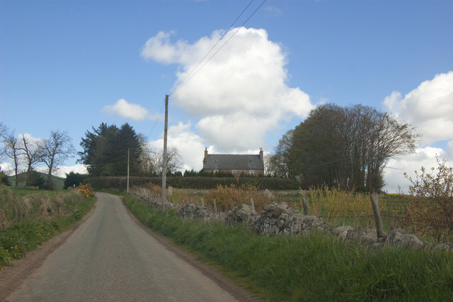
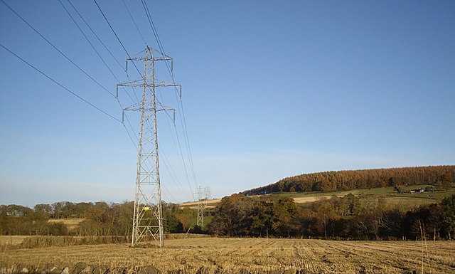
Blackburn Images

Images are sourced within 2km of 57.203953/-2.2891244 or Grid Reference NJ8212. Thanks to Geograph Open Source API. All images are credited.

A96 from a bridge The view of the A96 towards Aberdeen from a bridge crossing the carriageway
A96 from a bridge
The view of the A96 towards Aberdeen from a bridge crossing the carriageway
What Bee there here? Signs say bees here just past the fence.
What Bee there here?
Signs say bees here just past the fence.
Summit of the Tyrebagger Looking towards Bennachie
Summit of the Tyrebagger
Looking towards Bennachie
Where the Wildflowers Grow 
Art Trail 


Hare, there and everywhere!
Clan Cancer Support, the north-east’s leading cancer support charity, has partnered with Wild in Art once again to bring an exciting new art trail to the north-east, Moray, Orkney and Shetland.

The Big Hop Trail will take the public on another cultural tour of the north-east and the islands from July to September 2023, with hare sculptures designed and created by some of the country’s most talented artists.

The trail coincides with Clan’s 40th anniversary, with the 40 hares being the focal point to celebrate the charity’s commitment to supporting people affected by cancer. 

We chose the hare sculpture as they are an indigenous animal found in all parts of Clan’s geography. Much like our clients during their cancer journey, hares have to navigate rough and difficult terrain in order to survive. They are also adaptable, like our services team who deliver support to anyone affected by cancer. Most importantly, hares have incredible hearing. What better way to depict our lifeline listening and support service and the importance of being heard?
Where the Wildflowers Grow
Art Trail Hare, there and everywhere! Clan Cancer Support, the north-east’s leading cancer support charity, has partnered with Wild in Art once again to bring an exciting new art trail to the north-east, Moray, Orkney and Shetland. The Big Hop Trail will take the public on another cultural tour of the north-east and the islands from July to September 2023, with hare sculptures designed and created by some of the country’s most talented artists. The trail coincides with Clan’s 40th anniversary, with the 40 hares being the focal point to celebrate the charity’s commitment to supporting people affected by cancer. We chose the hare sculpture as they are an indigenous animal found in all parts of Clan’s geography. Much like our clients during their cancer journey, hares have to navigate rough and difficult terrain in order to survive. They are also adaptable, like our services team who deliver support to anyone affected by cancer. Most importantly, hares have incredible hearing. What better way to depict our lifeline listening and support service and the importance of being heard?
Forest Farm
Forest Farm
Wintry Aberdeenshire landscape The Bennachie granite massif looms in the distance, some 20 km distant.
Wintry Aberdeenshire landscape
The Bennachie granite massif looms in the distance, some 20 km distant.
Young woodland, Clinterty College A recently planted woodland north of the agricultural college with a view towards Tyrebagger Hill.
Young woodland, Clinterty College
A recently planted woodland north of the agricultural college with a view towards Tyrebagger Hill.
The old A96 The road from Aberdeen to Inverness ran through the trees behind the sheep. Now it is a dual carriageway as far as Inverurie and has been built on a new course bypassing Blackburn. The new road could be heard beyond the trees.
The old A96
The road from Aberdeen to Inverness ran through the trees behind the sheep. Now it is a dual carriageway as far as Inverurie and has been built on a new course bypassing Blackburn. The new road could be heard beyond the trees.
Sprouting field An extremely large field, part of Kirkton Farm
Sprouting field
An extremely large field, part of Kirkton Farm
Suburb in the country Blackburn (or Kinellar) continues to expand with high-density suburban developments.
Suburb in the country
Blackburn (or Kinellar) continues to expand with high-density suburban developments.
View towards Kirkton Farm
Wogle Farm name sign By the minor road at Kinella.
Wogle Farm name sign
By the minor road at Kinella.
Access lane to Wogle Farm From the minor road at Kinella.
Access lane to Wogle Farm
From the minor road at Kinella.
The older Wogle Farm name sign By a road bridge over a tributary of the Black Burn.
The older Wogle Farm name sign
By a road bridge over a tributary of the Black Burn.
Minor road bridge Over a tributasry of the Black Burn, near Wogle Farm.
Minor road bridge
Over a tributasry of the Black Burn, near Wogle Farm.
Power lines overhead B979 Heading off over the flank of Blue Hill.
Power lines overhead B979
Heading off over the flank of Blue Hill.
Strip wood, Clinterty A conifer shelter belt.
Strip wood, Clinterty
A conifer shelter belt.
Tyrebagger Hill Climbed up via white route to Tappie Tower with Richard Speirs before catching the ferry for a 2 week stay on Shetland.
Name: Tyrebagger Hill
Hill number: 4904
Height: 250m / 820ft
Area: 21B: Fraserburgh to the Dee Valley
Class: Hu
Grid ref: NJ 84436 12672
Summit feature: trig point: OS measurement
Drop: 106m
Col: 144m  NJ851101
Tyrebagger Hill
Climbed up via white route to Tappie Tower with Richard Speirs before catching the ferry for a 2 week stay on Shetland. Name: Tyrebagger Hill Hill number: 4904 Height: 250m / 820ft Area: 21B: Fraserburgh to the Dee Valley Class: Hu Grid ref: NJ 84436 12672 Summit feature: trig point: OS measurement Drop: 106m Col: 144m NJ851101
Show me another place!

Blackburn is located at Grid Ref: NJ8212 (Lat: 57.203953, Lng: -2.2891244)

Unitary Authority: Aberdeenshire

Police Authority: North East

What 3 Words

///breeding.areas.documents. Near Blackburn, Aberdeenshire

Nearby Locations

Blackburn

Related Wikis

Blackburn, Aberdeenshire

Blackburn is a rapidly growing village northwest of Aberdeen, Scotland, and is situated in Aberdeenshire. Local amenities include an industrial estate...

Kinellar

Kinellar is a small but ancient human settlement in Aberdeenshire between Kintore and Dyce just off the A96. It is said that the etymology appears to link...

Kinaldie railway station

Kinaldie railway station was a railway station in Kinaldie, Aberdeenshire. == History == The station was opened in November 1854 on the Great North of...

Kirkhill Forest

Kirkhill Forest is a forest in Scotland, situated to the north-west of Aberdeen, on the north side of the A96 between the villages of Dyce and Blackburn...

Nearby Amenities

Located within 500m of 57.203953,-2.2891244
Traffic Calming: table
Lat/Long: 57.2020588/-2.2831057
Traffic Calming: table
Lat/Long: 57.2018826/-2.284121
Traffic Calming: table
Lat/Long: 57.2018381/-2.2831525
Traffic Calming: table
Lat/Long: 57.2016872/-2.2825559
Traffic Calming: table
Lat/Long: 57.2026336/-2.2875241
Traffic Calming: table
Lat/Long: 57.2022264/-2.2868792
Traffic Calming: table
Lat/Long: 57.2020966/-2.285881
Traffic Calming: table
Lat/Long: 57.2021926/-2.2854958
Traffic Calming: table
Lat/Long: 57.2075073/-2.2916318
Traffic Calming: table
Lat/Long: 57.2081197/-2.2911054
Traffic Calming: table
Lat/Long: 57.2070089/-2.2923967
Traffic Calming: table
Lat/Long: 57.2042412/-2.2925869
Traffic Calming: table
Lat/Long: 57.20497/-2.2944812
Traffic Calming: table
Lat/Long: 57.204672/-2.2926218
Traffic Calming: table
Lat/Long: 57.2065141/-2.2911792
Traffic Calming: table
Lat/Long: 57.2053916/-2.2945295
Traffic Calming: table
Lat/Long: 57.20799/-2.2922617
Traffic Calming: table
Lat/Long: 57.2047344/-2.295117
Traffic Calming: table
Lat/Long: 57.2067586/-2.2904712
Bus Stop
Fechnie Brae
Bench: yes
Bin: yes
Bus: yes
Naptan AtcoCode: 630030792
Naptan Bearing: E
Naptan CommonName: Fechnie Brae
Naptan Indicator: at
Naptan NaptanCode: 23625684
Naptan Street: B973
Naptan Verified: no
Public Transport: platform
Shelter: yes
Tactile Paving: no
Lat/Long: 57.2038317/-2.288884
Bench
Lat/Long: 57.2057382/-2.2897894
Bus Stop
Norman Gray Park
Bus: yes
Naptan AtcoCode: 630045711
Naptan Bearing: E
Naptan CommonName: Norman Gray Park
Naptan Indicator: at
Naptan NaptanCode: 23629284
Naptan Street: B973
Naptan Verified: no
Public Transport: platform
Lat/Long: 57.2041634/-2.2938725
Bus Stop
Woodburn Road
Bench: no
Bin: no
Bus: yes
Naptan AtcoCode: 630030802
Naptan Bearing: E
Naptan CommonName: Woodburn Road
Naptan Indicator: opp
Naptan NaptanCode: 23625673
Naptan Street: B973
Naptan Verified: no
Public Transport: platform
Shelter: no
Source: naptan;bing;naptan_compare_tool
Tactile Paving: no
Lat/Long: 57.2040782/-2.2916083
Bus Stop
Woodburn Road
Bus: yes
Naptan AtcoCode: 630030801
Naptan Bearing: W
Naptan CommonName: Woodburn Road
Naptan Indicator: at
Naptan NaptanCode: 23625674
Naptan Street: B973
Naptan Verified: no
Public Transport: platform
Source: naptan;bing;naptan_compare_tool
Lat/Long: 57.2039837/-2.2915768
Bus Stop
Fechnie Brae
Bus: yes
Naptan AtcoCode: 630030791
Naptan Bearing: W
Naptan CommonName: Fechnie Brae
Naptan Indicator: opp
Naptan NaptanCode: 23625687
Naptan Street: B973
Naptan Verified: no
Public Transport: platform
Shelter: yes
Source: naptan;bing;naptan_compare_tool
Lat/Long: 57.2035652/-2.288077
Bus Stop
Benview Terrace
Bench: yes
Bin: yes
Bus: yes
Lit: yes
Naptan AtcoCode: 630030781
Naptan Bearing: SE
Naptan CommonName: Benview Terrace
Naptan Indicator: at
Naptan NaptanCode: 23625726
Naptan Street: B973
Naptan Verified: no
Public Transport: platform
Shelter: yes
Tactile Paving: no
Lat/Long: 57.2028/-2.2846749
Bus Stop
Norman Gray Park
Bus: yes
Naptan AtcoCode: 630045712
Naptan Bearing: W
Naptan CommonName: Norman Gray Park
Naptan Indicator: opp
Naptan NaptanCode: 23629293
Naptan Street: B973
Naptan Verified: no
Public Transport: platform
Lat/Long: 57.2041178/-2.2948491
Crossing
Crossing Island: yes
Lat/Long: 57.2018986/-2.2818731
Crossing
Crossing: traffic_signals
Lat/Long: 57.2034532/-2.2870919
Bus Stop
Benview Terrace
Bus: yes
Naptan AtcoCode: 630030782
Naptan Bearing: NW
Naptan CommonName: Benview Terrace
Naptan Indicator: opp
Naptan NaptanCode: 23625724
Naptan Street: B973
Naptan Verified: no
Public Transport: platform
Shelter: yes
Lat/Long: 57.2028063/-2.2851068
Bicycle Parking
Bicycle Parking: wall_loops
Capacity: 5
Lat/Long: 57.2062735/-2.290594
Traffic Calming: table
Lat/Long: 57.2023961/-2.2875426
Post Box
Operator: Royal Mail
Operator Wikidata: Q638098
Post Box Design: type_a
Post Box Type: pillar
Ref: AB21 323
Royal Cypher: scottish_crown
Lat/Long: 57.204122/-2.2890637
Shelter
Lat/Long: 57.2054284/-2.2860686
Shelter
Lat/Long: 57.2054528/-2.2857214
Crossing
Crossing Island: yes
Lat/Long: 57.2038929/-2.2891497
Traffic Calming: bump
Lat/Long: 57.2028325/-2.2885106
Traffic Calming: table
Lat/Long: 57.2043376/-2.2955062
Traffic Calming: bump
Lat/Long: 57.2031383/-2.2879028
Traffic Calming: bump
Lat/Long: 57.2029792/-2.2886029
Turning Circle
Lat/Long: 57.2035799/-2.2970217
Crossing
Lat/Long: 57.2045346/-2.2893129
Crossing
Lat/Long: 57.205351/-2.2895645
Crossing
Crossing Island: yes
Lat/Long: 57.2062262/-2.2898515
Grit Bin
Lat/Long: 57.2039464/-2.2890327
Grit Bin
Lat/Long: 57.2080024/-2.2861426
Generator Method: photovoltaic
Generator Output Electricity: yes
Generator Source: solar
Generator Type: solar_photovoltaic_panel
Location: roof
Power: generator
Lat/Long: 57.2015227/-2.2825693
Generator Method: photovoltaic
Generator Output Electricity: yes
Generator Source: solar
Generator Type: solar_photovoltaic_panel
Location: roof
Power: generator
Lat/Long: 57.2021667/-2.2832874
Generator Method: photovoltaic
Generator Output Electricity: yes
Generator Source: solar
Generator Type: solar_photovoltaic_panel
Location: roof
Power: generator
Lat/Long: 57.2028826/-2.2953138
Generator Method: photovoltaic
Generator Output Electricity: yes
Generator Source: solar
Generator Type: solar_photovoltaic_panel
Location: roof
Power: generator
Lat/Long: 57.2072191/-2.2945762
Generator Method: photovoltaic
Generator Output Electricity: yes
Generator Source: solar
Generator Type: solar_photovoltaic_panel
Location: roof
Power: generator
Lat/Long: 57.2063649/-2.2945333
Generator Method: photovoltaic
Generator Output Electricity: yes
Generator Source: solar
Generator Type: solar_photovoltaic_panel
Location: roof
Power: generator
Lat/Long: 57.2059654/-2.2885627
Generator Method: photovoltaic
Generator Output Electricity: yes
Generator Source: solar
Generator Type: solar_photovoltaic_panel
Location: roof
Power: generator
Lat/Long: 57.2066475/-2.2886163
Generator Method: photovoltaic
Generator Output Electricity: yes
Generator Source: solar
Generator Type: solar_photovoltaic_panel
Location: roof
Power: generator
Lat/Long: 57.2078801/-2.2896221
Grit Bin
Lat/Long: 57.2070368/-2.2933792
Generator Method: photovoltaic
Generator Output Electricity: yes
Generator Source: solar
Generator Type: solar_photovoltaic_panel
Location: roof
Power: generator
Lat/Long: 57.2036083/-2.2888765
Generator Method: photovoltaic
Generator Output Electricity: yes
Generator Source: solar
Generator Type: solar_photovoltaic_panel
Location: roof
Power: generator
Lat/Long: 57.2058826/-2.2931807
Generator Method: photovoltaic
Generator Output Electricity: yes
Generator Source: solar
Generator Type: solar_photovoltaic_panel
Location: roof
Power: generator
Lat/Long: 57.2077958/-2.292299
Grit Bin
Lat/Long: 57.2082494/-2.2913267
Grit Bin
Lat/Long: 57.2030987/-2.292771
Generator Method: photovoltaic
Generator Output Electricity: yes
Generator Source: solar
Generator Type: solar_photovoltaic_panel
Location: roof
Power: generator
Lat/Long: 57.2032138/-2.2869506
Generator Method: photovoltaic
Generator Output Electricity: yes
Generator Source: solar
Generator Type: solar_photovoltaic_panel
Location: roof
Power: generator
Lat/Long: 57.2036032/-2.2839761
Power: pole
Lat/Long: 57.2036425/-2.2812685
Power: pole
Lat/Long: 57.2040362/-2.2822044
Power: pole
Lat/Long: 57.2043133/-2.2828906
Power: pole
Lat/Long: 57.2046487/-2.2830673
Power: pole
Lat/Long: 57.2049676/-2.28258
Power: pole
Lat/Long: 57.2053283/-2.2821516
Bus Stop
Willowgrove Gardens
Bus: yes
Naptan AtcoCode: 630035241
Naptan Bearing: W
Naptan CommonName: Willowgrove Gardens
Naptan Indicator: at
Naptan NaptanCode: 23625692
Naptan Street: Bishop Forbes Crescent
Naptan Verified: no
Public Transport: platform
Source: naptan;bing;naptan_compare_tool
Lat/Long: 57.2063082/-2.2880037
Bus Stop
Leys Gardens
Bus: yes
Naptan AtcoCode: 630035221
Naptan Bearing: S
Naptan CommonName: Leys Gardens
Naptan Indicator: opp
Naptan NaptanCode: 23625696
Naptan Street: Bishop Forbes Crescent
Naptan Verified: no
Public Transport: platform
Source: naptan;bing;naptan_compare_tool
Lat/Long: 57.2071807/-2.2861322
Post Box
Operator: Royal Mail
Operator Wikidata: Q638098
Post Box Mounting: pier
Post Box Type: lamp
Ref: AB21 432
Royal Cypher: scottish_crown
Lat/Long: 57.2037979/-2.283811
Traffic Signals
Traffic Signals: crossing
Traffic Signals Direction: backward
Lat/Long: 57.2034654/-2.2871428
Traffic Signals
Traffic Signals: crossing
Traffic Signals Direction: forward
Lat/Long: 57.2034382/-2.2870399
The data included in this document is from www.openstreetmap.org. The data is made available under ODbL.

Have you been to Blackburn?

Leave your review of Blackburn below (or comments, questions and feedback).