Reybridge

Settlement in Wiltshire

England

Reybridge

Lane leading to the A350 ahead
Lane leading to the A350 ahead Credit: Rob Purvis

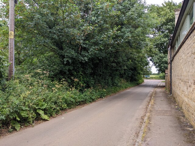
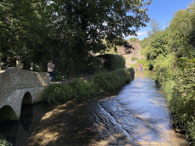
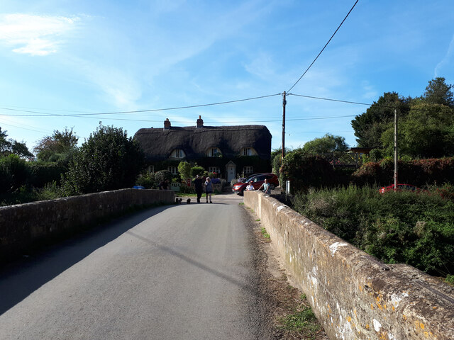
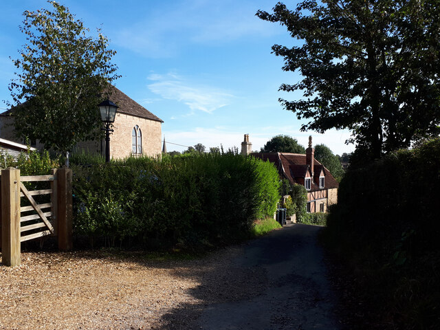
Reybridge is a small village located in the county of Wiltshire, England. Situated near the River Avon, it is part of the larger civil parish of Lacock, which lies approximately 5 miles northwest of the village. Reybridge has a population of around 200 residents.

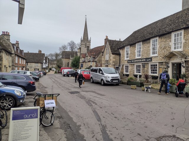
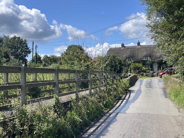
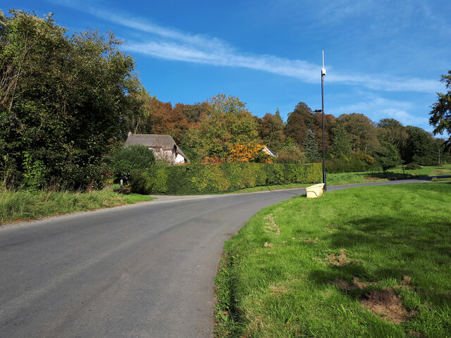
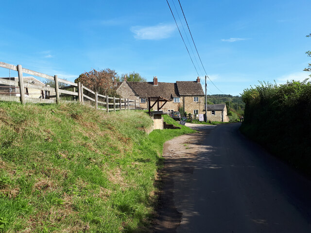
The village is known for its picturesque setting and tranquil atmosphere. It is surrounded by rolling countryside, with fields and meadows stretching as far as the eye can see. Reybridge is characterized by a mix of traditional stone-built cottages and more modern housing developments, providing a diverse range of accommodation options.

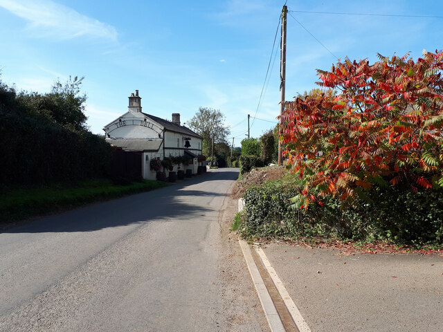
Though small in size, Reybridge offers a few amenities to its residents and visitors. There is a local pub, serving traditional British food and ales, which acts as a social hub for the community. Additionally, the village has a small convenience store providing essential groceries and supplies.

Reybridge's location is ideal for those who enjoy outdoor activities. The nearby River Avon offers opportunities for fishing and boating, while the surrounding countryside provides ample space for hiking, cycling, and horseback riding. The village is also within close proximity to several nature reserves and historic sites, such as the picturesque Lacock Abbey.

Overall, Reybridge is a charming and peaceful village that offers a close-knit community and access to the beautiful Wiltshire countryside.

If you have any feedback on the listing, please let us know in the comments section below.

Reybridge Images

Images are sourced within 2km of 51.420174/-2.116457 or Grid Reference ST9269. Thanks to Geograph Open Source API. All images are credited.

Lane leading to the A350 ahead
Topiary, Lacock, Wiltshire Is it a horse? A cat? This fine example of the topiarist's art has characteristics of both.
Topiary, Lacock, Wiltshire
Is it a horse? A cat? This fine example of the topiarist's art has characteristics of both.
Green lady, Lacock, Wiltshire This lady has, it seems to me, to have become a little more matronly, regal even, since I last photographed her <a href="https://www.geograph.org.uk/photo/4157101">ST9168 : Green lady, Lacock, Wiltshire</a>
Green lady, Lacock, Wiltshire
This lady has, it seems to me, to have become a little more matronly, regal even, since I last photographed her ST9168 : Green lady, Lacock, Wiltshire
Topiary whale, Lacock, Wiltshire The majestic cetacean seen here appears to be vaguely reminiscent of an inverted sperm whale. Elegant nevertheless.
Topiary whale, Lacock, Wiltshire
The majestic cetacean seen here appears to be vaguely reminiscent of an inverted sperm whale. Elegant nevertheless.
Church Street and East Street in Lacock The junction of Church Street and East Street in Lacock, looking up East Street from outside Lacock Bakery in Church Street.
Church Street and East Street in Lacock
The junction of Church Street and East Street in Lacock, looking up East Street from outside Lacock Bakery in Church Street.
Church Street in Lacock A view east along Church Street in Lacock.
Church Street in Lacock
A view east along Church Street in Lacock.
Phone box, grit box and houses in Lacock
Rural bus stop near Lacock
Reybridge Causeway This causeway is found at Reybridge near Lacock. The causeway lies on the flood plain of the River Avon.
Reybridge Causeway
This causeway is found at Reybridge near Lacock. The causeway lies on the flood plain of the River Avon.
Lacock Ford  Another visit to this five star ford on the River Avon at Lacock. A photograph from a previous visit can be seen at:
<a title="https://www.geograph.org.uk/photo/4872488" href="https://www.geograph.org.uk/photo/4872488">Link</a>
Lacock Ford
Another visit to this five star ford on the River Avon at Lacock. A photograph from a previous visit can be seen at: Link
Houses on Bowden Hill
Approaching the Bell Inn
New End Farm, Reybridge
Rey Bridge
Rey Bridge
The Old Chapel, Chapel Hill
Old Milestone by the A350, Chippenham Road, Lacock Metal plate attached to stone post by the A350, in parish of LACOCK (NORTH WILTSHIRE District), Chippenham Road; at traffic lights for junction with Corsham Road, by Whitehall Garden Centre, on wide well cut grass verge between road and hedge - between two sets of traffic lights, on West side of road. Bath incised iron plate, erected by the Lacock, Blue Vein (Corsham) turnpike trust in the 18th century. 

Inscription reads:-
To
BATH
12 
Carved benchmark left lower, rivet hole on top.

Grade II listed.
List Entry Number: 1022146 <span class="nowrap"><a title="https://historicengland.org.uk/listing/the-list/list-entry/1022146" rel="nofollow ugc noopener" href="https://historicengland.org.uk/listing/the-list/list-entry/1022146">Link</a><img style="margin-left:2px;" alt="External link" title="External link - shift click to open in new window" src="https://s1.geograph.org.uk/img/external.png" width="10" height="10"/></span>

Milestone Society National ID: WI_LB_BABH12.
Old Milestone by the A350, Chippenham Road, Lacock
Metal plate attached to stone post by the A350, in parish of LACOCK (NORTH WILTSHIRE District), Chippenham Road; at traffic lights for junction with Corsham Road, by Whitehall Garden Centre, on wide well cut grass verge between road and hedge - between two sets of traffic lights, on West side of road. Bath incised iron plate, erected by the Lacock, Blue Vein (Corsham) turnpike trust in the 18th century. Inscription reads:- To BATH 12 Carved benchmark left lower, rivet hole on top. Grade II listed. List Entry Number: 1022146 LinkExternal link Milestone Society National ID: WI_LB_BABH12.
Wilts & Berks Canal near Pewsham Re-watered section of the Wilts & Berks canal between Pewsham and Reybridge. Completed with funding through Viridor and others.
Wilts & Berks Canal near Pewsham
Re-watered section of the Wilts & Berks canal between Pewsham and Reybridge. Completed with funding through Viridor and others.
2011 : Entrance to Lackham College of Agriculture <a href="https://www.geograph.org.uk/photo/206400">ST9270 : Lackham House</a> was taken from a similar viewpoint in 2006.
2011 : Entrance to Lackham College of Agriculture
ST9270 : Lackham House was taken from a similar viewpoint in 2006.
Show me another place!

Reybridge is located at Grid Ref: ST9269 (Lat: 51.420174, Lng: -2.116457)

Unitary Authority: Wiltshire

Police Authority: Wiltshire

What 3 Words

///plant.point.soup. Near Lacock, Wiltshire

Nearby Locations

Reybridge Lackham Wood

Related Wikis

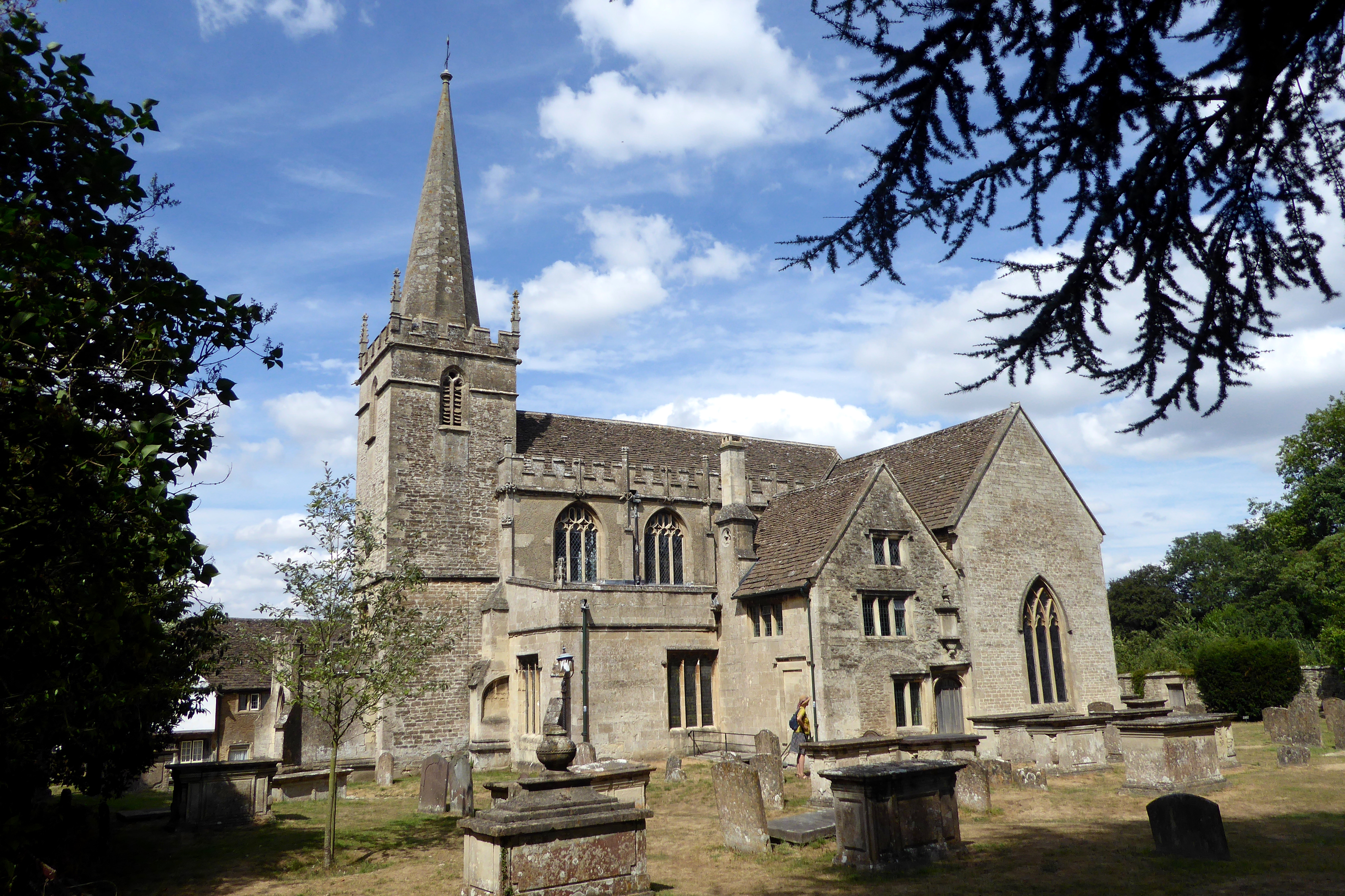
St Cyriac's Church, Lacock

St Cyriac's Church is a 14th-century Church of England church in the village of Lacock, Wiltshire. == History == The Norman architecture base to the current...

History of Lacock

Lacock, England was first mentioned in the Domesday Book in 1086 with a population of less than 200, two small mills and a vineyard. The village's main...

Lacock Abbey

Lacock Abbey in the village of Lacock, Wiltshire, England, was founded in the early 13th century by Ela, Countess of Salisbury, as a nunnery of the Augustinian...

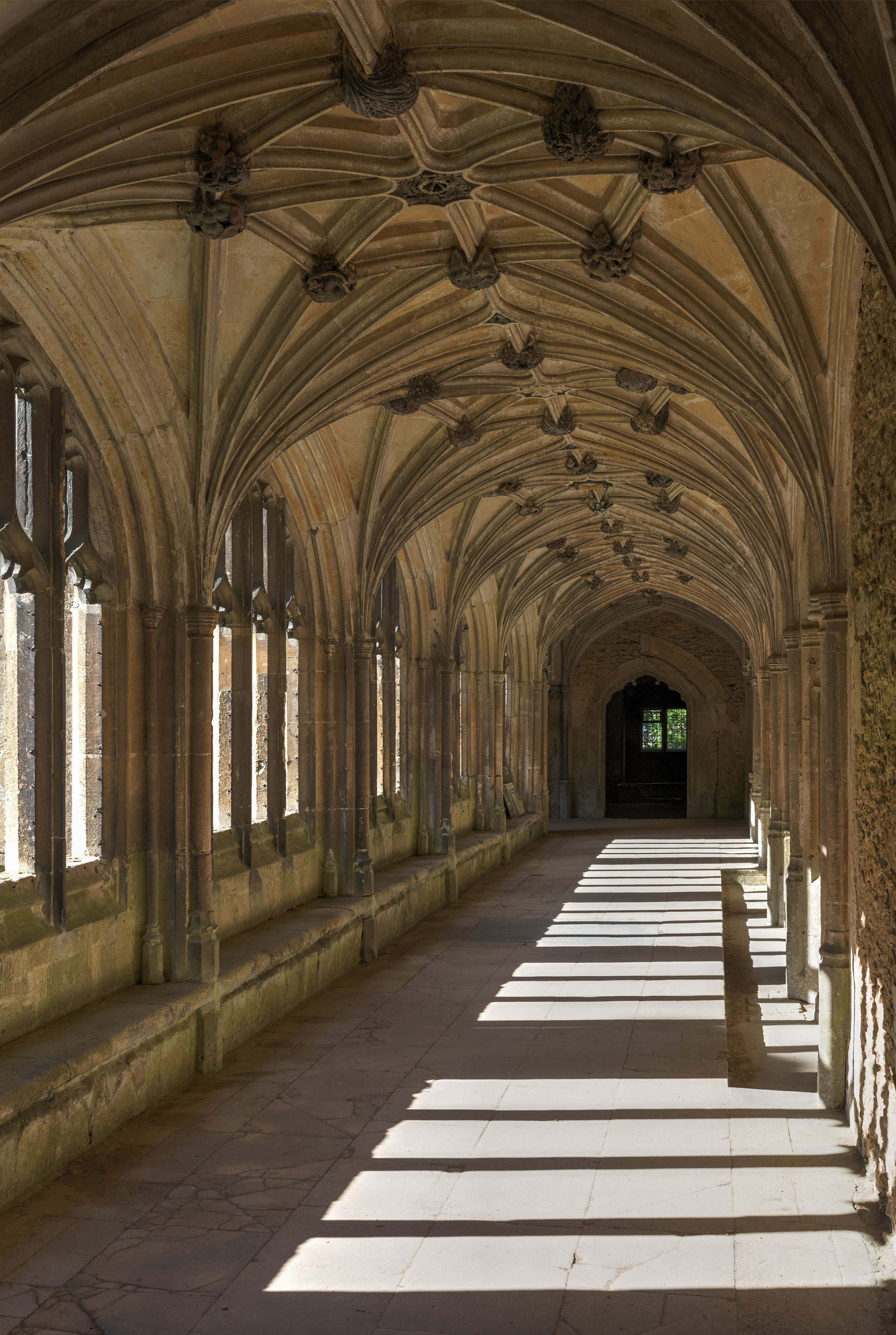
Lacock Abbey (monastery)

Lacock Abbey was a monastery founded at Lacock, in the county of Wiltshire in England, in the early 13th century by Ela, Countess of Salisbury, as a house...

Cantax House

Cantax House is a grade II* listed house in Cantax Hill, Lacock, Wiltshire, England. It dates from around 1700 and is of red brick with ashlar dressings...
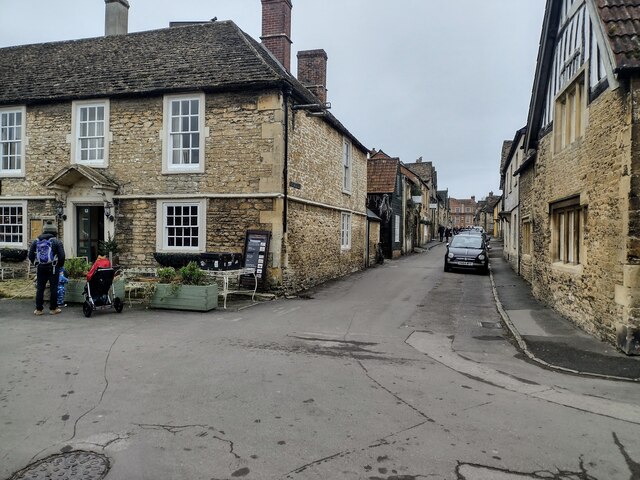
Lacock

Lacock is a village and civil parish in the county of Wiltshire, England, about 3 miles (5 km) south of the town of Chippenham, and about 3.7 miles (6...

Lacock Halt railway station

Lacock Halt was a minor railway station on the Chippenham–Trowbridge section of the former Wilts, Somerset and Weymouth Railway (WSWR), which opened as...

Cocklemore Brook

The Cocklemore Brook is a short tributary of the Bristol Avon, some 2.5 miles (4.0 km) long. It rises near Studley in Wiltshire, England, and flows in...

Related Videos

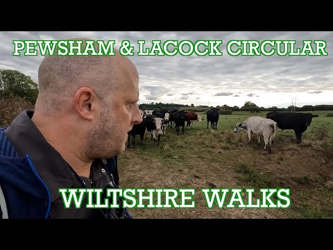
Pewsham & Lacock Circular |Wiltshire Walks | Cool Dudes Walking Club

A Wiltshire Circular Walk around Pewsham and Lacock. Featuring Lacock Abbey and village and a terrifying cow encounter.

Lacock, England, a beautiful village and morning walk.

Buying me a virtual coffee is greatly appreciated and helps the channel: https://www.buymeacoffee.com/imagined Need help with ...

A Snowy Morning Walk in the Beautiful Village of Lacock

Out and about Walking in Lacock So, this is a first visit to the beautiful village of Lacock which is situated four miles south of ...

Nearby Amenities

Located within 500m of 51.420174,-2.116457
Post Box
Collection Times: Mo-Fr 16:45, Sa 08:30
Post Box Type: wall
Ref: SN15 64
Royal Cypher: VR
Royal Cypher Wikidata: Q33102356
Lat/Long: 51.421073/-2.1180199
Barrier: kissing_gate
Foot: yes
Lat/Long: 51.4202976/-2.1186016
Barrier: kissing_gate
Foot: yes
Lat/Long: 51.4185198/-2.1211825
Barrier: stile
Lat/Long: 51.4210596/-2.1174786
Barrier: stile
Lat/Long: 51.4179108/-2.11953
Barrier: stile
Lat/Long: 51.4222016/-2.1155824
Barrier: stile
Lat/Long: 51.4224752/-2.1125063
Barrier: stile
Lat/Long: 51.4211422/-2.1172674
Barrier: stile
Lat/Long: 51.4221557/-2.1154863
Reybridge
Place: hamlet
Lat/Long: 51.4214694/-2.1163384
Barrier: stile
Foot: yes
Material: wood
Stile: stepover
Lat/Long: 51.4169972/-2.1119794
Barrier: stile
Material: wood
Stile: stepover
Lat/Long: 51.4203543/-2.1225768
Barrier: stile
Foot: yes
Material: wood
Stile: stepover
Lat/Long: 51.4205282/-2.1224776
Waste Basket
Waste: trash
Lat/Long: 51.4185412/-2.1211991
Bench
Backrest: yes
Lat/Long: 51.4185515/-2.1212082
Waste Basket
Waste: trash
Lat/Long: 51.420284/-2.1185993
Passing Place
Lat/Long: 51.4204965/-2.1227149
Passing Place
Lat/Long: 51.4206601/-2.1199465
Life Ring
Emergency: life_ring
Lat/Long: 51.4210847/-2.1174867
Parking
Parking: street_side
Lat/Long: 51.4211261/-2.1170513
Addr Housename: The Stables
Addr Housenumber: 25A
Lat/Long: 51.4213467/-2.1151432
Addr Housename: Lacock Shepherd's Hut
Lat/Long: 51.4217201/-2.1151689
The data included in this document is from www.openstreetmap.org. The data is made available under ODbL.

Have you been to Reybridge?

Leave your review of Reybridge below (or comments, questions and feedback).