Renfrew

Settlement in Renfrewshire

Scotland

Renfrew

Black Cart Water Looking towards the River Clyde from Inchinnan Bridge
Black Cart Water Credit: william craig

Renfrew is a historic town located in Renfrewshire, Scotland. Situated just a few miles west of Glasgow, it is part of the Greater Glasgow metropolitan area. Renfrew has a rich history that dates back to the 12th century when it was established as a royal burgh.

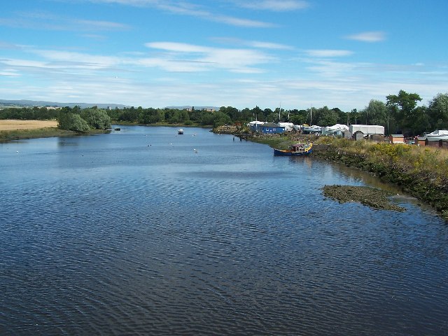
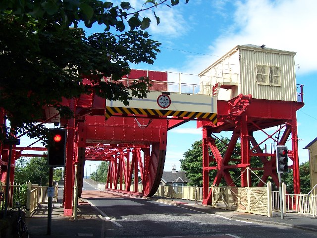
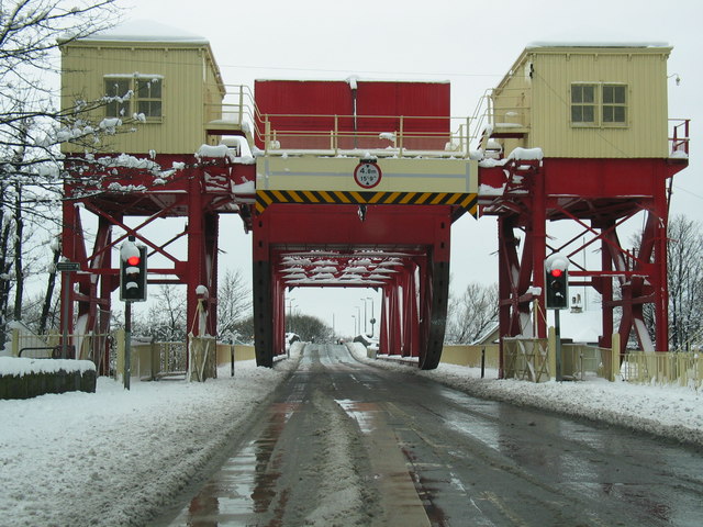
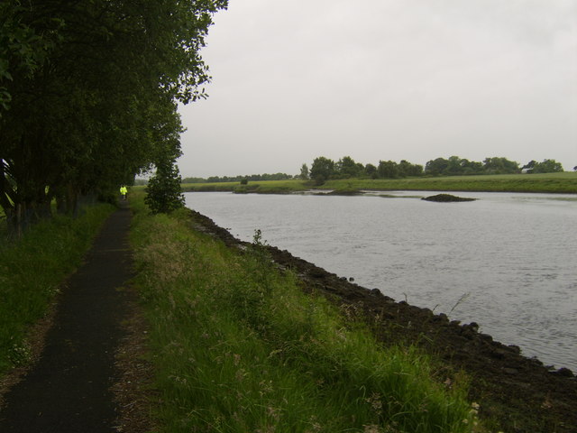
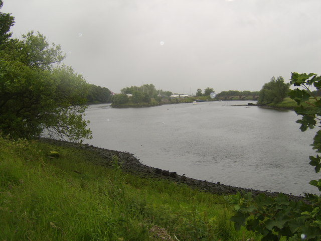
The town is known for its proximity to the River Clyde, which played a significant role in Renfrew's development as a center for shipbuilding and maritime trade. In the 19th and early 20th centuries, Renfrew became a hub for shipyards, attracting skilled workers and contributing to the growth of the local economy.

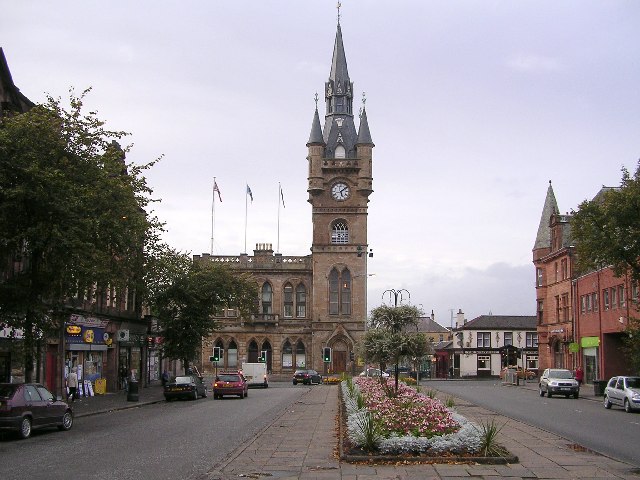
Renfrew boasts several notable landmarks, including Renfrew Abbey, a former monastery that dates back to the 12th century. Although the abbey is now in ruins, it remains an important historical site. Another prominent feature is Renfrew Town Hall, an impressive Victorian building that serves as a focal point for community events and gatherings.

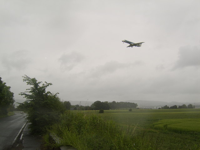
Today, Renfrew is a thriving town with a population of around 22,000 residents. It offers a range of amenities, including shops, restaurants, and recreational facilities. The town is well-connected to Glasgow and other surrounding areas through various transport links, making it an attractive place to live for those seeking a balance between urban and suburban living.

Renfrew also benefits from its proximity to the intu Braehead shopping center, which is one of the largest retail destinations in Scotland. This, along with the nearby Xscape leisure complex, provides residents with a wide range of shopping, dining, and entertainment options.

Overall, Renfrew is a historic town with a vibrant present, offering a mix of historical attractions, modern amenities, and easy access to nearby urban centers.

If you have any feedback on the listing, please let us know in the comments section below.

Renfrew Images

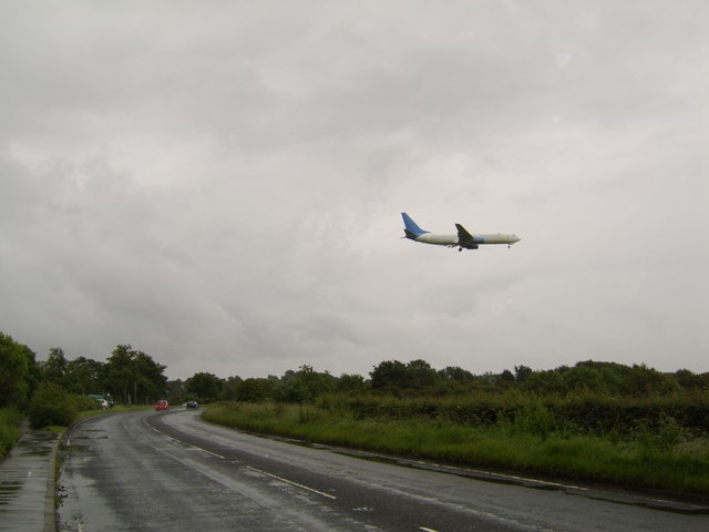
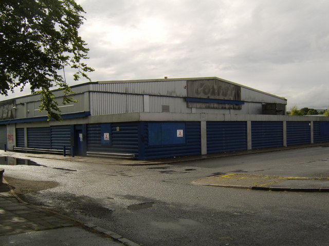
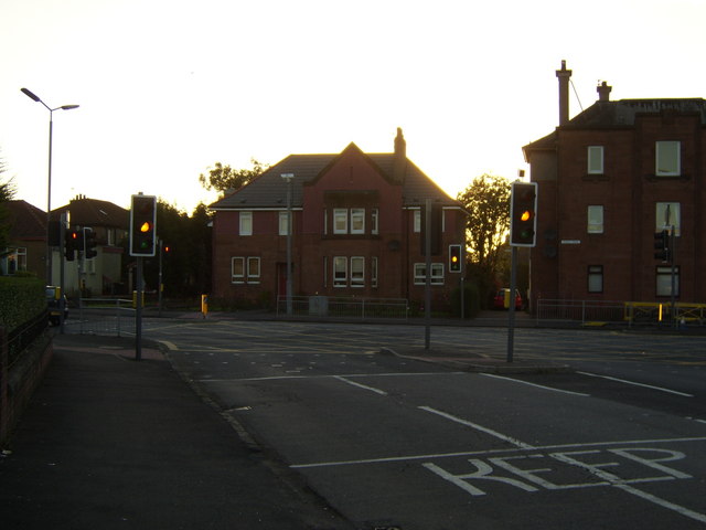
Images are sourced within 2km of 55.879905/-4.3852843 or Grid Reference NS5067. Thanks to Geograph Open Source API. All images are credited.

Black Cart Water Looking towards the River Clyde from Inchinnan Bridge
Black Cart Water
Looking towards the River Clyde from Inchinnan Bridge
White Cart bridge a Scherzer rolling lift bridge built 1924 recently refurbished
White Cart bridge
a Scherzer rolling lift bridge built 1924 recently refurbished
Old White Cart bridge Built 1812 3-span ashlar bridge landlocked between Black Cart and White Cart bridges.
Old White Cart bridge
Built 1812 3-span ashlar bridge landlocked between Black Cart and White Cart bridges.
White Cart bridge Renfrew.
Comet warehouse fire, August 1976
River Cart Looking south.
River Cart
Looking south.
Split of the Black Cart and White Cart Waters Glasgow Airport lies between these two River Clyde tributaries.
Split of the Black Cart and White Cart Waters
Glasgow Airport lies between these two River Clyde tributaries.
Plane landing over field On descent towards Glasgow Airport.
Plane landing over field
On descent towards Glasgow Airport.
Your landing gear is down.... Plane on final descent into the airport.
Your landing gear is down....
Plane on final descent into the airport.
Plane landing over Greenock Road At the north side of Glasgow Airport.
Plane landing over Greenock Road
At the north side of Glasgow Airport.
Disused Comet warehouse, Renfrew
Sign at entrance to Renfrew Retail Park
Bridge over White Cart Water Near Renfrew.
Bridge over White Cart Water
Near Renfrew.
Traffic lights At junction between Cockels Loan and Paisley Road.
Traffic lights
At junction between Cockels Loan and Paisley Road.
River Cart from across the Clyde Near Clydebank College.
River Cart from across the Clyde
Near Clydebank College.
Looking down the River Cart from by Queens Quay The River Cart splits to the Black Cart and White Cart waters, which flow either side of Glasgow Airport. Queens Quay has only recently been named as such since the regeneration of Clydebank began. It's named after the cruise liners built in John Brown's Shipyard.
Looking down the River Cart from by Queens Quay
The River Cart splits to the Black Cart and White Cart waters, which flow either side of Glasgow Airport. Queens Quay has only recently been named as such since the regeneration of Clydebank began. It's named after the cruise liners built in John Brown's Shipyard.
Normandy Hotel Renfrew
Litter strewn field, Portnauld Next to a layby/parking place with the inevitable consequences.
Litter strewn field, Portnauld
Next to a layby/parking place with the inevitable consequences.
Show me another place!

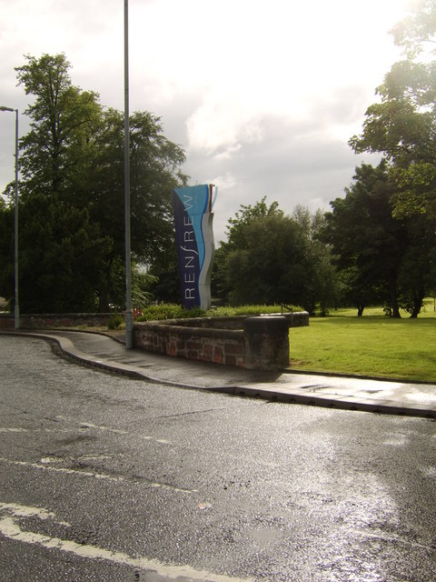
Renfrew is located at Grid Ref: NS5067 (Lat: 55.879905, Lng: -4.3852843)

Unitary Authority: Renfrewshire

Police Authority: Renfrewshire and Inverclyde

What 3 Words

///flash.margin.spring. Near Renfrew, Renfrewshire

Nearby Locations

Renfrew Loanhead

Related Wikis

Renfrew Castle

Renfrew Castle was situated at the royal burgh of Renfrew, Scotland, which is near the confluence of the River Clyde and the River Cart. The original 12th...

King's Inch railway station

King's Inch railway station served the town of Renfrew, Renfrewshire, Scotland from 1903 to 1926 on the Glasgow and Renfrew District Railway. == History... ==

Renfrew Town Hall

Renfrew Town Hall is a municipal facility at The Cross, Renfrew, Renfrewshire, Scotland. The town hall, which was the headquarters of the royal burgh of...

Renfrew

Renfrew (; Scots: Renfrew; Scottish Gaelic: Rinn Friù) is a town 6 miles (10 km) west of Glasgow in the west central Lowlands of Scotland. It is the historic...

Nearby Amenities

Located within 500m of 55.879905,-4.3852843
Traffic Signals
Lat/Long: 55.8838161/-4.3846101
Traffic Signals
Lat/Long: 55.8818568/-4.3814766
Traffic Signals
Lat/Long: 55.8789632/-4.3867388
Traffic Signals
Lat/Long: 55.8826912/-4.3829784
Traffic Signals
Lat/Long: 55.8809136/-4.3794257
Post Box
Collection Times: Mo-Fr 18:30; Sa 12:30
Postal Code: PA4
Ref: PA4 93
Lat/Long: 55.8797931/-4.3855183
Post Office
Renfrew Post Office
Brand: Post Office
Brand Wikidata: Q1783168
Check Date: 2023-09-27
Ref Pol Id: 6766
Website: https://www.postoffice.co.uk/branch-finder/198859x/renfrew
Lat/Long: 55.8796979/-4.3858671
Post Box
Post Box Type: lamp
Postal Code: PA4
Ref: PA4 206
Royal Cypher: scottish_crown
Lat/Long: 55.8817459/-4.3923175
Crossing
Crossing: traffic_signals
Crossing Island: no
Crossing Ref: puffin
Tactile Paving: no
Lat/Long: 55.8780306/-4.3901961
Telephone
Booth: KX100
Covered: booth
Lat/Long: 55.877933/-4.3902268
Renfrew
Name Be: Рэнфру
Name En: Renfrew
Name Gd: Rinn Friù
Name Ru: Ренфрю
Name Sco: Aranfrew
Name Uk: Ренфрю
Place: town
Wikidata: Q615693
Wikipedia: en:Renfrew
Lat/Long: 55.8775733/-4.3888761
Traffic Signals
Lat/Long: 55.8788423/-4.3869487
Traffic Calming: table
Lat/Long: 55.8787648/-4.380581
Traffic Signals
Lat/Long: 55.8803897/-4.3782605
Bus Stop
Renfrew Town Hall
Bus: yes
Public Transport: platform
Shelter: yes
Lat/Long: 55.8783959/-4.3880801
King's Inch
Abandoned Railway: station
Railway: site
Source: OS 1:25k
Wikidata: Q79802701
Wikipedia: en:King's Inch railway station
Lat/Long: 55.8795426/-4.3837214
Renfrew Fulbar Street
Abandoned Railway: station
Railway: site
Source: OS 1:25k
Wikidata: Q54869911
Wikipedia: en:Renfrew Fulbar Street railway station
Lat/Long: 55.8813279/-4.3909033
Traffic Calming: table
Lat/Long: 55.8799175/-4.3789664
Bus Stop
Bus: yes
Naptan AtcoCode: 614093
Naptan NaptanCode: 73925493
Public Transport: platform
Shelter: yes
Lat/Long: 55.8781356/-4.3852546
Bus Stop
Bus: yes
Public Transport: platform
Shelter: yes
Lat/Long: 55.8780253/-4.3856199
Crossing
Crossing: traffic_signals
Crossing Ref: toucan
Lat/Long: 55.8819308/-4.3813606
Crossing
Crossing: traffic_signals
Crossing Ref: toucan
Lat/Long: 55.8804553/-4.3781637
Crossing
Crossing: traffic_signals
Crossing Ref: toucan
Lat/Long: 55.8827415/-4.3828513
Crossing
Crossing: traffic_signals
Crossing Ref: toucan
Lat/Long: 55.8809912/-4.3793175
Traffic Signals
Traffic Signals Direction: backward
Lat/Long: 55.8798065/-4.3851628
Bus Stop
Bus: yes
Public Transport: platform
Shelter: yes
Source: survey; bing
Lat/Long: 55.8781035/-4.3905515
Traffic Calming: table
Lat/Long: 55.8799024/-4.3799663
Bank
Bank of Scotland
Addr City: Renfrew
Addr Country: GB
Addr Housenumber: 1
Addr Postcode: PA4 8QJ
Addr Street: High Street
Atm: yes
Brand: Bank of Scotland
Brand Wikidata: Q627381
Brand Wikipedia: en:Bank of Scotland
Contact Phone: +44 141 532 1305
Contact Website: https://branches.bankofscotland.co.uk/renfrew/1-high-street
Lat/Long: 55.8789557/-4.3865491
Bank
TSB
Addr City: Renfrew
Addr Housenumber: 9
Addr Postcode: PA4 8QE
Addr Street: Canal Street
Atm: yes
Brand: TSB
Brand Wikidata: Q7671560
Brand Wikipedia: en:TSB Bank (United Kingdom)
Phone: +44 845 9758758
Lat/Long: 55.8792198/-4.3865967
Telephone
Booth: KX100
Covered: booth
Operator: BT
Operator Wikidata: Q593786
Payment Coins: yes
Lat/Long: 55.8783823/-4.3857031
Renfrew Cenotaph
Historic: memorial
Inscription: Names of the soliders lost during the conflicts since the The Great War
Source: survey
Lat/Long: 55.8778841/-4.3890716
Telephone
Booth: KX100
Covered: booth
Source: survey
Lat/Long: 55.8834131/-4.3844612
Traffic Signals
Traffic Signals Direction: forward
Lat/Long: 55.8797609/-4.3854738
Traffic Signals
Lat/Long: 55.8800448/-4.3848701
Traffic Signals
Traffic Signals Direction: backward
Lat/Long: 55.8802831/-4.3849981
Bus Stop
Bus: yes
Public Transport: platform
Lat/Long: 55.8801883/-4.377647
Bus Stop
Bus: yes
Public Transport: platform
Lat/Long: 55.8806058/-4.3789557
Bus Stop
Bench: yes
Bus: yes
Naptan AtcoCode: 61401169
Naptan NaptanCode: 73925985
Public Transport: platform
Shelter: yes
Lat/Long: 55.8813534/-4.384602
Bus Stop
Bus: yes
Naptan AtcoCode: 614085
Naptan NaptanCode: 73925429
Public Transport: platform
Lat/Long: 55.8816447/-4.3848391
Bus Stop
Bus: yes
Naptan AtcoCode: 61401079
Naptan NaptanCode: 73965967
Public Transport: platform
Lat/Long: 55.8824579/-4.3824858
Bus Stop
Bus: yes
Naptan AtcoCode: 61401098
Naptan NaptanCode: 73965968
Public Transport: platform
Lat/Long: 55.882968/-4.3835184
Bus Stop
Bus: yes
Naptan AtcoCode: 614086
Naptan NaptanCode: 73923942
Public Transport: platform
Lat/Long: 55.8830842/-4.3847971
Bus Stop
Bus: yes
Naptan AtcoCode: 614090
Naptan NaptanCode: 73923253
Public Transport: platform
Lat/Long: 55.8832273/-4.3844519
Traffic Calming: table
Lat/Long: 55.8783241/-4.3811427
Traffic Calming: table
Lat/Long: 55.8791161/-4.380112
Traffic Calming: hump
Lat/Long: 55.8794677/-4.3796168
Addr Housenumber: 12
Building: terrace
Lat/Long: 55.879574/-4.3785104
Betfred
Brand: Betfred
Brand Wikidata: Q4897425
Brand Wikipedia: en:Betfred
Shop: bookmaker
Source: survey
Lat/Long: 55.8786474/-4.3869713
Pub
The Kind Man's
Source: survey
Lat/Long: 55.8783481/-4.3876305
Shopsmart
Addr City: Renfrew
Addr Housenumber: 42
Addr Postcode: PA4 8QY
Addr Street: Hairst Street
Phone: +44 141 886 4413
Shop: convenience
Lat/Long: 55.8783044/-4.3884093
Bus Stop
Bench: yes
Bus: yes
Naptan AtcoCode: 6140137
Naptan NaptanCode: 73925235
Public Transport: platform
Shelter: yes
Lat/Long: 55.8768699/-4.3905238
Bus Stop
Bench: yes
Bus: yes
Public Transport: platform
Shelter: yes
Lat/Long: 55.8766914/-4.390561
Entrance: yes
Lat/Long: 55.8780265/-4.3864579
Fast Food
Ferry Nice Food
Lat/Long: 55.8836315/-4.3848584
Traffic Signals
Lat/Long: 55.8776222/-4.3892822
Bicycle Parking
Access: permissive
Bicycle Parking: stands
Capacity: 4
Covered: no
Description: two sheffield stands. Installed too close to the wall.
Lat/Long: 55.8786132/-4.3860092
Doctors
Kingsinch Medical Practice
Addr City: Renfrew
Addr Housename: Renfrew Health & Social Work Centre
Addr Housenumber: 10
Addr Postcode: PA4 8RU
Addr Street: Ferry Road
Healthcare: doctor
Phone: +44 141 207 7700
Website: https://www.kingsinchmedicalpractice.scot.nhs.uk/
Lat/Long: 55.8814097/-4.3839017
Doctors
Braehead Medical Practice
Addr City: Renfrew
Addr Housename: Renfrew Health & Social Work Centre
Addr Housenumber: 10
Addr Postcode: PA4 8RU
Addr Street: Ferry Road
Healthcare: doctor
Healthcare Speciality: general
Opening Hours: Mo 07:15-18:40; Tu-Fr 08:00-18:00
Phone: +44 141 207 7480
Website: https://www.braeheadmedicalpractice.co.uk/
Lat/Long: 55.881385/-4.383555
Doctors
ClydeView Medical Practice
Addr City: Renfrew
Addr Postcode: PA4 8RU
Addr Street: Ferry Road
Healthcare: doctor
Opening Hours: Mo-Fr 08:00-18:00
Lat/Long: 55.881427/-4.3842319
Coral
Brand: Coral
Brand Wikidata: Q54621344
Brand Wikipedia: en:Coral (bookmaker)
Shop: bookmaker
Lat/Long: 55.8793054/-4.3864932
Cafe
Cafe Su
Lat/Long: 55.8793505/-4.3864179
Restaurant
Luna Rossa
Cuisine: italian
Lat/Long: 55.879126/-4.386808
Fast Food
Dominic's
Cuisine: fish_and_chips
Lat/Long: 55.8791523/-4.3869938
3rd Generation Hair
Shop: hairdresser
Lat/Long: 55.8791207/-4.3869253
Fast Food
Subway
Brand: Subway
Brand Wikidata: Q244457
Brand Wikipedia: en:Subway (restaurant)
Contact Website: https://restaurants.subway.com/united-kingdom/sc/renfrew/12-canal-street
Cuisine: sandwich
Takeaway: yes
Lat/Long: 55.8792431/-4.3860765
Quality Cards & Gifts
Shop: gift
Lat/Long: 55.879394/-4.3863463
Craft: shoemaker
Lat/Long: 55.8794339/-4.3862791
Renfrew Funeral Services
Shop: funeral_directors
Lat/Long: 55.8792893/-4.3860028
Pub
The Black Bull
Lat/Long: 55.8793571/-4.3859041
Braehead Radio Cars
Office: taxi
Lat/Long: 55.878773/-4.3873585
Pharmacy
Well Pharmacy
Brand: Well Pharmacy
Brand Wikidata: Q7726524
Brand Wikipedia: en:Well Pharmacy
Dispensing: yes
Healthcare: pharmacy
Website: https://finder.well.co.uk/store/renfrew-high-street
Lat/Long: 55.8785857/-4.3867711
William Hill
Brand: William Hill
Brand Wikidata: Q4053147
Brand Wikipedia: en:William Hill (bookmaker)
Shop: bookmaker
Lat/Long: 55.8783613/-4.3863609
day today
Shop: convenience
Lat/Long: 55.8784355/-4.3864965
Fast Food
Domino's
Addr City: Renfrew
Addr Country: GB
Addr Housenumber: 9
Addr Postcode: PA4 8QL
Addr Street: High Street
Brand: Domino's
Brand Wikidata: Q839466
Brand Wikipedia: en:Domino's Pizza
Contact Website: https://www.dominos.co.uk/pizza-near-me/renfrew/9-high-street
Cuisine: pizza
Drive Through: no
Takeaway: yes
Lat/Long: 55.8788194/-4.3862968
Shop: hairdresser
Lat/Long: 55.8778986/-4.385549
Shop: convenience
Lat/Long: 55.8820753/-4.3849013
Ozzys
Shop: convenience
Lat/Long: 55.8806647/-4.3871491
Grit Bin
Lat/Long: 55.8807986/-4.3874146
Crossing
Lat/Long: 55.8818541/-4.3797918
Generator Method: photovoltaic
Generator Output Electricity: yes
Generator Source: solar
Generator Type: solar_photovoltaic_panel
Power: generator
Lat/Long: 55.8773715/-4.3811359
Generator Method: photovoltaic
Generator Output Electricity: yes
Generator Source: solar
Generator Type: solar_photovoltaic_panel
Power: generator
Lat/Long: 55.8776393/-4.3816777
Bench
Lat/Long: 55.8782343/-4.3853084
Bench
Lat/Long: 55.8782303/-4.3853576
Bench
Lat/Long: 55.878288/-4.3854505
Bench
Lat/Long: 55.8788246/-4.3866736
Bench
Lat/Long: 55.8787955/-4.3867228
Bench
Lat/Long: 55.878637/-4.3864018
Bench
Lat/Long: 55.8784901/-4.3861497
Information: board
Tourism: information
Lat/Long: 55.8784444/-4.3860791
Crossing
Crossing: marked
Lat/Long: 55.8770744/-4.3837748
Crossing
Crossing: marked
Lat/Long: 55.8771347/-4.3836704
Noexit: yes
Lat/Long: 55.8797186/-4.3919939
Man Made: monitoring_station
Monitoring Air Quality: yes
Lat/Long: 55.8779126/-4.3901586
Crossing
Crossing: traffic_signals
Lat/Long: 55.8778062/-4.3889672
Topwon
Check Date: 2023-06-03
Cuisine: chinese
Disused Amenity: restaurant
Lat/Long: 55.8779916/-4.3896225
Restaurant
Piccolo Mondo
Check Date: 2023-06-03
Cuisine: italian
Lat/Long: 55.8776666/-4.3889082
Generator Method: photovoltaic
Generator Output Electricity: yes
Generator Source: solar
Generator Type: solar_photovoltaic_panel
Power: generator
Lat/Long: 55.8778715/-4.3790639
Generator Method: photovoltaic
Generator Output Electricity: yes
Generator Source: solar
Generator Type: solar_photovoltaic_panel
Power: generator
Lat/Long: 55.8773928/-4.3804658
Generator Method: photovoltaic
Generator Output Electricity: yes
Generator Source: solar
Generator Type: solar_photovoltaic_panel
Power: generator
Lat/Long: 55.877442/-4.3795323
Generator Method: photovoltaic
Generator Output Electricity: yes
Generator Source: solar
Generator Type: solar_photovoltaic_panel
Power: generator
Lat/Long: 55.8772258/-4.3792672
Generator Method: photovoltaic
Generator Output Electricity: yes
Generator Source: solar
Generator Type: solar_photovoltaic_panel
Power: generator
Lat/Long: 55.8785524/-4.3805274
Generator Method: photovoltaic
Generator Output Electricity: yes
Generator Source: solar
Generator Type: solar_photovoltaic_panel
Power: generator
Lat/Long: 55.8801741/-4.3820129
Generator Method: photovoltaic
Generator Output Electricity: yes
Generator Source: solar
Generator Type: solar_photovoltaic_panel
Power: generator
Lat/Long: 55.8801088/-4.3816949
Generator Method: photovoltaic
Generator Output Electricity: yes
Generator Source: solar
Generator Type: solar_photovoltaic_panel
Power: generator
Lat/Long: 55.8800025/-4.3811731
Generator Method: photovoltaic
Generator Output Electricity: yes
Generator Source: solar
Generator Type: solar_photovoltaic_panel
Power: generator
Lat/Long: 55.8799794/-4.3810638
Man Made: pumping_station
Lat/Long: 55.8840673/-4.3838712
Playground: slide
Lat/Long: 55.8829275/-4.3799503
Playground: climbingframe
Lat/Long: 55.8830596/-4.3800109
The data included in this document is from www.openstreetmap.org. The data is made available under ODbL.

Have you been to Renfrew?

Leave your review of Renfrew below (or comments, questions and feedback).