Reed

Settlement in Hertfordshire North Hertfordshire

England

Reed

Rokey Wood This is the edge of Rokey Wood looking towards the village of Barkway. The mud and puddles are very typical of this area, trust me on this.
Rokey Wood Credit: Paul Dixon

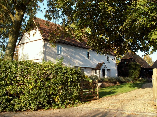
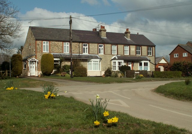
Reed is a picturesque village located in the county of Hertfordshire, England. Situated approximately 40 miles north of London, it falls within the district of North Hertfordshire. With a population of around 400 residents, Reed is a small and close-knit community.

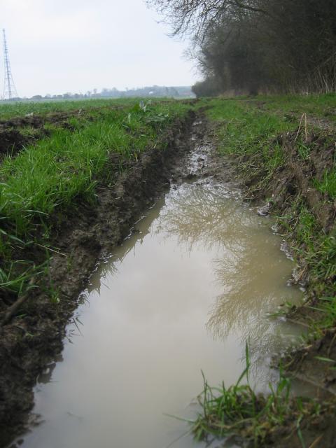
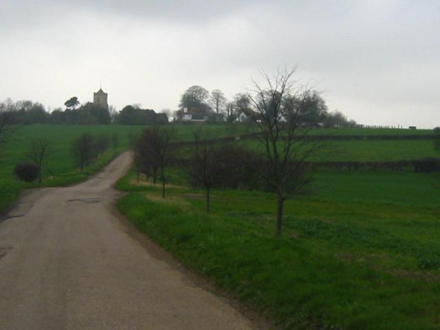
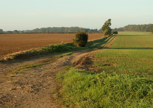
The village is known for its rural charm and is surrounded by beautiful countryside, making it an ideal destination for nature enthusiasts and those seeking a peaceful retreat. The area is characterized by rolling hills, meadows, and woodland, providing ample opportunities for outdoor activities such as walking, hiking, and cycling.

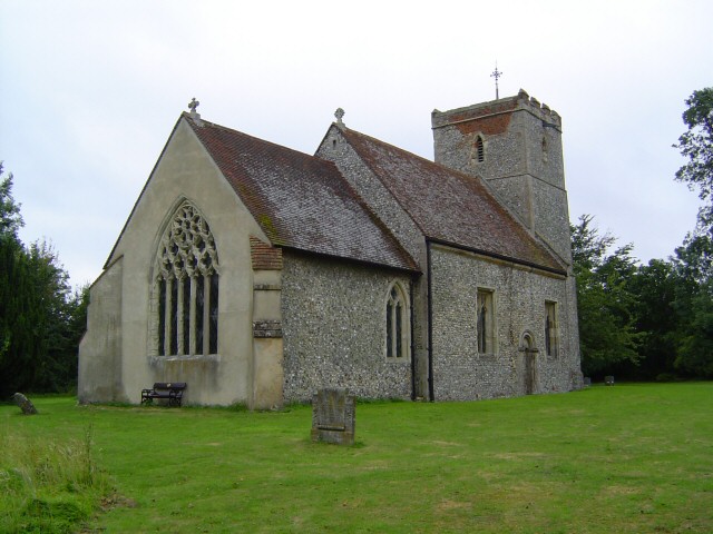
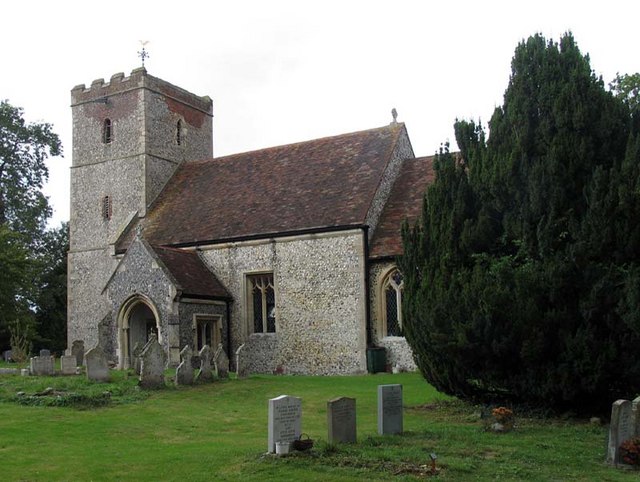
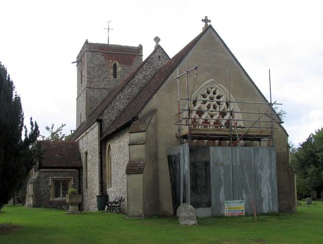
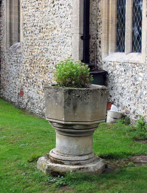
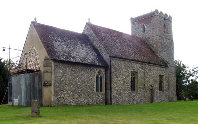
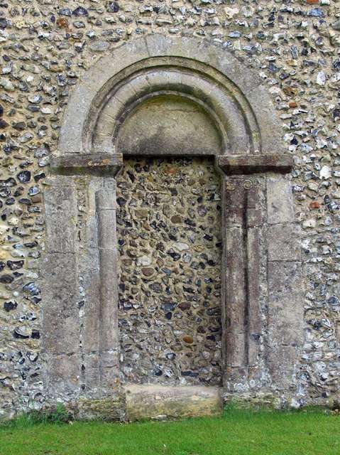
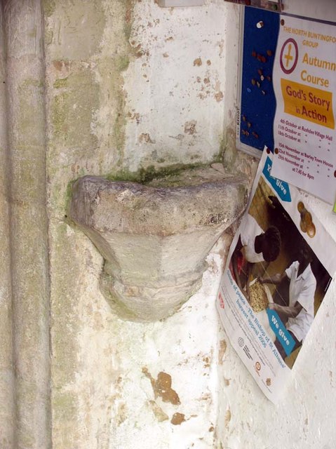
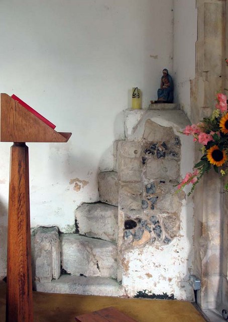
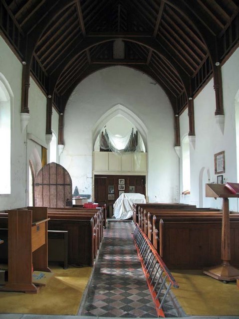
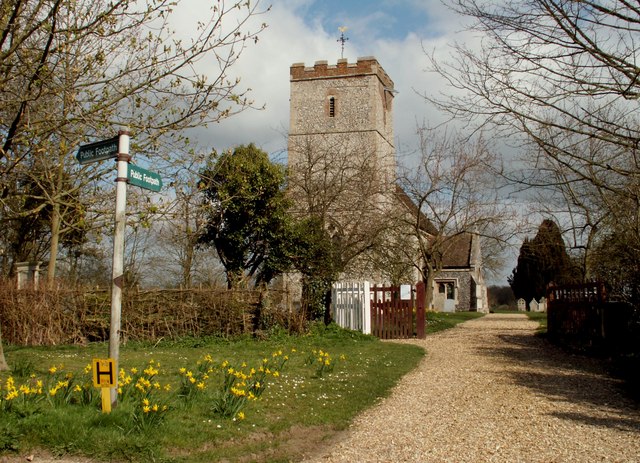
Reed boasts a rich history that can be traced back to the medieval period. The village is home to St. Mary's Church, a notable landmark with origins dating back to the 12th century. The church's architecture showcases a mix of Norman and Gothic styles, and it stands as a testament to the village's heritage.

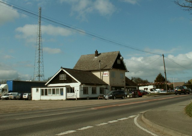
In terms of amenities, Reed offers a quaint village pub, The Cabinet, which serves as a gathering place for locals and visitors alike. Additionally, the village has a community hall that hosts various events throughout the year, fostering a strong sense of community spirit.

Despite its small size, Reed is conveniently located near several larger towns and cities. The nearby town of Royston provides access to a wider range of amenities, including shops, schools, and healthcare facilities.

Overall, Reed is a charming village that offers a peaceful and idyllic lifestyle, making it an attractive destination for those seeking a rural retreat within easy reach of urban conveniences.

If you have any feedback on the listing, please let us know in the comments section below.

Reed Images

Images are sourced within 2km of 52.005714/-0.018561 or Grid Reference TL3636. Thanks to Geograph Open Source API. All images are credited.

Rokey Wood This is the edge of Rokey Wood looking towards the village of Barkway. The mud and puddles are very typical of this area, trust me on this.
Rokey Wood
This is the edge of Rokey Wood looking towards the village of Barkway. The mud and puddles are very typical of this area, trust me on this.
Buckland, Herts Approaching Buckland from Barkway. The entire square is pretty much the green fields you see here, with this sapling-lined road cutting across it.
Buckland, Herts
Approaching Buckland from Barkway. The entire square is pretty much the green fields you see here, with this sapling-lined road cutting across it.
St Mary's, Reed Reed is a small village just off the rural single carriageway part of the A10. The Church is a small affair set some way from the village in a very peaceful location.
St Mary's, Reed
Reed is a small village just off the rural single carriageway part of the A10. The Church is a small affair set some way from the village in a very peaceful location.
Dane End Cottage, close to Dane End, Herts. It looks like this was originally two cottages.
Dane End Cottage, close to Dane End, Herts.
It looks like this was originally two cottages.
Holborn Farm, near to Reed End, Herts.
Public Footpath between Buckland and Barkway, Herts.
Communications tower near Reed Communications tower on the ridge between Barkway and reed - believed to be operated by NTL.
Communications tower near Reed
Communications tower on the ridge between Barkway and reed - believed to be operated by NTL.
St Mary, Reed, Herts
St Mary, Reed, Herts - Redundant font
St Mary, Reed, Herts - Under repair
St Mary, Reed, Herts - Blocked doorway
St Mary, Reed, Herts - Holy water stoup in porch
St Mary, Reed, Herts - Rood stairs
St Mary, Reed, Herts - East end
Terraced houses in Reed village These were probably built around 1900.
Terraced houses in Reed village
These were probably built around 1900.
St. Mary's church at Reed This is the view from Church Lane at the point where two footpaths begin. The church dates back to the Norman period.
St. Mary's church at Reed
This is the view from Church Lane at the point where two footpaths begin. The church dates back to the Norman period.
Roadside cafe on the A.10 at Reed
Show me another place!

Reed is located at Grid Ref: TL3636 (Lat: 52.005714, Lng: -0.018561)

Administrative County: Hertfordshire

District: North Hertfordshire

Police Authority: Hertfordshire

What 3 Words

///routs.ponies.strikers. Near Royston, Hertfordshire

Nearby Locations

Reed Reed

Related Wikis

Reed, Hertfordshire

Reed is a small village and civil parish in North Hertfordshire. It is situated on a chalk ridge, approximately 3 miles (4.8 km) south of the market town...

RAF Barkway

Royal Air Force Barkway or more simply RAF Barkway was one of the smallest Royal Air Force stations in the United Kingdom. It was a Communications Station...

Barkway Chalk Pit

Barkway Chalk Pit is a small (0.3 hectare) nature reserve in Barkway in North Hertfordshire. It was managed by the Herts and Middlesex Wildlife Trust...

St Andrew's Church, Buckland

St Andrew's Church is a redundant Anglican church in the village of Buckland, Hertfordshire, England. It is recorded in the National Heritage List for...

Nearby Amenities

Located within 500m of 52.005714,-0.018561
Reed
Created By: Potlatch 0.4a
Place: village
Source: npe
Wikidata: Q1848766
Lat/Long: 52.0071337/-0.0147518
Bus Stop
Village Hall
Bus: yes
Naptan AtcoCode: 210021104060
Naptan Bearing: W
Naptan BusStopType: CUS
Naptan CommonName: Village Hall
Naptan Crossing: Cricket Ground
Naptan Indicator: opp
Naptan Landmark: Cricket Ground
Naptan NaptanCode: hrtgjptw
Naptan ShortCommonName: NA
Naptan Street: Blacksmiths Lane
Naptan Verified: no
Public Transport: platform
Source: naptan_import
Lat/Long: 52.0083689/-0.0195255
Bus Stop
Village Hall
Bus: yes
Naptan AtcoCode: 210021104330
Naptan Bearing: E
Naptan CommonName: Village Hall
Naptan Crossing: opp Cricket Ground
Naptan Indicator: o/s
Naptan Landmark: opp Cricket Ground
Naptan NaptanCode: hrtgjpwm
Naptan ShortCommonName: NA
Naptan Street: Blacksmiths Lane
Naptan Verified: no
Public Transport: platform
Source: naptan_import
Lat/Long: 52.0084466/-0.0195357
Bus Stop
Silver Ball Cafe
Bench: no
Bin: no
Bus: yes
Lit: no
Naptan AtcoCode: 210021121660
Naptan Bearing: S
Naptan CommonName: Silver Ball Cafe
Naptan Crossing: Blacksmith's Lane
Naptan Indicator: opp
Naptan Landmark: Blacksmith's Lane
Naptan NaptanCode: hrtgapwp
Naptan ShortCommonName: NA
Naptan Street: Ermine Street
Naptan Verified: no
Public Transport: platform
Shelter: no
Source: naptan_import
Tactile Paving: no
Lat/Long: 52.0083838/-0.0243616
Bench
Lat/Long: 52.0059216/-0.0183803
Bench
Lat/Long: 52.0051674/-0.0141461
Post Box
Ref: SG8 388
Lat/Long: 52.0090494/-0.0136596
Power: pole
Lat/Long: 52.0036252/-0.0227826
Power: pole
Lat/Long: 52.0043963/-0.0118581
Power: pole
Lat/Long: 52.0034733/-0.0247969
Power: pole
Lat/Long: 52.0040215/-0.017158
Power: pole
Lat/Long: 52.0037292/-0.0211625
Power: pole
Lat/Long: 52.0043236/-0.0132099
Power: pole
Lat/Long: 52.0041651/-0.0151946
Power: pole
Lat/Long: 52.0038795/-0.0191697
Bench
Lat/Long: 52.0089018/-0.0135772
Power: pole
Lat/Long: 52.0050881/-0.0229947
Power: pole
Lat/Long: 52.0058647/-0.0233236
Power: pole
Lat/Long: 52.0041805/-0.0226182
Man Made: mast
Lat/Long: 52.0074706/-0.0218978
Power: pole
Lat/Long: 52.0067441/-0.0237564
Addr Housename: Cosykot
Lat/Long: 52.007687/-0.0140084
Barrier: kissing_gate
Foot: yes
Source: GPS, observation
Lat/Long: 52.0092348/-0.017771
Barrier: kissing_gate
Foot: yes
Source: GPS, observation
Lat/Long: 52.0067316/-0.0139679
Turning Loop
Lat/Long: 52.0080284/-0.0123577
Post Box
Post Box Type: lamp
Ref: SG8 732
Royal Cypher: EIIR
Royal Cypher Wikidata: Q33102113
Lat/Long: 52.00845/-0.0193753
Telephone
Defibrillator
Booth: K6
Covered: booth
Defibrillator Location: inside old red phone box in front of Reed Village Hall
Emergency: defibrillator
Man Made: telephone_box
Operator: Reed Parish Council
Ref GB The Circuit: 073ABFF9-815F-483F-B61D-AD8B010529BE
Lat/Long: 52.0084348/-0.0193636
The data included in this document is from www.openstreetmap.org. The data is made available under ODbL.

Have you been to Reed?

Leave your review of Reed below (or comments, questions and feedback).