Ravenshead

Settlement in Nottinghamshire Gedling

England

Ravenshead

Newstead Abbey Back door to the Abbey, downpipe showing two different symbols .
Newstead Abbey Credit: GARY ROE

Ravenshead is a village located in the county of Nottinghamshire, England. Situated about 14 miles north of Nottingham city center, it falls within the Mansfield district. The village is nestled on the eastern edge of Sherwood Forest, renowned for its association with the legendary outlaw Robin Hood.

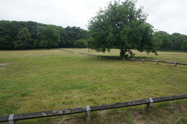
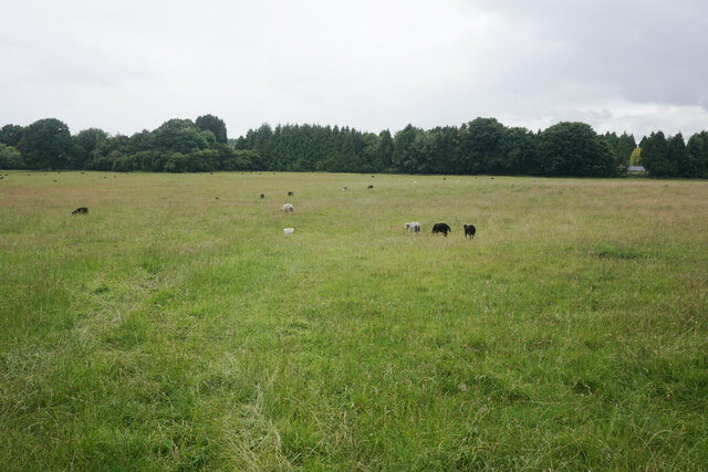
Ravenshead is a small and picturesque village, known for its charming rural setting and close-knit community. The area is characterized by its rolling hills, lush green fields, and dense woodland, offering residents and visitors alike ample opportunities for outdoor activities and scenic walks. The village has managed to retain much of its traditional charm, with many historic buildings and cottages lining its streets.

Despite its relatively small size, Ravenshead offers a range of amenities and services to its residents. These include several local shops, a post office, a library, and a selection of pubs and restaurants. The village is also home to a primary school and a secondary school, providing education for children of all ages.

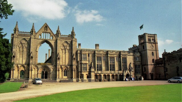
Transport links in Ravenshead are convenient, with regular bus services connecting the village to nearby towns and cities. The A60 road runs through the village, providing easy access to Nottingham and Mansfield. Additionally, the neighboring towns of Southwell and Newstead Abbey are within close proximity, offering further attractions and amenities.

Ravenshead provides a peaceful and idyllic setting for those seeking a quieter lifestyle, while still enjoying the convenience of nearby urban areas. Its natural beauty and community spirit make it a popular choice for both residents and visitors.

If you have any feedback on the listing, please let us know in the comments section below.
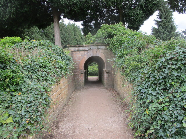
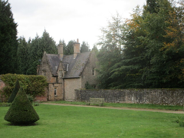
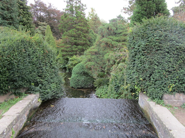
Ravenshead Images

Images are sourced within 2km of 53.085274/-1.166455 or Grid Reference SK5554. Thanks to Geograph Open Source API. All images are credited.

Newstead Abbey Back door to the Abbey, downpipe showing two different symbols .
Newstead Abbey
Back door to the Abbey, downpipe showing two different symbols .
The Japanese Garden, Newstead Abbey Created for Ethel Webb in the early years of the twentieth century.
The Japanese Garden, Newstead Abbey
Created for Ethel Webb in the early years of the twentieth century.
Weir below the Garden Lake, Newstead Abbey
The Stew Pond, Newstead Abbey
The Garden Lake, Newstead Abbey
The Eagle Pool and the east facade of Newstead Abbey The inside of the west front of the medieval abbey visible in the right <span class="nowrap"><a title="https://historicengland.org.uk/listing/the-list/list-entry/1265325" rel="nofollow ugc noopener" href="https://historicengland.org.uk/listing/the-list/list-entry/1265325">Link</a><img style="margin-left:2px;" alt="External link" title="External link - shift click to open in new window" src="https://s1.geograph.org.uk/img/external.png" width="10" height="10"/></span>
The Eagle Pool and the east facade of Newstead Abbey
The inside of the west front of the medieval abbey visible in the right LinkExternal link
Satyr, Newstead Abbey Early eighteenth century <span class="nowrap"><a title="https://historicengland.org.uk/listing/the-list/list-entry/1227526" rel="nofollow ugc noopener" href="https://historicengland.org.uk/listing/the-list/list-entry/1227526">Link</a><img style="margin-left:2px;" alt="External link" title="External link - shift click to open in new window" src="https://s1.geograph.org.uk/img/external.png" width="10" height="10"/></span> Probably the work of Jan van Nost the Elder <span class="nowrap"><a title="https://en.wikipedia.org/wiki/John_Nost" rel="nofollow ugc noopener" href="https://en.wikipedia.org/wiki/John_Nost">Link</a><img style="margin-left:2px;" alt="External link" title="External link - shift click to open in new window" src="https://s1.geograph.org.uk/img/external.png" width="10" height="10"/></span>
Satyr, Newstead Abbey
Early eighteenth century LinkExternal link Probably the work of Jan van Nost the Elder LinkExternal link
Monument to Boatswain Boatswain was Lord Byron's dog,
Monument to Boatswain
Boatswain was Lord Byron's dog,
The Spanish Garden, Newstead Abbey Originally created in the early eighteenth century.
The Gothic windows in the building beyond light the chapel which has been created from the chapter house of the original abbey (actually a priory).
The Spanish Garden, Newstead Abbey
Originally created in the early eighteenth century. The Gothic windows in the building beyond light the chapel which has been created from the chapter house of the original abbey (actually a priory).
Archway through the garden wall, Newstead Abbey
The Garden House, Newstead Abbey
Weir above the Japanese Garden, Newstead  Abbey This is the much modified River Leen.
Weir above the Japanese Garden, Newstead Abbey
This is the much modified River Leen.
Newstead Abbey in 2002 The west front
Newstead Abbey in 2002
The west front
Newstead Abbey A former Augustinian priory, now a residential property owned by Nottingham City Council. It is a popular local tourist attraction.
Newstead Abbey
A former Augustinian priory, now a residential property owned by Nottingham City Council. It is a popular local tourist attraction.
Overflow parking at Newstead Abbey There seemed quite a lot of cars in the main car park, but there is clearly capacity for a lot more.
Overflow parking at Newstead Abbey
There seemed quite a lot of cars in the main car park, but there is clearly capacity for a lot more.
Robin Hood Way crossing Swinecotte Dale The road is the main vehicle access route for Newstead Abbey.
Robin Hood Way crossing Swinecotte Dale
The road is the main vehicle access route for Newstead Abbey.
Robin Hood Way in Newstead Park Passing through woodland on the edge of the park. The Robin Hood Way is a long-distance footpath of 104 miles, but it takes a very circuitous route within Nottinghamshire.
Robin Hood Way in Newstead Park
Passing through woodland on the edge of the park. The Robin Hood Way is a long-distance footpath of 104 miles, but it takes a very circuitous route within Nottinghamshire.
Newstead Park A large area of the park given over to sheep grazing.
Newstead Park
A large area of the park given over to sheep grazing.
Show me another place!

Ravenshead is located at Grid Ref: SK5554 (Lat: 53.085274, Lng: -1.166455)

Administrative County: Nottinghamshire

District: Gedling

Police Authority: Nottinghamshire

What 3 Words

///news.redouble.reply. Near Ravenshead, Nottinghamshire

Nearby Locations

Ravenshead Tabramhill Wood

Related Wikis

Ravenshead

Ravenshead is a large village and civil parish in the Gedling district of Nottinghamshire, England. It borders Papplewick, Newstead Abbey and Blidworth...
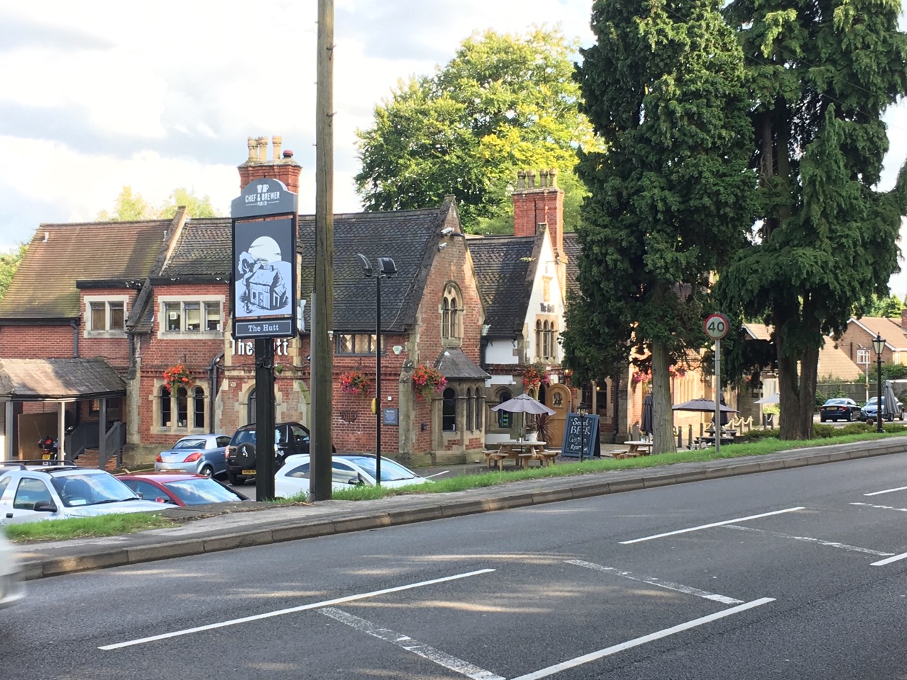
The Hutt

The Hutt is a public house located in the village of Ravenshead in Nottinghamshire, opposite Newstead Abbey. The pub was built on the site of The Royal...
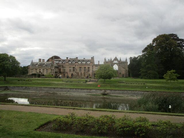
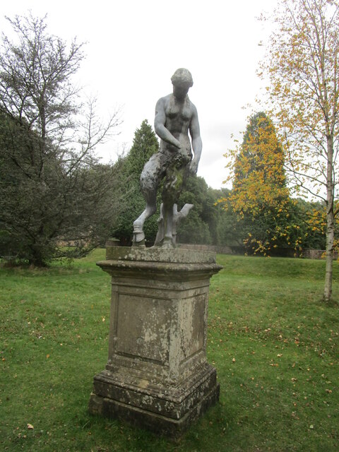
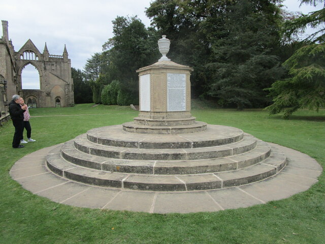
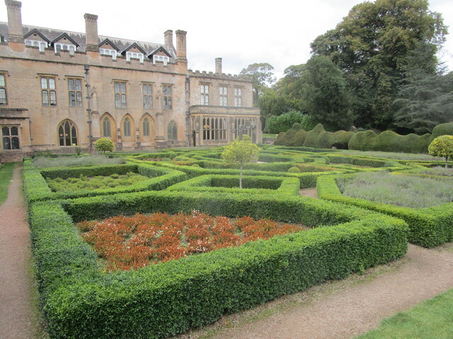
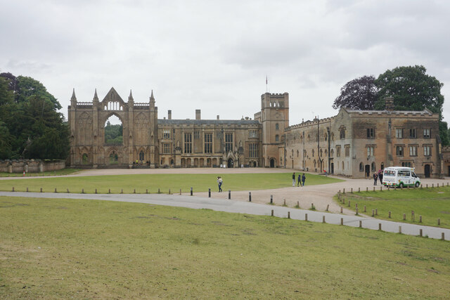
Newstead Abbey

Newstead Abbey, in Nottinghamshire, England, was formerly an Augustinian priory. Converted to a domestic home following the Dissolution of the Monasteries...

Skegby Rural District

Skegby was a rural district in Nottinghamshire, England from 1894 to 1935. It was created under the Local Government Act 1894 based on that part of the...

Nearby Amenities

Located within 500m of 53.085274,-1.166455
Turning Circle
Lat/Long: 53.0887742/-1.1681415
Turning Circle
Lat/Long: 53.0892588/-1.1657812
Turning Circle
Lat/Long: 53.0884082/-1.1621591
Ravenshead
Place: village
Wikidata: Q7296532
Wikipedia: en:Ravenshead
Lat/Long: 53.0868821/-1.1611984
Turning Circle
Lat/Long: 53.0866026/-1.1604446
Turning Circle
Lat/Long: 53.0849518/-1.1589955
Turning Circle
Lat/Long: 53.0838474/-1.1615766
Post Box
Lat/Long: 53.0829797/-1.1620859
Post Box
Collection Times: Mo-Fr 16:45, Sa 10:30
Post Box Type: pillar
Ref: NG15 36
Lat/Long: 53.0854425/-1.1663632
Pharmacy
Peak Pharmacy
Healthcare: pharmacy
Opening Hours: Mo-Fr 08:45-13:00,13:30-18:00; Sa 09:00-13:00
Lat/Long: 53.0855187/-1.1663212
Telephone
Booth: K6
Covered: booth
Man Made: telephone_box
Lat/Long: 53.0854763/-1.1663695
Pub
The Hutt
Brand: Chef & Brewer
Brand Wikidata: Q5089491
Opening Hours: Su-We 12:00-22:00; Th-Sa 12:00-23:00
Website: https://www.chefandbrewer.com/pubs/nottinghamshire/hutt
Wikidata: Q20054030
Wikipedia: en:The Hutt
Lat/Long: 53.0837828/-1.1700025
Grit Bin
Check Date: 2021-04-30
Lat/Long: 53.0868704/-1.166119
Bench
Backrest: yes
Lat/Long: 53.0868807/-1.1663336
Grit Bin
Lat/Long: 53.0891747/-1.1668486
Bus Stop
Village Hall
Bench: no
Bus: yes
Naptan AtcoCode: 3300GE0022
Naptan Bearing: S
Naptan CommonName: Village Hall
Naptan Indicator: adj
Naptan Landmark: Village Hall
Naptan NaptanCode: ntsawdtw
Naptan Notes: BW
Naptan PlusbusZoneRef: MFLDTWN
Naptan Street: Vernon Crescent
Public Transport: platform
Shelter: no
Source: naptan_import
Tactile Paving: no
Lat/Long: 53.0843455/-1.1661409
Bus Stop
Vernon Crescent
Bus: yes
Naptan AtcoCode: 3300GE0024
Naptan Bearing: SE
Naptan CommonName: Vernon Crescent
Naptan Indicator: o/s 33
Naptan NaptanCode: ntsawdwd
Naptan Notes: none
Naptan PlusbusZoneRef: MFLDTWN
Naptan Street: Vernon Crescent
Naptan Verified: no
Public Transport: platform
Source: naptan_import
Lat/Long: 53.0834333/-1.1642624
The Hollies
Naptan AtcoCode: 3300GE0031
Naptan Bearing: SE
Naptan CommonName: The Hollies
Naptan Crossing: The Hollies
Naptan Indicator: adj
Naptan NaptanCode: ntsdmgda
Naptan Notes: BW
Naptan PlusbusZoneRef: MFLDTWN
Naptan Street: Longdale Lane
Naptan Verified: yes
Physically Present: no
Source: naptan_import
Lat/Long: 53.084451/-1.1696624
Bus Stop
Vernon Crescent
Bus: yes
Naptan AtcoCode: 3300GE0033
Naptan Bearing: NW
Naptan CommonName: Vernon Crescent
Naptan Indicator: o/s 22
Naptan NaptanCode: ntsdmgdj
Naptan Notes: none
Naptan PlusbusZoneRef: MFLDTWN
Naptan Street: Vernon Crescent
Naptan Verified: no
Public Transport: platform
Source: naptan_import
Lat/Long: 53.083446/-1.1647847
Milton Drive
Naptan AtcoCode: 3300GE0086
Naptan Bearing: N
Naptan CommonName: Milton Drive
Naptan Crossing: Milton Drive
Naptan Indicator: opp
Naptan NaptanCode: ntsatgjm
Naptan Notes: none
Naptan PlusbusZoneRef: MFLDTWN
Naptan Street: Sheepwalk Lane
Physically Present: no
Source: naptan_import
Lat/Long: 53.0845567/-1.1680629
Bus Stop
Nottingham Road
Bus: yes
Naptan AtcoCode: 3300GE0096
Naptan Bearing: S
Naptan CommonName: Nottingham Road
Naptan Indicator: o/s 131
Naptan NaptanCode: ntsapmaj
Naptan Notes: none
Naptan PlusbusZoneRef: MFLDTWN
Naptan Street: Nottingham Road
Naptan Verified: no
Public Transport: platform
Source: naptan_import
Lat/Long: 53.0819632/-1.169994
Bus Stop
Nottingham Road
Bus: yes
Naptan AtcoCode: 3300GE0097
Naptan Bearing: N
Naptan CommonName: Nottingham Road
Naptan Indicator: o/s 130
Naptan NaptanCode: ntsapmam
Naptan Notes: BW
Naptan PlusbusZoneRef: MFLDTWN
Naptan Street: Nottingham Road
Naptan Verified: no
Public Transport: platform
Source: naptan_import
Lat/Long: 53.0818385/-1.1701606
Bus Stop
Newstead Abbey Gates
Bench: yes
Bus: yes
Naptan AtcoCode: 3300GE0100
Naptan Bearing: N
Naptan CommonName: Newstead Abbey Gates
Naptan Crossing: Longdale Lane
Naptan Indicator: o/s
Naptan Landmark: Newstead Abbey Gates
Naptan NaptanCode: ntsaptwg
Naptan PlusbusZoneRef: MFLDTWN
Naptan Street: Nottingham Road
Naptan Verified: no
Public Transport: platform
Shelter: yes
Source: naptan_import
Tactile Paving: no
Lat/Long: 53.0849548/-1.1710114
Bus Stop
Newstead Abbey Gates
Bench: yes
Bus: yes
Naptan AtcoCode: 3300GE0101
Naptan Bearing: S
Naptan CommonName: Newstead Abbey Gates
Naptan Crossing: Longdale Lane
Naptan Indicator: opp
Naptan Landmark: Newstead Abbey Gates
Naptan NaptanCode: ntsaptwj
Naptan Notes: none
Naptan PlusbusZoneRef: MFLDTWN
Naptan Street: Nottingham Road
Naptan Verified: yes
Public Transport: platform
Shelter: yes
Source: naptan_import
Tactile Paving: no
Lat/Long: 53.0857818/-1.1709955
Shopping Precinct
Naptan AtcoCode: 3300GE0704
Naptan Bearing: E
Naptan BusStopType: CUS
Naptan CommonName: Shopping Precinct
Naptan Crossing: Milton Crescent
Naptan Indicator: adj
Naptan Landmark: Shopping Precinct
Naptan NaptanCode: ntsapwta
Naptan Notes: CUS
Naptan PlusbusZoneRef: MFLDTWN
Naptan Street: Milton Drive
Naptan Verified: no
Source: naptan_import
Lat/Long: 53.0850877/-1.1655891
The Hollies
Naptan AtcoCode: 3300GE0705
Naptan Bearing: SW
Naptan BusStopType: CUS
Naptan CommonName: The Hollies
Naptan Crossing: Longdale Lane
Naptan Indicator: o/s 4
Naptan NaptanCode: ntsapwtd
Naptan Notes: CUS
Naptan PlusbusZoneRef: MFLDTWN
Naptan Street: The Hollies
Physically Present: no
Source: naptan_import
Lat/Long: 53.0849718/-1.1695778
Bus Stop
Health Centre
Bus: yes
Naptan AtcoCode: 3300GE0706
Naptan Bearing: N
Naptan BusStopType: CUS
Naptan CommonName: Health Centre
Naptan Crossing: Oakwood Drive
Naptan Indicator: opp
Naptan Landmark: Health Centre
Naptan NaptanCode: ntsapwtg
Naptan Notes: CUS
Naptan PlusbusZoneRef: MFLDTWN
Naptan Street: Longdale Avenue
Naptan Verified: no
Public Transport: platform
Source: naptan_import
Lat/Long: 53.0826386/-1.1624564
Bus Stop
Health Centre
Bus: yes
Naptan AtcoCode: 3300GE0707
Naptan Bearing: S
Naptan BusStopType: CUS
Naptan CommonName: Health Centre
Naptan Crossing: Oakwood Drive
Naptan Indicator: adj
Naptan Landmark: Health Centre
Naptan NaptanCode: ntsapwtj
Naptan Notes: CUS
Naptan PlusbusZoneRef: MFLDTWN
Naptan Street: Longdale Avenue
Naptan Verified: no
Public Transport: platform
Source: naptan_import
Lat/Long: 53.0826289/-1.162367
Village Hall
Naptan AtcoCode: 3300GE0722
Naptan Bearing: NW
Naptan BusStopType: CUS
Naptan CommonName: Village Hall
Naptan Indicator: opp
Naptan Landmark: Village Hall
Naptan NaptanCode: ntsgjdtp
Naptan Notes: CUS--3300GE0022
Naptan PlusbusZoneRef: MFLDTWN
Naptan Street: Vernon Crescent
Physically Present: no
Source: naptan_import
Lat/Long: 53.0842925/-1.1662763
The Hollies
Naptan AtcoCode: 3300GE0723
Naptan Bearing: NW
Naptan BusStopType: CUS
Naptan CommonName: The Hollies
Naptan Crossing: The Hollies
Naptan Indicator: opp
Naptan NaptanCode: ntsgjdtw
Naptan Notes: CUS--3300GE0031
Naptan PlusbusZoneRef: MFLDTWN
Naptan Street: Longdale Lane
Naptan Verified: yes
Source: naptan_import
Lat/Long: 53.0843709/-1.1697834
Bench
Backrest: yes
Lat/Long: 53.085414/-1.1661925
Bench
Backrest: yes
Lat/Long: 53.0854462/-1.1656024
Fast Food
Hoi Shan
Description: Chinese Take Away
Lat/Long: 53.0853998/-1.1653898
Fast Food
Kevin's Fish Bar
Description: Fish and Chips
Lat/Long: 53.0853584/-1.1653757
Cafe
Rose's Pantry
Phone: +44 1623 466118
Shop: newsagent
Takeaway: yes
Website: www.rosepantry.co.uk
Lat/Long: 53.0855171/-1.1656051
Post Office
Ravenshead Post Office
Addr Postcode: NG15 9BD
Branch: Ravenshead
Brand: Post Office
Brand Wikidata: Q1783168
Check Date: 2020-02-20
Contact Website: https://www.postoffice.co.uk/branch-finder/3762270/ravenshead
Opening Hours: Mo-Fr 09:00-17:30; Sa 08:30-14:00
Ref Pol Id: 14069
Lat/Long: 53.085475/-1.1663061
Bicycle Parking
Bicycle Parking: stands
Capacity: 4
Covered: no
Lat/Long: 53.0851949/-1.1663346
Barrier: cycle_barrier
Cycle Barrier: double
Lat/Long: 53.0859286/-1.1662268
Barrier: cycle_barrier
Cycle Barrier: double
Lat/Long: 53.0866632/-1.1666104
Barrier: cycle_barrier
Cycle Barrier: double
Lat/Long: 53.0849374/-1.1702766
Turning Circle
Lat/Long: 53.0826677/-1.1642025
Turning Circle
Lat/Long: 53.0828352/-1.1649535
Turning Circle
Lat/Long: 53.0826029/-1.1658324
Give Way
Direction: backward
Lat/Long: 53.0848328/-1.1705677
Crossing
Bicycle: yes
Crossing: traffic_signals
Crossing Island: yes
Crossing Ref: toucan
Tactile Paving: yes
Lat/Long: 53.0852535/-1.1708509
Give Way
Direction: forward
Lat/Long: 53.0849714/-1.1705307
Bairstow Eves
Addr City: Ravenshead, Nottingham
Addr Housenumber: 8b
Addr Postcode: NG15 9BD
Addr Street: Milton Court
Brand: Bairstow Eves
Brand Wikidata: Q81074787
Office: estate_agent
Phone: +44 1623594608
Website: https://www.bairstoweves.co.uk/forsaleoffice/Ravenshead/321
Lat/Long: 53.0854511/-1.1653795
Generator Method: photovoltaic
Generator Output Electricity: yes
Generator Source: solar
Generator Type: solar_photovoltaic_panel
Location: roof
Power: generator
Lat/Long: 53.0857992/-1.1668981
Generator Method: photovoltaic
Generator Output Electricity: yes
Generator Source: solar
Generator Type: solar_photovoltaic_panel
Location: roof
Power: generator
Lat/Long: 53.0857686/-1.1667908
Generator Method: photovoltaic
Generator Output Electricity: yes
Generator Source: solar
Generator Type: solar_photovoltaic_panel
Location: roof
Power: generator
Lat/Long: 53.0862099/-1.1675445
Generator Method: photovoltaic
Generator Output Electricity: yes
Generator Source: solar
Generator Type: solar_photovoltaic_panel
Location: roof
Power: generator
Lat/Long: 53.08621/-1.1676438
Generator Method: photovoltaic
Generator Output Electricity: yes
Generator Source: solar
Generator Type: solar_photovoltaic_panel
Location: roof
Power: generator
Lat/Long: 53.088193/-1.1689259
Give Way
Lat/Long: 53.0849985/-1.1663398
Generator Method: photovoltaic
Generator Output Electricity: yes
Generator Source: solar
Generator Type: solar_photovoltaic_panel
Location: roof
Power: generator
Lat/Long: 53.0893129/-1.1697084
Generator Method: photovoltaic
Generator Output Electricity: yes
Generator Source: solar
Generator Type: solar_photovoltaic_panel
Location: roof
Power: generator
Lat/Long: 53.0887705/-1.1627025
Generator Method: photovoltaic
Generator Output Electricity: yes
Generator Source: solar
Generator Type: solar_photovoltaic_panel
Location: roof
Power: generator
Lat/Long: 53.0858048/-1.1676538
Generator Method: photovoltaic
Generator Output Electricity: yes
Generator Source: solar
Generator Type: solar_photovoltaic_panel
Location: roof
Power: generator
Lat/Long: 53.0858866/-1.1647859
Generator Method: photovoltaic
Generator Output Electricity: yes
Generator Source: solar
Generator Type: solar_photovoltaic_panel
Location: roof
Power: generator
Lat/Long: 53.0858367/-1.1652633
Generator Method: photovoltaic
Generator Output Electricity: yes
Generator Source: solar
Generator Type: solar_photovoltaic_panel
Location: roof
Power: generator
Lat/Long: 53.0857658/-1.1660063
Generator Method: photovoltaic
Generator Output Electricity: yes
Generator Source: solar
Generator Type: solar_photovoltaic_panel
Location: roof
Power: generator
Lat/Long: 53.0858593/-1.1650273
Generator Method: photovoltaic
Generator Output Electricity: yes
Generator Source: solar
Generator Type: solar_photovoltaic_panel
Location: roof
Power: generator
Lat/Long: 53.0858915/-1.1645606
Generator Method: photovoltaic
Generator Output Electricity: yes
Generator Source: solar
Generator Type: solar_photovoltaic_panel
Location: roof
Power: generator
Lat/Long: 53.0859076/-1.1640483
Generator Method: photovoltaic
Generator Output Electricity: yes
Generator Source: solar
Generator Type: solar_photovoltaic_panel
Location: roof
Power: generator
Lat/Long: 53.0859398/-1.1634448
Generator Method: photovoltaic
Generator Output Electricity: yes
Generator Source: solar
Generator Type: solar_photovoltaic_panel
Location: roof
Power: generator
Lat/Long: 53.0850376/-1.1634716
Generator Method: photovoltaic
Generator Output Electricity: yes
Generator Source: solar
Generator Type: solar_photovoltaic_panel
Location: roof
Power: generator
Lat/Long: 53.0835684/-1.1643782
Generator Method: photovoltaic
Generator Output Electricity: yes
Generator Source: solar
Generator Type: solar_photovoltaic_panel
Location: roof
Power: generator
Lat/Long: 53.083607/-1.1642387
Generator Method: photovoltaic
Generator Output Electricity: yes
Generator Source: solar
Generator Type: solar_photovoltaic_panel
Location: roof
Power: generator
Lat/Long: 53.0856316/-1.1614492
Generator Method: photovoltaic
Generator Output Electricity: yes
Generator Source: solar
Generator Type: solar_photovoltaic_panel
Location: roof
Power: generator
Lat/Long: 53.0876759/-1.1624336
Generator Method: photovoltaic
Generator Output Electricity: yes
Generator Source: solar
Generator Type: solar_photovoltaic_panel
Location: roof
Power: generator
Lat/Long: 53.0877637/-1.1615055
Generator Method: photovoltaic
Generator Output Electricity: yes
Generator Source: solar
Generator Type: solar_photovoltaic_panel
Location: roof
Power: generator
Lat/Long: 53.0879917/-1.1605319
Generator Method: photovoltaic
Generator Output Electricity: yes
Generator Source: solar
Generator Type: solar_photovoltaic_panel
Location: roof
Power: generator
Lat/Long: 53.0829676/-1.1633764
Generator Method: photovoltaic
Generator Output Electricity: yes
Generator Source: solar
Generator Type: solar_photovoltaic_panel
Location: roof
Power: generator
Lat/Long: 53.0828484/-1.1618931
Generator Method: photovoltaic
Generator Output Electricity: yes
Generator Source: solar
Generator Type: solar_photovoltaic_panel
Location: roof
Power: generator
Lat/Long: 53.082879/-1.1626468
Generator Method: photovoltaic
Generator Output Electricity: yes
Generator Source: solar
Generator Type: solar_photovoltaic_panel
Location: roof
Power: generator
Lat/Long: 53.0821411/-1.1613996
Generator Method: photovoltaic
Generator Output Electricity: yes
Generator Source: solar
Generator Type: solar_photovoltaic_panel
Location: roof
Power: generator
Lat/Long: 53.0828065/-1.1658976
Generator Method: photovoltaic
Generator Output Electricity: yes
Generator Source: solar
Generator Type: solar_photovoltaic_panel
Location: roof
Power: generator
Lat/Long: 53.0879703/-1.1681946
Generator Method: photovoltaic
Generator Output Electricity: yes
Generator Source: solar
Generator Type: solar_photovoltaic_panel
Location: roof
Power: generator
Lat/Long: 53.0880078/-1.1682167
Adcock Financial
Addr Housenumber: 10
Addr Postcode: NG15 9GS
Addr Street: Milton Court
Email: info@adcockfinancial.co.uk
Office: accountant
Operator: Adcock Financial
Phone: +44 1623 490120
Website: https://adcockfinancial.co.uk/
Lat/Long: 53.0853134/-1.1653662
Gascoines
Office: estate_agent
Lat/Long: 53.0854882/-1.1660582
Platinum Hair
Shop: hairdresser
Lat/Long: 53.0855019/-1.1658168
Bradbury's
Shop: deli
Lat/Long: 53.08551/-1.1657055
Bench
Backrest: yes
Lat/Long: 53.0845619/-1.1701338
Barrier: toll_booth
Lat/Long: 53.0849373/-1.1718344
Generator Method: photovoltaic
Generator Output Electricity: yes
Generator Source: solar
Generator Type: solar_photovoltaic_panel
Location: roof
Power: generator
Lat/Long: 53.0877693/-1.1634028
Waste Basket
Waste: dog_excrement
Lat/Long: 53.086622/-1.1665457
Generator Method: photovoltaic
Generator Output Electricity: yes
Generator Source: solar
Generator Type: solar_photovoltaic_panel
Location: roof
Power: generator
Lat/Long: 53.0894499/-1.1657705
Turning Circle
Lat/Long: 53.0863155/-1.1612409
Generator Method: photovoltaic
Generator Output Electricity: yes
Generator Source: solar
Generator Type: solar_photovoltaic_panel
Location: roof
Power: generator
Lat/Long: 53.0851451/-1.1591421
Generator Method: photovoltaic
Generator Output Electricity: yes
Generator Source: solar
Generator Type: solar_photovoltaic_panel
Location: roof
Power: generator
Lat/Long: 53.0842566/-1.160504
Entrance: main
Lat/Long: 53.0843296/-1.1657276
Bench
Backrest: yes
Material: wood
Lat/Long: 53.0845017/-1.166029
Bench
Backrest: no
Material: wood
Lat/Long: 53.0842663/-1.1659036
Bench
Backrest: no
Material: wood
Lat/Long: 53.0843041/-1.1659278
Ravenshead Beauty
Addr Housenumber: 8
Addr Postcode: NG15 9BD
Addr Street: Milton Court
Phone: +44 1623 794448
Shop: beauty
Website: https://www.ravensheadbeauty.com/
Lat/Long: 53.0854927/-1.1659435
Post Box
Brand: Royal Mail
Brand Wikidata: Q638098
Brand Wikipedia: en:Royal Mail
Collection Times: Mo-Fr 09:00, Sa 07:00
Operator: Royal Mail
Operator Wikidata: Q638098
Post Box Type: lamp
Ref: NG15 33
Royal Cypher: EIIR
Royal Cypher Wikidata: Q33102113
Lat/Long: 53.0847536/-1.1710317
Bench
Backrest: yes
Lat/Long: 53.0849602/-1.171067
Generator Method: photovoltaic
Generator Output Electricity: yes
Generator Source: solar
Generator Type: solar_photovoltaic_panel
Location: roof
Power: generator
Lat/Long: 53.0819971/-1.1652113
Waste Basket
Waste: dog_excrement
Lat/Long: 53.0859635/-1.1608641
Barrier: cycle_barrier
Cycle Barrier: double
Lat/Long: 53.0873577/-1.1609465
Barrier: cycle_barrier
Cycle Barrier: double
Lat/Long: 53.0874862/-1.1609347
Grit Bin
Lat/Long: 53.0859385/-1.1662195
Generator Method: photovoltaic
Generator Output Electricity: yes
Generator Source: solar
Generator Type: solar_photovoltaic_panel
Location: roof
Power: generator
Lat/Long: 53.0855583/-1.1625029
Man Made: flagpole
Lat/Long: 53.0842423/-1.1659484
Defibrillator
Access: yes
Defibrillator Location: AED, The Centre at St Peters Church
Emergency: defibrillator
Indoor: no
Operator: St Peters Church
Phone: 01623 405203
Lat/Long: 53.0868024/-1.168902
The data included in this document is from www.openstreetmap.org. The data is made available under ODbL.

Have you been to Ravenshead?

Leave your review of Ravenshead below (or comments, questions and feedback).