Randwick

Settlement in Gloucestershire Stroud

England

Randwick

Stratford Park Lido View through turnstiles of 1930's open air lido with cast concrete diving boards and the modern leisure centre next door in Stratford Park, Stroud, Gloucestershire.
Stratford Park Lido Credit: Nat Bocking

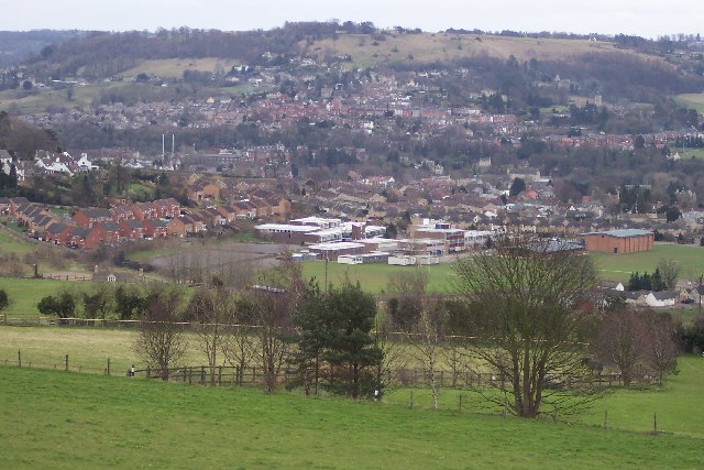
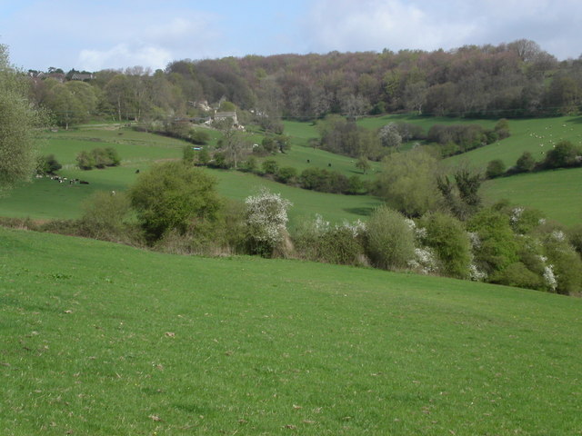
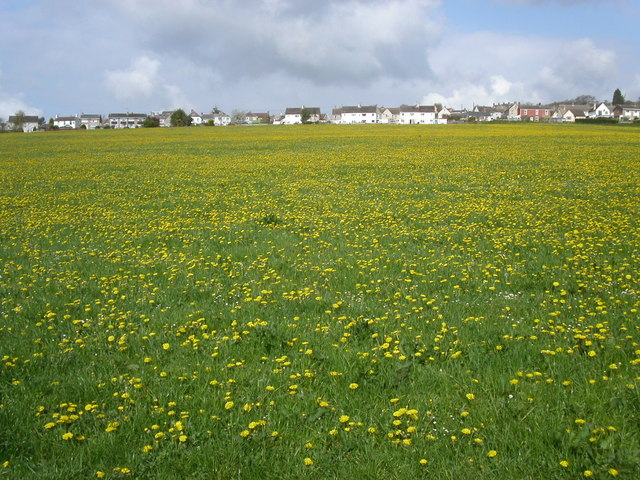
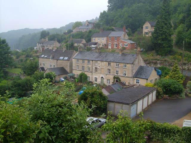
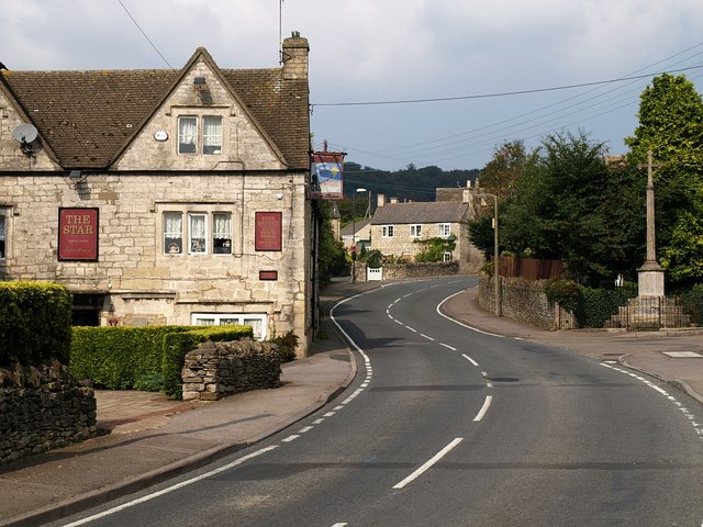
Randwick is a small village located in the district of Stroud, Gloucestershire, England. Nestled in the picturesque Cotswold Hills, Randwick is situated about 2 miles southwest of Stroud town center. The village is surrounded by stunning natural beauty, with rolling green hills and charming countryside views.

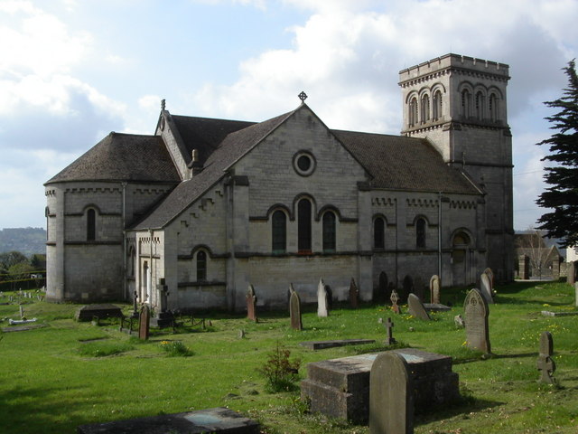
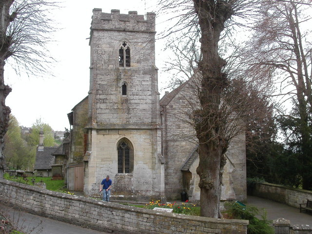
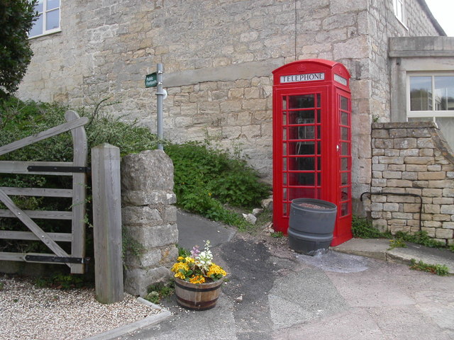
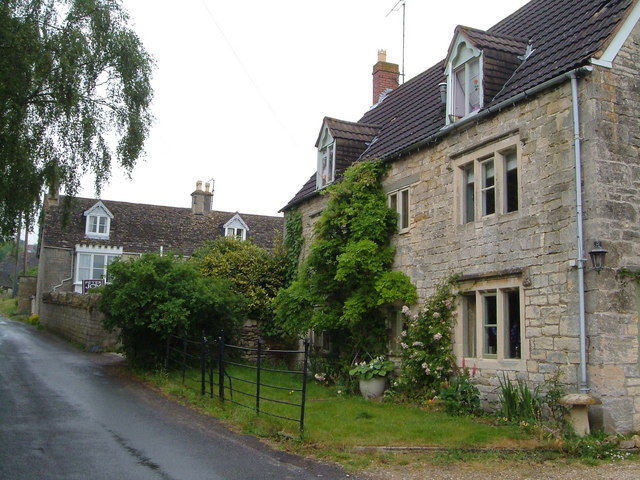
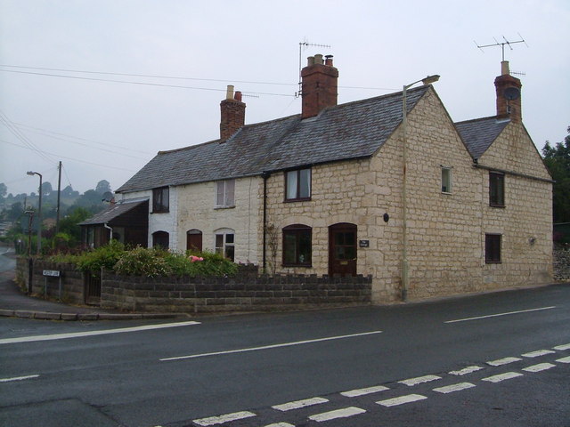
Randwick has a rich history, dating back to the early 13th century. The village is known for its traditional Cotswold stone houses, which add to its quaint and picturesque atmosphere. The local parish church, St. John the Baptist, is a prominent landmark and a testament to the village's historical significance.

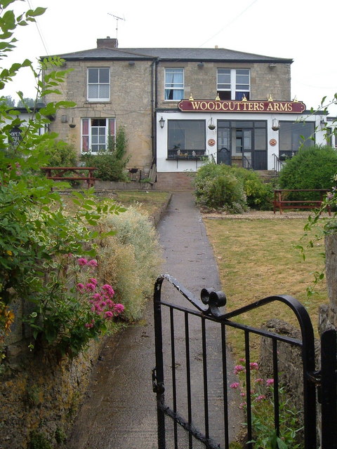
Despite its small size, Randwick offers a range of amenities to its residents. The village boasts a well-regarded primary school, providing educational opportunities for local children. There is also a cozy village pub, The Vine Tree, which serves as a social hub for the community. Additionally, Randwick has a village shop and post office, ensuring that locals have access to essential goods and services.

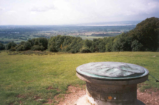
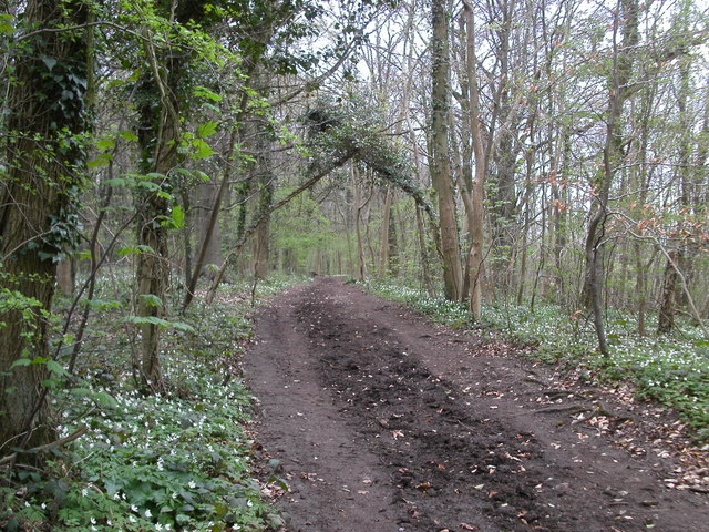
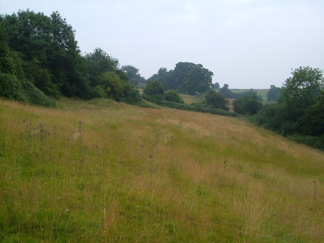
The surrounding area provides ample opportunities for outdoor activities. Randwick Woods and the adjacent Standish Woods offer beautiful walking trails, allowing residents and visitors to explore the natural surroundings. The village is also part of the Cotswold Way National Trail, making it a popular destination for hikers and nature enthusiasts.

Overall, Randwick offers a peaceful and idyllic countryside setting, coupled with a close-knit community and a range of amenities. It is a desirable place to live for those seeking a tranquil village lifestyle within easy reach of larger towns and cities.

If you have any feedback on the listing, please let us know in the comments section below.
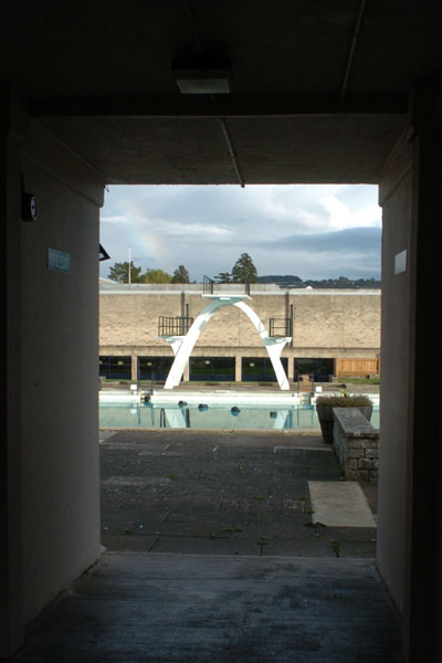
Randwick Images

Images are sourced within 2km of 51.759494/-2.2496926 or Grid Reference SO8206. Thanks to Geograph Open Source API. All images are credited.

Stratford Park Lido View through turnstiles of 1930's open air lido with cast concrete diving boards and the modern leisure centre next door in Stratford Park, Stroud, Gloucestershire.
Stratford Park Lido
View through turnstiles of 1930's open air lido with cast concrete diving boards and the modern leisure centre next door in Stratford Park, Stroud, Gloucestershire.
Topograph on Haresfield Beacon The Severn Estuary can be seen in the distance.
Topograph on Haresfield Beacon
The Severn Estuary can be seen in the distance.
Stroud view General view of Stroud. The clump of buildings in the centre of the picture belong to Archway School. The pair of white lines looking like a giant rugby goal are chimney stacks belonging to the Millikan factory, a wool cloth mill. The hill in the background is Rodborough Hill.
Stroud view
General view of Stroud. The clump of buildings in the centre of the picture belong to Archway School. The pair of white lines looking like a giant rugby goal are chimney stacks belonging to the Millikan factory, a wool cloth mill. The hill in the background is Rodborough Hill.
Road to Haresfield Beacon The road forks left to Haresfield Beacon. A popular walking area with views of the river Severn. The Cotswold Way path lies close to the road.
Road to Haresfield Beacon
The road forks left to Haresfield Beacon. A popular walking area with views of the river Severn. The Cotswold Way path lies close to the road.
Farmland below Standish Woods The farmland past Standish village starts to rise towards Standish woods. The Cotswold Way path runs through the woods.
Farmland below Standish Woods
The farmland past Standish village starts to rise towards Standish woods. The Cotswold Way path runs through the woods.
Whiteshill Church Whiteshill church is situated at the southern end of Whiteshill and just north of Stroud. The church was opened in 1840.
Whiteshill Church
Whiteshill church is situated at the southern end of Whiteshill and just north of Stroud. The church was opened in 1840.
Farmland below Whiteshill Cotswold farmland to the east and below Whiteshill village. 2Km north of Stroud.
Farmland below Whiteshill
Cotswold farmland to the east and below Whiteshill village. 2Km north of Stroud.
Whiteshill village Whiteshill village is 2Km north of Stroud. The Cotswold Way path is 1Km to the west in Standish woods.
Whiteshill village
Whiteshill village is 2Km north of Stroud. The Cotswold Way path is 1Km to the west in Standish woods.
Randwick church Randwick parish church lies just below Standish wood and is 1Km north of Stroud.
Randwick church
Randwick parish church lies just below Standish wood and is 1Km north of Stroud.
Cotswold Way path in Standish woods The Cotswold Way path as it runs south-west through Standish woods. Taken in late April with a late spring the floor of the wood was covered in Wild Garlic and Bluebells.
Cotswold Way path in Standish woods
The Cotswold Way path as it runs south-west through Standish woods. Taken in late April with a late spring the floor of the wood was covered in Wild Garlic and Bluebells.
Ocker Hill phone box An original red phonebox stands by the footpath marker at Ocker Hill, Randwick.
Ocker Hill phone box
An original red phonebox stands by the footpath marker at Ocker Hill, Randwick.
Stroud Fire Station Stroud Fire Station, Paganhill Lane, Stroud, Gloucestershire is station number W07 of the Gloucestershire Fire & Rescue Service.
Stroud Fire Station
Stroud Fire Station, Paganhill Lane, Stroud, Gloucestershire is station number W07 of the Gloucestershire Fire & Rescue Service.
Ruscombe Tucked into a narrow valley in the Cotswolds just north of Stroud. A view from the Congregational church.
Ruscombe
Tucked into a narrow valley in the Cotswolds just north of Stroud. A view from the Congregational church.
Redhouse Lane, Westrip Westrip, on the edge of the built-up area of Stroud, retains a village feel. This photo, looking up the lane, shows Westrip Farm House and Westrip Lodge.
Redhouse Lane, Westrip
Westrip, on the edge of the built-up area of Stroud, retains a village feel. This photo, looking up the lane, shows Westrip Farm House and Westrip Lodge.
Doverow Hill Doverow Hill overlooks Stonehouse on the west; this is the northeastern side, where it slopes down towards Stroud, and the Cotswold Way crosses not far behind the camera.
Doverow Hill
Doverow Hill overlooks Stonehouse on the west; this is the northeastern side, where it slopes down towards Stroud, and the Cotswold Way crosses not far behind the camera.
Welch's Farm, Standish C16-C17 farmhouse (and its dark guardian) - details from when it was offered for sale by Gloucestershire County Council in 2004 at <span class="nowrap"><a title="http://www.gloucestershire.gov.uk/media/adobe_acrobat/t/o/welchs_farm.pdf" rel="nofollow ugc noopener" href="http://www.gloucestershire.gov.uk/media/adobe_acrobat/t/o/welchs_farm.pdf">Link</a><img style="margin-left:2px;" alt="External link" title="External link - shift click to open in new window" src="https://s1.geograph.org.uk/img/external.png" width="10" height="10"/></span> . Seen from a diverted footpath past trees laden with mistletoe.
Welch's Farm, Standish
C16-C17 farmhouse (and its dark guardian) - details from when it was offered for sale by Gloucestershire County Council in 2004 at LinkExternal link . Seen from a diverted footpath past trees laden with mistletoe.
Woodcutters Arms, Whiteshill The pub occupies the fork of land between Upper Kitesnest Road and the Main Road in this ridge village.
Woodcutters Arms, Whiteshill
The pub occupies the fork of land between Upper Kitesnest Road and the Main Road in this ridge village.
Cottages in Cashes Green Cottages at the corner of Westrip Lane and Cashes Green Road, in an area where the majority of houses are modern.
Cottages in Cashes Green
Cottages at the corner of Westrip Lane and Cashes Green Road, in an area where the majority of houses are modern.
Show me another place!

Randwick is located at Grid Ref: SO8206 (Lat: 51.759494, Lng: -2.2496926)

Administrative County: Gloucestershire

District: Stroud

Police Authority: Gloucestershire

What 3 Words

///village.stability.stylist. Near Stonehouse, Gloucestershire

Related Wikis

Randwick, Gloucestershire

Randwick is a village bordering the market town of Stroud in Gloucestershire, England, the United Kingdom. It is known locally for its folk traditions...
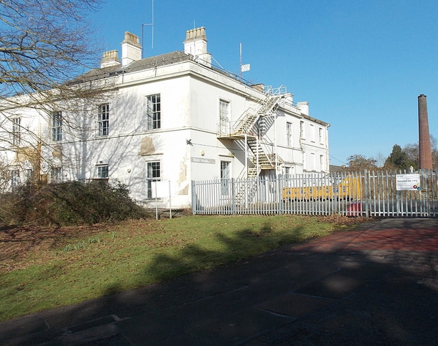
Standish Hospital

Standish Hospital was a specialist orthopaedics, rheumatology and respiratory care National Health Service (NHS) hospital, located in the hamlet of Standish...

Whiteshill, Stroud

Whiteshill is a village in the Cotswolds, situated between Stroud and Gloucester, in Gloucestershire, England and forms part of the Stroud urban area....

Archway School

Archway School is a comprehensive co-educational school for pupils aged 11 to 18 in Stroud, Gloucestershire, England. The headteacher is Kieron Smith....

Cashes Green

Cashes Green is a substantial residential area in the civil parish of Cainscross on the outskirts of Stroud, in Gloucestershire, England. Although the...

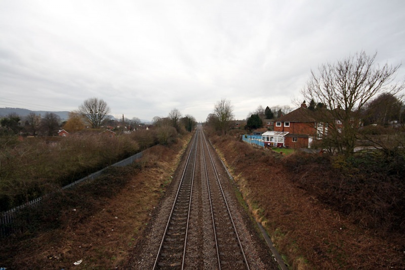
Cashes Green Halt railway station

Cashes Green Halt was opened on 22 January 1930 on what is now the Golden Valley Line between Stroud and Stonehouse. This line was opened in 1845 as the...

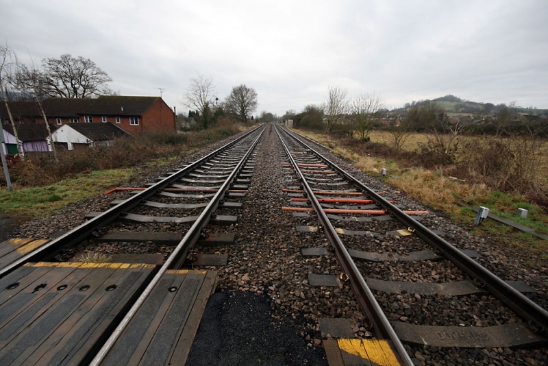
Ebley Crossing Halt railway station

Ebley Crossing Halt was opened on 12 October 1903 on what is now the Golden Valley Line between Stroud and Stonehouse. This line was opened in 1845 as...

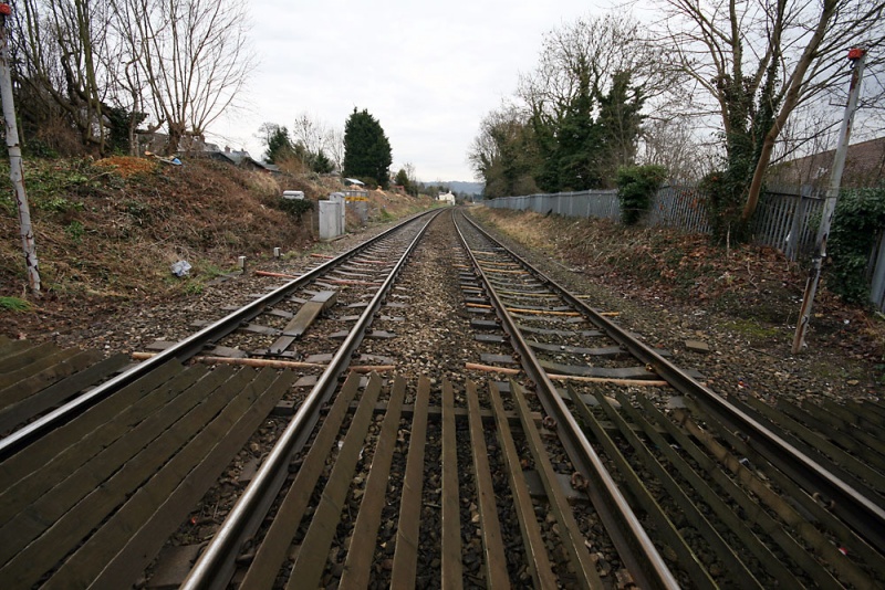
Downfield Crossing Halt railway station

Downfield Crossing Halt was on what is now the Golden Valley Line between Stroud and Stonehouse. == History == The line was opened in 1845 as the Cheltenham...

Nearby Amenities

Located within 500m of 51.759494,-2.2496926
Randwick
Created By: Potlatch 0.10f
Is In: Stroud
Place: village
Wikidata: Q7292041
Lat/Long: 51.759846/-2.2498284
Description: Long Barrow
Historic: archaeological_site
Source: NPE
Lat/Long: 51.7607618/-2.2547087
Ele: 226.0339355
Tourism: information
Lat/Long: 51.7620002/-2.2518348
Barrier: entrance
Ele: 229.8791504
Lat/Long: 51.7616629/-2.2537272
Barrier: entrance
Ele: 230.3598633
Note: Not sure if there was a path here or not but there was a deliberate gap in the wall...
Lat/Long: 51.760044/-2.256295
Bus Stop
Randwick Church
Naptan AtcoCode: 1600GLS1087
Naptan Bearing: SW
Naptan CommonName: Randwick Church
Naptan Crossing: The Lane
Naptan Indicator: Opp
Naptan NaptanCode: gloawpdw
Naptan PlusbusZoneRef: STRUD
Naptan Street: The Lane
Naptan Verified: no
Source: naptan_import
Lat/Long: 51.7592399/-2.2505859
Bus Stop
Lightwood Lane
Naptan AtcoCode: 1600GLS243
Naptan Bearing: NE
Naptan CommonName: Lightwood Lane
Naptan Indicator: Opp
Naptan NaptanCode: gloawtjp
Naptan PlusbusZoneRef: STRUD
Naptan Street: Church Rd
Naptan Verified: no
Source: naptan_import
Lat/Long: 51.7621349/-2.2464433
Bus Stop
Lightwood Lane
Naptan AtcoCode: 1600GLS244
Naptan Bearing: SW
Naptan CommonName: Lightwood Lane
Naptan NaptanCode: gloawtjt
Naptan PlusbusZoneRef: STRUD
Naptan Street: Church Rd
Naptan Verified: no
Source: naptan_import
Lat/Long: 51.762099/-2.2463852
Bus Stop
The Hill
Naptan AtcoCode: 1600GLS245
Naptan Bearing: NE
Naptan CommonName: The Hill
Naptan Indicator: Opp
Naptan NaptanCode: gloawtdj
Naptan PlusbusZoneRef: STRUD
Naptan Street: Church Rd
Naptan Verified: no
Source: naptan_import
Lat/Long: 51.7607649/-2.2480297
Bus Stop
The Hill
Naptan AtcoCode: 1600GLS246
Naptan Bearing: SW
Naptan CommonName: The Hill
Naptan NaptanCode: gloawtdt
Naptan PlusbusZoneRef: STRUD
Naptan Street: Church Rd
Naptan Verified: no
Source: naptan_import
Lat/Long: 51.7608103/-2.2477981
Barrier: stile
Foot: yes
Lat/Long: 51.7552422/-2.2489926
Barrier: stile
Foot: yes
Lat/Long: 51.7552017/-2.2491426
Barrier: stile
Foot: yes
Lat/Long: 51.7561216/-2.2475459
Power: pole
Lat/Long: 51.7560374/-2.2477434
Power: pole
Lat/Long: 51.7561428/-2.2478494
Power: pole
Lat/Long: 51.760028/-2.2426639
Power: pole
Lat/Long: 51.7563205/-2.2453093
Power: pole
Lat/Long: 51.7562491/-2.2464453
Power: pole
Lat/Long: 51.7561287/-2.246346
Power: pole
Lat/Long: 51.7561985/-2.2452168
Power: pole
Lat/Long: 51.7567347/-2.2445221
Power: pole
Lat/Long: 51.7605964/-2.2435391
Power: pole
Lat/Long: 51.7555891/-2.2492613
Power: pole
Lat/Long: 51.7554231/-2.2491811
Power: pole
Lat/Long: 51.7572253/-2.2435981
Power: pole
Lat/Long: 51.7580871/-2.2502715
Power: pole
Lat/Long: 51.7575657/-2.2490101
Power: pole
Lat/Long: 51.7583776/-2.2496974
Power: pole
Transformer: distribution
Lat/Long: 51.7591104/-2.2503093
Power: pole
Lat/Long: 51.7568995/-2.2484703
Power: pole
Lat/Long: 51.7610571/-2.2442915
Power: pole
Lat/Long: 51.7614488/-2.2449044
Power: pole
Lat/Long: 51.7618835/-2.2455522
Natural: spring
Lat/Long: 51.7589402/-2.2501946
Barrier: stile
Bicycle: no
Foot: yes
Material: wood
Stile: stepover
Lat/Long: 51.7602997/-2.2522555
Public Bookcase
Randwick Book Swap
Booth: K6
Colour: red
Disused Amenity: telephone
Public Bookcase Type: phone_box
Source: survey
Lat/Long: 51.7583806/-2.2473073
Post Box
Collection Times: Mo-Fr 09:00; Sa 07:00; Su off
Drive Through: no
Operator: Royal Mail
Post Box Type: lamp
Ref: GL6 237D
Royal Cypher: EIIR
Royal Cypher Wikidata: Q33102113
Source: survey
Lat/Long: 51.7621313/-2.2463127
Barrier: stile
Foot: designated
Lat/Long: 51.7589825/-2.2562091
Barrier: kissing_gate
Foot: designated
Lat/Long: 51.7587587/-2.2534115
Post Box
Collection Times: Mo-Fr 16:00; Sa 09:15; Su off
Drive Through: no
Operator: Royal Mail
Post Box Type: wall
Ref: GL6 107
Royal Cypher: EIIR
Royal Cypher Wikidata: Q33102113
Source: survey
Lat/Long: 51.7589162/-2.2478641
Give Way
Direction: backward
Lat/Long: 51.7621905/-2.2462749
Give Way
Direction: backward
Lat/Long: 51.7607138/-2.2479229
Give Way
Direction: backward
Lat/Long: 51.7594733/-2.2496317
Give Way
Direction: forward
Lat/Long: 51.7592836/-2.250583
Bench
Lat/Long: 51.7576943/-2.2470083
Bench
Lat/Long: 51.7576943/-2.2469774
Bench
Lat/Long: 51.7576927/-2.2469425
Bench
Lat/Long: 51.7576918/-2.2469117
Entrance: yes
Lat/Long: 51.7577326/-2.2470678
Defibrillator
Defibrillator Location: outside Randwick Village Hall, Chapel Fields, Randwick - to right of entrance
Emergency: defibrillator
Indoor: no
Lat/Long: 51.7577151/-2.2470694
Addr Postcode: GL6 6HW
Lat/Long: 51.7581559/-2.2474518
Addr Postcode: GL6 6HR
Lat/Long: 51.7581314/-2.2473807
Barrier: stile
Material: wood
Stile: stepover
Lat/Long: 51.7570438/-2.2438751
Transformer: distribution
Lat/Long: 51.7576753/-2.2480586
Power: pole
Transformer: distribution
Lat/Long: 51.7575059/-2.2513792
The data included in this document is from www.openstreetmap.org. The data is made available under ODbL.

Have you been to Randwick?

Leave your review of Randwick below (or comments, questions and feedback).