Rand

Settlement in Lincolnshire West Lindsey

England

Rand

Goltho, St. George's Church, 2021 (1) 8 years after a disastrous fire in 2013 - See <a href="https://www.geograph.org.uk/photo/3716859">TF1177 : St.George's church</a>.
Goltho, St. George's Church, 2021 (1) Credit: Chris

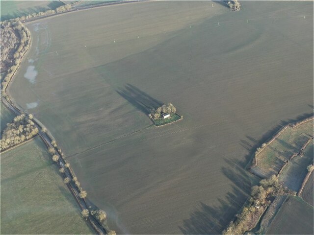
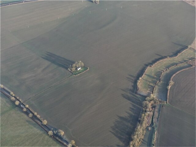
Rand is a small village located in the East Lindsey district of Lincolnshire, England. Situated about 5 miles south of the town of Wragby, Rand is nestled in the beautiful countryside of the Lincolnshire Wolds, an Area of Outstanding Natural Beauty. With a population of around 200 people, Rand offers a peaceful and idyllic retreat from the hustle and bustle of city life.

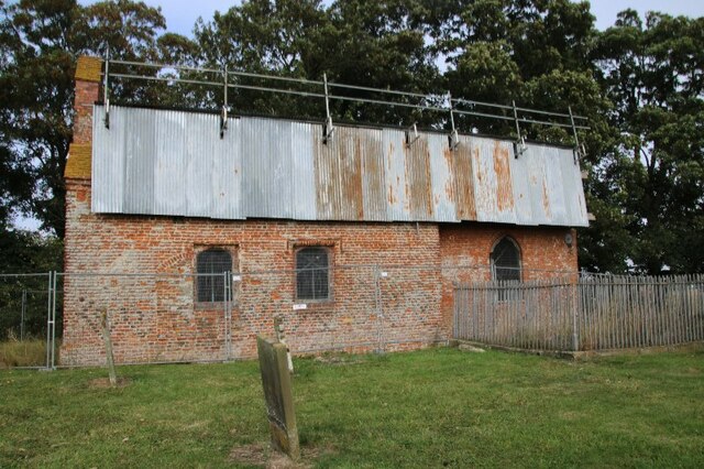
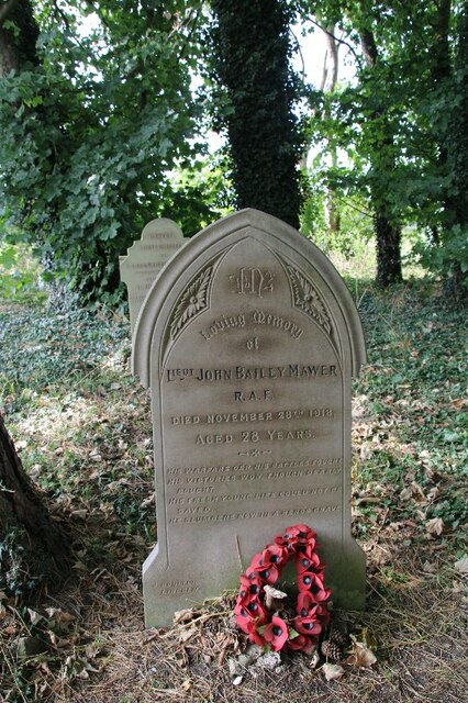
The village is characterized by its charming, traditional English architecture, with many buildings dating back several centuries. The picturesque St. Oswald's Church, a Grade II listed building, is a prominent feature in Rand and serves as a gathering place for the local community. The village also boasts a well-maintained village green, providing a serene spot for relaxation and recreation.

Despite its small size, Rand is home to a close-knit community that is known for its friendliness and welcoming nature. The village has a strong sense of community spirit, with residents actively participating in various social events and activities. The Rand Village Hall serves as a hub for these gatherings, hosting regular events such as coffee mornings, craft fairs, and community meetings.

Surrounded by rolling hills and stunning countryside, Rand offers ample opportunities for outdoor pursuits. The nearby Lincolnshire Wolds provide extensive walking and cycling routes, allowing residents and visitors to explore the area's natural beauty. Additionally, the village is well-connected to the wider area, with good transport links to neighboring towns and cities.

Overall, Rand is a charming and tranquil village that offers a slice of traditional English village life. Its beautiful surroundings, strong community spirit, and rich history make it an appealing place to live or visit for those seeking a peaceful and picturesque setting.

If you have any feedback on the listing, please let us know in the comments section below.
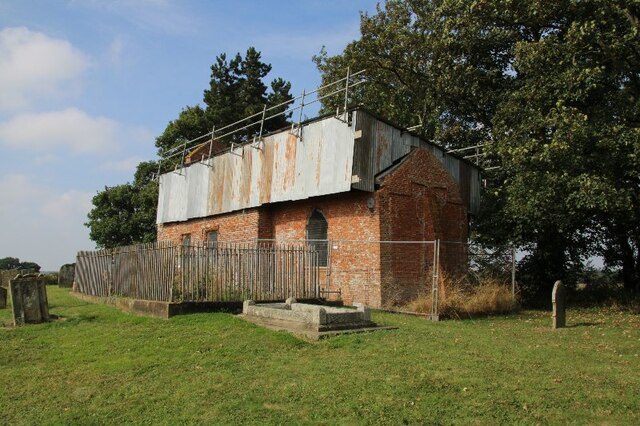
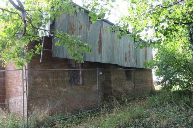
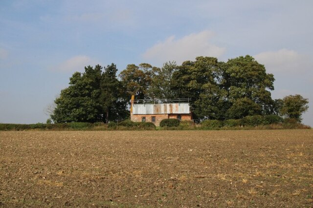
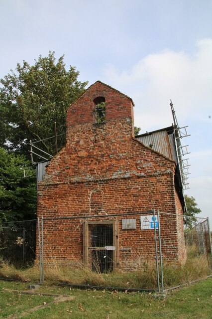
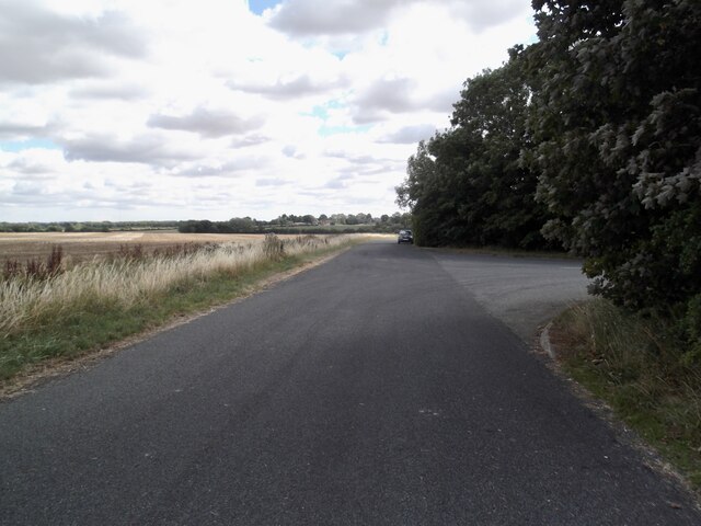
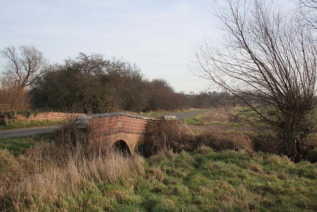
Rand Images

Images are sourced within 2km of 53.294706/-0.343879 or Grid Reference TF1078. Thanks to Geograph Open Source API. All images are credited.

Goltho, St. George's Church, 2021 (1) 8 years after a disastrous fire in 2013 - See <a href="https://www.geograph.org.uk/photo/3716859">TF1177 : St.George's church</a>.
Goltho, St. George's Church, 2021 (1)
8 years after a disastrous fire in 2013 - See TF1177 : St.George's church.
Goltho, St. George's Church, 2021 (2) 8 years after a disastrous fire in 2013 - See <a href="https://www.geograph.org.uk/photo/3716859">TF1177 : St.George's church</a>.
Goltho, St. George's Church, 2021 (2)
8 years after a disastrous fire in 2013 - See TF1177 : St.George's church.
Goltho, St. George's Church, 2021 (3) 8 years after a disastrous fire in 2013 - See <a href="https://www.geograph.org.uk/photo/3716859">TF1177 : St.George's church</a>.
Goltho, St. George's Church, 2021 (3)
8 years after a disastrous fire in 2013 - See TF1177 : St.George's church.
Goltho, St. George's Church, 2021 (4) 8 years after a disastrous fire in 2013 - See <a href="https://www.geograph.org.uk/photo/3716859">TF1177 : St.George's church</a>.
Goltho, St. George's Church, 2021 (4)
8 years after a disastrous fire in 2013 - See TF1177 : St.George's church.
Goltho, St. George's Church, 2021 (5) 8 years after a disastrous fire in 2013 - See <a href="https://www.geograph.org.uk/photo/3716859">TF1177 : St.George's church</a>.
Goltho, St. George's Church, 2021 (5)
8 years after a disastrous fire in 2013 - See TF1177 : St.George's church.
War grave at Goltho, St. George's Church, 2021 8 years after a disastrous fire in 2013 - See <a href="https://www.geograph.org.uk/photo/3716859">TF1177 : St.George's church</a>.
War grave at Goltho, St. George's Church, 2021
8 years after a disastrous fire in 2013 - See TF1177 : St.George's church.
Rand Medieval Settlement: aerial 2021 (1) Rand was documented in the late 11th century as a manor of Wragby, but during the late 12th century a separate manor was established here by the Burdet family, who retained it until the mid 14th century.

See <span class="nowrap"><a title="https://www.heritagegateway.org.uk/Gateway/Results_Single.aspx?uid=MLI54189&resourceID=1006" rel="nofollow ugc noopener" href="https://www.heritagegateway.org.uk/Gateway/Results_Single.aspx?uid=MLI54189&resourceID=1006">Link</a><img style="margin-left:2px;" alt="External link" title="External link - shift click to open in new window" src="https://s1.geograph.org.uk/img/external.png" width="10" height="10"/></span>
Rand Medieval Settlement: aerial 2021 (1)
Rand was documented in the late 11th century as a manor of Wragby, but during the late 12th century a separate manor was established here by the Burdet family, who retained it until the mid 14th century. See LinkExternal link
Rand Medieval Settlement: aerial 2021 (2) Rand was documented in the late 11th century as a manor of Wragby, but during the late 12th century a separate manor was established here by the Burdet family, who retained it until the mid 14th century.

See <span class="nowrap"><a title="https://www.heritagegateway.org.uk/Gateway/Results_Single.aspx?uid=MLI54189&resourceID=1006" rel="nofollow ugc noopener" href="https://www.heritagegateway.org.uk/Gateway/Results_Single.aspx?uid=MLI54189&resourceID=1006">Link</a><img style="margin-left:2px;" alt="External link" title="External link - shift click to open in new window" src="https://s1.geograph.org.uk/img/external.png" width="10" height="10"/></span>
Rand Medieval Settlement: aerial 2021 (2)
Rand was documented in the late 11th century as a manor of Wragby, but during the late 12th century a separate manor was established here by the Burdet family, who retained it until the mid 14th century. See LinkExternal link
Rand Medieval Settlement: aerial 2021 (3) Rand was documented in the late 11th century as a manor of Wragby, but during the late 12th century a separate manor was established here by the Burdet family, who retained it until the mid 14th century.

See <span class="nowrap"><a title="https://www.heritagegateway.org.uk/Gateway/Results_Single.aspx?uid=MLI54189&resourceID=1006" rel="nofollow ugc noopener" href="https://www.heritagegateway.org.uk/Gateway/Results_Single.aspx?uid=MLI54189&resourceID=1006">Link</a><img style="margin-left:2px;" alt="External link" title="External link - shift click to open in new window" src="https://s1.geograph.org.uk/img/external.png" width="10" height="10"/></span> 

The moated site is first recorded in 1153: see <span class="nowrap"><a title="https://www.heritagegateway.org.uk/Gateway/Results_Single.aspx?uid=MLI54190&resourceID=1006" rel="nofollow ugc noopener" href="https://www.heritagegateway.org.uk/Gateway/Results_Single.aspx?uid=MLI54190&resourceID=1006">Link</a><img style="margin-left:2px;" alt="External link" title="External link - shift click to open in new window" src="https://s1.geograph.org.uk/img/external.png" width="10" height="10"/></span>

Former fishponds to the south of the moat: see <span class="nowrap"><a title="https://www.heritagegateway.org.uk/Gateway/Results_Single.aspx?uid=MLI51215&resourceID=1006" rel="nofollow ugc noopener" href="https://www.heritagegateway.org.uk/Gateway/Results_Single.aspx?uid=MLI51215&resourceID=1006">Link</a><img style="margin-left:2px;" alt="External link" title="External link - shift click to open in new window" src="https://s1.geograph.org.uk/img/external.png" width="10" height="10"/></span>
Rand Medieval Settlement: aerial 2021 (3)
Rand was documented in the late 11th century as a manor of Wragby, but during the late 12th century a separate manor was established here by the Burdet family, who retained it until the mid 14th century. See LinkExternal link The moated site is first recorded in 1153: see LinkExternal link Former fishponds to the south of the moat: see LinkExternal link
Goltho: aerial 2022 (1) St. George's Church: <span class="nowrap"><a title="https://www.heritagegateway.org.uk/Gateway/Results_Single.aspx?uid=76b2167a-05d4-432c-a931-3a659f9cdacf&resourceID=19191" rel="nofollow ugc noopener" href="https://www.heritagegateway.org.uk/Gateway/Results_Single.aspx?uid=76b2167a-05d4-432c-a931-3a659f9cdacf&resourceID=19191">Link</a><img style="margin-left:2px;" alt="External link" title="External link - shift click to open in new window" src="https://s1.geograph.org.uk/img/external.png" width="10" height="10"/></span>

Goltho Medieval Settlement Earthwork And Cropmark Site: <span class="nowrap"><a title="https://www.heritagegateway.org.uk/Gateway/Results_Single.aspx?uid=ec19aad5-49d4-4854-bafb-f065821c9129&resourceID=19191" rel="nofollow ugc noopener" href="https://www.heritagegateway.org.uk/Gateway/Results_Single.aspx?uid=ec19aad5-49d4-4854-bafb-f065821c9129&resourceID=19191">Link</a><img style="margin-left:2px;" alt="External link" title="External link - shift click to open in new window" src="https://s1.geograph.org.uk/img/external.png" width="10" height="10"/></span>

Traces of Romano-British settlement: <span class="nowrap"><a title="https://www.heritagegateway.org.uk/Gateway/Results_Single.aspx?uid=59411ede-0a52-4991-907a-6925db9d8905&resourceID=19191" rel="nofollow ugc noopener" href="https://www.heritagegateway.org.uk/Gateway/Results_Single.aspx?uid=59411ede-0a52-4991-907a-6925db9d8905&resourceID=19191">Link</a><img style="margin-left:2px;" alt="External link" title="External link - shift click to open in new window" src="https://s1.geograph.org.uk/img/external.png" width="10" height="10"/></span>

Site of defended manorial enclosure: <span class="nowrap"><a title="https://www.heritagegateway.org.uk/Gateway/Results_Single.aspx?uid=MLI50494&resourceID=1006" rel="nofollow ugc noopener" href="https://www.heritagegateway.org.uk/Gateway/Results_Single.aspx?uid=MLI50494&resourceID=1006">Link</a><img style="margin-left:2px;" alt="External link" title="External link - shift click to open in new window" src="https://s1.geograph.org.uk/img/external.png" width="10" height="10"/></span>

Site of motte and bailey castle: <span class="nowrap"><a title="https://www.heritagegateway.org.uk/Gateway/Results_Single.aspx?uid=MLI50493&resourceID=1006" rel="nofollow ugc noopener" href="https://www.heritagegateway.org.uk/Gateway/Results_Single.aspx?uid=MLI50493&resourceID=1006">Link</a><img style="margin-left:2px;" alt="External link" title="External link - shift click to open in new window" src="https://s1.geograph.org.uk/img/external.png" width="10" height="10"/></span>

Part of Middle-Saxon settlement: <span class="nowrap"><a title="https://www.heritagegateway.org.uk/Gateway/Results_Single.aspx?uid=MLI51233&resourceID=1006" rel="nofollow ugc noopener" href="https://www.heritagegateway.org.uk/Gateway/Results_Single.aspx?uid=MLI51233&resourceID=1006">Link</a><img style="margin-left:2px;" alt="External link" title="External link - shift click to open in new window" src="https://s1.geograph.org.uk/img/external.png" width="10" height="10"/></span>

Deserted settlement of Goltho or Bullington: <span class="nowrap"><a title="https://www.heritagegateway.org.uk/Gateway/Results_Single.aspx?uid=MLI51217&resourceID=1006" rel="nofollow ugc noopener" href="https://www.heritagegateway.org.uk/Gateway/Results_Single.aspx?uid=MLI51217&resourceID=1006">Link</a><img style="margin-left:2px;" alt="External link" title="External link - shift click to open in new window" src="https://s1.geograph.org.uk/img/external.png" width="10" height="10"/></span>

Romano-British farmstead and building remains: <span class="nowrap"><a title="https://www.heritagegateway.org.uk/Gateway/Results_Single.aspx?uid=MLI50713&resourceID=1006" rel="nofollow ugc noopener" href="https://www.heritagegateway.org.uk/Gateway/Results_Single.aspx?uid=MLI50713&resourceID=1006">Link</a><img style="margin-left:2px;" alt="External link" title="External link - shift click to open in new window" src="https://s1.geograph.org.uk/img/external.png" width="10" height="10"/></span>


The soilmarks are picked out by the early morning January frost, and the remains of the earthworks by the (long) early morning morning winter shadows - note the shadows of the trees around the church.
Goltho: aerial 2022 (1)
St. George's Church: LinkExternal link Goltho Medieval Settlement Earthwork And Cropmark Site: LinkExternal link Traces of Romano-British settlement: LinkExternal link Site of defended manorial enclosure: LinkExternal link Site of motte and bailey castle: LinkExternal link Part of Middle-Saxon settlement: LinkExternal link Deserted settlement of Goltho or Bullington: LinkExternal link Romano-British farmstead and building remains: LinkExternal link The soilmarks are picked out by the early morning January frost, and the remains of the earthworks by the (long) early morning morning winter shadows - note the shadows of the trees around the church.
Goltho: aerial 2022 (2) St. George's Church: <span class="nowrap"><a title="https://www.heritagegateway.org.uk/Gateway/Results_Single.aspx?uid=76b2167a-05d4-432c-a931-3a659f9cdacf&resourceID=19191" rel="nofollow ugc noopener" href="https://www.heritagegateway.org.uk/Gateway/Results_Single.aspx?uid=76b2167a-05d4-432c-a931-3a659f9cdacf&resourceID=19191">Link</a><img style="margin-left:2px;" alt="External link" title="External link - shift click to open in new window" src="https://s1.geograph.org.uk/img/external.png" width="10" height="10"/></span>

Goltho Medieval Settlement Earthwork And Cropmark Site: <span class="nowrap"><a title="https://www.heritagegateway.org.uk/Gateway/Results_Single.aspx?uid=ec19aad5-49d4-4854-bafb-f065821c9129&resourceID=19191" rel="nofollow ugc noopener" href="https://www.heritagegateway.org.uk/Gateway/Results_Single.aspx?uid=ec19aad5-49d4-4854-bafb-f065821c9129&resourceID=19191">Link</a><img style="margin-left:2px;" alt="External link" title="External link - shift click to open in new window" src="https://s1.geograph.org.uk/img/external.png" width="10" height="10"/></span>

Traces of Romano-British settlement: <span class="nowrap"><a title="https://www.heritagegateway.org.uk/Gateway/Results_Single.aspx?uid=59411ede-0a52-4991-907a-6925db9d8905&resourceID=19191" rel="nofollow ugc noopener" href="https://www.heritagegateway.org.uk/Gateway/Results_Single.aspx?uid=59411ede-0a52-4991-907a-6925db9d8905&resourceID=19191">Link</a><img style="margin-left:2px;" alt="External link" title="External link - shift click to open in new window" src="https://s1.geograph.org.uk/img/external.png" width="10" height="10"/></span>

Site of defended manorial enclosure: <span class="nowrap"><a title="https://www.heritagegateway.org.uk/Gateway/Results_Single.aspx?uid=MLI50494&resourceID=1006" rel="nofollow ugc noopener" href="https://www.heritagegateway.org.uk/Gateway/Results_Single.aspx?uid=MLI50494&resourceID=1006">Link</a><img style="margin-left:2px;" alt="External link" title="External link - shift click to open in new window" src="https://s1.geograph.org.uk/img/external.png" width="10" height="10"/></span>

Site of motte and bailey castle: <span class="nowrap"><a title="https://www.heritagegateway.org.uk/Gateway/Results_Single.aspx?uid=MLI50493&resourceID=1006" rel="nofollow ugc noopener" href="https://www.heritagegateway.org.uk/Gateway/Results_Single.aspx?uid=MLI50493&resourceID=1006">Link</a><img style="margin-left:2px;" alt="External link" title="External link - shift click to open in new window" src="https://s1.geograph.org.uk/img/external.png" width="10" height="10"/></span>

Part of Middle-Saxon settlement: <span class="nowrap"><a title="https://www.heritagegateway.org.uk/Gateway/Results_Single.aspx?uid=MLI51233&resourceID=1006" rel="nofollow ugc noopener" href="https://www.heritagegateway.org.uk/Gateway/Results_Single.aspx?uid=MLI51233&resourceID=1006">Link</a><img style="margin-left:2px;" alt="External link" title="External link - shift click to open in new window" src="https://s1.geograph.org.uk/img/external.png" width="10" height="10"/></span>

Deserted settlement of Goltho or Bullington: <span class="nowrap"><a title="https://www.heritagegateway.org.uk/Gateway/Results_Single.aspx?uid=MLI51217&resourceID=1006" rel="nofollow ugc noopener" href="https://www.heritagegateway.org.uk/Gateway/Results_Single.aspx?uid=MLI51217&resourceID=1006">Link</a><img style="margin-left:2px;" alt="External link" title="External link - shift click to open in new window" src="https://s1.geograph.org.uk/img/external.png" width="10" height="10"/></span>

Romano-British farmstead and building remains: <span class="nowrap"><a title="https://www.heritagegateway.org.uk/Gateway/Results_Single.aspx?uid=MLI50713&resourceID=1006" rel="nofollow ugc noopener" href="https://www.heritagegateway.org.uk/Gateway/Results_Single.aspx?uid=MLI50713&resourceID=1006">Link</a><img style="margin-left:2px;" alt="External link" title="External link - shift click to open in new window" src="https://s1.geograph.org.uk/img/external.png" width="10" height="10"/></span>

The soilmarks are picked out by the early morning January frost, and the remains of the earthworks by the (long) early morning morning winter shadows - note the shadows of the trees around the church.
Goltho: aerial 2022 (2)
St. George's Church: LinkExternal link Goltho Medieval Settlement Earthwork And Cropmark Site: LinkExternal link Traces of Romano-British settlement: LinkExternal link Site of defended manorial enclosure: LinkExternal link Site of motte and bailey castle: LinkExternal link Part of Middle-Saxon settlement: LinkExternal link Deserted settlement of Goltho or Bullington: LinkExternal link Romano-British farmstead and building remains: LinkExternal link The soilmarks are picked out by the early morning January frost, and the remains of the earthworks by the (long) early morning morning winter shadows - note the shadows of the trees around the church.
Old Lincoln Road, Goltho
Monument to Anne Metham, St Oswald's church, Rand She was daughter of Robert Dymoke of Scrivelsby. She married Charles Metham and they had 8 children, one died young.
Monument to Anne Metham, St Oswald's church, Rand
She was daughter of Robert Dymoke of Scrivelsby. She married Charles Metham and they had 8 children, one died young.
Ten years later It is nearly ten years since St George's church at Goltho was struck by lightning and severely damaged by fire. As yet repairs have not been made.
Ten years later
It is nearly ten years since St George's church at Goltho was struck by lightning and severely damaged by fire. As yet repairs have not been made.
A sorry sight It is nearly ten years since St George's church at Goltho was struck by lightning and severely damaged by fire. As yet repairs have not been made.
A sorry sight
It is nearly ten years since St George's church at Goltho was struck by lightning and severely damaged by fire. As yet repairs have not been made.
Entrance to woodland near Goltho
Rand: aerial 2023 (1) Medieval site with village, manor, fishponds, moat and possible dovecote.
See: <span class="nowrap"><a title="https://www.heritagegateway.org.uk/Gateway/Results_Single.aspx?uid=MLI54189&resourceID=1006," rel="nofollow ugc noopener" href="https://www.heritagegateway.org.uk/Gateway/Results_Single.aspx?uid=MLI54189&resourceID=1006,">Link</a><img style="margin-left:2px;" alt="External link" title="External link - shift click to open in new window" src="https://s1.geograph.org.uk/img/external.png" width="10" height="10"/></span>
<span class="nowrap"><a title="https://www.heritagegateway.org.uk/Gateway/Results_Single.aspx?uid=MLI51215&resourceID=1006," rel="nofollow ugc noopener" href="https://www.heritagegateway.org.uk/Gateway/Results_Single.aspx?uid=MLI51215&resourceID=1006,">Link</a><img style="margin-left:2px;" alt="External link" title="External link - shift click to open in new window" src="https://s1.geograph.org.uk/img/external.png" width="10" height="10"/></span>
<span class="nowrap"><a title="https://www.heritagegateway.org.uk/Gateway/Results_Single.aspx?uid=MLI51214&resourceID=1006," rel="nofollow ugc noopener" href="https://www.heritagegateway.org.uk/Gateway/Results_Single.aspx?uid=MLI51214&resourceID=1006,">Link</a><img style="margin-left:2px;" alt="External link" title="External link - shift click to open in new window" src="https://s1.geograph.org.uk/img/external.png" width="10" height="10"/></span>
<span class="nowrap"><a title="https://www.heritagegateway.org.uk/Gateway/Results_Single.aspx?uid=MLI54190&resourceID=1006" rel="nofollow ugc noopener" href="https://www.heritagegateway.org.uk/Gateway/Results_Single.aspx?uid=MLI54190&resourceID=1006">Link</a><img style="margin-left:2px;" alt="External link" title="External link - shift click to open in new window" src="https://s1.geograph.org.uk/img/external.png" width="10" height="10"/></span>
Rand: aerial 2023 (1)
Medieval site with village, manor, fishponds, moat and possible dovecote. See: LinkExternal link LinkExternal link LinkExternal link LinkExternal link
Rand: aerial 2023 (2) Medieval site with village, manor, fishponds, moat and possible dovecote.
See: <span class="nowrap"><a title="https://www.heritagegateway.org.uk/Gateway/Results_Single.aspx?uid=MLI54189&resourceID=1006," rel="nofollow ugc noopener" href="https://www.heritagegateway.org.uk/Gateway/Results_Single.aspx?uid=MLI54189&resourceID=1006,">Link</a><img style="margin-left:2px;" alt="External link" title="External link - shift click to open in new window" src="https://s1.geograph.org.uk/img/external.png" width="10" height="10"/></span>
<span class="nowrap"><a title="https://www.heritagegateway.org.uk/Gateway/Results_Single.aspx?uid=MLI51215&resourceID=1006," rel="nofollow ugc noopener" href="https://www.heritagegateway.org.uk/Gateway/Results_Single.aspx?uid=MLI51215&resourceID=1006,">Link</a><img style="margin-left:2px;" alt="External link" title="External link - shift click to open in new window" src="https://s1.geograph.org.uk/img/external.png" width="10" height="10"/></span>
<span class="nowrap"><a title="https://www.heritagegateway.org.uk/Gateway/Results_Single.aspx?uid=MLI51214&resourceID=1006," rel="nofollow ugc noopener" href="https://www.heritagegateway.org.uk/Gateway/Results_Single.aspx?uid=MLI51214&resourceID=1006,">Link</a><img style="margin-left:2px;" alt="External link" title="External link - shift click to open in new window" src="https://s1.geograph.org.uk/img/external.png" width="10" height="10"/></span>
<span class="nowrap"><a title="https://www.heritagegateway.org.uk/Gateway/Results_Single.aspx?uid=MLI54190&resourceID=1006" rel="nofollow ugc noopener" href="https://www.heritagegateway.org.uk/Gateway/Results_Single.aspx?uid=MLI54190&resourceID=1006">Link</a><img style="margin-left:2px;" alt="External link" title="External link - shift click to open in new window" src="https://s1.geograph.org.uk/img/external.png" width="10" height="10"/></span>
Rand: aerial 2023 (2)
Medieval site with village, manor, fishponds, moat and possible dovecote. See: LinkExternal link LinkExternal link LinkExternal link LinkExternal link
Show me another place!

Rand is located at Grid Ref: TF1078 (Lat: 53.294706, Lng: -0.343879)

Division: Parts of Lindsey

Administrative County: Lincolnshire

District: West Lindsey

Police Authority: Lincolnshire

What 3 Words

///silver.demanding.buffoon. Near Wragby, Lincolnshire

Nearby Locations

Rand Rand

Related Wikis

Rand, Lincolnshire

Rand is a small village and civil parish in the West Lindsey district of Lincolnshire, England. It is situated approximately 9 miles (14 km) north-east...

Fulnetby

Fulnetby is a hamlet and civil parish in the West Lindsey district of Lincolnshire, England. It is situated approximately 8 miles (13 km) north-east from...

St George's Church, Goltho

St George's Church is a redundant Anglican church in the deserted village of Goltho, Lincolnshire, England. It is recorded in the National Heritage List...

Bullington, Lincolnshire

Bullington is a village and civil parish in the West Lindsey district of Lincolnshire, England. It is situated approximately 8 miles (13 km) north-east...

Nearby Amenities

Located within 500m of 53.294706,-0.343879
Rand
Is In: Lincolnshire, England, UK
Place: hamlet
Source: NPE
Wikidata: Q2194369
Lat/Long: 53.2945987/-0.3445336
Bus Stop
Brookside
Naptan AtcoCode: 270000010262
Naptan Bearing: SW
Naptan CommonName: Brookside
Naptan Indicator: opp
Naptan Landmark: Brookside
Naptan NaptanCode: linjmgdg
Naptan Street: Rand
Naptan Verified: no
Source: naptan_import
Lat/Long: 53.2946999/-0.3439601
Bus Stop
Brookside
Naptan AtcoCode: 2700LRV00350
Naptan Bearing: NE
Naptan CommonName: Brookside
Naptan Indicator: adj
Naptan Landmark: Brookside
Naptan NaptanCode: linadmja
Naptan Street: Rand
Naptan Verified: no
Source: naptan_import
Lat/Long: 53.2948073/-0.3439259
Power: pole
Source: Bing
Lat/Long: 53.2939212/-0.3468789
Power: pole
Source: Bing
Lat/Long: 53.2941633/-0.3455543
Power: pole
Source: Bing
Lat/Long: 53.2951364/-0.3427229
Power: pole
Source: Bing
Lat/Long: 53.2946498/-0.3448409
Power: pole
Source: Bing
Lat/Long: 53.2948646/-0.3438029
Power: pole
Source: Bing
Lat/Long: 53.2936751/-0.3482486
Note: End of public Highway
Lat/Long: 53.2955895/-0.3408691
Archaeological Site: fortification
Historic: archaeological_site
Source: Bing
Start Date: ~1200
Lat/Long: 53.2974105/-0.3421075
Rand
Archaeological Site: village
Fixme: would be better mapped as an area
Historic: archaeological_site
Source: Bing
Lat/Long: 53.2969908/-0.3380138
Passing Place
Source: Bing
Lat/Long: 53.2917664/-0.3426322
Power: pole
Lat/Long: 53.293224/-0.3507747
Power: pole
Lat/Long: 53.293441/-0.3495789
Home Farm
Place: farm
Source: Bing
Lat/Long: 53.2944932/-0.3459164
Church Farm
Place: farm
Source: Bing
Lat/Long: 53.2957981/-0.3402076
The data included in this document is from www.openstreetmap.org. The data is made available under ODbL.

Have you been to Rand?

Leave your review of Rand below (or comments, questions and feedback).