Rampton

Settlement in Cambridgeshire South Cambridgeshire

England

Rampton

Iram Drove
Iram Drove Credit: Hugh Venables

Rampton, located in Cambridgeshire, England, is a small and picturesque village situated approximately 8 miles northwest of Cambridge. With a population of around 1,500 residents, Rampton offers a tranquil and close-knit community environment.

The village is renowned for its rich history, dating back to the Roman era when it was a significant settlement on the Fen edge. Today, traces of its past can still be seen through the impressive All Saints' Church, a Grade I listed building, which dates back to the 13th century. This beautiful church is a focal point of the village and attracts visitors from far and wide.

Rampton is surrounded by stunning countryside, with vast open fields and meadows that offer breathtaking views. The village is also home to a nature reserve, known as Rampton Drift, which is a haven for wildlife enthusiasts and nature lovers. The reserve boasts an array of plant and animal species, making it an excellent spot for birdwatching and peaceful walks.

The village is well-served by amenities, including a primary school, a village hall, and a local shop. Additionally, Rampton hosts various community events throughout the year, such as the annual summer fete and the traditional Christmas fair, which bring residents together and create a strong sense of community spirit.

Overall, Rampton is a charming and historic village that offers a tranquil lifestyle amidst stunning natural surroundings. Its rich heritage, friendly community, and beautiful landscapes make it an attractive place to live or visit.

If you have any feedback on the listing, please let us know in the comments section below.
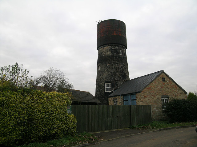
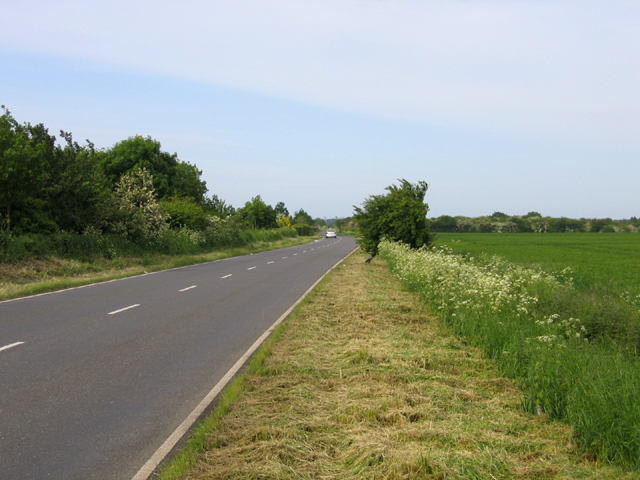
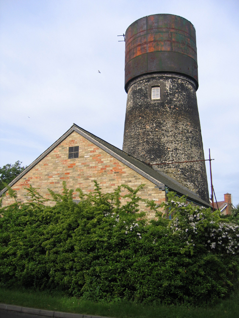
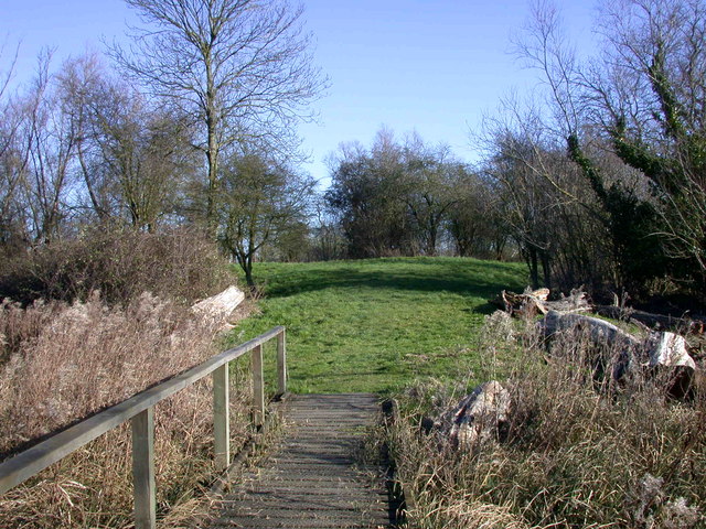
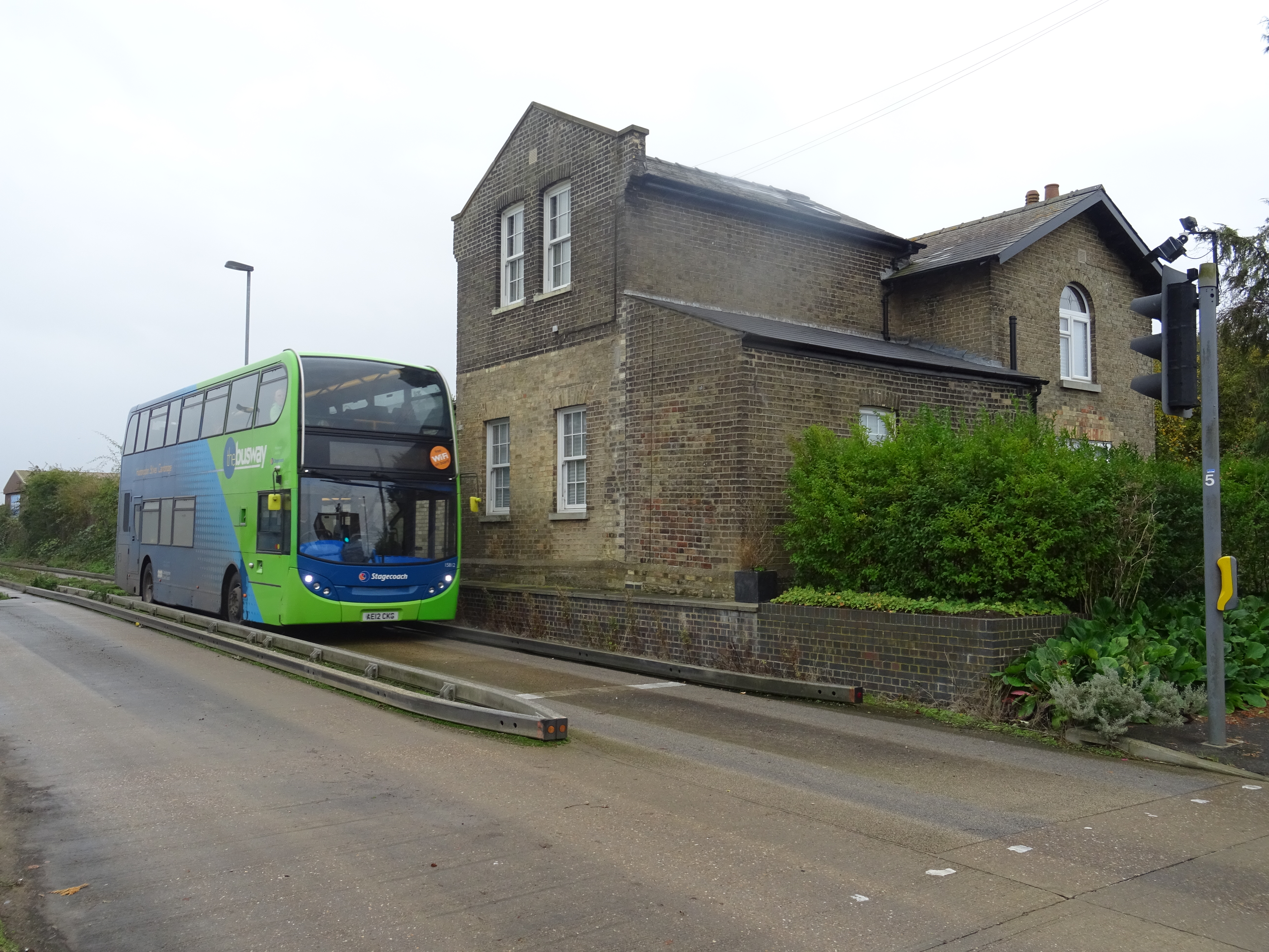
Rampton Images

Images are sourced within 2km of 52.292099/0.088416 or Grid Reference TL4268. Thanks to Geograph Open Source API. All images are credited.

Iram Drove
Iram Drove
Rampton, All Saints <span class="nowrap"><a title="http://www.druidic.org/camchurch/churches/rampton.htm" rel="nofollow ugc noopener" href="http://www.druidic.org/camchurch/churches/rampton.htm">Link</a><img style="margin-left:2px;" alt="External link" title="External link - shift click to open in new window" src="https://s1.geograph.org.uk/img/external.png" width="10" height="10"/></span>
Rampton, All Saints
Converted water tower in Cottenham, Cambridgeshire Brick tower mill converted to water tower with riveted steel tank. Apparently (3/05) undergoing second conversion. Mill was used for the processing of cereals from 1843 until 1898. The cap of the mill was then removed and from 1904 the building had been used as a water tower. 1903 photo is in the NMR.
Converted water tower in Cottenham, Cambridgeshire
Brick tower mill converted to water tower with riveted steel tank. Apparently (3/05) undergoing second conversion. Mill was used for the processing of cereals from 1843 until 1898. The cap of the mill was then removed and from 1904 the building had been used as a water tower. 1903 photo is in the NMR.
The Black Horse, Rampton CB4 Dating from 1851, or earlier.
The Black Horse, Rampton CB4
Dating from 1851, or earlier.
Little North Fen, Cottenham CB4 Little North fen, west of Cottenham village, was recorded as early as 1330.
Little North Fen, Cottenham CB4
Little North fen, west of Cottenham village, was recorded as early as 1330.
Oakington Road, Cottenham, Cambs – view towards Westwick as the road crosses Further or Farm Field.
Oakington Road, Cottenham, Cambs
– view towards Westwick as the road crosses Further or Farm Field.
Windmill turned water tower, Cottenham, Cambs – view from Manse Drive.
Windmill turned water tower, Cottenham, Cambs
– view from Manse Drive.
Rampton Bridge, Cambs spanning the Westwick Brook, taken from the footpath forming the parish boundary between Rampton and Cottenham.
Rampton Bridge, Cambs
spanning the Westwick Brook, taken from the footpath forming the parish boundary between Rampton and Cottenham.
New Cut drain, Cottenham, Cambs at the bend where it heads across the North Fen.
New Cut drain, Cottenham, Cambs
at the bend where it heads across the North Fen.
Reynolds' Drove, Rampton, Cambs a public byway crossing Brook Field, from Cuckoo Lane towards Longstanton.
Reynolds' Drove, Rampton, Cambs
a public byway crossing Brook Field, from Cuckoo Lane towards Longstanton.
Cottages by The Green, Rampton, Cambs
Corrugated metal roof, Rampton, Cambs on the south side of King Street.
Corrugated metal roof, Rampton, Cambs
on the south side of King Street.
Cottages by The Green, Rampton, Cambs No. 19 and 20, built in 1902.
Cottages by The Green, Rampton, Cambs
No. 19 and 20, built in 1902.
Free Church Mission Hall, Rampton, Cambs erected 1902 on the corner of High Street and Cow Lane.
Free Church Mission Hall, Rampton, Cambs
erected 1902 on the corner of High Street and Cow Lane.
Parish pump, Rampton, Cambs located on The Green.
Parish pump, Rampton, Cambs
located on The Green.
Farm in Little Field, Rampton, Cambs beside Rampton Road bend.
Farm in Little Field, Rampton, Cambs
beside Rampton Road bend.
Nether Irams Fen, Rampton, Cambs A drain forming the parish boundary with Willingham, on the right (north).
Nether Irams Fen, Rampton, Cambs
A drain forming the parish boundary with Willingham, on the right (north).
Belsars Field, Willingham, Cambs – view SW across an expanse of oilseed rape from Iram Drove.
Belsars Field, Willingham, Cambs
– view SW across an expanse of oilseed rape from Iram Drove.
Show me another place!

Rampton is located at Grid Ref: TL4268 (Lat: 52.292099, Lng: 0.088416)

Administrative County: Cambridgeshire

District: South Cambridgeshire

Police Authority: Cambridgeshire

What 3 Words

///tunnel.sprayer.sway. Near Cottenham, Cambridgeshire

Related Wikis

Rampton, Cambridgeshire

Rampton is a village in Cambridgeshire, England, situated on the edge of The Fens six miles to the north of Cambridge. == History == The edge of the Fens...

Rampton Castle

Rampton Castle, known locally as Giant's Hill, is the earthwork remains of a motte and bailey castle in Rampton, Cambridgeshire. It is believed that the...

Northstowe Secondary College

Northstowe Secondary College is a co-educational secondary school and sixth form located in Northstowe in the English county of Cambridgeshire.The school...

Belsar's Hill

Belsar's Hill is a hillfort near Willingham, Cambridgeshire, England. == Description == Belsar's Hill is an oval-shaped area, 265–220 metres (869–722 ft...

Northstowe

Northstowe is a new town that will eventually have up to 10,000 homes, with an anticipated population of 24,400 in Cambridgeshire, England, UK. On 1 April...

Cottenham

Cottenham is a village in Cambridgeshire, England. Cottenham is one of the larger villages surrounding the city of Cambridge, located around five miles...

Oakington Immigration Reception Centre

Oakington Immigration Reception Centre was an immigration detention centre located in Cambridgeshire run by UK Visas and Immigration. Originally a World...

Long Stanton railway station

Long Stanton railway station was a station on the Great Eastern Railway, between Cambridge and Huntingdon. It served the villages of Longstanton and Willingham...

Nearby Amenities

Located within 500m of 52.292099,0.088416
Place Of Worship
Rampton Free Church
Created By: Potlatch 0.6c
Denomination: free
Religion: christian
Lat/Long: 52.2919924/0.0897419
Barrier: kissing_gate
Kissing Gate: square_profile
Lat/Long: 52.2914177/0.0956368
Man Made: water_well
Pump: manual
Lat/Long: 52.2916476/0.0901156
Post Box
Brand: Royal Mail
Brand Wikidata: Q638098
Brand Wikipedia: en:Royal Mail
Collection Times: Mo-Fr 16:00; Sa 10:30
Operator: Royal Mail
Operator Wikidata: Q638098
Post Box Design: type_m
Post Box Type: lamp
Ref: CB24 469
Royal Cypher: no
Source: survey
Lat/Long: 52.2912694/0.0905328
Fuel
Rampton Motors
Note: Looks like there are fuel pumps here; I'm assuming they work. Looks like a general garage.
Source: survey
Lat/Long: 52.29172/0.0907535
Public Bookcase
Book Exchange
Booth: K6
Disused Amenity: telephone
Man Made: telephone_box
Old Phone: +44 1954 250220
Public Bookcase Type: phone_box
Source: survey
Lat/Long: 52.2916629/0.0905025
Shelter
Note: bus_shelter
Source: survey
Lat/Long: 52.2917546/0.0903706
Bus Stop
King Street
Bus: yes
Naptan AtcoCode: 0500SRAMP001
Naptan Bearing: NW
Naptan CommonName: King Street
Naptan Indicator: near
Naptan Landmark: King Street
Naptan NaptanCode: cmbgapjd
Naptan Street: The Green
Naptan Verified: no
Public Transport: platform
Source: naptan_import
Lat/Long: 52.2915889/0.0904577
Bus Stop
King Street
Bus: yes
Naptan AtcoCode: 0500SRAMP002
Naptan Bearing: SE
Naptan CommonName: King Street
Naptan Indicator: opp
Naptan Landmark: King Street
Naptan NaptanCode: cmbgapjg
Naptan Street: The Green
Naptan Verified: no
Note: Sign labels this "Rampton The Green, Opp King Street CMBGAPJG" Shelter is across the road.
Operator: Stagecoach
Public Transport: platform
Shelter: yes
Source: naptan_import
Lat/Long: 52.2917175/0.0903025
Power: pole
Lat/Long: 52.2920892/0.0907638
Power: pole
Lat/Long: 52.2901131/0.0950071
Power: pole
Lat/Long: 52.293187/0.0819415
Power: pole
Lat/Long: 52.2902422/0.0929962
Power: pole
Lat/Long: 52.2901651/0.0942339
Power: pole
Lat/Long: 52.2940721/0.0825151
Power: pole
Lat/Long: 52.2948259/0.0916669
Line Attachment: anchor
Location Transition: yes
Power: pole
Lat/Long: 52.2912632/0.0916649
Power: pole
Lat/Long: 52.2926716/0.0909355
Power: pole
Lat/Long: 52.2903176/0.0917824
Power: pole
Lat/Long: 52.2955378/0.0919351
Power: pole
Lat/Long: 52.2952736/0.0832209
Power: pole
Lat/Long: 52.2941472/0.0913807
Power: pole
Lat/Long: 52.2924881/0.0815821
Power: pole
Lat/Long: 52.2917006/0.0812012
Tourism: information
Lat/Long: 52.2917307/0.0938466
Board Title: Giant's Hill Manor Farm, Rampton
Board Type: history;nature
Information: board
Operator: Cambridgeshire County Council County Farms Estate
Tourism: information
Lat/Long: 52.2914213/0.0956364
Parking
Lat/Long: 52.2912533/0.0921193
Historic: archaeological_site
Lat/Long: 52.2937608/0.0940431
Historic: archaeological_site
Lat/Long: 52.2937634/0.0939623
Generator Method: photovoltaic
Generator Output Electricity: yes
Generator Source: solar
Generator Type: solar_photovoltaic_panel
Location: roof
Power: generator
Lat/Long: 52.2906572/0.0845486
Generator Method: photovoltaic
Generator Output Electricity: yes
Generator Source: solar
Generator Type: solar_photovoltaic_panel
Location: roof
Power: generator
Lat/Long: 52.2907064/0.0845915
Generator Method: photovoltaic
Generator Output Electricity: yes
Generator Source: solar
Generator Type: solar_photovoltaic_panel
Location: roof
Power: generator
Lat/Long: 52.2911002/0.0844225
Generator Method: photovoltaic
Generator Output Electricity: yes
Generator Source: solar
Generator Type: solar_photovoltaic_panel
Location: roof
Power: generator
Lat/Long: 52.2912314/0.0853318
Generator Method: photovoltaic
Generator Output Electricity: yes
Generator Source: solar
Generator Type: solar_photovoltaic_panel
Location: roof
Power: generator
Lat/Long: 52.2909312/0.0856644
Generator Method: photovoltaic
Generator Output Electricity: yes
Generator Source: solar
Generator Type: solar_photovoltaic_panel
Location: roof
Power: generator
Lat/Long: 52.2906096/0.0853613
Generator Method: photovoltaic
Generator Output Electricity: yes
Generator Source: solar
Generator Type: solar_photovoltaic_panel
Location: roof
Power: generator
Lat/Long: 52.2906178/0.0854632
Generator Method: photovoltaic
Generator Output Electricity: yes
Generator Source: solar
Generator Type: solar_photovoltaic_panel
Location: roof
Power: generator
Lat/Long: 52.2906211/0.0855973
Generator Method: photovoltaic
Generator Output Electricity: yes
Generator Source: solar
Generator Type: solar_photovoltaic_panel
Location: roof
Power: generator
Lat/Long: 52.2905128/0.0862089
Generator Method: photovoltaic
Generator Output Electricity: yes
Generator Source: solar
Generator Type: solar_photovoltaic_panel
Location: roof
Power: generator
Lat/Long: 52.2905161/0.0863403
Generator Method: photovoltaic
Generator Output Electricity: yes
Generator Source: solar
Generator Type: solar_photovoltaic_panel
Location: roof
Power: generator
Lat/Long: 52.2905178/0.0864503
Generator Method: photovoltaic
Generator Output Electricity: yes
Generator Source: solar
Generator Type: solar_photovoltaic_panel
Location: roof
Power: generator
Lat/Long: 52.2904997/0.0881991
Generator Method: photovoltaic
Generator Output Electricity: yes
Generator Source: solar
Generator Type: solar_photovoltaic_panel
Location: roof
Power: generator
Lat/Long: 52.2906342/0.0878799
Generator Method: photovoltaic
Generator Output Electricity: yes
Generator Source: solar
Generator Type: solar_photovoltaic_panel
Location: roof
Power: generator
Lat/Long: 52.2905637/0.090664
Generator Method: photovoltaic
Generator Output Electricity: yes
Generator Source: solar
Generator Type: solar_photovoltaic_panel
Location: roof
Power: generator
Lat/Long: 52.2913528/0.0942421
Generator Method: photovoltaic
Generator Output Electricity: yes
Generator Source: solar
Generator Type: solar_photovoltaic_panel
Location: roof
Power: generator
Lat/Long: 52.2907507/0.0901946
Generator Method: photovoltaic
Generator Output Electricity: yes
Generator Source: solar
Generator Type: solar_photovoltaic_panel
Location: roof
Power: generator
Lat/Long: 52.2912216/0.0919113
Generator Method: photovoltaic
Generator Output Electricity: yes
Generator Source: solar
Generator Type: solar_photovoltaic_panel
Location: roof
Power: generator
Lat/Long: 52.2916908/0.091922
Generator Method: photovoltaic
Generator Output Electricity: yes
Generator Source: solar
Generator Type: solar_photovoltaic_panel
Location: roof
Power: generator
Lat/Long: 52.29216/0.090149
Generator Method: photovoltaic
Generator Output Electricity: yes
Generator Source: solar
Generator Type: solar_photovoltaic_panel
Location: roof
Power: generator
Lat/Long: 52.2910756/0.0888777
Generator Method: photovoltaic
Generator Output Electricity: yes
Generator Source: solar
Generator Type: solar_photovoltaic_panel
Location: roof
Power: generator
Lat/Long: 52.2910181/0.0883225
Generator Method: photovoltaic
Generator Output Electricity: yes
Generator Source: solar
Generator Type: solar_photovoltaic_panel
Location: roof
Power: generator
Lat/Long: 52.2925881/0.0853398
Generator Method: photovoltaic
Generator Output Electricity: yes
Generator Source: solar
Generator Type: solar_photovoltaic_panel
Location: roof
Power: generator
Lat/Long: 52.2924963/0.085879
Generator Method: photovoltaic
Generator Output Electricity: yes
Generator Source: solar
Generator Type: solar_photovoltaic_panel
Location: roof
Power: generator
Lat/Long: 52.2925922/0.0869787
Generator Method: photovoltaic
Generator Output Electricity: yes
Generator Source: solar
Generator Type: solar_photovoltaic_panel
Location: roof
Power: generator
Lat/Long: 52.2922928/0.0894034
Generator Method: photovoltaic
Generator Output Electricity: yes
Generator Source: solar
Generator Type: solar_photovoltaic_panel
Location: roof
Power: generator
Lat/Long: 52.2923339/0.0893202
Generator Method: photovoltaic
Generator Output Electricity: yes
Generator Source: solar
Generator Type: solar_photovoltaic_panel
Location: roof
Power: generator
Lat/Long: 52.2924454/0.0895858
Generator Method: photovoltaic
Generator Output Electricity: yes
Generator Source: solar
Generator Type: solar_photovoltaic_panel
Location: roof
Power: generator
Lat/Long: 52.2923519/0.0904494
Generator Method: photovoltaic
Generator Output Electricity: yes
Generator Source: solar
Generator Type: solar_photovoltaic_panel
Location: roof
Power: generator
Lat/Long: 52.2930622/0.0898191
Generator Method: photovoltaic
Generator Output Electricity: yes
Generator Source: solar
Generator Type: solar_photovoltaic_panel
Location: roof
Power: generator
Lat/Long: 52.2936052/0.0899747
Generator Method: photovoltaic
Generator Output Electricity: yes
Generator Source: solar
Generator Type: solar_photovoltaic_panel
Location: roof
Power: generator
Lat/Long: 52.2938891/0.0901946
Generator Method: photovoltaic
Generator Output Electricity: yes
Generator Source: solar
Generator Type: solar_photovoltaic_panel
Location: roof
Power: generator
Lat/Long: 52.2950702/0.0908866
Rampton
Man Made: village_sign
Source: survey
Tourism: artwork
Lat/Long: 52.291557/0.0910801
Advertising: board
Lat/Long: 52.2914523/0.0917359
Defibrillator
Defibrillator Location: outside Rampton Village Hall
Emergency: defibrillator
Indoor: no
Lat/Long: 52.2913617/0.0919455
Bench
Backrest: yes
Lat/Long: 52.291618/0.0902691
Bench
Backrest: yes
Lat/Long: 52.2913878/0.09061
Bench
Backrest: yes
Material: wood
Lat/Long: 52.2914889/0.0906688
Bench
Backrest: yes
Inscription: IN MEMORY OF MR & MRS BILL SILK RAMPTON RESIDENTS 1954-1996
Material: wood
Openbenches Id: 23157
Seats: 2
Lat/Long: 52.2913781/0.0916002
Advertising: board
Board Title: All Saints' Church Rampton
Lat/Long: 52.2916522/0.0929915
Medieval ridge and furrow fieldmarks
Access: yes
Archaeological Site: earthwork
Historic: archaeological_site
Historic Civilization: medieval
Lat/Long: 52.2928304/0.0951552
Entrance: main
Lat/Long: 52.292504/0.0931694
The data included in this document is from www.openstreetmap.org. The data is made available under ODbL.

Have you been to Rampton?

Leave your review of Rampton below (or comments, questions and feedback).