Bissoe

Settlement in Cornwall

England

Bissoe

Carnon Viaducts 1969 Brunel's viaduct on the right had wooden trestles.
Carnon Viaducts 1969 Credit: Gordon Spicer

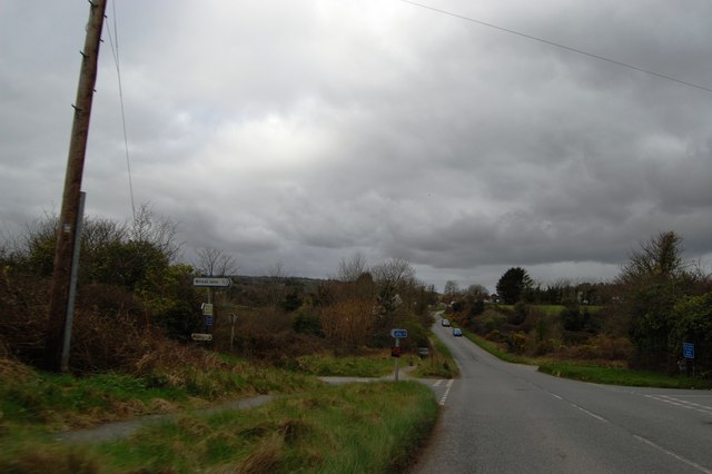
Bissoe is a small village located in the county of Cornwall, England. Situated approximately 6 miles southwest of the city of Truro, it lies on the A39 road, which connects Truro to Falmouth. With a population of around 400 residents, the village is nestled in the picturesque countryside, surrounded by rolling hills and farmland.

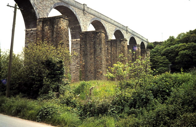
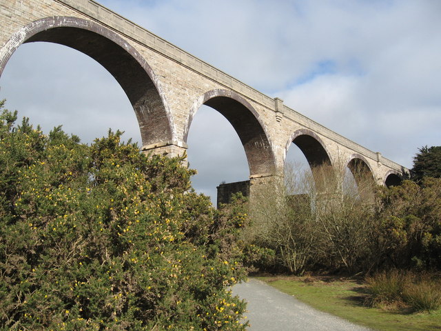
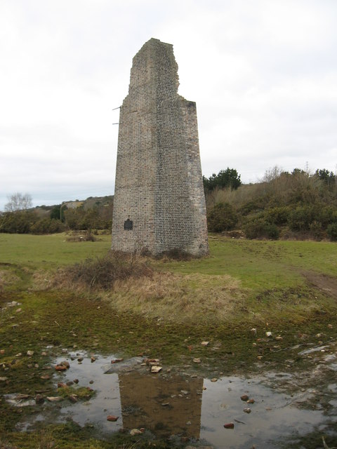
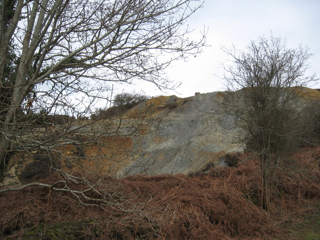
Bissoe is known for its rich history, dating back to the medieval era. The village was once a significant mining area, with several tin and copper mines operating in the vicinity. Today, remnants of this mining heritage can still be seen in the form of disused engine houses and mine shafts scattered throughout the landscape.

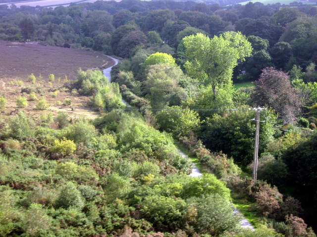
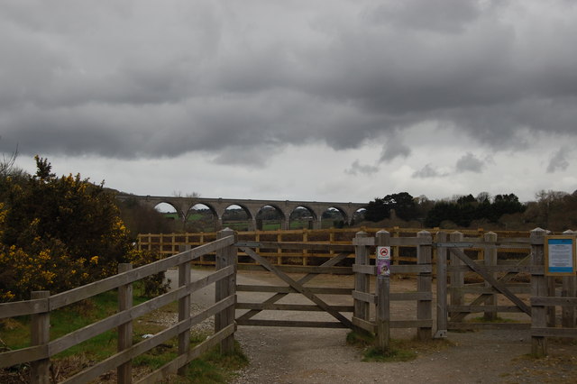
One of the village's main attractions is the Bissoe Cycle Trail, a popular route for walkers and cyclists. This multi-use trail follows the path of an old mining tramway and offers stunning views of the surrounding countryside. The trail stretches for approximately 11 miles, passing through beautiful woodland and alongside the scenic Devoran Creek.

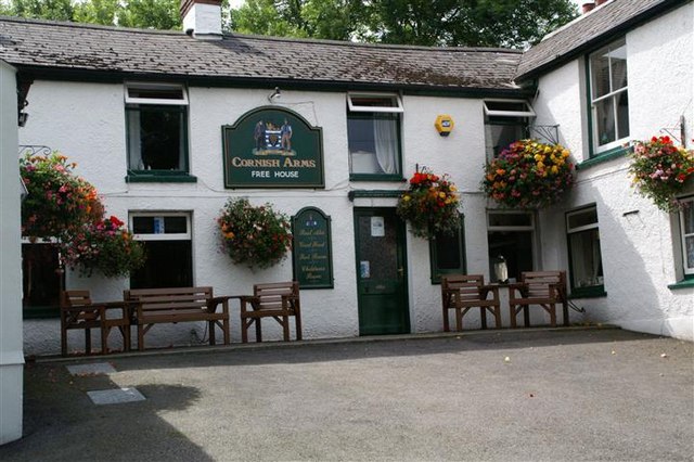
In terms of amenities, Bissoe boasts a community center, a primary school, and a small number of local businesses, including a farm shop and a café. The village also hosts various events throughout the year, such as the Bissoe Bike Show and the Bissoe Christmas Market, which attract visitors from near and far.

Overall, Bissoe is a charming village that offers a peaceful and scenic retreat for both residents and visitors. Its historic past, natural beauty, and community spirit make it a hidden gem in the heart of Cornwall.

If you have any feedback on the listing, please let us know in the comments section below.
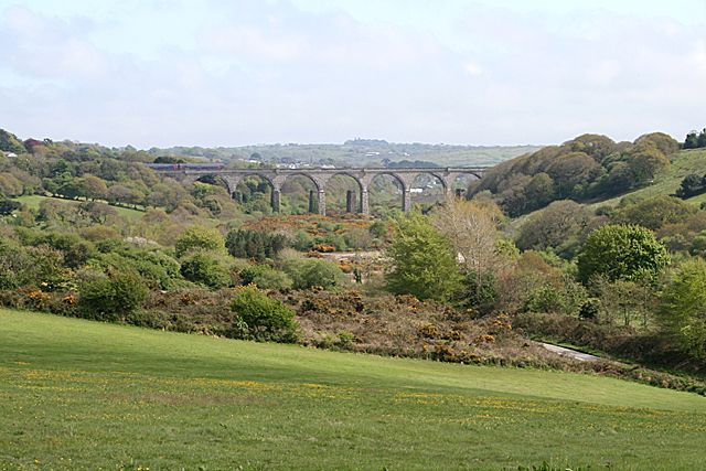
Bissoe Images

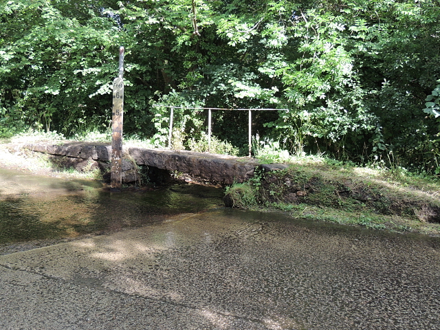
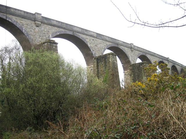
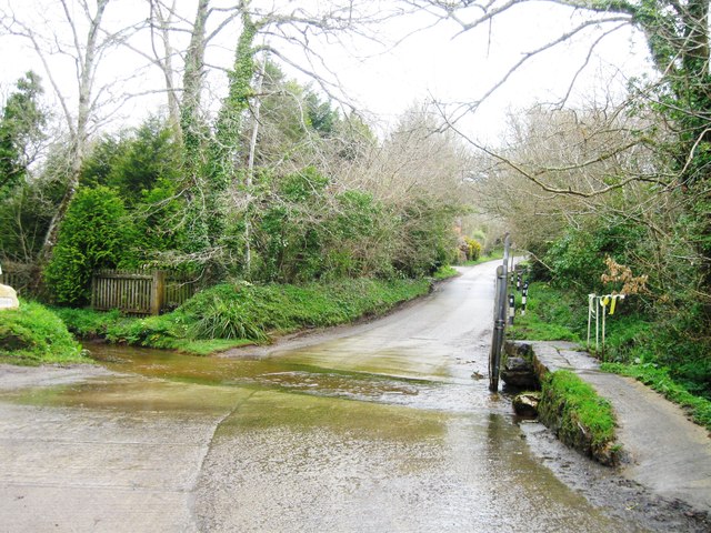
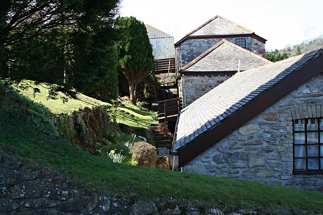
Images are sourced within 2km of 50.231148/-5.123063 or Grid Reference SW7741. Thanks to Geograph Open Source API. All images are credited.

Carnon Viaducts 1969 Brunel's viaduct on the right had wooden trestles.
Carnon Viaducts 1969
Brunel's viaduct on the right had wooden trestles.
The Cornish Arms in summer
Solar array at Wheal Jane This recently commissioned 1.4MW solar farm is apparently the UK's largest to date. It consists of 5600 photovoltaic panels on a 7.2 acre plot and is predicted to save more than 737 tonnes of CO2 per year by supplying the site's electricity requirements. The former mine now houses various commercial and industrial activities. Further similar developments have been planned for Cornwall to take advantage of its high sunshine levels but their future is now in doubt since the Government has indicated that feed-in tariff rates are to be reduced for large schemes.
Solar array at Wheal Jane
This recently commissioned 1.4MW solar farm is apparently the UK's largest to date. It consists of 5600 photovoltaic panels on a 7.2 acre plot and is predicted to save more than 737 tonnes of CO2 per year by supplying the site's electricity requirements. The former mine now houses various commercial and industrial activities. Further similar developments have been planned for Cornwall to take advantage of its high sunshine levels but their future is now in doubt since the Government has indicated that feed-in tariff rates are to be reduced for large schemes.
Footpath at Wheal Jane With a distant view of the new solar array <a href="https://www.geograph.org.uk/photo/2500442">SW7742 : Solar array at Wheal Jane</a>.
Footpath at Wheal Jane
With a distant view of the new solar array SW7742 : Solar array at Wheal Jane.
Mine shaft at Wheal Jane An open shaft which has been fitted with a protective cage.
Mine shaft at Wheal Jane
An open shaft which has been fitted with a protective cage.
Maritime Line Crossing the Carnon River Viaduct
Carnon Valley Viaduct
Chimney, Point Mills Arsenic Refinery, Bissoe
Spoil heap, Nangiles mine
Old shaft near Hale Mills
Carnon Viaduct and entrance to cycleway
The Falmouth Branch A Truro to Falmouth train nr Carnon during the early evening. During the day the Falmouth to Truro line now has an half hourly service , the best ever.
The Falmouth Branch
A Truro to Falmouth train nr Carnon during the early evening. During the day the Falmouth to Truro line now has an half hourly service , the best ever.
Road into Bissoe
Road into Bissoe
Track to Twelveheads
Bridge and ford Carnon Valley Crossing a tributary to the Carnon River.
Bridge and ford Carnon Valley
Crossing a tributary to the Carnon River.
Carnon Viaduct
Carnon Viaduct
Ford near Higher Carnon Farm
Railway Bridge
Railway Bridge
Show me another place!

Bissoe is located at Grid Ref: SW7741 (Lat: 50.231148, Lng: -5.123063)

Unitary Authority: Cornwall

Police Authority: Devon and Cornwall

What 3 Words

///headlight.stores.design. Near Perranwell, Cornwall

Nearby Locations

Wheal Baddon Bissoe

Related Wikis

Bissoe

Bissoe (Cornish: Besow, meaning birch trees) is a hamlet in west Cornwall, England, United Kingdom. It is situated five miles (8 km) east of Redruth in...

Hicks Mill

Hicks Mill is a rural hamlet in Cornwall, England. it is situated around the what3words address: ///jeep.removals.nimbly and is about 7 km (4.3 mi) WSW...

Helston Water

Helston Water is a hamlet northwest of Carnon Downs in Cornwall, England. It is in the civil parish of Kea == References ==

Coombe, Gwennap

Coombe (Cornish: Komm) is a settlement in Gwennap civil parish, Cornwall, England, United Kingdom. It is situated approximately three-and-a-half miles...

Nearby Amenities

Located within 500m of 50.231148,-5.123063
Bissoe
Is In: Cornwall, England, UK
Is In Country: England
Is In Country Code: GB
Is In County: Cornwall
Name En: Bissoe
Name Kw: Besow
Place: village
Source: npe
Wikidata: Q4918477
Wikipedia: en:Bissoe
Lat/Long: 50.2306171/-5.1183196
Bicycle Rental
Bike Chain
Phone: +44 1872 870341
Shop: bicycle
Lat/Long: 50.2316294/-5.128388
Bus Stop
Post Office
Bus: yes
Naptan AtcoCode: 0800COC30110
Naptan Bearing: NW
Naptan CommonName: Post Office
Naptan Indicator: Opp
Naptan NaptanCode: corapwmw
Naptan Street: Unclassified
Naptan Verified: no
Public Transport: platform
Shelter: yes
Source: naptan_import
Lat/Long: 50.2311935/-5.1229011
Barrier: cycle_barrier
Bicycle: designated
Foot: designated
Horse: designated
Lat/Long: 50.2313078/-5.1282312
Power: tower
Lat/Long: 50.2275513/-5.1264837
Power: tower
Lat/Long: 50.2286254/-5.1242468
Power: tower
Lat/Long: 50.2307942/-5.1198426
Power: tower
Lat/Long: 50.2300633/-5.1213564
Power: tower
Lat/Long: 50.2337316/-5.1201226
Power: tower
Lat/Long: 50.2327262/-5.1202728
Arsenic Works
Historic: archaeological_site
Lat/Long: 50.2302234/-5.1270342
Power: pole
Lat/Long: 50.2291661/-5.1291722
Power: pole
Lat/Long: 50.2292398/-5.1268119
Power: pole
Lat/Long: 50.2292724/-5.1253501
Power: pole
Lat/Long: 50.2302488/-5.1225472
Power: pole
Lat/Long: 50.2315373/-5.1208842
Power: pole
Lat/Long: 50.2321842/-5.1198596
Power: pole
Lat/Long: 50.2333629/-5.1180652
Cafe
Bike Chain
Lat/Long: 50.23154/-5.1284853
Generator Method: photovoltaic
Generator Output Electricity: yes
Generator Source: solar
Generator Type: solar_photovoltaic_panel
Location: roof
Power: generator
Lat/Long: 50.233845/-5.1282911
Material: wood
Power: pole
Lat/Long: 50.2336339/-5.125629
Power: pole
Lat/Long: 50.2332085/-5.1240921
Power: pole
Lat/Long: 50.2330129/-5.1225552
Power: pole
Lat/Long: 50.233308/-5.1211122
Power: pole
Lat/Long: 50.2335756/-5.1198167
Power: pole
Lat/Long: 50.2339616/-5.1179579
Barrier: stile
Stile: stepover
Lat/Long: 50.2290881/-5.1234403
Barrier: stile
Stile: stepover
Lat/Long: 50.2292646/-5.12343
Post Box
Brand: Royal Mail
Brand Wikidata: Q638098
Collection Times: Mo-Fr 16:00; Sa 09:30; Su off
Drive Through: no
Operator: Royal Mail
Operator Wikidata: Q638098
Post Box Mounting: pier
Post Box Type: lamp
Ref: TR4 175
Royal Cypher: EIIR
Royal Cypher Wikidata: Q33102113
Source: survey;streetlevel imagery;aerial imagery
Lat/Long: 50.2312044/-5.1229327
The data included in this document is from www.openstreetmap.org. The data is made available under ODbL.

Have you been to Bissoe?

Leave your review of Bissoe below (or comments, questions and feedback).