Pyrland
Settlement in Somerset Somerset West and Taunton
England
Pyrland

Pyrland is a small village located in the county of Somerset, England. Situated on the outskirts of the town of Taunton, Pyrland is known for its picturesque surroundings and tranquil atmosphere. The village is nestled amidst rolling hills, lush green fields, and meandering streams, offering residents and visitors a peaceful rural setting.
Pyrland is renowned for its rich history, with evidence of human settlement dating back to the Roman period. The village is home to several historic buildings, including St. Bartholomew's Church, a beautiful medieval structure that stands as a testament to the area's architectural heritage.
The village is primarily residential, with a small population of friendly and welcoming locals. The community is close-knit, organizing regular events and gatherings to foster a sense of unity among its residents. The village also has a primary school, providing education to the local children.
Pyrland is a haven for nature enthusiasts, offering ample opportunities for outdoor activities. The surrounding countryside is ideal for hiking, cycling, and horse riding, with numerous scenic trails and bridleways to explore. The village is also in close proximity to the Quantock Hills, a designated Area of Outstanding Natural Beauty, which attracts visitors from far and wide.
In terms of amenities, Pyrland has limited facilities, with a small convenience store catering to the basic needs of the community. However, the nearby town of Taunton provides a wider range of services, including supermarkets, shops, restaurants, and leisure facilities.
Overall, Pyrland is a charming village that combines natural beauty, a rich history, and a close-knit community, making it an attractive place to live or visit for those seeking a peaceful and idyllic countryside setting.
If you have any feedback on the listing, please let us know in the comments section below.
Pyrland Images
Images are sourced within 2km of 51.035257/-3.097149 or Grid Reference ST2326. Thanks to Geograph Open Source API. All images are credited.


Pyrland is located at Grid Ref: ST2326 (Lat: 51.035257, Lng: -3.097149)
Administrative County: Somerset
District: Somerset West and Taunton
Police Authority: Avon and Somerset
What 3 Words
///drama.evenly.panic. Near Taunton, Somerset
Nearby Locations
Related Wikis

The Taunton Academy
Pyrland School (formerly The Taunton Academy) is a school with academy status in Taunton, Somerset, England. The school was formed by the merger of The...
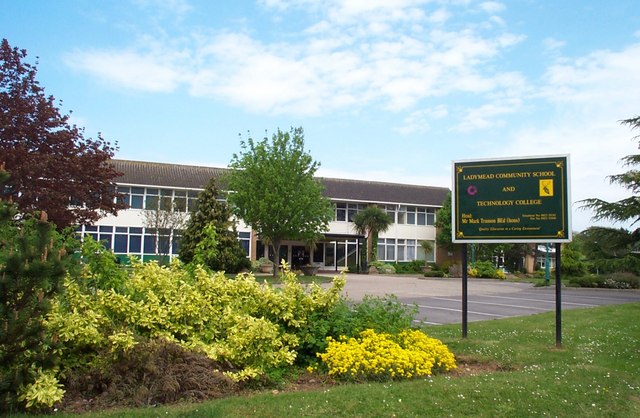
Ladymead Community School
Ladymead Community School was a secondary school and technology college located on Cheddon Road, Taunton, Somerset, England. It had 753 students aged 11...

Roman Catholic Church of St Teresa of Lisieux, Taunton
The Roman Catholic Church of St Teresa of Lisieux in Taunton, Somerset, England, dates from 1958–1959. It is the only known church design of Eric Francis...
The St Augustine of Canterbury School, Taunton
The St Augustine of Canterbury School was a joint Church of England and Roman Catholic Voluntary Aided (VA) secondary school in Taunton, Somerset, England...

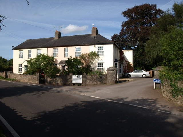
King's College Preparatory School
King's College Preparatory School is a co-educational preparatory school that provides day and boarding school. The school is located within the parish...
Pyrland Hall
Pyrland Hall is a country house near Cheddon Fitzpaine in the English county of Somerset. It is a Grade II* listed building. == History == Pyrland Hall...
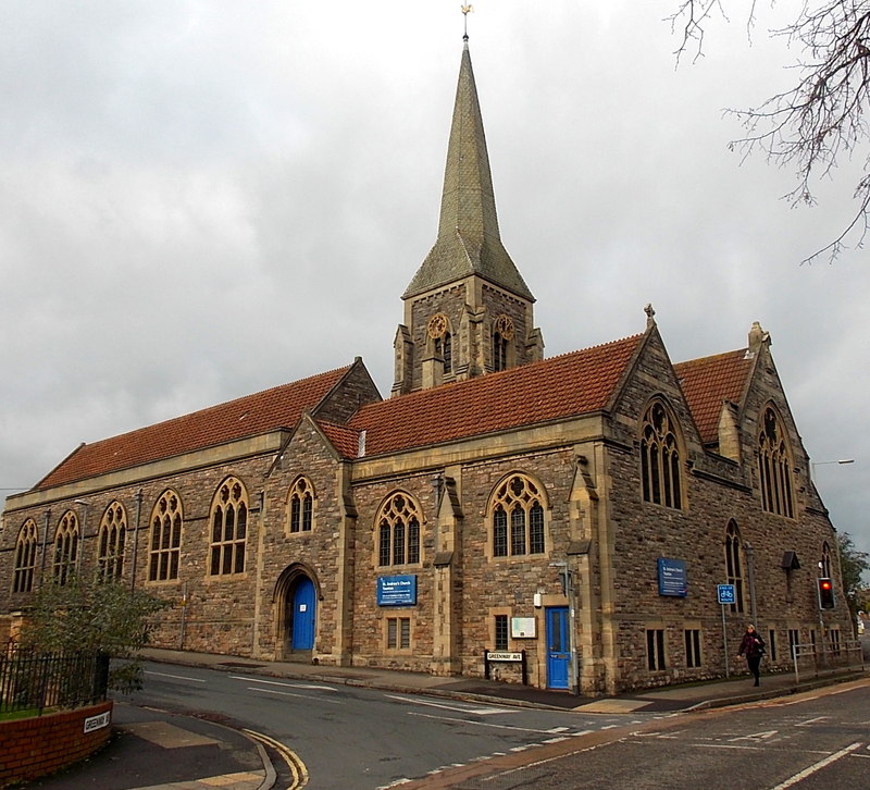
St Andrew's Church, Taunton
St Andrew's Church is a Church of England church in Taunton, Somerset, England. Designed by J. Houghton Spencer, it was built in 1880–81 and has been a...

Church of St Mary, Cheddon Fitzpaine
The Anglican Church of St Mary in Cheddon Fitzpaine, Somerset, England was built in the late 13th century. It is a Grade II* listed building. == History... ==
Nearby Amenities
Located within 500m of 51.035257,-3.097149Have you been to Pyrland?
Leave your review of Pyrland below (or comments, questions and feedback).