Pyrford Green

Settlement in Surrey Woking

England

Pyrford Green

Bridleway 92, Woking Running from the end of suburban Dodd's Lane to and including the old Dodd's Lane. Older maps suggest this part was once a track.
Bridleway 92, Woking Credit: Robin Webster

Pyrford Green is a small village located in the county of Surrey, England. Situated along the River Wey, it is part of the larger Pyrford area, which also includes Pyrford Village and Pyrford Woods. The village is located approximately 20 miles southwest of London and falls within the borough of Woking.

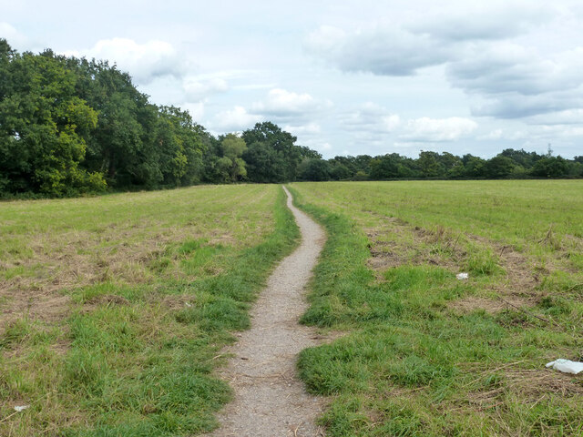
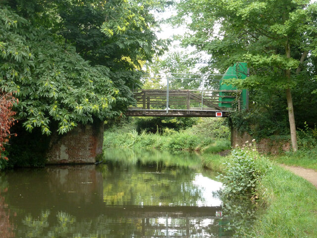
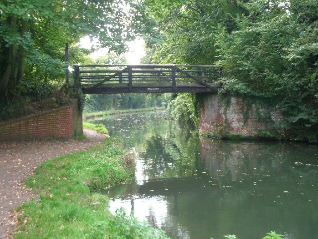
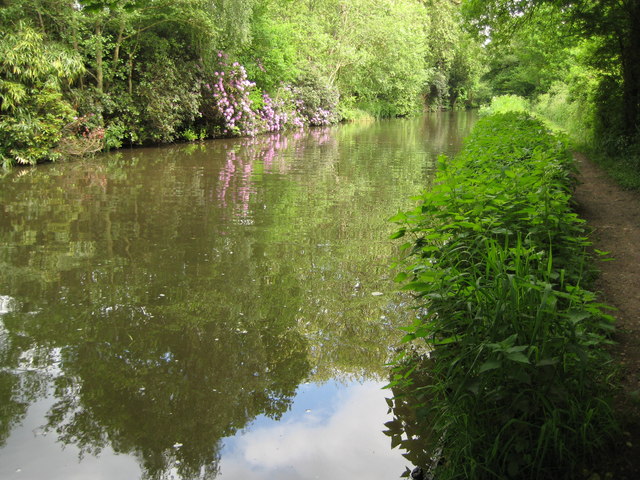
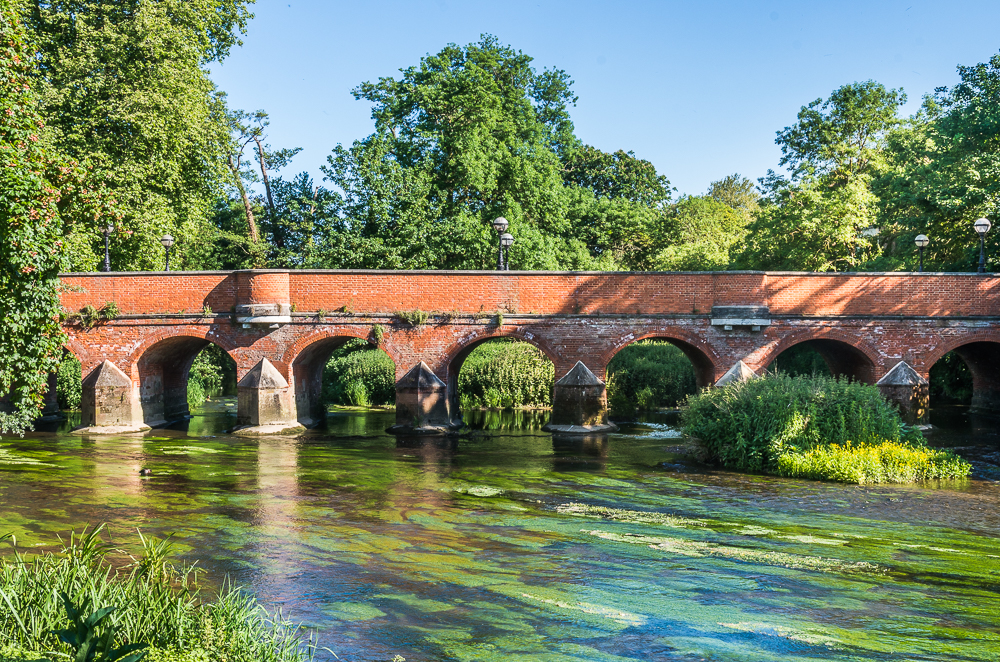
Pyrford Green is known for its picturesque and idyllic surroundings. The village is surrounded by lush green fields and open countryside, offering residents and visitors a peaceful and rural atmosphere. The River Wey, which flows through the village, adds to its charm, providing opportunities for boating, fishing, and leisurely walks along its banks.

The village itself is characterized by its quaint and historic architecture. There are several traditional cottages and buildings, some of which date back hundreds of years, giving Pyrford Green a timeless and traditional feel. The village also features a historic church, St. Nicholas Church, which contributes to the area's rich heritage.

Despite its rural setting, Pyrford Green is conveniently located near several amenities. The nearby towns of Woking and Guildford provide a range of shopping, dining, and entertainment options. Additionally, the village benefits from excellent transport links, with easy access to major roads and railway stations, allowing for convenient travel to London and other parts of Surrey.

In summary, Pyrford Green offers a charming and tranquil village setting, surrounded by beautiful countryside and a meandering river. Its historical architecture and convenient location make it an attractive place to live or visit for those seeking a peaceful yet well-connected community.

If you have any feedback on the listing, please let us know in the comments section below.

Pyrford Green Images

Images are sourced within 2km of 51.317843/-0.496079 or Grid Reference TQ0458. Thanks to Geograph Open Source API. All images are credited.

Bridleway 92, Woking Running from the end of suburban Dodd's Lane to and including the old Dodd's Lane. Older maps suggest this part was once a track.
Bridleway 92, Woking
Running from the end of suburban Dodd's Lane to and including the old Dodd's Lane. Older maps suggest this part was once a track.
Dodd's Lane Bridleway 92, Woking, towards the River Wey Navigation.
Dodd's Lane
Bridleway 92, Woking, towards the River Wey Navigation.
Dodd's Lane Bridleway 92, Woking, towards the River Wey Navigation.
Dodd's Lane
Bridleway 92, Woking, towards the River Wey Navigation.
River Wey Navigation north of Dodd's Bridge The Navigation and the natural river are separate for several km here, and are a good way apart, the river being well to the east - over 1 km at this spot.
River Wey Navigation north of Dodd's Bridge
The Navigation and the natural river are separate for several km here, and are a good way apart, the river being well to the east - over 1 km at this spot.
River Wey Navigation - rowing boat 10 Hired from Byfleet Boat Club, which is some way ahead.
River Wey Navigation - rowing boat 10
Hired from Byfleet Boat Club, which is some way ahead.
River Wey Navigation - Murray's Bridge A wooden span that appears to be fenced off. There is no right of way.
River Wey Navigation - Murray's Bridge
A wooden span that appears to be fenced off. There is no right of way.
River Wey Navigation : Dodds Bridge
Murray's bridge over the Wey Navigation looking south-west
Murray's bridge over the Wey Navigation
looking south-west
Dodd's Footbridge, Wey Navigation, Surrey The footbridge carries a public right of way.
Dodd's Footbridge, Wey Navigation, Surrey
The footbridge carries a public right of way.
Murray's Bridge, Wey Navigation, Surrey Muray's Bridge carries a track, probably private, giving access to a large house, West Hall.  It is, however, not much used, as this house has easier access by another route.
Murray's Bridge, Wey Navigation, Surrey
Muray's Bridge carries a track, probably private, giving access to a large house, West Hall. It is, however, not much used, as this house has easier access by another route.
M25 Motorway near Byfleet (1) Looking clockwise and in the direction of Junction 11 from the Murray's Lane bridge.
M25 Motorway near Byfleet (1)
Looking clockwise and in the direction of Junction 11 from the Murray's Lane bridge.
M25 Motorway near Byfleet (2) Anyone familiar with Douglas Adams' book "The Meaning of Liff", which is basically a dictionary of words for which no words exist, will instantly recognise the traffic here manoeuvring into a classic 'grimbister' formation where everyone stays behind the police van (with the double rear windows) travelling at 60 mph, too scared to overtake just in case...     

Anyway this is looking anti-clockwise and in the direction of Junction 10 from the Murray's Lane bridge.
M25 Motorway near Byfleet (2)
Anyone familiar with Douglas Adams' book "The Meaning of Liff", which is basically a dictionary of words for which no words exist, will instantly recognise the traffic here manoeuvring into a classic 'grimbister' formation where everyone stays behind the police van (with the double rear windows) travelling at 60 mph, too scared to overtake just in case... Anyway this is looking anti-clockwise and in the direction of Junction 10 from the Murray's Lane bridge.
River Wey Navigation near Byfleet Taken from just north of Murray's Bridge, the towpath is on the right and the rhododendrons in bloom on the left are in the grounds of West Hall.
River Wey Navigation near Byfleet
Taken from just north of Murray's Bridge, the towpath is on the right and the rhododendrons in bloom on the left are in the grounds of West Hall.
River Wey Navigation near West Hall The navigation becomes rural surprisingly quickly, despite the M25 being just yards to the east.  Although a river navigation, many parts such as this are canal-like in appearance, with a definitive towpath.
River Wey Navigation near West Hall
The navigation becomes rural surprisingly quickly, despite the M25 being just yards to the east. Although a river navigation, many parts such as this are canal-like in appearance, with a definitive towpath.
River Wey Navigation near West Hall This section of the navigation has a more river-like quality, with open fields to the west.
River Wey Navigation near West Hall
This section of the navigation has a more river-like quality, with open fields to the west.
Dodd's Footbridge Compare this with Dr Neil Clifton's picture 25 years earlier <a href="https://www.geograph.org.uk/photo/624072">TQ0560 : Dodd's Footbridge, Wey Navigation, Surrey</a>.  It has become more overgrown since then.
Dodd's Footbridge
Compare this with Dr Neil Clifton's picture 25 years earlier TQ0560 : Dodd's Footbridge, Wey Navigation, Surrey. It has become more overgrown since then.
Show me another place!

Pyrford Green is located at Grid Ref: TQ0458 (Lat: 51.317843, Lng: -0.496079)

Administrative County: Surrey

District: Woking

Police Authority: Surrey

What 3 Words

///spins.hired.onions. Near Ripley, Surrey

Related Wikis

Mole Valley

Mole Valley is a local government district in Surrey, England. Its council is based in Dorking, and the district's other town is Leatherhead. The largest...

Pyrford

Pyrford is a village in the borough of Woking in Surrey, England. It is on the left bank of the River Wey, around two miles (three kilometres) east of...
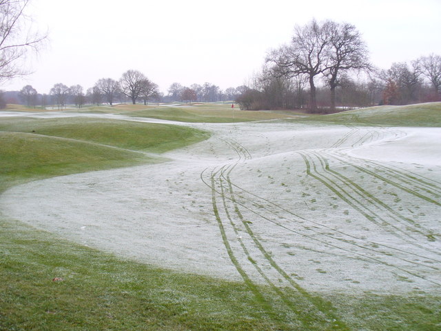
Wisley Golf Club

The Wisley Golf Club is a golf club in Wisley in Surrey, England. The club is only open to members and their guests. The club has 700 members, each of...
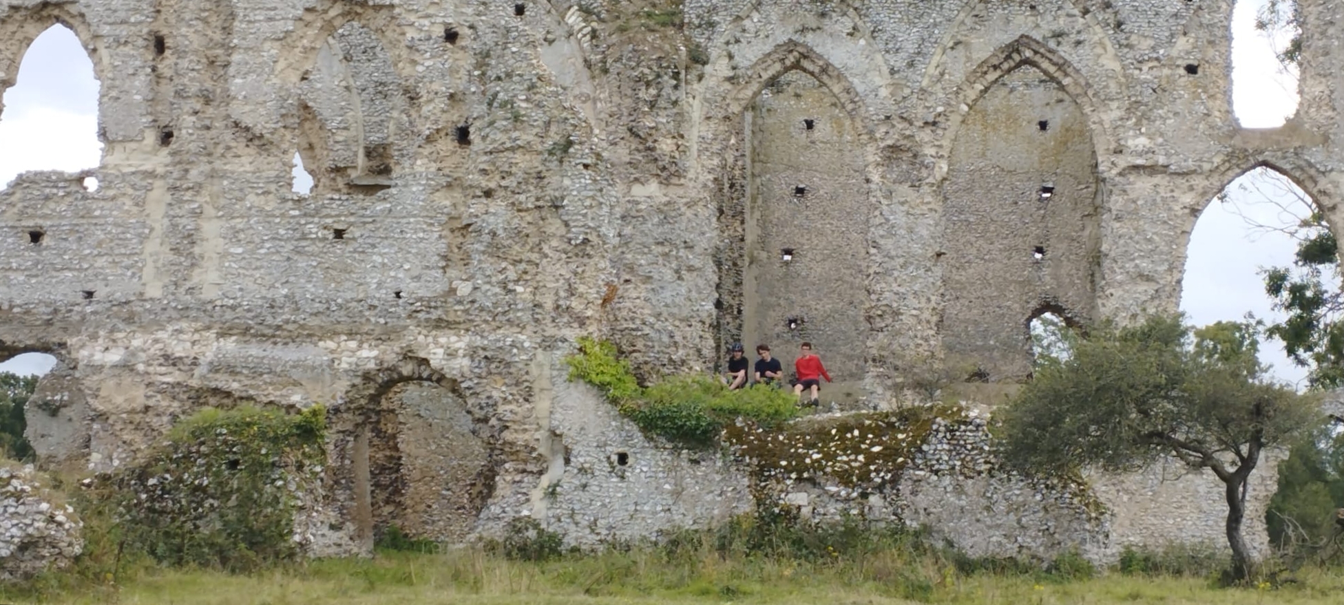
Newark Priory

Newark Priory is a ruined priory on an island surrounded by the River Wey and its former leat (the Abbey Stream) near the boundary of the village (parish...

Nearby Amenities

Located within 500m of 51.317843,-0.496079
Power: tower
Lat/Long: 51.3160464/-0.5007505
Power: tower
Lat/Long: 51.3196394/-0.5018865
Natural: shrub
Lat/Long: 51.3197137/-0.5026003
Power: tower
Lat/Long: 51.3182905/-0.5031273
Power: tower
Lat/Long: 51.3206207/-0.5014979
Power: tower
Lat/Long: 51.3197571/-0.5024541
Green Farm
Landuse: farm
Note Retag: CS #48756035
Source: npe
Lat/Long: 51.3177416/-0.5006458
Give Way
Source: Surrey-Air_Survey
Lat/Long: 51.3203969/-0.498255
Hiking: yes
Information: guidepost
Source: GPS survey
Tourism: information
Lat/Long: 51.3195828/-0.4973834
Hiking: yes
Information: guidepost
Source: GPS survey
Tourism: information
Lat/Long: 51.3196168/-0.4975297
Golf: pin
Lat/Long: 51.3204981/-0.4934487
Golf: pin
Lat/Long: 51.3193649/-0.4945913
Golf: pin
Lat/Long: 51.3216359/-0.4934637
Golf: pin
Lat/Long: 51.3181715/-0.492694
Golf: pin
Lat/Long: 51.3211901/-0.4921035
Golf: pin
Lat/Long: 51.3193401/-0.4915166
Golf: pin
Lat/Long: 51.3175384/-0.4945082
Golf: pin
Lat/Long: 51.3151048/-0.4976447
Golf: pin
Lat/Long: 51.3152411/-0.4956981
Golf: pin
Lat/Long: 51.3152419/-0.4947131
Post Box
Brand: Royal Mail
Brand Wikidata: Q638098
Collection Plate: CP7D
Collection Times: Mo-Fr 09:00; Sa 07:00
Operator: Royal Mail
Operator Wikidata: Q638098
Post Box Mounting: pier
Post Box Type: lamp
Ref: GU22 76D
Royal Cypher: EIIR
Royal Cypher Wikidata: Q33102113
Source: survey
Survey Point: 2022-08-28
Lat/Long: 51.3179819/-0.4961651
Barrier: kissing_gate
Lat/Long: 51.3192737/-0.4987837
The data included in this document is from www.openstreetmap.org. The data is made available under ODbL.

Have you been to Pyrford Green?

Leave your review of Pyrford Green below (or comments, questions and feedback).