Puncknowle

Settlement in Dorset

England

Puncknowle

Pond and field west of West Bexington The pond is unmapped but appears on satellite images, though not reaching as far west as shown here.
Pond and field west of West Bexington Credit: Derek Harper

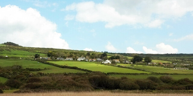
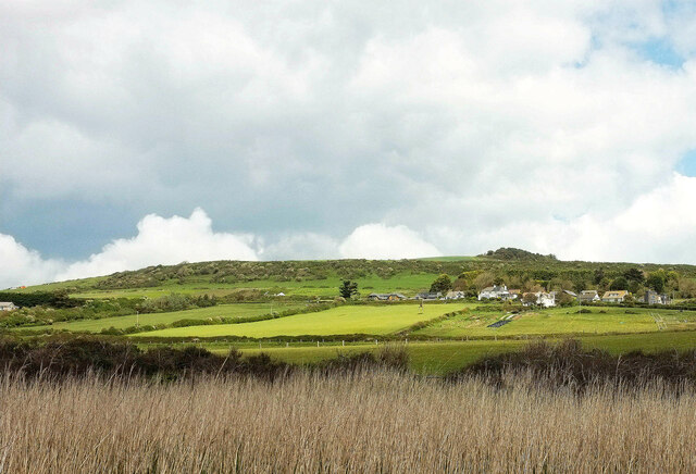
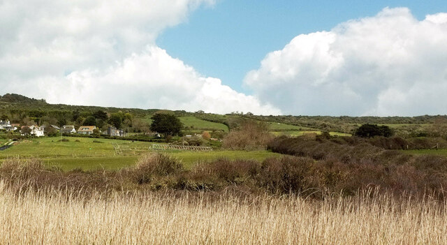
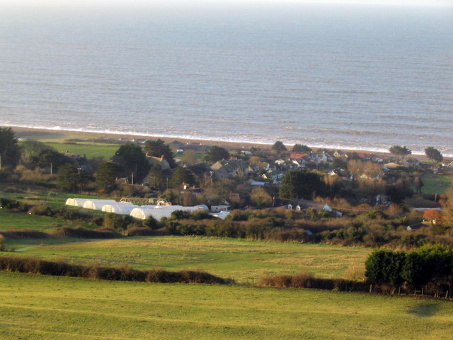
Puncknowle is a small village located in the county of Dorset, England. Situated approximately 10 miles west of the town of Dorchester, it is nestled in the picturesque Bride Valley. With a population of around 200 residents, Puncknowle exudes a genuine sense of countryside tranquility.

The village itself is characterized by its quintessential English charm, with traditional thatched cottages and stone-built houses lining the narrow lanes. The centerpiece of Puncknowle is the 12th-century Church of Saint Mary, a Grade I listed building that showcases stunning architectural features.

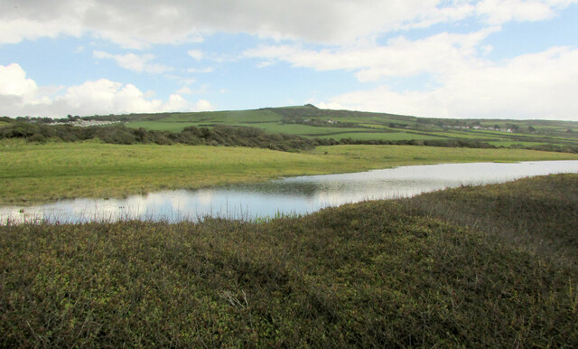
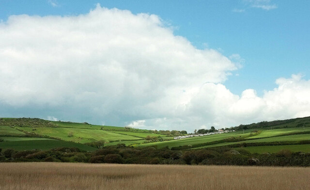
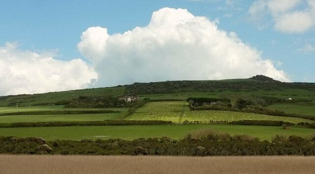
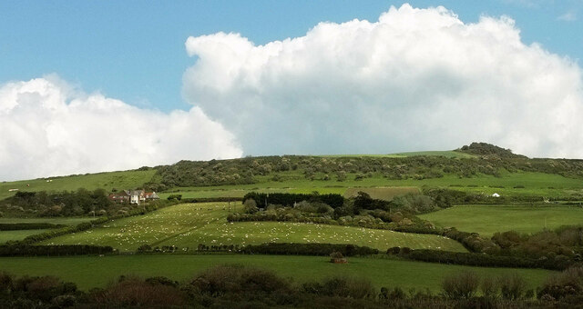
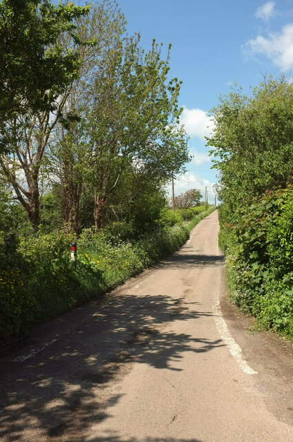
Surrounded by rolling hills and expansive fields, Puncknowle offers breathtaking views of the Dorset countryside. Walking enthusiasts can explore the numerous footpaths that wind through the area, providing opportunities to witness the diverse wildlife and natural beauty that the region has to offer.

Although small in size, Puncknowle boasts a strong sense of community. The village hall serves as a hub for social gatherings and hosts a range of activities, including art exhibitions, yoga classes, and local events. Additionally, Puncknowle is home to a welcoming pub where residents and visitors can enjoy a relaxing meal or a drink.

With its idyllic rural setting, Puncknowle provides a peaceful retreat away from the hustle and bustle of city life. Its close proximity to the Jurassic Coast, a UNESCO World Heritage Site, makes it an ideal base for exploring the stunning coastline and nearby attractions such as the market town of Bridport and the famous Chesil Beach.

If you have any feedback on the listing, please let us know in the comments section below.

Puncknowle Images

Images are sourced within 2km of 50.695856/-2.6603412 or Grid Reference SY5388. Thanks to Geograph Open Source API. All images are credited.

Pond and field west of West Bexington The pond is unmapped but appears on satellite images, though not reaching as far west as shown here.
Pond and field west of West Bexington
The pond is unmapped but appears on satellite images, though not reaching as far west as shown here.
Towards Swyre Looking right from <a href="https://www.geograph.org.uk/photo/7059268">SY5286 : Chesil Beach near West Bexington Nature Reserve</a> across the reed beds of West Bexington Nature Reserve. To the right is Gorselands Caravan Park.
Towards Swyre
Looking right from SY5286 : Chesil Beach near West Bexington Nature Reserve across the reed beds of West Bexington Nature Reserve. To the right is Gorselands Caravan Park.
Fields by Swyre Road Looking right from <a href="https://www.geograph.org.uk/photo/7059281">SY5287 : Towards Swyre</a>, again with the reed beds of West Bexington Nature Reserve in the foreground. The houses are along Swyre Road between Swyre and West Bexington. Behind rises The Knoll.
Fields by Swyre Road
Looking right from SY5287 : Towards Swyre, again with the reed beds of West Bexington Nature Reserve in the foreground. The houses are along Swyre Road between Swyre and West Bexington. Behind rises The Knoll.
Hillside below The Knoll A patch of sunlight crosses the hillside shown in <a href="https://www.geograph.org.uk/photo/7059387">SY5287 : Fields by Swyre Road</a> which was taken a little to the west along the coast path and Hardy Way.
Hillside below The Knoll
A patch of sunlight crosses the hillside shown in SY5287 : Fields by Swyre Road which was taken a little to the west along the coast path and Hardy Way.
Field, West Bexington Looking right from <a href="https://www.geograph.org.uk/photo/7059437">SY5287 : Hillside below The Knoll</a> with overlap, with houses along Swyre Road at the upper end of the village.
Field, West Bexington
Looking right from SY5287 : Hillside below The Knoll with overlap, with houses along Swyre Road at the upper end of the village.
Fields, West Bexington A different angle on the hillside and some of the houses seen in <a href="https://www.geograph.org.uk/photo/7059475">SY5387 : Field, West Bexington</a>, with The Knoll behind. This looks right from <a href="https://www.geograph.org.uk/photo/6852602">SY5286 : Coast path near West Bexington</a>.
Fields, West Bexington
A different angle on the hillside and some of the houses seen in SY5387 : Field, West Bexington, with The Knoll behind. This looks right from SY5286 : Coast path near West Bexington.
Fields, West Bexington Looking right from <a href="https://www.geograph.org.uk/photo/7059785">SY5386 : Fields, West Bexington</a> across the reed beds.
Fields, West Bexington
Looking right from SY5386 : Fields, West Bexington across the reed beds.
House and hotel, West Bexington The Manor Hotel (left centre) also appears in <a href="https://www.geograph.org.uk/photo/6852848">SY5386 : Manor Hotel, West Bexington</a>.
House and hotel, West Bexington
The Manor Hotel (left centre) also appears in SY5386 : Manor Hotel, West Bexington.
Farm buildings, West Bexington Listed as a "Range of Farmbuildings (Stables, Saddlery and Forge) at Tamarisk Farm" and described at <span class="nowrap"><a title="https://historicengland.org.uk/listing/the-list/list-entry/1215778?section=official-listing" rel="nofollow ugc noopener" href="https://historicengland.org.uk/listing/the-list/list-entry/1215778?section=official-listing">Link</a><img style="margin-left:2px;" alt="External link" title="External link - shift click to open in new window" src="https://s1.geograph.org.uk/img/external.png" width="10" height="10"/></span> . See also <a href="https://www.geograph.org.uk/photo/6852863">SY5386 : Listed farm building, West Bexington</a> and <a href="https://www.geograph.org.uk/photo/6853050">SY5386 : Former forge, West Bexington</a>.
Farm buildings, West Bexington
Listed as a "Range of Farmbuildings (Stables, Saddlery and Forge) at Tamarisk Farm" and described at LinkExternal link . See also SY5386 : Listed farm building, West Bexington and SY5386 : Former forge, West Bexington.
Horticulture at West Bexington A view towards Chesil Beach from Swyre Road across crops at Tamarisk Farm.
Horticulture at West Bexington
A view towards Chesil Beach from Swyre Road across crops at Tamarisk Farm.
Swyre Road The road climbs away from West Bexington.
Swyre Road
The road climbs away from West Bexington.
Cottage, West Bexington Only one house is visible in <a href="https://www.geograph.org.uk/photo/7060972">SY5386 : Swyre Road</a>, but this is one of several on the right-hand side.
Cottage, West Bexington
Only one house is visible in SY5386 : Swyre Road, but this is one of several on the right-hand side.
Houses on Swyre Road I suppose this is ribbon development on the northern fringe of the village.
Houses on Swyre Road
I suppose this is ribbon development on the northern fringe of the village.
Horticulture at West Bexington A clearer view of the plots somewhat hidden at <a href="https://www.geograph.org.uk/photo/7060955">SY5386 : Horticulture at West Bexington</a>.
Horticulture at West Bexington
A clearer view of the plots somewhat hidden at SY5386 : Horticulture at West Bexington.
House, West Bexington A smart modern house on Swyre Road.
House, West Bexington
A smart modern house on Swyre Road.
Farmland, West Bexington Looking left from close to <a href="https://www.geograph.org.uk/photo/7061022">SY5387 : House, West Bexington</a>, with a pond close to the nature reserve.
Farmland, West Bexington
Looking left from close to SY5387 : House, West Bexington, with a pond close to the nature reserve.
Farmland by Swyre Road With a view to the pond alongside Chesil Beach seen in <a href="https://www.geograph.org.uk/photo/7059095">SY5287 : Pond behind Chesil Beach</a>.
Farmland by Swyre Road
With a view to the pond alongside Chesil Beach seen in SY5287 : Pond behind Chesil Beach.
Pond by Swyre Road Another view of the field shown in <a href="https://www.geograph.org.uk/photo/7061038">SY5387 : Farmland by Swyre Road</a>, with, down below, the pond seen in <a href="https://www.geograph.org.uk/photo/7061030">SY5387 : Farmland, West Bexington</a>.
Pond by Swyre Road
Another view of the field shown in SY5387 : Farmland by Swyre Road, with, down below, the pond seen in SY5387 : Farmland, West Bexington.
Show me another place!

Puncknowle is located at Grid Ref: SY5388 (Lat: 50.695856, Lng: -2.6603412)

Unitary Authority: Dorset

Police Authority: Dorset

What 3 Words

///ended.skies.mice. Near Bridport, Dorset

Nearby Locations

Puncknowle

Related Wikis

Puncknowle

Puncknowle ( PUN-əl) is a village and civil parish in the county of Dorset in southwest England, situated on the southern slopes of the Bride Valley approximately...

Holy Trinity Church, Swyre

Holy Trinity Church is a Church of England church in Swyre, Dorset, England. The oldest part of the church has been dated to the early 15th century, with...

Swyre

Swyre ( ) is a small village and civil parish in southwest Dorset, England, situated in a valley beside Chesil Beach 6 miles (9.7 km) southeast of Bridport...

West Bexington

West Bexington is a village in south-west Dorset, England, sited just behind the Chesil Beach about 6 miles (10 km) southeast of Bridport. It forms part...

Nearby Amenities

Located within 500m of 50.695856,-2.6603412
Puncknowle
Is In: Dorset, England, UK
Place: village
Population: 429
Lat/Long: 50.695703/-2.6603816
Turning Circle
Lat/Long: 50.6944335/-2.6557033
Post Box
Post Box Mounting: telegraph_pole
Post Box Type: lamp
Ref: DT2 82
Ref GB Uprn: 10015474203
Royal Cypher: EIIR
Royal Cypher Wikidata: Q33102113
Lat/Long: 50.6959478/-2.6600541
Post Box
Post Box Type: lamp
Ref: DT2 126
Ref GB Uprn: 10015477571
Royal Cypher: EIIR
Royal Cypher Wikidata: Q33102113
Lat/Long: 50.6946503/-2.6564608
Historic: memorial
Memorial: war_memorial
Lat/Long: 50.6956901/-2.6594821
Defibrillator
Emergency: defibrillator
Lat/Long: 50.6958534/-2.6592985
Telephone
Booth: K6
Covered: booth
Lat/Long: 50.6958897/-2.6601127
The Crown Inn Community Shop
Shop: convenience
Lat/Long: 50.6958297/-2.6593226
Addr Housename: The Manor
Building: yes
Lat/Long: 50.6953842/-2.6594058
Waste Basket
Lat/Long: 50.6956913/-2.6569171
Entrance: main
Lat/Long: 50.6955877/-2.6598716
The data included in this document is from www.openstreetmap.org. The data is made available under ODbL.

Have you been to Puncknowle?

Leave your review of Puncknowle below (or comments, questions and feedback).