Bishopswood

Settlement in Somerset / Devon Somerset West and Taunton

England

Bishopswood

Newhaven Bridge Over the River Yarty, it is named on old maps. The new A303 has made it into a massive structure.
See <span class="nowrap"><a title="https://maps.nls.uk/view/101724922" rel="nofollow ugc noopener" href="https://maps.nls.uk/view/101724922">Link</a><img style="margin-left:2px;" alt="External link" title="External link - shift click to open in new window" src="https://s1.geograph.org.uk/img/external.png" width="10" height="10"/></span>  Thanks to Jon Alexander for locating the bridge via Speculative Upload.
This photo appeared among family photos from my deceased father, Alfred W. Wills, seen on the left, my uncle E. George Wills, on right, with third person unknown.  Taken on trip to North Tawton in 1938.
Newhaven Bridge Credit: Unknown. Photo from Wills family archives

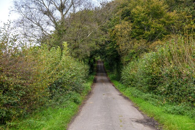
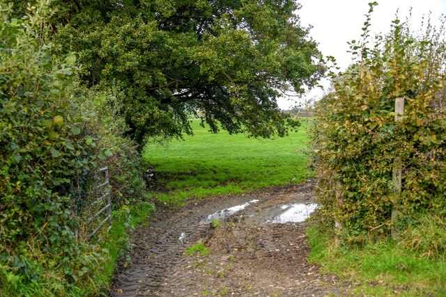
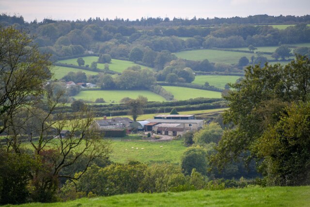
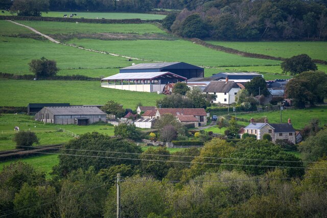
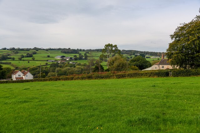
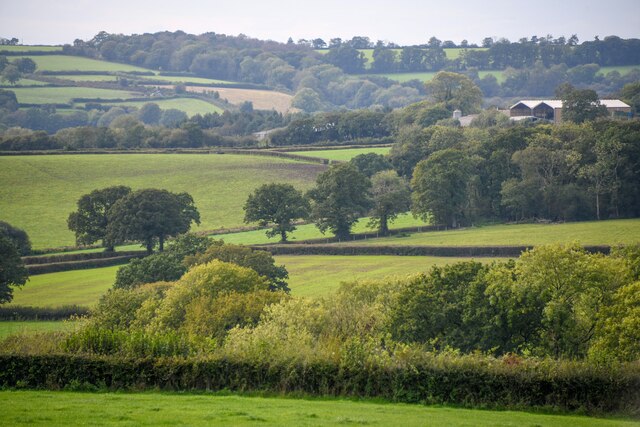
Bishopswood is a small village located on the border of Somerset and Devon in southwestern England. Situated in the picturesque Blackdown Hills, it is surrounded by rolling countryside and stunning landscapes. The village is part of the Devon County Council and falls within the district of East Devon.

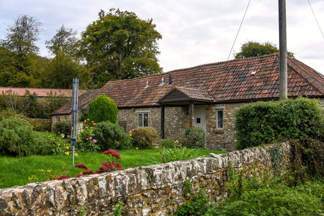
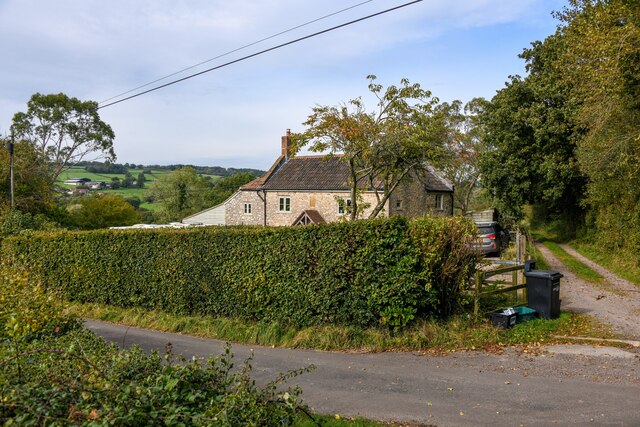
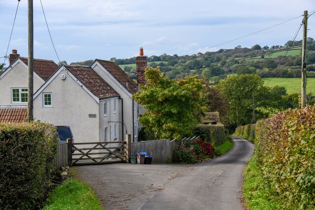
Bishopswood is a tranquil and peaceful place, attracting visitors who seek a break from the hustle and bustle of city life. The village is characterized by its charming thatched-roof cottages, quaint gardens, and traditional village green. It is a close-knit community with a friendly and welcoming atmosphere.

The village is well-connected to nearby towns and cities, with the A30 road passing through, providing convenient access to Exeter, which is approximately 20 miles away. The nearby Honiton railway station offers additional transport options.

Nature lovers will find plenty to explore in Bishopswood and its surroundings. The Blackdown Hills Area of Outstanding Natural Beauty is a haven for outdoor enthusiasts, offering opportunities for hiking, cycling, and wildlife spotting. The River Otter flows nearby, providing scenic walks and fishing spots.

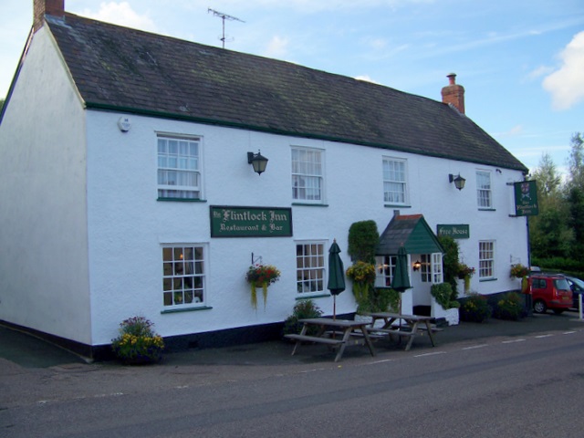
Although Bishopswood is a small village, it is not lacking in amenities. There is a local pub, The Candlelight Inn, known for its warm hospitality and traditional pub food. The village also has a community hall where various events and activities take place, fostering a strong sense of community spirit.

Overall, Bishopswood is a charming rural village that offers a peaceful escape amidst stunning natural beauty.

If you have any feedback on the listing, please let us know in the comments section below.
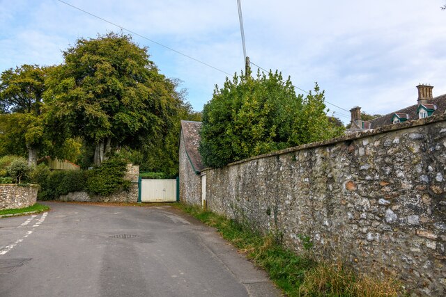
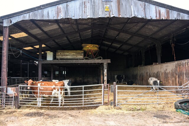
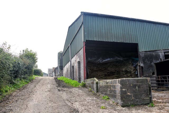
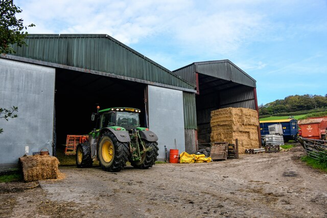
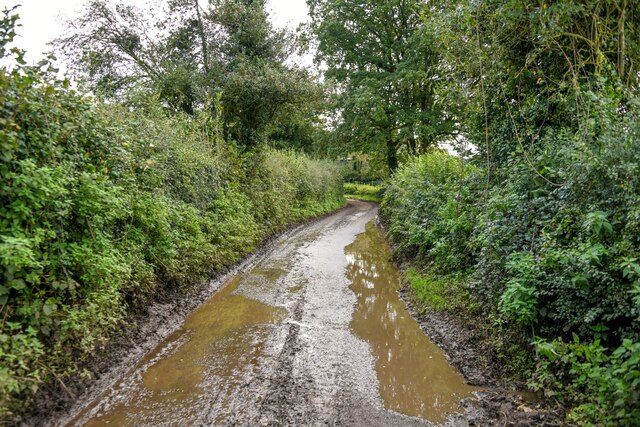
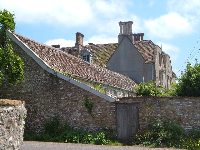
Bishopswood Images

Images are sourced within 2km of 50.909064/-3.054836 or Grid Reference ST2512. Thanks to Geograph Open Source API. All images are credited.

Newhaven Bridge Over the River Yarty, it is named on old maps. The new A303 has made it into a massive structure.
See <span class="nowrap"><a title="https://maps.nls.uk/view/101724922" rel="nofollow ugc noopener" href="https://maps.nls.uk/view/101724922">Link</a><img style="margin-left:2px;" alt="External link" title="External link - shift click to open in new window" src="https://s1.geograph.org.uk/img/external.png" width="10" height="10"/></span>  Thanks to Jon Alexander for locating the bridge via Speculative Upload.
This photo appeared among family photos from my deceased father, Alfred W. Wills, seen on the left, my uncle E. George Wills, on right, with third person unknown.  Taken on trip to North Tawton in 1938.
Newhaven Bridge
Over the River Yarty, it is named on old maps. The new A303 has made it into a massive structure. See LinkExternal link Thanks to Jon Alexander for locating the bridge via Speculative Upload. This photo appeared among family photos from my deceased father, Alfred W. Wills, seen on the left, my uncle E. George Wills, on right, with third person unknown. Taken on trip to North Tawton in 1938.
Buckland St Mary : Fairend Lane Looking along a road through the village.
Buckland St Mary : Fairend Lane
Looking along a road through the village.
Buckland St Mary : Hillcrest Barn Hillcrest Barn in Buckland St Mary.
Buckland St Mary : Hillcrest Barn
Hillcrest Barn in Buckland St Mary.
Buckland St Mary : Pound Lane Looking along Pound Lane with dwellings alongside it.
Buckland St Mary : Pound Lane
Looking along Pound Lane with dwellings alongside it.
Buckland St Mary : Pound Lane Passing Pound Farm.
Buckland St Mary : Pound Lane
Passing Pound Farm.
Buckland St Mary : Pound Farm Looking towards the farmhouse from Pound Lane.
Buckland St Mary : Pound Farm
Looking towards the farmhouse from Pound Lane.
Buckland St Mary : Pound Farm Looking into one of the cattle barns.
Buckland St Mary : Pound Farm
Looking into one of the cattle barns.
Buckland St Mary : Pound Lane Passing Pound Farm.
Buckland St Mary : Pound Lane
Passing Pound Farm.
Buckland St Mary : Pound Farm Farm buildings off Pound Lane.
Buckland St Mary : Pound Farm
Farm buildings off Pound Lane.
Buckland St Mary : Pound Lane Looking along a wet looking Pound Lane.
Buckland St Mary : Pound Lane
Looking along a wet looking Pound Lane.
Buckland St Mary : Pound Lane Looking along Pound Lane.
Buckland St Mary : Pound Lane
Looking along Pound Lane.
Buckland St Mary : Field Entrance Entry to the field and right of way off Pound Lane.
Buckland St Mary : Field Entrance
Entry to the field and right of way off Pound Lane.
Buckland St Mary : Countryside Scenery Looking across towards Cross Hill Farm.
Buckland St Mary : Countryside Scenery
Looking across towards Cross Hill Farm.
Buckland St Mary : Countryside Scenery Looking towards Higher Blindmoor Farm.
Buckland St Mary : Countryside Scenery
Looking towards Higher Blindmoor Farm.
Buckland St Mary : Grassy Field A field with a right of way through it.
Buckland St Mary : Grassy Field
A field with a right of way through it.
Buckland St Mary : Countryside Scenery Looking out across the countryside.
Buckland St Mary : Countryside Scenery
Looking out across the countryside.
Buckland St Mary : Pound Lane Pound Lane with Little Thatch in view.
Buckland St Mary : Pound Lane
Pound Lane with Little Thatch in view.
Buckland St Mary : Pound Lane Pound Lane passing Paddock Cottage.
Buckland St Mary : Pound Lane
Pound Lane passing Paddock Cottage.
Show me another place!

Bishopswood is located at Grid Ref: ST2512 (Lat: 50.909064, Lng: -3.054836)

Administrative County: Somerset

District: Somerset West and Taunton

Police Authority: Avon and Somerset

What 3 Words

///jugs.thousands.ambushes. Near Chard, Somerset

Related Wikis

Bishopswood Meadows

Bishopswood Meadows is a nature reserve situated within the Blackdown Hills Area of Outstanding Natural Beauty in the county of Somerset, England. The...

Long Lye

Long Lye (grid reference ST265122) is an 11.7 hectare (29.0 acre) biological Site of Special Scientific Interest at Buckland St Mary in the Blackdown Hills...

Buckland St Mary

Buckland St Mary is a village and parish in Somerset, England, situated 6 miles (9.7 km) to the west of Ilminster and 8 miles (12.9 km) south of Taunton...

Long Lye Meadow

Long Lye Meadow (grid reference ST267119) is a 3.3 hectare biological Site of Special Scientific Interest at Buckland St Mary in the Blackdown Hills, Somerset...

Church of St Mary, Buckland St Mary

The Anglican Church of St Mary in Buckland St Mary, Somerset, England was built in 1853-1863. It is a Grade II* listed building. == History == The church...

Freshmoor

Freshmoor (grid reference ST280125) is an 11.2 hectare (27.7 acre) biological Site of Special Scientific Interest in Somerset, notified in 1989. Freshmoor...

Marsh, Devon

Marsh is a village in the Blackdown Hills, Devon, England. It is part of the East Devon district, and close to the River Yarty and border with Somerset...

Robin Hood's Butts

Robin Hood's Butts are a group of nine Bronze Age barrows near Otterford on the Blackdown Hills in Somerset, England. They have been scheduled as ancient...

Nearby Amenities

Located within 500m of 50.909064,-3.054836
Bishopswood
Is In: Somerset, England, UK
Place: hamlet
Lat/Long: 50.9090322/-3.0597301
Ford: yes
Lat/Long: 50.9078185/-3.0522055
Generator Method: photovoltaic
Generator Output Electricity: yes
Generator Source: solar
Generator Type: solar_photovoltaic_panel
Location: roof
Power: generator
Source: Bing
Lat/Long: 50.909767/-3.0608632
Generator Method: photovoltaic
Generator Output Electricity: yes
Generator Source: solar
Generator Type: solar_photovoltaic_panel
Location: roof
Power: generator
Source: Bing
Lat/Long: 50.909378/-3.0553499
Generator Method: photovoltaic
Generator Output Electricity: yes
Generator Source: solar
Generator Type: solar_photovoltaic_panel
Location: roof
Power: generator
Source: Bing
Lat/Long: 50.9093662/-3.0552252
Generator Method: photovoltaic
Generator Output Electricity: yes
Generator Source: solar
Generator Type: solar_photovoltaic_panel
Location: roof
Power: generator
Source: Bing
Lat/Long: 50.9088123/-3.0542636
Power: pole
Source: bing
Lat/Long: 50.9134597/-3.0552292
Power: pole
Source: bing
Lat/Long: 50.9134352/-3.0534911
The data included in this document is from www.openstreetmap.org. The data is made available under ODbL.

Have you been to Bishopswood?

Leave your review of Bishopswood below (or comments, questions and feedback).