Bishopstone
Settlement in Kent Canterbury
England
Bishopstone
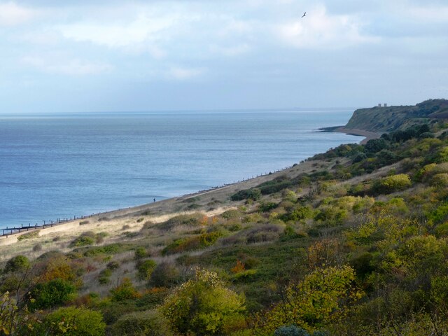
![Reculver Towers and Roman Fort [14] Looking west along the coast from the ruins of the church.
Reculver is a village and coastal resort some 3 miles east of Herne Bay in Kent. The village is known for the ruins of a church and for being the site of a Roman fort. During the Middle Ages Reculver was a thriving township with a weekly market and a yearly fair. The village declined, due to coastal erosion and to the Wantsum Channel silting up, and was abandoned in the late 18th century. There was a revival of tourism in the 20th century and there are now two large caravan parks.](https://s0.geograph.org.uk/geophotos/07/05/83/7058396_d8d972d5.jpg)
Bishopstone is a small village located in the county of Kent, in southeastern England. Situated on the southern coast of the country, it is part of the Lewes district and lies approximately 5 miles east of the town of Seaford. The village is nestled between the South Downs National Park and the English Channel, offering residents and visitors picturesque views of the surrounding countryside and coastline.
With a population of around 500 people, Bishopstone is a close-knit community known for its peaceful and rural atmosphere. The village is characterized by its traditional architecture, featuring charming cottages and historic buildings, which add to its quaint and idyllic ambiance.
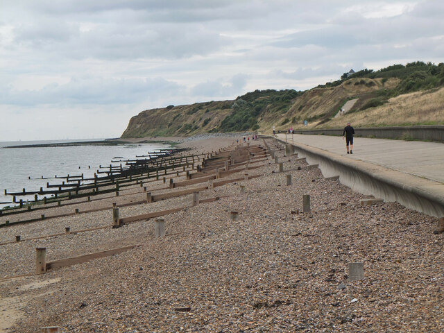
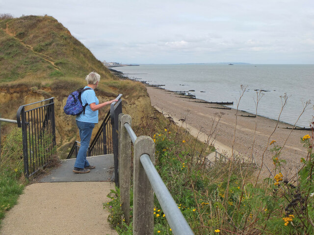
One of the main attractions in Bishopstone is its beach, which stretches along the shoreline and provides a serene setting for leisurely walks or picnics. The beach is also popular among water sports enthusiasts, offering opportunities for swimming, windsurfing, and sailing.
In terms of amenities, Bishopstone is home to a local pub, The Coach and Horses, which serves as a meeting place for villagers and visitors alike. The village also has a community center that hosts various events and activities throughout the year, fostering a sense of community spirit.
Bishopstone benefits from its proximity to other nearby towns and cities, including Seaford and Lewes, which provide a wider range of amenities such as shops, restaurants, and schools. Additionally, the village benefits from good transportation links, with regular bus services connecting it to surrounding areas.
Overall, Bishopstone offers a tranquil and picturesque setting, ideal for those seeking a peaceful retreat while still being within reach of larger towns and cities.
If you have any feedback on the listing, please let us know in the comments section below.
Bishopstone Images
Images are sourced within 2km of 51.371178/1.17168 or Grid Reference TR2068. Thanks to Geograph Open Source API. All images are credited.
![Hillborough buildings [1] The church of St Mary the Virgin in Reculver Lane was built in 1878. Constructed, as a Gothic Revival church in the Early English style, of knapped flint with limestone dressings under a tile roof. The south doorway is a 13th century one reused from the ancient church at Reculver as are a few stones at the junction of the nave and chancel. Listed, grade II, with details at: <span class="nowrap"><a title="https://historicengland.org.uk/listing/the-list/list-entry/1318906" rel="nofollow ugc noopener" href="https://historicengland.org.uk/listing/the-list/list-entry/1318906">Link</a><img style="margin-left:2px;" alt="External link" title="External link - shift click to open in new window" src="https://s1.geograph.org.uk/img/external.png" width="10" height="10"/></span>
Hillborough is a suburb of the town of Herne Bay, a seaside town on the Thames Estuary, some 6 miles north of Canterbury and about 4 miles east of Whitstable. It neighbours the ancient villages of Herne and Reculver.](https://s1.geograph.org.uk/geophotos/07/05/84/7058417_ad51439f.jpg)
![Hillborough buildings [2] Part of the churchyard.
The church of St Mary the Virgin in Reculver Lane was built in 1878. Constructed, as a Gothic Revival church in the Early English style, of knapped flint with limestone dressings under a tile roof. The south doorway is a 13th century one reused from the ancient church at Reculver as are a few stones at the junction of the nave and chancel. Listed, grade II, with details at: <span class="nowrap"><a title="https://historicengland.org.uk/listing/the-list/list-entry/1318906" rel="nofollow ugc noopener" href="https://historicengland.org.uk/listing/the-list/list-entry/1318906">Link</a><img style="margin-left:2px;" alt="External link" title="External link - shift click to open in new window" src="https://s1.geograph.org.uk/img/external.png" width="10" height="10"/></span>
Hillborough is a suburb of the town of Herne Bay, a seaside town on the Thames Estuary, some 6 miles north of Canterbury and about 4 miles east of Whitstable. It neighbours the ancient villages of Herne and Reculver.](https://s3.geograph.org.uk/geophotos/07/05/84/7058431_dba5ff46.jpg)
![Hillborough buildings [3] The Reculver Church of England Primary School in Reculver Lane.
Hillborough is a suburb of the town of Herne Bay, a seaside town on the Thames Estuary, some 6 miles north of Canterbury and about 4 miles east of Whitstable. It neighbours the ancient villages of Herne and Reculver.](https://s3.geograph.org.uk/geophotos/07/05/84/7058435_39cccef0.jpg)
![Hillborough buildings [4] St Mary&#039;s Cottage is, probably, 17th century. Now partly stuccoed and partly pebbledashed, all under a thatch roof. Listed, grade II, with details at: <span class="nowrap"><a title="https://historicengland.org.uk/listing/the-list/list-entry/1336864" rel="nofollow ugc noopener" href="https://historicengland.org.uk/listing/the-list/list-entry/1336864">Link</a><img style="margin-left:2px;" alt="External link" title="External link - shift click to open in new window" src="https://s1.geograph.org.uk/img/external.png" width="10" height="10"/></span>
Hillborough is a suburb of the town of Herne Bay, a seaside town on the Thames Estuary, some 6 miles north of Canterbury and about 4 miles east of Whitstable. It neighbours the ancient villages of Herne and Reculver.](https://s0.geograph.org.uk/geophotos/07/05/84/7058440_adb230a3.jpg)
![Hillborough buildings [5] Forge House, Reculver Lane, is an 18th century building. Constructed of rendered brick under a tile roof. There is a modern extension on the right. Listed, grade II, with details at: <span class="nowrap"><a title="https://historicengland.org.uk/listing/the-list/list-entry/1084988" rel="nofollow ugc noopener" href="https://historicengland.org.uk/listing/the-list/list-entry/1084988">Link</a><img style="margin-left:2px;" alt="External link" title="External link - shift click to open in new window" src="https://s1.geograph.org.uk/img/external.png" width="10" height="10"/></span>
Hillborough is a suburb of the town of Herne Bay, a seaside town on the Thames Estuary, some 6 miles north of Canterbury and about 4 miles east of Whitstable. It neighbours the ancient villages of Herne and Reculver.](https://s0.geograph.org.uk/geophotos/07/05/84/7058444_52b8a8a5.jpg)
Bishopstone is located at Grid Ref: TR2068 (Lat: 51.371178, Lng: 1.17168)
Administrative County: Kent
District: Canterbury
Police Authority: Kent
What 3 Words
///fatter.corded.unsecured. Near Herne Bay, Kent
Nearby Locations
Related Wikis

Hillborough
Hillborough is an area of eastern Herne Bay in Kent, England. The population is included in the Reculver ward of Herne Bay. == External links == Media...

Church of St Mary the Virgin, Reculver
The Church of St Mary the Virgin, Reculver, is an Anglican church on Reculver Lane in the village of Hillborough, in the parish of Reculver, in north-eastern...

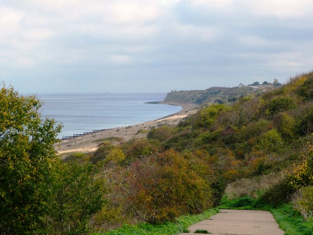
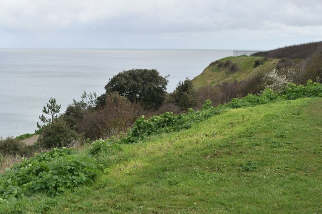
Bishopstone Cliffs
Bishopstone Cliffs is a 67.4-hectare (167-acre) Local Nature Reserve in Reculver on the eastern outskirts of Herne Bay, Kent. It is owned and managed...

Beltinge
Beltinge is a low cliff-top suburb of Herne Bay in Kent, England. It forms the easternmost part of the urban area of Herne Bay and is just west of the...
Hawthorn Corner
Hawthorn Corner is a hamlet near Herne Bay in Kent, England. It is part of the Herne and Broomfield civil parish and consists of a few houses and a sewage...
Chislet Windmill
Chislet windmill was a Grade II listed smock mill in Chislet, Kent, England. It was built in 1744 and burnt down on 15 October 2005. == History == The...

A299 road
The A299, better known as the Thanet Way, is a major road of 22 miles (35 km) in the county of Kent, England, and runs from Brenley Corner near Faversham...

Broomfield, Herne Bay
Broomfield is a village in Kent, England, divided by the Thanet Way from the seaside town of Herne Bay. It is part of the Herne and Broomfield civil parish...
Related Videos

Beltinge & Reculver Towers, a Walking History Tour Guide Using Postcards Kent UK
Beltinge & Reculver Towers, Kent, UK, A walking history tour guide of Beltinge & Reculver Towers using old postcards.

Walking For MacMillan.
Walking, hiking, wild swimming, kayaking, outdoor pursuits and JUST LIVING in Kent.

Chausson 711 Travel Line
This 2020 Chausson 711 Travel Line is a great choice for couples or small families who want a modern, practical, and luxurious ...
Nearby Amenities
Located within 500m of 51.371178,1.17168Have you been to Bishopstone?
Leave your review of Bishopstone below (or comments, questions and feedback).