Bishop's Sutton

Settlement in Hampshire Winchester

England

Bishop's Sutton

Ford at Bishop's Sutton This ford is found on Water Lane at Bishop's Sutton.
Ford at Bishop's Sutton Credit: John Walton

Bishop's Sutton is a small village located in the Winchester district of Hampshire, England. Situated approximately 10 miles northeast of the city of Winchester, the village is nestled amidst the picturesque South Downs National Park. With a population of around 600 residents, Bishop's Sutton exudes a charming and tranquil ambiance.

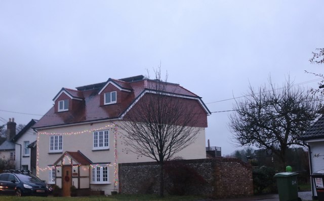
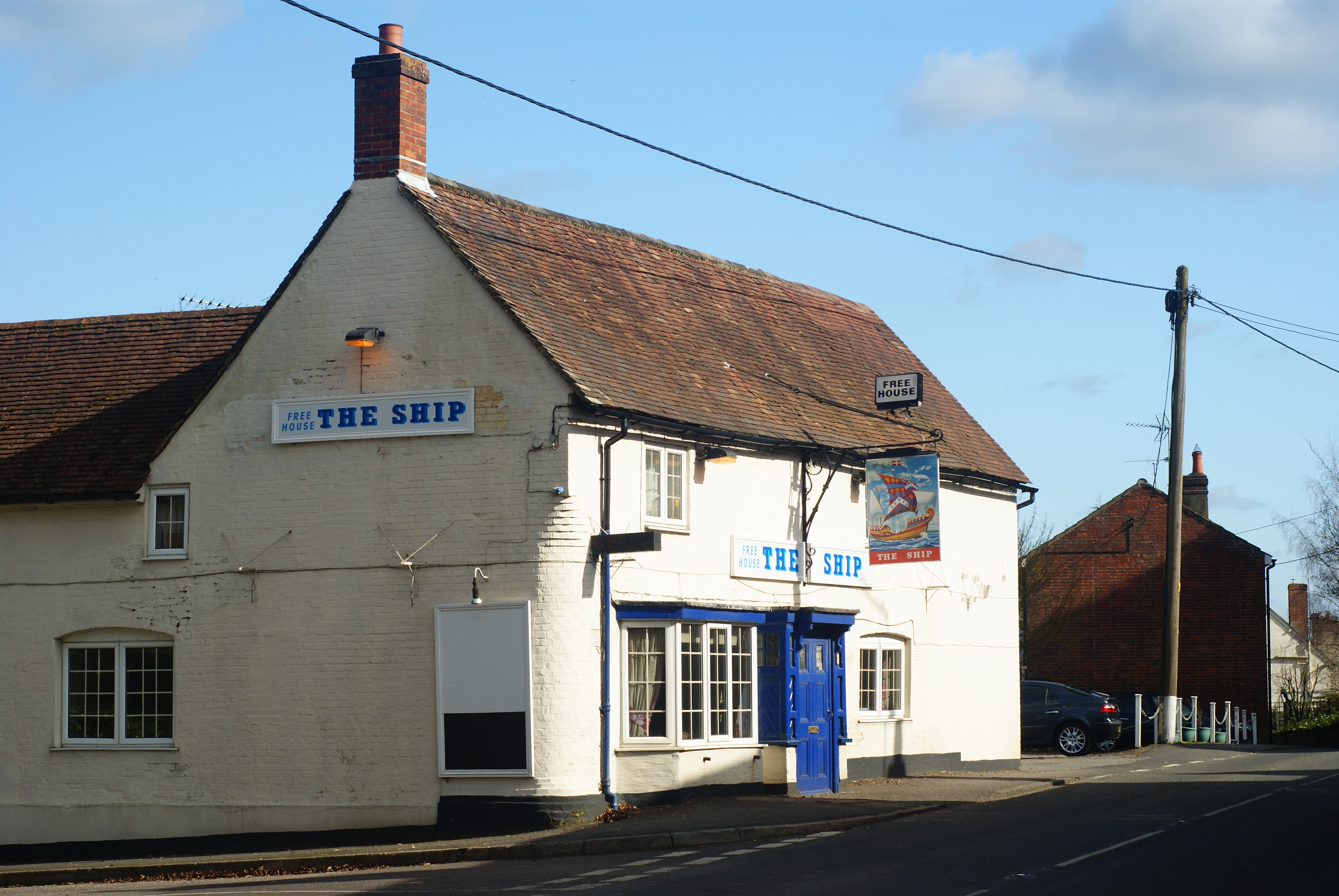
The village is primarily residential, characterized by its traditional Hampshire architecture, including quaint thatched cottages and well-preserved historic buildings. The centerpiece of Bishop's Sutton is the Grade II listed St. Nicholas Church, which dates back to the 12th century and features a striking Norman tower. This architectural gem serves as a reminder of the village's rich heritage.

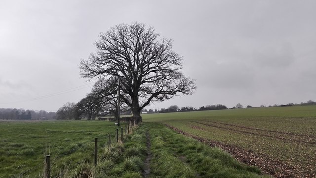
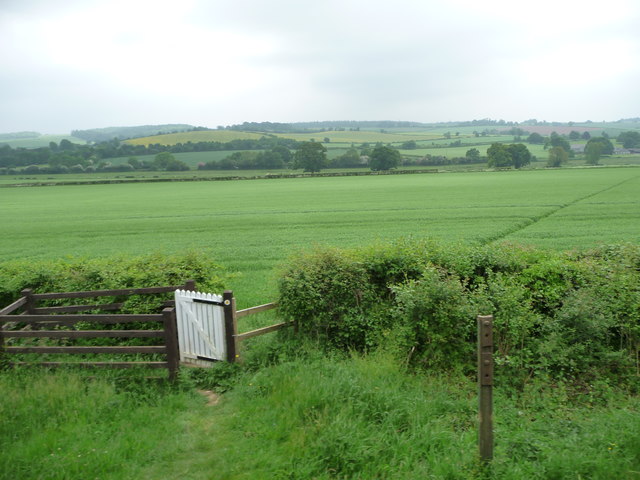
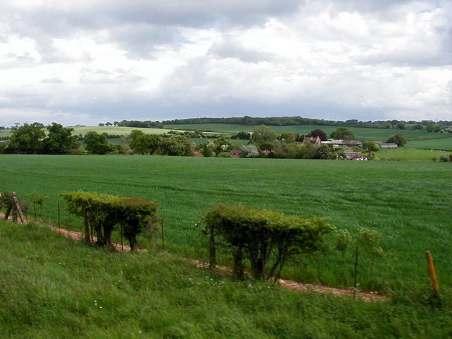
Surrounded by idyllic countryside, Bishop's Sutton offers residents and visitors ample opportunities for outdoor activities. The nearby South Downs Way provides stunning walking and cycling routes, allowing visitors to fully immerse themselves in the natural beauty of the area. Additionally, the village boasts a vibrant community spirit, with various social clubs and events organized throughout the year, including the annual village fete and the popular Sutton Fest music festival.

Although Bishop's Sutton is a predominantly rural village, it benefits from its close proximity to major road networks, making it easily accessible to neighboring towns and cities. The village also benefits from good transport links, with regular bus services connecting it to Winchester and other nearby towns.

Overall, Bishop's Sutton is a charming and close-knit community, offering a peaceful retreat for those seeking a slower pace of life amidst the stunning Hampshire countryside.

If you have any feedback on the listing, please let us know in the comments section below.

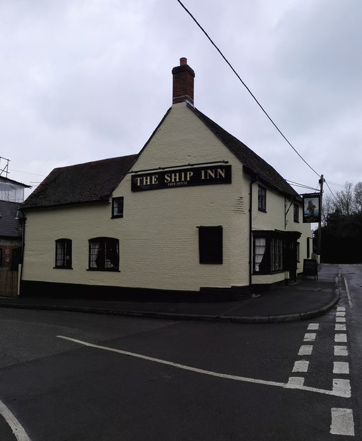
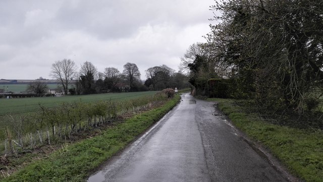
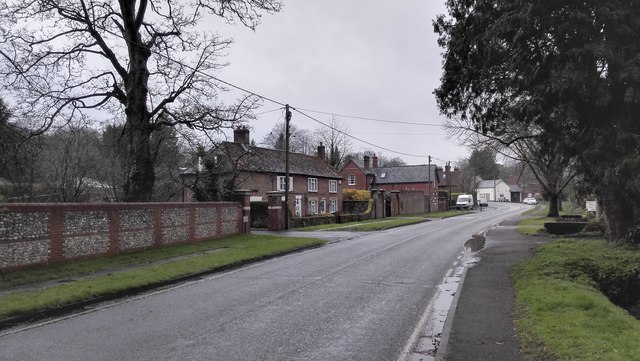
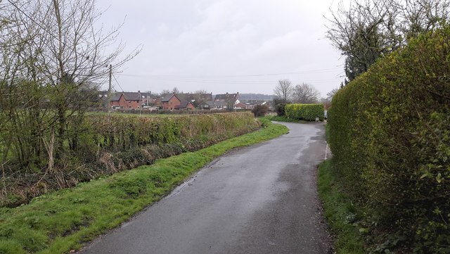
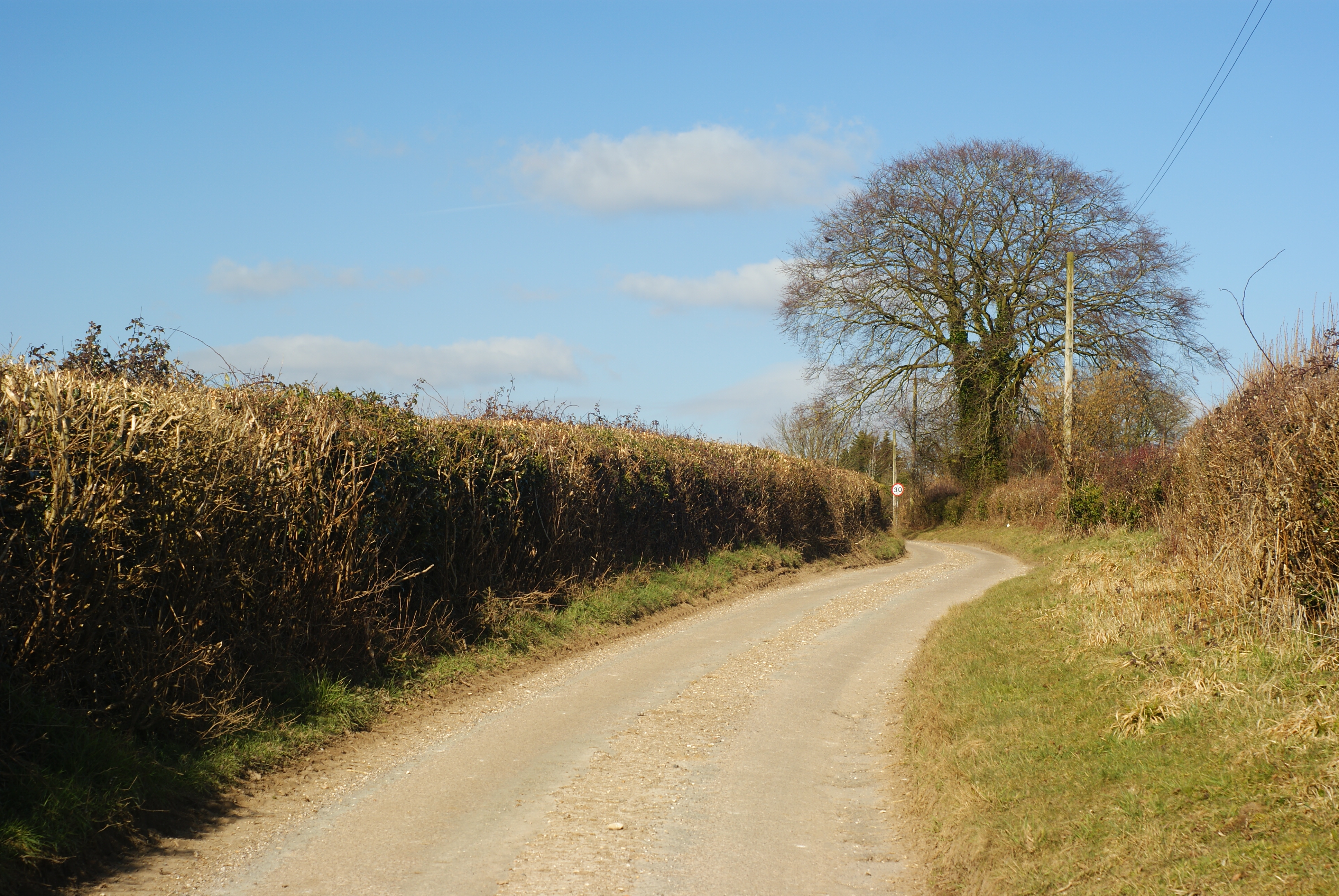
Bishop's Sutton Images

Images are sourced within 2km of 51.084438/-1.13549 or Grid Reference SU6032. Thanks to Geograph Open Source API. All images are credited.

Ford at Bishop's Sutton This ford is found on Water Lane at Bishop's Sutton.
Ford at Bishop's Sutton
This ford is found on Water Lane at Bishop's Sutton.
The Ship Inn
The Ship Inn
Rural Road outside Bishop's Sutton
House on Old Park Road
Bush Cottage - Tegg Down Road Small remote rural cottage on the Saint Swithun's Way
Bush Cottage - Tegg Down Road
Small remote rural cottage on the Saint Swithun's Way
Bishop's Sutton B3047 road through village.
Bishop's Sutton
B3047 road through village.
Water Lane - Bishop's Sutton
Saint Swithun's Way - Bishop's Sutton
Farmland north-west of Sunnybank Farm, Ropley Dean Bounded by the railway line, Northside Lane and the A31.
Farmland north-west of Sunnybank Farm, Ropley Dean
Bounded by the railway line, Northside Lane and the A31.
Public footpath to Green Lane At the railway crossing. The path, as used, is slightly more westerly than legal route mapped.
Public footpath to Green Lane
At the railway crossing. The path, as used, is slightly more westerly than legal route mapped.
St Nicholas' Church, Bishop's Sutton Seen from the north, across the large (and fairly empty) churchyard.  

Internally a striking feature is the exposed timber frame of the bell-turret.  The churchyard adjoins the grounds of Sutton Manor, to the west.
St Nicholas' Church, Bishop's Sutton
Seen from the north, across the large (and fairly empty) churchyard. Internally a striking feature is the exposed timber frame of the bell-turret. The churchyard adjoins the grounds of Sutton Manor, to the west.
Church Lane, Bishop's Sutton Looking south toward the Ship Inn (on the corner by the B3047).  The brightness of the southern sky made for tricky light conditions.
Church Lane, Bishop's Sutton
Looking south toward the Ship Inn (on the corner by the B3047). The brightness of the southern sky made for tricky light conditions.
St Nicholas' Church, Bishop's Sutton: west end The squat little bell-turret is hung with shingles - more often met with in Surrey (and in Essex).  The truncated west gable results in a 'half-hipped' appearance, reminiscent of a barn roof.
St Nicholas' Church, Bishop's Sutton: west end
The squat little bell-turret is hung with shingles - more often met with in Surrey (and in Essex). The truncated west gable results in a 'half-hipped' appearance, reminiscent of a barn roof.
Ropley Business Park
The Dene, Ropley Dean
A view towards Sutton Manor Viewed from a Watercress Line train.
A view towards Sutton Manor
Viewed from a Watercress Line train.
House in Bishop's Sutton The roof conversion and porch were added since the last view online in 2011
House in Bishop's Sutton
The roof conversion and porch were added since the last view online in 2011
Bishop's Sutton Road
Show me another place!

Bishop's Sutton is located at Grid Ref: SU6032 (Lat: 51.084438, Lng: -1.13549)

Administrative County: Hampshire

District: Winchester

Police Authority: Hampshire

What 3 Words

///staked.glides.disposing. Near New Alresford, Hampshire

Related Wikis

Bishops Sutton

Bishops Sutton or Bishop's Sutton is a village and civil parish one mile (1.6 km) east of the market town of Alresford in the City of Winchester district...

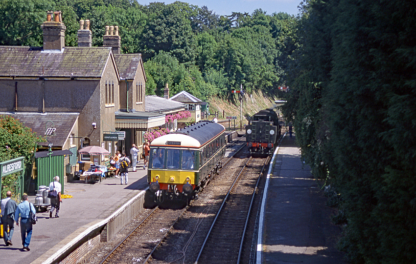
Alresford railway station (Hampshire)

Alresford railway station ( or ) in Hampshire, England, is the terminus of the Watercress Line from Alton. It is in the small town of New Alresford, 7½...
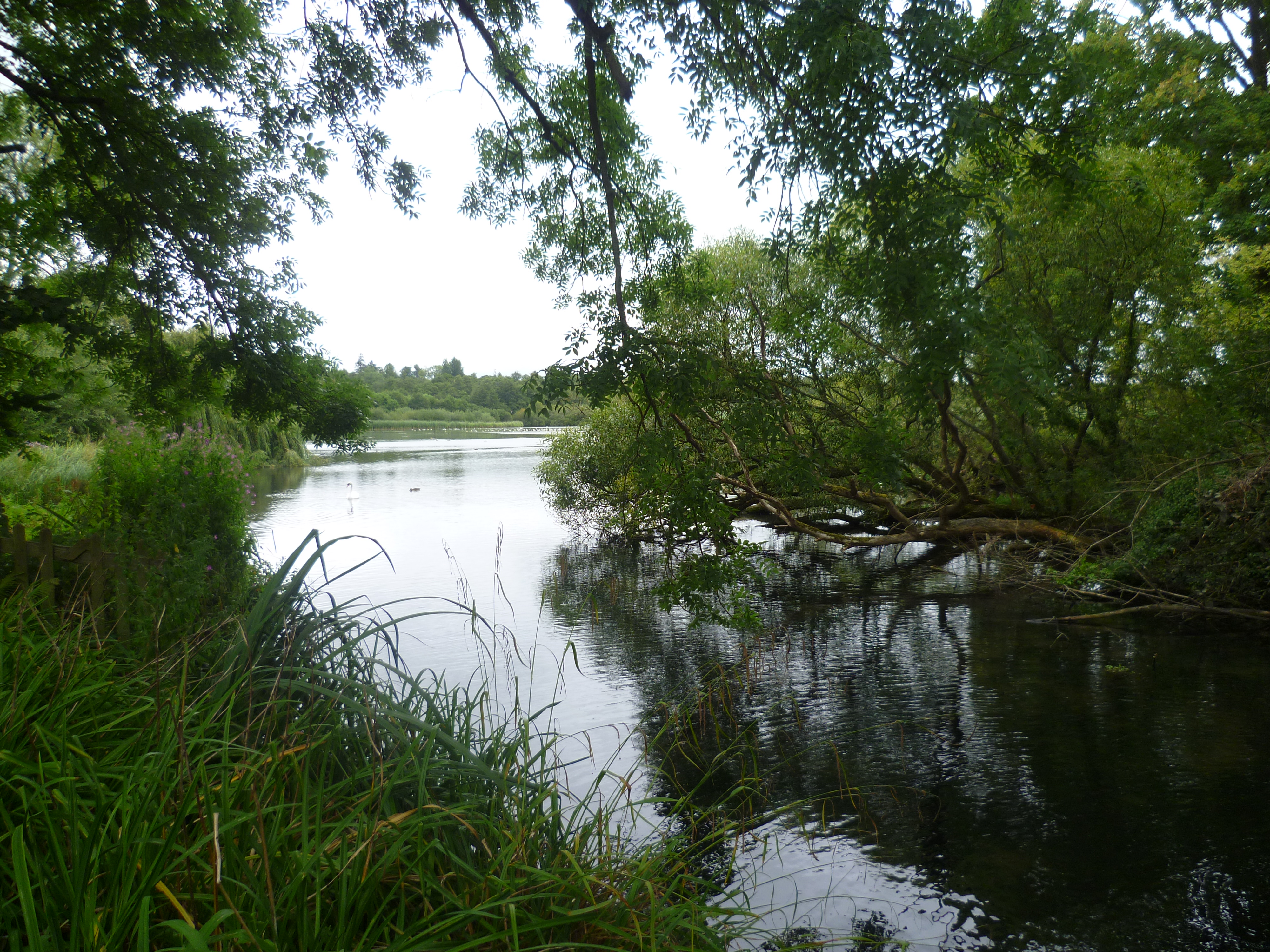
Alresford Pond

Alresford Pond is a 30.2-hectare (75-acre) biological Site of Special Scientific Interest on the north side of New Alresford in Hampshire. This large lake...

Deanery of Alresford

The Deanery of Alresford lies within the Diocese of Winchester in England. It includes the parishes of Cliddesden, Dummer, Itchen Abbas, Martyr Worthy...
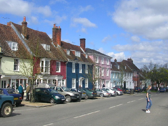
New Alresford

New Alresford or simply Alresford ( OLZ-fərd or AWLZ-fərd) is a market town and civil parish in the City of Winchester district of Hampshire, England...

Alresford Community Centre

Alresford Community Centre, formerly Alresford Town Hall, is a municipal building in West Street, New Alresford, Hampshire, England. The structure, which...

Itchin Stoke Down

Itchin Stoke Down is a rural location near the town of Alresford in Hampshire. It was used as a venue for 13 first-class cricket matches between 1778 and...

Gundleton

Gundleton is a village in Hampshire, England. It is in the civil parish of Bighton. Its nearest railway station is the restored Watercress Line in New...

Nearby Amenities

Located within 500m of 51.084438,-1.13549
Bus Stop
Plough Ph
Naptan AtcoCode: 1900HA110774
Naptan Bearing: E
Naptan CommonName: Plough Ph
Naptan Crossing: Water Lane
Naptan NaptanCode: hamdwpgj
Naptan Street: B3047
Naptan Verified: no
Source: naptan_import
Lat/Long: 51.0822189/-1.1294735
Bus Stop
Plough Ph
Naptan AtcoCode: 1900HA110775
Naptan Bearing: W
Naptan CommonName: Plough Ph
Naptan Crossing: Water Lane
Naptan NaptanCode: hamdwpdp
Naptan Street: B3047
Naptan Verified: no
Source: naptan_import
Lat/Long: 51.0821515/-1.1296263
Bus Stop
Ship Ph
Naptan AtcoCode: 1900HA110776
Naptan Bearing: W
Naptan CommonName: Ship Ph
Naptan Crossing: Church Lane
Naptan NaptanCode: hamdwjdw
Naptan Street: B3047
Naptan Verified: no
Source: naptan_import
Lat/Long: 51.0834867/-1.1366034
Bus Stop
Ship Ph
Naptan AtcoCode: 1900HA110777
Naptan Bearing: E
Naptan CommonName: Ship Ph
Naptan Crossing: Church Lane
Naptan NaptanCode: hamdwjga
Naptan Street: B3047
Naptan Verified: no
Source: naptan_import
Lat/Long: 51.0835986/-1.136551
Bishop's Sutton
Place: village
Lat/Long: 51.0839386/-1.1354721
Pub
The Ship
Wikidata: Q26448771
Lat/Long: 51.0835985/-1.1359497
Post Box
Ref: SO24 209
Lat/Long: 51.0833867/-1.1344755
Post Box
Collection Times: Mo-Fr 16:45; Sa 10:00
Post Box Type: wall
Ref: SO24 118
Royal Cypher: GVIR
Royal Cypher Wikidata: Q33102169
Lat/Long: 51.0847435/-1.1408614
Historic: milestone
Inscription: London 56; Winton 8
Lat/Long: 51.0825813/-1.1319424
Barrier: cattle_grid
Bicycle: no
Foot: no
Lat/Long: 51.085068/-1.13794
Barrier: cattle_grid
Bicycle: no
Foot: no
Lat/Long: 51.0860196/-1.1352242
Give Way
Direction: forward
Source: Hampshire-Aerial-FCIR
Lat/Long: 51.0834903/-1.1362461
Give Way
Source: Hampshire-Aerial-FCIR
Lat/Long: 51.0833391/-1.1342901
Give Way
Direction: backward
Lat/Long: 51.0837033/-1.1371889
Give Way
Direction: forward
Lat/Long: 51.0833877/-1.1376794
The data included in this document is from www.openstreetmap.org. The data is made available under ODbL.

Have you been to Bishop's Sutton?

Leave your review of Bishop's Sutton below (or comments, questions and feedback).