Potterhanworth

Settlement in Lincolnshire North Kesteven

England

Potterhanworth

Farm track and footpath, Potterhanworth Heath A field of poppies on the left.
Farm track and footpath, Potterhanworth Heath Credit: Jonathan Thacker

Potterhanworth is a small village located in the county of Lincolnshire, England. Situated approximately 8 miles southeast of the city of Lincoln, it falls within the North Kesteven district. With a population of around 1,000 residents, Potterhanworth is known for its picturesque setting and rural charm.

The village is surrounded by beautiful countryside, offering stunning views of the Lincolnshire Wolds, a designated Area of Outstanding Natural Beauty. It is well-connected to nearby towns and cities, with the A15 road passing through the village, providing easy access to Lincoln and other major destinations.

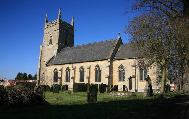
Potterhanworth boasts a rich history, with evidence of settlements dating back to Roman times. The village is home to St. Andrew's Church, a Grade II listed building that exhibits exquisite architectural features, including a Norman tower. The local primary school, Potterhanworth Church of England Primary School, provides education to the village's children.

A strong sense of community exists within Potterhanworth, with various local events and activities taking place throughout the year. The village has a village hall that serves as a gathering place for social functions, clubs, and meetings.

Amenities in Potterhanworth include a village store and a pub, providing essential services and a place for locals and visitors to relax and socialize. The village offers a peaceful and idyllic lifestyle, making it a desirable place to reside for those seeking a quieter, rural setting within close proximity to the amenities of Lincoln.

If you have any feedback on the listing, please let us know in the comments section below.

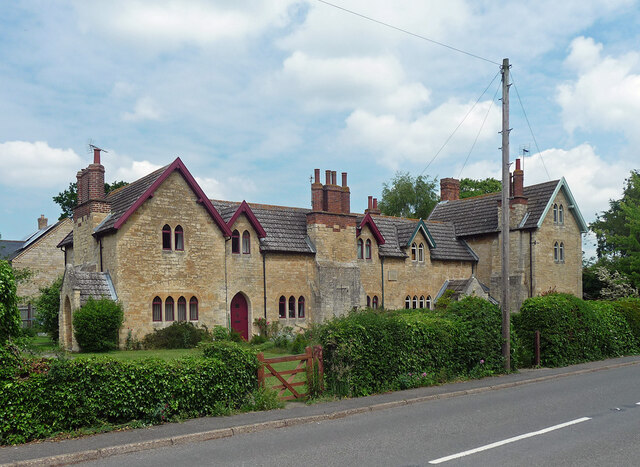
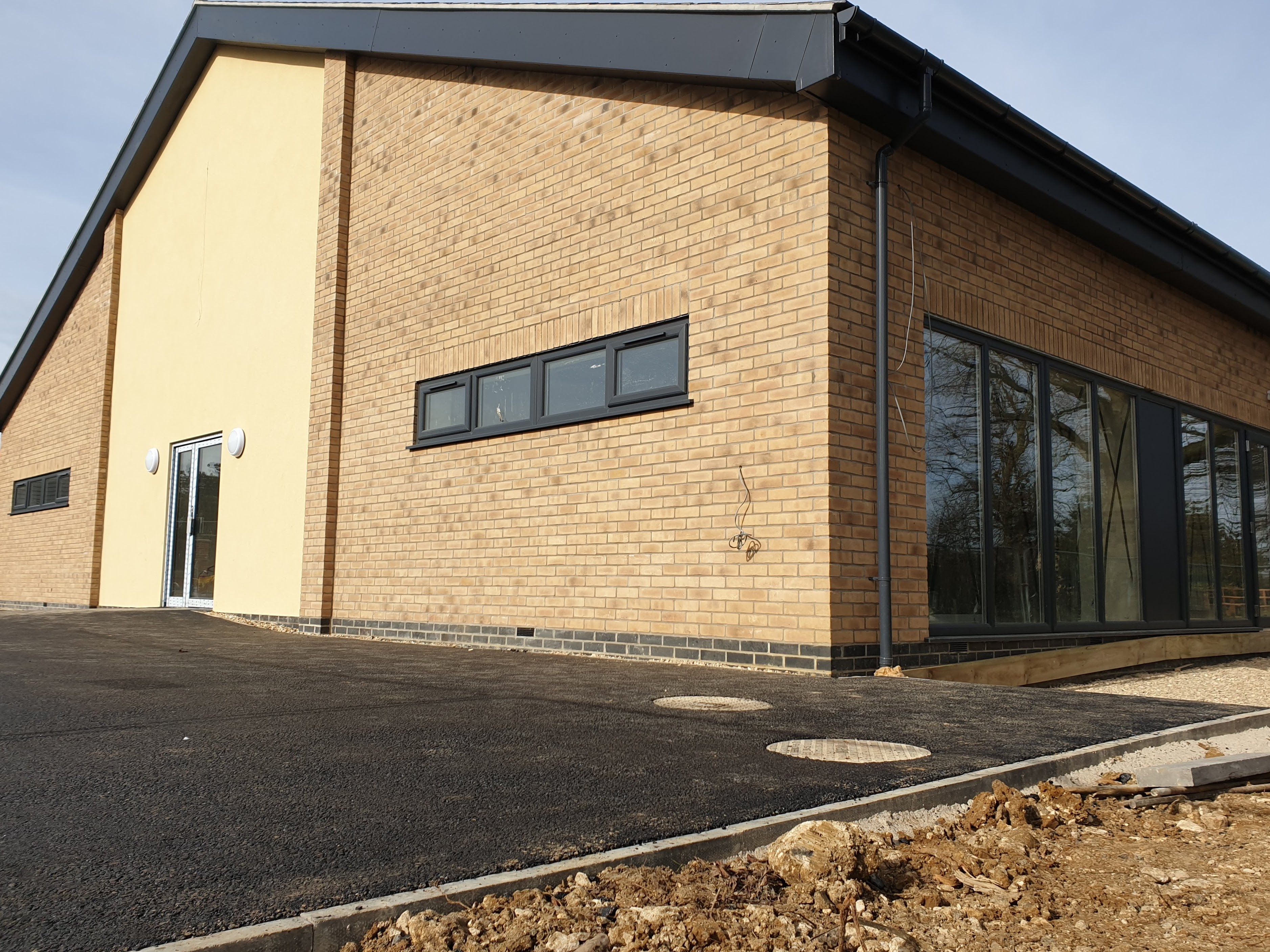
Potterhanworth Images

Images are sourced within 2km of 53.1829/-0.42290973 or Grid Reference TF0566. Thanks to Geograph Open Source API. All images are credited.

Farm track and footpath, Potterhanworth Heath A field of poppies on the left.
Farm track and footpath, Potterhanworth Heath
A field of poppies on the left.
Farm track and footpath, Potterhanworth Heath A field of potatoes on the right.
Farm track and footpath, Potterhanworth Heath
A field of potatoes on the right.
Footpath approaching the B1188, Potterhanworth Heath
18-21 Main Road, Nocton Distinctive Gothic estate cottages by George Gilbert Scott, c1860. Grade II listed.
18-21 Main Road, Nocton
Distinctive Gothic estate cottages by George Gilbert Scott, c1860. Grade II listed.
Country road near Branston (1) The bridge ahead carries the railway between Lincoln (left) and Sleaford (right).
Country road near Branston (1)
The bridge ahead carries the railway between Lincoln (left) and Sleaford (right).
Country road near Branston (2) Same as this one <a href="https://www.geograph.org.uk/photo/380495">TF0467 : Branston Moor</a>.
Country road near Branston (2)
Same as this one TF0467 : Branston Moor.
Interior, St Andrew's church, Potterhanworth A cake sale was in progress.
Interior, St Andrew's church, Potterhanworth
A cake sale was in progress.
East window, St Andrew's church, Potterhanworth Four light window by Wailes.
East window, St Andrew's church, Potterhanworth
Four light window by Wailes.
Stained glass window, St Andrew's church, Potterhanworth South chancel window featuring Moses.
Stained glass window, St Andrew's church, Potterhanworth
South chancel window featuring Moses.
Stained glass window, St Andrew's church, Potterhanworth Featuring St George and St Martin.

In memory of Arthur Newsum Battle, 2nd Lieutenant, Lincolnshire Regiment, who fell in Gallipoli in 1915, aged 21.
Stained glass window, St Andrew's church, Potterhanworth
Featuring St George and St Martin. In memory of Arthur Newsum Battle, 2nd Lieutenant, Lincolnshire Regiment, who fell in Gallipoli in 1915, aged 21.
St Andrew's church, Potterhanworth From the north.
St Andrew's church, Potterhanworth
From the north.
St.Andrew's church, Potterhanworth, Lincs. Medieval Decorated gothic tower and mid-19th century nave & chancel
St.Andrew's church, Potterhanworth, Lincs.
Medieval Decorated gothic tower and mid-19th century nave & chancel
Potterhanworth Water Tower Potterhanworth Water Tower was built in 1903 with a tank capacity of 37,000 gallons filled from a 150ft deep artesian bore hole in a nearby field. It was financed by an Endowment from Christ's Hospital as the 16th century philanthropist Dr.Richard Smith, founder of Christ's Hospital in Lincoln had land in Potterhanworth .... his coat of arms can be seen in the brickwork. The two rooms below the tank were used for Parish Council meetings, the Men's Institute and, during the war for the Home Guard platoon. The tower was declared redundant in 1978 and tastefully converted to a private house in 1995.
Potterhanworth Water Tower
Potterhanworth Water Tower was built in 1903 with a tank capacity of 37,000 gallons filled from a 150ft deep artesian bore hole in a nearby field. It was financed by an Endowment from Christ's Hospital as the 16th century philanthropist Dr.Richard Smith, founder of Christ's Hospital in Lincoln had land in Potterhanworth .... his coat of arms can be seen in the brickwork. The two rooms below the tank were used for Parish Council meetings, the Men's Institute and, during the war for the Home Guard platoon. The tower was declared redundant in 1978 and tastefully converted to a private house in 1995.
Nocton Hall - entrance front North or Entrance front to Nocton Hall. The Jacobean mansion of the Ellys family was destroyed by fire in 1834, rebuilt in 1841 and itself destroyed by fire in October 2004. The ruined shell faces an uncertain future.
Nocton Hall - entrance front
North or Entrance front to Nocton Hall. The Jacobean mansion of the Ellys family was destroyed by fire in 1834, rebuilt in 1841 and itself destroyed by fire in October 2004. The ruined shell faces an uncertain future.
Nocton Hall - west front The Jacobean mansion of the Ellys family was destroyed by fire in 1834, rebuilt in 1841 and itself destroyed by fire in October 2004. The ruined shell faces an uncertain future.
Nocton Hall - west front
The Jacobean mansion of the Ellys family was destroyed by fire in 1834, rebuilt in 1841 and itself destroyed by fire in October 2004. The ruined shell faces an uncertain future.
Nocton Hall - east front The Jacobean mansion of the Ellys family was destroyed by fire in 1834, rebuilt in 1841 and itself destroyed by fire in October 2004. The ruined shell faces an uncertain future.
Nocton Hall - east front
The Jacobean mansion of the Ellys family was destroyed by fire in 1834, rebuilt in 1841 and itself destroyed by fire in October 2004. The ruined shell faces an uncertain future.
Nocton Hall The Jacobean mansion of the Ellys family was destroyed by fire in 1834, rebuilt in 1841 and itself destroyed by fire in October 2004. The ruined shell faces an uncertain future.
Nocton Hall
The Jacobean mansion of the Ellys family was destroyed by fire in 1834, rebuilt in 1841 and itself destroyed by fire in October 2004. The ruined shell faces an uncertain future.
Chestnut Tree Reputedly planted when King Henry VIII visited in 1541
Chestnut Tree
Reputedly planted when King Henry VIII visited in 1541
Show me another place!

Potterhanworth is located at Grid Ref: TF0566 (Lat: 53.1829, Lng: -0.42290973)

Division: Parts of Kesteven

Administrative County: Lincolnshire

District: North Kesteven

Police Authority: Lincolnshire

What 3 Words

///scramble.tram.respects. Near Branston, Lincolnshire

Nearby Locations

Potterhanworth

Related Wikis

Potterhanworth

Potterhanworth is a village and civil parish in the North Kesteven district of Lincolnshire, England. The population of the civil parish at the 2011 census...

Potterhanworth railway station

Potterhanworth railway station is a former railway station in Potterhanworth, Lincolnshire. It was on the still-open line between Lincoln and Sleaford...
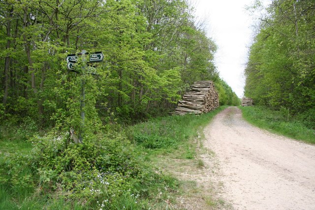
Potterhanworth Wood

Potterhanworth Wood (grid reference TF070670) is a 32.0 hectare woodland, close to the village of Potterhanworth in North Kesteven, Lincolnshire, England...

Nocton Hub

Nocton Hub in Nocton, Lincolnshire, England was built in 2019-2020 as a community-owned and operated building to replace the previous village hall that...
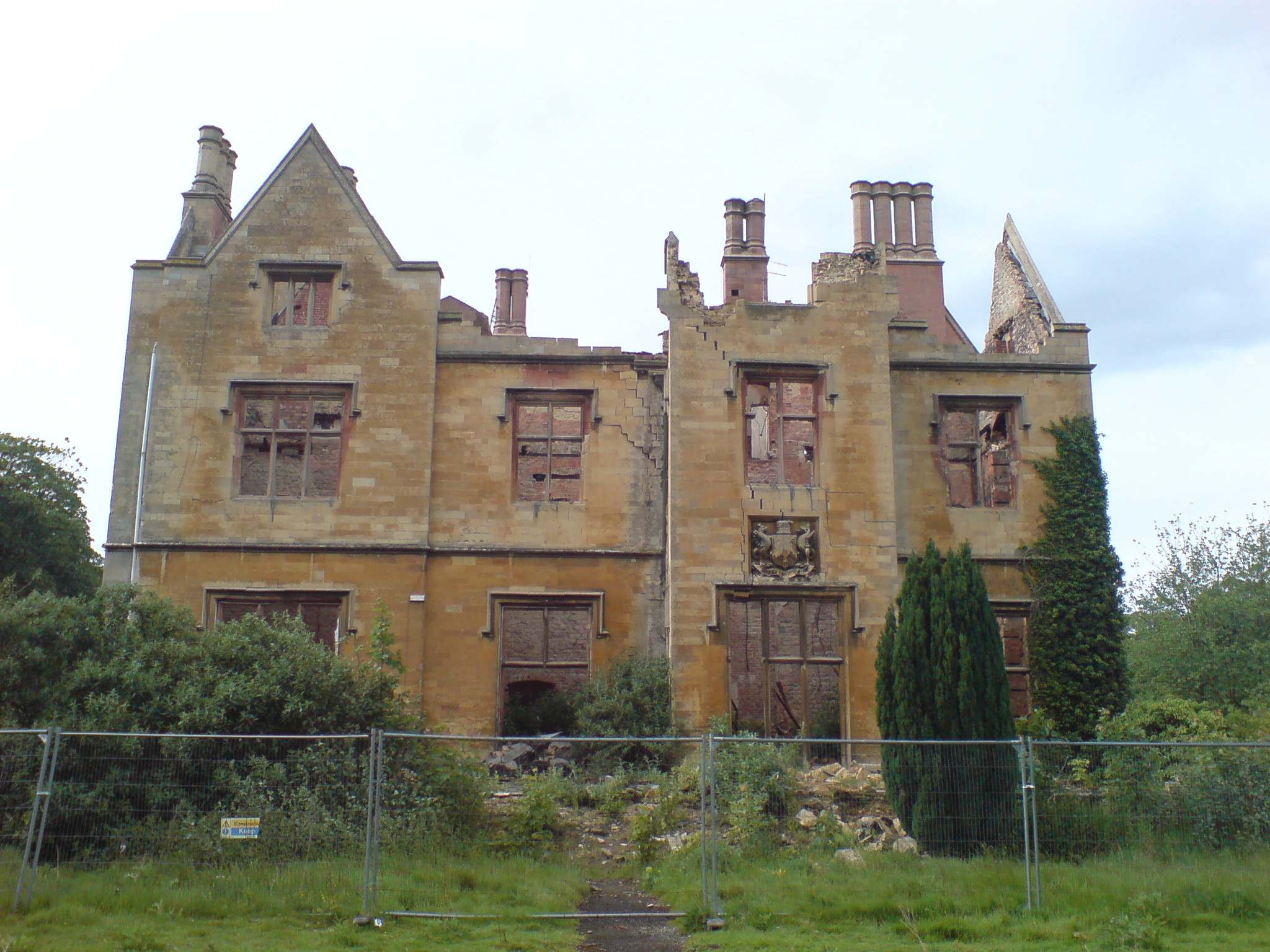
Nocton Hall

Nocton Hall is a historic Grade II listed building in the village of Nocton, in Lincolnshire, England. The plaque on the north face of the Hall (see below...

Nocton

Nocton is a village and civil parish in the North Kesteven district of Lincolnshire, England. It is situated on the B1202 road, 7 miles (11 km) south-east...

RAF Hospital Nocton Hall

RAF Hospital Nocton Hall was a 740-bed RAF hospital in Nocton, Lincolnshire serving the predominantly RAF personnel based at the large number of RAF Stations...

Branston Booths

Branston Booths is a small village in the North Kesteven district of Lincolnshire, England. The village is situated approximately 5 miles (8 km) east from...

Nearby Amenities

Located within 500m of 53.1829,-0.42290973
Potterhanworth
Alt Name: Potter Hanworth
Is In: Lincolnshire, England, UK
Local Name: Potter Hanworth
Old Name: Hanworth
Place: village
Source: Bing
Lat/Long: 53.1831353/-0.4228439
Bus Stop
War Memorial
Naptan AtcoCode: 270000008303
Naptan Bearing: S
Naptan CommonName: War Memorial
Naptan Indicator: adj
Naptan Landmark: War Memorial
Naptan NaptanCode: lingpmdj
Naptan Street: Main Road
Naptan Verified: no
Source: naptan_import
Lat/Long: 53.1823125/-0.4226758
Bus Stop
War Memorial
Naptan AtcoCode: 2700LPWM1440
Naptan Bearing: N
Naptan CommonName: War Memorial
Naptan Indicator: opp
Naptan Landmark: War Memorial
Naptan NaptanCode: linajwdg
Naptan Street: Main Road
Naptan Verified: no
Source: naptan_import
Lat/Long: 53.1823935/-0.4227845
Power: pole
Lat/Long: 53.1869731/-0.425405
Power: pole
Lat/Long: 53.1867023/-0.4268051
Power: pole
Lat/Long: 53.1870317/-0.4254734
Power: pole
Lat/Long: 53.1863021/-0.4245655
Power: pole
Lat/Long: 53.18336/-0.4156054
Crossing
Crossing: unmarked
Source: Bing
Lat/Long: 53.1820247/-0.42284
Crossing
Crossing: unmarked
Source: Bing
Lat/Long: 53.1818199/-0.422931
Bench
Source: Bing
Lat/Long: 53.1823174/-0.422637
Historic: memorial
Memorial: war_memorial
Source: Bing
Lat/Long: 53.1822487/-0.4225478
Man Made: sign
Note: is there a more appropriate tag for this?
Source: Bing
Lat/Long: 53.1819318/-0.4229609
Street Lamp
Source: Bing
Lat/Long: 53.1820407/-0.4226122
Street Lamp
Source: Bing
Lat/Long: 53.1821697/-0.4220523
Street Lamp
Lat/Long: 53.1827913/-0.4231346
Crossing
Crossing: unmarked
Source: Bing
Lat/Long: 53.1828572/-0.4230631
Crossing
Crossing: unmarked
Source: Bing
Lat/Long: 53.1827952/-0.4232603
Power: pole
Lat/Long: 53.1837972/-0.4184085
Power: pole
Lat/Long: 53.1831067/-0.4209231
Power: pole
Lat/Long: 53.1839973/-0.419708
Power: pole
Lat/Long: 53.1835793/-0.4170419
Power: pole
Lat/Long: 53.1839562/-0.4208172
Street Lamp
Source: Bing
Lat/Long: 53.1845654/-0.4230065
Red House Farm
Place: farm
Source: Bing
Lat/Long: 53.1830841/-0.4244209
Street Lamp
Source: Bing
Lat/Long: 53.1816852/-0.4225991
Moorhouse Poultry Farm
Place: farm
Source: Bing
Lat/Long: 53.186887/-0.4220982
Power: pole
Lat/Long: 53.1822999/-0.4273403
Power: pole
Lat/Long: 53.1820347/-0.42844
Power: pole
Lat/Long: 53.1817968/-0.429588
Generator Method: photovoltaic
Generator Output Electricity: yes
Generator Source: solar
Generator Type: solar_photovoltaic_panel
Location: roof
Power: generator
Lat/Long: 53.1790561/-0.4213455
Generator Method: photovoltaic
Generator Output Electricity: yes
Generator Source: solar
Generator Type: solar_photovoltaic_panel
Location: roof
Power: generator
Lat/Long: 53.1791365/-0.4213254
Generator Method: photovoltaic
Generator Output Electricity: yes
Generator Source: solar
Generator Type: solar_photovoltaic_panel
Location: roof
Power: generator
Lat/Long: 53.1792217/-0.4217747
Generator Method: photovoltaic
Generator Output Electricity: yes
Generator Source: solar
Generator Type: solar_photovoltaic_panel
Location: roof
Power: generator
Lat/Long: 53.1792225/-0.4219115
Generator Method: photovoltaic
Generator Output Electricity: yes
Generator Source: solar
Generator Type: solar_photovoltaic_panel
Location: roof
Power: generator
Lat/Long: 53.1792273/-0.4220523
Generator Method: photovoltaic
Generator Output Electricity: yes
Generator Source: solar
Generator Type: solar_photovoltaic_panel
Location: roof
Power: generator
Lat/Long: 53.1792265/-0.4219826
Generator Method: photovoltaic
Generator Output Electricity: yes
Generator Source: solar
Generator Type: solar_photovoltaic_panel
Location: roof
Power: generator
Lat/Long: 53.179515/-0.4221234
Generator Method: photovoltaic
Generator Output Electricity: yes
Generator Source: solar
Generator Type: solar_photovoltaic_panel
Location: roof
Power: generator
Lat/Long: 53.1790906/-0.423962
Generator Method: photovoltaic
Generator Output Electricity: yes
Generator Source: solar
Generator Type: solar_photovoltaic_panel
Location: roof
Power: generator
Lat/Long: 53.1790722/-0.4265007
Generator Method: photovoltaic
Generator Output Electricity: yes
Generator Source: solar
Generator Type: solar_photovoltaic_panel
Location: roof
Power: generator
Lat/Long: 53.1790762/-0.4264726
Generator Method: photovoltaic
Generator Output Electricity: yes
Generator Source: solar
Generator Type: solar_photovoltaic_panel
Location: roof
Power: generator
Lat/Long: 53.1817309/-0.419995
Generator Method: photovoltaic
Generator Output Electricity: yes
Generator Source: solar
Generator Type: solar_photovoltaic_panel
Location: roof
Power: generator
Lat/Long: 53.1818418/-0.4206723
Generator Method: photovoltaic
Generator Output Electricity: yes
Generator Source: solar
Generator Type: solar_photovoltaic_panel
Location: roof
Power: generator
Lat/Long: 53.1866323/-0.4208145
Generator Method: photovoltaic
Generator Output Electricity: yes
Generator Source: solar
Generator Type: solar_photovoltaic_panel
Location: roof
Power: generator
Lat/Long: 53.1866813/-0.4207326
Generator Method: photovoltaic
Generator Output Electricity: yes
Generator Source: solar
Generator Type: solar_photovoltaic_panel
Location: roof
Power: generator
Lat/Long: 53.1831984/-0.4256867
Generator Method: photovoltaic
Generator Output Electricity: yes
Generator Source: solar
Generator Type: solar_photovoltaic_panel
Location: roof
Power: generator
Lat/Long: 53.1831871/-0.425739
Generator Method: photovoltaic
Generator Output Electricity: yes
Generator Source: solar
Generator Type: solar_photovoltaic_panel
Location: roof
Power: generator
Lat/Long: 53.1831759/-0.4257819
Leisure: playground
Lat/Long: 53.1847436/-0.4184779
The data included in this document is from www.openstreetmap.org. The data is made available under ODbL.

Have you been to Potterhanworth?

Leave your review of Potterhanworth below (or comments, questions and feedback).