Pott Shrigley

Settlement in Cheshire

England

Pott Shrigley

Scarecrow in garden area, Cockshead Hey Farm Harrop Valley visible in background
Scarecrow in garden area, Cockshead Hey Farm Credit: Philip Cornwall

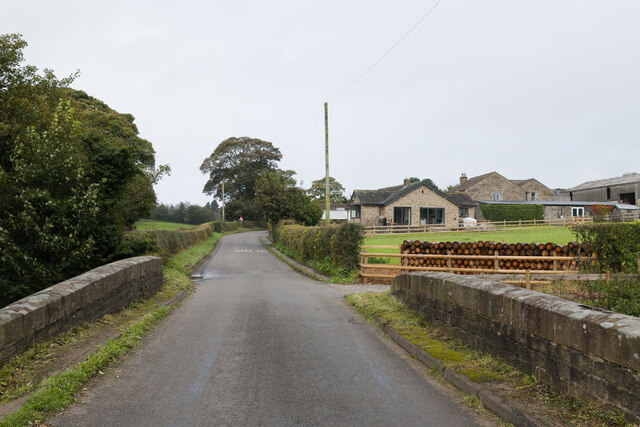
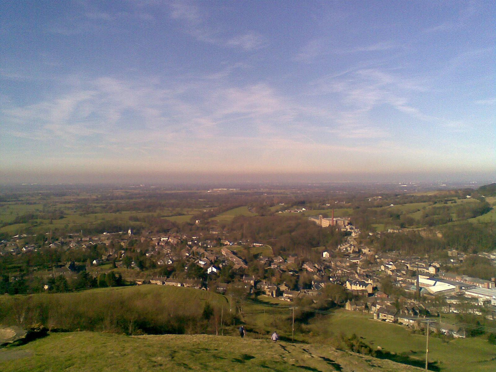
Pott Shrigley is a small village located in the county of Cheshire, England. It is situated on the western edge of the Peak District National Park, offering stunning views of the surrounding countryside. The village is approximately 15 miles southeast of Manchester and 6 miles west of Macclesfield.

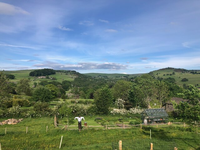
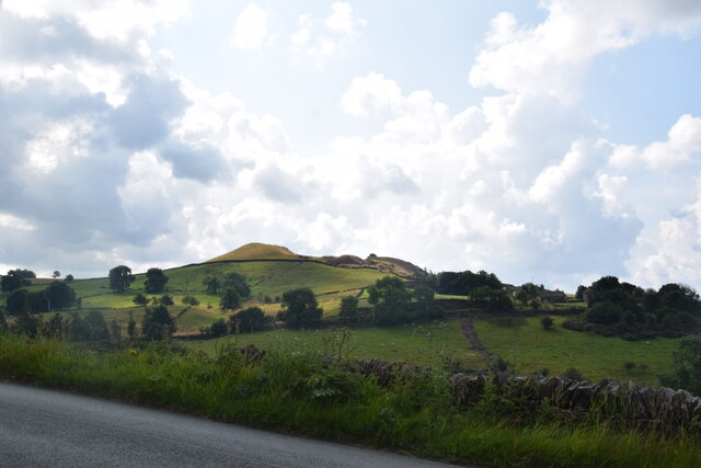
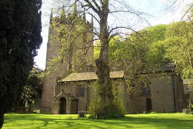
Pott Shrigley is known for its picturesque setting, with rolling hills, lush green fields, and charming stone houses. The village has a rich history, dating back to the medieval period, and is home to several historic buildings, including St. Christopher's Church, which dates back to the 17th century.

Although small in size, Pott Shrigley has a strong sense of community and offers a range of amenities for its residents. These include a primary school, a village hall, and a local pub, providing a hub for social activities.

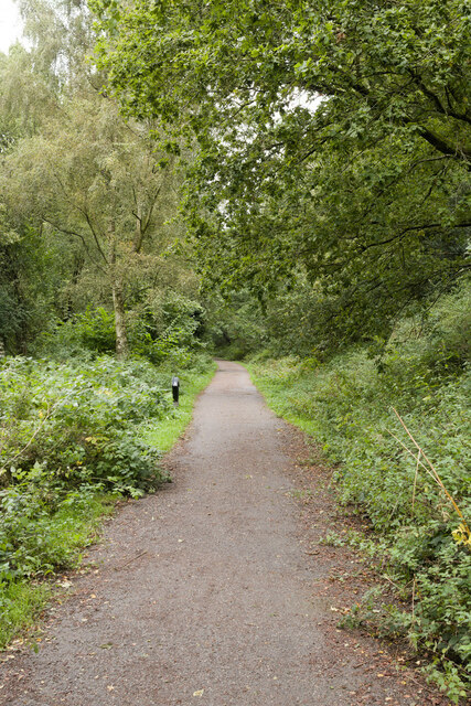
The village is also a popular destination for outdoor enthusiasts, with numerous walking and cycling trails in the surrounding area. Nearby attractions include Lyme Park, an impressive stately home and gardens, and the Goyt Valley, offering stunning scenery and opportunities for wildlife spotting.

Overall, Pott Shrigley is a tranquil and idyllic village, perfect for those seeking a peaceful rural retreat while still being within easy reach of larger towns and cities.

If you have any feedback on the listing, please let us know in the comments section below.

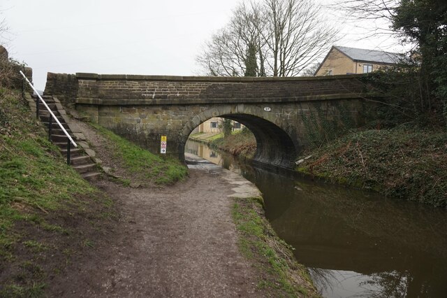
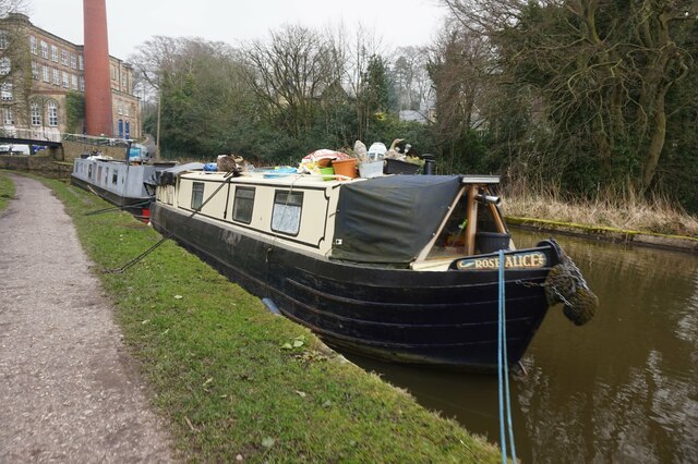
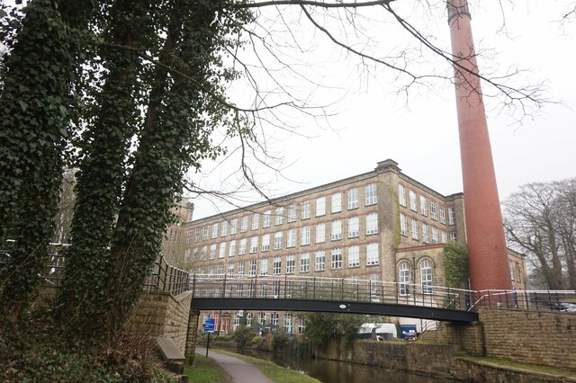
Pott Shrigley Images

Images are sourced within 2km of 53.307425/-2.082914 or Grid Reference SJ9478. Thanks to Geograph Open Source API. All images are credited.

Scarecrow in garden area, Cockshead Hey Farm Harrop Valley visible in background
Scarecrow in garden area, Cockshead Hey Farm
Harrop Valley visible in background
View across Macclesfield Canal at Bollington Aqueduct One of the last narrow canals to be built the canal was approved by Act of Parliament in April 1826. Thomas Telford surveyed the canal and construction was engineered by William Crosley. The completed canal was opened on 9th November 1831 at a cost of £320,000.00. The canal was bought out by the Manchester, Sheffield & Lincoln Railway in 1847. With nationalisation in 1947 it passed to the Docks & Inland Waterways Board with commercial carrying finishing only in the 1960's shortly before British Waterways was formed. The canal runs from Marple Junction with the Peak Forest Canal in the north 26¼ miles to the stop lock at Hall Green near Kidsgrove. The canal is noted for its six fine change or snake bridges where the tow-path changes sides of the canal. These bridges were designed to allow the horse to move over without having to untie it from the boat. Thanks to Telford's design for commercial traffic the Macclesfield Canal has a very shallow and tapered bottom. The deep channel is just wide enough for two boats to pass in the centre making mooring other than at wharves 'challenging'.
View across Macclesfield Canal at Bollington Aqueduct
One of the last narrow canals to be built the canal was approved by Act of Parliament in April 1826. Thomas Telford surveyed the canal and construction was engineered by William Crosley. The completed canal was opened on 9th November 1831 at a cost of £320,000.00. The canal was bought out by the Manchester, Sheffield & Lincoln Railway in 1847. With nationalisation in 1947 it passed to the Docks & Inland Waterways Board with commercial carrying finishing only in the 1960's shortly before British Waterways was formed. The canal runs from Marple Junction with the Peak Forest Canal in the north 26¼ miles to the stop lock at Hall Green near Kidsgrove. The canal is noted for its six fine change or snake bridges where the tow-path changes sides of the canal. These bridges were designed to allow the horse to move over without having to untie it from the boat. Thanks to Telford's design for commercial traffic the Macclesfield Canal has a very shallow and tapered bottom. The deep channel is just wide enough for two boats to pass in the centre making mooring other than at wharves 'challenging'.
Ingersley Clough Mill The building in the picture housed the wheel, powered by water delivered from the hill opposite via a cast iron aqueduct (also visible). The mill site is currently being developed for housing. The history of this building can be read at the following link <span class="nowrap"><a title="https://happyvalley.org.uk/?page_id=3958" rel="nofollow ugc noopener" href="https://happyvalley.org.uk/?page_id=3958">Link</a><img style="margin-left:2px;" alt="External link" title="External link - shift click to open in new window" src="https://s1.geograph.org.uk/img/external.png" width="10" height="10"/></span>
Ingersley Clough Mill
The building in the picture housed the wheel, powered by water delivered from the hill opposite via a cast iron aqueduct (also visible). The mill site is currently being developed for housing. The history of this building can be read at the following link LinkExternal link
Billinge Hill Taken from Blaze Hill (the road).
Billinge Hill
Taken from Blaze Hill (the road).
View over Bollington, 1984 Looking east from the Macclesfield Canal at the Palmerston Street aqueduct.
View over Bollington, 1984
Looking east from the Macclesfield Canal at the Palmerston Street aqueduct.
Wellington Road, Bollington Viewed from the viaduct of the former railway.
Wellington Road, Bollington
Viewed from the viaduct of the former railway.
Middlewood Way
Middlewood Way
Bridge near Sugarlane Farm
Narrowboat passing Clarence Mill
Macclesfield Canal towards bridge #27
Macclesfield Canal at bridge #27
Canalside houses at bridge  #27, Macclesfield Canal
Canalside houses at bridge #27, Macclesfield Canal
Wellington Road, Bollington from Macclesfield Canal
Macclesfield Canal towards bridge #26A
Canal boat Swallowtail, Macclesfield Canal
Canal boat Rose Alice, Macclesfield Canal
Macclesfield Canal at bridge #26A With Clarence Mill in the background.
Macclesfield Canal at bridge #26A
With Clarence Mill in the background.
Macclesfield Canal at bridge #26A
Show me another place!

Pott Shrigley is located at Grid Ref: SJ9478 (Lat: 53.307425, Lng: -2.082914)

Unitary Authority: Cheshire East

Police Authority: Cheshire

What 3 Words

///spaceship.bleaker.subway. Near Pott Shrigley, Cheshire

Related Wikis

Pott Shrigley

Pott Shrigley is a small village and civil parish in the unitary authority of Cheshire East and the ceremonial county of Cheshire, England. According...

Leonard Haigh

Leonard Haigh (19 October 1880 – 6 August 1916) was an English rugby player. He won seven caps for England between 1910 and 1911, and also represented...

St Christopher's Church, Pott Shrigley

St Christopher's Church is in the small village of Pott Shrigley, Cheshire, England. The church is recorded in the National Heritage List for England...

Shrigley Hall

Shrigley Hall is a former country house standing to the northwest of the village of Pott Shrigley, Cheshire, England. It has since been used as a school...

Limefield

Limefield is a house standing to the north of Bollington, Cheshire, England. It was built in about 1830 for Joseph Brook. It is constructed in ashlar...

Bollington Urban District

Bollington is a former Urban District in Cheshire, based in the town of Bollington. It was created in 1894 and abolished in 1974 when it was incorporated...

Bollington

Bollington is a town and civil parish in Cheshire, England, to the east of Prestbury. In the Middle Ages, it was part of the Earl of Chester's manor of...

St John the Baptist's Church, Bollington

St John the Baptist's Church is a redundant Anglican parish church in Church Street, Bollington, Cheshire, England. It is recorded in the National Heritage...

Nearby Amenities

Located within 500m of 53.307425,-2.082914
Pott Shrigley
Place: hamlet
Source: NPE
Lat/Long: 53.3093362/-2.0833989
Bus Stop
Pott Shrigley, Shrigley Road / Saint Christopher's Church
Bus: yes
Naptan AtcoCode: 0600MA0445
Naptan Bearing: SE
Naptan CommonName: Saint Christopher's Church
Naptan Indicator: opp
Naptan Landmark: Saint Christopher's Church
Naptan LocalityName: Pott Shrigley
Naptan NaptanCode: chegadt
Naptan ShortCommonName: Saint Christopher's
Naptan Street: Shrigley Road
Naptan Verified: no
Network: Cheshire East Council
Operator: Ansa Transport
Public Transport: platform
Source: naptan_import
Lat/Long: 53.3095381/-2.0836266
Bus Stop
Pott Shrigley, Shrigley Road / Saint Christopher's Church
Bus: yes
Naptan AtcoCode: 0600MA0446
Naptan Bearing: NW
Naptan CommonName: Saint Christopher's Church
Naptan Indicator: nr
Naptan Landmark: Saint Christopher's Church
Naptan LocalityName: Pott Shrigley
Naptan NaptanCode: chegadw
Naptan ShortCommonName: Saint Christopher's
Naptan Street: Shrigley Road
Naptan Verified: no
Network: Cheshire East Council
Operator: Ansa Transport
Public Transport: platform
Source: naptan_import
Lat/Long: 53.3093942/-2.0837464
Post Box
Post Box Type: wall
Postal Code: SK10
Ref: SK10 12
Royal Cypher: EIIR
Royal Cypher Wikidata: Q33102113
Lat/Long: 53.3100631/-2.0845824
Telephone
Defibrillator
Access: yes
Booth: K6
Covered: booth
Defibrillator Location: in old red phone box between Pott Shrigley school and church
Emergency: defibrillator
Listed Status: Grade II
Man Made: telephone_box
Old Phone: +44 1625 573213
Lat/Long: 53.3097513/-2.0842838
Community Centre
Pott Shrigley Village Hall
Community Centre: village_hall
Lat/Long: 53.3099179/-2.0841322
Bus Stop
Pott Shrigley, Shrigley Road / Spuley Lane
Bus: yes
Naptan AtcoCode: 0600MA0441
Naptan Bearing: N
Naptan BusStopType: CUS
Naptan CommonName: Spuley Lane
Naptan Indicator: opp
Naptan Landmark: Barristall Hall Farm
Naptan LocalityName: Pott Shrigley
Naptan NaptanCode: chepadj
Naptan ShortCommonName: Barristall Hall Fm
Naptan Street: Shrigley Road
Network: Cheshire East Council
Operator: Ansa Transport
Public Transport: platform
Source: naptan_import
Lat/Long: 53.3075062/-2.0829729
Bus Stop
Pott Shrigley, Shrigley Road / Spuley Lane
Bus: yes
Naptan AtcoCode: 0600MA0442
Naptan Bearing: S
Naptan CommonName: Spuley Lane
Naptan Indicator: nr
Naptan Landmark: Spuley Lane
Naptan LocalityName: Pott Shrigley
Naptan NaptanCode: chepadm
Naptan ShortCommonName: Spuley Lane
Naptan Street: Shrigley Road
Network: Cheshire East Council
Operator: Ansa Transport
Public Transport: platform
Source: naptan_import
Lat/Long: 53.3074902/-2.0829279
The data included in this document is from www.openstreetmap.org. The data is made available under ODbL.

Have you been to Pott Shrigley?

Leave your review of Pott Shrigley below (or comments, questions and feedback).