Portway

Settlement in Worcestershire / Warwickshire Bromsgrove

England

Portway

Alcester Road at the junction of the M42
Alcester Road at the junction of the M42 Credit: David Howard

Portway is a small village located on the border between Worcestershire and Warwickshire in England. Situated in the picturesque countryside, it is surrounded by rolling hills and verdant farmlands. The village is part of the Redditch borough and falls under the jurisdiction of the Bromsgrove district council.

With a population of around 500 residents, Portway offers a peaceful and close-knit community atmosphere. The village is primarily residential, consisting of traditional cottages and newer housing developments. The local architecture reflects the area's rural charm, with many buildings featuring exposed brickwork and thatched roofs.

Despite its tranquil setting, Portway benefits from good transport links. The nearby A441 road provides easy access to both Redditch and Bromsgrove, which offer a range of amenities including shopping centers, supermarkets, and leisure facilities. The village also has a bus service connecting it with other nearby towns and villages.

Portway is surrounded by natural beauty, making it an ideal location for outdoor enthusiasts. The Worcestershire and Warwickshire countryside offers ample opportunities for hiking, cycling, and horse riding. Additionally, the nearby Lickey Hills Country Park provides stunning panoramic views and a tranquil environment for walkers and nature lovers.

While Portway itself does not have many amenities, the neighboring villages and towns offer a wider range of services, including schools, healthcare facilities, and recreational activities. Overall, Portway is a charming and picturesque village that provides a peaceful and idyllic setting for its residents.

If you have any feedback on the listing, please let us know in the comments section below.

Portway Images

Images are sourced within 2km of 52.3503/-1.884133 or Grid Reference SP0772. Thanks to Geograph Open Source API. All images are credited.

Alcester Road at the junction of the M42
Forshaw Park Farm on Poolhead Lane
Across the Cole Valley The River Cole marks the border between Warwickshire and Worcestershire
Across the Cole Valley
The River Cole marks the border between Warwickshire and Worcestershire
Former granary at Forshaw Park Farm Originally built in the 17th century, and used variously as a granary and cartshed over the next 300-400 years; there are 2 dog kennels built in beneath the 19th century steps at this gable end. It's now been tastefully converted to a holiday let, and is called The Coach House. Grade II listed <span class="nowrap"><a title="https://britishlistedbuildings.co.uk/101382421-granary-approximately-10-metres-west-of-forshaw-park-farmhouse-tanworth-in-arden#.YoE-nejMLIU" rel="nofollow ugc noopener" href="https://britishlistedbuildings.co.uk/101382421-granary-approximately-10-metres-west-of-forshaw-park-farmhouse-tanworth-in-arden#.YoE-nejMLIU">Link</a><img style="margin-left:2px;" alt="External link" title="External link - shift click to open in new window" src="https://s1.geograph.org.uk/img/external.png" width="10" height="10"/></span> & <span class="nowrap"><a title="https://historicengland.org.uk/listing/the-list/list-entry/1382421" rel="nofollow ugc noopener" href="https://historicengland.org.uk/listing/the-list/list-entry/1382421">Link</a><img style="margin-left:2px;" alt="External link" title="External link - shift click to open in new window" src="https://s1.geograph.org.uk/img/external.png" width="10" height="10"/></span> in 1988.
Former granary at Forshaw Park Farm
Originally built in the 17th century, and used variously as a granary and cartshed over the next 300-400 years; there are 2 dog kennels built in beneath the 19th century steps at this gable end. It's now been tastefully converted to a holiday let, and is called The Coach House. Grade II listed LinkExternal link & LinkExternal link in 1988.
Forshaw Park Farmhouse The farmhouse seen here is 18th century in origin with a timber frame, albeit with alterations and extensions over the years. It was Grade II listed <span class="nowrap"><a title="https://britishlistedbuildings.co.uk/101382420-forshaw-park-farmhouse-and-attached-barn-tanworth-in-arden#.YoFA-ejMLIU" rel="nofollow ugc noopener" href="https://britishlistedbuildings.co.uk/101382420-forshaw-park-farmhouse-and-attached-barn-tanworth-in-arden#.YoFA-ejMLIU">Link</a><img style="margin-left:2px;" alt="External link" title="External link - shift click to open in new window" src="https://s1.geograph.org.uk/img/external.png" width="10" height="10"/></span> & <span class="nowrap"><a title="https://historicengland.org.uk/listing/the-list/list-entry/1382420" rel="nofollow ugc noopener" href="https://historicengland.org.uk/listing/the-list/list-entry/1382420">Link</a><img style="margin-left:2px;" alt="External link" title="External link - shift click to open in new window" src="https://s1.geograph.org.uk/img/external.png" width="10" height="10"/></span> in 1988, and is noted for a number of remaining features, including an open fireplace and a queen strut roof. A large barn of similar vintage at the rear is included in the listing details.
Forshaw Park Farmhouse
The farmhouse seen here is 18th century in origin with a timber frame, albeit with alterations and extensions over the years. It was Grade II listed LinkExternal link & LinkExternal link in 1988, and is noted for a number of remaining features, including an open fireplace and a queen strut roof. A large barn of similar vintage at the rear is included in the listing details.
An apparently pointless gateway Set back a few yards from the existing road edge and hedge, but with a hardcore track leading to it from the road. Purpose currently unclear.
An apparently pointless gateway
Set back a few yards from the existing road edge and hedge, but with a hardcore track leading to it from the road. Purpose currently unclear.
'Park homes' at Oak Tree Farm A substantial development of chalet-style park homes at Oak Tree Farm.
'Park homes' at Oak Tree Farm
A substantial development of chalet-style park homes at Oak Tree Farm.
OS benchmark - Tanner's Green, bridge over R Cole An OS cutmark on the parapet of the bridge on Mill Lane which, rather unusually, is on the 'outside' of the bridge rather than facing the road. Last levelled by the OS in 1965 at 145.39m above Ordnance Datum Newlyn.
OS benchmark - Tanner's Green, bridge over R Cole
An OS cutmark on the parapet of the bridge on Mill Lane which, rather unusually, is on the 'outside' of the bridge rather than facing the road. Last levelled by the OS in 1965 at 145.39m above Ordnance Datum Newlyn.
Hob Hill trig Looking W
Hob Hill trig
Looking W
Rose and Crown, Portway This restaurant is on a busy road.
Rose and Crown, Portway
This restaurant is on a busy road.
Forshaw Park Farm An interesting mixture of converted and original buildings beside Poolhead Lane.
Forshaw Park Farm
An interesting mixture of converted and original buildings beside Poolhead Lane.
Earlswood Trading Estate Situated in Poolhead lane, some way from Earlswood itself.
Earlswood Trading Estate
Situated in Poolhead lane, some way from Earlswood itself.
End of life vehicle depollution centre Situated at the junction of Juggins Lane with Foreshaw Heath Lane. The elaborate description on the sign seems out of keeping with the view through the entrance.
End of life vehicle depollution centre
Situated at the junction of Juggins Lane with Foreshaw Heath Lane. The elaborate description on the sign seems out of keeping with the view through the entrance.
Building work at Fairwood Developments taking place beside the lane which links under the M42 with the present route of Foreshaw Heath lane.  Until the M42 was constructed  this was probably a busier thoroughfare.
Building work at Fairwood
Developments taking place beside the lane which links under the M42 with the present route of Foreshaw Heath lane. Until the M42 was constructed this was probably a busier thoroughfare.
Horse & Jockey, Blackoak
View from Watery Lane Although still not far from the southern edge of the West Midlands conurbation and despite being clipped by the M42 on its southern boundary this square is predominantly uninhabited open farmland.
View from Watery Lane
Although still not far from the southern edge of the West Midlands conurbation and despite being clipped by the M42 on its southern boundary this square is predominantly uninhabited open farmland.
Juggins Lane junction With a multitude of "for sale" signs.  Juggins Lane is a dead end serving to a residential park so this is the only opportunity to catch the eye of potential passing business.
Juggins Lane junction
With a multitude of "for sale" signs. Juggins Lane is a dead end serving to a residential park so this is the only opportunity to catch the eye of potential passing business.
Entrance to Birmingham & Solihull Rugby Football Club The entrance of the narrow lane under the M42 to the pitches shown on the OS Maps.
Entrance to Birmingham & Solihull Rugby Football Club
The entrance of the narrow lane under the M42 to the pitches shown on the OS Maps.
Show me another place!

Portway is located at Grid Ref: SP0772 (Lat: 52.3503, Lng: -1.884133)

Administrative County: Worcestershire

District: Bromsgrove

Police Authority: West Mercia

What 3 Words

///spared.clear.magic. Near Tidbury Green, West Midlands

Nearby Locations

Portway

Related Wikis

Ladbrooke, Tanworth-in-Arden

Ladbrooke is an historic estate in the parish of Tanworth-in-Arden, Warwickshire, England. The early history until the late 14th century is sparse and...

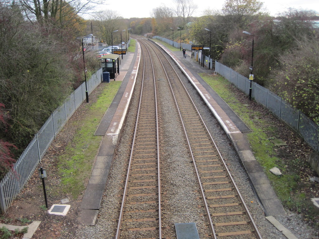
Earlswood railway station (West Midlands)

Earlswood railway station is located on the western fringe of the village of Earlswood on the West Midlands/Warwickshire border in England. The platforms...

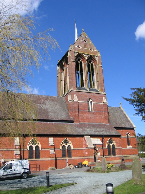
St Mary's Church, Wythall

The Former Church of St Mary, Wythall is a Grade II listed redundant parish church in the Church of England in Wythall, Worcestershire. == History == The...
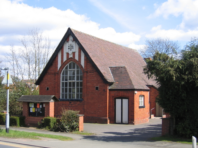
Wythall

Wythall is a village and civil parish in the Bromsgrove District, in the north-east corner of the county of Worcestershire, England. Wythall parish borders...

Nearby Amenities

Located within 500m of 52.3503,-1.884133
Traffic Signals
Source: Maxar
Lat/Long: 52.3546389/-1.8847778
Traffic Signals
Source: Maxar
Lat/Long: 52.3540938/-1.8856201
Traffic Signals
Source: Maxar
Lat/Long: 52.3545861/-1.8846267
Motorway Junction
Lat/Long: 52.3485243/-1.8797989
Bus Stop
Rose & Crown
Bus: yes
Naptan AtcoCode: 4200F160701
Naptan Bearing: N
Naptan CommonName: Rose & Crown
Naptan Indicator: Adj
Naptan NaptanCode: waragmtj
Naptan Street: Alcester Road
Naptan Verified: no
Public Transport: platform
Source: naptan_import
Lat/Long: 52.3529554/-1.884524
Bus Stop
Rose & Crown
Bus: yes
Naptan AtcoCode: 2000G001200
Naptan Bearing: N
Naptan CommonName: Rose & Crown
Naptan Indicator: opp
Naptan Landmark: Rose & Crown Inn
Naptan NaptanCode: wocgamdm
Naptan Street: Alcester Road
Naptan Verified: no
Public Transport: platform
Source: naptan_import
Lat/Long: 52.3529548/-1.8839367
Bus Stop
Rose & Crown
Bus: yes
Naptan AtcoCode: 2000G001201
Naptan Bearing: NW
Naptan CommonName: Rose & Crown
Naptan Indicator: Adj
Naptan Landmark: Rose & Crown Inn
Naptan NaptanCode: wocgamdp
Naptan Street: Alcester Road
Naptan Verified: no
Public Transport: platform
Source: naptan_import
Lat/Long: 52.3531354/-1.8847291
Bus Stop
Portway Hotel
Bus: yes
Naptan AtcoCode: 2000G088700
Naptan Bearing: NW
Naptan CommonName: Portway Hotel
Naptan Indicator: Adj
Naptan Landmark: Hotel
Naptan NaptanCode: wocdagtj
Naptan Street: Alcester Road
Naptan Verified: no
Public Transport: platform
Source: naptan_import
Lat/Long: 52.3512096/-1.8828695
Bus Stop
Old Alcester Road
Bus: yes
Naptan AtcoCode: 2000G800091
Naptan Bearing: N
Naptan CommonName: Old Alcester Road
Naptan Indicator: adj
Naptan NaptanCode: wocgjptj
Naptan Street: Old Alcester Road
Naptan Verified: no
Public Transport: platform
Source: naptan_import
Lat/Long: 52.3471251/-1.8800177
Traffic Signals
Source: Maxar
Lat/Long: 52.3539566/-1.8856325
Portway
Place: village
Lat/Long: 52.3483378/-1.8832399
Give Way
Source: bing
Lat/Long: 52.3524571/-1.8840263
Give Way
Source: bing
Lat/Long: 52.3525313/-1.8837095
Post Box
Collection Times: Mo-Fr 16:15; Sa 09:00
Operator: Royal Mail
Operator Wikidata: Q638098
Post Box Type: lamp
Ref: B48 178
Royal Cypher: EIIR
Royal Cypher Wikidata: Q33102113
Lat/Long: 52.3473154/-1.8800911
Generator Method: photovoltaic
Generator Output Electricity: yes
Generator Source: solar
Generator Type: solar_photovoltaic_panel
Location: roof
Power: generator
Lat/Long: 52.3503049/-1.8878916
Power: substation
Ref: 720695
Source: wpd_opendata
Lat/Long: 52.3512871/-1.88198
Power: pole
Source: bing
Lat/Long: 52.3528689/-1.8800676
Power: pole
Source: bing
Lat/Long: 52.3509373/-1.8838991
Power: pole
Source: bing
Lat/Long: 52.350486/-1.8848124
Power: pole
Source: bing
Lat/Long: 52.3500665/-1.885664
Power: pole
Source: bing
Lat/Long: 52.3496127/-1.8866095
Power: pole
Source: bing
Lat/Long: 52.3499265/-1.8874946
Power: pole
Ref: 720685
Source: wpd_opendata
Transformer: distribution
Lat/Long: 52.3503582/-1.8884951
The data included in this document is from www.openstreetmap.org. The data is made available under ODbL.

Have you been to Portway?

Leave your review of Portway below (or comments, questions and feedback).