Birtley

Settlement in Northumberland

England

Birtley

River Erosion, River North Tyne
River Erosion, River North Tyne Credit: Les Hull

Birtley is a small village located in the county of Northumberland, England. Situated approximately 10 miles south of the historic market town of Hexham, Birtley is nestled in the picturesque countryside of the Tyne Valley. The village is surrounded by rolling hills, lush green fields, and dense woodland, providing residents and visitors with stunning natural landscapes to explore.

With a population of around 300 people, Birtley offers a peaceful and close-knit community atmosphere. The village is characterized by its charming stone-built houses, many of which date back to the 18th and 19th centuries, adding to the area's rustic charm.

Birtley is home to a few amenities, including a village hall, a primary school, and a local pub, where residents can gather and socialize. The village also benefits from its proximity to Hexham, where a wider range of services, shops, and leisure facilities can be found.

For those seeking outdoor activities, Birtley is surrounded by numerous walking and cycling routes, allowing visitors to immerse themselves in the area's natural beauty. The nearby North Pennines Area of Outstanding Natural Beauty is a popular destination for nature enthusiasts, offering breathtaking landscapes and diverse wildlife.

Overall, Birtley is a tranquil village that offers a peaceful retreat from the hustle and bustle of city life. Its idyllic setting, community spirit, and access to stunning natural surroundings make it an attractive place to live or visit in Northumberland.

If you have any feedback on the listing, please let us know in the comments section below.

Birtley Images

Images are sourced within 2km of 55.098217/-2.1902732 or Grid Reference NY8778. Thanks to Geograph Open Source API. All images are credited.

River Erosion, River North Tyne
A development since our Last Walk No doubt an eco friendly house in a lovely, secluded spot.
A development since our Last Walk
No doubt an eco friendly house in a lovely, secluded spot.
High Carry House (bastle) The ruins of the old farm at High Carry House stands a few hundred metres north of the present farm. The old farmhouse was originally a bastle which was later added to and remodelled. The walls of the bastle are 1.2m thick and built of large stones. The entrance to the ground floor is in one of the long walls, but little now remains standing of the first floor walls. Before the upper floor had totally collapsed several original features were visible, including fireplaces at both ends of the first floor. These and a number of other elements, suggest this was slightly superior to the average bastle. The building has stood roofless since at least 1970.
<span class="nowrap"><a title="http://www.keystothepast.info/article/10339/Site-Details?PRN=N7742" rel="nofollow ugc noopener" href="http://www.keystothepast.info/article/10339/Site-Details?PRN=N7742">Link</a><img style="margin-left:2px;" alt="External link" title="External link - shift click to open in new window" src="https://s1.geograph.org.uk/img/external.png" width="10" height="10"/></span>
High Carry House (bastle)
The ruins of the old farm at High Carry House stands a few hundred metres north of the present farm. The old farmhouse was originally a bastle which was later added to and remodelled. The walls of the bastle are 1.2m thick and built of large stones. The entrance to the ground floor is in one of the long walls, but little now remains standing of the first floor walls. Before the upper floor had totally collapsed several original features were visible, including fireplaces at both ends of the first floor. These and a number of other elements, suggest this was slightly superior to the average bastle. The building has stood roofless since at least 1970. LinkExternal link
New Surface on the path of the Old Border Counties Railway Access for farm vehicles?
Path to make it easier to access fishing spots on the River North Tyne?
It doesn't Follow the River Tyne Trail.
Very intriguing.
New Surface on the path of the Old Border Counties Railway
Access for farm vehicles? Path to make it easier to access fishing spots on the River North Tyne? It doesn't Follow the River Tyne Trail. Very intriguing.
Disused Quarry below High Carry House (bastle).
Plate Layers Hut former Border Counties railway
Pretty waterfall on the Holywell Burn
Pretty waterfall on the Holywell Burn Metres from the road, completely hidden from view.
Pretty waterfall on the Holywell Burn
Metres from the road, completely hidden from view.
Stepping stones from Gold Island Compare with <a href="https://www.geograph.org.uk/photo/6808626">NY8677 : Stepping stones to Gold Island</a>. On this occasion, water levels were very low, making the crossing over the backwater to Gold Island much less fraught. Seen from the island looking towards the mainland.
Stepping stones from Gold Island
Compare with NY8677 : Stepping stones to Gold Island. On this occasion, water levels were very low, making the crossing over the backwater to Gold Island much less fraught. Seen from the island looking towards the mainland.
Infinite patience Heron in the North Tyne.
Infinite patience
Heron in the North Tyne.
Former Percy Arms Pub Another rural pub bites the dust.
Former Percy Arms Pub
Another rural pub bites the dust.
Plantation near T-Junction
View Across Farmland
Covered Reservoir and Communication Mast
Trig Point Robbingstob Hill
Pond on Robbingstob Hill
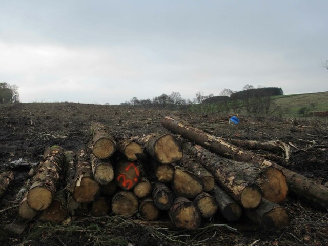
Felled Trees, Cola Burn Plantation
Felled Trees, Coal Burn Plantation
Show me another place!

Birtley is located at Grid Ref: NY8778 (Lat: 55.098217, Lng: -2.1902732)

Unitary Authority: Northumberland

Police Authority: Northumbria

What 3 Words

///crumb.elite.brands. Near Birtley, Northumberland

Nearby Locations

Tom's Hill Birtley

Related Wikis

Birtley, Northumberland

Birtley is a village in Northumberland, England southeast of Bellingham. It is about 10 miles (16 km) north of Hexham. == References == == External... ==

Wark on Tyne

Wark on Tyne is a small village and civil parish in Northumberland, England, 12 miles (19 km) north of Hexham. == History == The name is derived from the...

Wark railway station

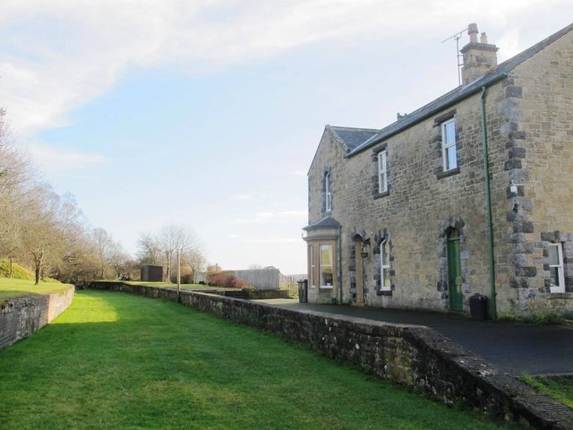
Wark railway station is a disused railway station which served the village of Wark on Tyne, Northumberland, England. Located on the Border Counties Railway...

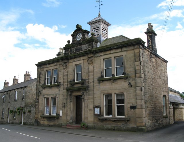
Wark Town Hall

Wark Town Hall is a municipal building on The Green in Wark on Tyne, Northumberland, England. The building, which is used as a community events venue,...

Nearby Amenities

Located within 500m of 55.098217,-2.1902732
Birtley
Place: village
Lat/Long: 55.0978629/-2.1904683
Power: pole
Lat/Long: 55.0968906/-2.1949785
Post Box
Drive Through: no
Ref: NE48 73
Lat/Long: 55.0972049/-2.1925793
Barrier: stile
Lat/Long: 55.0959695/-2.1931015
Direction: SSE
Generator Method: photovoltaic
Generator Output Electricity: yes
Generator Solar Modules: 12
Generator Source: solar
Generator Type: solar_photovoltaic_panel
Location: roof
Power: generator
Lat/Long: 55.0976378/-2.1900451
Direction: SSE
Generator Method: photovoltaic
Generator Output Electricity: yes
Generator Solar Modules: 16
Generator Source: solar
Generator Type: solar_photovoltaic_panel
Location: roof
Power: generator
Lat/Long: 55.0988195/-2.187603
The data included in this document is from www.openstreetmap.org. The data is made available under ODbL.

Have you been to Birtley?

Leave your review of Birtley below (or comments, questions and feedback).