Birse

Settlement in Aberdeenshire

Scotland

Birse

Bell Wood bike park
Bell Wood bike park Credit: Ralph Greig

Birse is a small village located in Aberdeenshire, Scotland. Situated in the picturesque countryside, it is nestled within the stunning landscape of the Cairngorms National Park. The village is approximately 30 miles west of Aberdeen, making it easily accessible for both locals and tourists.

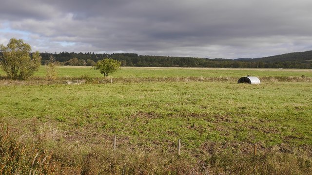
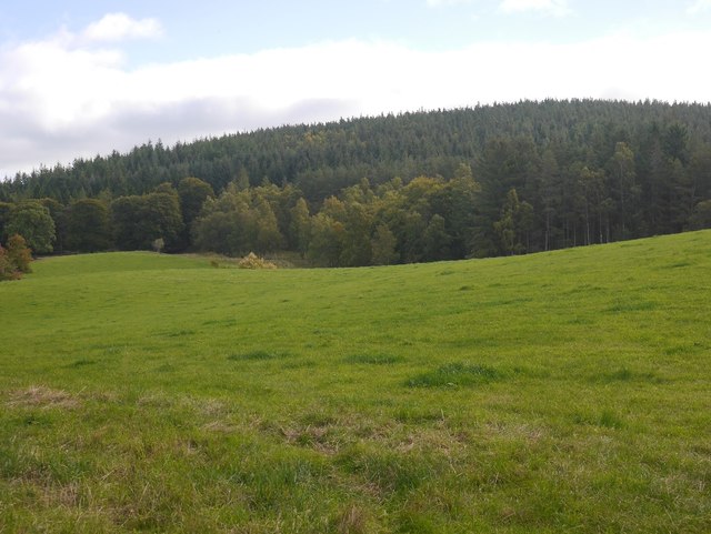
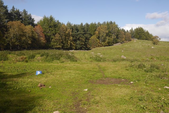
Birse is known for its rich history and charming rural atmosphere. The village is home to a small population, with a close-knit community that takes pride in its heritage. The surrounding area offers breathtaking views of rolling hills, lush green fields, and the meandering River Dee.

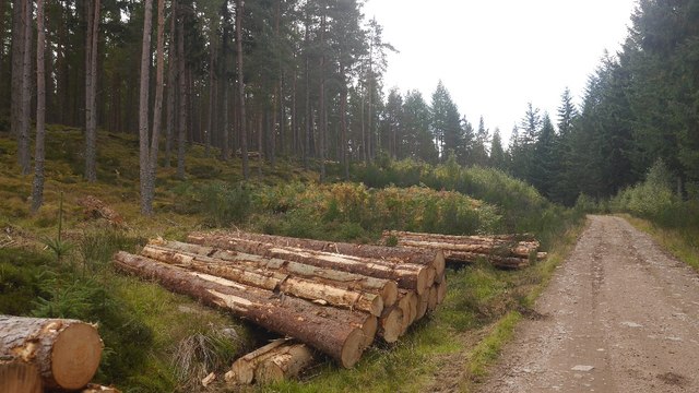
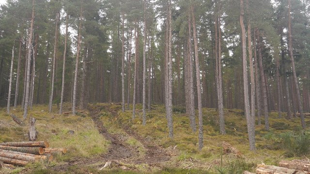
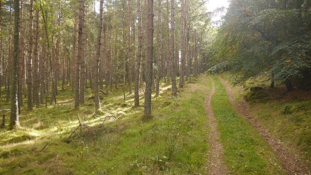
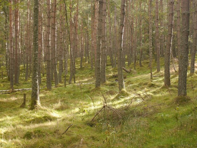
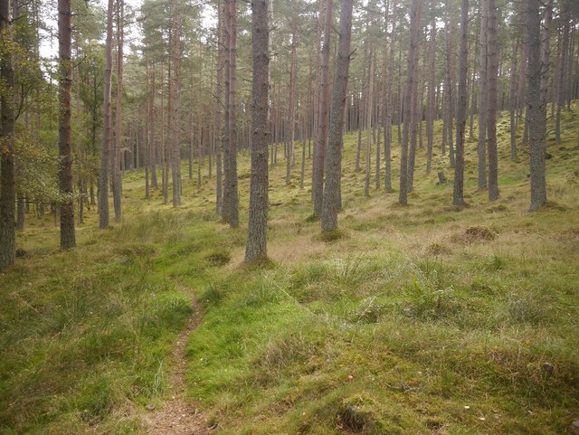
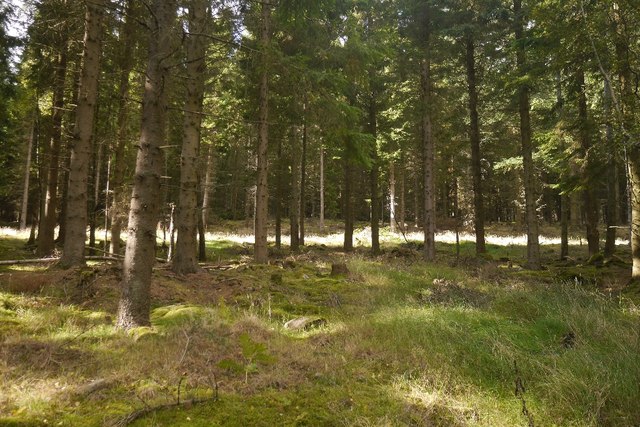
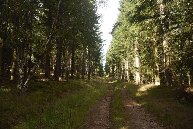
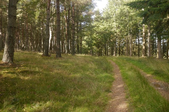
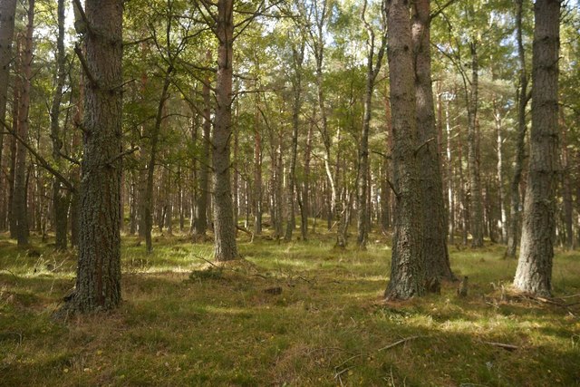
The village is an ideal destination for outdoor enthusiasts, offering a range of activities such as hiking, fishing, and birdwatching. The nearby Birse Castle Estate offers beautiful walking trails where visitors can explore ancient woodlands and spot wildlife, including red squirrels and various bird species.

Birse also boasts several historical landmarks, including the 16th-century Birse Kirk, a traditional Scottish church. The village is steeped in folklore and legends, with stories of ancient standing stones and hidden treasures adding to its allure.

Although Birse is a small village, it offers essential amenities such as a local shop and a pub, providing a warm welcome to visitors. The village hosts various events throughout the year, including an annual Highland Games, where locals and tourists can experience traditional Scottish culture and sports.

Overall, Birse is a hidden gem in Aberdeenshire, offering a tranquil retreat for those seeking natural beauty, historical sites, and a sense of community.

If you have any feedback on the listing, please let us know in the comments section below.
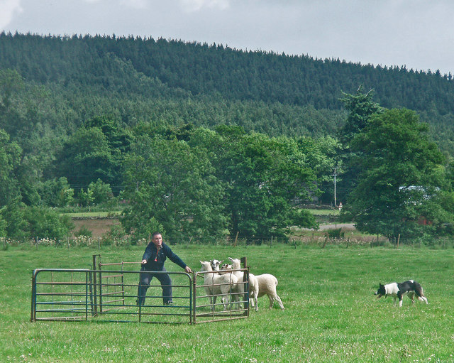
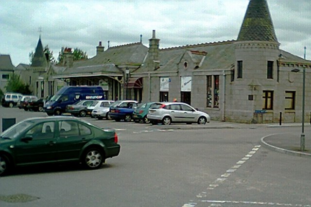
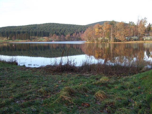
Birse Images

Images are sourced within 2km of 57.06183/-2.731592 or Grid Reference NO5596. Thanks to Geograph Open Source API. All images are credited.

Bell Wood bike park
Bell Wood bike park
Digger's shelter Geocaching is a type of global treasure hunt of people looking for caches, or hidden stashes of objects. Geocaching may also be described as a series of hide-and-seek games, where hiders provide online clues for seekers. Seekers use global positioning system (GPS) devices to find hidden caches
Digger's shelter
Geocaching is a type of global treasure hunt of people looking for caches, or hidden stashes of objects. Geocaching may also be described as a series of hide-and-seek games, where hiders provide online clues for seekers. Seekers use global positioning system (GPS) devices to find hidden caches
Pig ark, Haugh A haugh south of the Dee.
Pig ark, Haugh
A haugh south of the Dee.
Log piles, Balfour Forest Thinning in progress.
Log piles, Balfour Forest
Thinning in progress.
Thinning, Balfour Forest A community woodland.  There are few old trees here, the area was nearly clear felled completely in the two big twentieth century wars - there was a Canadian work camp nearby in World War II.  The few trees which survived the war were taken out by the great gale of 1953.   The forest is now restored.
Thinning, Balfour Forest
A community woodland. There are few old trees here, the area was nearly clear felled completely in the two big twentieth century wars - there was a Canadian work camp nearby in World War II. The few trees which survived the war were taken out by the great gale of 1953. The forest is now restored.
Kittling Wood The forest at Balfour, now restored after complete destruction by wartime logging camps and the gale of 1953.  The track leads to a field, but there is a fine bit of singletrack continuing into the woods.
Kittling Wood
The forest at Balfour, now restored after complete destruction by wartime logging camps and the gale of 1953. The track leads to a field, but there is a fine bit of singletrack continuing into the woods.
Woodland, Balfour
Woodland, Balfour
Field, Balfour Between the house and forest.  Black Hill in the background, like most woodland here was stripped of trees by wartime lumber camps and the 1953 gale.
Field, Balfour
Between the house and forest. Black Hill in the background, like most woodland here was stripped of trees by wartime lumber camps and the 1953 gale.
The Bimble Single track in the very runnable Balfour Forest.
The Bimble
Single track in the very runnable Balfour Forest.
Balfour Forest Singletrack, nicknamed The Bimble through very open woodland.  It is a lovely easy run on the bike.
Balfour Forest
Singletrack, nicknamed The Bimble through very open woodland. It is a lovely easy run on the bike.
Old dyke, Balfour Between Ballogie and Balfour in pine woods.  The woodland was felled by wartime lumber camps and the notorious 1953 gale, but is now well established and thriving again.
Old dyke, Balfour
Between Ballogie and Balfour in pine woods. The woodland was felled by wartime lumber camps and the notorious 1953 gale, but is now well established and thriving again.
Balfour Forest I am glad that I had the orienteering map with me, as this old, well established track is omitted from the Ordnance Survey 1:25,000 map. It climbs up to the south of Brown Hill, joining the road network in the former Forestry Commission woodland there.
Balfour Forest
I am glad that I had the orienteering map with me, as this old, well established track is omitted from the Ordnance Survey 1:25,000 map. It climbs up to the south of Brown Hill, joining the road network in the former Forestry Commission woodland there.
Path in Balfour Forest While not shown on the current 1:25,000 map, this is a long established route shown on older maps and still exists on the ground. In places there are parallel gullies suggesting that this once a busy route used over a long period of time.
Path in Balfour Forest
While not shown on the current 1:25,000 map, this is a long established route shown on older maps and still exists on the ground. In places there are parallel gullies suggesting that this once a busy route used over a long period of time.
Whitehill Wood Eastern side of Balfour Forest, above the Canadian Road.
Whitehill Wood
Eastern side of Balfour Forest, above the Canadian Road.
The Canadian Road Named after the World War II lumberjacks who felled almost everything that survived World War I.  Any remaining trees in Balfour Forest were finished off by the gale of January 1953. (The one which killed thousands around the North Sea).
The Canadian Road
Named after the World War II lumberjacks who felled almost everything that survived World War I. Any remaining trees in Balfour Forest were finished off by the gale of January 1953. (The one which killed thousands around the North Sea).
Whitehill Wood A beautiful runnable forest, restored after destruction in the mid 20th century. It was felled in both wars and the remnants finished off by the disastrous storm of 1953.
Whitehill Wood
A beautiful runnable forest, restored after destruction in the mid 20th century. It was felled in both wars and the remnants finished off by the disastrous storm of 1953.
Quarry, Achnafoy The Canadian Road ends here in a grassed over quarry. There is a gate at the far side which leads to a disused road in the forest. From here a path leads down to the Balfour to Kinminity road. Goes a treat on a bike, lovely singletrack.
Quarry, Achnafoy
The Canadian Road ends here in a grassed over quarry. There is a gate at the far side which leads to a disused road in the forest. From here a path leads down to the Balfour to Kinminity road. Goes a treat on a bike, lovely singletrack.
Show me another place!

Birse is located at Grid Ref: NO5596 (Lat: 57.06183, Lng: -2.731592)

Unitary Authority: Aberdeenshire

Police Authority: North East

What 3 Words

///dozens.conspired.unpainted. Near Aboyne, Aberdeenshire

Nearby Locations

Birse

Related Wikis

Birse

Birse (Scottish Gaelic: Braois/Breis) is a parish in the Lower Deeside area of Aberdeenshire, Scotland, which includes the communities of Finzean and Ballogie...

Kinminity

Kinminity is a former village located south-east of Birse, Aberdeenshire in Scotland. == History == The property was in hands of the cadet family of Sutherlands...

Belwade Farm

Belwade Farm is a horse stables near Aboyne, Scotland owned by World Horse Welfare. == History == A new visitor centre and indoor arena was opened by Princess...

Ballogie

Ballogie is a rural community and an estate in the Lower Deeside area of Aberdeenshire, Scotland. Most of Ballogie lies within the parish of Birse, although...

Aboyne Hospital

Aboyne Hospital is a community hospital in Bellwood Road, Aboyne, Scotland. It is managed by NHS Grampian. == History == The facility, which was designed...

Aboyne railway station

Aboyne railway station was a station which served Aboyne in the Scottish county of Aberdeenshire. It was served by trains on the line from Aberdeen to...

Aboyne Curling Pond railway station

Aboyne Curling Pond railway station, Loch of Aboyne Platform or Curlers' Platform was a private station opened on the Deeside Extension Railway for the...

Birsemore

Birsemore is a village in Aberdeenshire, Scotland opposite Aboyne on the River Dee. == References ==

Related Videos

Kincardine O’Neil Village to Dess Waterfall Walk, Scotland Countryside 4K

Kincardine O'Neil Village to Dess Waterfall Walk, Scotland Countryside 4K. The video was recorded on location by DJI Pocket 2 ...

Dess Waterfall and Kincardine O’Neil #aboyne #aberdeenshire #scotland #unitedkingdom #waterfall

Dess Waterfall, Aboyne Start your journey at the Old Smiddy (maps of the routes and other walks in the area can be found in the ...

kiltwalk day 3, Deeside way, Scotland

continued from potarch to Aboyne via dess waterfall.

4K Dess Waterfall from Kincardine O’Neil | Nature Sounds ASMR | Scotland’s Scenery [short preview]

Short preview 4K walk from Kincardine O'Neil to Dess Waterfall, Scottish Countryside with no added music and nature sounds ...

Nearby Amenities

Located within 500m of 57.06183,-2.731592
Birse
Place: hamlet
Lat/Long: 57.0622972/-2.7346091
Oldyleiper
Place: locality
Lat/Long: 57.0624144/-2.7288151
Birseside
Place: locality
Lat/Long: 57.0644116/-2.7358532
Power: pole
Lat/Long: 57.0604633/-2.7240866
Power: pole
Lat/Long: 57.0603513/-2.7256342
Power: pole
Lat/Long: 57.0602706/-2.7268086
Power: pole
Lat/Long: 57.0601822/-2.7280671
Power: pole
Lat/Long: 57.0600908/-2.7294201
Power: pole
Lat/Long: 57.0600106/-2.7307712
Power: pole
Lat/Long: 57.0601453/-2.7319806
Power: pole
Lat/Long: 57.0602819/-2.733224
Power: pole
Lat/Long: 57.0603898/-2.7343503
Power: pole
Lat/Long: 57.0605265/-2.7353348
Power: pole
Lat/Long: 57.060583/-2.735862
Power: pole
Lat/Long: 57.0605783/-2.736085
Power: pole
Lat/Long: 57.0611342/-2.7241792
Power: pole
Lat/Long: 57.0618339/-2.7242793
Power: pole
Lat/Long: 57.0625439/-2.7244059
Power: pole
Lat/Long: 57.063297/-2.7245344
Power: pole
Lat/Long: 57.0639556/-2.7246459
Power: pole
Lat/Long: 57.0643481/-2.7258005
Power: pole
Lat/Long: 57.0646568/-2.7268219
Power: pole
Lat/Long: 57.0648931/-2.7268464
Power: pole
Lat/Long: 57.0601386/-2.7379992
Power: pole
Lat/Long: 57.0599485/-2.7389421
Power: pole
Lat/Long: 57.0648289/-2.736787
Power: pole
Lat/Long: 57.0650595/-2.736924
Power: pole
Lat/Long: 57.0625907/-2.7396234
Power: pole
Lat/Long: 57.0619701/-2.7394571
Power: pole
Lat/Long: 57.0614235/-2.7393097
Power: pole
Lat/Long: 57.0606087/-2.739098
Ford: yes
Lat/Long: 57.0640851/-2.7280561
Post Box
Brand: Royal Mail
Brand Wikidata: Q638098
Operator: Royal Mail
Operator Wikidata: Q638098
Post Box Design: type_c
Post Box Type: wall
Ref: AB34 210
Royal Cypher: EVIIR
Royal Cypher Wikidata: Q33102324
Source: survey
Lat/Long: 57.0618092/-2.7321311
Hall
Place: locality
Lat/Long: 57.0607695/-2.7352241
The data included in this document is from www.openstreetmap.org. The data is made available under ODbL.

Have you been to Birse?

Leave your review of Birse below (or comments, questions and feedback).