Plasau

Settlement in Shropshire

England

Plasau

Kinnerley Junction obscured - Edgerley, Shropshire Looking out from the railway bridge at Kinnerley Junction. This bridge straddled the now almost vanished Shropshire and Montgomeryshire Railway, known as The Potts. This was from the original company Potteries Shrewsbury and North Wales Railway which later became the Shropshire and Montgomeryshire Railway and was intended to link the Potteries area of Staffordshire with Dublin in the Irish Republic. The line opened in 1866 and finally closed in 1962 having been in private and military ownership during its lifetime. Kinnerley Junction station opened in 1911 and closed in 1933. From this point there was a 5 mile branch to a quarry at Criggion. The land on this route is private and there is no public access. Taken at 3.09 pm BST (British Summer Time). <a href="https://www.geograph.org.uk/photo/160295">SJ3319 : Kinnerley Bridge</a> <a href="https://www.geograph.org.uk/photo/600880">SJ3319 : Course of the Shropshire & Montgomery Railway</a> <a href="https://www.geograph.org.uk/photo/600887">SJ3319 : Site of Kinnerley Junction</a> <a href="https://www.geograph.org.uk/photo/758323">SJ3319 : Bridge over the stream</a>
Kinnerley Junction obscured - Edgerley, Shropshire Credit: Martin Richard Phelan

The requested URL returned error: 429 Too Many Requests

If you have any feedback on the listing, please let us know in the comments section below.
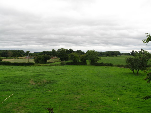
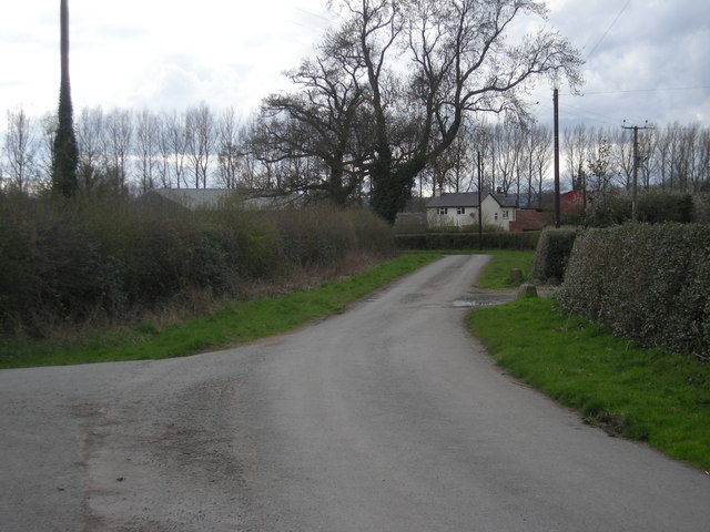
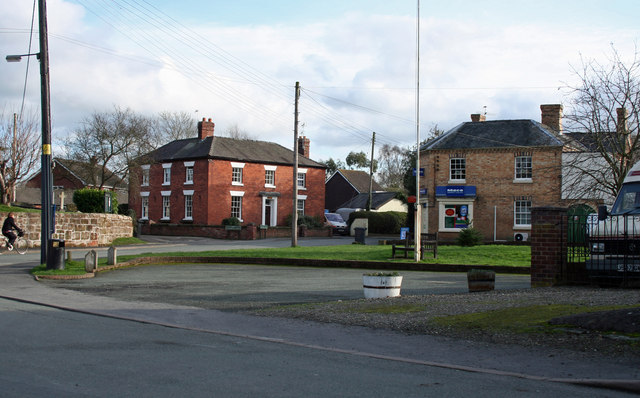
Plasau Images

Images are sourced within 2km of 52.778589/-2.964196 or Grid Reference SJ3520. Thanks to Geograph Open Source API. All images are credited.

Kinnerley Junction obscured - Edgerley, Shropshire Looking out from the railway bridge at Kinnerley Junction. This bridge straddled the now almost vanished Shropshire and Montgomeryshire Railway, known as The Potts. This was from the original company Potteries Shrewsbury and North Wales Railway which later became the Shropshire and Montgomeryshire Railway and was intended to link the Potteries area of Staffordshire with Dublin in the Irish Republic. The line opened in 1866 and finally closed in 1962 having been in private and military ownership during its lifetime. Kinnerley Junction station opened in 1911 and closed in 1933. From this point there was a 5 mile branch to a quarry at Criggion. The land on this route is private and there is no public access. Taken at 3.09 pm BST (British Summer Time). <a href="https://www.geograph.org.uk/photo/160295">SJ3319 : Kinnerley Bridge</a> <a href="https://www.geograph.org.uk/photo/600880">SJ3319 : Course of the Shropshire & Montgomery Railway</a> <a href="https://www.geograph.org.uk/photo/600887">SJ3319 : Site of Kinnerley Junction</a> <a href="https://www.geograph.org.uk/photo/758323">SJ3319 : Bridge over the stream</a>
Kinnerley Junction obscured - Edgerley, Shropshire
Looking out from the railway bridge at Kinnerley Junction. This bridge straddled the now almost vanished Shropshire and Montgomeryshire Railway, known as The Potts. This was from the original company Potteries Shrewsbury and North Wales Railway which later became the Shropshire and Montgomeryshire Railway and was intended to link the Potteries area of Staffordshire with Dublin in the Irish Republic. The line opened in 1866 and finally closed in 1962 having been in private and military ownership during its lifetime. Kinnerley Junction station opened in 1911 and closed in 1933. From this point there was a 5 mile branch to a quarry at Criggion. The land on this route is private and there is no public access. Taken at 3.09 pm BST (British Summer Time). SJ3319 : Kinnerley Bridge SJ3319 : Course of the Shropshire & Montgomery Railway SJ3319 : Site of Kinnerley Junction SJ3319 : Bridge over the stream
Bridge Cottage by the way - Edgerley, Shropshire A party of Railway Ramblers on a day walk making their way along the B-road from Pentre to Kinnerley at Edgerley towards the road bridge overlooking the site of Kinnerley Junction. The walk started at the village of Shrawardine <a href="https://www.geograph.org.uk/gridref/SJ3915">SJ3915</a> 'Shraden' to the locals, and was to end at Argoed <a href="https://www.geograph.org.uk/gridref/SJ3220">SJ3220</a>. Time taken 3.06 pm BST (British Summer Time).
Bridge Cottage by the way - Edgerley, Shropshire
A party of Railway Ramblers on a day walk making their way along the B-road from Pentre to Kinnerley at Edgerley towards the road bridge overlooking the site of Kinnerley Junction. The walk started at the village of Shrawardine SJ3915 'Shraden' to the locals, and was to end at Argoed SJ3220. Time taken 3.06 pm BST (British Summer Time).
Towards Kinnerley Junction - Edgerley, Shropshire A party of Railway Ramblers at Edgerley on the B-road between Pentre and Kinnerley as they approach the road bridge overlooking the site of Kinnerley Junction. The now-vanished Shropshire and Montgomeryshire Railway once ran this way and at Kinnerley Junction a 5-mile branch led off  to the basalt quarry at Criggion <a href="https://www.geograph.org.uk/gridref/SJ2814">SJ2814</a>. Time taken 3.07 pm BST (British Summer Time).

<a href="https://www.geograph.org.uk/photo/5319315">SJ3319 : Bridge over Kinnerley Junction - Edgerley, Shropshire</a>
Towards Kinnerley Junction - Edgerley, Shropshire
A party of Railway Ramblers at Edgerley on the B-road between Pentre and Kinnerley as they approach the road bridge overlooking the site of Kinnerley Junction. The now-vanished Shropshire and Montgomeryshire Railway once ran this way and at Kinnerley Junction a 5-mile branch led off to the basalt quarry at Criggion SJ2814. Time taken 3.07 pm BST (British Summer Time). SJ3319 : Bridge over Kinnerley Junction - Edgerley, Shropshire
Bridge over Kinnerley Junction - Edgerley, Shropshire Some of the group of Railway Ramblers at Edgerley stopping for a look from the bridge at the site of Kinnerley Junction, from where a 5-mile branch left the Shropshire and Montgomeryshire Railway for the basalt quarry at Criggion <a href="https://www.geograph.org.uk/gridref/SJ2814">SJ2814</a>. The sign on the left shows a 22 ton weight limit on the bridge. Time taken 3.07 pm BST (British Summer Time).
Bridge over Kinnerley Junction - Edgerley, Shropshire
Some of the group of Railway Ramblers at Edgerley stopping for a look from the bridge at the site of Kinnerley Junction, from where a 5-mile branch left the Shropshire and Montgomeryshire Railway for the basalt quarry at Criggion SJ2814. The sign on the left shows a 22 ton weight limit on the bridge. Time taken 3.07 pm BST (British Summer Time).
A bridge there was - Edgerley, Shropshire The embankment ahead in this picture was the filled-in road bridgehole over the Shropshire & Montgomeryshire Railway at Edgerley. This line was intended to make a link between The Potteries at Stoke on Trent and Dublin, hence it's nickname the Potts, but this plan never came to fruition. Somewhat confusingly, there are two places named Edgerley on the OS map here, but whether they are separate or the same place named twice is not clear. Time taken 3.02 pm BST (British Summer Time).
<a href="https://www.geograph.org.uk/photo/3607444">SJ3419 : Rails once ran - Edgerley, Shropshire</a> <a href="https://www.geograph.org.uk/photo/3607850">SJ3319 : The road to Kynaston - Edgerley, Shropshire</a>
A bridge there was - Edgerley, Shropshire
The embankment ahead in this picture was the filled-in road bridgehole over the Shropshire & Montgomeryshire Railway at Edgerley. This line was intended to make a link between The Potteries at Stoke on Trent and Dublin, hence it's nickname the Potts, but this plan never came to fruition. Somewhat confusingly, there are two places named Edgerley on the OS map here, but whether they are separate or the same place named twice is not clear. Time taken 3.02 pm BST (British Summer Time). SJ3419 : Rails once ran - Edgerley, Shropshire SJ3319 : The road to Kynaston - Edgerley, Shropshire
Rails once ran - Edgerley, Shropshire Looking eastwards from the bridge in Edgerley 1, the long-abandoned former route of the Shropshire & Montgomeryshire Railway - nicknamed the Potts - can be seen. Passing through the gate which is seen ahead in the centre of the picture, the line ran through the present Nesscliffe Military Training Area - no public access - to the station house, a rebuilt one, at Shrawardine (locally pronounced Shraden). There are a number of books available which give a history of this former line. Time taken 3.08 pm BST (British Summer Time). <a href="https://www.geograph.org.uk/photo/3607429">SJ3319 : A bridge there was - Edgerley, Shropshire</a> <a href="https://www.geograph.org.uk/photo/3607850">SJ3319 : The road to Kynaston - Edgerley, Shropshire</a>
Rails once ran - Edgerley, Shropshire
Looking eastwards from the bridge in Edgerley 1, the long-abandoned former route of the Shropshire & Montgomeryshire Railway - nicknamed the Potts - can be seen. Passing through the gate which is seen ahead in the centre of the picture, the line ran through the present Nesscliffe Military Training Area - no public access - to the station house, a rebuilt one, at Shrawardine (locally pronounced Shraden). There are a number of books available which give a history of this former line. Time taken 3.08 pm BST (British Summer Time). SJ3319 : A bridge there was - Edgerley, Shropshire SJ3319 : The road to Kynaston - Edgerley, Shropshire
The road to Kynaston - Edgerley, Shropshire Just to the west of here, behind the photographer, lies the site of Kinnerley Junction where the Shropshire & Montgomeryshire Railway, the 'Potts', diverged, one branch turning southwards to Criggion and the other westwards to Llanymynech. In existence from 1866 to 1962, the line had a very chequered history and there are a number of books published on the story of it. The trackbed these days is private land, with no public access. The lower sign reads 'TRAINING AREAS 1 TO 6' and the signpost arms 'Kinnerley Knockin' 'Pentre Wilcott' and 'Kynaston'. Time taken 3.13 pm BST (British Summer Time).    

<a href="https://www.geograph.org.uk/photo/3607429">SJ3319 : A bridge there was - Edgerley, Shropshire</a> <a href="https://www.geograph.org.uk/photo/3607444">SJ3419 : Rails once ran - Edgerley, Shropshire</a>
The road to Kynaston - Edgerley, Shropshire
Just to the west of here, behind the photographer, lies the site of Kinnerley Junction where the Shropshire & Montgomeryshire Railway, the 'Potts', diverged, one branch turning southwards to Criggion and the other westwards to Llanymynech. In existence from 1866 to 1962, the line had a very chequered history and there are a number of books published on the story of it. The trackbed these days is private land, with no public access. The lower sign reads 'TRAINING AREAS 1 TO 6' and the signpost arms 'Kinnerley Knockin' 'Pentre Wilcott' and 'Kynaston'. Time taken 3.13 pm BST (British Summer Time). SJ3319 : A bridge there was - Edgerley, Shropshire SJ3419 : Rails once ran - Edgerley, Shropshire
Exit to Knockin
Exit to Knockin
The A5 south of Shottaton
Minor road off the A5 The A5 is a major trunk road that runs 260 miles from London to Holyhead. It follows the course of an old Roman Road (Watling Street).
Wikipedia: <span class="nowrap"><a title="http://en.wikipedia.org/wiki/A5_road_(Great_Britain)" rel="nofollow ugc noopener" href="http://en.wikipedia.org/wiki/A5_road_(Great_Britain)">Link</a><img style="margin-left:2px;" alt="External link" title="External link - shift click to open in new window" src="https://s1.geograph.org.uk/img/external.png" width="10" height="10"/></span>
Minor road off the A5
The A5 is a major trunk road that runs 260 miles from London to Holyhead. It follows the course of an old Roman Road (Watling Street). Wikipedia: LinkExternal link
Roundabout, A5 The A5 is a major trunk road that runs 260 miles from London to Holyhead. It follows the course of an old Roman Road (Watling Street).
Wikipedia: <span class="nowrap"><a title="http://en.wikipedia.org/wiki/A5_road_(Great_Britain)" rel="nofollow ugc noopener" href="http://en.wikipedia.org/wiki/A5_road_(Great_Britain)">Link</a><img style="margin-left:2px;" alt="External link" title="External link - shift click to open in new window" src="https://s1.geograph.org.uk/img/external.png" width="10" height="10"/></span>
Roundabout, A5
The A5 is a major trunk road that runs 260 miles from London to Holyhead. It follows the course of an old Roman Road (Watling Street). Wikipedia: LinkExternal link
A5 south of Wolfshead Roundabout The A5 is a major trunk road that runs 260 miles from London to Holyhead. It follows the course of an old Roman Road (Watling Street).
Wikipedia: <span class="nowrap"><a title="http://en.wikipedia.org/wiki/A5_road_(Great_Britain)" rel="nofollow ugc noopener" href="http://en.wikipedia.org/wiki/A5_road_(Great_Britain)">Link</a><img style="margin-left:2px;" alt="External link" title="External link - shift click to open in new window" src="https://s1.geograph.org.uk/img/external.png" width="10" height="10"/></span>
A5 south of Wolfshead Roundabout
The A5 is a major trunk road that runs 260 miles from London to Holyhead. It follows the course of an old Roman Road (Watling Street). Wikipedia: LinkExternal link
Road to Plasau, Knockin Heath
Junction for Knockin at Doveston
Doveston United Reformed Church
Hall in grounds of Doveston Church
Approaching Knockin road at Knockin Heath
Approaching north end of Nesscliffe bypass
Show me another place!

Plasau is located at Grid Ref: SJ3520 (Lat: 52.778589, Lng: -2.964196)

Unitary Authority: Shropshire

Police Authority: West Mercia

What 3 Words

///soulful.greed.founders. Near Ruyton-XI-Towns, Shropshire

Nearby Locations

Kynaston Plasau

Related Wikis

Kynaston, Shropshire

Kynaston is an English hamlet in the parish of Kinnerley, Shropshire. It was described in 1870 as "KYNASTONE, a township in Kinnerley parish, Salop; 7½...

Edgerley Halt railway station

Edgerley Halt railway station was a station to the southeast of Kinnerley, Shropshire, England. The station was opened in 1927 and closed in 1933. ��2...

Kinnerley

Kinnerley (historic Welsh name: Generdinlle) is a small village in Shropshire, England. It lies between the neighbouring villages of Dovaston and Pentre...

Kinnerley Junction railway station

Kinnerley Junction railway station was a station to the north of Kinnerley, Shropshire, England. The station was opened in 1866 and closed in 1933. �...

Nearby Amenities

Located within 500m of 52.778589,-2.964196
Created By: Merkaartor 0.12
Lat/Long: 52.7820394/-2.960236
Kynaston
Place: hamlet
Wikidata: Q16247001
Lat/Long: 52.7757183/-2.9610913
Generator Method: photovoltaic
Generator Output Electricity: yes
Generator Source: solar
Generator Type: solar_photovoltaic_panel
Location: roof
Power: generator
Lat/Long: 52.78202/-2.963275
Generator Method: photovoltaic
Generator Output Electricity: yes
Generator Source: solar
Generator Type: solar_photovoltaic_panel
Location: roof
Power: generator
Lat/Long: 52.7819616/-2.9641065
Generator Method: photovoltaic
Generator Output Electricity: yes
Generator Source: solar
Generator Type: solar_photovoltaic_panel
Location: roof
Power: generator
Lat/Long: 52.7818626/-2.9638061
Generator Method: photovoltaic
Generator Output Electricity: yes
Generator Source: solar
Generator Type: solar_photovoltaic_panel
Location: roof
Power: generator
Lat/Long: 52.7818026/-2.9608583
Give Way
Direction: forward
Lat/Long: 52.7818042/-2.968202
Give Way
Direction: forward
Lat/Long: 52.7826351/-2.9627589
The data included in this document is from www.openstreetmap.org. The data is made available under ODbL.

Have you been to Plasau?

Leave your review of Plasau below (or comments, questions and feedback).