Pitteuchar

Settlement in Fife

Scotland

Pitteuchar

Beaufort Drive, Glenrothes
Beaufort Drive, Glenrothes Credit: Steven Brown

Pitteuchar is a small residential area located in the town of Glenrothes, within the region of Fife, Scotland. It is situated on the eastern side of the town, bordered by the neighborhoods of Rimbleton, Macedonia, and Tanshall. The area is primarily comprised of housing developments, making it a popular choice for families and individuals looking for a quiet suburban setting.

Pitteuchar benefits from its proximity to various amenities and services. The local primary school, Pitteuchar East Primary, provides education for children in the area. For secondary education, Glenrothes High School is within close reach. The Glenrothes town center, with its array of shops, restaurants, and leisure facilities, can be easily accessed from Pitteuchar.

Nature enthusiasts can enjoy the nearby Balbirnie Park, a picturesque country park offering scenic walks, outdoor activities, and a golf course. Additionally, the surrounding area is dotted with several green spaces, providing ample opportunities for recreation and relaxation.

Transportation links in Pitteuchar are well-developed, with regular bus services connecting the area to other parts of Glenrothes and neighboring towns. The nearby Markinch railway station allows for convenient travel to various destinations within Fife and beyond.

Overall, Pitteuchar offers a pleasant residential environment with access to essential amenities, educational institutions, and recreational spaces. Its location within Glenrothes provides residents with a range of opportunities and services, making it an attractive place to live in Fife.

If you have any feedback on the listing, please let us know in the comments section below.
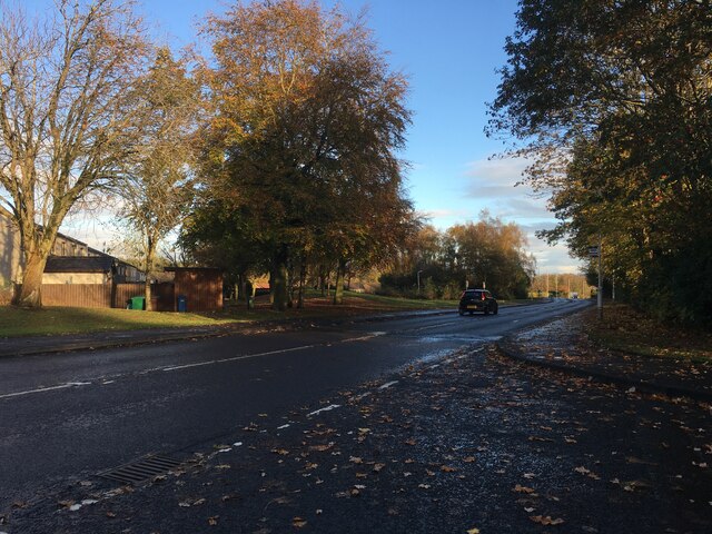
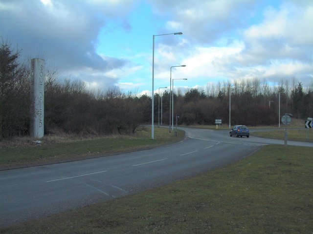
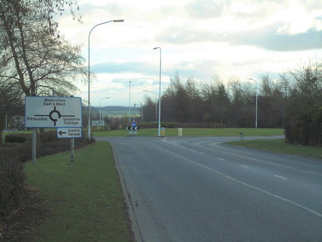
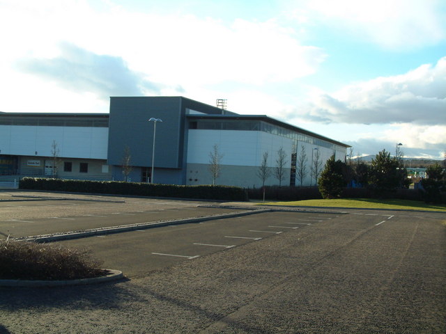
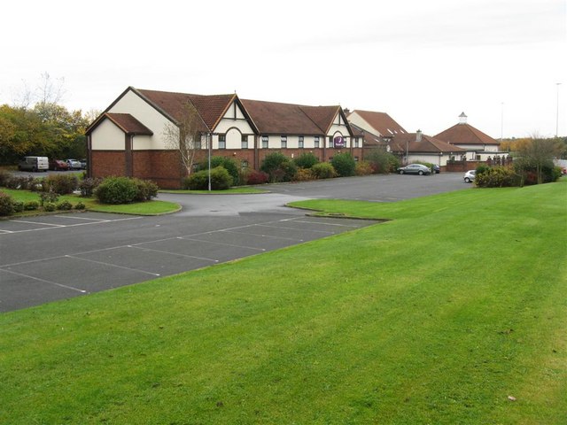
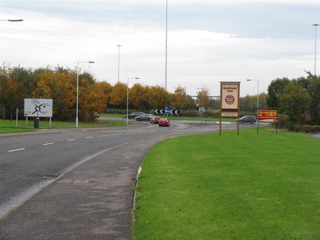
Pitteuchar Images

Images are sourced within 2km of 56.183179/-3.164643 or Grid Reference NT2799. Thanks to Geograph Open Source API. All images are credited.

Beaufort Drive, Glenrothes
A92 Trunk road A92 just south of the roundabout at Balgonie
A92
Trunk road A92 just south of the roundabout at Balgonie
A92 trunk road Looking south towards Kirkcaldy from the bridge north of Thornton
A92 trunk road
Looking south towards Kirkcaldy from the bridge north of Thornton
New towns are not all new A "Marriage Lintel" with the initials of husband and wife and 1741 date, presumably that of their marriage. This type of lintel was fairly common in Fife (though not always as ornate as this) and this one, preserved in Stenton area,  presumably came from one of the old houses demolished to make way for constructing Glenrothes new town.
New towns are not all new
A "Marriage Lintel" with the initials of husband and wife and 1741 date, presumably that of their marriage. This type of lintel was fairly common in Fife (though not always as ornate as this) and this one, preserved in Stenton area, presumably came from one of the old houses demolished to make way for constructing Glenrothes new town.
Rural looking Industrial Estate Factory on the southern edge of Southfield Industrial Estate, looking west
Rural looking Industrial Estate
Factory on the southern edge of Southfield Industrial Estate, looking west
Southfield roundabout Seen from the entrance road to Southfield Industrial Estate, the elevated roundabout over the B921
Southfield roundabout
Seen from the entrance road to Southfield Industrial Estate, the elevated roundabout over the B921
Glamis roundabout On the south west edge of the Pitteuchar area of Glenrothes
Glamis roundabout
On the south west edge of the Pitteuchar area of Glenrothes
Houses in Stenton Varied styles of houses in the Stenton area of Glenrothes
Houses in Stenton
Varied styles of houses in the Stenton area of Glenrothes
Amazon.co.uk The Glenrothes warehouse and distribution centre for Amazon
Amazon.co.uk
The Glenrothes warehouse and distribution centre for Amazon
Stenton Pond Small body of water right on the southern outskirts of Glenrothes new town; popular with waterfowl, despite all the dog-walkers.
Stenton Pond
Small body of water right on the southern outskirts of Glenrothes new town; popular with waterfowl, despite all the dog-walkers.
Beside Lochty Burn A woodland path running alongside the Lochty Burn just south of Glenrothes new town.
Beside Lochty Burn
A woodland path running alongside the Lochty Burn just south of Glenrothes new town.
Thornton, Fife. The road toward and through the old mining village.
Thornton, Fife.
The road toward and through the old mining village.
View from a lay-by on the A92 Looking across Glenrothes towards West and East Lomond.
View from a lay-by on the A92
Looking across Glenrothes towards West and East Lomond.
Stubble field at Mid Strathore
Looking NW from Strathore Road Towards the Lomond Hills.
Looking NW from Strathore Road
Towards the Lomond Hills.
Premier Inn, Bankhead Gate
Bankhead Roundabout, Glenrothes A major junction on the A92 at Glenrothes.
Bankhead Roundabout, Glenrothes
A major junction on the A92 at Glenrothes.
Tykesburn at Coaltown of Balgonie Farmland on the south-eastern edge of Glenrothes.
Tykesburn at Coaltown of Balgonie
Farmland on the south-eastern edge of Glenrothes.
Show me another place!

Pitteuchar is located at Grid Ref: NT2799 (Lat: 56.183179, Lng: -3.164643)

Unitary Authority: Fife

Police Authority: Fife

What 3 Words

///faces.navy.budget. Near Glenrothes, Fife

Nearby Locations

Pitteuchar

Related Wikis

Glenrothes F.C.

Glenrothes Football Club is a Scottish football club based in the new town of Glenrothes, Fife. The club play home games at Warout Stadium, and currently...

Auchmuty High School

Auchmuty School is a state secondary school in the town of Glenrothes in the Fife council area of Scotland. Opened in 1957, it was the first school for...

Kingdom Shopping Centre

The Kingdom Centre is the main shopping destination in Glenrothes, located in the town centre. It is the largest indoor shopping centre in Fife and is...

Glenrothes (UK Parliament constituency)

Glenrothes () is a constituency in Scotland represented in the House of Commons of the UK Parliament since 2005. The seat has been held since the 2015...

Nearby Amenities

Located within 500m of 56.183179,-3.164643
Mini Roundabout
Lat/Long: 56.1836748/-3.1575808
Crossing
Crossing: traffic_signals
Lat/Long: 56.1835732/-3.168544
Parking
Lat/Long: 56.1850602/-3.1639885
Parking
Lat/Long: 56.1838564/-3.1636827
Parking
Lat/Long: 56.1838239/-3.1647251
Parking
Lat/Long: 56.1850481/-3.1668198
Parking
Parking: street_side
Lat/Long: 56.1866274/-3.1659768
Traffic Calming: cushion
Lat/Long: 56.1840504/-3.1603666
Parking
Lat/Long: 56.1851973/-3.1623258
Parking
Lat/Long: 56.1836065/-3.1613351
Parking
Lat/Long: 56.1845339/-3.162574
Parking
Parking: street_side
Lat/Long: 56.1855385/-3.1651392
Parking
Lat/Long: 56.1849416/-3.159382
Parking
Lat/Long: 56.1835804/-3.1623131
Parking
Lat/Long: 56.1862321/-3.1625964
Parking
Lat/Long: 56.185006/-3.1678362
Parking
Lat/Long: 56.1862713/-3.1611281
Parking
Lat/Long: 56.1847404/-3.160291
Parking
Parking: street_side
Lat/Long: 56.1854848/-3.1672932
Parking
Lat/Long: 56.1838376/-3.158611
Parking
Lat/Long: 56.1846174/-3.1616232
Parking
Parking: street_side
Lat/Long: 56.1857313/-3.1641421
Parking
Parking: street_side
Lat/Long: 56.1864425/-3.168588
Parking
Lat/Long: 56.1854293/-3.1609087
Parking
Parking: street_side
Lat/Long: 56.185407/-3.1683336
Parking
Lat/Long: 56.1836592/-3.1595362
Pitteuchar
Place: suburb
Lat/Long: 56.1849237/-3.1614157
Parking
Parking: street_side
Lat/Long: 56.1867786/-3.1601636
Parking
Lat/Long: 56.186271/-3.1587758
Parking
Lat/Long: 56.1849037/-3.1574202
Parking
Lat/Long: 56.1859493/-3.1584265
Parking
Lat/Long: 56.1855379/-3.1589648
Parking
Lat/Long: 56.1842198/-3.1577172
Parking
Parking: street_side
Lat/Long: 56.1788175/-3.1630002
Turning Circle
Lat/Long: 56.1815345/-3.1601356
Turning Circle
Lat/Long: 56.1817316/-3.1592452
Turning Circle
Lat/Long: 56.1819088/-3.1573647
Parking
Access: private
Parking: lane
Lat/Long: 56.1817409/-3.1659891
Parking
Access: private
Parking: lane
Lat/Long: 56.1824084/-3.1672835
Disused Shop: yes
Source: OS OpenData StreetView
Lat/Long: 56.1826594/-3.1627795
Crossing
Crossing: unmarked
Crossing Island: no
Kerb: lowered
Tactile Paving: no
Lat/Long: 56.1817286/-3.1624187
Post Box
Collection Times: Mo-Fr 17:00; Sa 12:00
Operator: Royal Mail
Ref: KY7 4
Source: survey
Lat/Long: 56.1843961/-3.1584472
Post Box
Collection Times: Mo-Fr 17:00; Sa 12:00
Operator: Royal Mail
Post Box Type: pillar
Ref: KY7 38
Royal Cypher: scottish_crown
Source: survey
Lat/Long: 56.18261/-3.1628179
Atm
Check Date: 2022-11-04
Lat/Long: 56.182426/-3.162604
Fast Food
Pearl
Cuisine: chinese
Lat/Long: 56.1823899/-3.1625464
Spar
Addr City: Glenrothes
Addr Street: Glamis Avenue
Brand: Spar
Brand Wikidata: Q610492
Brand Wikipedia: en:Spar (retailer)
Opening Hours: Mo-Sa 07:00-22:00; Su 08:00-22:00
Shop: convenience
Lat/Long: 56.1824861/-3.1625608
Pharmacy
Dears Pharmacy
Healthcare: pharmacy
Opening Hours: Mo-Fr 09:00-18:00; Sa 09:00-17:00
Wheelchair: yes
Lat/Long: 56.1827253/-3.1626184
Alex Mitchell Butchers
Contact Facebook: 100063502423032
Opening Hours: Mo-Fr 08:00-16:30; Sa 08:00-15:00
Shop: butcher
Lat/Long: 56.1828001/-3.1627913
Fast Food
Elio's
Cuisine: fish_and_chips
Lat/Long: 56.1828669/-3.1627937
Premier
Brand: Premier
Brand Wikidata: Q7240340
Brand Wikipedia: en:Premier Stores
Shop: convenience
Wheelchair: yes
Lat/Long: 56.1821945/-3.1623404
Inch by Inch
Shop: beauty
Lat/Long: 56.1821384/-3.1624436
Salon G2G
Shop: hairdresser
Lat/Long: 56.1820035/-3.1624436
Dentist
Dental Care
Healthcare: dentist
Opening Hours: Mo-Fr 08:30-17:30
Lat/Long: 56.1819407/-3.1624196
Hago Computers
Shop: computer
Lat/Long: 56.1822627/-3.1618627
Fast Food
Fatima
Cuisine: indian
Lat/Long: 56.1822386/-3.1621436
Bus Stop
Bench: yes
Bin: yes
Shelter: yes
Tactile Paving: no
Lat/Long: 56.1863698/-3.1599442
Bus Stop
Lat/Long: 56.1854914/-3.1593355
Bus Stop
Lat/Long: 56.1846681/-3.1581888
Parking
Lat/Long: 56.1843514/-3.1682282
Crossing
Crossing: zebra
Lat/Long: 56.1856241/-3.1593235
Parking
Parking: street_side
Lat/Long: 56.1865756/-3.1596615
Kerb: raised
Lat/Long: 56.1871103/-3.1608071
Crossing
Crossing: marked
Crossing Island: no
Kerb: flush
Tactile Paving: yes
Lat/Long: 56.1869649/-3.1606619
Recycling
Glamis centre recycling point
Lat/Long: 56.1820934/-3.1635835
Crossing
Crossing: unmarked
Crossing Island: no
Kerb: lowered
Tactile Paving: no
Lat/Long: 56.1862461/-3.1658804
Bus Stop
Bus: yes
Naptan AtcoCode: 6500K0788
Naptan NaptanCode: 34328345
Public Transport: platform
Lat/Long: 56.1833221/-3.1662823
Bus Stop
Bus: yes
Naptan AtcoCode: 6500K0789
Naptan NaptanCode: 34328327
Public Transport: platform
Lat/Long: 56.1831692/-3.1664779
Bus Stop
Bus: yes
Public Transport: platform
Lat/Long: 56.1830705/-3.1635076
Bus Stop
Bus: yes
Naptan AtcoCode: 650GK0786;6500K0786
Naptan NaptanCode: 34328342
Public Transport: platform
Lat/Long: 56.1832999/-3.1622757
Bus Stop
Bus: yes
Naptan AtcoCode: 6500K0643
Naptan NaptanCode: 34328349
Public Transport: platform
Lat/Long: 56.1834653/-3.1588054
Bus Stop
Bus: yes
Naptan AtcoCode: 6500K0642
Naptan NaptanCode: 34328343
Public Transport: platform
Lat/Long: 56.1834122/-3.1582024
Crossing
Crossing: zebra
Crossing Island: no
Tactile Paving: yes
Lat/Long: 56.1832395/-3.156952
Parking
Access: private
Parking: lane
Lat/Long: 56.1826167/-3.1663319
Parking
Access: private
Parking: lane
Lat/Long: 56.1816599/-3.1669932
Parking
Lat/Long: 56.1832053/-3.1595017
Crossing
Crossing: zebra
Lat/Long: 56.1833434/-3.1599326
Parking
Lat/Long: 56.1813345/-3.163424
The Henge
Artist Name: David Harding
Artwork Type: installation
Tourism: artwork
Lat/Long: 56.1852849/-3.1597987
Parking
Access: private
Parking: lane
Lat/Long: 56.1825648/-3.1650443
Parking
Lat/Long: 56.1807859/-3.1631012
Brick Gable Pattern
Artist Name: David Harding
Artwork Type: installation
Tourism: artwork
Lat/Long: 56.18583/-3.1601635
Brick Gable Pattern
Artist Name: David Harding
Artwork Type: installation
Tourism: artwork
Lat/Long: 56.185722/-3.1616302
Brick Gable Pattern
Artist Name: David Harding
Artwork Type: installation
Tourism: artwork
Lat/Long: 56.1850111/-3.1615648
Brick Gable Pattern
Artist Name: David Harding
Artwork Type: installation
Tourism: artwork
Lat/Long: 56.1850326/-3.1610434
Brick Gable Pattern
Artist Name: David Harding
Artwork Type: installation
Tourism: artwork
Lat/Long: 56.1842671/-3.1590843
Brick Gable Pattern
Artist Name: David Harding
Artwork Type: installation
Tourism: artwork
Lat/Long: 56.1841216/-3.1610112
Parking
Parking: street_side
Lat/Long: 56.1789022/-3.1633957
Generator Method: photovoltaic
Generator Output Electricity: yes
Generator Source: solar
Generator Type: solar_photovoltaic_panel
Power: generator
Lat/Long: 56.1864608/-3.1666774
Parking
Lat/Long: 56.1798232/-3.1594884
Parking
Parking: street_side
Lat/Long: 56.186549/-3.1670489
Parking
Lat/Long: 56.1823743/-3.1574438
Mushrooms
Artist Name: David Harding and Stanley Bonnar
Artwork Type: installation
Tourism: artwork
Year Of Construction: 1974
Lat/Long: 56.1838738/-3.1678468
Communication Mobile Phone: yes
Man Made: mast
Tower Construction: pole
Tower Type: communication
Lat/Long: 56.1853798/-3.1586455
Communication Mobile Phone: yes
Man Made: mast
Tower Construction: pole
Tower Type: communication
Lat/Long: 56.1826264/-3.1720122
Addr Housenumber: 40
Addr Street: Inveraray Avenue
Lat/Long: 56.1865412/-3.1638251
Addr Housenumber: 109
Addr Street: Inveraray Avenue
Lat/Long: 56.1866883/-3.1675247
Addr Housenumber: 156
Addr Street: Inveraray Avenue
Lat/Long: 56.1856012/-3.1687003
Addr Housenumber: 136
Addr Street: Inveraray Avenue
Lat/Long: 56.1865617/-3.1691652
Addr Housenumber: 115
Addr Street: Inveraray Avenue
Lat/Long: 56.1866333/-3.1681526
Addr Housenumber: 35
Addr Street: Inveraray Avenue
Lat/Long: 56.1865173/-3.1644071
Addr Housenumber: 82
Addr Street: Inveraray Avenue
Lat/Long: 56.1854664/-3.1656432
Addr Housenumber: 181
Addr Street: Inveraray Avenue
Lat/Long: 56.1853574/-3.1678875
Addr Housenumber: 24
Addr Street: Inveraray Avenue
Lat/Long: 56.1864281/-3.1656951
Addr Housenumber: 147
Addr Street: Inveraray Avenue
Lat/Long: 56.1862232/-3.1691629
Addr Housenumber: 113
Addr Street: Inveraray Avenue
Lat/Long: 56.1866416/-3.1679207
Addr Housenumber: 59
Addr Street: Inveraray Avenue
Lat/Long: 56.1854031/-3.1648179
Addr Housenumber: 32
Addr Street: Inveraray Avenue
Lat/Long: 56.1864823/-3.1647888
Addr Housenumber: 148
Addr Street: Inveraray Avenue
Lat/Long: 56.1862824/-3.169181
Addr Housenumber: 33
Addr Street: Inveraray Avenue
Lat/Long: 56.1864933/-3.1646387
Addr Housenumber: 111
Addr Street: Inveraray Avenue
Lat/Long: 56.186679/-3.1677161
Addr Housenumber: 189
Addr Street: Inveraray Avenue
Lat/Long: 56.1854316/-3.167051
Addr Housenumber: 58
Addr Street: Inveraray Avenue
Lat/Long: 56.1854198/-3.1646949
Addr Housenumber: 122
Addr Street: Inveraray Avenue
Lat/Long: 56.1861443/-3.1676681
Addr Housenumber: 182
Addr Street: Inveraray Avenue
Lat/Long: 56.185352/-3.1677662
Addr Housenumber: 183
Addr Street: Inveraray Avenue
Lat/Long: 56.1853559/-3.1676562
Addr Housenumber: 8
Addr Street: Inveraray Avenue
Lat/Long: 56.1867246/-3.1666726
Addr Housenumber: 27
Addr Street: Inveraray Avenue
Lat/Long: 56.1864586/-3.1653073
Addr Housenumber: 149
Addr Street: Inveraray Avenue
Lat/Long: 56.1863486/-3.169219
Addr Housenumber: 52
Addr Street: Inveraray Avenue
Lat/Long: 56.1854293/-3.1639719
Addr Housenumber: 38
Addr Street: Inveraray Avenue
Lat/Long: 56.1865521/-3.1640289
Addr Housenumber: 116
Addr Street: Inveraray Avenue
Lat/Long: 56.1866271/-3.1682472
Addr Housenumber: 160
Addr Street: Inveraray Avenue
Lat/Long: 56.1853771/-3.1686576
Addr Housenumber: 158
Addr Street: Inveraray Avenue
Lat/Long: 56.1854733/-3.1686769
Addr Housenumber: 26
Addr Street: Inveraray Avenue
Lat/Long: 56.1864473/-3.1654439
Addr Housenumber: 121
Addr Street: Inveraray Avenue
Lat/Long: 56.1861969/-3.1676722
Addr Housenumber: 145
Addr Street: Inveraray Avenue
Lat/Long: 56.1861139/-3.1691403
Addr Housenumber: 184
Addr Street: Inveraray Avenue
Lat/Long: 56.1853612/-3.1675485
Addr Housenumber: 16
Addr Street: Inveraray Avenue
Lat/Long: 56.1867655/-3.1657541
Addr Housenumber: 78
Addr Street: Inveraray Avenue
Lat/Long: 56.1853969/-3.1650197
Addr Housenumber: 163
Addr Street: Inveraray Avenue
Lat/Long: 56.185309/-3.1684651
Addr Housenumber: 11
Addr Street: Inveraray Avenue
Lat/Long: 56.1867426/-3.1663711
Addr Housenumber: 132
Addr Street: Inveraray Avenue
Lat/Long: 56.1865838/-3.1687501
Addr Housenumber: 110
Addr Street: Inveraray Avenue
Lat/Long: 56.1866805/-3.1676265
Addr Housenumber: 85
Addr Street: Inveraray Avenue
Lat/Long: 56.1854302/-3.1659514
Addr Housenumber: 37
Addr Street: Inveraray Avenue
Lat/Long: 56.1865356/-3.1641735
Addr Housenumber: 84
Addr Street: Inveraray Avenue
Lat/Long: 56.1854517/-3.1658484
Addr Housenumber: 134
Addr Street: Inveraray Avenue
Lat/Long: 56.1865736/-3.1689564
Addr Housenumber: 166
Addr Street: Inveraray Avenue
Lat/Long: 56.1853364/-3.1681613
Addr Housenumber: 186
Addr Street: Inveraray Avenue
Lat/Long: 56.185393/-3.167365
Addr Housenumber: 55
Addr Street: Inveraray Avenue
Lat/Long: 56.1854356/-3.1643872
Addr Housenumber: 13
Addr Street: Inveraray Avenue
Lat/Long: 56.1867394/-3.1660736
Addr Housenumber: 79
Addr Street: Inveraray Avenue
Lat/Long: 56.185331/-3.1650064
Addr Housenumber: 159
Addr Street: Inveraray Avenue
Lat/Long: 56.1854143/-3.1686619
Addr Housenumber: 14
Addr Street: Inveraray Avenue
Lat/Long: 56.1867413/-3.1659701
Addr Housenumber: 157
Addr Street: Inveraray Avenue
Lat/Long: 56.1855192/-3.1686899
Addr Housenumber: 185
Addr Street: Inveraray Avenue
Lat/Long: 56.185382/-3.167457
Addr Housenumber: 130
Addr Street: Inveraray Avenue
Lat/Long: 56.186602/-3.168537
Addr Housenumber: 165
Addr Street: Inveraray Avenue
Lat/Long: 56.1853297/-3.1682428
Addr Housenumber: 77
Addr Street: Inveraray Avenue
Lat/Long: 56.1854619/-3.1650461
Addr Housenumber: 28
Addr Street: Inveraray Avenue
Lat/Long: 56.1864745/-3.1651706
Addr Housenumber: 135
Addr Street: Inveraray Avenue
Lat/Long: 56.1865687/-3.1690666
Addr Housenumber: 162
Addr Street: Inveraray Avenue
Lat/Long: 56.1852503/-3.1686044
Addr Housenumber: 7
Addr Street: Inveraray Avenue
Lat/Long: 56.1867098/-3.1667843
Addr Housenumber: 131
Addr Street: Inveraray Avenue
Lat/Long: 56.1865946/-3.1686396
Addr Housenumber: 118
Addr Street: Inveraray Avenue
Lat/Long: 56.1863762/-3.1677088
Addr Housenumber: 80
Addr Street: Inveraray Avenue
Lat/Long: 56.1854709/-3.1654083
Addr Housenumber: 36
Addr Street: Inveraray Avenue
Lat/Long: 56.1865266/-3.1643
Addr Housenumber: 155
Addr Street: Inveraray Avenue
Lat/Long: 56.1856704/-3.1687138
Addr Housenumber: 188
Addr Street: Inveraray Avenue
Lat/Long: 56.1854205/-3.1671632
Addr Housenumber: 51
Addr Street: Inveraray Avenue
Lat/Long: 56.1854237/-3.1638799
Addr Housenumber: 25
Addr Street: Inveraray Avenue
Lat/Long: 56.1864366/-3.1655632
Addr Housenumber: 114
Addr Street: Inveraray Avenue
Lat/Long: 56.1866281/-3.1680336
Addr Housenumber: 161
Addr Street: Inveraray Avenue
Lat/Long: 56.1853147/-3.1686299
Addr Housenumber: 187
Addr Street: Inveraray Avenue
Lat/Long: 56.1854107/-3.1672875
Addr Housenumber: 12
Addr Street: Inveraray Avenue
Lat/Long: 56.1867485/-3.1662501
Addr Housenumber: 146
Addr Street: Inveraray Avenue
Lat/Long: 56.1861633/-3.1691648
Addr Housenumber: 112
Addr Street: Inveraray Avenue
Lat/Long: 56.1866643/-3.1678127
Addr Housenumber: 164
Addr Street: Inveraray Avenue
Lat/Long: 56.1853216/-3.1683493
Addr Housenumber: 154
Addr Street: Inveraray Avenue
Lat/Long: 56.1857394/-3.1687329
Addr Housenumber: 29
Addr Street: Inveraray Avenue
Lat/Long: 56.1864877/-3.1651017
Addr Housenumber: 190
Addr Street: Inveraray Avenue
Lat/Long: 56.1854442/-3.1669512
Addr Housenumber: 9
Addr Street: Inveraray Avenue
Lat/Long: 56.1867307/-3.1665857
Addr Housenumber: 56
Addr Street: Inveraray Avenue
Lat/Long: 56.1854307/-3.164484
Addr Housenumber: 144
Addr Street: Inveraray Avenue
Lat/Long: 56.1860631/-3.1691221
Addr Housenumber: 120
Addr Street: Inveraray Avenue
Lat/Long: 56.186251/-3.1676851
Addr Housenumber: 153
Addr Street: Inveraray Avenue
Lat/Long: 56.1857989/-3.168744
Addr Housenumber: 31
Addr Street: Inveraray Avenue
Lat/Long: 56.1864642/-3.1649036
Addr Housenumber: 54
Addr Street: Inveraray Avenue
Lat/Long: 56.1854158/-3.1642395
Addr Housenumber: 53
Addr Street: Inveraray Avenue
Lat/Long: 56.1854192/-3.1640814
Addr Housenumber: 39
Addr Street: Inveraray Avenue
Lat/Long: 56.1865632/-3.1639312
Addr Housenumber: 81
Addr Street: Inveraray Avenue
Lat/Long: 56.1854729/-3.1655488
Addr Housenumber: 119
Addr Street: Inveraray Avenue
Lat/Long: 56.1863109/-3.1676994
Addr Housenumber: 15
Addr Street: Inveraray Avenue
Lat/Long: 56.1867564/-3.1658596
Addr Housenumber: 108
Addr Street: Inveraray Avenue
Lat/Long: 56.1866929/-3.1674208
Addr Housenumber: 180
Addr Street: Inveraray Avenue
Lat/Long: 56.1853524/-3.167993
Addr Housenumber: 34
Addr Street: Inveraray Avenue
Lat/Long: 56.1865038/-3.1645161
Addr Housenumber: 57
Addr Street: Inveraray Avenue
Lat/Long: 56.185428/-3.1645804
Addr Housenumber: 10
Addr Street: Inveraray Avenue
Lat/Long: 56.1867364/-3.1664901
Addr Housenumber: 30
Addr Street: Inveraray Avenue
Lat/Long: 56.1864734/-3.1650294
Addr Housenumber: 83
Addr Street: Inveraray Avenue
Lat/Long: 56.1854576/-3.1657392
Addr Housenumber: 52
Addr Street: Craigievar Drive
Lat/Long: 56.1869033/-3.1613884
Addr Housenumber: 49
Addr Street: Craigievar Drive
Lat/Long: 56.1868061/-3.161724
Addr Housenumber: 54
Addr Street: Craigievar Drive
Lat/Long: 56.1869786/-3.1611657
Addr Housenumber: 39
Addr Street: Craigievar Drive
Lat/Long: 56.1867519/-3.1619292
Addr Housenumber: 51
Addr Street: Craigievar Drive
Lat/Long: 56.186872/-3.1614861
Addr Housenumber: 50
Addr Street: Craigievar Drive
Lat/Long: 56.1868378/-3.1616101
Addr Housenumber: 56
Addr Street: Craigievar Drive
Lat/Long: 56.1870317/-3.1609583
Addr Housenumber: 53
Addr Street: Craigievar Drive
Lat/Long: 56.1869411/-3.1612807
Addr Housenumber: 6
Addr Street: Skibo Avenue
Lat/Long: 56.1870051/-3.1603932
Addr Housenumber: 55
Addr Street: Craigievar Drive
Lat/Long: 56.1869957/-3.1610593
Addr Housenumber: 40
Addr Street: Craigievar Drive
Lat/Long: 56.1867779/-3.1618195
Addr Housenumber: 26
Addr Street: Fyvie Green
Lat/Long: 56.178885/-3.1656592
Addr Housenumber: 39
Addr Street: Fyvie Green
Lat/Long: 56.179001/-3.1640124
Addr Housenumber: 1
Addr Street: Hatton Green
Entrance: yes
Lat/Long: 56.1789885/-3.1635058
Addr Housenumber: 28
Addr Street: Fyvie Green
Lat/Long: 56.178902/-3.1654567
Addr Housenumber: 4
Addr Street: Hatton Green
Entrance: yes
Lat/Long: 56.1789745/-3.1632131
Addr Housenumber: 11
Addr Street: Hatton Green
Entrance: yes
Lat/Long: 56.178988/-3.1624098
Addr Housenumber: 45
Addr Street: Fyvie Green
Entrance: yes
Lat/Long: 56.1788126/-3.1637664
Addr Housenumber: 13
Addr Street: Hatton Green
Lat/Long: 56.1790864/-3.1621992
Addr Housenumber: 43
Addr Street: Fyvie Green
Entrance: yes
Lat/Long: 56.1787355/-3.1645543
Addr Housenumber: 25
Addr Street: Fyvie Green
Lat/Long: 56.1788731/-3.1658168
Addr Housenumber: 31
Addr Street: Fyvie Green
Lat/Long: 56.1789169/-3.1651546
Addr Housenumber: 47
Addr Street: Fyvie Green
Entrance: yes
Lat/Long: 56.1788084/-3.1640199
Addr Housenumber: 7
Addr Street: Hatton Green
Entrance: yes
Lat/Long: 56.1789993/-3.162867
Addr Housenumber: 23
Addr Street: Fyvie Green
Lat/Long: 56.1787229/-3.1656388
Addr Housenumber: 30
Addr Street: Fyvie Green
Lat/Long: 56.1789181/-3.1652488
Addr Housenumber: 2
Addr Street: Hatton Green
Entrance: yes
Lat/Long: 56.1790069/-3.163413
Addr Housenumber: 6
Addr Street: Hatton Green
Entrance: yes
Lat/Long: 56.1789976/-3.1629666
Addr Housenumber: 12
Addr Street: Hatton Green
Lat/Long: 56.1791583/-3.1622084
Addr Housenumber: 33
Addr Street: Fyvie Green
Entrance: yes
Lat/Long: 56.1788124/-3.164915
Addr Housenumber: 44
Addr Street: Fyvie Green
Entrance: yes
Lat/Long: 56.178778/-3.1644523
Addr Housenumber: 38
Addr Street: Fyvie Green
Lat/Long: 56.1789943/-3.1641278
Addr Housenumber: 10
Addr Street: Hatton Green
Entrance: yes
Lat/Long: 56.1790051/-3.1625285
Addr Housenumber: 27
Addr Street: Fyvie Green
Lat/Long: 56.1788945/-3.1655632
Addr Housenumber: 42
Addr Street: Fyvie Green
Entrance: yes
Lat/Long: 56.1786958/-3.1646529
Addr Housenumber: 35
Addr Street: Fyvie Green
Lat/Long: 56.1789667/-3.164669
Addr Housenumber: 5
Addr Street: Hatton Green
Entrance: yes
Lat/Long: 56.1789399/-3.1630963
Addr Housenumber: 32
Addr Street: Fyvie Green
Entrance: yes
Lat/Long: 56.17881/-3.1650382
Addr Housenumber: 3
Addr Street: Hatton Green
Entrance: yes
Lat/Long: 56.1790072/-3.1633404
Addr Housenumber: 24
Addr Street: Fyvie Green
Lat/Long: 56.1788037/-3.1658271
Addr Housenumber: 36
Addr Street: Fyvie Green
Lat/Long: 56.1789806/-3.1643477
Addr Housenumber: 34
Addr Street: Fyvie Green
Lat/Long: 56.1789085/-3.1646731
Addr Housenumber: 8
Addr Street: Hatton Green
Entrance: yes
Lat/Long: 56.1790013/-3.1627527
Addr Housenumber: 14
Addr Street: Hatton Green
Lat/Long: 56.179022/-3.1621915
Addr Housenumber: 37
Addr Street: Fyvie Green
Lat/Long: 56.1789802/-3.1642303
Addr Housenumber: 40
Addr Street: Fyvie Green
Lat/Long: 56.179005/-3.1639247
Addr Housenumber: 15
Addr Street: Hatton Green
Lat/Long: 56.1789526/-3.1621967
Addr Housenumber: 46
Addr Street: Fyvie Green
Entrance: yes
Lat/Long: 56.1788108/-3.1638771
Addr Housenumber: 29
Addr Street: Fyvie Green
Lat/Long: 56.1789089/-3.1653778
Addr Housenumber: 41
Addr Street: Fyvie Green
Entrance: yes
Lat/Long: 56.1787196/-3.1647466
Addr Housenumber: 9
Addr Street: Hatton Green
Entrance: yes
Lat/Long: 56.1790034/-3.1626298
Defibrillator
Emergency: defibrillator
Lat/Long: 56.1820175/-3.1627689
Generator Method: photovoltaic
Generator Output Electricity: yes
Generator Source: solar
Generator Type: solar_photovoltaic_panel
Power: generator
Lat/Long: 56.1818356/-3.1569953
Generator Method: photovoltaic
Generator Output Electricity: yes
Generator Source: solar
Generator Type: solar_photovoltaic_panel
Power: generator
Lat/Long: 56.1810862/-3.1583096
Generator Method: photovoltaic
Generator Output Electricity: yes
Generator Source: solar
Generator Type: solar_photovoltaic_panel
Power: generator
Lat/Long: 56.1819282/-3.1569417
The data included in this document is from www.openstreetmap.org. The data is made available under ODbL.

Have you been to Pitteuchar?

Leave your review of Pitteuchar below (or comments, questions and feedback).