Adabroc

Settlement in Ross-shire

Scotland

Adabroc

Port of Ness
Port of Ness Credit: Catherine Morgan

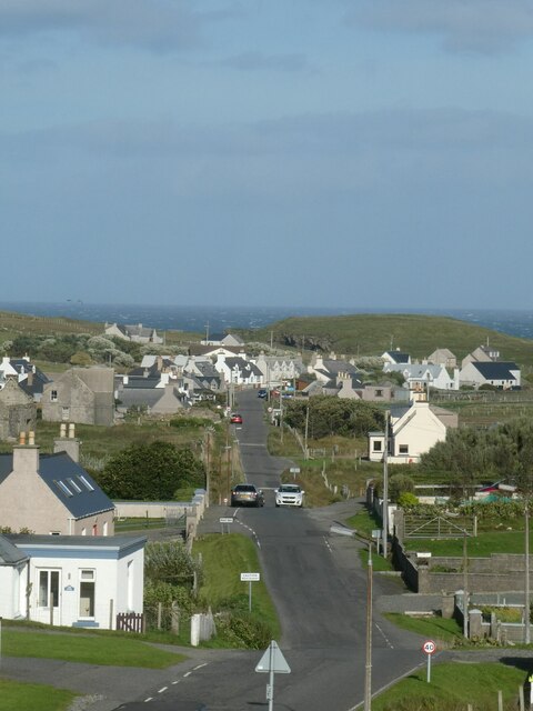
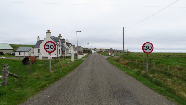
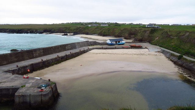
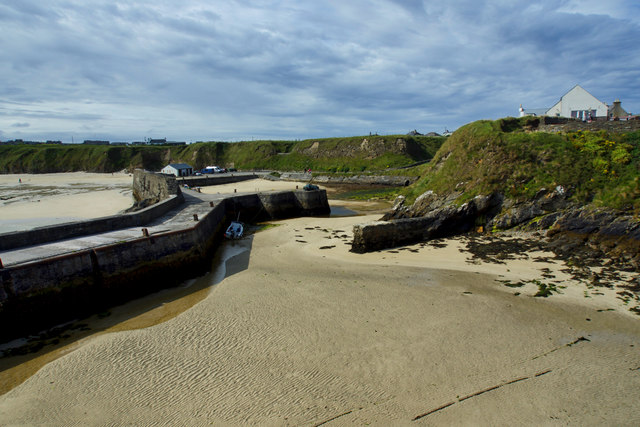
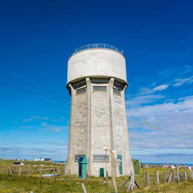
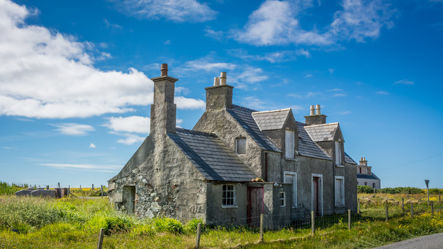
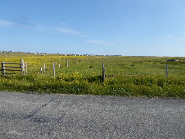
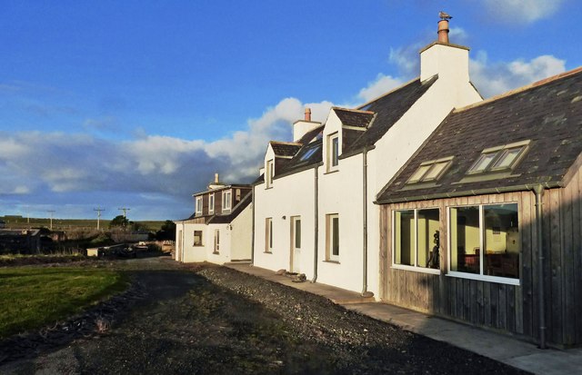
Adabroc is a small village located in the county of Ross-shire, Scotland. Situated on the picturesque Isle of Lewis, Adabroc is surrounded by stunning coastal landscapes and breathtaking views of the Atlantic Ocean. With a population of approximately 150 residents, it is a close-knit community that thrives on the beauty and tranquility of its surroundings.

The village is known for its rich history, dating back to ancient times. The area is scattered with archaeological sites and ruins, including standing stones and chambered cairns that offer glimpses into its past. Adabroc is also renowned for its strong Gaelic heritage, with many residents still speaking the language.

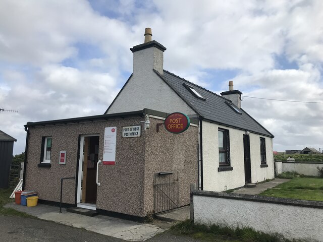
Although small in size, Adabroc offers a range of amenities to its residents and visitors. The village has a community center, a primary school, and a local shop that caters to everyday needs. For outdoor enthusiasts, the surrounding area provides ample opportunities for activities such as hiking, fishing, and bird-watching.

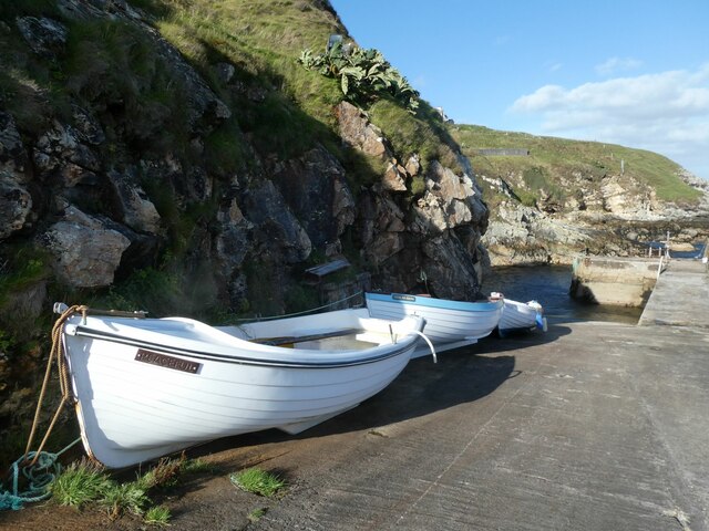
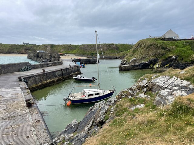
Adabroc's proximity to the coast makes it an ideal spot for exploring the nearby beaches and enjoying stunning sunsets. The village is also a popular destination for those interested in wildlife, as it is home to a variety of seabirds and marine life.

Overall, Adabroc offers a peaceful and idyllic retreat for those seeking a slower pace of life and a connection with nature. Its rich history, stunning landscapes, and strong sense of community make it a truly special place in Ross-shire.

If you have any feedback on the listing, please let us know in the comments section below.

Adabroc Images

Images are sourced within 2km of 58.476059/-6.2383939 or Grid Reference NB5362. Thanks to Geograph Open Source API. All images are credited.

Port of Ness
Port of Ness
Skigersta harbour
Skigersta harbour
Port of Ness Post Office
Port Nis In around 1999, the Ordnance Survey replaced English-language placenames in the Western Isles with Gaelic-language names. Some of the more prominent features (e.g. Isle of Barra; Stornoway; Sound of Harris) do have bilingual labels but, on the whole, villages, lochs, peaks etc. generally have the Gaelic names on the modern-day mapping.

Because the English versions have a tendency not to appear on the maps any more, I have decided to use them in my image titles and, as such, a translation will be readily available from the Gaelic labelling on the map. 

(NB I have not translated some of the more minor loch and river names, where I have not easily found the English version.)
Port Nis
In around 1999, the Ordnance Survey replaced English-language placenames in the Western Isles with Gaelic-language names. Some of the more prominent features (e.g. Isle of Barra; Stornoway; Sound of Harris) do have bilingual labels but, on the whole, villages, lochs, peaks etc. generally have the Gaelic names on the modern-day mapping. Because the English versions have a tendency not to appear on the maps any more, I have decided to use them in my image titles and, as such, a translation will be readily available from the Gaelic labelling on the map. (NB I have not translated some of the more minor loch and river names, where I have not easily found the English version.)
A857 entering Port of Ness
Harbour at Port of Ness
Old Rover 2000 (1) The remains of a once-beautiful car crumble away outside a derelict garage.  This series of Rovers was produced at Solihull from 1963 to 1977. <span class="nowrap"><a title="https://en.wikipedia.org/wiki/Rover_P6" rel="nofollow ugc noopener" href="https://en.wikipedia.org/wiki/Rover_P6">Link</a><img style="margin-left:2px;" alt="External link" title="External link - shift click to open in new window" src="https://s1.geograph.org.uk/img/external.png" width="10" height="10"/></span> .  For the front view see <a href="https://www.geograph.org.uk/photo/4705342">NB5363 : Old Rover 2000 (2)</a>.
Old Rover 2000 (1)
The remains of a once-beautiful car crumble away outside a derelict garage. This series of Rovers was produced at Solihull from 1963 to 1977. LinkExternal link . For the front view see NB5363 : Old Rover 2000 (2).
Old Rover 2000 (2) Once a fine car, rusting away outside a derelict garage in Port.  For the rear view see <a href="https://www.geograph.org.uk/photo/4705333">NB5363 : Old Rover 2000 (1)</a>.
Old Rover 2000 (2)
Once a fine car, rusting away outside a derelict garage in Port. For the rear view see NB5363 : Old Rover 2000 (1).
Abandoned car, Airigh na Gaoithe, Isle of Lewis The adjacent peat cutters' track provides easy access for vehicle dumping.

I think it's a Mark 1 Vauxhall Astra.  Only 44k on the clock, so if anyone wants a project.....
Abandoned car, Airigh na Gaoithe, Isle of Lewis
The adjacent peat cutters' track provides easy access for vehicle dumping. I think it's a Mark 1 Vauxhall Astra. Only 44k on the clock, so if anyone wants a project.....
View towards Port of Ness/Port Nis from Airigh na Gaoithe, Isle of Lewis Taken adjacent to a support for the transmitter mast shown at <a href="https://www.geograph.org.uk/photo/385222">NB5360 : Ness of Lewis transmitters / Croinn-chraolaidh Nis</a>.
View towards Port of Ness/Port Nis from Airigh na Gaoithe, Isle of Lewis
Taken adjacent to a support for the transmitter mast shown at NB5360 : Ness of Lewis transmitters / Croinn-chraolaidh Nis.
Port Nis
Port Nis
Abandoned building and phone box
Water tower at Swainbost
Small wind turbines
Small wind turbines
Derelict house at Habost
Looking from the A857 across fields towards scattered houses in Habost
Port Nis harbour and breakwater
At Port Nis A late-October view of modernised houses in Port Nis, on the Isle of Lewis.
At Port Nis
A late-October view of modernised houses in Port Nis, on the Isle of Lewis.
Show me another place!

Adabroc is located at Grid Ref: NB5362 (Lat: 58.476059, Lng: -6.2383939)

Unitary Authority: Na h-Eileanan an Iar

Police Authority: Highlands and Islands

Also known as: Adabrock

What 3 Words

///boarding.cubes.insulated. Near North Tolsta, Na h-Eileanan Siar

Related Wikis

Adabroc

Adabrock (Scottish Gaelic: Adabroc), is a village in the area of Ness, Lewis, in the Outer Hebrides, Scotland. Adabrock is within the parish of Barvas...

Eorodale

Eorodale (Scottish Gaelic: Eòradal) is a settlement in the community of Ness, on Lewis, in the Outer Hebrides, Scotland. Eorodale is within the parish...

Ness, Lewis

Ness (Scottish Gaelic: Nis) is the northernmost part of the Isle of Lewis, a community consisting of about 16 villages, including Lionel, Habost, Swainbost...

Skigersta

Skigersta (Scottish Gaelic: Sgiogarstaigh) is a village to the south east of Ness on the Isle of Lewis, in the Outer Hebrides, Scotland. It is the easternmost...

Nearby Amenities

Located within 500m of 58.476059,-6.2383939
Bus Stop
Cross Skigersta
Naptan AtcoCode: 6010731621
Naptan Bearing: N
Naptan CommonName: Cross Skigersta
Naptan Indicator: Village
Naptan Landmark: Village
Naptan NaptanCode: 94724267
Naptan Street: Village
Naptan Verified: no
Source: naptan_import
Lat/Long: 58.4789002/-6.2341607
Passing Place
Lat/Long: 58.4785375/-6.2385706
Booth: K6
Covered: booth
Disused Amenity: telephone
Man Made: telephone_box
Lat/Long: 58.4793084/-6.2347942
Passing Place
Lat/Long: 58.478623/-6.2370586
Power: pole
Lat/Long: 58.4805385/-6.2387552
Power: pole
Lat/Long: 58.4790991/-6.2375495
Power: pole
Lat/Long: 58.4794644/-6.2380376
Power: pole
Lat/Long: 58.4797806/-6.2381128
Power: pole
Lat/Long: 58.4796086/-6.2430828
Power: pole
Lat/Long: 58.4789904/-6.2426698
Power: pole
Lat/Long: 58.4783921/-6.242188
Power: pole
Lat/Long: 58.4792369/-6.2388089
Power: pole
Lat/Long: 58.4787644/-6.2394154
Power: pole
Lat/Long: 58.4790039/-6.2397808
Power: pole
Lat/Long: 58.4792668/-6.234784
Power: pole
Lat/Long: 58.4788779/-6.2339046
Power: pole
Lat/Long: 58.4787499/-6.2329091
Power: pole
Lat/Long: 58.478691/-6.2321046
Power: pole
Lat/Long: 58.4778775/-6.2307673
Power: pole
Lat/Long: 58.4787681/-6.2318268
Barrier: cattle_grid
Lat/Long: 58.475817/-6.2322655
Generator Method: wind_turbine
Generator Output Electricity: small_installation
Generator Source: wind
Generator Type: horizontal_axis
Power: generator
Lat/Long: 58.4766974/-6.244906
The data included in this document is from www.openstreetmap.org. The data is made available under ODbL.

Have you been to Adabroc?

Leave your review of Adabroc below (or comments, questions and feedback).