Acton, East

Settlement in Middlesex

England

Acton, East

Signs and qr code on car for tattooing and piercing The Smart Car for Ink'D London has signs for tattooing, piercing, and tattoo numbing cream. It displays a qr code panel for scanning on a smart phone.
Signs and qr code on car for tattooing and piercing Credit: David Hawgood

Acton is a suburban town located in the borough of Ealing, in the county of Middlesex, in the eastern part of England. It is situated about 6 miles west of Charing Cross and has a population of approximately 61,000 residents.

Historically, Acton was a rural village that developed during the medieval period. However, with the arrival of the railway in the 19th century, the area experienced significant growth and became a thriving industrial center. Throughout the 20th century, Acton underwent further urbanization, with the development of residential areas and the establishment of various industries.

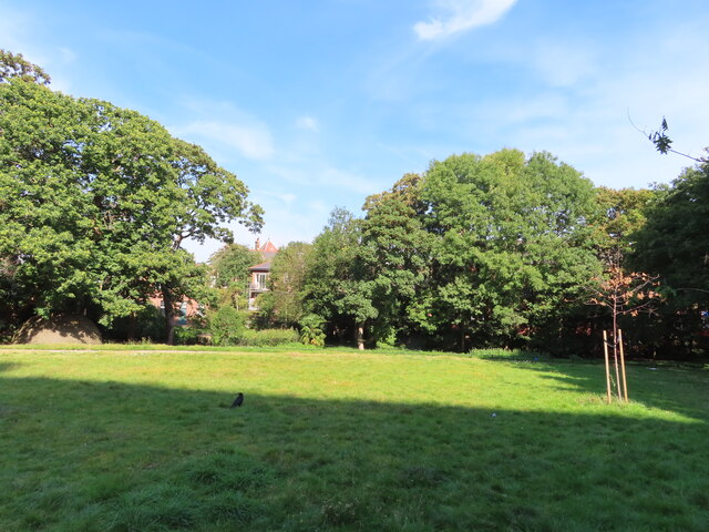
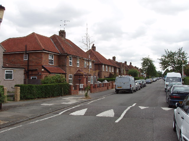
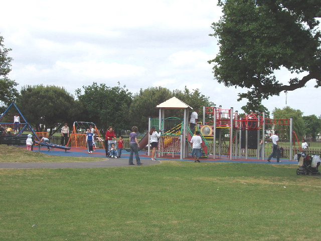
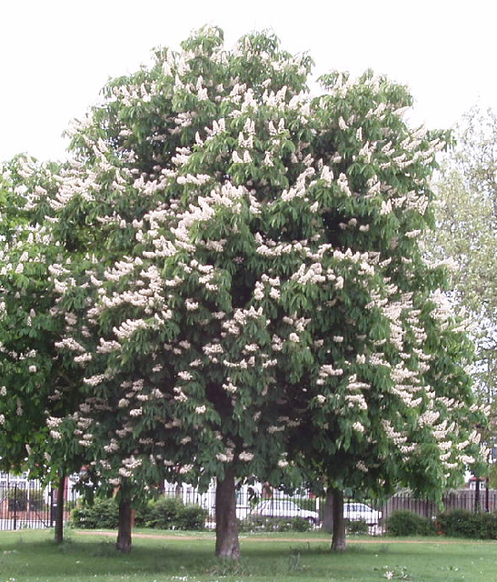
Today, Acton is a diverse and vibrant area, known for its multicultural community and a range of amenities. The town offers a mix of housing options, from Victorian and Edwardian terraced houses to modern apartment complexes. It is also home to numerous parks and green spaces, providing recreational opportunities for residents.

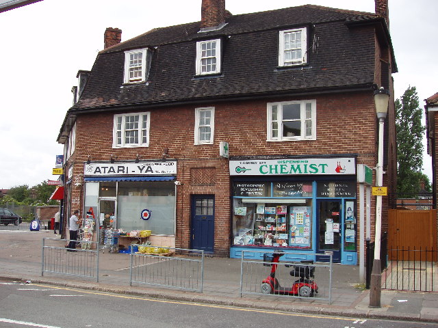
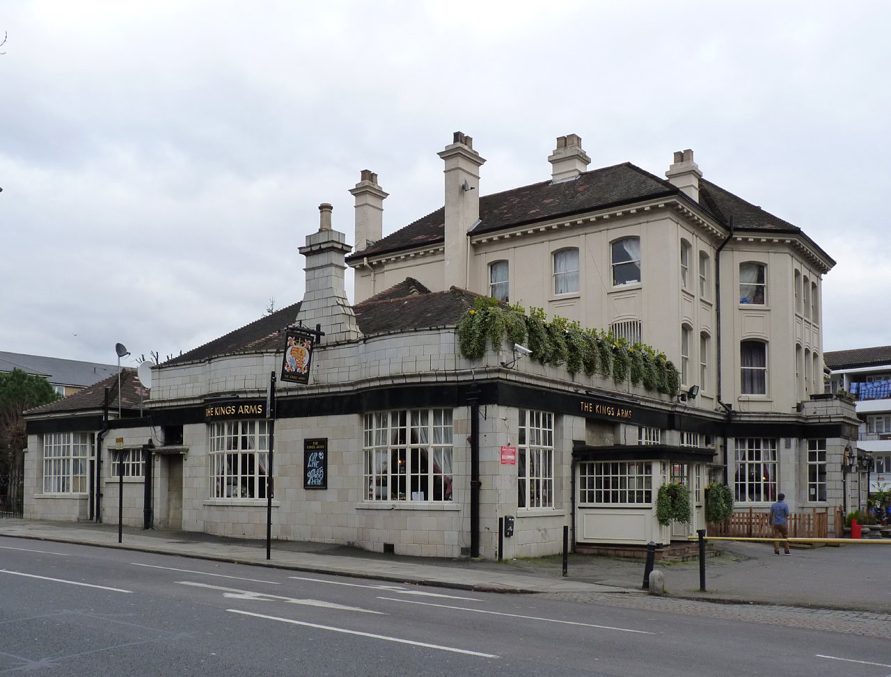
Acton has a variety of shops, restaurants, and bars, particularly along the bustling High Street and Churchfield Road. The town is well-served by public transportation, with several tube stations providing easy access to central London and other parts of the city.

Education is also a prominent feature of Acton, with several primary and secondary schools located in the area. Additionally, Acton is home to the University of West London, which offers a range of undergraduate and postgraduate programs.

Overall, Acton is a dynamic and well-connected town that combines a rich history with modern amenities, making it an attractive place to live and visit.

If you have any feedback on the listing, please let us know in the comments section below.
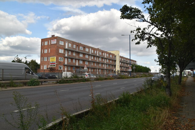
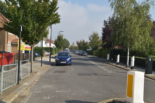
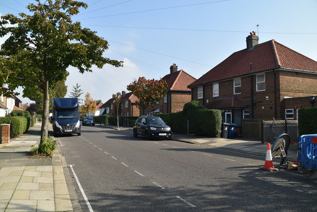
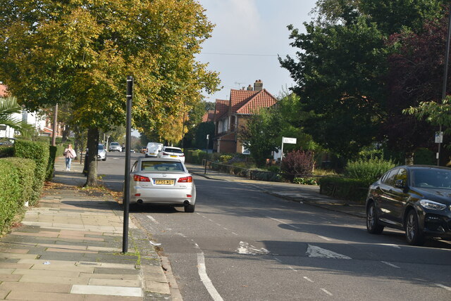
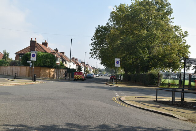
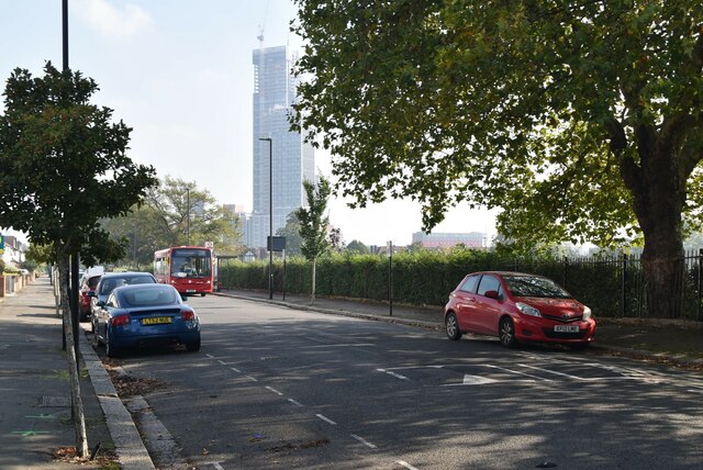
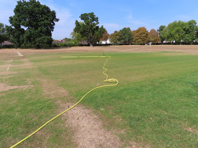
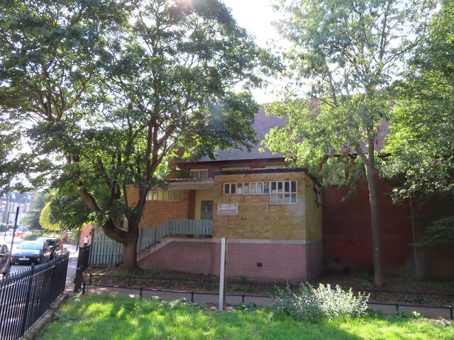
Acton, East Images

Images are sourced within 2km of 51.513937/-0.251872 or Grid Reference TQ2180. Thanks to Geograph Open Source API. All images are credited.

Signs and qr code on car for tattooing and piercing The Smart Car for Ink'D London has signs for tattooing, piercing, and tattoo numbing cream. It displays a qr code panel for scanning on a smart phone.
Signs and qr code on car for tattooing and piercing
The Smart Car for Ink'D London has signs for tattooing, piercing, and tattoo numbing cream. It displays a qr code panel for scanning on a smart phone.
Western Avenue The A40 road runs 256 miles from the City of London to Fishguard. It is a major trunk road and runs through High Wycombe, Oxford, Cheltenham, Ross on Wye, Abergavenny, Llandeilo and Carmarthen.
Western Avenue
The A40 road runs 256 miles from the City of London to Fishguard. It is a major trunk road and runs through High Wycombe, Oxford, Cheltenham, Ross on Wye, Abergavenny, Llandeilo and Carmarthen.
Saxon Drive A few years ago I read a book by Mark Mason "Walking the lines" in which he walked the route of the London Underground lines, overground. I will repeat this visiting all 272 stations (some more than once). My route tries to follow the line of the railway as closely as possible, using footpaths and roads, deviations are made to make the walk more "interesting".
Saxon Drive
A few years ago I read a book by Mark Mason "Walking the lines" in which he walked the route of the London Underground lines, overground. I will repeat this visiting all 272 stations (some more than once). My route tries to follow the line of the railway as closely as possible, using footpaths and roads, deviations are made to make the walk more "interesting".
Saxon Drive
Saxon Drive
The Link
The Link
Saxon Drive A few years ago I read a book by Mark Mason "Walking the lines" in which he walked the route of the London Underground lines, overground. I will repeat this visiting all 272 stations (some more than once). My route tries to follow the line of the railway as closely as possible, using footpaths and roads, deviations are made to make the walk more "interesting".
Saxon Drive
A few years ago I read a book by Mark Mason "Walking the lines" in which he walked the route of the London Underground lines, overground. I will repeat this visiting all 272 stations (some more than once). My route tries to follow the line of the railway as closely as possible, using footpaths and roads, deviations are made to make the walk more "interesting".
Saxon Drive, Allan Way junction
Allan Way A few years ago I read a book by Mark Mason "Walking the lines" in which he walked the route of the London Underground lines, overground. I will repeat this visiting all 272 stations (some more than once). My route tries to follow the line of the railway as closely as possible, using footpaths and roads, deviations are made to make the walk more "interesting".
Allan Way
A few years ago I read a book by Mark Mason "Walking the lines" in which he walked the route of the London Underground lines, overground. I will repeat this visiting all 272 stations (some more than once). My route tries to follow the line of the railway as closely as possible, using footpaths and roads, deviations are made to make the walk more "interesting".
Watered cricket square green in drought-browned field North Acton Playing Field grass has become generally brown after a very dry period, positions of old walls and huts show up even browner, cricket squares are being watered.
Watered cricket square green in drought-browned field
North Acton Playing Field grass has become generally brown after a very dry period, positions of old walls and huts show up even browner, cricket squares are being watered.
Library for Iranian Studies, Acton In The Woodlands Hall, by Woodlands Park.
Library for Iranian Studies, Acton
In The Woodlands Hall, by Woodlands Park.
Woodlands Park with ice house, Acton Woodlands is a small park near the centre of Acton.
The domed brick structure visible under the tree on the left is the top of an ice house. It was in the 6-acre garden of a house "Woodlands" demolished in 1903. The ice house and the nearby pond which provided the ice were restored in 2006.
Woodlands Park with ice house, Acton
Woodlands is a small park near the centre of Acton. The domed brick structure visible under the tree on the left is the top of an ice house. It was in the 6-acre garden of a house "Woodlands" demolished in 1903. The ice house and the nearby pond which provided the ice were restored in 2006.
National Garden Scheme, 41 Mill Hill Road, tea on the lawn The garden was open for charity, and with assistance from neighbours was providing home-made teas. On the left of the photo is a long low lavender hedge, on the right a varied selection of plants. See also <a href="https://www.geograph.org.uk/photo/7593948">TQ1979 : National Garden Scheme, pond in new area of 41 Mill Hill Road</a>.
National Garden Scheme, 41 Mill Hill Road, tea on the lawn
The garden was open for charity, and with assistance from neighbours was providing home-made teas. On the left of the photo is a long low lavender hedge, on the right a varied selection of plants. See also TQ1979 : National Garden Scheme, pond in new area of 41 Mill Hill Road.
National Garden Scheme, pond in new area of 41 Mill Hill Road 37 and 39 Mill Hill Road next door were redeveloped as 8 flats, it appears that the bottom area of their gardens was added to that of No. 41. The photo shows the pond area. This area of garden is heavily planted with rocks and a gravel surface. See also <a href="https://www.geograph.org.uk/photo/7593916">TQ1979 : National Garden Scheme, 41 Mill Hill Road, tea on the lawn</a>.
National Garden Scheme, pond in new area of 41 Mill Hill Road
37 and 39 Mill Hill Road next door were redeveloped as 8 flats, it appears that the bottom area of their gardens was added to that of No. 41. The photo shows the pond area. This area of garden is heavily planted with rocks and a gravel surface. See also TQ1979 : National Garden Scheme, 41 Mill Hill Road, tea on the lawn.
Shops near West Acton Underground station There is a Japanese food shop because there is a Japanese High School nearby.
Shops near West Acton Underground station
There is a Japanese food shop because there is a Japanese High School nearby.
Film studio, Alliance Road, North Acton The large building was a cold store until about 1980. This area has light industry, distribution depots, and warehouse style retail units.
Film studio, Alliance Road, North Acton
The large building was a cold store until about 1980. This area has light industry, distribution depots, and warehouse style retail units.
Saxon Drive, West Acton Many of the houses in this area were built by the Great Western Railway for their workers. The road markings are on a speed hump for traffic calming - there is a 20mph speed limit in this residential area.
Saxon Drive, West Acton
Many of the houses in this area were built by the Great Western Railway for their workers. The road markings are on a speed hump for traffic calming - there is a 20mph speed limit in this residential area.
Playground on North Acton Playing Field This photo was taken on a weekday just after school finished for the day, so there are parents and children enjoying the playground.
Playground on North Acton Playing Field
This photo was taken on a weekday just after school finished for the day, so there are parents and children enjoying the playground.
Horse chestnut tree in flower, North Acton Recreation Ground This tree is in the north-west corner of the field. There are other trees around the edge of the field.
Horse chestnut tree in flower, North Acton Recreation Ground
This tree is in the north-west corner of the field. There are other trees around the edge of the field.
Show me another place!

Acton, East is located at Grid Ref: TQ2180 (Lat: 51.513937, Lng: -0.251872)

Unitary Authority: Ealing

Police Authority: Metropolitan

What 3 Words

///sharp.proven.mount. Near Acton, London

Nearby Locations

East Acton Acton, East

Related Wikis

King Fahad Academy

King Fahad Academy (KFA; Arabic: أكاديمية الملك فهد بلندن) was a private school in Acton in the London Borough of Ealing that provided an Islamic-based...

Barbara Speake Stage School

The Barbara Speake Stage School was opened on 10 February 1945 as an independent school, and was initially set up as a dancing school, by the founding...

East Acton tube station

East Acton is a London Underground station in East Acton in London Borough of Hammersmith and Fulham. The station is on the Central line, between White...

Acton Vale, London

Acton Vale is a district in London, England. It lies between Acton to the west, and Shepherd's Bush to the east. In 1897, it referred to the stretch of...

Nearby Amenities

Located within 500m of 51.513937,-0.251872
Crossing
Crossing: traffic_signals
Crossing Ref: pelican
Lat/Long: 51.5139748/-0.2486113
Traffic Calming: table
Lat/Long: 51.5153494/-0.2464728
Traffic Calming: table
Lat/Long: 51.5163253/-0.2478405
Barrier: bollard
Bicycle: yes
Bollard: fixed
Foot: yes
Lat/Long: 51.5138041/-0.2457874
Turning Circle
Lat/Long: 51.5139929/-0.2560241
Barrier: bollard
Lat/Long: 51.5138357/-0.2522482
Ref GB Tflcid: RWG271958
Traffic Calming: hump
Lat/Long: 51.5170483/-0.254942
Turning Circle
Lat/Long: 51.5148693/-0.2531603
Barrier: bollard
Lat/Long: 51.5124067/-0.2522864
Car Sharing
Capacity: 1
Operator: Streetcar
Source: WebSite
Lat/Long: 51.5136702/-0.2566123
Crossing
Crossing: uncontrolled
Crossing Island: yes
Crossing Ref: zebra
Tactile Paving: yes
Lat/Long: 51.5176866/-0.2502766
Post Box
Collection Times: Mo-Fr 17:30; Sa 12:00
Operator: Royal Mail
Operator Wikidata: Q638098
Post Box Type: pillar
Ref: W3 51
Royal Cypher: GR
Royal Cypher Wikidata: Q33102273
Lat/Long: 51.5144559/-0.2586568
Strawberry Local
Off License: yes
Opening Hours: Mo-Su 08:00-22:00
Shop: convenience
Lat/Long: 51.5145118/-0.2585632
Post Box
Brand: Royal Mail
Brand Wikidata: Q638098
Brand Wikipedia: en:Royal Mail
Collection Times: Mo-Fr 17:30; Sa 12:00
Operator: Royal Mail
Operator Wikidata: Q638098
Post Box Type: pillar
Ref: W3 57
Royal Cypher: GR
Royal Cypher Wikidata: Q33102273
Lat/Long: 51.5126411/-0.2524183
Post Box
Brand: Royal Mail
Brand Wikidata: Q638098
Brand Wikipedia: en:Royal Mail
Collection Times: Mo-Fr 09:00; Sa 07:00
Operator: Royal Mail
Operator Wikidata: Q638098
Post Box Type: pillar
Ref: W12 39D
Royal Cypher: GR
Royal Cypher Wikidata: Q33102273
Lat/Long: 51.513239/-0.2482678
Turning Circle
Lat/Long: 51.512427/-0.2456242
Turning Circle
Lat/Long: 51.5120691/-0.2462147
Post Box
Collection Times: Mo-Fr 09:00; Sa 07:00
Operator: Royal Mail
Operator Wikidata: Q638098
Post Box Type: pillar
Ref: W12 37D
Royal Cypher: GR
Royal Cypher Wikidata: Q33102273
Lat/Long: 51.511192/-0.246548
Traffic Calming: cushion
Lat/Long: 51.5158698/-0.2470851
Bus Stop
East Acton Station / Fitzneal Street
Bus: yes
Local Ref: C
Naptan AtcoCode: 490000065C
Naptan Bearing: E
Naptan CommonName: East Acton
Naptan Indicator: Stop C
Naptan Street: DU CANE ROAD
Naptan Verified: no
Public Transport: platform
Ref: 76957
Source Ref: naptan
Lat/Long: 51.5153487/-0.2476154
Bus Stop
East Acton Station
Bus: yes
Local Ref: H
Naptan AtcoCode: 490000065H
Naptan Bearing: W
Naptan CommonName: East Acton
Naptan Indicator: Stop H
Naptan Street: DU CANE ROAD
Naptan Verified: no
Public Transport: platform
Ref: 53503
Source Ref: naptan
Lat/Long: 51.5151665/-0.248644
Bus Stop
Carlisle Avenue
Bench: yes
Bus: yes
Naptan AtcoCode: 490004789E
Naptan Bearing: N
Naptan CommonName: Carlisle Avenue
Naptan Street: WESTERN AVENUE
Naptan Verified: no
Public Transport: platform
Ref: 76168
Shelter: yes
Source Ref: naptan
Lat/Long: 51.5152554/-0.2568831
Bus Stop
East Acton Station / Erconwald Street
Bus: yes
Local Ref: B
Naptan AtcoCode: 490006211B
Naptan Bearing: S
Naptan CommonName: Du Cane RdOld Oak Common Lane
Naptan Indicator: Stop B
Naptan Street: OLD OAK COMMON LANE
Naptan Verified: no
Public Transport: platform
Lat/Long: 51.5157142/-0.2495165
Bus Stop
Foster Road
Bus: yes
Local Ref: T
Naptan AtcoCode: 490007170W
Naptan Bearing: N
Naptan CommonName: Foster Road
Naptan Street: WESTERN AVENUE
Naptan Verified: no
Public Transport: platform
Ref: 74571
Source Local Ref: naptan
Source Ref: naptan
Lat/Long: 51.5141666/-0.2538433
Bus Stop
King Fahad Academy
Bus: yes
Local Ref: P
Naptan AtcoCode: 490008744X
Naptan Bearing: N
Naptan CommonName: King Fahad Academy
Naptan Indicator: X
Naptan Street: EAST ACTON LANE
Naptan Verified: no
Public Transport: platform
Ref: 56428
Source Ref: naptan
Lat/Long: 51.5126635/-0.2511176
Bus Stop
Perryn Road
Bus: yes
Naptan AtcoCode: 490010949W
Naptan Bearing: N
Naptan CommonName: Perryn Road
Naptan Street: WESTERN AVENUE
Naptan Verified: no
Public Transport: platform
Ref: 75393
Source Ref: naptan
Lat/Long: 51.5149318/-0.2567915
Bus Stop
East Acton Lane / Old Oak Road
Bus: yes
Local Ref: J
Naptan AtcoCode: 490011937J
Naptan Bearing: N
Naptan CommonName: Hilary Road Savoy Circus
Naptan Indicator: J
Naptan Street: OLD OAK ROAD
Naptan Verified: yes
Public Transport: platform
Ref: J
Lat/Long: 51.5133369/-0.2483919
Bus Stop
Hilary Road
Bus: yes
Local Ref: U
Naptan AtcoCode: 490011937N
Naptan Bearing: N
Naptan CommonName: Hilary Road Savoy Circus
Naptan Street: OLD OAK ROAD
Naptan Verified: no
Public Transport: platform
Ref: 50661
Source Ref: naptan
Lat/Long: 51.5118836/-0.2473064
Bus Stop
Savoy Circus
Bus: yes
Local Ref: E
Naptan AtcoCode: 490011937P
Naptan Bearing: N
Naptan CommonName: Hilary Road Savoy Circus
Naptan Indicator: P
Naptan Street: WESTWAY
Naptan Verified: no
Public Transport: platform
Ref: 75187
Source Ref: naptan
Lat/Long: 51.5140946/-0.2478127
Bus Stop
Savoy Circus
Bus: yes
Local Ref: F
Naptan AtcoCode: 490011937X
Naptan Bearing: N
Naptan CommonName: Hilary Road Savoy Circus
Naptan Indicator: Y
Naptan Street: WESTWAY
Naptan Verified: no
Public Transport: platform
Ref: 48656
Source Ref: naptan
Lat/Long: 51.5138802/-0.2474408
Bus Stop
Shaa Road
Local Ref: EX
Naptan AtcoCode: 490012016S
Naptan Bearing: S
Naptan CommonName: Shaa Road
Naptan Indicator: Stop EX
Naptan Street: EAST ACTON LANE
Naptan Verified: no
Public Transport: platform
Lat/Long: 51.5111649/-0.2567194
Bus Stop
Glendun Road
Bus: yes
Local Ref: S
Naptan AtcoCode: 490012067E
Naptan Bearing: N
Naptan CommonName: Shepherds Bush Cricket Club
Naptan Street: EAST ACTON LANE
Naptan Verified: yes
Public Transport: platform
Ref: 74798
Source Ref: naptan
Lat/Long: 51.5124308/-0.2535546
Bus Stop
Beechwood Grove
Bus: yes
Local Ref: W
Naptan AtcoCode: 490012067W
Naptan Bearing: N
Naptan CommonName: Shepherds Bush Cricket Club
Naptan Street: EAST ACTON LANE
Naptan Verified: no
Public Transport: platform
Ref: 74845
Source Ref: naptan
Lat/Long: 51.5119996/-0.2552816
Bus Stop
Hemlock Road
Bus: yes
Local Ref: W
Naptan AtcoCode: 490015227S
Naptan Bearing: S
Naptan CommonName: Hemlock Road Old Oak Road
Naptan Street: OLD OAK ROAD
Naptan Verified: no
Public Transport: platform
Lat/Long: 51.5115239/-0.2468477
Bus Stop
The Fairway
Bus: yes
Local Ref: A
Naptan AtcoCode: 490013349A
Naptan Bearing: S
Naptan CommonName: The Fairway Old Oak Common Ln
Naptan Indicator: A
Naptan Street: OLD OAK COMMON LANE
Naptan Verified: yes
Public Transport: platform
Lat/Long: 51.5182931/-0.2503822
Bus Stop
The Fairway
Bus: yes
Local Ref: M
Naptan AtcoCode: 490013349M
Naptan Bearing: N
Naptan CommonName: The Fairway Old Oak Common Ln
Naptan Indicator: M
Naptan Street: OLD OAK COMMON LANE
Naptan Verified: no
Public Transport: platform
Lat/Long: 51.516909/-0.2500606
Bus Stop
Westway
Bus: yes
Local Ref: D
Naptan AtcoCode: 490014446I
Naptan Bearing: S
Naptan CommonName: Western Circus
Naptan Indicator: Stop I
Naptan Street: OLD OAK COMMON LANE
Naptan Verified: no
Public Transport: platform
Lat/Long: 51.5142193/-0.2490383
Bus Stop
Old Oak Common Lane / Savoy Circus
Bus: yes
Local Ref: K
Naptan AtcoCode: 490014446K
Naptan Bearing: N
Naptan CommonName: Western Circus
Naptan Indicator: K
Naptan Street: OLD OAK COMMON LANE
Naptan Verified: no
Public Transport: platform
Lat/Long: 51.5133458/-0.2492322
Bus Stop
Western Avenue / Savoy Circus
Bench: yes
Bin: yes
Bus: yes
Lit: yes
Local Ref: L
Naptan AtcoCode: 490014446L
Naptan Bearing: W
Naptan CommonName: Western Circus
Naptan Indicator: L
Naptan Street: WESTERN AVENUE
Naptan Verified: no
Public Transport: platform
Shelter: yes
Tactile Paving: no
Lat/Long: 51.51378/-0.2497776
Bus Stop
Western Avenue / Savoy Circus
Bus: yes
Local Ref: Y
Naptan AtcoCode: 490014446N
Naptan Bearing: E
Naptan CommonName: Western Circus
Naptan Indicator: N
Naptan Street: WESTERN AVENUE
Naptan Verified: no
Public Transport: platform
Lat/Long: 51.5139852/-0.2497337
Fast Food
Savoy Fish & Chips
Addr Housenumber: 100
Addr Street: Old Oak Common Lane
Phone: +44 20 8743 1466
Lat/Long: 51.5151221/-0.2488926
Post Office
East Acton Post Office
Addr City: London
Addr Housenumber: 71
Addr Postcode: W3 7DH
Addr Street: Old Oak Common Lane
Brand: Post Office
Brand Wikidata: Q1783168
Check Date: 2023-09-27
Opening Hours: Mo,We-Fr 08:30-17:30; Tu,Sa 09:00-17:30
Ref Pol Id: 96526
Lat/Long: 51.5143789/-0.2492858
Fast Food
Greggs
Brand: Greggs
Brand Wikidata: Q3403981
Brand Wikipedia: en:Greggs
Cuisine: sandwich;bakery
Shop: bakery
Takeaway: yes
Lat/Long: 51.5143308/-0.2492713
Speed Camera
Red Light Camera
Lat/Long: 51.513878/-0.249449
Ref GB Tflcid: RWG016961
Traffic Calming: hump
Lat/Long: 51.5137734/-0.245539
Ref GB Tflcid: RWG271952
Traffic Calming: hump
Lat/Long: 51.515391/-0.2527135
Ref GB Tflcid: RWG272215
Traffic Calming: hump
Lat/Long: 51.5108655/-0.251732
Crossing
Crossing: uncontrolled
Crossing Island: no
Not Crossing Ref: zebra
Lat/Long: 51.5138731/-0.2521997
Crossing
Bicycle: yes
Crossing: traffic_signals
Crossing Ref: toucan
Lat/Long: 51.5137425/-0.2492351
Crossing
Bicycle: yes
Crossing: traffic_signals
Crossing Ref: toucan
Lat/Long: 51.5137652/-0.2488993
Savoy Circus
Place: locality
Lat/Long: 51.5138781/-0.2490046
Place Of Worship
Ezzeitouna
Religion: muslim
Lat/Long: 51.514035/-0.2498237
Give Way
Lat/Long: 51.5136605/-0.2488695
Entrance: yes
Lat/Long: 51.5136226/-0.2473896
Crossing
Crossing: uncontrolled
Crossing Ref: zebra
Lat/Long: 51.5113741/-0.2566474
East Acton
Fare Zone: 2
Line: Central
Name Ru: Ист-Актон
Naptan AtcoCode: 940GZZLUEAN
Network: London Underground
Operator: London Underground
Platforms: 2
Public Transport: station
Railway: station
Source Ref: http://en.wikipedia.org/wiki/List_of_London_Underground_stations
Start Date: 1920-08-03
Station: subway
Subway: yes
Wheelchair: no
Wikidata: Q1277721
Wikimedia Commons: Category:East Acton tube station
Wikipedia: en:East Acton tube station
Lat/Long: 51.5173451/-0.248137
Traffic Signals
Traffic Signals: crossing
Lat/Long: 51.5140212/-0.2518576
Crossing
Crossing: traffic_signals
Crossing Ref: pelican
Mapillary: 1202115453600882
Survey Date: 2021-09-29
Tactile Paving: yes
Lat/Long: 51.5140603/-0.2492723
Crossing
Crossing: uncontrolled
Crossing Island: no
Not Crossing Ref: zebra
Lat/Long: 51.5150171/-0.2570343
Crossing
Crossing: unmarked
Crossing Markings: no
Lat/Long: 51.5158725/-0.2582802
Crossing
Crossing: unmarked
Crossing Island: no
Crossing Markings: no
Lat/Long: 51.5142187/-0.2457697
Traffic Signals
Traffic Signals: signal
Traffic Signals Direction: forward
Lat/Long: 51.514028/-0.2493096
Crossing
Crossing: traffic_signals
Crossing Ref: pelican
Mapillary: 292785742442744
Survey Date: 2021-09-29
Tactile Paving: yes
Lat/Long: 51.5140622/-0.2491115
Traffic Signals
Traffic Signals: signal
Traffic Signals Direction: forward
Lat/Long: 51.5140981/-0.2491232
Crossing
Crossing: traffic_signals
Crossing Island: no
Crossing Ref: pelican
Lat/Long: 51.5141279/-0.245976
Crossing
Crossing: traffic_signals
Crossing Ref: pelican
Tactile Paving: yes
Lat/Long: 51.5139287/-0.2519492
Crossing
Crossing: traffic_signals
Crossing Ref: pelican
Tactile Paving: yes
Lat/Long: 51.5140115/-0.2517963
Crossing
Bicycle: yes
Crossing: traffic_signals
Crossing Ref: toucan
Lat/Long: 51.5137734/-0.2487088
Traffic Signals
Traffic Signals: signal
Traffic Signals Direction: forward
Lat/Long: 51.5136956/-0.2491858
Crossing
Bicycle: yes
Crossing: traffic_signals
Crossing Ref: toucan
Lat/Long: 51.5137429/-0.249102
Crossing
Crossing: traffic_signals
Crossing Ref: pelican
Tactile Paving: yes
Lat/Long: 51.5139516/-0.2492181
Crossing
Crossing: traffic_signals
Crossing Ref: pelican
Mapillary: 615281686511394
Survey Date: 2021-09-29
Tactile Paving: yes
Lat/Long: 51.513821/-0.249208
Crossing
Crossing: traffic_signals
Crossing Ref: pelican
Lat/Long: 51.5138559/-0.248772
Traffic Signals
Traffic Signals: signal
Traffic Signals Direction: forward
Lat/Long: 51.513698/-0.2491128
Traffic Signals
Traffic Signals: signal
Lat/Long: 51.5137988/-0.2486754
Traffic Signals
Traffic Signals: signal
Traffic Signals Direction: forward
Lat/Long: 51.5138571/-0.2486901
Speed Camera
Maxspeed: 40 mph
Lat/Long: 51.5138624/-0.2486033
Speed Camera
Maxspeed: 40 mph
Lat/Long: 51.5139445/-0.2498087
Traffic Signals
Traffic Signals: signal
Traffic Signals Direction: forward
Lat/Long: 51.5139519/-0.2492909
Give Way
Direction: backward
Lat/Long: 51.5140023/-0.2502552
East Acton
Network: London Underground
Operator: Transport for London
Public Transport: stop_position
Railway: stop
Subway: yes
Lat/Long: 51.5173376/-0.2481593
East Acton
Network: London Underground
Operator: Transport for London
Public Transport: stop_position
Railway: stop
Subway: yes
Lat/Long: 51.5173528/-0.2481132
Ref GB Tflcid: RWG271969
Traffic Calming: cushion
Lat/Long: 51.5174667/-0.251104
Ref GB Tflcid: RWG271957
Traffic Calming: hump
Lat/Long: 51.5174088/-0.2545583
Traffic Calming: cushion
Lat/Long: 51.5174569/-0.2492205
Traffic Calming: cushion
Lat/Long: 51.5169521/-0.2486905
Addr City: London
Addr Housename: Westerham Cottages
Addr Housenumber: 1
Addr Place: Acton
Addr Street: Old Oak Common Lane
Building: house
Lat/Long: 51.513394/-0.2490248
Give Way
Direction: forward
Traffic Sign: GB:1003A
Lat/Long: 51.516207/-0.2476976
M
Tourism: caravan_site
Lat/Long: 51.5164578/-0.2518826
Direction: backward
Maxwidth: 2
Traffic Sign: GB:629A[2.0]
Lat/Long: 51.5163464/-0.2478771
Crossing
Crossing: unmarked
Lat/Long: 51.5099181/-0.2509452
Crossing
Crossing: unmarked
Lat/Long: 51.5099896/-0.2509981
Iceland
Addr Housenumber: 90/92
Addr Street: Old Oak Common Lane
Brand: Iceland
Brand Wikidata: Q721810
Brand Wikipedia: en:Iceland (supermarket)
Phone: +44 20 8740 6003
Shop: frozen_food
Website: https://www.iceland.co.uk/store-finder/store?StoreID=354&StoreName=EAST%20ACTON
Lat/Long: 51.5147553/-0.2490783
Barrier: block
Lat/Long: 51.5112438/-0.2465387
Charging Station
Capacity: 3
Motorcar: yes
Lat/Long: 51.5166388/-0.247246
Bicycle Parking
Bicycle Parking: stands
Capacity: 12
Covered: no
Lat/Long: 51.5165696/-0.2474016
Ankaran Food & Wine
Addr City: London
Addr Housenumber: 73
Addr Postcode: W12 0BP
Addr Street: Erconwald Street
Fhrs Id: 344950
Fhrs Local Authority Id: 01637/0073/1/000
Level: 0
Shop: convenience
Source Addr: FHRS Open Data
Lat/Long: 51.5170759/-0.246791
Disused Shop: convenience
Level: 0
Lat/Long: 51.5169535/-0.2465894
Traffic Calming: cushion
Lat/Long: 51.5169503/-0.2467859
Barrier: kerb
Kerb: flush
Lat/Long: 51.513944/-0.2486112
Traffic Signals
Traffic Signals: crossing
Lat/Long: 51.5139205/-0.25188
Direction: forward
Maxheight: 4.5
Traffic Sign: GB:629.2A[4.5]
Lat/Long: 51.5163431/-0.2477148
Give Way
Direction: backward
Traffic Sign: GB:1003A
Lat/Long: 51.5163311/-0.2478497
Traffic Signals
Traffic Signals: crossing
Traffic Signals Direction: forward
Lat/Long: 51.5140447/-0.2457368
Give Way
Direction: backward
Lat/Long: 51.5150534/-0.2570733
Give Way
Direction: backward
Lat/Long: 51.5138788/-0.2522353
Crossing
Crossing: uncontrolled
Not Crossing Ref: zebra
Lat/Long: 51.5148114/-0.256439
Give Way
Direction: forward
Lat/Long: 51.5138674/-0.2521496
Tactile Paving: yes
Lat/Long: 51.5138844/-0.2521829
Give Way
Direction: forward
Lat/Long: 51.5150052/-0.2570147
Tactile Paving: yes
Lat/Long: 51.5138591/-0.2522207
Traffic Signals
Traffic Signals: crossing
Traffic Signals Direction: forward
Lat/Long: 51.514125/-0.2460313
Give Way
Direction: forward
Lat/Long: 51.5148013/-0.2564045
Give Way
Direction: backward
Lat/Long: 51.5148138/-0.2564668
Bicycle Parking
Bicycle Parking: stands
Capacity: 4
Covered: no
Lat/Long: 51.5167489/-0.2471542
Bicycle Parking
Bicycle Parking: stands
Capacity: 14
Covered: no
Lat/Long: 51.5152603/-0.2490191
Bicycle Parking
Bicycle Parking: stands
Capacity: 4
Covered: no
Lat/Long: 51.5165271/-0.2474605
Bicycle Parking
Bicycle Parking: stands
Capacity: 12
Covered: no
Lat/Long: 51.5165229/-0.2473171
Addr Housenumber: 1
Addr Street: Duncan Grove
Lat/Long: 51.5177541/-0.2556947
Yes
Access: no
Barrier: bollard
Bicycle: yes
Bollard: removable
Emergency: yes
Foot: yes
Horse: yes
Material: metal
Motor Vehicle: no
Note Covid19: Experimental modal filter
Lat/Long: 51.5127308/-0.2522391
Crossing
Crossing: marked
Crossing Island: no
Lat/Long: 51.5118688/-0.2519923
Addr Housenumber: 107
Addr Street: Henchman Street
Lat/Long: 51.5176101/-0.2477029
Addr Housenumber: 105
Addr Street: Henchman Street
Lat/Long: 51.5175812/-0.2476707
Addr Housenumber: 103
Addr Street: Henchman Street
Lat/Long: 51.517553/-0.2476394
Addr Housenumber: 101
Addr Street: Henchman Street
Lat/Long: 51.5175246/-0.2476079
Addr Housenumber: 99
Addr Street: Henchman Street
Lat/Long: 51.517493/-0.2475727
Addr Housenumber: 97
Addr Street: Henchman Street
Lat/Long: 51.5174537/-0.2475291
Addr Housenumber: 95
Addr Street: Henchman Street
Lat/Long: 51.5174255/-0.2474977
Addr Housenumber: 93
Addr Street: Henchman Street
Lat/Long: 51.517397/-0.2474661
Addr Housenumber: 91
Addr Street: Henchman Street
Lat/Long: 51.5173673/-0.2474332
Addr Housenumber: 89
Addr Street: Henchman Street
Lat/Long: 51.5173306/-0.2473924
Addr Housenumber: 87
Addr Street: Henchman Street
Lat/Long: 51.5173038/-0.2473626
Addr Housenumber: 85
Addr Street: Henchman Street
Lat/Long: 51.5172999/-0.2473095
Addr Housenumber: 83
Addr Street: Henchman Street
Lat/Long: 51.5173182/-0.2472676
Addr Housenumber: 81
Addr Street: Henchman Street
Lat/Long: 51.5173411/-0.2472151
Addr Housenumber: 71
Addr Street: Erconwald Street
Lat/Long: 51.5170613/-0.24688
Addr Housenumber: 69
Addr Street: Erconwald Street
Lat/Long: 51.517039/-0.2469136
Addr Housenumber: 67
Addr Street: Erconwald Street
Lat/Long: 51.5170093/-0.2469584
Addr Housenumber: 65
Addr Street: Erconwald Street
Lat/Long: 51.5169841/-0.2469963
Addr Housenumber: 63
Addr Street: Erconwald Street
Lat/Long: 51.5169569/-0.2470374
Addr Housenumber: 61
Addr Street: Erconwald Street
Lat/Long: 51.5169321/-0.2470747
Addr Housenumber: 170;172
Addr Street: Old Oak Common Lane
Entrance: yes
Lat/Long: 51.5181632/-0.2502124
Addr Housenumber: 174;176
Addr Street: Old Oak Common Lane
Entrance: yes
Lat/Long: 51.5181839/-0.2500491
Addr Housenumber: 178;180
Addr Street: Old Oak Common Lane
Entrance: yes
Lat/Long: 51.5182039/-0.2498913
Entrance: yes
Lat/Long: 51.517907/-0.250148
Addr Housenumber: 138;140
Addr Street: Fitzneal Street
Entrance: yes
Lat/Long: 51.5179218/-0.2497477
Addr Housenumber: 134;136
Addr Street: Fitzneal Street
Entrance: yes
Lat/Long: 51.5179546/-0.2496523
Addr Housenumber: 128;130;132
Addr Street: Fitzneal Street
Entrance: yes
Lat/Long: 51.5179165/-0.2495226
Addr Housenumber: 124;126
Addr Street: Fitzneal Street
Entrance: yes
Lat/Long: 51.5178698/-0.2493976
Addr Housenumber: 120;122
Addr Street: Fitzneal Street
Entrance: yes
Lat/Long: 51.5178039/-0.2493981
Crossing
Crossing: unmarked
Crossing Island: no
Crossing Markings: no
Traffic Calming: table
Lat/Long: 51.5178052/-0.2502186
Addr Housenumber: 114;116;118
Addr Street: Fitzneal Street
Entrance: yes
Lat/Long: 51.5176301/-0.2492697
Addr Housenumber: 110;112
Addr Street: Fitzneal Street
Entrance: yes
Lat/Long: 51.5175849/-0.2491029
Addr Housenumber: 106;108
Addr Street: Fitzneal Street
Entrance: yes
Lat/Long: 51.517524/-0.2490388
Addr Housenumber: 102;104
Addr Street: Fitzneal Street
Entrance: yes
Lat/Long: 51.5174574/-0.2489672
Addr Housenumber: 98;100
Addr Street: Fitzneal Street
Entrance: yes
Lat/Long: 51.5173859/-0.2488922
Addr Housenumber: 92;94;96
Addr Street: Fitzneal Street
Entrance: yes
Lat/Long: 51.5173123/-0.2488185
Addr Housenumber: 88;90
Addr Street: Fitzneal Street
Entrance: yes
Lat/Long: 51.5172388/-0.2487379
Addr Housenumber: 84;86
Addr Street: Fitzneal Street
Entrance: yes
Lat/Long: 51.5171722/-0.2486682
Addr Housenumber: 80;82
Addr Street: Fitzneal Street
Entrance: yes
Lat/Long: 51.5171109/-0.2486039
Addr Housenumber: 76;78
Addr Street: Fitzneal Street
Entrance: yes
Lat/Long: 51.5170434/-0.2485331
Addr Housenumber: 70;72;74
Addr Street: Fitzneal Street
Entrance: yes
Lat/Long: 51.516935/-0.2485406
Addr Housenumber: 66;68
Addr Street: Fitzneal Street
Entrance: yes
Lat/Long: 51.5168469/-0.2483449
Addr Housenumber: 62;64
Addr Street: Fitzneal Street
Entrance: yes
Lat/Long: 51.5167918/-0.2482723
Addr Housenumber: 58;60
Addr Street: Fitzneal Street
Entrance: yes
Lat/Long: 51.5167183/-0.2482014
Addr Housenumber: 54;56
Addr Street: Fitzneal Street
Entrance: yes
Lat/Long: 51.5166499/-0.2480928
Addr Housenumber: 50;52
Addr Street: Fitzneal Street
Entrance: yes
Lat/Long: 51.5166007/-0.2480319
Addr Housenumber: 47
Addr Street: Erconwald Street
Lat/Long: 51.5164308/-0.2478388
Addr Housenumber: 49
Addr Street: Erconwald Street
Lat/Long: 51.5164598/-0.2477924
Addr Housenumber: 51
Addr Street: Erconwald Street
Lat/Long: 51.5164856/-0.247751
Addr Housenumber: 53
Addr Street: Erconwald Street
Lat/Long: 51.5165143/-0.247705
Addr Housenumber: 55
Addr Street: Erconwald Street
Lat/Long: 51.5165405/-0.2476629
Addr Housenumber: 57
Addr Street: Erconwald Street
Lat/Long: 51.516567/-0.2476205
Addr Housenumber: 59
Addr Street: Erconwald Street
Lat/Long: 51.5165928/-0.2475791
Addr Housenumber: 107
Addr Street: Fitzneal Street
Lat/Long: 51.5176744/-0.2500937
Addr Housenumber: 105
Addr Street: Fitzneal Street
Lat/Long: 51.5177223/-0.2500222
Addr Housenumber: 101;103
Addr Street: Fitzneal Street
Entrance: yes
Lat/Long: 51.5177304/-0.2497344
Addr Housenumber: 97-99
Addr Street: Fitzneal Street
Entrance: yes
Lat/Long: 51.517706/-0.2496409
Addr Housenumber: 91;93;95
Addr Street: Fitzneal Street
Entrance: yes
Lat/Long: 51.5175559/-0.2494405
Addr Housenumber: 87;89
Addr Street: Fitzneal Street
Entrance: yes
Lat/Long: 51.5174403/-0.2494476
Addr Housenumber: 83;85
Addr Street: Fitzneal Street
Entrance: yes
Lat/Long: 51.517378/-0.2493825
Addr Housenumber: 79;81
Addr Street: Fitzneal Street
Entrance: yes
Lat/Long: 51.5173091/-0.2493105
Addr Housenumber: 75;77
Addr Street: Fitzneal Street
Entrance: yes
Lat/Long: 51.5172413/-0.2492397
Addr Housenumber: 69;71;73
Addr Street: Fitzneal Street
Entrance: yes
Lat/Long: 51.517168/-0.2491518
Addr Housenumber: 65;67
Addr Street: Fitzneal Street
Entrance: yes
Lat/Long: 51.5170846/-0.2490817
Addr Housenumber: 61;63
Addr Street: Fitzneal Street
Entrance: yes
Lat/Long: 51.5170254/-0.2490182
Addr Housenumber: 57;59
Addr Street: Fitzneal Street
Entrance: yes
Lat/Long: 51.5169653/-0.2489537
Addr Housenumber: 53;55
Addr Street: Fitzneal Street
Entrance: yes
Lat/Long: 51.5169086/-0.2488929
Addr Street: Fitzneal Street
Entrance: yes
Lat/Long: 51.516866/-0.2487257
Addr Street: Foliot Street
Entrance: yes
Lat/Long: 51.5166088/-0.248579
Entrance: yes
Lat/Long: 51.5165196/-0.2490496
Entrance: yes
Lat/Long: 51.5166084/-0.2489258
Entrance: yes
Lat/Long: 51.5164474/-0.2491798
Addr Housenumber: 11
Addr Street: Foliot Street
Lat/Long: 51.5164053/-0.2492986
Addr Housenumber: 13
Addr Street: Foliot Street
Lat/Long: 51.5164395/-0.2492444
Addr Housenumber: 15
Addr Street: Foliot Street
Lat/Long: 51.5164709/-0.2491946
Addr Housenumber: 17
Addr Street: Foliot Street
Lat/Long: 51.5164977/-0.2491522
Addr Housenumber: 19
Addr Street: Foliot Street
Lat/Long: 51.5165256/-0.2491079
Addr Housenumber: 21
Addr Street: Foliot Street
Lat/Long: 51.516553/-0.2490646
Addr Housenumber: 23
Addr Street: Foliot Street
Lat/Long: 51.5165816/-0.2490192
Addr Housenumber: 25
Addr Street: Foliot Street
Lat/Long: 51.5166114/-0.248972
Addr Housenumber: 27
Addr Street: Foliot Street
Lat/Long: 51.5166439/-0.2489205
Addr Housenumber: 29
Addr Street: Foliot Street
Lat/Long: 51.5166755/-0.2488704
Entrance: yes
Lat/Long: 51.516226/-0.2491841
Addr Housenumber: 1
Addr Street: Foliot Street
Lat/Long: 51.5160922/-0.2495683
Addr Housenumber: 3
Addr Street: Foliot Street
Lat/Long: 51.5160644/-0.2494843
Crossing
Crossing: marked
Crossing Markings: yes
Traffic Calming: table
Lat/Long: 51.5159611/-0.2495969
Entrance: yes
Lat/Long: 51.5163737/-0.249667
Entrance: yes
Lat/Long: 51.516273/-0.2496347
Entrance: yes
Lat/Long: 51.5164783/-0.2497005
Addr Housenumber: 102
Addr Street: Old Oak Common Lane
Lat/Long: 51.5162126/-0.2495651
Addr Housenumber: 104
Addr Street: Old Oak Common Lane
Lat/Long: 51.5162542/-0.2495785
Addr Housenumber: 106
Addr Street: Old Oak Common Lane
Lat/Long: 51.5163048/-0.2495949
Addr Housenumber: 108
Addr Street: Old Oak Common Lane
Lat/Long: 51.5163512/-0.2496099
Addr Housenumber: 110
Addr Street: Old Oak Common Lane
Lat/Long: 51.5164013/-0.2496261
Addr Housenumber: 112
Addr Street: Old Oak Common Lane
Lat/Long: 51.51645/-0.2496419
Addr Housenumber: 114
Addr Street: Old Oak Common Lane
Lat/Long: 51.5165022/-0.2496588
Addr Housenumber: 116
Addr Street: Old Oak Common Lane
Lat/Long: 51.5165492/-0.249674
Addr Housenumber: 5
Addr Street: Foliot Street
Lat/Long: 51.5162045/-0.2492741
Addr Housenumber: 7
Addr Street: Foliot Street
Lat/Long: 51.5162448/-0.2492161
Addr Housenumber: 9
Addr Street: Foliot Street
Lat/Long: 51.5162831/-0.2491584
Addr Housenumber: 31
Addr Street: Foliot Street
Lat/Long: 51.5165977/-0.248668
Addr Housenumber: 33
Addr Street: Foliot Street
Lat/Long: 51.5166316/-0.248603
Addr Housenumber: 35
Addr Street: Foliot Street
Lat/Long: 51.516661/-0.248542
Addr Housenumber: 47
Addr Street: Fitzneal Street
Lat/Long: 51.5168147/-0.2487396
Addr Housenumber: 49
Addr Street: Fitzneal Street
Lat/Long: 51.5168456/-0.2487698
Addr Housenumber: 51
Addr Street: Fitzneal Street
Lat/Long: 51.5168781/-0.2488034
Entrance: yes
Lat/Long: 51.5167237/-0.249736
Entrance: yes
Lat/Long: 51.5167637/-0.2495606
Entrance: yes
Lat/Long: 51.5169211/-0.2495863
Entrance: yes
Lat/Long: 51.5170656/-0.2496619
Entrance: yes
Lat/Long: 51.5170584/-0.2498465
Addr Housenumber: 118
Addr Street: Old Oak Common Lane
Lat/Long: 51.5166894/-0.2497672
Addr Housenumber: 120
Addr Street: Old Oak Common Lane
Lat/Long: 51.5167004/-0.2496866
Addr Housenumber: 122
Addr Street: Old Oak Common Lane
Lat/Long: 51.5167104/-0.2496124
Addr Housenumber: 124
Addr Street: Old Oak Common Lane
Lat/Long: 51.5167326/-0.2495503
Addr Housenumber: 126
Addr Street: Old Oak Common Lane
Lat/Long: 51.5167688/-0.2495143
Addr Housenumber: 128
Addr Street: Old Oak Common Lane
Lat/Long: 51.5168097/-0.2495044
Addr Housenumber: 130
Addr Street: Old Oak Common Lane
Lat/Long: 51.5168554/-0.2495197
Addr Housenumber: 132
Addr Street: Old Oak Common Lane
Lat/Long: 51.5169054/-0.2495364
Addr Housenumber: 134
Addr Street: Old Oak Common Lane
Lat/Long: 51.5169559/-0.2495533
Addr Housenumber: 136
Addr Street: Old Oak Common Lane
Lat/Long: 51.5169941/-0.2495661
Addr Housenumber: 138
Addr Street: Old Oak Common Lane
Lat/Long: 51.5170384/-0.2495809
Addr Housenumber: 140
Addr Street: Old Oak Common Lane
Lat/Long: 51.5170811/-0.2496098
Addr Housenumber: 142
Addr Street: Old Oak Common Lane
Lat/Long: 51.5171052/-0.2496639
Addr Housenumber: 144
Addr Street: Old Oak Common Lane
Lat/Long: 51.5170978/-0.2497288
Addr Housenumber: 146
Addr Street: Old Oak Common Lane
Lat/Long: 51.5170888/-0.2498063
Addr Housenumber: 148
Addr Street: Old Oak Common Lane
Lat/Long: 51.5170787/-0.2498945
Entrance: yes
Lat/Long: 51.5172672/-0.24997
Entrance: yes
Lat/Long: 51.5173501/-0.2499967
Entrance: yes
Lat/Long: 51.5174485/-0.2500286
Entrance: yes
Lat/Long: 51.5175489/-0.250061
Addr Housenumber: 150
Addr Street: Old Oak Common Lane
Lat/Long: 51.5172332/-0.2499176
Addr Housenumber: 152
Addr Street: Old Oak Common Lane
Lat/Long: 51.5172892/-0.2499351
Addr Housenumber: 154
Addr Street: Old Oak Common Lane
Lat/Long: 51.5173367/-0.24995
Addr Housenumber: 156
Addr Street: Old Oak Common Lane
Lat/Long: 51.5173785/-0.2499631
Addr Housenumber: 158
Addr Street: Old Oak Common Lane
Lat/Long: 51.5174294/-0.249979
Addr Housenumber: 160
Addr Street: Old Oak Common Lane
Lat/Long: 51.51748/-0.2499948
Addr Housenumber: 162
Addr Street: Old Oak Common Lane
Lat/Long: 51.5175318/-0.250011
Addr Housenumber: 164
Addr Street: Old Oak Common Lane
Lat/Long: 51.5175841/-0.2500274
Traffic Calming: cushion
Lat/Long: 51.5159947/-0.24825
Addr Housenumber: 2
Addr Street: Foliot Street
Lat/Long: 51.51584/-0.2494878
Addr Housenumber: 4
Addr Street: Foliot Street
Lat/Long: 51.515883/-0.2494249
Addr Housenumber: 6
Addr Street: Foliot Street
Lat/Long: 51.5158755/-0.2493432
Addr Housenumber: 8
Addr Street: Foliot Street
Lat/Long: 51.5159009/-0.2492742
Addr Housenumber: 10
Addr Street: Foliot Street
Lat/Long: 51.5159335/-0.2492246
Addr Housenumber: 12
Addr Street: Foliot Street
Lat/Long: 51.515959/-0.2491859
Addr Housenumber: 14
Addr Street: Foliot Street
Lat/Long: 51.5159871/-0.2491431
Addr Housenumber: 16
Addr Street: Foliot Street
Lat/Long: 51.5160218/-0.2490905
Entrance: yes
Lat/Long: 51.5158627/-0.2494804
Entrance: yes
Lat/Long: 51.5159072/-0.2493249
Entrance: yes
Lat/Long: 51.5159631/-0.2492298
Entrance: yes
Lat/Long: 51.5160094/-0.2491567
Addr Housenumber: 18
Addr Street: Foliot Street
Lat/Long: 51.5160767/-0.2490278
Addr Housenumber: 20
Addr Street: Foliot Street
Lat/Long: 51.5160988/-0.2489933
Addr Housenumber: 22
Addr Street: Foliot Street
Lat/Long: 51.5161264/-0.2489504
Addr Housenumber: 24
Addr Street: Foliot Street
Lat/Long: 51.5161516/-0.2489112
Entrance: yes
Lat/Long: 51.5161027/-0.249039
Entrance: yes
Lat/Long: 51.516157/-0.2489576
Entrance: yes
Lat/Long: 51.516218/-0.2488125
Entrance: yes
Lat/Long: 51.5162715/-0.2487298
Entrance: yes
Lat/Long: 51.5163286/-0.2486393
Entrance: yes
Lat/Long: 51.5163891/-0.2485457
Addr Housenumber: 26
Addr Street: Foliot Street
Lat/Long: 51.5161843/-0.2488015
Addr Housenumber: 28
Addr Street: Foliot Street
Lat/Long: 51.5162127/-0.2487584
Addr Housenumber: 30
Addr Street: Foliot Street
Lat/Long: 51.516236/-0.2487229
Addr Housenumber: 32
Addr Street: Foliot Street
Lat/Long: 51.5162653/-0.2486783
Addr Housenumber: 34
Addr Street: Foliot Street
Lat/Long: 51.5162976/-0.2486292
Addr Housenumber: 36
Addr Street: Foliot Street
Lat/Long: 51.5163283/-0.2485827
Addr Housenumber: 38
Addr Street: Foliot Street
Lat/Long: 51.5163526/-0.2485457
Addr Housenumber: 40
Addr Street: Foliot Street
Lat/Long: 51.5163806/-0.2485032
Entrance: yes
Lat/Long: 51.5164828/-0.2484627
Entrance: yes
Lat/Long: 51.5165317/-0.248373
Addr Housenumber: 42
Addr Street: Foliot Street
Lat/Long: 51.5164497/-0.248458
Addr Housenumber: 44
Addr Street: Foliot Street
Lat/Long: 51.5164693/-0.2484221
Addr Housenumber: 46
Addr Street: Foliot Street
Lat/Long: 51.5164944/-0.248376
Addr Housenumber: 48
Addr Street: Foliot Street
Lat/Long: 51.5165206/-0.2483281
Entrance: yes
Lat/Long: 51.5164033/-0.2481154
Addr Housenumber: 7
Addr Street: Erconwald Street
Lat/Long: 51.5156502/-0.2489811
Addr Housenumber: 9
Addr Street: Erconwald Street
Lat/Long: 51.5156988/-0.2489814
Addr Housenumber: 11
Addr Street: Erconwald Street
Lat/Long: 51.5157331/-0.2489288
Addr Housenumber: 13
Addr Street: Erconwald Street
Lat/Long: 51.5157601/-0.2488873
Addr Housenumber: 15
Addr Street: Erconwald Street
Lat/Long: 51.5157895/-0.2488422
Addr Housenumber: 17
Addr Street: Erconwald Street
Lat/Long: 51.5158131/-0.248806
Addr Housenumber: 19
Addr Street: Erconwald Street
Lat/Long: 51.5158487/-0.2487514
Addr Housenumber: 21
Addr Street: Erconwald Street
Lat/Long: 51.5158742/-0.2487123
Addr Housenumber: 23
Addr Street: Erconwald Street
Lat/Long: 51.515906/-0.2486634
Addr Housenumber: 25
Addr Street: Erconwald Street
Lat/Long: 51.5159321/-0.2486235
Addr Housenumber: 27
Addr Street: Erconwald Street
Lat/Long: 51.5159641/-0.2485743
Addr Housenumber: 29
Addr Street: Erconwald Street
Lat/Long: 51.5159889/-0.2485362
Addr Housenumber: 31
Addr Street: Erconwald Street
Lat/Long: 51.5160213/-0.2484866
Addr Housenumber: 33
Addr Street: Erconwald Street
Lat/Long: 51.5160483/-0.2484451
Addr Housenumber: 35
Addr Street: Erconwald Street
Lat/Long: 51.5160799/-0.2483967
Addr Housenumber: 37
Addr Street: Erconwald Street
Lat/Long: 51.5161068/-0.2483553
Addr Housenumber: 39
Addr Street: Erconwald Street
Lat/Long: 51.5161405/-0.2483036
Addr Housenumber: 41
Addr Street: Erconwald Street
Lat/Long: 51.5161428/-0.2482273
Entrance: yes
Lat/Long: 51.5156743/-0.2489575
Entrance: yes
Lat/Long: 51.5157268/-0.2488763
Entrance: yes
Lat/Long: 51.5157827/-0.2487897
Entrance: yes
Lat/Long: 51.5158403/-0.2487007
Entrance: yes
Lat/Long: 51.5158979/-0.2486116
Entrance: yes
Lat/Long: 51.5159562/-0.2485214
Entrance: yes
Lat/Long: 51.5160172/-0.2484271
Entrance: yes
Lat/Long: 51.5160714/-0.2483432
Entrance: yes
Lat/Long: 51.51612/-0.2482681
Addr Housenumber: 1
Addr Street: Erconwald Street
Lat/Long: 51.5155917/-0.2493948
Addr Housenumber: 3
Addr Street: Erconwald Street
Lat/Long: 51.5155736/-0.249282
Addr Housenumber: 5
Addr Street: Erconwald Street
Lat/Long: 51.5155564/-0.2491753
Mashiva Ltd
Addr Housenumber: 1-3
Addr Street: Erconwald Street
Phone: +44 20 8743 1441
Shop: newsagent
Lat/Long: 51.5155538/-0.2493468
Fresh Look
Addr Housenumber: 5
Addr Street: Erconwald Street
Phone: +44 20 8616 7557
Shop: hairdresser
Lat/Long: 51.5155305/-0.2492004
Savoy
Addr Housenumber: 2
Addr Street: Erconwald Street
Office: estate_agent
Phone: +44 20 8749 4111
Website: https://www.savoyproperty.co.uk/
Lat/Long: 51.5153149/-0.2489182
Hammersmith Food & Wine
Addr Housenumber: 4
Addr Street: Erconwald Street
Phone: +44 20 8743 1157
Shop: convenience
Lat/Long: 51.5153755/-0.248961
Addr Housenumber: 6
Addr Street: Erconwald Street
Lat/Long: 51.515515/-0.2487754
Addr Housenumber: 8
Addr Street: Erconwald Street
Lat/Long: 51.5155314/-0.2487142
Addr Housenumber: 10
Addr Street: Erconwald Street
Lat/Long: 51.5155616/-0.2486674
Addr Housenumber: 12
Addr Street: Erconwald Street
Lat/Long: 51.5155935/-0.248618
Addr Housenumber: 14
Addr Street: Erconwald Street
Lat/Long: 51.5156293/-0.2485624
Addr Housenumber: 16
Addr Street: Erconwald Street
Lat/Long: 51.5156571/-0.2485192
Addr Housenumber: 18
Addr Street: Erconwald Street
Lat/Long: 51.5156811/-0.2484819
Addr Housenumber: 20
Addr Street: Erconwald Street
Lat/Long: 51.5157078/-0.2484406
Addr Housenumber: 22
Addr Street: Erconwald Street
Lat/Long: 51.515743/-0.248386
Addr Housenumber: 24
Addr Street: Erconwald Street
Lat/Long: 51.5157714/-0.2483419
Addr Housenumber: 26
Addr Street: Erconwald Street
Lat/Long: 51.515794/-0.2483068
Addr Housenumber: 28
Addr Street: Erconwald Street
Lat/Long: 51.5158232/-0.2482615
Addr Housenumber: 30
Addr Street: Erconwald Street
Lat/Long: 51.5158537/-0.2482142
Addr Housenumber: 32
Addr Street: Erconwald Street
Lat/Long: 51.5158859/-0.2481643
Addr Housenumber: 34
Addr Street: Erconwald Street
Lat/Long: 51.5159121/-0.2481236
Addr Housenumber: 36
Addr Street: Erconwald Street
Lat/Long: 51.5159371/-0.2480848
Addr Housenumber: 40
Addr Street: Erconwald Street
Lat/Long: 51.5160084/-0.2480209
Addr Housenumber: 38
Addr Street: Erconwald Street
Lat/Long: 51.5159667/-0.2480388
Entrance: yes
Lat/Long: 51.515544/-0.2487503
Entrance: yes
Lat/Long: 51.5155988/-0.248664
Entrance: yes
Lat/Long: 51.5156641/-0.2485615
Entrance: yes
Lat/Long: 51.515715/-0.2484814
Entrance: yes
Lat/Long: 51.5157778/-0.2483826
Entrance: yes
Lat/Long: 51.5158305/-0.2482998
Entrance: yes
Lat/Long: 51.5158886/-0.2482085
Entrance: yes
Lat/Long: 51.5159453/-0.2481194
Entrance: yes
Lat/Long: 51.5159872/-0.2480534
Addr Housenumber: 43
Addr Street: Fitzneal Street
Lat/Long: 51.5161281/-0.2478155
Addr Housenumber: 41
Addr Street: Fitzneal Street
Lat/Long: 51.516106/-0.2477774
Addr Housenumber: 39
Addr Street: Fitzneal Street
Lat/Long: 51.5160814/-0.2477348
Addr Housenumber: 37
Addr Street: Fitzneal Street
Lat/Long: 51.5160579/-0.2476941
Addr Housenumber: 35
Addr Street: Fitzneal Street
Lat/Long: 51.5160329/-0.2476509
Addr Housenumber: 33
Addr Street: Fitzneal Street
Lat/Long: 51.51601/-0.2476114
Addr Housenumber: 31
Addr Street: Fitzneal Street
Lat/Long: 51.5159798/-0.2475591
Addr Housenumber: 29
Addr Street: Fitzneal Street
Lat/Long: 51.5159537/-0.2475139
Addr Housenumber: 27
Addr Street: Fitzneal Street
Lat/Long: 51.5159269/-0.2474676
Addr Housenumber: 25
Addr Street: Fitzneal Street
Lat/Long: 51.5159016/-0.2474239
Addr Housenumber: 23
Addr Street: Fitzneal Street
Lat/Long: 51.5158547/-0.2473454
Addr Housenumber: 21
Addr Street: Fitzneal Street
Lat/Long: 51.5158305/-0.2472956
Addr Housenumber: 19
Addr Street: Fitzneal Street
Lat/Long: 51.5158029/-0.2472389
Addr Housenumber: 17
Addr Street: Fitzneal Street
Lat/Long: 51.5157812/-0.2471942
Addr Housenumber: 15
Addr Street: Fitzneal Street
Lat/Long: 51.515756/-0.2471425
Addr Housenumber: 13
Addr Street: Fitzneal Street
Lat/Long: 51.5157381/-0.2471056
Addr Housenumber: 11
Addr Street: Fitzneal Street
Lat/Long: 51.5157131/-0.2470543
Addr Housenumber: 9
Addr Street: Fitzneal Street
Lat/Long: 51.5156893/-0.2470053
Addr Housenumber: 7
Addr Street: Fitzneal Street
Lat/Long: 51.5156678/-0.246961
Addr Housenumber: 5
Addr Street: Fitzneal Street
Lat/Long: 51.5156473/-0.2469189
Addr Housenumber: 3
Addr Street: Fitzneal Street
Lat/Long: 51.5156237/-0.2468704
Addr Housenumber: 1
Addr Street: Fitzneal Street
Lat/Long: 51.515603/-0.2468279
Entrance: yes
Lat/Long: 51.5156301/-0.2468241
Entrance: yes
Lat/Long: 51.5156836/-0.2469092
Entrance: yes
Lat/Long: 51.515721/-0.247006
Entrance: yes
Lat/Long: 51.5157693/-0.2471017
Entrance: yes
Lat/Long: 51.5158132/-0.2471889
Entrance: yes
Lat/Long: 51.5158623/-0.2472862
Entrance: yes
Lat/Long: 51.515933/-0.2474161
Entrance: yes
Lat/Long: 51.5159867/-0.2475084
Entrance: yes
Lat/Long: 51.5160398/-0.2475997
Entrance: yes
Lat/Long: 51.5160947/-0.2476793
Entrance: yes
Lat/Long: 51.5161372/-0.2477765
Addr Housenumber: 224
Addr Street: Du Cane Road
Lat/Long: 51.5155046/-0.2466022
Addr Housenumber: 226
Addr Street: Du Cane Road
Lat/Long: 51.5154499/-0.246675
Entrance: yes
Lat/Long: 51.5154681/-0.2466223
Addr Housenumber: 228
Addr Street: Du Cane Road
Lat/Long: 51.5154632/-0.2468969
Addr Housenumber: 230
Addr Street: Du Cane Road
Lat/Long: 51.5154549/-0.2470315
Entrance: yes
Lat/Long: 51.5154348/-0.2469624
Addr Housenumber: 232
Addr Street: Du Cane Road
Lat/Long: 51.5154159/-0.2472683
Addr Housenumber: 234
Addr Street: Du Cane Road
Lat/Long: 51.5154655/-0.2472778
Addr Housenumber: 236
Addr Street: Du Cane Road
Lat/Long: 51.5155045/-0.2473129
Addr Housenumber: 238
Addr Street: Du Cane Road
Lat/Long: 51.5155369/-0.2473682
Addr Housenumber: 240
Addr Street: Du Cane Road
Lat/Long: 51.5155635/-0.2474204
Addr Housenumber: 242
Addr Street: Du Cane Road
Lat/Long: 51.5155902/-0.2474776
Addr Housenumber: 244
Addr Street: Du Cane Road
Lat/Long: 51.5156064/-0.2475427
Addr Housenumber: 246
Addr Street: Du Cane Road
Lat/Long: 51.5156032/-0.2476217
Addr Housenumber: 248
Addr Street: Du Cane Road
Lat/Long: 51.5155985/-0.2477001
Addr Housenumber: 250
Addr Street: Du Cane Road
Lat/Long: 51.5155932/-0.2477886
Addr Housenumber: 252
Addr Street: Du Cane Road
Lat/Long: 51.5155863/-0.2478699
Addr Housenumber: 254
Addr Street: Du Cane Road
Lat/Long: 51.515578/-0.2479533
Addr Housenumber: 256
Addr Street: Du Cane Road
Lat/Long: 51.5155576/-0.2480089
Addr Housenumber: 258
Addr Street: Du Cane Road
Lat/Long: 51.5155229/-0.2480617
Addr Housenumber: 260
Addr Street: Du Cane Road
Lat/Long: 51.5154934/-0.2481108
Addr Housenumber: 262
Addr Street: Du Cane Road
Lat/Long: 51.5154586/-0.2481483
Addr Housenumber: 264
Addr Street: Du Cane Road
Lat/Long: 51.5154155/-0.248173
Addr Housenumber: 268
Addr Street: Du Cane Road
Lat/Long: 51.515366/-0.2481654
Entrance: yes
Lat/Long: 51.5154769/-0.247318
Entrance: yes
Lat/Long: 51.5155817/-0.2475201
Entrance: yes
Lat/Long: 51.5155482/-0.2479634
Entrance: yes
Lat/Long: 51.5154328/-0.2481243
Entrance: yes
Lat/Long: 51.5155598/-0.2478192
Entrance: yes
Lat/Long: 51.5155712/-0.2476629
Entrance: yes
Lat/Long: 51.5155289/-0.2474183
Entrance: yes
Lat/Long: 51.5154139/-0.2473082
Entrance: yes
Lat/Long: 51.5153673/-0.2481164
Entrance: yes
Lat/Long: 51.51549/-0.2480429
Addr Housenumber: 268
Addr Street: Du Cane Road
Lat/Long: 51.515371/-0.2484025
Addr Housenumber: 270
Addr Street: Du Cane Road
Lat/Long: 51.5153674/-0.2484735
Addr Housenumber: 272
Addr Street: Du Cane Road
Lat/Long: 51.5153627/-0.2485632
Addr Housenumber: 274
Addr Street: Du Cane Road
Lat/Long: 51.5153591/-0.2486315
Entrance: yes
Lat/Long: 51.5153265/-0.2484526
Entrance: yes
Lat/Long: 51.515322/-0.2485411
Addr Housenumber: 202
Addr Street: Du Cane Road
Lat/Long: 51.5155138/-0.2455518
Addr Housenumber: 204
Addr Street: Du Cane Road
Lat/Long: 51.5155339/-0.2456078
Addr Housenumber: 206
Addr Street: Du Cane Road
Lat/Long: 51.5155304/-0.2456903
Addr Housenumber: 208
Addr Street: Du Cane Road
Lat/Long: 51.5155262/-0.2457699
Addr Housenumber: 210
Addr Street: Du Cane Road
Lat/Long: 51.5155036/-0.2458249
Entrance: yes
Lat/Long: 51.5155152/-0.2456107
Entrance: yes
Lat/Long: 51.5155063/-0.2457694
Entrance: yes
Lat/Long: 51.5155117/-0.2456728
Addr Housenumber: 212
Addr Street: Du Cane Road
Lat/Long: 51.5156297/-0.2459462
Addr Housenumber: 214
Addr Street: Du Cane Road
Lat/Long: 51.5156436/-0.2460271
Addr Housenumber: 216
Addr Street: Du Cane Road
Lat/Long: 51.5156412/-0.2461065
Addr Housenumber: 218
Addr Street: Du Cane Road
Lat/Long: 51.5156177/-0.2461719
Addr Housenumber: 220
Addr Street: Du Cane Road
Lat/Long: 51.5154752/-0.2462557
Addr Housenumber: 222
Addr Street: Du Cane Road
Lat/Long: 51.5155188/-0.2463444
Entrance: yes
Lat/Long: 51.5154883/-0.2463198
Crossing
Crossing: marked
Crossing Markings: yes
Lat/Long: 51.5154163/-0.2464826
Crossing
Crossing: uncontrolled
Crossing Island: no
Crossing Ref: zebra
Lat/Long: 51.5153621/-0.246255
Crossing
Bicycle: yes
Crossing: uncontrolled
Crossing Island: no
Lat/Long: 51.5153573/-0.2463394
Entrance: yes
Lat/Long: 51.5156248/-0.2460604
Entrance: yes
Lat/Long: 51.5156131/-0.2459589
Entrance: yes
Lat/Long: 51.5155994/-0.2461588
Addr Housenumber: 2
Addr Street: Fitzneal Street
Lat/Long: 51.5157078/-0.246554
Addr Housenumber: 4
Addr Street: Fitzneal Street
Lat/Long: 51.5157328/-0.2465237
Addr Housenumber: 6
Addr Street: Fitzneal Street
Lat/Long: 51.51576/-0.2464908
Addr Housenumber: 8
Addr Street: Fitzneal Street
Lat/Long: 51.5157861/-0.2464591
Addr Housenumber: 10
Addr Street: Fitzneal Street
Lat/Long: 51.5158164/-0.2464223
Addr Housenumber: 12
Addr Street: Fitzneal Street
Lat/Long: 51.5158559/-0.2464473
Addr Housenumber: 14
Addr Street: Fitzneal Street
Lat/Long: 51.5158814/-0.2464995
Addr Housenumber: 16
Addr Street: Fitzneal Street
Lat/Long: 51.515899/-0.2465354
Addr Housenumber: 18
Addr Street: Fitzneal Street
Lat/Long: 51.5159222/-0.246583
Addr Housenumber: 20
Addr Street: Fitzneal Street
Lat/Long: 51.5159454/-0.2466304
Addr Housenumber: 22
Addr Street: Fitzneal Street
Lat/Long: 51.5159682/-0.2466772
Addr Housenumber: 24
Addr Street: Fitzneal Street
Lat/Long: 51.5159852/-0.246712
Addr Housenumber: 26
Addr Street: Fitzneal Street
Lat/Long: 51.5160148/-0.2467725
Addr Housenumber: 28
Addr Street: Fitzneal Street
Lat/Long: 51.5160157/-0.2468413
Addr Housenumber: 30
Addr Street: Fitzneal Street
Lat/Long: 51.5159873/-0.2468765
Addr Housenumber: 32
Addr Street: Fitzneal Street
Lat/Long: 51.5159606/-0.2469097
Addr Housenumber: 34
Addr Street: Fitzneal Street
Lat/Long: 51.5159344/-0.2469421
Addr Housenumber: 36
Addr Street: Fitzneal Street
Lat/Long: 51.5159078/-0.2469751
Entrance: yes
Lat/Long: 51.5159128/-0.24693
Entrance: yes
Lat/Long: 51.5159635/-0.2468669
Entrance: yes
Lat/Long: 51.5159971/-0.2467992
Entrance: yes
Lat/Long: 51.5159579/-0.2467177
Entrance: yes
Lat/Long: 51.5159093/-0.2466378
Entrance: yes
Lat/Long: 51.5158721/-0.2465395
Entrance: yes
Lat/Long: 51.5158203/-0.246455
Entrance: yes
Lat/Long: 51.5157867/-0.2464964
Entrance: yes
Lat/Long: 51.5157389/-0.2465553
Entrance: yes
Lat/Long: 51.5161828/-0.2470065
Entrance: yes
Lat/Long: 51.5161219/-0.2470892
Entrance: yes
Lat/Long: 51.5160582/-0.2471979
Addr Housenumber: 40
Addr Street: Erconwald Street
Lat/Long: 51.5162596/-0.2476004
Addr Housenumber: 40
Addr Street: Erconwald Street
Lat/Long: 51.5162828/-0.2475648
Addr Housenumber: 40
Addr Street: Erconwald Street
Lat/Long: 51.5163076/-0.2475269
Addr Housenumber: 40
Addr Street: Erconwald Street
Lat/Long: 51.5163327/-0.2474884
Addr Housenumber: 40
Addr Street: Erconwald Street
Lat/Long: 51.5163569/-0.2474513
Addr Housenumber: 40
Addr Street: Erconwald Street
Lat/Long: 51.5163815/-0.2474135
Addr Housenumber: 40
Addr Street: Erconwald Street
Lat/Long: 51.5164072/-0.2473742
Addr Housenumber: 40
Addr Street: Erconwald Street
Lat/Long: 51.5164317/-0.2473367
Addr Housenumber: 60
Addr Street: Erconwald Street
Lat/Long: 51.5167948/-0.2467589
Addr Housenumber: 62
Addr Street: Erconwald Street
Lat/Long: 51.5168227/-0.2467178
Addr Housenumber: 64
Addr Street: Erconwald Street
Lat/Long: 51.5168467/-0.2466822
Addr Housenumber: 66
Addr Street: Erconwald Street
Lat/Long: 51.516875/-0.2466404
Addr Housenumber: 68
Addr Street: Erconwald Street
Lat/Long: 51.5168992/-0.2466047
Addr Housenumber: 58a
Addr Street: Erconwald Street
Lat/Long: 51.5167719/-0.2467928
Entrance: yes
Lat/Long: 51.5168101/-0.2468028
Entrance: yes
Lat/Long: 51.5168572/-0.2467314
Entrance: yes
Lat/Long: 51.5169057/-0.2466576
Addr Housenumber: 75
Addr Street: Henchman Street
Lat/Long: 51.5167479/-0.2462651
Addr Housenumber: 73
Addr Street: Henchman Street
Lat/Long: 51.5167159/-0.2463093
Addr Housenumber: 71
Addr Street: Henchman Street
Lat/Long: 51.5166869/-0.2463494
Addr Housenumber: 69
Addr Street: Henchman Street
Lat/Long: 51.5166445/-0.2463485
Addr Housenumber: 67
Addr Street: Henchman Street
Lat/Long: 51.5166182/-0.2462949
Addr Housenumber: 65
Addr Street: Henchman Street
Lat/Long: 51.5165957/-0.2462491
Addr Housenumber: 63
Addr Street: Henchman Street
Lat/Long: 51.5165727/-0.2462022
Addr Housenumber: 61
Addr Street: Henchman Street
Lat/Long: 51.5165525/-0.2461611
Addr Housenumber: 59
Addr Street: Henchman Street
Lat/Long: 51.5165293/-0.246114
Addr Housenumber: 57
Addr Street: Henchman Street
Lat/Long: 51.5165066/-0.246066
Addr Housenumber: 55
Addr Street: Henchman Street
Lat/Long: 51.5164793/-0.2460122
Addr Housenumber: 53
Addr Street: Henchman Street
Lat/Long: 51.5164558/-0.2459645
Addr Housenumber: 51
Addr Street: Henchman Street
Lat/Long: 51.5164371/-0.2459265
Addr Housenumber: 49
Addr Street: Henchman Street
Lat/Long: 51.5164179/-0.2458874
Addr Housenumber: 47
Addr Street: Henchman Street
Lat/Long: 51.5163921/-0.2458349
Addr Housenumber: 45
Addr Street: Henchman Street
Lat/Long: 51.5163701/-0.2457902
Entrance: yes
Lat/Long: 51.5165973/-0.2461757
Entrance: yes
Lat/Long: 51.516658/-0.2462939
Entrance: yes
Lat/Long: 51.51668/-0.2462984
Entrance: yes
Lat/Long: 51.5165363/-0.2460311
Entrance: yes
Lat/Long: 51.5164573/-0.2458995
Crossing
Crossing: unmarked
Crossing Island: no
Crossing Markings: no
Lat/Long: 51.5142212/-0.245739
Zahra Supermarket
Addr Housenumber: 98
Addr Street: Old Oak Common Lane
Phone: +44 20 8748 0727
Shop: convenience
Lat/Long: 51.5150757/-0.2489777
Pharmacy
Marcus Jones Pharmacy
Addr Housenumber: 96
Addr Street: Old Oak Common Lane
Dispensing: yes
Healthcare: pharmacy
Phone: +44 20 8743 3674
Website: https://www.wellcarepharmacy.co.uk/marcus-jones-pharmacy/
Lat/Long: 51.5150265/-0.2490533
Discount Store & Locksmiths
Addr Housenumber: 94
Addr Street: Old Oak Common Lane
Phone: +44 20 8740 8400
Shop: variety_store
Lat/Long: 51.5149728/-0.2491249
Fast Food
Magic Wok
Addr Housenumber: 94a
Addr Street: Old Oak Common Lane
Cuisine: chinese
Phone: +44 20 8743 0020
Lat/Long: 51.5148978/-0.2491291
Monaco Food & Wine
Addr Housenumber: 92
Addr Street: Old Oak Common Lane
Phone: +44 20 8749 9083
Shop: convenience
Lat/Long: 51.5148475/-0.2491026
Bicycle Parking
Lat/Long: 51.5145731/-0.2489906
Crossing
Crossing: traffic_signals
Crossing Ref: pelican
Lat/Long: 51.5150956/-0.2494245
Crossing
Crossing: traffic_signals
Crossing Ref: pelican
Lat/Long: 51.5151661/-0.2493302
Cycleway: asl
Direction: forward
Lat/Long: 51.5151779/-0.2492003
Crossing
Crossing: traffic_signals
Crossing Ref: pelican
Lat/Long: 51.515082/-0.2492597
Cycleway: asl
Direction: forward
Lat/Long: 51.5152635/-0.2493623
Traffic Signals
Traffic Signals Direction: forward
Lat/Long: 51.515312/-0.2494851
Crossing
Crossing: traffic_signals
Crossing Ref: pelican
Lat/Long: 51.5152475/-0.2493228
Crossing
Crossing: marked
Crossing Markings: yes
Lat/Long: 51.5145393/-0.2491017
Hammersmith Carpet & Furniture
Addr Housenumber: 88a-88b
Addr Street: Old Oak Common Lane
Phone: +44 20 8749 6798
Shop: carpet
Lat/Long: 51.5146725/-0.2490495
Fast Food
Chicken land
Addr Housenumber: 88
Addr Street: Old Oak Common Lane
Cuisine: chicken
Phone: +44 20 3583 5760
Lat/Long: 51.5146217/-0.2490285
Addr Housenumber: 255
Addr Street: Du Cane Road
Lat/Long: 51.5150819/-0.2486943
Addr Housenumber: 253
Addr Street: Du Cane Road
Lat/Long: 51.515087/-0.2485992
Addr Housenumber: 251
Addr Street: Du Cane Road
Lat/Long: 51.5150927/-0.248491
Addr Housenumber: 249
Addr Street: Du Cane Road
Lat/Long: 51.5150977/-0.248396
Addr Housenumber: 247
Addr Street: Du Cane Road
Lat/Long: 51.5151045/-0.248268
Addr Housenumber: 2
Addr Street: Cactus Walk,
Lat/Long: 51.5149178/-0.248277
Addr Housenumber: 4
Addr Street: Cactus Walk,
Lat/Long: 51.514859/-0.2482664
Addr Housenumber: 6
Addr Street: Cactus Walk,
Lat/Long: 51.5147801/-0.2482523
Addr Housenumber: 8
Addr Street: Cactus Walk,
Lat/Long: 51.5147204/-0.2482417
Addr Housenumber: 245
Addr Street: Du Cane Road
Lat/Long: 51.5151414/-0.2479683
Addr Housenumber: 243
Addr Street: Du Cane Road
Lat/Long: 51.5151476/-0.2478594
Addr Housenumber: 241
Addr Street: Du Cane Road
Lat/Long: 51.5151534/-0.2477548
Addr Housenumber: 239
Addr Street: Du Cane Road
Lat/Long: 51.5151606/-0.2476278
Addr Housenumber: 237
Addr Street: Du Cane Road
Lat/Long: 51.5151678/-0.2475001
Addr Housenumber: 235
Addr Street: Du Cane Road
Lat/Long: 51.5151747/-0.2473771
Addr Housenumber: 231
Addr Street: Du Cane Road
Lat/Long: 51.5152018/-0.2468597
Addr Housenumber: 229
Addr Street: Du Cane Road
Lat/Long: 51.5152077/-0.2467635
Addr Housenumber: 227
Addr Street: Du Cane Road
Lat/Long: 51.515214/-0.2466581
Addr Housenumber: 225
Addr Street: Du Cane Road
Lat/Long: 51.5152198/-0.2465622
Addr Housenumber: 223
Addr Street: Du Cane Road
Lat/Long: 51.5152268/-0.2464299
Addr Housenumber: 221
Addr Street: Du Cane Road
Lat/Long: 51.5151862/-0.2463516
Addr Housenumber: 219
Addr Street: Du Cane Road
Lat/Long: 51.5151455/-0.2462559
Addr Housenumber: 217
Addr Street: Du Cane Road
Lat/Long: 51.5151082/-0.2461648
Addr Housenumber: 53
Addr Street: Hilary Road
Lat/Long: 51.5150252/-0.2461652
Addr Housenumber: 51
Addr Street: Hilary Road
Lat/Long: 51.5149584/-0.2461528
Addr Housenumber: 49
Addr Street: Hilary Road
Lat/Long: 51.5148937/-0.2461387
Addr Housenumber: 47
Addr Street: Hilary Road
Lat/Long: 51.5148296/-0.2461294
Addr Housenumber: 51
Addr Street: Norbroke Street
Lat/Long: 51.5148516/-0.2465895
Addr Housenumber: 52
Addr Street: Norbroke Street
Lat/Long: 51.5148439/-0.2467158
Addr Housenumber: 53
Addr Street: Norbroke Street
Lat/Long: 51.5148365/-0.2468383
Addr Housenumber: 54
Addr Street: Norbroke Street
Lat/Long: 51.5148293/-0.2469585
Addr Housenumber: 55
Addr Street: Norbroke Street
Lat/Long: 51.5148221/-0.2470762
Addr Housenumber: 56
Addr Street: Norbroke Street
Lat/Long: 51.5148161/-0.2471762
Addr Housenumber: 57
Addr Street: Norbroke Street
Lat/Long: 51.5148063/-0.2473372
Addr Housenumber: 58
Addr Street: Norbroke Street
Lat/Long: 51.5147994/-0.2474525
Addr Housenumber: 59
Addr Street: Norbroke Street
Lat/Long: 51.5147915/-0.247583
Addr Housenumber: 60
Addr Street: Norbroke Street
Lat/Long: 51.5147848/-0.2476938
Addr Housenumber: 61
Addr Street: Norbroke Street
Lat/Long: 51.5147775/-0.2478146
Addr Housenumber: 62
Addr Street: Norbroke Street
Lat/Long: 51.5147706/-0.2479283
Traffic Signals
Traffic Signals Direction: forward
Lat/Long: 51.5151915/-0.2491261
Cycleway: asl
Direction: backward
Lat/Long: 51.5150404/-0.249408
Traffic Signals
Traffic Signals Direction: backward
Lat/Long: 51.5149959/-0.2493936
Cycleway: asl
Direction: forward
Lat/Long: 51.5152389/-0.2494659
Savoy Dry Cleaners and laundry
Addr Housenumber: 84a
Addr Street: Old Oak Common Lane
Phone: +44 20 8743 7074
Shop: dry_cleaning
Lat/Long: 51.5144228/-0.2489929
William Hill
Addr Housenumber: 82
Addr Street: Old Oak Common Lane
Brand: William Hill
Brand Wikidata: Q4053147
Brand Wikipedia: en:William Hill (bookmaker)
Shop: bookmaker
Lat/Long: 51.5143246/-0.2489664
Wem & Co
Addr Housenumber: 78-80
Addr Street: Old Oak Common Lane
Office: accountant
Phone: +44 20 8740 6000
Website: https://www.wem.biz/
Lat/Long: 51.5141934/-0.2489162
Dentist
Oakwood Dental Practice
Addr Housenumber: 74
Addr Street: Old Oak Common Lane
Healthcare: dentist
Phone: +44 20 8749 3371
Website: https://www.oakwooddental.co.uk/
Lat/Long: 51.5141326/-0.2487121
Nail & Spa
Addr Housenumber: 76
Addr Street: Old Oak Common Lane
Beauty: nails
Phone: +44 20 3561 8239
Shop: beauty
Website: https://www.nailandspa.co.uk/
Lat/Long: 51.5141654/-0.2487782
Addr Housenumber: 5
Addr Street: Westway
Lat/Long: 51.514125/-0.2484729
Addr Housenumber: 7
Addr Street: Westway
Lat/Long: 51.5141299/-0.2483798
Addr Housenumber: 9
Addr Street: Westway
Lat/Long: 51.5141339/-0.2483024
Addr Housenumber: 11
Addr Street: Westway
Lat/Long: 51.5141387/-0.2482106
Cutting Room
Addr Housenumber: 7
Addr Street: Westway
Phone: +44 20 8743 3262
Shop: hairdresser
Lat/Long: 51.5141109/-0.2483829
Pharmacy
Westway Pharmacy
Addr Housenumber: 11
Addr Street: Westway
Dispensing: yes
Healthcare: pharmacy
Phone: +44 20 8749 0782
Lat/Long: 51.5141199/-0.2482008
Addr Housenumber: 15
Addr Street: Westway
Lat/Long: 51.514169/-0.2478958
Addr Housenumber: 17
Addr Street: Westway
Lat/Long: 51.5141744/-0.247803
Addr Housenumber: 19
Addr Street: Westway
Lat/Long: 51.5141788/-0.2477256
Addr Housenumber: 21
Addr Street: Westway
Lat/Long: 51.5141838/-0.2476391
Addr Housenumber: 23
Addr Street: Westway
Lat/Long: 51.5142283/-0.2475116
Addr Housenumber: 25
Addr Street: Westway
Lat/Long: 51.5142334/-0.247429
Addr Housenumber: 27
Addr Street: Westway
Lat/Long: 51.5142388/-0.2473424
Addr Housenumber: 29
Addr Street: Westway
Lat/Long: 51.514244/-0.2472588
Addr Housenumber: 31
Addr Street: Westway
Lat/Long: 51.5142486/-0.247186
Addr Housenumber: 33
Addr Street: Westway
Lat/Long: 51.5142541/-0.2470969
Addr Housenumber: 35
Addr Street: Westway
Lat/Long: 51.5142586/-0.2470248
Addr Housenumber: 37
Addr Street: Westway
Lat/Long: 51.5142643/-0.2469321
Addr Housenumber: 39
Addr Street: Westway
Lat/Long: 51.5142689/-0.2468582
Addr Housenumber: 41
Addr Street: Westway
Lat/Long: 51.5142745/-0.246769
Addr Housenumber: 43
Addr Street: Westway
Lat/Long: 51.5142389/-0.2466301
Addr Housenumber: 45
Addr Street: Westway
Lat/Long: 51.5142478/-0.2465438
Addr Housenumber: 47
Addr Street: Westway
Lat/Long: 51.5142513/-0.2464756
Addr Housenumber: 49
Addr Street: Westway
Lat/Long: 51.5142576/-0.2463706
Addr Housenumber: 51
Addr Street: Westway
Lat/Long: 51.5142647/-0.2462919
Addr Housenumber: 53
Addr Street: Westway
Lat/Long: 51.5142712/-0.2462047
Crossing
Crossing: traffic_signals
Crossing Island: no
Crossing Ref: pelican
Lat/Long: 51.5140357/-0.2459094
Barrier: bollard
Lat/Long: 51.5142155/-0.2460379
Barrier: bollard
Lat/Long: 51.514217/-0.2460051
Barrier: bollard
Lat/Long: 51.5142186/-0.245973
Barrier: bollard
Lat/Long: 51.5142199/-0.2459439
Barrier: bollard
Lat/Long: 51.5142216/-0.2459094
Barrier: bollard
Lat/Long: 51.5142231/-0.2458768
Barrier: bollard
Lat/Long: 51.5142258/-0.2458208
Barrier: bollard
Lat/Long: 51.5142287/-0.245764
Barrier: bollard
Lat/Long: 51.5142299/-0.2457353
Barrier: bollard
Lat/Long: 51.5142313/-0.2457056
Barrier: bollard
Lat/Long: 51.5142331/-0.2456682
Barrier: bollard
Lat/Long: 51.5142271/-0.2457939
Addr Housenumber: 39
Addr Street: Hilary Road
Lat/Long: 51.5143862/-0.2460646
Addr Housenumber: 41
Addr Street: Hilary Road
Lat/Long: 51.5144341/-0.246069
Addr Housenumber: 43
Addr Street: Hilary Road
Lat/Long: 51.5144806/-0.2460739
Addr Housenumber: 1
Addr Street: Norbroke Street
Lat/Long: 51.5144901/-0.2487144
Addr Housenumber: 2
Addr Street: Norbroke Street
Lat/Long: 51.5145087/-0.2485821
Addr Housenumber: 3
Addr Street: Norbroke Street
Lat/Long: 51.5145225/-0.248451
Addr Housenumber: 4
Addr Street: Norbroke Street
Lat/Long: 51.5145339/-0.2483198
Addr Housenumber: 5
Addr Street: Norbroke Street
Lat/Long: 51.5145429/-0.2481972
Addr Housenumber: 6
Addr Street: Norbroke Street
Lat/Long: 51.5145432/-0.2480285
Addr Housenumber: 7
Addr Street: Norbroke Street
Lat/Long: 51.51455/-0.2479113
Addr Housenumber: 8
Addr Street: Norbroke Street
Lat/Long: 51.5145576/-0.2477801
Addr Housenumber: 9
Addr Street: Norbroke Street
Lat/Long: 51.5145649/-0.2476536
Addr Housenumber: 10
Addr Street: Norbroke Street
Lat/Long: 51.5145727/-0.2475198
Addr Housenumber: 11
Addr Street: Norbroke Street
Lat/Long: 51.5145799/-0.2473953
Addr Housenumber: 12
Addr Street: Norbroke Street
Lat/Long: 51.5145869/-0.2472735
Addr Housenumber: 13
Addr Street: Norbroke Street
Lat/Long: 51.5145947/-0.2471389
Addr Housenumber: 14
Addr Street: Norbroke Street
Lat/Long: 51.5146162/-0.2469806
Addr Housenumber: 15
Addr Street: Norbroke Street
Lat/Long: 51.5146241/-0.2468527
Addr Housenumber: 16
Addr Street: Norbroke Street
Lat/Long: 51.514632/-0.2467234
Addr Housenumber: 17
Addr Street: Norbroke Street
Lat/Long: 51.5146401/-0.2465915
Addr Housenumber: 18
Addr Street: Norbroke Street
Lat/Long: 51.5146482/-0.2464594
Addr Housenumber: 19
Addr Street: Norbroke Street
Lat/Long: 51.5146557/-0.2463355
Crossing
Crossing: marked
Crossing Markings: yes
Lat/Long: 51.5153232/-0.24601
Addr Housenumber: 207
Addr Street: Du Cane Road
Lat/Long: 51.515274/-0.2453373
Addr Housenumber: 205
Addr Street: Du Cane Road
Lat/Long: 51.5152834/-0.245219
Addr Housenumber: 203
Addr Street: Du Cane Road
Lat/Long: 51.5153074/-0.2450965
Addr Housenumber: 2
Addr Street: Begonia Walk
Lat/Long: 51.5151626/-0.2449987
Addr Housenumber: 4
Addr Street: Begonia Walk
Lat/Long: 51.5150991/-0.2449897
Addr Housenumber: 60
Addr Street: Hilary Road
Lat/Long: 51.5149807/-0.2457586
Addr Housenumber: 58
Addr Street: Hilary Road
Lat/Long: 51.5149065/-0.2457438
Addr Housenumber: 50
Addr Street: Norbroke Street
Lat/Long: 51.5149303/-0.2455214
Addr Housenumber: 49
Addr Street: Norbroke Street
Lat/Long: 51.5149365/-0.2454175
Addr Housenumber: 48
Addr Street: Norbroke Street
Lat/Long: 51.5149448/-0.2452719
Addr Housenumber: 47
Addr Street: Norbroke Street
Lat/Long: 51.5149493/-0.2451757
Addr Housenumber: 46
Addr Street: Norbroke Street
Lat/Long: 51.5149566/-0.2450285
Addr Housenumber: 45
Addr Street: Norbroke Street
Lat/Long: 51.5149633/-0.2449261
Addr Housenumber: 20
Addr Street: Norbroke Street
Lat/Long: 51.5147115/-0.2454968
Addr Housenumber: 21
Addr Street: Norbroke Street
Lat/Long: 51.5147219/-0.2453834
Addr Housenumber: 22
Addr Street: Norbroke Street
Lat/Long: 51.5147284/-0.2452553
Addr Housenumber: 23
Addr Street: Norbroke Street
Lat/Long: 51.5147349/-0.2451386
Addr Housenumber: 24
Addr Street: Norbroke Street
Lat/Long: 51.5147449/-0.2450011
Addr Housenumber: 25
Addr Street: Norbroke Street
Lat/Long: 51.5147532/-0.2448826
Addr Housenumber: 56
Addr Street: Hilary Road
Lat/Long: 51.5147202/-0.2457217
Addr Housenumber: 54
Addr Street: Hilary Road
Lat/Long: 51.5146347/-0.2457045
Addr Housenumber: 52
Addr Street: Hilary Road
Lat/Long: 51.5145046/-0.2456878
Addr Housenumber: 50
Addr Street: Hilary Road
Lat/Long: 51.514459/-0.2456792
Addr Housenumber: 48
Addr Street: Hilary Road
Lat/Long: 51.5144046/-0.2456702
Addr Housenumber: 55
Addr Street: Westway
Lat/Long: 51.5143094/-0.2454958
Addr Housenumber: 57
Addr Street: Westway
Lat/Long: 51.5143143/-0.245406
Addr Housenumber: 59
Addr Street: Westway
Lat/Long: 51.5143187/-0.2453271
Addr Housenumber: 61
Addr Street: Westway
Lat/Long: 51.5143235/-0.2452403
Addr Housenumber: 63
Addr Street: Westway
Lat/Long: 51.5143277/-0.2451647
Addr Housenumber: 65
Addr Street: Westway
Lat/Long: 51.5143327/-0.2450746
Addr Housenumber: 67
Addr Street: Westway
Lat/Long: 51.514387/-0.2449544
Addr Housenumber: 69
Addr Street: Westway
Lat/Long: 51.5143916/-0.2448712
Addr Housenumber: 71
Addr Street: Westway
Lat/Long: 51.5143958/-0.244795
Addr Housenumber: 73
Addr Street: Westway
Lat/Long: 51.5144009/-0.2447027
Barrier: bollard
Lat/Long: 51.5132641/-0.2483283
Barrier: bollard
Lat/Long: 51.5132533/-0.2481913
Barrier: bollard
Lat/Long: 51.5132406/-0.2481995
Barrier: bollard
Lat/Long: 51.5132309/-0.2482215
Barrier: bollard
Lat/Long: 51.5132266/-0.2482526
Barrier: bollard
Lat/Long: 51.513229/-0.2482874
Barrier: bollard
Lat/Long: 51.5132422/-0.2483128
Barrier: bollard
Lat/Long: 51.5132061/-0.2480318
Barrier: bollard
Lat/Long: 51.5132014/-0.2480547
Barrier: bollard
Lat/Long: 51.5131976/-0.2480897
Barrier: bollard
Lat/Long: 51.5131881/-0.2481162
Barrier: bollard
Lat/Long: 51.5131793/-0.2481477
Barrier: bollard
Lat/Long: 51.5131704/-0.2481761
Barrier: bollard
Lat/Long: 51.5131596/-0.248201
Barrier: bollard
Lat/Long: 51.5131469/-0.2482188
Crossing
Crossing: marked
Crossing Markings: yes
Lat/Long: 51.5131894/-0.2482352
Addr Housenumber: 36
Addr Street: Foxglove Street
Lat/Long: 51.5133377/-0.2479651
Addr Housenumber: 34
Addr Street: Foxglove Street
Lat/Long: 51.513343/-0.2478729
Addr Housenumber: 32
Addr Street: Foxglove Street
Lat/Long: 51.5133474/-0.2477963
Addr Housenumber: 30
Addr Street: Foxglove Street
Lat/Long: 51.5133523/-0.2477119
Addr Housenumber: 28
Addr Street: Foxglove Street
Lat/Long: 51.5133679/-0.247529
Addr Housenumber: 26
Addr Street: Foxglove Street
Lat/Long: 51.5133727/-0.2474305
Addr Housenumber: 24
Addr Street: Foxglove Street
Lat/Long: 51.5133774/-0.2473349
Addr Housenumber: 22
Addr Street: Foxglove Street
Lat/Long: 51.5133823/-0.2472348
Addr Housenumber: 20
Addr Street: Foxglove Street
Lat/Long: 51.5134199/-0.2471135
Addr Housenumber: 18
Addr Street: Foxglove Street
Lat/Long: 51.5134252/-0.2470082
Addr Housenumber: 16
Addr Street: Foxglove Street
Lat/Long: 51.51343/-0.2469125
Addr Housenumber: 14
Addr Street: Foxglove Street
Lat/Long: 51.513435/-0.2468133
Crossing
Crossing: marked
Crossing Markings: yes
Mapillary: 116223694156834
Survey Date: 2021-09-29
Tactile Paving: yes
Lat/Long: 51.5132483/-0.2481458
Addr Housenumber: 12
Addr Street: Foxglove Street
Lat/Long: 51.5133896/-0.2466282
Addr Housenumber: 10
Addr Street: Foxglove Street
Lat/Long: 51.513332/-0.2466195
Addr Housenumber: 8
Addr Street: Foxglove Street
Lat/Long: 51.5132759/-0.2466109
Addr Housenumber: 6
Addr Street: Foxglove Street
Lat/Long: 51.513209/-0.2466008
Addr Housenumber: 4
Addr Street: Foxglove Street
Lat/Long: 51.513116/-0.2466197
Addr Housenumber: 2
Addr Street: Foxglove Street
Lat/Long: 51.5130588/-0.2465935
Addr Housenumber: 9
Addr Street: Hilary Road
Lat/Long: 51.5128554/-0.2465227
Addr Housenumber: 11
Addr Street: Hilary Road
Lat/Long: 51.5128985/-0.2464542
Addr Housenumber: 13
Addr Street: Hilary Road
Lat/Long: 51.512939/-0.2463352
Addr Housenumber: 15
Addr Street: Hilary Road
Lat/Long: 51.5129833/-0.2462651
Addr Housenumber: 17
Addr Street: Hilary Road
Lat/Long: 51.5131064/-0.2460853
Addr Housenumber: 19
Addr Street: Hilary Road
Lat/Long: 51.5131711/-0.2460986
Addr Housenumber: 21
Addr Street: Hilary Road
Lat/Long: 51.5132461/-0.2461157
Addr Housenumber: 23
Addr Street: Hilary Road
Lat/Long: 51.513313/-0.2460966
Addr Housenumber: 25
Addr Street: Hilary Road
Lat/Long: 51.5133629/-0.2460347
Addr Housenumber: 27
Addr Street: Hilary Road
Lat/Long: 51.5134118/-0.2459647
Addr Housenumber: 29
Addr Street: Hilary Road
Lat/Long: 51.5135287/-0.2459505
Addr Housenumber: 31
Addr Street: Hilary Road
Lat/Long: 51.5135897/-0.2459599
Addr Housenumber: 15
Addr Street: Foxglove Street
Lat/Long: 51.5131095/-0.2478471
Addr Housenumber: 164
Addr Street: Old Oak Road
Lat/Long: 51.5130505/-0.2478826
Addr Housenumber: 162
Addr Street: Old Oak Road
Lat/Long: 51.5129896/-0.2479361
Addr Housenumber: 162
Addr Street: Old Oak Road
Lat/Long: 51.5128783/-0.2477981
Addr Housenumber: 162
Addr Street: Old Oak Road
Lat/Long: 51.5128313/-0.2477548
Addr Housenumber: 162
Addr Street: Old Oak Road
Lat/Long: 51.512742/-0.2476726
Addr Housenumber: 162
Addr Street: Old Oak Road
Lat/Long: 51.5126832/-0.2476184
Addr Housenumber: 162
Addr Street: Old Oak Road
Lat/Long: 51.512606/-0.2475472
Addr Housenumber: 162
Addr Street: Old Oak Road
Lat/Long: 51.5125499/-0.2474956
Addr Housenumber: 13
Addr Street: Foxglove Street
Lat/Long: 51.5131197/-0.2476167
Addr Housenumber: 11
Addr Street: Foxglove Street
Lat/Long: 51.5131238/-0.2474931
Addr Housenumber: 9
Addr Street: Foxglove Street
Lat/Long: 51.5131255/-0.2471845
Addr Housenumber: 7
Addr Street: Foxglove Street
Lat/Long: 51.51307/-0.2471773
Addr Housenumber: 5
Addr Street: Foxglove Street
Lat/Long: 51.5129941/-0.2471233
Addr Housenumber: 3
Addr Street: Foxglove Street
Lat/Long: 51.5129211/-0.247114
Addr Housenumber: 1
Addr Street: Foxglove Street
Lat/Long: 51.5128534/-0.2470531
Addr Housenumber: 1
Addr Street: Hilary Road
Lat/Long: 51.5125434/-0.2470612
Addr Housenumber: 3
Addr Street: Hilary Road
Lat/Long: 51.5125805/-0.2469816
Addr Housenumber: 5
Addr Street: Hilary Road
Lat/Long: 51.5126582/-0.2469174
Addr Housenumber: 7
Addr Street: Hilary Road
Lat/Long: 51.5126962/-0.2468393
Addr Housenumber: 144
Addr Street: Old Oak Road
Lat/Long: 51.5122048/-0.2471688
Addr Housenumber: 142
Addr Street: Old Oak Road
Lat/Long: 51.5121397/-0.2471182
Addr Housenumber: 140
Addr Street: Old Oak Road
Lat/Long: 51.5120531/-0.2470591
Addr Housenumber: 38
Addr Street: Old Oak Road
Lat/Long: 51.5119888/-0.2469994
Addr Housenumber: 136
Addr Street: Old Oak Road
Lat/Long: 51.5118967/-0.2469257
Addr Housenumber: 134
Addr Street: Old Oak Road
Lat/Long: 51.5118413/-0.2468793
Addr Housenumber: 132
Addr Street: Old Oak Road
Lat/Long: 51.5117496/-0.2468113
Addr Housenumber: 130
Addr Street: Old Oak Road
Lat/Long: 51.5116884/-0.2467642
Addr Housenumber: 128
Addr Street: Old Oak Road
Lat/Long: 51.5115914/-0.2466962
Addr Housenumber: 126
Addr Street: Old Oak Road
Lat/Long: 51.5115367/-0.246658
Addr Housenumber: 124
Addr Street: Old Oak Road
Lat/Long: 51.5114387/-0.2465992
Addr Housenumber: 122
Addr Street: Old Oak Road
Lat/Long: 51.5113845/-0.2465167
Addr Housenumber: 2
Addr Street: Hilary Road
Lat/Long: 51.5123633/-0.2467973
Addr Housenumber: 4
Addr Street: Hilary Road
Lat/Long: 51.5124016/-0.2467187
Addr Housenumber: 6
Addr Street: Hilary Road
Lat/Long: 51.5124384/-0.2466433
Addr Housenumber: 8
Addr Street: Hilary Road
Lat/Long: 51.5124827/-0.2465523
Crossing
Crossing: marked
Lat/Long: 51.5122551/-0.2474232
Addr Housenumber: 10
Addr Street: Hilary Road
Lat/Long: 51.5126338/-0.2462837
Addr Housenumber: 12
Addr Street: Hilary Road
Lat/Long: 51.5126757/-0.2462163
Addr Housenumber: 14
Addr Street: Hilary Road
Lat/Long: 51.5127175/-0.2461489
Addr Housenumber: 16
Addr Street: Hilary Road
Lat/Long: 51.5127641/-0.2460739
Addr Housenumber: 16a
Addr Street: Hilary Road
Lat/Long: 51.5128208/-0.2459573
Addr Housenumber: 16b
Addr Street: Hilary Road
Lat/Long: 51.512853/-0.2459109
Addr Housenumber: 18
Addr Street: Hilary Road
Lat/Long: 51.5129309/-0.2458109
Addr Housenumber: 20
Addr Street: Hilary Road
Lat/Long: 51.5129249/-0.2457047
Addr Housenumber: 22
Addr Street: Hilary Road
Lat/Long: 51.51293/-0.2455983
Addr Housenumber: 24
Addr Street: Hilary Road
Lat/Long: 51.5129344/-0.2454835
Addr Housenumber: 53
Addr Street: Yew Tree Road
Lat/Long: 51.5128775/-0.2452895
Addr Housenumber: 51
Addr Street: Yew Tree Road
Lat/Long: 51.5128411/-0.245207
Addr Housenumber: 49
Addr Street: Yew Tree Road
Lat/Long: 51.5128033/-0.2451159
Addr Housenumber: 47
Addr Street: Yew Tree Road
Lat/Long: 51.5127316/-0.2449796
Addr Housenumber: 17
Addr Street: Hemlock Road
Lat/Long: 51.5120296/-0.2453479
Addr Housenumber: 24
Addr Street: Tamarisk Square
Lat/Long: 51.5122438/-0.2455743
Addr Housenumber: 23
Addr Street: Tamarisk Square
Lat/Long: 51.5122889/-0.2455005
Addr Housenumber: 22
Addr Street: Tamarisk Square
Lat/Long: 51.5123324/-0.2454294
Addr Housenumber: 21
Addr Street: Tamarisk Square
Lat/Long: 51.5124407/-0.2453865
Addr Housenumber: 20
Addr Street: Tamarisk Square
Lat/Long: 51.5124856/-0.2454569
Addr Housenumber: 19
Addr Street: Tamarisk Square
Lat/Long: 51.512534/-0.2455326
Addr Housenumber: 18
Addr Street: Tamarisk Square
Lat/Long: 51.5125749/-0.2455967
Addr Housenumber: 17
Addr Street: Tamarisk Square
Lat/Long: 51.5125543/-0.2457581
Addr Housenumber: 16
Addr Street: Tamarisk Square
Lat/Long: 51.5125139/-0.2458256
Addr Housenumber: 15
Addr Street: Tamarisk Square
Lat/Long: 51.5124726/-0.2458946
Addr Housenumber: 14
Addr Street: Tamarisk Square
Lat/Long: 51.5124292/-0.2459673
Addr Housenumber: 13
Addr Street: Tamarisk Square
Lat/Long: 51.5123796/-0.2460501
Addr Housenumber: 12
Addr Street: Tamarisk Square
Lat/Long: 51.5123326/-0.2461287
Addr Housenumber: 11
Addr Street: Tamarisk Square
Lat/Long: 51.512287/-0.246205
Addr Housenumber: 10
Addr Street: Tamarisk Square
Lat/Long: 51.5122454/-0.2462744
Addr Housenumber: 9
Addr Street: Tamarisk Square
Lat/Long: 51.5122021/-0.2463469
Addr Housenumber: 8
Addr Street: Tamarisk Square
Lat/Long: 51.5121581/-0.2464205
Addr Housenumber: 7
Addr Street: Tamarisk Square
Lat/Long: 51.5120555/-0.2464591
Addr Housenumber: 6
Addr Street: Tamarisk Square
Lat/Long: 51.5120114/-0.2463853
Addr Housenumber: 5
Addr Street: Tamarisk Square
Lat/Long: 51.5119686/-0.2463138
Addr Housenumber: 4
Addr Street: Tamarisk Square
Lat/Long: 51.5119238/-0.2462387
Addr Housenumber: 3
Addr Street: Tamarisk Square
Lat/Long: 51.511943/-0.246062
Addr Housenumber: 2
Addr Street: Tamarisk Square
Lat/Long: 51.5119889/-0.2459871
Addr Housenumber: 1
Addr Street: Tamarisk Square
Lat/Long: 51.5120334/-0.2459146
Addr Housenumber: 1
Addr Street: Hemlock Road
Lat/Long: 51.51151/-0.2462485
Addr Housenumber: 3
Addr Street: Hemlock Road
Lat/Long: 51.5115584/-0.2461612
Addr Housenumber: 5
Addr Street: Hemlock Road
Lat/Long: 51.5116026/-0.2460711
Addr Housenumber: 7
Addr Street: Hemlock Road
Lat/Long: 51.5116593/-0.2459438
Addr Housenumber: 9
Addr Street: Hemlock Road
Lat/Long: 51.5117/-0.2458594
Addr Housenumber: 11
Addr Street: Hemlock Road
Lat/Long: 51.5117705/-0.2457328
Addr Housenumber: 13
Addr Street: Hemlock Road
Lat/Long: 51.5118245/-0.2456582
Addr Housenumber: 15
Addr Street: Hemlock Road
Lat/Long: 51.5118816/-0.2455749
Addr Housenumber: 40
Addr Street: Hilary Road
Lat/Long: 51.5136174/-0.2455303
Addr Housenumber: 38
Addr Street: Hilary Road
Lat/Long: 51.5135491/-0.2455217
Addr Housenumber: 36
Addr Street: Hilary Road
Lat/Long: 51.5134409/-0.245477
Addr Housenumber: 34
Addr Street: Hilary Road
Lat/Long: 51.5134026/-0.2453801
Addr Housenumber: 32
Addr Street: Hilary Road
Lat/Long: 51.5133533/-0.2452852
Addr Housenumber: 30
Addr Street: Hilary Road
Lat/Long: 51.513289/-0.2452731
Addr Housenumber: 28
Addr Street: Hilary Road
Lat/Long: 51.5132269/-0.2452698
Addr Housenumber: 26
Addr Street: Hilary Road
Lat/Long: 51.5131505/-0.2452799
Addr Housenumber: 54
Addr Street: Yew Tree Road
Lat/Long: 51.5130614/-0.2450806
Addr Housenumber: 52
Addr Street: Yew Tree Road
Lat/Long: 51.5130213/-0.2449885
Addr Housenumber: 50
Addr Street: Yew Tree Road
Lat/Long: 51.5129815/-0.2448969
Addr Housenumber: 4
Addr Street: Viola Square
Lat/Long: 51.5132777/-0.2447471
Addr Housenumber: 5
Addr Street: Viola Square
Lat/Long: 51.5133885/-0.2447538
Addr Housenumber: 6
Addr Street: Viola Square
Lat/Long: 51.5134375/-0.2446957
Entrance: yes
Lat/Long: 51.5136798/-0.2464552
Entrance: yes
Lat/Long: 51.5137597/-0.2450705
Entrance: yes
Lat/Long: 51.5138144/-0.2475957
Entrance: yes
Lat/Long: 51.5138314/-0.2472583
Entrance: yes
Lat/Long: 51.5138709/-0.2466637
Entrance: yes
Lat/Long: 51.5138884/-0.2463281
Entrance: yes
Lat/Long: 51.5139512/-0.2452869
Entrance: yes
Lat/Long: 51.513968/-0.2449449
Addr Housenumber: 120
Addr Street: Old Oak Road
Lat/Long: 51.5111504/-0.246363
Addr Housenumber: 118
Addr Street: Old Oak Road
Lat/Long: 51.5110629/-0.2463375
Post Box
Collection Times: Mo-Fr 17:30; Sa 12:00
Operator: Royal Mail
Operator Wikidata: Q638098
Post Box Type: pillar
Ref: W3 24
Royal Cypher: EIIR
Royal Cypher Wikidata: Q33102113
Lat/Long: 51.5119537/-0.255278
Post Box
Brand: Royal Mail
Brand Wikidata: Q638098
Brand Wikipedia: en:Royal Mail
Collection Times: Mo-Fr 17:30; Sa 12:00
Operator: Royal Mail
Operator Wikidata: Q638098
Post Box Type: pillar
Ref: W3 62
Royal Cypher: GR
Royal Cypher Wikidata: Q33102273
Lat/Long: 51.5147217/-0.2494435
Escooter Rental
Lat/Long: 51.5133095/-0.2557884
Kerb: lowered
Lat/Long: 51.5155312/-0.2464441
Kerb: lowered
Lat/Long: 51.5152583/-0.24605
Tactile Paving: yes
Lat/Long: 51.5153332/-0.2462501
Tactile Paving: yes
Lat/Long: 51.5153901/-0.2462598
Bicycle: yes
Information: guidepost
Tourism: information
Lat/Long: 51.5137817/-0.2484863
Traffic Signals
Bicycle: yes
Traffic Signals Direction: forward
Lat/Long: 51.5141918/-0.2457324
Traffic Signals
Bicycle: yes
Traffic Signals Direction: backward
Lat/Long: 51.5141036/-0.2457312
Traffic Signals
Bicycle: yes
Traffic Signals Direction: forward
Lat/Long: 51.5140819/-0.2458458
Traffic Signals
Bicycle: yes
Traffic Signals Direction: backward
Lat/Long: 51.5139864/-0.2458145
Ref GB Tflcid: RWG271956
Traffic Calming: hump
Lat/Long: 51.5168966/-0.2539434
Ref GB Tflcid: RWG271899
Traffic Calming: hump
Lat/Long: 51.5100764/-0.2489527
Ref GB Tflcid: RWG271990
Traffic Calming: hump
Lat/Long: 51.5172957/-0.2554045
Ref GB Tflcid: RWG271998
Traffic Calming: hump
Lat/Long: 51.5157703/-0.2556491
Ref GB Tflcid: RWG271974
Traffic Calming: hump
Lat/Long: 51.5174748/-0.2532245
Ref GB Tflcid: RWG272213
Traffic Calming: hump
Lat/Long: 51.5105236/-0.2516464
Ref GB Tflcid: RWG016947
Traffic Calming: cushion
Lat/Long: 51.5162892/-0.2489164
Ref GB Tflcid: RWG271989
Traffic Calming: hump
Lat/Long: 51.5178001/-0.2552111
Ref GB Tflcid: RWG271996
Traffic Calming: hump
Lat/Long: 51.5160486/-0.255819
Ref GB Tflcid: RWG271951
Traffic Calming: hump
Lat/Long: 51.5154665/-0.2519071
Ref GB Tflcid: RWG271995
Traffic Calming: hump
Lat/Long: 51.516594/-0.2566581
Ref GB Tflcid: RWG271954
Traffic Calming: hump
Lat/Long: 51.5157266/-0.2538252
Ref GB Tflcid: RWG271950
Traffic Calming: hump
Lat/Long: 51.5155873/-0.2510663
Ref GB Tflcid: RWG271999
Traffic Calming: hump
Lat/Long: 51.5153959/-0.2560156
Ref GB Tflcid: RWG271973
Traffic Calming: cushion
Lat/Long: 51.5174612/-0.2522207
Ref GB Tflcid: RWG049311
Traffic Calming: cushion
Lat/Long: 51.5164837/-0.2474923
Ref GB Tflcid: RWG271977
Traffic Calming: hump
Lat/Long: 51.5178464/-0.2514522
Ref GB Tflcid: RWG271991
Traffic Calming: hump
Lat/Long: 51.5171695/-0.2563025
Ref GB Tflcid: RWG272210
Traffic Calming: hump
Lat/Long: 51.5100047/-0.2502489
Ref GB Tflcid: RWG271960
Traffic Calming: hump
Lat/Long: 51.516092/-0.2553603
Ref GB Tflcid: RWG271964
Traffic Calming: hump
Lat/Long: 51.5155328/-0.2543355
Ref GB Tflcid: RWG017000
Traffic Calming: yes
Lat/Long: 51.5136026/-0.2473716
Ref GB Tflcid: RWG271962
Traffic Calming: hump
Lat/Long: 51.5157601/-0.2551769
Ref GB Tflcid: RWG271975
Traffic Calming: hump
Lat/Long: 51.517837/-0.2528283
Ref GB Tflcid: RWG272207
Traffic Calming: hump
Lat/Long: 51.511471/-0.2518861
Ref GB Tflcid: RWG271947
Traffic Calming: hump
Lat/Long: 51.5157257/-0.2500108
Ref GB Tflcid: RWG272208
Traffic Calming: hump
Lat/Long: 51.5113625/-0.251303
Bicycle Parking
Bicycle Parking: stands
Capacity: 2
Ref GB Tflcid: RWG014690
Lat/Long: 51.5140446/-0.2484112
Bicycle Parking
Bicycle Parking: stands
Capacity: 2
Ref GB Tflcid: RWG260872
Lat/Long: 51.5145846/-0.2493788
Bicycle Parking
Bicycle Parking: stands
Capacity: 2
Ref GB Tflcid: RWG260871
Lat/Long: 51.5142346/-0.2492655
Bicycle Parking
Bicycle Parking: stands
Capacity: 2
Ref GB Tflcid: RWG261011
Lat/Long: 51.5133849/-0.2486223
Bicycle Parking
Bicycle Parking: stands
Capacity: 4
Ref GB Tflcid: RWG014692
Lat/Long: 51.5141147/-0.2489204
Bicycle Parking
Bicycle Parking: stands
Capacity: 4
Ref GB Tflcid: RWG014691
Lat/Long: 51.5140579/-0.2488426
Bicycle Parking
Bicycle Parking: stands
Capacity: 2
Ref GB Tflcid: RWG260873
Lat/Long: 51.5148976/-0.2494779
Bicycle Parking
Bicycle Parking: stands
Capacity: 2
Ref GB Tflcid: RWG014689
Lat/Long: 51.514071/-0.2481584
Bicycle Parking
Bicycle Parking: stands
Capacity: 2
Ref GB Tflcid: RWG260874
Lat/Long: 51.5153018/-0.2495674
Bicycle: yes
Information: guidepost
Tourism: information
Lat/Long: 51.5162992/-0.2476406
Tactile Paving: yes
Lat/Long: 51.5176785/-0.2503381
Give Way
Direction: backward
Lat/Long: 51.5138641/-0.2522648
Tactile Paving: yes
Lat/Long: 51.5176964/-0.250202
Give Way
Direction: forward
Lat/Long: 51.5175577/-0.2503033
Give Way
Direction: forward
Lat/Long: 51.5174843/-0.2515075
Waste Basket
Lat/Long: 51.5112152/-0.2567119
Crossing
Bicycle: yes
Crossing: uncontrolled
Crossing Island: yes
Crossing Ref: parallel
Lat/Long: 51.5176499/-0.2502647
Bicycle Parking
Lat/Long: 51.5128231/-0.2584426
Waste Basket
Lat/Long: 51.5144699/-0.2586667
Parcel Locker
Brand: InPost
Brand Wikidata: Q3182097
Parcel Mail In: yes
Parcel Pickup: yes
Lat/Long: 51.5144525/-0.2586094
Traffic Signals
Traffic Signals: crossing
Lat/Long: 51.5139734/-0.2486444
Bench
Lat/Long: 51.5125598/-0.2483026
Bench
Lat/Long: 51.5126024/-0.2481404
Leisure: picnic_table
Lat/Long: 51.5109149/-0.2483447
Waste Basket
Lat/Long: 51.5110576/-0.2475897
Bench
Lat/Long: 51.5104992/-0.2501597
Waste Basket
Lat/Long: 51.512686/-0.250903
Waste Basket
Lat/Long: 51.5124665/-0.2520368
Waste Basket
Lat/Long: 51.512807/-0.2484121
Bench
Lat/Long: 51.5124816/-0.2481413
Waste Basket
Lat/Long: 51.512446/-0.2478208
Waste Basket
Lat/Long: 51.5123117/-0.2474822
Waste Basket
Lat/Long: 51.5115574/-0.2468737
Bench
Lat/Long: 51.5110802/-0.2477331
Waste Basket
Lat/Long: 51.5110904/-0.247317
Tourism: information
Lat/Long: 51.5110844/-0.2473419
Waste Basket
Lat/Long: 51.5105253/-0.2486787
Tourism: information
Lat/Long: 51.5104842/-0.2486502
Tourism: information
Lat/Long: 51.5104463/-0.2486139
Bench
Lat/Long: 51.5109422/-0.2487947
Waste Basket
Lat/Long: 51.5111331/-0.2489004
Tourism: information
Lat/Long: 51.5114605/-0.2490853
Waste Basket
Lat/Long: 51.5114876/-0.249114
Waste Basket
Lat/Long: 51.5112587/-0.2503362
Leisure: picnic_table
Lat/Long: 51.5109491/-0.2478618
Atm
Opening Hours: 24/7
Lat/Long: 51.5143782/-0.2492307
Salam Supermarket
Addr City: London
Addr Housenumber: 67
Addr Postcode: W3 7DD
Addr Street: Old Oak Common Lane
Shop: grocery
Lat/Long: 51.5143028/-0.2492652
Hampden Apartments
Landuse: residential
Residential: apartments
Lat/Long: 51.5130355/-0.2500867
Tidey Apartments
Landuse: residential
Residential: apartments
Lat/Long: 51.5130463/-0.2499841
Tabbard Apartments
Landuse: residential
Residential: apartments
Lat/Long: 51.5130616/-0.2498035
Winter Apartments
Landuse: residential
Residential: apartments
Lat/Long: 51.5130728/-0.2496197
Garraway Apartments
Landuse: residential
Residential: apartments
Lat/Long: 51.5130788/-0.2494747
Kerb: lowered
Lat/Long: 51.5177794/-0.2501461
Bench
Lat/Long: 51.511143/-0.2472561
Bench
Lat/Long: 51.5111535/-0.2472723
Bench
Lat/Long: 51.5111508/-0.2472283
Bench
Lat/Long: 51.5111567/-0.2472473
Bench
Lat/Long: 51.5111636/-0.2472624
Waste Basket
Lat/Long: 51.5108809/-0.2478394
Bench
Lat/Long: 51.5105433/-0.2489362
The data included in this document is from www.openstreetmap.org. The data is made available under ODbL.

Have you been to Acton, East?

Leave your review of Acton, East below (or comments, questions and feedback).