Pinchbeck West

Settlement in Lincolnshire South Holland

England

Pinchbeck West

Cropmarks in field between Black Hole Drove and Leaves Lake Drove south of Northgate: aerial 2021 (1) NW of Pinchbeck West.
Cropmarks in field between Black Hole Drove and Leaves Lake Drove south of Northgate: aerial 2021 (1) Credit: Chris

Pinchbeck West is a small village located in the South Holland district of Lincolnshire, England. Situated approximately 2 miles west of Spalding, it is nestled in the picturesque countryside of the Lincolnshire Fens. With a population of around 1,500 residents, Pinchbeck West offers a peaceful and close-knit community.

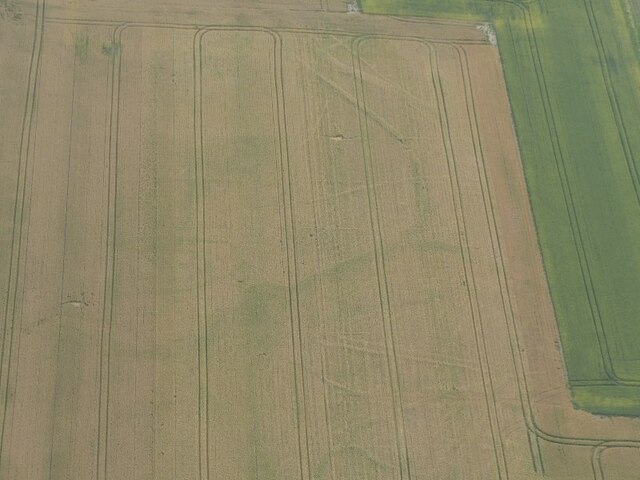
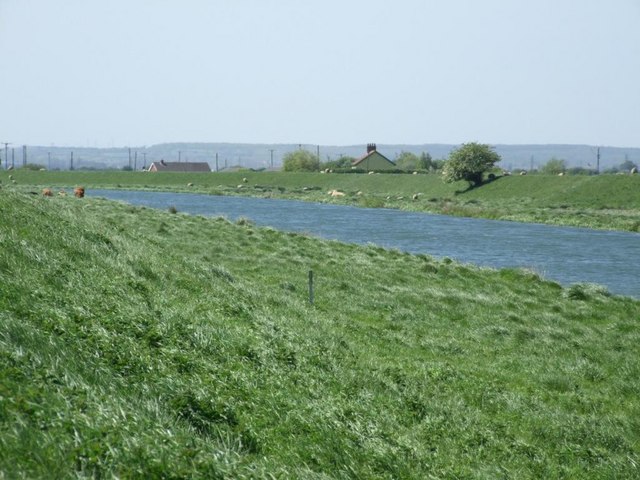
The village is known for its rich agricultural heritage, with vast farmlands dominating the surrounding landscape. Agriculture plays a crucial role in the local economy, and the fertile soil of the Fens allows for the cultivation of a variety of crops, including potatoes, vegetables, and flowers.

Pinchbeck West is home to a charming parish church, St. Mary's, which dates back to the 13th century. Its architecture showcases a mix of styles, including Gothic and Decorated Gothic, making it an interesting site for history enthusiasts.

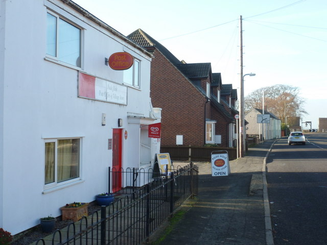
While the village itself is relatively small, it benefits from its proximity to Spalding, a larger town that offers a wider range of amenities and services. Residents of Pinchbeck West can access schools, healthcare facilities, shopping centers, and recreational activities in Spalding with ease.

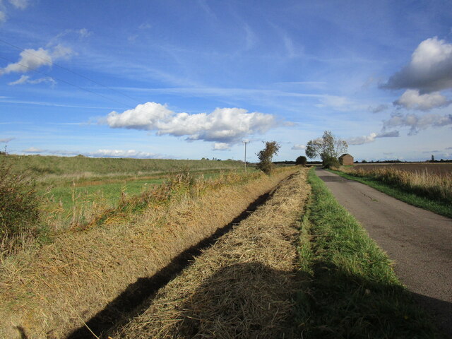
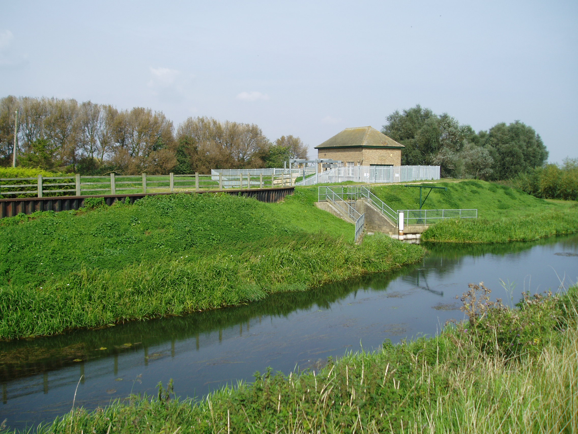
The area surrounding Pinchbeck West provides opportunities for outdoor pursuits, such as walking and cycling, thanks to its network of footpaths and quiet country lanes. The nearby River Welland also offers opportunities for boating and fishing.

Overall, Pinchbeck West offers a tranquil and idyllic setting, making it an attractive place for those seeking a peaceful rural lifestyle within easy reach of larger towns.

If you have any feedback on the listing, please let us know in the comments section below.

Pinchbeck West Images

Images are sourced within 2km of 52.805421/-0.218731 or Grid Reference TF2024. Thanks to Geograph Open Source API. All images are credited.

Cropmarks in field between Black Hole Drove and Leaves Lake Drove south of Northgate: aerial 2021 (1) NW of Pinchbeck West.
Cropmarks in field between Black Hole Drove and Leaves Lake Drove south of Northgate: aerial 2021 (1)
NW of Pinchbeck West.
Cropmarks in field between Black Hole Drove and Leaves Lake Drove south of Northgate: aerial 2021 (2)
Cropmarks in field between Black Hole Drove and Leaves Lake Drove south of Northgate: aerial 2021 (3)
Pinchbeck South Fen and River Glen: aerial 2021 South of Pinchbeck West.
Pinchbeck South Fen and River Glen: aerial 2021
South of Pinchbeck West.
Flat landscape, bumpy road The lane is Slipe Drove by the River Glen above Pinchbeck West. Pinchbeck South Fen can be seen to the left.
Flat landscape, bumpy road
The lane is Slipe Drove by the River Glen above Pinchbeck West. Pinchbeck South Fen can be seen to the left.
Labyrinth by Slipe Drove, Pinchbeck West According to Lauren Artress, “A maze is designed to make you lose your way, while a labyrinth is designed to help you find your way.” 

A labyrinth is typically circular (though square ones also exist), with a single winding path leading to the centre. The design has been known and used for at least 4000 years, as surviving art works attest. For Christians it symbolises the journey of faith; the famous labyrinth in the floor of Chartres Cathedral, a pilgrimage site in France, has been walked by pilgrims since 1205. See this article by Sarah James in Earth & Altar <span class="nowrap"><a title="https://earthandaltarmag.com/posts/qs6pevk77i0lhpqlvv8w0u23f1sbwk" rel="nofollow ugc noopener" href="https://earthandaltarmag.com/posts/qs6pevk77i0lhpqlvv8w0u23f1sbwk">Link</a><img style="margin-left:2px;" alt="External link" title="External link - shift click to open in new window" src="https://s1.geograph.org.uk/img/external.png" width="10" height="10"/></span> .

This Lincolnshire labyrinth belongs to an Anglican Franciscan hermitage.
Labyrinth by Slipe Drove, Pinchbeck West
According to Lauren Artress, “A maze is designed to make you lose your way, while a labyrinth is designed to help you find your way.” A labyrinth is typically circular (though square ones also exist), with a single winding path leading to the centre. The design has been known and used for at least 4000 years, as surviving art works attest. For Christians it symbolises the journey of faith; the famous labyrinth in the floor of Chartres Cathedral, a pilgrimage site in France, has been walked by pilgrims since 1205. See this article by Sarah James in Earth & Altar LinkExternal link . This Lincolnshire labyrinth belongs to an Anglican Franciscan hermitage.
Glass cats eye An odd thing in the middle of the road.  A solid glass lump with a raised centre section.  This must be the modern version of the old fashioned catseye.  A tricky thing to image, I did not fancy bending any lower in the middle of a busy road.
Glass cats eye
An odd thing in the middle of the road. A solid glass lump with a raised centre section. This must be the modern version of the old fashioned catseye. A tricky thing to image, I did not fancy bending any lower in the middle of a busy road.
Glass road reflector An odd thing in the middle of the road.  A solid glass lump with a raised centre section.  This must be the modern version of the old fashioned catseye.  A tricky thing to image, I did not fancy bending any lower in the middle of a busy road.
Glass road reflector
An odd thing in the middle of the road. A solid glass lump with a raised centre section. This must be the modern version of the old fashioned catseye. A tricky thing to image, I did not fancy bending any lower in the middle of a busy road.
Field at West Pinchbeck A 90 degree panorama of a fenland field.
Field at West Pinchbeck
A 90 degree panorama of a fenland field.
The Macmillan Way The footpath on the southern bank of the River Glen is part of a long distance footpath.  the bank, and the slipe below on the left, are a nature reserve managed by the Lincolnshire Wildlife Trust
The Macmillan Way
The footpath on the southern bank of the River Glen is part of a long distance footpath. the bank, and the slipe below on the left, are a nature reserve managed by the Lincolnshire Wildlife Trust
Slipe Drove
Slipe Drove
Pinchbeck South Fen Looking towards Marshall Farm.
Pinchbeck South Fen
Looking towards Marshall Farm.
Drain alongside Slipe Drove
Pinchbeck South Fen The land has been prepared for the next crop.
Pinchbeck South Fen
The land has been prepared for the next crop.
Pinchbeck South Fen
Pinchbeck South Fen
Drain alongside Holland's Chase
Glenside Mill, Pinchbeck West, Lincs built 1812, worked with wind until 1931 and by modern machinery until the late 1970s; has acquired a distinct lean <span class="nowrap"><a title="http://www.lincolnshire.gov.uk/windmills/section.asp?catId=3416" rel="nofollow ugc noopener" href="http://www.lincolnshire.gov.uk/windmills/section.asp?catId=3416">Link</a><img style="margin-left:2px;" alt="External link" title="External link - shift click to open in new window" src="https://s1.geograph.org.uk/img/external.png" width="10" height="10"/></span> .
Glenside Mill, Pinchbeck West, Lincs
built 1812, worked with wind until 1931 and by modern machinery until the late 1970s; has acquired a distinct lean LinkExternal link .
Show me another place!

Pinchbeck West is located at Grid Ref: TF2024 (Lat: 52.805421, Lng: -0.218731)

Division: Parts of Holland

Administrative County: Lincolnshire

District: South Holland

Police Authority: Lincolnshire

Also known as: Over Hulton

What 3 Words

///uncle.staining.appealing. Near Pinchbeck, Lincolnshire

Nearby Locations

Pinchbeck West

Related Wikis

Pode Hole

Pode Hole is a village in South Holland, Lincolnshire, England. It is 2 miles (3.2 km) from Spalding and a similar distance from Bourne. The village lies...

Guthram Gowt

Guthram Gowt is a small settlement in the South Holland district of Lincolnshire, England. It is situated 5 miles (8 km) both east from Bourne and west...

North Drove railway station

North Drove railway station was a station serving Pode Hole in Lincolnshire, England. It was on the route of the Spalding and Bourne Railway (opened 1866...

River Glen, Lincolnshire

The River Glen is a river in Lincolnshire, England with a short stretch passing through Rutland near Essendine. The river's name appears to derive from...

Pinchbeck railway station

Pinchbeck railway station was a station in Pinchbeck, Lincolnshire, England on the line between Spalding and Sleaford. The station opened in 1882, closed...

Willow Tree Fen

Willow Tree Fen is a local nature reserve with an area of over 112.0 ha (277 acres) located near Bourne and Spalding, south of the River Glen, England...

Pinchbeck, Lincolnshire

Pinchbeck is a village and civil parish in the South Holland district of Lincolnshire, England. The civil parish population was 5,153 at the 2001 census...

Counter Drain railway station

Counter Drain railway station was a remote station in Lincolnshire serving the village of Tongue End. It was on the route of the Spalding and Bourne Railway...

Nearby Amenities

Located within 500m of 52.805421,-0.218731
West Pinchbeck
Alt Name: Pinchbeck West
Is In: Lincolnshire
Place: village
Source: local knowledge
Source Name: sign
Wikidata: Q118955343
Lat/Long: 52.805792/-0.2180283
Bus Stop
Glenside South
Bus: yes
Naptan AtcoCode: 270000009760
Naptan Bearing: SE
Naptan CommonName: Glenside South
Naptan Indicator: adj
Naptan Landmark: Glenside South
Naptan NaptanCode: linjdtwm
Naptan Street: Dozen's Bank
Naptan Verified: no
Public Transport: platform
Source: naptan_import
Lat/Long: 52.8041791/-0.2194244
Bus Stop
Glenside South
Bus: yes
Naptan AtcoCode: 270000009761
Naptan Bearing: NW
Naptan CommonName: Glenside South
Naptan Indicator: opp
Naptan Landmark: Glenside South
Naptan NaptanCode: linjdtwp
Naptan Street: Dozen's Bank
Naptan Verified: no
Public Transport: platform
Source: naptan_import
Lat/Long: 52.8039593/-0.2191515
Bus Stop
St Bartholomews Church
Bus: yes
Naptan AtcoCode: 270000010592
Naptan Bearing: N
Naptan CommonName: St Bartholomews Church
Naptan Indicator: opp
Naptan Landmark: St Bartholomews Church
Naptan NaptanCode: linjpagj
Naptan Street: Six House Bank
Naptan Verified: no
Public Transport: platform
Source: naptan_import
Lat/Long: 52.807772/-0.2221856
Bus Stop
St Bartholomews Church
Bus: yes
Naptan AtcoCode: 270000010593
Naptan Bearing: S
Naptan CommonName: St Bartholomews Church
Naptan Indicator: o/s
Naptan Landmark: St Bartholomews Church
Naptan NaptanCode: linjpagm
Naptan Street: Six House Bank
Naptan Verified: no
Public Transport: platform
Source: naptan_import
Lat/Long: 52.8076249/-0.221969
Give Way
Source: Bing
Lat/Long: 52.8048713/-0.2209071
Bridge Farm
Place: farm
Source: Bing
Lat/Long: 52.8073803/-0.2173887
Dovehirne Farm
Place: farm
Source: OS OpenData StreetView
Lat/Long: 52.8046887/-0.2239362
Pinchbeck Bars
Place: locality
Source: OS OpenData StreetView
Lat/Long: 52.8055899/-0.2223232
Pear Tree Farm
Place: farm
Source: Bing
Lat/Long: 52.8058637/-0.2165806
Milestone
Historic: milestone
Listed Status: Grade II
Lat/Long: 52.8037831/-0.2187691
Place: farm
Lat/Long: 52.8026186/-0.21598
Give Way
Source: Bing
Lat/Long: 52.8029995/-0.2166525
Give Way
Source: Bing
Lat/Long: 52.80309/-0.2168326
Give Way
Source: Bing
Lat/Long: 52.8046439/-0.220448
Noexit: yes
Lat/Long: 52.8042082/-0.2187865
Noexit: yes
Lat/Long: 52.8029796/-0.2163904
Noexit: yes
Lat/Long: 52.80273/-0.2162157
The data included in this document is from www.openstreetmap.org. The data is made available under ODbL.

Have you been to Pinchbeck West?

Leave your review of Pinchbeck West below (or comments, questions and feedback).