Birkenshaw Bottoms

Settlement in Yorkshire

England

Birkenshaw Bottoms

Oakwell Hall Country Park Parts of Oakwell Hall date from the 15th century but the present building is largely due to John Batt in 1583, with some further modifications in the 17th century. In the 19th century it was used as a boarding school. When Charlotte Bronte lived at nearby Hartshead, she allegedly used Oakwell as the basis for 'Fieldhead' in the novel 'Shirley' (Fieldhead is in fact a local name for part of Birstall). The hall and its outbuildings are listed grade I (list entry 11344609) and now operated as a museum by Kirklees council (open at weekends). 

The grounds, along with the site of a former colliery and railway line, form Oakwell Country Park covering 45 hectares of woodland and open fields, which has a separate free car park. There are nature trails and a mountain bike route.
Oakwell Hall Country Park Credit: habiloid

Birkenshaw Bottoms is a small village located in West Yorkshire, England. Situated in the metropolitan borough of Kirklees, it lies approximately 8 miles south-west of the city of Bradford and 12 miles south-east of Leeds.

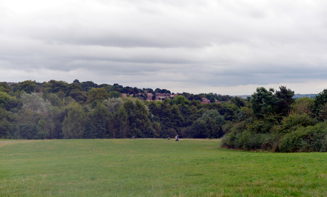
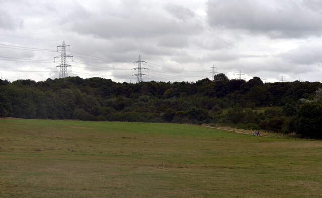
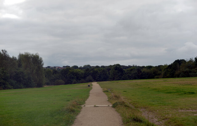
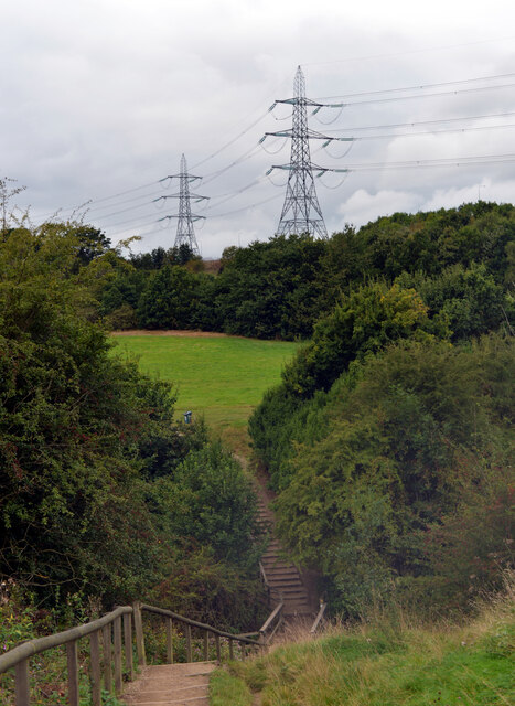
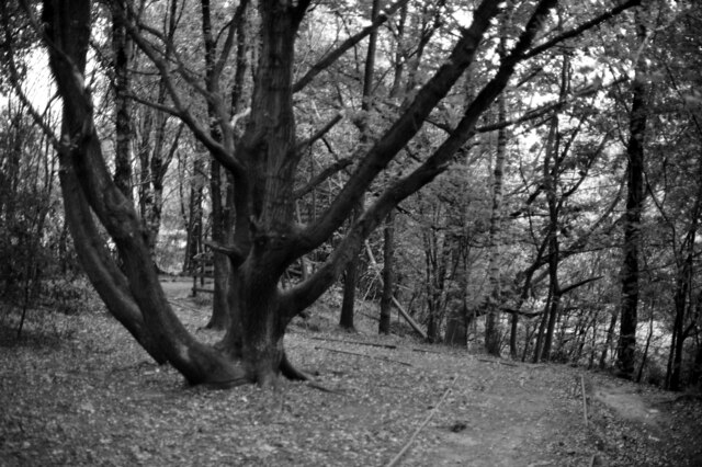
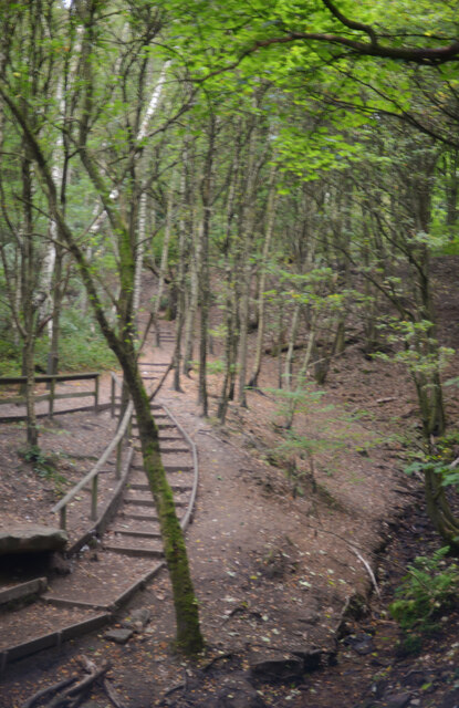
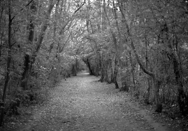
The village is named after the surrounding area, which is characterized by its low-lying land and picturesque meadows known as "bottoms." Birkenshaw Bottoms is a predominantly rural area, with a scattering of farms and residential properties. The landscape is dotted with traditional stone-built houses and farm buildings, giving the village a charming and quintessentially Yorkshire feel.

Despite its rural setting, Birkenshaw Bottoms benefits from its close proximity to major urban centers. The village is conveniently located near several major roads, including the M62 motorway, which provides easy access to surrounding towns and cities. This accessibility makes Birkenshaw Bottoms an attractive location for commuters looking to escape the hustle and bustle of city life while still having convenient access to employment opportunities.

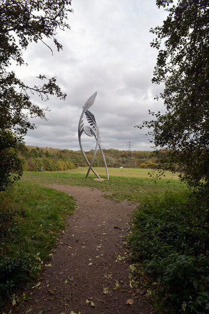
The village itself offers a peaceful and close-knit community atmosphere. It boasts a primary school, a village hall, and a handful of local shops and amenities, catering to the needs of its residents. The surrounding countryside provides ample opportunities for outdoor activities, such as walking, cycling, and horse riding.

Overall, Birkenshaw Bottoms offers a unique blend of rural tranquility and convenient access to urban amenities, making it an appealing place to live for those seeking a slower pace of life in the beautiful Yorkshire countryside.

If you have any feedback on the listing, please let us know in the comments section below.

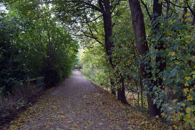
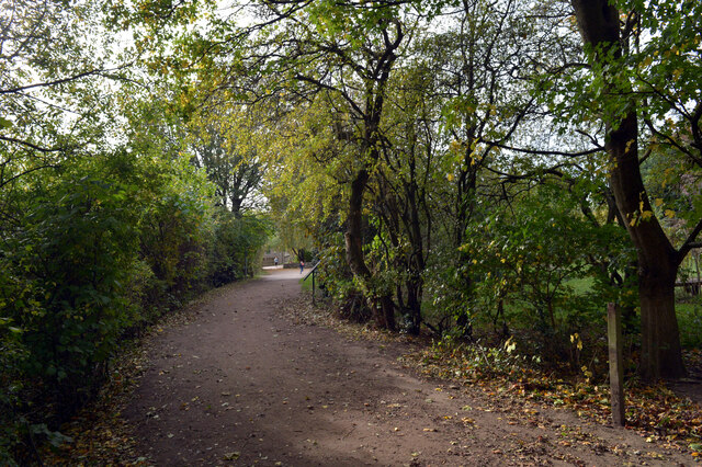
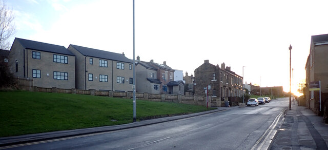
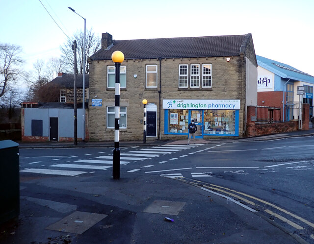
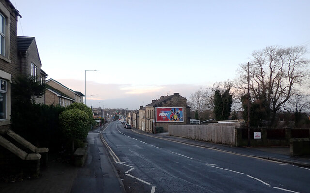
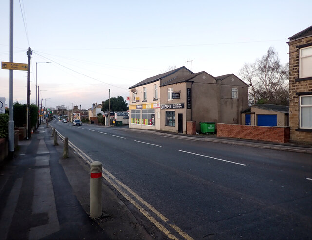
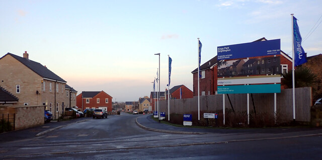
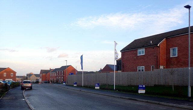
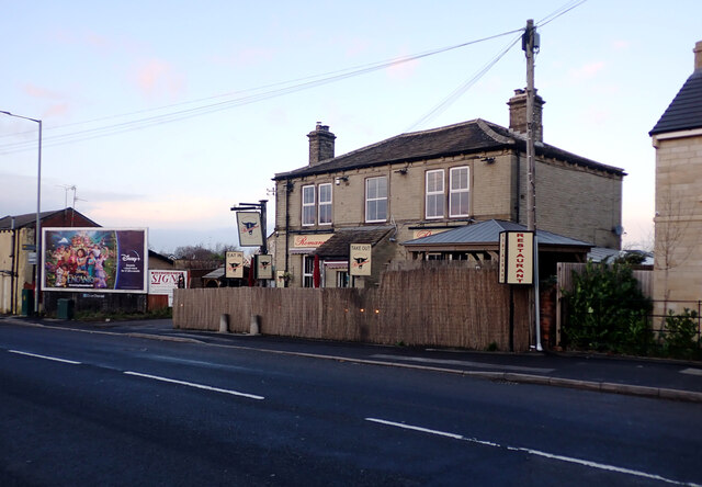
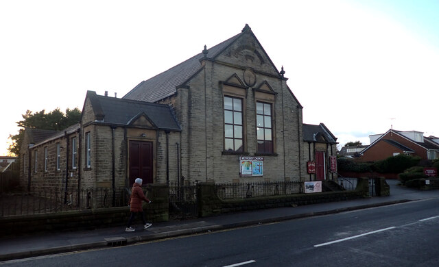
Birkenshaw Bottoms Images

Images are sourced within 2km of 53.744802/-1.682258 or Grid Reference SE2127. Thanks to Geograph Open Source API. All images are credited.

Oakwell Hall Country Park Parts of Oakwell Hall date from the 15th century but the present building is largely due to John Batt in 1583, with some further modifications in the 17th century. In the 19th century it was used as a boarding school. When Charlotte Bronte lived at nearby Hartshead, she allegedly used Oakwell as the basis for 'Fieldhead' in the novel 'Shirley' (Fieldhead is in fact a local name for part of Birstall). The hall and its outbuildings are listed grade I (list entry 11344609) and now operated as a museum by Kirklees council (open at weekends). 

The grounds, along with the site of a former colliery and railway line, form Oakwell Country Park covering 45 hectares of woodland and open fields, which has a separate free car park. There are nature trails and a mountain bike route.
Oakwell Hall Country Park
Parts of Oakwell Hall date from the 15th century but the present building is largely due to John Batt in 1583, with some further modifications in the 17th century. In the 19th century it was used as a boarding school. When Charlotte Bronte lived at nearby Hartshead, she allegedly used Oakwell as the basis for 'Fieldhead' in the novel 'Shirley' (Fieldhead is in fact a local name for part of Birstall). The hall and its outbuildings are listed grade I (list entry 11344609) and now operated as a museum by Kirklees council (open at weekends). The grounds, along with the site of a former colliery and railway line, form Oakwell Country Park covering 45 hectares of woodland and open fields, which has a separate free car park. There are nature trails and a mountain bike route.
Path, Oakwell Hall Country Park Parts of Oakwell Hall date from the 15th century but the present building is largely due to John Batt in 1583, with some further modifications in the 17th century. In the 19th century it was used as a boarding school. When Charlotte Bronte lived at nearby Hartshead, she allegedly used Oakwell as the basis for 'Fieldhead' in the novel 'Shirley' (Fieldhead is in fact a local name for part of Birstall). The hall and its outbuildings are listed grade I (list entry 11344609) and now operated as a museum by Kirklees council (open at weekends). 

The grounds, along with the site of a former colliery and railway line, form Oakwell Country Park covering 45 hectares of woodland and open fields, which has a separate free car park. There are nature trails and a mountain bike route.
Path, Oakwell Hall Country Park
Parts of Oakwell Hall date from the 15th century but the present building is largely due to John Batt in 1583, with some further modifications in the 17th century. In the 19th century it was used as a boarding school. When Charlotte Bronte lived at nearby Hartshead, she allegedly used Oakwell as the basis for 'Fieldhead' in the novel 'Shirley' (Fieldhead is in fact a local name for part of Birstall). The hall and its outbuildings are listed grade I (list entry 11344609) and now operated as a museum by Kirklees council (open at weekends). The grounds, along with the site of a former colliery and railway line, form Oakwell Country Park covering 45 hectares of woodland and open fields, which has a separate free car park. There are nature trails and a mountain bike route.
Path and pylons, Oakwell Hall Country Park Parts of Oakwell Hall date from the 15th century but the present building is largely due to John Batt in 1583, with some further modifications in the 17th century. In the 19th century it was used as a boarding school. When Charlotte Bronte lived at nearby Hartshead, she allegedly used Oakwell as the basis for 'Fieldhead' in the novel 'Shirley' (Fieldhead is in fact a local name for part of Birstall). The hall and its outbuildings are listed grade I (list entry 11344609) and now operated as a museum by Kirklees council (open at weekends). 

The grounds, along with the site of a former colliery and railway line, form Oakwell Country Park covering 45 hectares of woodland and open fields, which has a separate free car park. There are nature trails and a mountain bike route.
Path and pylons, Oakwell Hall Country Park
Parts of Oakwell Hall date from the 15th century but the present building is largely due to John Batt in 1583, with some further modifications in the 17th century. In the 19th century it was used as a boarding school. When Charlotte Bronte lived at nearby Hartshead, she allegedly used Oakwell as the basis for 'Fieldhead' in the novel 'Shirley' (Fieldhead is in fact a local name for part of Birstall). The hall and its outbuildings are listed grade I (list entry 11344609) and now operated as a museum by Kirklees council (open at weekends). The grounds, along with the site of a former colliery and railway line, form Oakwell Country Park covering 45 hectares of woodland and open fields, which has a separate free car park. There are nature trails and a mountain bike route.
Oakwell Hall Country Park Parts of Oakwell Hall date from the 15th century but the present building is largely due to John Batt in 1583, with some further modifications in the 17th century. In the 19th century it was used as a boarding school. When Charlotte Bronte lived at nearby Hartshead, she allegedly used Oakwell as the basis for 'Fieldhead' in the novel 'Shirley' (Fieldhead is in fact a local name for part of Birstall). The hall and its outbuildings are listed grade I (list entry 11344609) and now operated as a museum by Kirklees council (open at weekends). 

The grounds, along with the site of a former colliery and railway line, form Oakwell Country Park covering 45 hectares of woodland and open fields, which has a separate free car park. There are nature trails and a mountain bike route.
Oakwell Hall Country Park
Parts of Oakwell Hall date from the 15th century but the present building is largely due to John Batt in 1583, with some further modifications in the 17th century. In the 19th century it was used as a boarding school. When Charlotte Bronte lived at nearby Hartshead, she allegedly used Oakwell as the basis for 'Fieldhead' in the novel 'Shirley' (Fieldhead is in fact a local name for part of Birstall). The hall and its outbuildings are listed grade I (list entry 11344609) and now operated as a museum by Kirklees council (open at weekends). The grounds, along with the site of a former colliery and railway line, form Oakwell Country Park covering 45 hectares of woodland and open fields, which has a separate free car park. There are nature trails and a mountain bike route.
Path through the woods, Oakwell Hall Country Park
Route of an old railway line passing through the woods, Oakwell Hall Country Park Parts of Oakwell Hall date from the 15th century but the present building is largely due to John Batt in 1583, with some further modifications in the 17th century. In the 19th century it was used as a boarding school. When Charlotte Bronte lived at nearby Hartshead, she allegedly used Oakwell as the basis for 'Fieldhead' in the novel 'Shirley' (Fieldhead is in fact a local name for part of Birstall). The hall and its outbuildings are listed grade I (list entry 11344609) and now operated as a museum by Kirklees council (open at weekends). 

The grounds, along with the site of a former colliery and railway line, form Oakwell Country Park covering 45 hectares of woodland and open fields, which has a separate free car park. There are nature trails and a mountain bike route.
Route of an old railway line passing through the woods, Oakwell Hall Country Park
Parts of Oakwell Hall date from the 15th century but the present building is largely due to John Batt in 1583, with some further modifications in the 17th century. In the 19th century it was used as a boarding school. When Charlotte Bronte lived at nearby Hartshead, she allegedly used Oakwell as the basis for 'Fieldhead' in the novel 'Shirley' (Fieldhead is in fact a local name for part of Birstall). The hall and its outbuildings are listed grade I (list entry 11344609) and now operated as a museum by Kirklees council (open at weekends). The grounds, along with the site of a former colliery and railway line, form Oakwell Country Park covering 45 hectares of woodland and open fields, which has a separate free car park. There are nature trails and a mountain bike route.
"Fiddlehead and Fernblades" by Adrian Moakes, Oakwell Hall Country Park "Fiddlehead and Fernblades" is a sculpture by Adrian Moakes (2008). It stands at the highest point of the colliery field of Oakwell Hall Country park, Birstall. The colliery field is the landscape site of Gomersal Pit which closed in 1973. The sculpture depicts ferns which formed the coal mined there.
It is 6.5m high and is formed from galvanized tubular and sheet steel. It was officially opened on 19th October 2008.
"Fiddlehead and Fernblades" by Adrian Moakes, Oakwell Hall Country Park
"Fiddlehead and Fernblades" is a sculpture by Adrian Moakes (2008). It stands at the highest point of the colliery field of Oakwell Hall Country park, Birstall. The colliery field is the landscape site of Gomersal Pit which closed in 1973. The sculpture depicts ferns which formed the coal mined there. It is 6.5m high and is formed from galvanized tubular and sheet steel. It was officially opened on 19th October 2008.
Route of an old railway line passing through the woods, Oakwell Hall Country Park
Warrens Lane, Oakwell Hall Country Park
Moorside Road, Drighlington
Drighlington Pharmacy, King Street (B6135), Drighlington
King Street (B6135), Drighlington
Winterfell Road seen from King Street (B6135), Drighlington
Winterfell Road, Drighlington
Romano's Restaurant, King Street (B6135), Drighlington
Drighlington Methodist Church, King Street (B6135), Drighlington
Show me another place!

Birkenshaw Bottoms is located at Grid Ref: SE2127 (Lat: 53.744802, Lng: -1.682258)

Division: West Riding

Unitary Authority: Kirklees

Police Authority: West Yorkshire

What 3 Words

///judges.meant.wiping. Near Drighlington, West Yorkshire

Related Wikis

BBG Academy

BBG Academy (formerly Birkenshaw Middle School) is a mixed secondary school located in Birkenshaw, West Yorkshire, England.Birkenshaw Middle School was...

Birkenshaw, West Yorkshire

Birkenshaw is a village in the borough of Kirklees in the county of West Yorkshire, England. It lies at the crossroads between the A58 Leeds to Halifax...

M62 coach bombing

The M62 coach bombing, sometimes referred to as the M62 Massacre, occurred on 4 February 1974 on the M62 motorway in northern England, when a 25-pound...

Gomersal railway station

Gomersal railway station served the town of Gomersal, West Yorkshire, England, from 1900 to 1953 on the Leeds New Line. == History == The station was opened...

Nearby Amenities

Located within 500m of 53.744802,-1.682258
Power: tower
Lat/Long: 53.7417415/-1.6843692
Power: tower
Lat/Long: 53.74165/-1.6874951
Moor Lane Mini-Market
Addr City: Bradford
Addr Hamlet: Birkenshaw
Addr Housenumber: 262
Addr Postcode: BD11 2HH
Addr Street: Moor Lane
Fhrs Id: 228006
Shop: convenience
Source Addr: FHRS Open Data
Lat/Long: 53.7454083/-1.6815852
Telephone
Booth: KX100
Covered: booth
Lat/Long: 53.7454194/-1.681751
Post Box
Operator: Royal Mail
Post Box Mounting: lamp_post
Post Box Type: lamp
Ref: BD11 411
Lat/Long: 53.745144/-1.6825127
Turning Circle
Lat/Long: 53.7462142/-1.6833496
Turning Circle
Lat/Long: 53.747996/-1.6846442
Bus Stop
Moor Lane Norwood Crescent
Local Ref: 45012436
Naptan AtcoCode: 450012436
Naptan Bearing: NW
Naptan CommonName: Moor Lane Norwood Crescent
Naptan Crossing: Norwood Crescent
Naptan Indicator: Stop 45012436
Naptan Notes: OSR taken place 080905Commutaport shelter removed 270208Trueform installed on 270208
Naptan PlusbusZoneRef: LEEDS
Naptan ShortCommonName: Norwood Crescent
Naptan Street: Moor Lane
Naptan Verified: no
Source: naptan_import
Lat/Long: 53.7429816/-1.6822358
Bus Stop
Moor Lane Norwood Crescent
Local Ref: 45012437
Naptan AtcoCode: 450012437
Naptan Bearing: SE
Naptan CommonName: Moor Lane Norwood Crescent
Naptan Crossing: Norwood Crescent
Naptan Indicator: Stop 45012437
Naptan PlusbusZoneRef: LEEDS
Naptan ShortCommonName: Norwood Crescent
Naptan Street: Moor Lane
Naptan Verified: no
Source: naptan_import
Lat/Long: 53.7429414/-1.6820298
Bus Stop
Birkenshaw Lane Moor Lane
Local Ref: 45012438
Naptan AtcoCode: 450012438
Naptan Bearing: NW
Naptan CommonName: Birkenshaw Lane Moor Lane
Naptan Crossing: Moor Lane
Naptan Indicator: Stop 45012438
Naptan PlusbusZoneRef: LEEDS
Naptan ShortCommonName: Moor Lane
Naptan Street: Birkenshaw Lane
Naptan Verified: no
Source: naptan_import
Lat/Long: 53.7460492/-1.6814776
Bus Stop
Birkenshaw Lane Moor Road
Local Ref: 45012439
Naptan AtcoCode: 450012439
Naptan Bearing: SE
Naptan CommonName: Birkenshaw Lane Moor Road
Naptan Crossing: Moor Road
Naptan Indicator: Stop 45012439
Naptan Notes: OSR taken place 080905
Naptan PlusbusZoneRef: LEEDS
Naptan ShortCommonName: Moor Road
Naptan Street: Birkenshaw Lane
Naptan Verified: no
Source: naptan_import
Lat/Long: 53.7459636/-1.681279
Bus Stop
Birkenshaw Lane Whitehall Road East
Local Ref: 45012440
Naptan AtcoCode: 450012440
Naptan Bearing: SE
Naptan CommonName: Birkenshaw Lane Whitehall Road East
Naptan Crossing: Whitehall Road East
Naptan Indicator: Stop 45012440
Naptan PlusbusZoneRef: LEEDS
Naptan ShortCommonName: Birkenshaw Bar
Naptan Street: Birkenshaw Lane
Naptan Verified: no
Source: naptan_import
Lat/Long: 53.7490108/-1.6847135
Generator Method: photovoltaic
Generator Output Electricity: yes
Generator Source: solar
Generator Type: solar_photovoltaic_panel
Location: roof
Power: generator
Lat/Long: 53.7438454/-1.683241
Barrier: stile
Material: wood
Stile: stepover
Lat/Long: 53.7425893/-1.6758568
Barrier: stile
Material: stone
Stile: stepover
Lat/Long: 53.7436271/-1.6789295
Waste Basket
Lat/Long: 53.7417866/-1.6811603
Tutti Frutti
Shop: hairdresser
Lat/Long: 53.7459254/-1.6810129
Barford
Office: estate_agent
Phone: +44 1274877258
Lat/Long: 53.7460142/-1.6810987
The data included in this document is from www.openstreetmap.org. The data is made available under ODbL.

Have you been to Birkenshaw Bottoms?

Leave your review of Birkenshaw Bottoms below (or comments, questions and feedback).