Birkacre

Settlement in Lancashire Chorley

England

Birkacre

Yew Tree House Farm
Yew Tree House Farm Credit: Peter McDermott

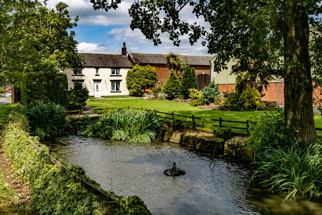
Birkacre is a small village located in the county of Lancashire, England. Situated approximately 3 miles southeast of the town of Chorley, Birkacre is nestled in a picturesque rural landscape, surrounded by rolling green hills and farmland. The village is part of the civil parish of Coppull and falls within the administrative district of Chorley.

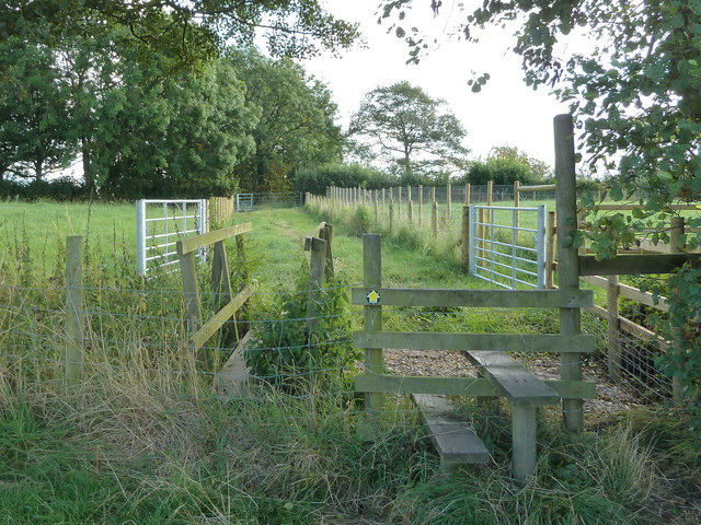
Birkacre is renowned for its natural beauty and offers a tranquil escape from the hustle and bustle of nearby urban areas. The village is home to Birkacre Brow, a local nature reserve that spans over 30 hectares. This reserve is a haven for wildlife enthusiasts, with its diverse range of flora and fauna, including woodlands, wetlands, and meadows. It is a popular spot for walking, birdwatching, and nature photography.

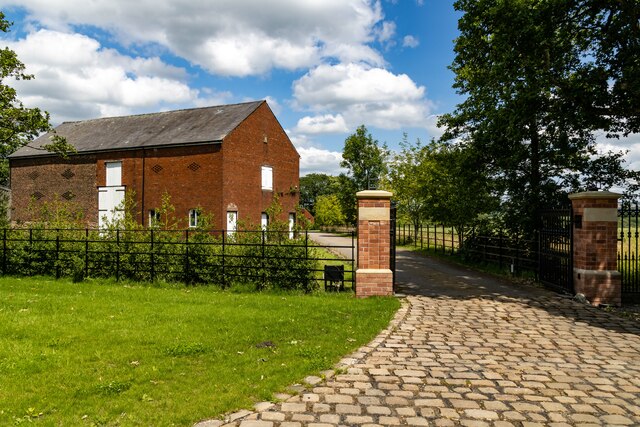
Historically, Birkacre was an important industrial area during the 19th and early 20th centuries. The village was home to several coal mines and brickworks, which played a significant role in the local economy. Although these industries have now ceased operation, remnants of the mining heritage can still be seen in the form of old pit shafts and mining infrastructure.

Today, Birkacre is primarily a residential area, with a close-knit community and a handful of local amenities. The village offers a peaceful and idyllic lifestyle while still being within easy reach of the amenities and transport links of nearby Chorley. Birkacre provides the perfect balance between rural living and accessibility, making it an attractive place for both families and individuals seeking a serene countryside retreat.

If you have any feedback on the listing, please let us know in the comments section below.

Birkacre Images

Images are sourced within 2km of 53.632464/-2.647975 or Grid Reference SD5715. Thanks to Geograph Open Source API. All images are credited.

Yew Tree House Farm
Yew Tree House Farm
Coppull Hall Lane
Coppull Hall Lane
Coppull Hall Barn at entrance to Coppull Hall.
Coppull Hall
Barn at entrance to Coppull Hall.
Wheatsheaf Hotel The Wheatsheaf Hotel public house.
Wheatsheaf Hotel
The Wheatsheaf Hotel public house.
Village Hall New house on the site of the old Village Hall.
Village Hall
New house on the site of the old Village Hall.
Butterworth Brow
Butterworth Brow
B5252 New roundabout on the B5252, Yarrow Valley Way.
B5252
New roundabout on the B5252, Yarrow Valley Way.
Big Wood Weir and dam at the lake in Big Wood.
Big Wood
Weir and dam at the lake in Big Wood.
Play area, Coppull
Play area, Coppull
St John's Church, Coppull At the junction of Park Road and Hewlett Street
St John's Church, Coppull
At the junction of Park Road and Hewlett Street
Garden of Remembrance, Spendmore Lane, Coppull
Stile at turn in footpath between Chapel Lane and Green Lane
Junction of Coppull Hall Lane and Green Lane
Coppull Parish Church, Chapel Lane
Path between Blainscough Hall and Chapel Lane, Coppull Moor
Footpath between Chorley Lane and Park Road, Coppull
Footpath from Park Road to Chorley Lane, Coppull
Footbridge over Tanyard Brook, Coppull
Show me another place!

Birkacre is located at Grid Ref: SD5715 (Lat: 53.632464, Lng: -2.647975)

Administrative County: Lancashire

District: Chorley

Police Authority: Lancashire

What 3 Words

///oiled.senior.rust. Near Coppull, Lancashire

Related Wikis

Yarrow Valley Country Park

Yarrow Valley Country Park is a country park managed by Chorley Borough Council in Lancashire, England. It follows the River Yarrow for about 6 miles...

Southlands High School

Southlands High School is a coeducational secondary school in Chorley, Lancashire, United Kingdom. It has approximately 1,000 students per annum. ��2...

Coppull Mill

Coppull Mill is a former cotton spinning mill in Coppull, Chorley, Lancashire. It was opened in 1906 by the Coppull Ring Spinning Co, followed by its sister...

Mavis Mill

Mavis Mill was a cotton spinning mill in Coppull, Chorley, Lancashire Mavis Mill was built in 1908 alongside the Coppull Ring Mill, which still survives...

Nearby Amenities

Located within 500m of 53.632464,-2.647975
Yarrow Valley Country Park
Source: survey
Tourism: attraction
Lat/Long: 53.6319759/-2.6515859
Cafe
Birkacre
Lat/Long: 53.6346088/-2.652824
Toilets
Access: yes
Fee: no
Toilets Handwashing: yes
Wheelchair: yes
Lat/Long: 53.6318969/-2.6510137
Defibrillator
Access: yes
Defibrillator Location: Right corner of Ranger Station
Emergency: defibrillator
Mapillary: 263392202181835
Source: survey
Lat/Long: 53.6317703/-2.6509989
Cafe
TreeFace Cafe
Addr City: Chorley
Addr Postcode: PR7 3RN
Addr Street: Burgh Hall Road
Mapillary: 369685774480955
Source: survey
Lat/Long: 53.6318206/-2.6509935
Jonathan Holland
Historic: memorial
Mapillary: 1567223743668806
Lat/Long: 53.6304193/-2.6496336
Bus Stop
Birkacre, Sharratts Path
Bench: no
Bus: yes
Naptan AtcoCode: 2500DCL3425
Naptan CommonName: Sharratts Path
Naptan Indicator: opp
Naptan NaptanCode: landjgwt
Naptan Verified: no
Public Transport: platform
Shelter: no
Lat/Long: 53.6333759/-2.654907
Bus Stop
Birkacre, Sharratts Path
Bench: yes
Bus: yes
Naptan AtcoCode: 2500DCL3424
Naptan CommonName: Sharratts Path
Naptan Indicator: by
Naptan NaptanCode: landjgwp
Naptan Verified: no
Public Transport: platform
Shelter: yes
Lat/Long: 53.6337183/-2.6550003
Bus Stop
Birkacre Lane
Bus: yes
Naptan AtcoCode: 2500DCL3423
Naptan CommonName: Birkacre Lane
Naptan Indicator: by
Naptan NaptanCode: landjgwm
Naptan Verified: no
Public Transport: platform
Shelter: no
Lat/Long: 53.6360608/-2.6520044
Bus Stop
Birkacre Lane
Bus: yes
Naptan AtcoCode: 250015423
Naptan CommonName: Birkacre Road
Naptan Indicator: by
Naptan NaptanCode: lanapmap
Naptan Verified: no
Public Transport: platform
Shelter: yes
Lat/Long: 53.6360503/-2.6522764
Turning Circle
Lat/Long: 53.6308885/-2.6426743
Turning Circle
Lat/Long: 53.6314158/-2.6420966
Barrier: kissing_gate
Foot: yes
Maxwidth: 1
Motor Vehicle: no
Lat/Long: 53.6335605/-2.6548156
Parking
Access: permissive
Parking: surface
Smoothness: bad
Surface: ground
Lat/Long: 53.635003/-2.6480055
Barrier: kissing_gate
Bicycle: yes
Foot: yes
Maxwidth: 1
Lat/Long: 53.6336321/-2.6411364
Lower Burgh 3
Barrier: kissing_gate
Bicycle: yes
Foot: yes
Maxwidth: 1
Lat/Long: 53.6315645/-2.6471928
Defibrillator
Defibrillator Location: Roadside on a wooden stand.
Emergency: defibrillator
Indoor: no
Lat/Long: 53.63553/-2.6527143
The data included in this document is from www.openstreetmap.org. The data is made available under ODbL.

Have you been to Birkacre?

Leave your review of Birkacre below (or comments, questions and feedback).