Penzance

Settlement in Cornwall

England

Penzance

Newlyn harbour from Fore Street
Newlyn harbour from Fore Street Credit: David Gearing

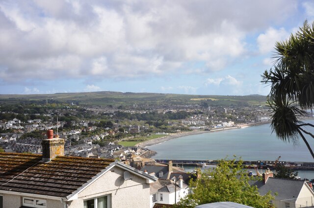
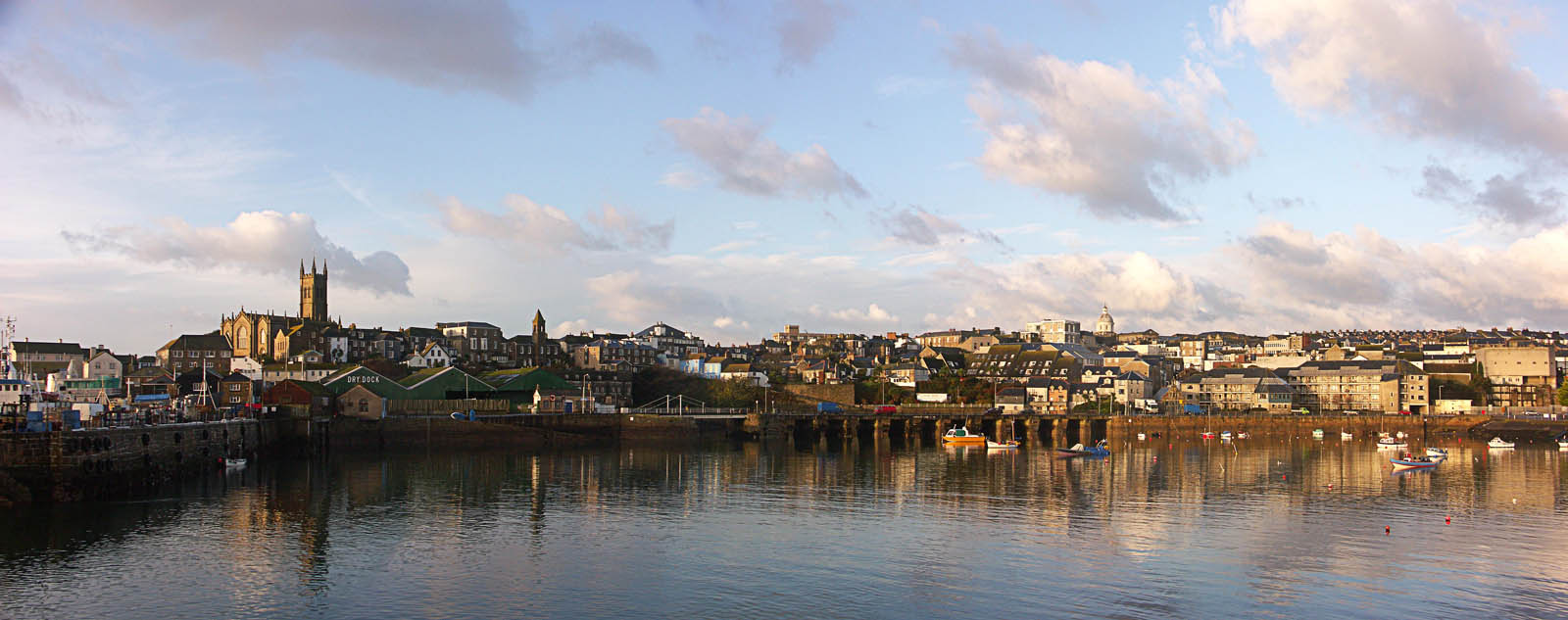
Penzance is a picturesque town located in Cornwall, England. Situated on the south-western coast of the country, Penzance is surrounded by stunning natural beauty, including rugged cliffs, sandy beaches, and crystal-clear waters. With a population of around 21,000 people, it is the largest town in the region.

The town's history dates back to ancient times, with evidence of human settlement found as far back as the Bronze Age. Over the centuries, Penzance grew into a thriving port town, playing a significant role in trade and fishing. Today, remnants of its maritime past can still be seen in the town's architecture and harbor.

Penzance is known for its mild climate, which is influenced by the Gulf Stream, making it a popular destination for tourists seeking a mild and pleasant seaside experience. The town boasts a vibrant cultural scene, with numerous art galleries, theaters, and music festivals. Penzance is also home to the iconic Egyptian House, a unique 19th-century building adorned with Egyptian-themed decorations.

Visitors to Penzance can explore its charming streets, filled with independent shops, cafes, and restaurants. The town is also a gateway to many nearby attractions, such as the famous St. Michael's Mount, a tidal island with a medieval castle, and the Minack Theatre, an open-air theater carved into the cliffs overlooking the sea.

In summary, Penzance offers a delightful blend of natural beauty, rich history, and cultural experiences. Whether it's exploring its coastal landscapes, immersing oneself in its artistic atmosphere, or simply enjoying the laid-back charm of a traditional Cornish town, Penzance has something to offer every visitor.

If you have any feedback on the listing, please let us know in the comments section below.
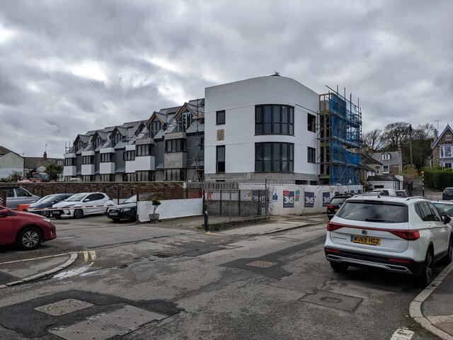
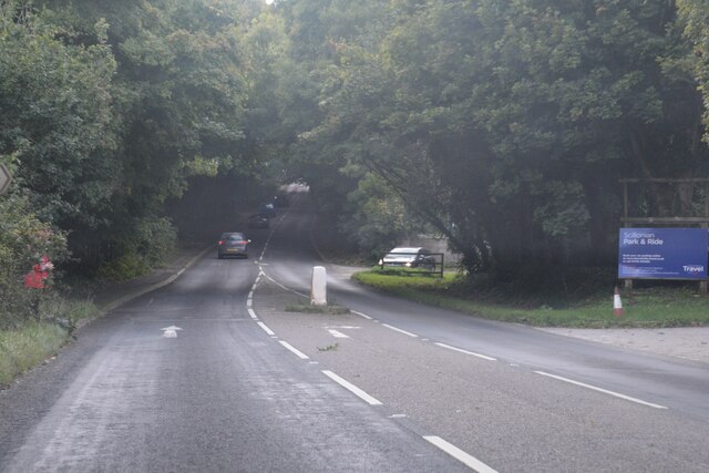
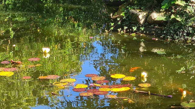
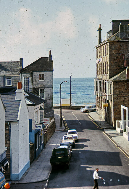
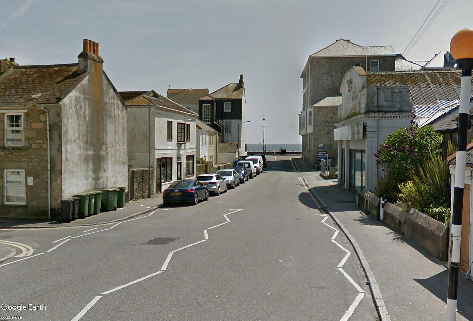
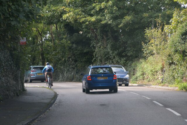
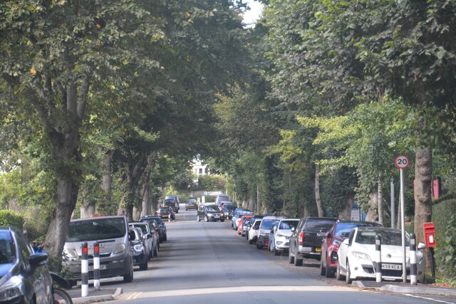
Penzance Images

Images are sourced within 2km of 50.118373/-5.539359 or Grid Reference SW4730. Thanks to Geograph Open Source API. All images are credited.

Newlyn harbour from Fore Street
The Newlyn Fishermen Memorial
Royal National Mission to Deep Sea Fishermen, Newlyn
Coastal views
Coastal views
View towards Newlyn Tidal Observatory from Tolcarne FBM
Newlyn Harbour A view of Newlyn Harbour taken from behind the RNLI station and looking southeast with the Mary Williams Pier on the left and the South Pier in the background.
Newlyn Harbour
A view of Newlyn Harbour taken from behind the RNLI station and looking southeast with the Mary Williams Pier on the left and the South Pier in the background.
Newlyn Harbour View of Newlyn Harbour, taken looking south from the Mary Williams Pier.
Newlyn Harbour
View of Newlyn Harbour, taken looking south from the Mary Williams Pier.
Street in Tolcarne
Street in Tolcarne
Looking across towards Penzance A view from Chywoone Hill across Newlyn towards Penzance.  Newlyn Harbour North  Quay crosses the bay from left to right.
Looking across towards Penzance
A view from Chywoone Hill across Newlyn towards Penzance. Newlyn Harbour North Quay crosses the bay from left to right.
Looking in to Mennaye Field
The gates to Penzance football club ground
Sponsored by Jewsons
Where once a garage stood Apartments have replaced the old garage. See: <a title="https://www.geograph.org.uk/photo/5749923" href="https://www.geograph.org.uk/photo/5749923">Link</a>
Where once a garage stood
Apartments have replaced the old garage. See: Link
Newlyn : A30 Looking along the A30.
Newlyn : A30
Looking along the A30.
Fish pond in Morrab Gardens
Morrab Road, Penzance c.1970 From the upstairs window of the former Marine Park Hotel. Streetview image Sep 2021: <span class="nowrap"><a title="https://media.geograph.org.uk/files/7eabe3a1649ffa2b3ff8c02ebfd5659f/Morrab_Rd_Penzance_Sep_2021-original.jpg" rel="nofollow ugc noopener" href="https://media.geograph.org.uk/files/7eabe3a1649ffa2b3ff8c02ebfd5659f/Morrab_Rd_Penzance_Sep_2021-original.jpg">Link</a><img style="margin-left:2px;" alt="External link" title="External link - shift click to open in new window" src="https://s1.geograph.org.uk/img/external.png" width="10" height="10"/></span>

<a href="https://www.geograph.org.uk/photo/7416705">SW4729 : Marine Park Hotel, Morab Road, Penzance c.1970</a>
Morrab Road, Penzance c.1970
From the upstairs window of the former Marine Park Hotel. Streetview image Sep 2021: LinkExternal link SW4729 : Marine Park Hotel, Morab Road, Penzance c.1970
Penzance : Road A road heading out from Penzance.
Penzance : Road
A road heading out from Penzance.
Penzance : Alexandra Road Looking along Alexandra Road.
Penzance : Alexandra Road
Looking along Alexandra Road.
Show me another place!

Penzance is located at Grid Ref: SW4730 (Lat: 50.118373, Lng: -5.539359)

Unitary Authority: Cornwall

Police Authority: Devon and Cornwall

What 3 Words

///perkily.lotteries.chatters. Near Penzance, Cornwall

Related Wikis

St John's Hall, Penzance

St John's Hall, formerly known as the Public Buildings, Penzance, is a municipal building in Alverton Street, Penzance, Cornwall, England. The structure...

Open Shed

Open Shed was a hackerspace in Penzance, Cornwall. Founded in 2012 (closed May 2014 ) it provided space for people working in the tech community to meet...

Penzance School of Art

Penzance School of Art is an art school in Penzance, Cornwall, England, housed in a purpose-built Grade II listed building opened in 1881. == History... ==

Coast FM (West Cornwall)

West Cornwall's Coast FM is a local radio station for West Cornwall. It contains a combination of local news, weather, music and talk. The station launched...

Penwith Hundred

Penwith Hundred was one of ten ancient administrative hundreds of the county of Cornwall, England, UK. The ancient hundred of Penwith was larger than the...

Penzance

Penzance ( pen-ZANSS; Cornish: Pennsans) is a town, civil parish and port in the Penwith district of Cornwall, England, United Kingdom. It is the most...

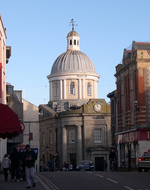
Market Building, Penzance

The Market Building in Penzance is a Grade I listed building situated at the top of Market Jew Street, Penzance. == History == The site of the Market Building...

Penlee House

Penlee House is a museum and art gallery located in the town of Penzance in Cornwall, and is home to a great many paintings by members of the Newlyn School...

Nearby Amenities

Located within 500m of 50.118373,-5.539359
Parking
Town Hall Car Park
Access: yes
Fee: yes
Parking: surface
Lat/Long: 50.1190002/-5.5408581
Townhall
Penzance Town Hall
Lat/Long: 50.1188437/-5.5403372
Traffic Signals
Lat/Long: 50.1184528/-5.5392862
Crossing
Crossing: marked
Crossing Island: no
Crossing Markings: yes
Tactile Paving: yes
Lat/Long: 50.1148196/-5.5380427
Humphry Davy
Artwork Type: statue
Tourism: artwork
Lat/Long: 50.1189237/-5.5363634
Operator: NatWest
Lat/Long: 50.1187037/-5.538659
Operator: Barclays
Lat/Long: 50.1193569/-5.5357339
Operator: Halifax
Lat/Long: 50.119496/-5.5354533
Parking
St Erbyn's Car Park
Access: yes
Designation: Long Stay
Fee: yes
Operator: Cornwall Council
Operator Type: government
Operator Wikidata: Q3774189
Parking: surface
Lat/Long: 50.1201556/-5.5402628
Parking
Short Stay
Access: yes
Fee: yes
Parking: surface
Lat/Long: 50.118947/-5.5389831
Cinema
Savoy Cinema
Addr City: Penzance
Addr Country: GB
Addr Housename: Savoy Cinema
Addr Postcode: TR18 2SN
Addr Street: Causeway Head
Fhrs Id: 402634
Wheelchair: no
Wikidata: Q41751426
Lat/Long: 50.1197257/-5.5387222
Bus Stop
Town Centre
Bus: yes
Naptan AtcoCode: 0800COD40022
Naptan Bearing: SW
Naptan CommonName: Town Centre
Naptan Crossing: Bread Street
Naptan NaptanCode: coradwjw
Naptan PlusbusZoneRef: PENZNCE
Naptan Street: Market Jew Street
Naptan Verified: no
Public Transport: platform
Shelter: no
Source: naptan_import
Tactile Paving: no
Lat/Long: 50.1205514/-5.53433
Bus Stop
Town Centre
Bench: yes
Bin: no
Bus: yes
Lit: no
Naptan AtcoCode: 0800COD40024
Naptan Bearing: NE
Naptan CommonName: Town Centre
Naptan Crossing: Bread Street
Naptan Indicator: Opp
Naptan NaptanCode: coradwjg
Naptan PlusbusZoneRef: PENZNCE
Naptan Street: Market Jew Street
Naptan Verified: no
Public Transport: platform
Shelter: no
Source: naptan_import
Tactile Paving: no
Lat/Long: 50.1193768/-5.5356191
Bus Stop
Green Market
Bus: yes
Naptan AtcoCode: 0800COD40025
Naptan Bearing: W
Naptan CommonName: Green Market
Naptan Crossing: Union Street
Naptan NaptanCode: coradwga
Naptan PlusbusZoneRef: PENZNCE
Naptan Street: Alverton Street
Naptan Verified: no
Public Transport: platform
Shelter: no
Source: naptan_import
Tactile Paving: no
Lat/Long: 50.1185382/-5.5379165
Bus Stop
First and Last
Bus: yes
Naptan AtcoCode: 0800COD40026
Naptan Bearing: E
Naptan CommonName: First and Last
Naptan NaptanCode: coradtwa
Naptan PlusbusZoneRef: PENZNCE
Naptan Street: Alverton Road
Naptan Verified: no
Public Transport: platform
Shelter: yes
Source: naptan_import
Lat/Long: 50.1182051/-5.54146
Bus Stop
Bellair
Bus: yes
Naptan AtcoCode: 0800COD40027
Naptan Bearing: W
Naptan CommonName: Bellair
Naptan Crossing: Trevean Gardens
Naptan NaptanCode: coradtpj
Naptan PlusbusZoneRef: PENZNCE
Naptan Street: Alverton Road
Naptan Verified: no
Public Transport: platform
Shelter: no
Source: OS_OpenData_StreetView
Lat/Long: 50.1178955/-5.5425992
Bus Stop
Top of Alexandra Road
Bus: yes
Naptan AtcoCode: 0800COD40028
Naptan Bearing: W
Naptan CommonName: Top of Alexandra Road
Naptan Crossing: Alexandra Road
Naptan NaptanCode: coradtja
Naptan PlusbusZoneRef: PENZNCE
Naptan Street: Alverton Road
Naptan Verified: no
Public Transport: platform
Source: naptan_import
Lat/Long: 50.1172304/-5.5453897
Bus Stop
West Cornwall Hospital
Bus: yes
Naptan AtcoCode: 0800COD40258
Naptan Bearing: N
Naptan CommonName: West Cornwall Hospital
Naptan Crossing: Parc Wartha Crescent
Naptan NaptanCode: coradtpw
Naptan PlusbusZoneRef: PENZNCE
Naptan Street: Penalverne Drive
Naptan Verified: no
Public Transport: platform
Source: naptan_import
Lat/Long: 50.1213859/-5.5418908
Bus Stop
High Street
Bus: yes
Naptan AtcoCode: 0800COD40341
Naptan Bearing: S
Naptan CommonName: High Street
Naptan NaptanCode: coradwdw
Naptan PlusbusZoneRef: PENZNCE
Naptan Street: Tolver Road
Naptan Verified: no
Public Transport: platform
Source: naptan_import
Lat/Long: 50.1217199/-5.5389069
Bus Stop
High Street
Bus: yes
Naptan AtcoCode: 0800COD40342
Naptan Bearing: N
Naptan CommonName: High Street
Naptan NaptanCode: coradwdt
Naptan PlusbusZoneRef: PENZNCE
Naptan Street: Tolver Road
Naptan Verified: no
Public Transport: platform
Source: naptan_import
Lat/Long: 50.1213104/-5.5390586
Bus Stop
Church
Bus: yes
Naptan AtcoCode: 0800COD40343
Naptan Bearing: S
Naptan CommonName: Church
Naptan NaptanCode: coradwdp
Naptan PlusbusZoneRef: PENZNCE
Naptan Street: Clarence Street
Naptan Verified: no
Public Transport: platform
Source: naptan_import
Lat/Long: 50.119227/-5.5395205
Bus Stop
St Clare Street
Bus: yes
Naptan AtcoCode: 0800COD40344
Naptan Bearing: SE
Naptan CommonName: St Clare Street
Naptan Crossing: St Clare Street
Naptan NaptanCode: coradwaj
Naptan PlusbusZoneRef: PENZNCE
Naptan Street: Windsor Place
Naptan Verified: no
Public Transport: platform
Source: naptan_import
Lat/Long: 50.1214037/-5.5404229
Bus Stop
Adelaide Street
Bus: yes
Naptan AtcoCode: 0800COD40345
Naptan Bearing: SE
Naptan CommonName: Adelaide Street
Naptan Crossing: Leskinnick Place
Naptan NaptanCode: coradwma
Naptan PlusbusZoneRef: PENZNCE
Naptan Street: Adelaide Street
Naptan Verified: no
Public Transport: platform
Source: naptan_import
Lat/Long: 50.1210753/-5.5342341
Pub
The Star Inn
Wikidata: Q26436846
Lat/Long: 50.1187551/-5.5361947
Restaurant
Harris's
Cuisine: european
Phone: +44 1736 364408
Lat/Long: 50.1186592/-5.5363117
Cafe
Mermaid Alley
Addr City: Penzance
Addr Country: GB
Addr Housenumber: 45
Addr Postcode: TR18 2LZ
Addr Street: New Street
Contact Facebook: https://www.facebook.com/mermaidalley/
Cuisine: international
Fhrs Id: 929138
Phone: +44 1736 448982
Source Addr: FHRS Open Data
Lat/Long: 50.1186204/-5.5362253
Kerb: raised
Lat/Long: 50.1188287/-5.5364291
Bonmarché
Brand: Bonmarché
Brand Wikidata: Q4942146
Brand Wikipedia: en:Bonmarché
Shop: clothes
Lat/Long: 50.1191775/-5.5360961
Disused Shop: yes
Lat/Long: 50.1192037/-5.536033
Specsavers
Brand: Specsavers
Brand Wikidata: Q2000610
Brand Wikipedia: en:Specsavers
Contact Website: https://www.specsavers.co.uk/stores/penzance
Shop: optician
Lat/Long: 50.1190745/-5.5356499
Fast Food
Mounts Bay Pastry Company
Lat/Long: 50.1192707/-5.5358709
Ryman
Brand: Ryman
Brand Wikidata: Q7385188
Brand Wikipedia: en:Ryman
Shop: stationery
Lat/Long: 50.1192344/-5.5359588
Bicycle Parking
Capacity: 4
Covered: no
Lat/Long: 50.1192685/-5.5357834
Jessops
Brand: Jessops
Brand Wikidata: Q3191701
Brand Wikipedia: en:Jessops
Shop: camera
Lat/Long: 50.1192983/-5.5358214
Vodafone
Brand: Vodafone
Brand Wikidata: Q122141
Brand Wikipedia: en:Vodafone
Shop: mobile_phone
Lat/Long: 50.1195369/-5.5353983
Cafe
Terrace Cafe
Addr City: Penzance
Addr Country: GB
Addr County: Cornwall
Addr Housename: Terrace Coffee And Sandwich Bar
Addr Housenumber: 15
Addr Postcode: TR18 2HN
Addr Street: Market Jew Street
Contact Website: https://theterracepenzance.co.uk/
Lat/Long: 50.1195694/-5.5353339
JAG
Shop: mobile_phone
Lat/Long: 50.1194583/-5.5355195
D & A
Shop: optician
Lat/Long: 50.1197797/-5.5351139
EE
Addr City: Penzance
Addr Country: GB
Addr County: Cornwall
Addr Housenumber: 15A
Addr Postcode: TR18 2HN
Addr Street: Market Jew Street
Brand: EE
Brand Wikidata: Q5322942
Brand Wikipedia: en:EE Limited
Opening Hours: Mo-Sa 09:00-17:30
Shop: mobile_phone
Lat/Long: 50.1196197/-5.5352681
Crossing
Crossing: marked
Crossing Markings: yes
Tactile Paving: yes
Lat/Long: 50.1210085/-5.5338283
Restaurant
The Star Inn
Lat/Long: 50.1187018/-5.5360499
Cycle Centre
Phone: +44 1736 351671
Shop: bicycle
Website: http://www.cornwallcyclecentre.co.uk
Lat/Long: 50.118645/-5.5358782
Queens Hotel
Addr City: Penzance
Addr Country: GB
Addr Housename: Queens Hotel
Addr Place: Promenade
Addr Postcode: TR18 4HG
Tourism: hotel
Lat/Long: 50.1139828/-5.5379473
Restaurant
Gino's Spaghetti House
Addr City: Penzance
Addr Country: GB
Addr Housename: Ginos Spaghetti House
Addr Place: Promenade
Addr Postcode: TR18 4HG
Check Date: 2023-08-09
Cuisine: italian
Fhrs Id: 465894
Lat/Long: 50.1140894/-5.5376553
Disused Shop: yes
Lat/Long: 50.1147928/-5.5381731
Bench
Backrest: yes
Lat/Long: 50.1141271/-5.5370475
Bench
Backrest: yes
Lat/Long: 50.1143046/-5.5365526
Bench
Backrest: yes
Lat/Long: 50.1142709/-5.5366423
Bench
Backrest: yes
Lat/Long: 50.1142253/-5.5367784
Bench
Backrest: yes
Lat/Long: 50.1141806/-5.5369083
Bench
Lat/Long: 50.1144224/-5.5361837
Litter Bin
Lat/Long: 50.114364/-5.5364006
The Lugger Inn
Alt Name: The Lugger Hotel
Internet Access: wlan
Tourism: hotel
Lat/Long: 50.1146611/-5.5362719
Bench
Backrest: yes
Lat/Long: 50.1145247/-5.5358925
Bench
Backrest: yes
Lat/Long: 50.1145882/-5.5356939
Marita's Hair & Beauty
Female: yes
Male: yes
Phone: +44 1736 364398
Shop: hairdresser
Lat/Long: 50.1185917/-5.5357843
Post Box
Collection Times: Mo-Fr 09:00; Sa 07:00
Ref: TR18 17
Royal Cypher: EIIR
Royal Cypher Wikidata: Q33102113
Lat/Long: 50.1169591/-5.5340124
The Chocolate House
Addr Housenumber: 44
Addr Street: Chapel Street
Lat/Long: 50.116942/-5.5338529
The Abbey Hotel
Tourism: hotel
Wikidata: Q26579423
Lat/Long: 50.1175711/-5.533952
British Heart Foundation
Brand: British Heart Foundation
Brand Wikidata: Q4970039
Brand Wikipedia: en:British Heart Foundation
Shop: charity
Website: https://www.bhf.org.uk/what-we-do/find-bhf-near-you/penzance-bhf-shop
Lat/Long: 50.120299/-5.5343088
Rowe's Cornish Bakery
Shop: bakery
Lat/Long: 50.120244/-5.5343625
Card Sharp
Shop: gift
Lat/Long: 50.1201889/-5.5344054
Peacocks
Brand: Peacocks
Brand Wikidata: Q7157762
Brand Wikipedia: en:Peacocks (clothing)
Contact Website: https://www.peacocks.co.uk/store-finder/index/storeDetail/id/85/
Shop: clothes
Lat/Long: 50.1203609/-5.5342445
Bicycle Parking
Bicycle Parking: stands
Capacity: 6
Check Date Capacity: 2022-05-07
Covered: no
Lat/Long: 50.1203616/-5.5330836
Restaurant
On The Bay
Addr City: Penzance
Addr Country: GB
Addr Housename: Unit 6
Addr Place: Wharfside Shopping Centre
Addr Postcode: TR18 2GB
Addr Street: Market Jew Street
Fhrs Id: 1029812
Lat/Long: 50.1204762/-5.53326
Barrier: bollard
Lat/Long: 50.1200299/-5.534491
Poundstretcher
Addr City: Penzance
Addr Housename: 94
Addr Postcode: TR18 2LE
Addr Street: Market Jew Street
Brand: Poundstretcher
Brand Wikidata: Q7235675
Brand Wikipedia: en:Poundstretcher
Fhrs Id: 623914
Shop: variety_store
Source Addr: FHRS Open Data
Lat/Long: 50.1199735/-5.5344921
Pellow's
Shop: bakery
Lat/Long: 50.1199246/-5.5346095
Traffic Signals
Lat/Long: 50.1185519/-5.5332927
Atm
Brand: Cashzone
Brand Wikidata: Q110738461
Cash In: no
Check Date: 2022-05-07
Fee: yes
Network: Allpoint
Network Wikidata: Q4733264
Operator: Cash Zone
Lat/Long: 50.1202254/-5.5333074
Penzance
Is In: Cornwall
Name Br: Penzañs
Name Cy: Pennsans
Name En: Penzance
Name Ga: Pennsans
Name Kw: Pennsans
Name Ru: Пензанс
Place: town
Population: 21200
Postal Code: TR18
Source Name Br: proper translation
Wikidata: Q208209
Wikipedia: en:Penzance
Lat/Long: 50.1194794/-5.5352463
Pub
Sir Humphry Davy Inn
Opening Hours: Mo-Su 11:00-23:00
Operator: Freehold
Lat/Long: 50.118726/-5.53817
Pub
The Tremenheere
Addr City: Penzance
Addr Country: GB
Addr Housenumber: 4-8
Addr Postcode: TR18 2JA
Addr Street: Market Place
Brand: Wetherspoon
Brand Wikidata: Q6109362
Brand Wikipedia: en:Wetherspoons
Cuisine: burger;pizza;sausage
Diet Vegan: yes
Diet Vegetarian: yes
Fhrs Id: 457630
Internet Access: wlan
Opening Hours: Su-Th 08:00-23:00; Fr-Sa 08:00-23:55
Payment Cash: yes
Payment Credit Cards: yes
Payment Debit Cards: yes
Payment Mastercard: yes
Payment Visa: yes
Phone: +44 1736 335 350
Source Addr: FHRS Open Data
Website: https://www.jdwetherspoon.com/pubs/all-pubs/england/cornwall/the-tremenheere-penzance
Wheelchair: yes
Lat/Long: 50.1184485/-5.5368087
Crossing
Crossing: marked
Crossing Island: no
Crossing Markings: yes
Tactile Paving: incorrect
Lat/Long: 50.1164338/-5.5389864
Noexit: yes
Lat/Long: 50.1153482/-5.5428658
Post Box
Collection Times: Mo-Fr 09:00; Sa 07:00
Operator: Royal Mail
Operator Wikidata: Q638098
Post Box Type: pillar
Ref: TR18 98D
Royal Cypher: VR
Royal Cypher Wikidata: Q33102356
Source: survey
Survey Date: 2015-09-28
Lat/Long: 50.1148547/-5.5403902
Place Of Worship
Clarence Street Baptist Chapel
Addr City: Penzance
Addr Street: Clarence Street
Building: chapel
Denomination: baptist
Religion: christian
Lat/Long: 50.1202852/-5.5395847
Parking
Access: yes
Fee: yes
Parking: surface
Lat/Long: 50.1182113/-5.5375877
Parking
Penlee House
Access: yes
Fee: yes
Operator: Penzance Town Council
Parking: surface
Lat/Long: 50.117962/-5.5412181
Pub
First & Last
Addr City: Penzance
Addr Country: GB
Addr Housename: First And Last Inn
Addr Postcode: TR18 4TN
Addr Street: Alverton Road
Fhrs Id: 679519
Wikidata: Q26514421
Lat/Long: 50.1180912/-5.5409073
Pub
The Crown
Addr City: Penzance
Addr Country: GB
Addr Housenumber: 1
Addr Postcode: TR18 2EP
Addr Street: Victoria Square
Check Date: 2023-08-10
Fhrs Id: 402631
Operator: Free House
Website: https://www.thecrownpenzance.co.uk/
Wikidata: Q26505412
Lat/Long: 50.1209014/-5.5345333
Crossing
Crossing: uncontrolled
Crossing Island: yes
Crossing Ref: zebra
Tactile Paving: yes
Lat/Long: 50.1182063/-5.5410216
Traffic Signals
Lat/Long: 50.1184091/-5.5397991
Crossing
Crossing: uncontrolled
Crossing Ref: zebra
Lat/Long: 50.118513/-5.5409268
Turning Circle
Lat/Long: 50.1202001/-5.5414488
Crossing
Crossing: marked
Crossing Island: no
Crossing Markings: yes
Tactile Paving: yes
Lat/Long: 50.1209241/-5.5390491
Crossing
Crossing: marked
Crossing Island: no
Crossing Markings: yes
Lat/Long: 50.1209671/-5.5397935
Mini Roundabout
Direction: clockwise
Lat/Long: 50.1219385/-5.5417549
Iceland
Addr Housename: Wharfside Shopping Centre
Addr Postcode: TR18 2GB
Addr Street: Wharf Road
Brand: Iceland
Brand Wikidata: Q721810
Brand Wikipedia: en:Iceland (supermarket)
Check Date: 2023-09-03
Contact Website: https://www.iceland.co.uk/store-finder/store?StoreID=983&StoreName=PENZANCE
Shop: frozen_food
Lat/Long: 50.1202323/-5.5334637
Library
Penzance Public Library
Wikidata: Q54879181
Lat/Long: 50.1185986/-5.5401456
Pub
Admiral Benbow
Addr City: Penzance
Addr Country: GB
Addr Housenumber: 46
Addr Postcode: TR18 4AF
Addr Street: Chapel Street
Fhrs Id: 1044534
Lat/Long: 50.117075/-5.5343453
Pub
The Turks Head
Addr City: Penzance
Addr Country: GB
Addr Housename: The Turks Head
Addr Housenumber: 49
Addr Postcode: TR18 4AF
Addr Street: Chapel Steet
Fhrs Id: 1475612
Wikidata: Q26435944
Lat/Long: 50.1172847/-5.5348001
Restaurant
Taj Mahal
Addr City: Penzance
Addr Country: GB
Addr Housenumber: 63
Addr Postcode: TR18 4DU
Addr Street: Daniel Place
Cuisine: indian
Fhrs Id: 447736
Lat/Long: 50.1152632/-5.5359459
Barrier: door
Lat/Long: 50.1166056/-5.5403559
Venton Vean
Tourism: guest_house
Website: https://ventonvean.co.uk/
Lat/Long: 50.1162346/-5.5442735
Fast Food
New Delhi Indian Palace & Ricardo's Pizza
Addr City: Penzance
Addr Housenumber: 1
Addr Postcode: TR18 2AA
Addr Street: Taroveor Road
Cuisine: pizza;indian
Phone: +44 1736 364098;+44 1736 366353
Lat/Long: 50.1210435/-5.5390862
Street Lamp
Lamp Flames: 1
Lamp Mount: bent_mast
Lamp Type: electric
Lat/Long: 50.1177751/-5.5327291
Power: cable_distribution_cabinet
Lat/Long: 50.1177877/-5.5327441
Street Lamp
Lamp Flames: 1
Lamp Mount: bent_mast
Lamp Type: electric
Ref: L153
Survey Date: 2022-05-07
Lat/Long: 50.1180141/-5.5329203
Street Lamp
Lamp Flames: 1
Lamp Mount: bent_mast
Lamp Type: electric
Lat/Long: 50.1182378/-5.533119
Street Lamp
Lamp Flames: 1
Lamp Mount: bent_mast
Lamp Type: electric
Lat/Long: 50.1184479/-5.5333301
Bench
Lat/Long: 50.1187474/-5.5375602
Telephone
Booth: K6
Covered: booth
Listed Status: Grade II
Lat/Long: 50.1188709/-5.5364771
Bench
Backrest: yes
Mapillary: 476046430303038
Survey Date: 2016-07-20
Lat/Long: 50.1189461/-5.5364073
Bench
Backrest: yes
Mapillary: 896212427621770
Survey Date: 2016-07-22
Lat/Long: 50.119266/-5.5358199
Bench
Backrest: yes
Mapillary: 1668122620054198
Survey Date: 2016-07-22
Lat/Long: 50.1193567/-5.5356107
Bench
Backrest: yes
Mapillary: 1668122620054198
Survey Date: 2016-07-22
Lat/Long: 50.1193649/-5.5355993
Crossing
Crossing: marked
Crossing Markings: yes
Lat/Long: 50.1190964/-5.5359139
Post Box
Collection Times: Mo-Fr 09:00; Sa 07:00
Operator: Royal Mail
Operator Wikidata: Q638098
Post Box Type: lamp
Ref: TR18 84D
Royal Cypher: EIIR
Royal Cypher Wikidata: Q33102113
Source: survey
Survey Date: 2015-09-30
Lat/Long: 50.1202858/-5.5416824
Bench
Backrest: no
Lat/Long: 50.1186863/-5.5371488
Bench
Backrest: no
Lat/Long: 50.1187194/-5.5371421
Barrier: bollard
Lat/Long: 50.1179881/-5.5407023
Barrier: cycle_barrier
Lat/Long: 50.11944/-5.5412744
Drinking Water
Lat/Long: 50.1167085/-5.5435976
Bicycle Parking
Bicycle Parking: stands
Capacity: 10
Covered: yes
Lat/Long: 50.1214091/-5.5426069
Defibrillator
Emergency: defibrillator
Indoor: no
Lat/Long: 50.1171106/-5.53482
Post Box
Collection Times: Mo-Fr 16:15; Sa 11:30
Fixme: inn navy the nearwrong location
Operator: Royal Mail
Operator Wikidata: Q638098
Post Box Type: pillar
Ref: TR18 66
Royal Cypher: EIIR
Royal Cypher Wikidata: Q33102113
Source: survey
Survey Date: 2022-05-07
Lat/Long: 50.1141213/-5.5373946
Post Box
Collection Times: Mo-Fr 16:00; Sa 11:30
Operator: Royal Mail
Operator Wikidata: Q638098
Post Box Type: pillar
Ref: TR18 95
Royal Cypher: EIIR
Royal Cypher Wikidata: Q33102113
Source: survey
Survey Date: 2015-09-28
Lat/Long: 50.1180221/-5.5369717
Post Office
Penzance Post Office
Addr City: Penzance
Addr Country: GB
Addr Housenumber: 96
Addr Postcode: TR18 2LE
Addr Street: Market Jew Street
Brand: Post Office
Brand Wikidata: Q1783168
Brand Wikipedia: en:Post Office Ltd
Check Date: 2024-03-13
Contact Website: https://www.postoffice.co.uk/branch-finder/4355555/penzance
Opening Hours: Mo-Sa 09:00-17:30; Su 10:00-16:00
Operator: Post Office
Operator Wikidata: Q1783168
Ref Pol Id: 140157
Source: survey
Lat/Long: 50.1198297/-5.5346954
Disused Amenity: post_box
Post Box Type: wall
Ref: TR18 153
Royal Cypher: no
Source: survey
Survey Date: 2015-09-28
Lat/Long: 50.1190264/-5.535924
Post Box
Collection Times: Mo-Fr 17:15; Sa 11:30
Operator: Royal Mail
Operator Wikidata: Q638098
Post Box Type: pillar
Ref: TR18 16
Royal Cypher: EIIR
Royal Cypher Wikidata: Q33102113
Source: survey
Survey Date: 2015-09-28
Lat/Long: 50.1207094/-5.5393193
Post Box
Collection Times: Mo-Fr 16:30; Sa 11:30
Operator: Royal Mail
Operator Wikidata: Q638098
Post Box Type: pillar
Ref: TR18 68
Royal Cypher: EIIR
Royal Cypher Wikidata: Q33102113
Source: survey
Survey Date: 2015-09-28
Lat/Long: 50.1166707/-5.539208
Post Box
Check Date: 2022-02-12
Collection Times: Mo-Fr 17:30; Sa 11:30
Operator: Royal Mail
Operator Wikidata: Q638098
Post Box Type: pillar
Ref: TR18 2
Royal Cypher: EIIR
Royal Cypher Wikidata: Q33102113
Source: survey
Lat/Long: 50.1178676/-5.5433072
Post Office
St Clare Street Post Office
Addr City: Penzance
Addr Country: GB
Addr Postcode: TR18 2PG
Addr Street: St Clare Street
Opening Hours: Mo-Fr 09:00-17:30; Sa 09:00-14:30
Ref Pol Id: 14098
Source: survey
Survey Date: 2015-09-30
Lat/Long: 50.1221391/-5.5420398
Post Box
Collection Times: Mo-Fr 16:45; Sa 11:30
Operator: Royal Mail
Operator Wikidata: Q638098
Post Box Type: lamp
Ref: TR18 121
Royal Cypher: EIIR
Royal Cypher Wikidata: Q33102113
Source: survey
Survey Date: 2015-09-30
Lat/Long: 50.1216307/-5.53664
Post Box
Collection Times: Mo-Fr 16:45; Sa 11:30
Operator: Royal Mail
Operator Wikidata: Q638098
Post Box Type: pillar
Ref: TR18 115
Royal Cypher: GR
Royal Cypher Wikidata: Q33102273
Source: survey
Survey Date: 2015-09-30
Lat/Long: 50.1221001/-5.5420516
Pub
Fountain Tavern
Addr City: Penzance
Addr Country: GB
Addr Housename: Fountain Tavern
Addr Postcode: TR18 2PD
Addr Street: St Clare Street
Fhrs Id: 1174225
Internet Access: wlan
Source Addr: FHRS Open Data
Website: http://www.fountaintavernpenzance.co.uk
Lat/Long: 50.1211902/-5.5399243
Restaurant
Artist Residence
Addr City: Penzance
Addr Country: GB
Addr Housenumber: 20-22
Addr Postcode: TR18 4AW
Addr Street: Chapel Street
Opening Hours: Mo-Su 07:30-21:00
Lat/Long: 50.1169634/-5.5345061
Shoreline bed and breakfast by the sea
Addr Street: Western Promenade Rd
Name En: Shoreline bed and breakfast by the sea
Tourism: hotel
Lat/Long: 50.1141748/-5.5372076
Atm
Lat/Long: 50.1221148/-5.541971
Egyptian House
Addr Postcode: TR18 4AJ
Addr Street: Chapel Street
Name En: Egyptian House
Tourism: attraction
Wikidata: Q17582872
Lat/Long: 50.1178443/-5.5363002
Restaurant
Alverne
Addr City: Penzance
Addr Country: GB
Addr Housenumber: 30
Addr Postcode: TR18 2QN
Addr Street: Alverton Street
Fhrs Id: 459839
Source Addr: FHRS Open Data
Lat/Long: 50.1185615/-5.5386797
Restaurant
The Pirates Rest
Addr City: Penzance
Addr Country: GB
Addr Housename: Captains Fish Bar
Addr Housenumber: 62
Addr Postcode: TR18 4DU
Addr Street: Daniel Place
Cuisine: fish_and_chips
Fhrs Id: 528391
Opening Hours: Mo-Th 16:30-21:30; Fr 12:00-14:00,16:30-21:30; Sa-Su 16:30-20:00
Source: Bing
Source Addr: FHRS Open Data
Takeaway: yes
Lat/Long: 50.1151485/-5.5358957
Restaurant
The Shore
Addr City: Penzance
Addr Country: GB
Addr Housenumber: 13/14
Addr Postcode: TR18 2QP
Addr Street: Alverton Street
Cuisine: seafood
Fhrs Id: 780603
Opening Hours: Tu-Sa 18:30-21:00
Source: Bing, internet
Source Addr: FHRS Open Data
Takeaway: no
Website: https://theshorerestaurant.uk/
Lat/Long: 50.1183467/-5.5396642
Cafe
The Front Room
Addr City: Penzance
Addr Country: GB
Addr Housenumber: 83
Addr Postcode: TR18 2LG
Addr Street: Market Jew Street
Check Date: 2023-08-10
Fhrs Id: 1157545
Phone: +44 1736 448681
Source: Bing, internet
Source Addr: FHRS Open Data
Website: https://thefrontroompz.co.uk/
Lat/Long: 50.1206177/-5.5342233
Dentist
Penzance Dental
Check Date: 2023-08-10
Healthcare: dentist
Phone: +44 1736 363925
Website: https://www.penzancedental.com/
Lat/Long: 50.1206925/-5.5341482
Sports Direct
Brand: Sports Direct
Brand Wikidata: Q7579661
Brand Wikipedia: en:SportsDirect.com
Check Date: 2023-08-10
Shop: sports
Source: Bing
Lat/Long: 50.1207767/-5.5340342
Fresh Barnet
Shop: hairdresser
Source: Bing
Lat/Long: 50.1208765/-5.5339578
Post Box
Collection Times: Mo-Fr 18:00; Sa 12:15
Operator: Royal Mail
Operator Wikidata: Q638098
Post Box Type: wall
Ref: TR18 1520
Royal Cypher: EIIR
Royal Cypher Wikidata: Q33102113
Source: survey
Survey Date: 2017-10-24
Lat/Long: 50.11894/-5.5395354
Post Box
Collection Times: Mo-Fr 18:00; Sa 12:15
Operator: Royal Mail
Operator Wikidata: Q638098
Post Box Type: wall
Ref: TR18 152
Royal Cypher: EIIR
Royal Cypher Wikidata: Q33102113
Source: survey
Survey Date: 2017-10-24
Lat/Long: 50.1189598/-5.5395435
Wolf Clothing
Addr City: Penzance
Addr Housenumber: 76
Addr Postcode: TR18 2LG
Addr Street: Market Jew Street
Check Date: 2023-08-10
Phone: +44 1736 366166
Shop: clothes
Website: http://wolfclothing.co.uk
Lat/Long: 50.1209292/-5.5338481
Bench
Backrest: yes
Lat/Long: 50.1185075/-5.5335903
Cafe
Zebra Crossings
Addr City: Penzance
Addr Postcode: TR18 4HD
Addr Street: Morrab Road
Fhrs Id: 1041207
Lat/Long: 50.1147969/-5.5378522
Pub
The Navy Inn
Addr City: Penzance
Addr Country: GB
Addr Housename: Navy Inn
Addr Postcode: TR18 4DE
Addr Street: Queen Street
Fhrs Id: 1070804
Website: http://navyinn.co.uk
Lat/Long: 50.1148398/-5.5358809
Penzance Launderette
Shop: laundry
Lat/Long: 50.1210397/-5.5387841
The Workbox
Addr City: Penzance
Addr Housename: Unit 1, Mounts Bay Lodge
Addr Postcode: TR18 4FG
Addr Street: Wharf Road
Check Date: 2023-08-10
Internet Access: yes
Internet Access Fee: no
Office: coworking
Opening Hours: Mo-Fr 09:00-17:00
Phone: +44 1736 333073
Website: https://theworkbox.com/
Lat/Long: 50.119369/-5.5334012
Agapanthus Guest House
Tourism: guest_house
Lat/Long: 50.1170331/-5.5396052
Restaurant
May's
Addr City: Penzance
Addr Country: GB
Addr Housename: Sunny City Restaurant
Addr Housenumber: 33-34
Addr Postcode: TR18 2JF
Addr Street: Market Place
Cuisine: chinese
Fhrs Id: 402576
Source Addr: FHRS Open Data
Lat/Long: 50.1188936/-5.5369295
Addr City: Penzance
Addr Housenumber: 1
Addr Street: St James' Street
Lat/Long: 50.1211201/-5.5374879
Addr City: Penzance
Addr Housenumber: 2
Addr Street: St James' Street
Lat/Long: 50.1210737/-5.537445
Addr City: Penzance
Addr Housenumber: 3
Addr Street: St James' Street
Lat/Long: 50.1210333/-5.5374195
Addr City: Penzance
Addr Housenumber: 75
Addr Street: St James' Street
Lat/Long: 50.1211992/-5.5371982
Addr City: Penzance
Addr Housenumber: 74
Addr Street: St James' Street
Lat/Long: 50.1211287/-5.5372036
Addr City: Penzance
Addr Housenumber: 73
Addr Street: St James' Street
Lat/Long: 50.1210866/-5.5371902
Addr City: Penzance
Addr Housenumber: 72
Addr Street: St James' Street
Lat/Long: 50.1210479/-5.5371513
Addr City: Penzance
Addr Housenumber: 78
Addr Street: St James' Street
Lat/Long: 50.1198337/-5.5364177
Addr City: Penzance
Addr Housenumber: 86
Addr Street: St James' Street
Lat/Long: 50.1195655/-5.5361602
Addr City: Penzance
Addr Housenumber: 85
Addr Street: St James' Street
Lat/Long: 50.1196076/-5.5361924
Addr City: Penzance
Addr Housenumber: 79
Addr Street: St James' Street
Lat/Long: 50.119783/-5.5363815
Addr City: Penzance
Addr Housenumber: 35
Addr Street: St James' Street
Lat/Long: 50.1199025/-5.5365049
Addr City: Penzance
Addr Housenumber: 34
Addr Street: St James' Street
Lat/Long: 50.1199447/-5.5365344
Addr City: Penzance
Addr Housenumber: 33
Addr Street: St James' Street
Lat/Long: 50.1199782/-5.5365558
Addr City: Penzance
Addr Housenumber: 35
Addr Street: St James' Street
Lat/Long: 50.1196394/-5.5360932
Addr City: Penzance
Addr Housenumber: 36
Addr Street: St James' Street
Lat/Long: 50.1196781/-5.5361173
Addr City: Penzance
Addr Housenumber: 38
Addr Street: St James' Street
Lat/Long: 50.1197495/-5.5361669
Addr City: Penzance
Addr Housenumber: 37
Addr Street: St James' Street
Lat/Long: 50.1197185/-5.5361428
Addr City: Penzance
Addr Housenumber: 40
Addr Street: St James' Street
Lat/Long: 50.119832/-5.5362366
Addr City: Penzance
Addr Housenumber: 41
Addr Street: St James' Street
Lat/Long: 50.1198707/-5.5362621
Addr City: Penzance
Addr Housenumber: 4
Addr Street: St James' Street
Lat/Long: 50.120998/-5.537382
Addr City: Penzance
Addr Housenumber: 5
Addr Street: St James' Street
Lat/Long: 50.1209645/-5.5373444
Kugelbake
Start Date: 2011
Tourism: artwork
Lat/Long: 50.1163697/-5.5396494
Waste Basket
Lat/Long: 50.1205815/-5.5392002
Bench
Backrest: yes
Lat/Long: 50.1206048/-5.5392189
Causewayhead
Board Type: history
Information: board
Tourism: information
Lat/Long: 50.1207535/-5.5391894
Fast Food
Modern Chinese
Addr City: Penzance
Addr Country: GB
Addr Housenumber: 36
Addr Postcode: TR18 2ST
Addr Street: Causeway Head
Cuisine: chinese
Fhrs Id: 571232
Source Addr: FHRS Open Data
Lat/Long: 50.1206477/-5.5390459
Cafe
The Singing Rooster
Addr City: Penzance
Addr Country: GB
Addr Housenumber: 39
Addr Postcode: TR18 2ST
Addr Street: Causeway Head
Fhrs Id: 978124
Source Addr: FHRS Open Data
Lat/Long: 50.1205377/-5.5389507
The Healing Star
Check Date: 2023-08-10
Shop: yes
Lat/Long: 50.1203924/-5.5391988
Bench
Backrest: yes
Lat/Long: 50.1204741/-5.5392203
Waste Basket
Lat/Long: 50.1193906/-5.5382413
Bench
Backrest: yes
Material: wood
Seats: 4
Lat/Long: 50.1192848/-5.5381621
Flower House
Shop: florist
Lat/Long: 50.119382/-5.5381876
Woots News
Shop: newsagent
Lat/Long: 50.1193407/-5.5381487
Baker Tom's Bread
Addr City: Penzance
Addr Country: GB
Addr Housenumber: 63
Addr Postcode: TR18 2SR
Addr Street: Causeway Head
Fhrs Id: 944883
Shop: bakery
Source Addr: FHRS Open Data
Lat/Long: 50.1192994/-5.5381165
Spiegelhalter
Shop: yes
Lat/Long: 50.1192556/-5.5380991
Fishboy PZ
Shop: clothes
Lat/Long: 50.1177421/-5.536011
Bank
Nationwide
Addr City: Penzance
Addr Country: GB
Addr County: Cornwall
Addr Housenumber: 17
Addr Postcode: TR18 2JT
Addr Street: Market Jew Street
Atm: yes
Brand: Nationwide
Brand Wikidata: Q846735
Brand Wikipedia: en:Nationwide Building Society
Contact Website: https://locations.nationwidebranches.co.uk/penzance/17-market-jew-street
Drive Through: no
Opening Hours: Mo-Fr 09:00-16:30; Sa 09:00-12:00
Lat/Long: 50.1197245/-5.5351681
Cafe
Impresso Espresso
Addr City: Penzance
Addr Country: GB
Addr Housename: Impresso Espresso
Addr Housenumber: 85
Addr Postcode: TR18 2LG
Addr Street: Market Jew Street
Cuisine: burger;coffee_shop;sandwich;chicken;steak_house
Fhrs Id: 1051681
Internet Access: wlan
Internet Access Ssid: Impresso Espresso Guest
Opening Hours: Mo-Fr 09:00-18:00
Outdoor Seating: yes
Takeaway: yes
Lat/Long: 50.1205736/-5.5342353
Generator Method: photovoltaic
Generator Output Electricity: yes
Generator Source: solar
Generator Type: solar_photovoltaic_panel
Location: roof
Power: generator
Lat/Long: 50.1186952/-5.5422282
Direction: E
Generator Method: photovoltaic
Generator Output Electricity: small_installation
Generator Source: solar
Generator Type: solar_photovoltaic_panel
Location: roof
Power: generator
Source: bing
Lat/Long: 50.1190698/-5.5460653
Direction: S
Generator Method: photovoltaic
Generator Output Electricity: small_installation
Generator Source: solar
Generator Type: solar_photovoltaic_panel
Location: roof
Power: generator
Source: bing
Lat/Long: 50.1145912/-5.538429
Direction: E
Generator Method: photovoltaic
Generator Output Electricity: small_installation
Generator Source: solar
Generator Type: solar_photovoltaic_panel
Location: roof
Power: generator
Source: bing
Lat/Long: 50.120695/-5.5340785
Direction: S
Generator Method: photovoltaic
Generator Output Electricity: small_installation
Generator Source: solar
Generator Type: solar_photovoltaic_panel
Location: roof
Power: generator
Source: bing
Lat/Long: 50.1204508/-5.5362484
Direction: S
Generator Method: photovoltaic
Generator Output Electricity: small_installation
Generator Source: solar
Generator Type: solar_photovoltaic_panel
Location: roof
Power: generator
Source: bing
Lat/Long: 50.1210734/-5.5366641
Direction: SW
Generator Method: photovoltaic
Generator Output Electricity: small_installation
Generator Source: solar
Generator Type: solar_photovoltaic_panel
Location: roof
Power: generator
Source: bing
Lat/Long: 50.1211749/-5.5359131
Toilets
Fee: no
Wheelchair: yes
Lat/Long: 50.1186373/-5.5398146
Cafe
Honey Pot
Check Date: 2023-08-09
Internet Access: wlan
Opening Hours: Mo-Su 09:00-15:00
Lat/Long: 50.1177229/-5.5372897
Elevator
Lat/Long: 50.1203391/-5.5333505
Crossing
Crossing: unmarked
Crossing Island: yes
Crossing Markings: no
Tactile Paving: yes
Lat/Long: 50.1194374/-5.5333042
Crossing
Crossing: unmarked
Crossing Island: no
Crossing Markings: no
Tactile Paving: no
Lat/Long: 50.1185826/-5.5333587
Bicycle Parking
Access: yes
Bicycle Parking: stands
Capacity: 12
Covered: no
Fee: no
Lat/Long: 50.1185308/-5.5403271
Bicycle Parking
Access: yes
Bicycle Parking: stands
Capacity: 20
Covered: yes
Fee: no
Lat/Long: 50.1184803/-5.5407534
Bicycle Parking
Access: yes
Bicycle Parking: stands
Capacity: 2
Covered: no
Fee: no
Lat/Long: 50.118863/-5.5376527
Bicycle Parking
Access: yes
Bicycle Parking: stands
Capacity: 4
Covered: no
Fee: no
Lat/Long: 50.1206824/-5.5392412
Bicycle Parking
Access: yes
Bicycle Parking: stands
Capacity: 10
Covered: yes
Fee: no
Lat/Long: 50.1180922/-5.5414668
Bicycle Parking
Access: yes
Bicycle Parking: stands
Capacity: 20
Covered: yes
Fee: no
Lat/Long: 50.1189517/-5.5385716
Bicycle Parking
Access: yes
Bicycle Parking: stands
Capacity: 40
Covered: yes
Fee: no
Lat/Long: 50.1200825/-5.5400564
Bar
45
Lat/Long: 50.1173501/-5.5360827
Give Way
Direction: backward
Lat/Long: 50.1207907/-5.5395284
Give Way
Direction: forward
Lat/Long: 50.1224016/-5.5394742
Give Way
Direction: backward
Lat/Long: 50.1183089/-5.540625
Life Ring
Emergency: life_ring
Survey Date: 2022-05-07
Lat/Long: 50.1184593/-5.5336211
Life Ring
Emergency: life_ring
Survey Date: 2022-05-07
Lat/Long: 50.1175881/-5.5325187
Life Ring
Emergency: life_ring
Survey Date: 2022-05-07
Lat/Long: 50.1193627/-5.5332623
Waste Basket
Survey Date: 2022-05-07
Lat/Long: 50.11849/-5.5336127
Recycling
Recycling Glass Bottles: yes
Recycling Type: container
Survey Date: 2022-05-07
Lat/Long: 50.1184773/-5.5336174
Bench
Backrest: yes
Survey Date: 2022-05-07
Lat/Long: 50.1185112/-5.5335535
Bench
Backrest: yes
Survey Date: 2022-05-07
Lat/Long: 50.1185024/-5.5335239
Waste Basket
Survey Date: 2022-05-07
Lat/Long: 50.1146737/-5.5354393
Fire Hydrant
Emergency: fire_hydrant
Survey Date: 2022-05-07
Lat/Long: 50.1159337/-5.535597
Fire Hydrant
Emergency: fire_hydrant
Survey Date: 2022-05-07
Lat/Long: 50.1148576/-5.5373305
Waste Basket
Survey Date: 2022-05-07
Lat/Long: 50.1209362/-5.5339552
Fire Hydrant
Emergency: fire_hydrant
Survey Date: 2022-05-07
Lat/Long: 50.1203032/-5.5345222
Fire Hydrant
Emergency: fire_hydrant
Survey Date: 2022-05-07
Lat/Long: 50.11474/-5.5383351
Fire Hydrant
Emergency: fire_hydrant
Fire Hydrant Diameter Signed: no
Fire Hydrant Position: lane
Fire Hydrant Type: underground
Survey Date: 2022-05-07
Lat/Long: 50.1169743/-5.534329
Fire Hydrant
Emergency: fire_hydrant
Fire Hydrant Diameter Signed: no
Fire Hydrant Position: sidewalk
Fire Hydrant Type: underground
Survey Date: 2022-05-07
Lat/Long: 50.1173077/-5.533982
Fire Hydrant
Emergency: fire_hydrant
Fire Hydrant Position: lane
Fire Hydrant Type: underground
Survey Date: 2022-05-07
Lat/Long: 50.1185689/-5.533622
Bench
Backrest: yes
Survey Date: 2022-05-07
Lat/Long: 50.1185394/-5.5336028
Fire Hydrant
Emergency: fire_hydrant
Survey Date: 2022-05-07
Lat/Long: 50.1139909/-5.538888
Waste Basket
Survey Date: 2022-05-07
Lat/Long: 50.1198244/-5.533105
Fire Hydrant
Emergency: fire_hydrant
Fire Hydrant Diameter: 6"
Fire Hydrant Position: sidewalk
Fire Hydrant Type: underground
Survey Date: 2022-05-07
Lat/Long: 50.1209848/-5.5339323
Fire Hydrant
Emergency: fire_hydrant
Fire Hydrant Diameter: 3"
Fire Hydrant Position: sidewalk
Fire Hydrant Type: underground
Survey Date: 2022-05-07
Lat/Long: 50.1149053/-5.5380028
Fire Hydrant
Emergency: fire_hydrant
Survey Date: 2022-05-07
Lat/Long: 50.1161436/-5.535613
Bench
Backrest: yes
Lat/Long: 50.1189677/-5.5362876
Bench
Lat/Long: 50.1189348/-5.5363369
Telephone
Booth: K6
Covered: booth
Listed Status: Grade II
Lat/Long: 50.1188625/-5.536468
Restaurant
The Bakehouse
Addr City: Penzance
Addr Housename: Old Bakehouse Lane
Addr Postcode: TR18 4AE
Addr Street: Chapel Street
Cuisine: seafood;steak_house
Opening Hours: Fr-Sa 10:00-12:00; Tu-Sa 12:00-14:00,18:00-20:30
Reservation: yes
Website: https://bakehouserestaurant.co.uk
Lat/Long: 50.1176972/-5.5356541
St Marys Terrace
Power: substation
Voltage: 11000
Lat/Long: 50.1174368/-5.5374849
Penlee Gardens
Power: substation
Voltage: 11000
Lat/Long: 50.1163383/-5.5436566
Morrab Road
Power: substation
Voltage: 11000
Lat/Long: 50.1163378/-5.5393671
Wharf Road
Power: substation
Voltage: 11000
Lat/Long: 50.1199065/-5.5336922
Market Jew Street
Power: substation
Voltage: 11000
Lat/Long: 50.1194267/-5.535207
Churchill Flats Penzance
Power: substation
Voltage: 11000
Lat/Long: 50.1196107/-5.5335997
West Cornwall Hospital
Power: substation
Voltage: 11000
Lat/Long: 50.1214259/-5.5433871
Theatre
The Acorn
Addr City: Penzance
Addr Postcode: TR18 4BU
Addr Street: Parade Street
Website: https://www.theacornpenzance.com/
Wikidata: Q47004364
Lat/Long: 50.1178531/-5.5374654
The Exchange
Addr City: Penzance
Addr Housename: Princes Street
Addr Postcode: TR18 2NL
Addr Street: Princes Street
Check Date Opening Hours: 2023-09-29
Fee: yes
Opening Hours: Tu-Sa 10:00-17:00; Dec 24-26 off
Tourism: gallery
Website: https://newlynartgallery.co.uk/
Wheelchair: yes
Lat/Long: 50.1184772/-5.5360586
Warrens Bakery
Brand: Warrens Bakery
Brand Wikidata: Q7970646
Shop: bakery
Lat/Long: 50.1205087/-5.5343774
Toilets
Warrens Bakery toilet
Lat/Long: 50.1205068/-5.5343606
Place Of Worship
The Salvation Army - Penzance
Addr City: Penzance
Addr Country: GB
Addr Postcode: TR18 4BH
Addr Street: Queen Street
Denomination: salvation_army
Email: penzance@salvationarmy.org.uk
Phone: 01736 330090
Religion: christian
Website: https://www.salvationarmy.org.uk/penzance
Lat/Long: 50.1172072/-5.536117
Fast Food
Subway
Addr Street: Causeway Head
Lat/Long: 50.1192058/-5.5380594
The data included in this document is from www.openstreetmap.org. The data is made available under ODbL.

Have you been to Penzance?

Leave your review of Penzance below (or comments, questions and feedback).