Pen-y-rhiw

Settlement in Glamorgan

Wales

Pen-y-rhiw

Looking over the heath
Looking over the heath Credit: byproxy

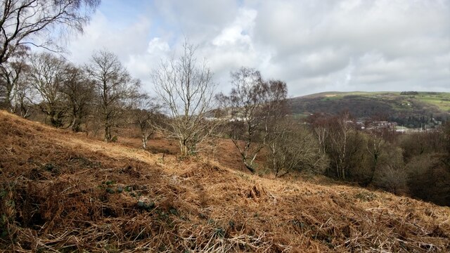
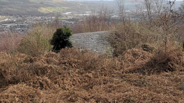
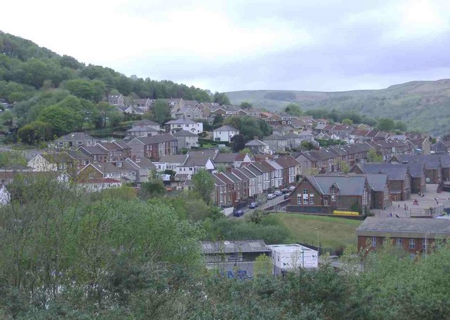
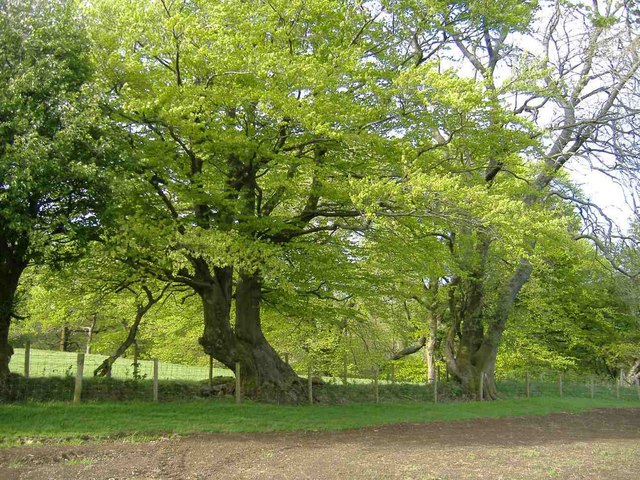
Pen-y-rhiw is a small village located in the county of Glamorgan, South Wales. Nestled in the picturesque landscape of the Rhondda Valley, the village is surrounded by rolling hills and lush greenery, offering stunning views to its residents and visitors alike.

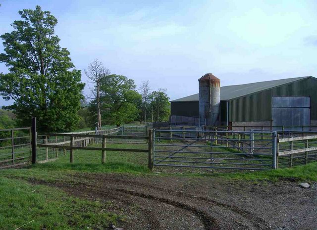
With a population of around 2,500, Pen-y-rhiw provides a tight-knit community atmosphere. The village is primarily residential, with a mix of houses ranging from traditional cottages to more modern developments. Its quaint charm is further enhanced by the presence of a local church, community center, and a primary school, catering to the needs of the residents.

Pen-y-rhiw benefits from its proximity to the nearby town of Treorchy, located just two miles away. This allows residents easy access to a wider range of amenities, including shops, supermarkets, and leisure facilities. Additionally, excellent transport links connect the village to major towns and cities, making it a convenient location for commuters.

Nature enthusiasts will appreciate the abundance of outdoor activities available in and around Pen-y-rhiw. The surrounding hills provide numerous opportunities for hiking, cycling, and picnicking, while the nearby rivers offer fishing and kayaking opportunities. The village is also within easy reach of the Brecon Beacons National Park, a popular destination for outdoor enthusiasts seeking more challenging adventures.

In conclusion, Pen-y-rhiw is a charming village in Glamorgan, offering a tranquil and picturesque setting, a close-knit community, and access to a range of amenities and outdoor activities.

If you have any feedback on the listing, please let us know in the comments section below.

Pen-y-rhiw Images

Images are sourced within 2km of 51.582991/-3.3580678 or Grid Reference ST0688. Thanks to Geograph Open Source API. All images are credited.

Looking over the heath
Farmer's entrance Path that goes towards some farmer's land.
Farmer's entrance
Path that goes towards some farmer's land.
View from the path to the farmer's land
A lone evergreen tree Amongst all the leafless trees is this one evergreen sticking out.
A lone evergreen tree
Amongst all the leafless trees is this one evergreen sticking out.
East view of an abandoned shack
Looking inside abandoned shack Couldn't enter due to overwhelming amount of trees, nettles and a very tight gap for space. Looks like people have been in here though.
Looking inside abandoned shack
Couldn't enter due to overwhelming amount of trees, nettles and a very tight gap for space. Looks like people have been in here though.
Rock face and water seepage
Cwm Coke The former Cwm Coke coking plant is slowly succumbing to the regrowth of nature.
Cwm Coke
The former Cwm Coke coking plant is slowly succumbing to the regrowth of nature.
Maendy farm
Maendy farm
Pen-y-rhiw farm
Pen-y-rhiw farm
Leyshon Street, Graig
The Morning Star, Llantrisant Road, Graig
Maesycoed Viewed from Llantrisant Road, Graig.
Maesycoed
Viewed from Llantrisant Road, Graig.
Cefn-coed farm
Cefn-coed farm
Moorland, north of Tonyrefail Road
Track to Crofft-yr-haidd farm
Minor road to Castellau
Fresh green leaves
Fresh green leaves
Show me another place!

Pen-y-rhiw is located at Grid Ref: ST0688 (Lat: 51.582991, Lng: -3.3580678)

Unitary Authority: Rhondda Cynon Taf

Police Authority: South Wales

What 3 Words

///steam.saved.quench. Near Pontypridd, Rhondda Cynon Taf

Nearby Locations

Coed Dan-y-ty Pen-y-rhiw

Related Wikis

Pen-y-coedcae

Pen-y-coedcae is a village within the electoral ward of Graig and Pontypridd West, between the town of Pontypridd and the village of Beddau, and is part...

Maendy Quarry

Maendy Quarry is an abandoned stone quarry near Cardiff in South Wales that was subsequently used in the 1960s as a landfill site for industrial waste...

Castellau

Castellau ("fortifications"; alternate: Castella) is a hamlet, with a country house of the same name in the county borough of Rhondda Cynon Taf, South...

Taff-Ely

Taff-Ely (Welsh: Taf-Elái) was a local government district with borough status in Wales from 1974 to 1996. == History == The borough was formed in 1974...

Nearby Amenities

Located within 500m of 51.582991,-3.3580678
Power: pole
Lat/Long: 51.5844783/-3.3644235
Power: pole
Lat/Long: 51.5840033/-3.3634526
Power: pole
Lat/Long: 51.5830399/-3.3613926
Power: pole
Lat/Long: 51.5827699/-3.3601534
Power: pole
Lat/Long: 51.5821866/-3.3573425
Power: pole
Lat/Long: 51.5818866/-3.3559021
Power: pole
Lat/Long: 51.5817266/-3.3552074
Power: pole
Lat/Long: 51.5813699/-3.3534533
Direction: W
Generator Method: photovoltaic
Generator Output Electricity: yes
Generator Solar Modules: 9
Generator Source: solar
Generator Type: solar_photovoltaic_panel
Location: roof
Power: generator
Lat/Long: 51.5795869/-3.3566196
Direction: ENE
Generator Method: photovoltaic
Generator Output Electricity: yes
Generator Solar Modules: 8
Generator Source: solar
Generator Type: solar_photovoltaic_panel
Location: roof
Power: generator
Lat/Long: 51.5804219/-3.3580781
Direction: WSW
Generator Method: photovoltaic
Generator Output Electricity: yes
Generator Solar Modules: 8
Generator Source: solar
Generator Type: solar_photovoltaic_panel
Location: roof
Power: generator
Lat/Long: 51.5804061/-3.3581304
Direction: S
Generator Method: photovoltaic
Generator Output Electricity: yes
Generator Solar Modules: 9
Generator Source: solar
Generator Type: solar_photovoltaic_panel
Location: roof
Power: generator
Lat/Long: 51.5795631/-3.3564895
Direction: SSW
Generator Method: photovoltaic
Generator Output Electricity: yes
Generator Solar Modules: 5
Generator Source: solar
Generator Type: solar_photovoltaic_panel
Location: roof
Power: generator
Lat/Long: 51.5800598/-3.3580197
Direction: S
Generator Method: photovoltaic
Generator Output Electricity: yes
Generator Solar Modules: 9
Generator Source: solar
Generator Type: solar_photovoltaic_panel
Location: roof
Power: generator
Lat/Long: 51.5800578/-3.3579721
Direction: S
Generator Method: photovoltaic
Generator Output Electricity: yes
Generator Solar Modules: 18
Generator Source: solar
Generator Type: solar_photovoltaic_panel
Location: roof
Power: generator
Lat/Long: 51.5800698/-3.3578122
Post Box
Lat/Long: 51.580939/-3.3579426
The data included in this document is from www.openstreetmap.org. The data is made available under ODbL.

Have you been to Pen-y-rhiw?

Leave your review of Pen-y-rhiw below (or comments, questions and feedback).