Pen-Rhiw-Newydd

Settlement in Cardiganshire

Wales

Pen-Rhiw-Newydd

Track off the road between Pen-y-cwm and Bont-goch
Track off the road between Pen-y-cwm and Bont-goch Credit: John Lord

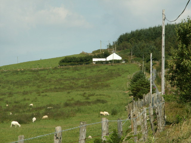
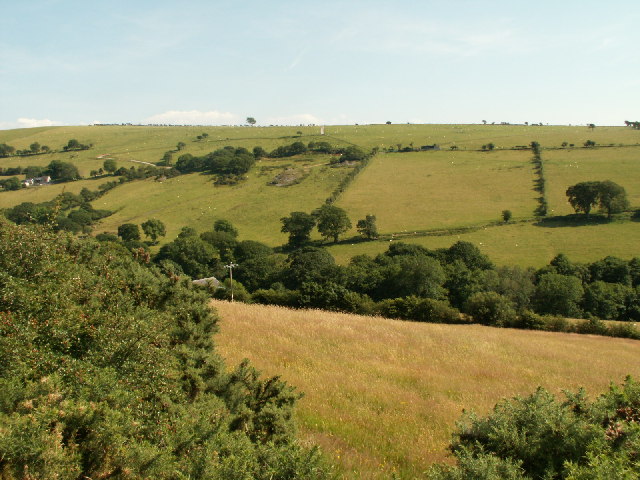
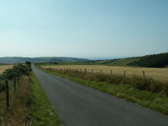
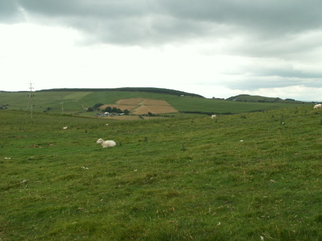
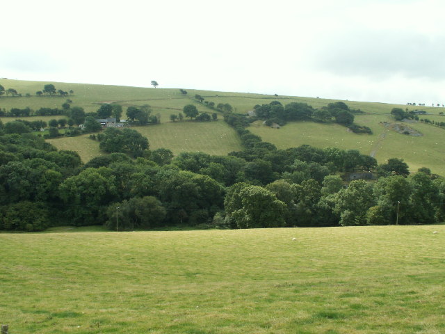
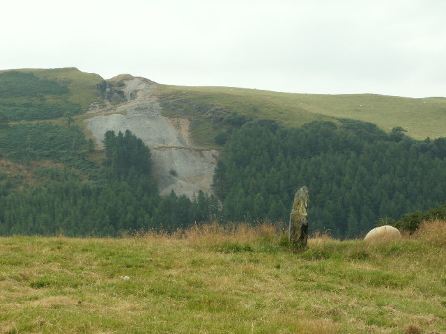
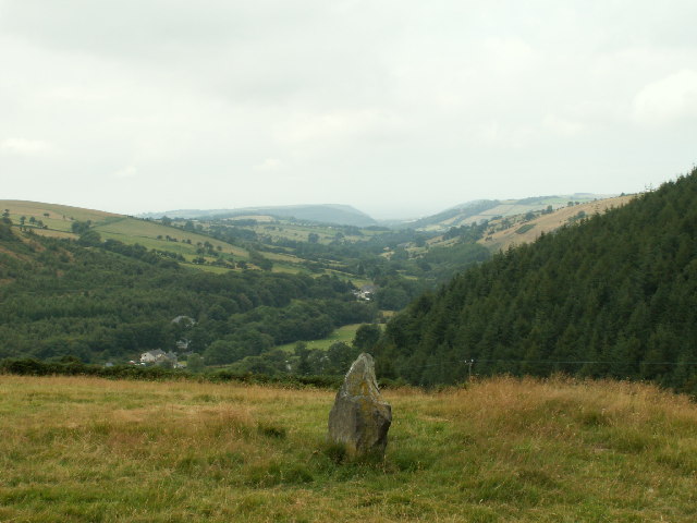
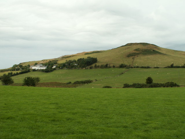
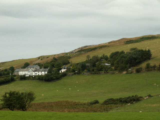
Pen-Rhiw-Newydd is a small rural village located in the county of Cardiganshire, Wales. Situated in the rolling hills of the Teifi Valley, it is surrounded by picturesque countryside and offers stunning views of the Welsh landscape. The village is part of the larger community of Llandysul and is approximately 10 miles southeast of the town of Cardigan.

Pen-Rhiw-Newydd is characterized by its peaceful and close-knit community. The village features a mix of traditional stone cottages and more modern houses, giving it a charming and diverse architectural style. The population of the village is relatively small, and residents enjoy a tranquil lifestyle away from the hustle and bustle of urban areas.

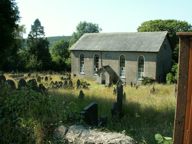
Despite its size, Pen-Rhiw-Newydd offers a range of amenities for its residents. The village has a community center, which serves as a hub for various activities and events throughout the year. There is also a local pub where residents can gather and socialize. For basic necessities and services, residents can easily access nearby towns such as Llandysul or Cardigan.

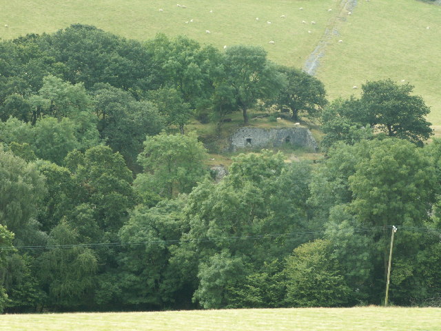
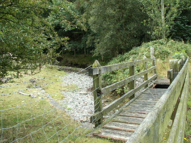
Nature lovers and outdoor enthusiasts will find plenty to explore in the surrounding area. The nearby Teifi River is a popular destination for fishing and kayaking, and the picturesque Ceredigion coastline is within a short drive. Additionally, the village is surrounded by beautiful walking trails, offering opportunities to enjoy the stunning Welsh countryside.

Overall, Pen-Rhiw-Newydd offers a tranquil and picturesque setting, ideal for those seeking a peaceful and rural lifestyle amidst the natural beauty of Cardiganshire.

If you have any feedback on the listing, please let us know in the comments section below.

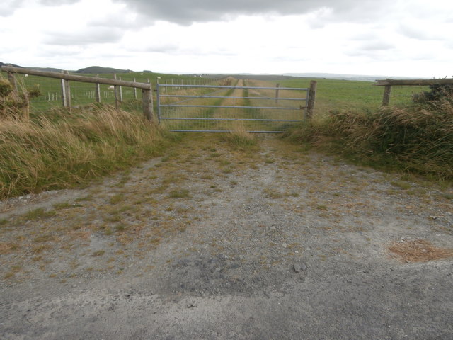
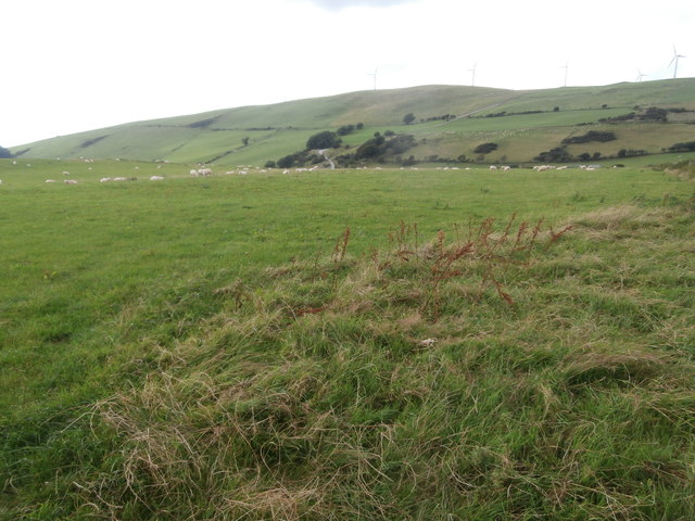
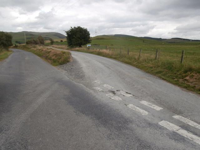
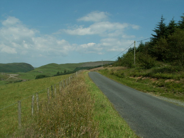
Pen-Rhiw-Newydd Images

Images are sourced within 2km of 52.438055/-3.959199 or Grid Reference SN6684. Thanks to Geograph Open Source API. All images are credited.

Track off the road between Pen-y-cwm and Bont-goch
Sheep on pasture land on the north side of the road from Pen-y-cwm to Bont-goch Wind turbines on the skyline.
Sheep on pasture land on the north side of the road from Pen-y-cwm to Bont-goch
Wind turbines on the skyline.
Road junction near Bont-goch
Banc Clawddmelyn The road along Banc Clawddmelyn, looking E. towards the Nant-y-moch area.
Banc Clawddmelyn
The road along Banc Clawddmelyn, looking E. towards the Nant-y-moch area.
Pasture, Llwyn Prysg Pasture, house and forestry by the roadside near Llwyn Prysg
Pasture, Llwyn Prysg
Pasture, house and forestry by the roadside near Llwyn Prysg
Pen-y-banc Farm Pen-y-banc farm, near Garth and Penrhyncoch, at the end of Banc Clawddmelyn.
Pen-y-banc Farm
Pen-y-banc farm, near Garth and Penrhyncoch, at the end of Banc Clawddmelyn.
Capel Salem The chapel in Salem, Coed Gruffydd, near Penrhyncoch, built in 1824 as an Independent chapel. Rebuilt 1850 and extended in 1864.
Capel Salem
The chapel in Salem, Coed Gruffydd, near Penrhyncoch, built in 1824 as an Independent chapel. Rebuilt 1850 and extended in 1864.
Nant Silo The valley of Nant Seilo, south of Penrhyncoch. The stream runs along the line of the trees. Looking S.
Nant Silo
The valley of Nant Seilo, south of Penrhyncoch. The stream runs along the line of the trees. Looking S.
Banc Troedrhiwseiri The road running between fields along the top of the ridge. Looking W.
Banc Troedrhiwseiri
The road running between fields along the top of the ridge. Looking W.
Pasture, Banc Troedrhiwseiri Upland pasture on Banc Troedrhiwseiri, with Mynydd Gorddu farm in the distance. Looking N.
Pasture, Banc Troedrhiwseiri
Upland pasture on Banc Troedrhiwseiri, with Mynydd Gorddu farm in the distance. Looking N.
Nant Silo Looking S across Nant Silo, remains of Bron Flwyd (Bronllwyd) leadmine on right
Nant Silo
Looking S across Nant Silo, remains of Bron Flwyd (Bronllwyd) leadmine on right
Bron Floyd leadmine Remains of part of the Bron Floyd (Bronllwyd) lead mine. Originally worked c. 1600 and re-opened for a while in mid 1800s.
Bron Floyd leadmine
Remains of part of the Bron Floyd (Bronllwyd) lead mine. Originally worked c. 1600 and re-opened for a while in mid 1800s.
Footbridge, Pen-bont Rhydybeddau Footbridge (disused?) across Nant Silo next to modern road bridge that replaces the original ford.
Footbridge, Pen-bont Rhydybeddau
Footbridge (disused?) across Nant Silo next to modern road bridge that replaces the original ford.
Cerrig-yr-Wyn One of the two standing stones called 'Cerrig-yr-Wyn', each about three ft high and about 200yds apart. Looking SW. The scar on the hillside opposite is the old Darren metal mine (in SN6782), which was originally worked in the mid 16th Cent. There is also the remains of a hill fort on top of the hill.
Cerrig-yr-Wyn
One of the two standing stones called 'Cerrig-yr-Wyn', each about three ft high and about 200yds apart. Looking SW. The scar on the hillside opposite is the old Darren metal mine (in SN6782), which was originally worked in the mid 16th Cent. There is also the remains of a hill fort on top of the hill.
Gatepost and standing stone Old stone gatepost and one of the two standing stones (in the middle of the field) that make up 'Cerrig-yr-Wyn'. Looking S.
Gatepost and standing stone
Old stone gatepost and one of the two standing stones (in the middle of the field) that make up 'Cerrig-yr-Wyn'. Looking S.
Cerrig yr Wyn One of the two standing stones called Cerrig yr Wyn, looking West up the valley of Nant Silo and Clarach to Clarach bay on the coast in the distance (the obvious headland is the S shore of the bay, about 10km away)
Cerrig yr Wyn
One of the two standing stones called Cerrig yr Wyn, looking West up the valley of Nant Silo and Clarach to Clarach bay on the coast in the distance (the obvious headland is the S shore of the bay, about 10km away)
Banc y Darren The hamlet of Darren below the hill of Banc y Darren. There is a fort on top of the hill. Looking NW.
Banc y Darren
The hamlet of Darren below the hill of Banc y Darren. There is a fort on top of the hill. Looking NW.
Darren Closer view of the houses and some of the old mine workings at Darren.
Darren
Closer view of the houses and some of the old mine workings at Darren.
Show me another place!

Pen-Rhiw-Newydd is located at Grid Ref: SN6684 (Lat: 52.438055, Lng: -3.959199)

Unitary Authority: Ceredigion

Police Authority: Dyfed Powys

What 3 Words

///slam.political.hires. Near Bow Street, Ceredigion

Related Wikis

Pen-Rhiw-Newydd

Penrhiwnewydd is a hamlet in the community of Trefeurig, Ceredigion, Wales, which is 74.1 miles (119.2 km) from Cardiff and 175.3 miles (282 km) from London...

Salem, Ceredigion

Salem is a small Welsh village in Ceredigion, located between the Afon Stewi and Nant Seilo rivers. The closest village is Penrhyn-coch. The Salem Independent...

Pen-bont-rhyd-y-beddau

Pen-bont-rhyd-y-beddau is a small village in the community of Trefeurig, Ceredigion, Wales, which is 73.7 miles (118.6 km) from Cardiff and 174.8 miles...

Broginin

Broginin is a hamlet in the community of Trefeurig, Ceredigion, Wales, which is 74.6 miles (120 km) from Cardiff and 175.7 miles (282.8 km) from London...

Daren

Daren is a hamlet bach in the community of Trefeurig, Ceredigion, Wales, which is 73.2 miles (117.7 km) from Cardiff and 174.5 miles (280.8 km) from London...

Trefeurig

Trefeurig is a community in Mid and West Wales, situated around 4 miles (6.4 km) north-east of Aberystwyth. It is a site of particular prehistoric, Roman...

Garth, Ceredigion

Garth, Ceredigion is a small village in the community of Trefeurig, Ceredigion, Wales, which is 74.6 miles (120.1 km) from Cardiff and 176.3 miles (283...

Cefn-y-Llwyd

Cefn-y-Llwyd is a hamlet in the community of Trefeurig, Ceredigion, Wales, which is 74 miles (119.1 km) from Cardiff and 176 miles (283.3 km) from London...

Nearby Amenities

Located within 500m of 52.438055,-3.959199
Salem
Is In: Ceredigion, Wales, UK
Place: hamlet
Wikidata: Q10968561
Lat/Long: 52.4410234/-3.9592577
Telephone
Salem
Lat/Long: 52.4411018/-3.9592173
Post Box
Lat/Long: 52.4354875/-3.9539582
Building: yes
Lat/Long: 52.4383265/-3.9627197
Building: yes
Lat/Long: 52.4350954/-3.9577845
Building: yes
Lat/Long: 52.4362727/-3.9578918
Building: yes
Lat/Long: 52.4348991/-3.9552525
Building: yes
Lat/Long: 52.435841/-3.9535144
Direction: 170
Generator Method: photovoltaic
Generator Output Electricity: yes
Generator Solar Modules: 14
Generator Source: solar
Generator Type: solar_photovoltaic_panel
Location: roof
Power: generator
Lat/Long: 52.4383995/-3.9598578
Direction: 175
Generator Method: photovoltaic
Generator Output Electricity: yes
Generator Solar Modules: 12
Generator Source: solar
Generator Type: solar_photovoltaic_panel
Location: roof
Power: generator
Lat/Long: 52.4383423/-3.9600483
Ford: yes
Lat/Long: 52.4367651/-3.9650674
The data included in this document is from www.openstreetmap.org. The data is made available under ODbL.

Have you been to Pen-Rhiw-Newydd?

Leave your review of Pen-Rhiw-Newydd below (or comments, questions and feedback).