Bircham Tofts

Settlement in Norfolk King's Lynn and West Norfolk

England

Bircham Tofts

Church of All Saints, Bircham Newton Largely built in the thirteenth century <span class="nowrap"><a title="https://historicengland.org.uk/listing/the-list/list-entry/1077805?section=official-list-entry" rel="nofollow ugc noopener" href="https://historicengland.org.uk/listing/the-list/list-entry/1077805?section=official-list-entry">Link</a><img style="margin-left:2px;" alt="External link" title="External link - shift click to open in new window" src="https://s1.geograph.org.uk/img/external.png" width="10" height="10"/></span>
Church of All Saints, Bircham Newton Credit: Jonathan Thacker

Bircham Tofts is a small village located in the county of Norfolk, England. It is situated approximately 2 miles southwest of the town of Docking and around 8 miles northeast of the popular coastal resort of Hunstanton. The village is part of the civil parish of Bircham, which also includes the neighboring villages of Bircham Newton and Great Bircham.

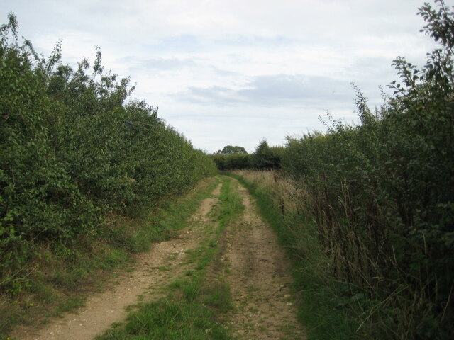
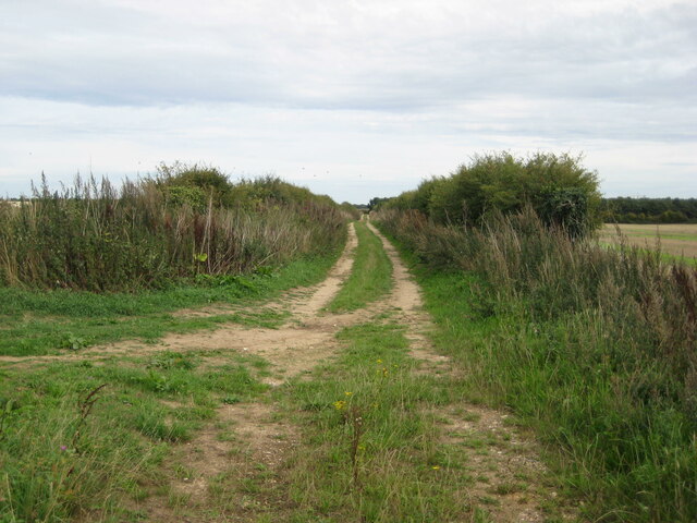
Bircham Tofts is known for its picturesque rural setting, with rolling countryside and open fields surrounding the village. The landscape is dotted with traditional Norfolk flint cottages and farmhouses, giving it a charming and quintessentially English feel.

The village is home to a close-knit community, with a small population of around 200 residents. Most of the local economy is centered around agriculture, with many residents working in farming or associated industries. The village also benefits from its proximity to the nearby towns, which provide additional employment opportunities and services.

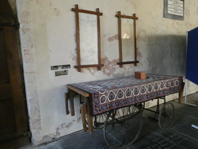
The village boasts a few amenities for its residents, including a community hall and a village green, which is often used for local events and gatherings. Additionally, there is a small church in the village, St Andrew's Church, which dates back to the 14th century and is a notable historical landmark.

Bircham Tofts offers a peaceful and idyllic rural lifestyle, with easy access to the stunning Norfolk coastline and nearby towns. It is a popular destination for those seeking a slower pace of life and a close connection to nature.

If you have any feedback on the listing, please let us know in the comments section below.

Bircham Tofts Images

Images are sourced within 2km of 52.863316/0.638325 or Grid Reference TF7732. Thanks to Geograph Open Source API. All images are credited.

Church of All Saints, Bircham Newton Largely built in the thirteenth century <span class="nowrap"><a title="https://historicengland.org.uk/listing/the-list/list-entry/1077805?section=official-list-entry" rel="nofollow ugc noopener" href="https://historicengland.org.uk/listing/the-list/list-entry/1077805?section=official-list-entry">Link</a><img style="margin-left:2px;" alt="External link" title="External link - shift click to open in new window" src="https://s1.geograph.org.uk/img/external.png" width="10" height="10"/></span>
Church of All Saints, Bircham Newton
Largely built in the thirteenth century LinkExternal link
Byway at Bircham Newton
Farm track near Bircham Newton This is the continuation of a byway which begins in Bircham Newton. Prior to the construction of RAF Bircham Newton this contunued towards Stanhoe and Barwick.
Farm track near Bircham Newton
This is the continuation of a byway which begins in Bircham Newton. Prior to the construction of RAF Bircham Newton this contunued towards Stanhoe and Barwick.
Interior, All Saints' church, Bircham Newton The furnshings date from 1858 and are more Georgian than Victorian in style <span class="nowrap"><a title="https://historicengland.org.uk/listing/the-list/list-entry/1077805?section=official-list-entry" rel="nofollow ugc noopener" href="https://historicengland.org.uk/listing/the-list/list-entry/1077805?section=official-list-entry">Link</a><img style="margin-left:2px;" alt="External link" title="External link - shift click to open in new window" src="https://s1.geograph.org.uk/img/external.png" width="10" height="10"/></span>
Interior, All Saints' church, Bircham Newton
The furnshings date from 1858 and are more Georgian than Victorian in style LinkExternal link
Converted barn, Bircham Newton Now provides holiday accommodation.
Converted barn, Bircham Newton
Now provides holiday accommodation.
Houses on Fring Road, Great Bircham
National Construction College, Bircham Tofts
Great Bircham: The Cross of Sacrifice For more, see <span class="nowrap"><a title="https://www.warmemorialsonline.org.uk/memorial/268237/" rel="nofollow ugc noopener" href="https://www.warmemorialsonline.org.uk/memorial/268237/">Link</a><img style="margin-left:2px;" alt="External link" title="External link - shift click to open in new window" src="https://s1.geograph.org.uk/img/external.png" width="10" height="10"/></span>
Great Bircham: The Cross of Sacrifice
For more, see LinkExternal link
Great Bircham: inscription on the Cross of Sacrifice
St Mary, Great Bircham: font The font in a Christian church is that place where new members are inducted in a ceremony known as a christening. Fonts are often symbolically placed at or near the entrance. Typically, the font is between 90 and 130 centimetres tall and sculpted in stone- although wood and metal are sometimes used.  During the ceremony, a priest traces the sign of the cross on the new member’s forehead.  If an infant, several adults will be asked to be godparents. They will then pledge at the font to guide the child on their Christian journey.
St Mary, Great Bircham: font
The font in a Christian church is that place where new members are inducted in a ceremony known as a christening. Fonts are often symbolically placed at or near the entrance. Typically, the font is between 90 and 130 centimetres tall and sculpted in stone- although wood and metal are sometimes used. During the ceremony, a priest traces the sign of the cross on the new member’s forehead. If an infant, several adults will be asked to be godparents. They will then pledge at the font to guide the child on their Christian journey.
Inside St Mary, Great Bircham (A)
Inside St Mary, Great Bircham (B)
Inside St Mary, Great Bircham (C)
Inside St Mary, Great Bircham (D) A shield commemorating the life of Sidney Wharton <span class="nowrap"><a title="http://whartonfamilyhistory.weebly.com/sidney-alfred-wharton-1895-1916.html" rel="nofollow ugc noopener" href="http://whartonfamilyhistory.weebly.com/sidney-alfred-wharton-1895-1916.html">Link</a><img style="margin-left:2px;" alt="External link" title="External link - shift click to open in new window" src="https://s1.geograph.org.uk/img/external.png" width="10" height="10"/></span>
Inside St Mary, Great Bircham (D)
A shield commemorating the life of Sidney Wharton LinkExternal link
Inside St Mary, Great Bircham (E)
St Mary, Great Bircham: memorial (a)
Inside St Mary, Great Bircham (F)
St Mary, Great Bircham: memorial (b)
Show me another place!

Bircham Tofts is located at Grid Ref: TF7732 (Lat: 52.863316, Lng: 0.638325)

Administrative County: Norfolk

District: King's Lynn and West Norfolk

Police Authority: Norfolk

What 3 Words

///path.chucked.reply. Near Snettisham, Norfolk

Nearby Locations

Bircham Tofts

Related Wikis

Nearby Amenities

Located within 500m of 52.863316,0.638325
Bus Stop
Stocks Close, adj
Naptan AtcoCode: 2900B3011
Naptan Bearing: W
Naptan BusStopType: CUS
Naptan CommonName: Stocks Close
Naptan Indicator: adj
Naptan Landmark: Stocks Close
Naptan Locality: Bircham Tofts
Naptan NaptanCode: nfoadwmp
Naptan ShortCommonName: Stocks Cl
Naptan Street: B1155
Naptan Verified: no
Source: naptan_import
Lat/Long: 52.8629233/0.6328501
Bus Stop
Stocks Close, opp
Naptan AtcoCode: 2900B3012
Naptan Bearing: W
Naptan BusStopType: CUS
Naptan CommonName: Stocks Close
Naptan Indicator: opp
Naptan Landmark: Stocks Close
Naptan Locality: Bircham Tofts
Naptan NaptanCode: nfoadwmt
Naptan ShortCommonName: Stocks Cl
Naptan Street: B1155
Naptan Verified: no
Source: naptan_import
Lat/Long: 52.8626952/0.6335578
Bus Stop
Church Lane, adj
Naptan AtcoCode: 2900B303
Naptan Bearing: W
Naptan BusStopType: CUS
Naptan CommonName: Church Lane
Naptan Indicator: adj
Naptan Landmark: Church Lane
Naptan Locality: Bircham Tofts
Naptan NaptanCode: nfoadwpd
Naptan ShortCommonName: Church Ln
Naptan Street: B1155
Naptan Verified: no
Source: naptan_import
Lat/Long: 52.8621189/0.6386999
Bus Stop
Church Lane, opp
Naptan AtcoCode: 2900B308
Naptan Bearing: E
Naptan BusStopType: CUS
Naptan CommonName: Church Lane
Naptan Indicator: opp
Naptan Landmark: Church Lane
Naptan Locality: Bircham Tofts
Naptan NaptanCode: nfoadwpt
Naptan ShortCommonName: Church Ln
Naptan Street: B1155
Naptan Verified: no
Source: naptan_import
Lat/Long: 52.8621908/0.6387043
Bircham Tofts
Place: hamlet
Lat/Long: 52.8623791/0.6390409
Post Box
Operator: Royal Mail
Operator Wikidata: Q638098
Post Box Mounting: pier
Post Box Type: lamp
Ref: PE31 113
Lat/Long: 52.8620914/0.6385236
Telephone
Booth: KX100
Lat/Long: 52.8620924/0.6385001
Lower Farm
Place: farm
Lat/Long: 52.8622655/0.641728
Stocks Close
Place: isolated_dwelling
Lat/Long: 52.8629744/0.6331074
Pond Farm
Alt Name: Pond House Farm
Place: farm
Lat/Long: 52.8629499/0.6366216
Saint Andrew
Abandoned Amenity: place_of_worship
Denomination: anglican
Historic: ruins
Listed Status: Grade II
Material: stone
Religion: christian
Ruins: church
Website: http://www.heritage.norfolk.gov.uk/record-details?MNF1723
Lat/Long: 52.8607081/0.6393743
Information: board
Operator: Bircham Parish Council
Tourism: information
Lat/Long: 52.862091/0.6385508
The data included in this document is from www.openstreetmap.org. The data is made available under ODbL.

Have you been to Bircham Tofts?

Leave your review of Bircham Tofts below (or comments, questions and feedback).