Birch Hill

Settlement in Berkshire

England

Birch Hill

SU8566 Great Hollands The Great Hollands Recreation Ground, in the east of the square. Great Hollands is part of the huge sprawl called Bracknell.
SU8566 Great Hollands Credit: Brendan and Ruth McCartney

Birch Hill is a residential area located in the town of Bracknell, in the county of Berkshire, England. Situated approximately 30 miles west of London, it is part of the Bracknell Forest borough. Birch Hill is known for its peaceful and family-friendly atmosphere, making it an ideal place for those seeking a tranquil suburban lifestyle.

The area is predominantly residential, with a mix of housing types ranging from detached houses to semi-detached properties and apartments. Birch Hill offers a variety of amenities to its residents, including a local shopping centre that caters to everyday needs, such as grocery stores, pharmacies, and small retail shops. Additionally, there are several schools within close proximity, providing education options for families with children.

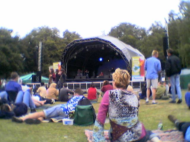
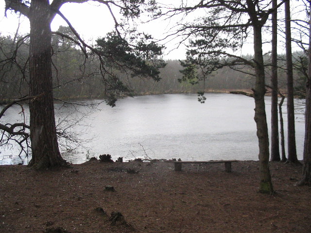
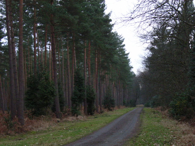
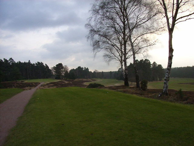
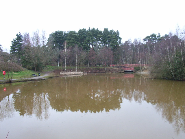
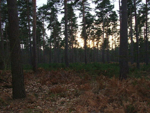
For those who enjoy outdoor activities, Birch Hill is surrounded by green spaces and parks, offering opportunities for leisurely walks, picnics, and sports. South Hill Park, a popular local attraction, is a short distance away and features a historic mansion, art galleries, and a theater.

Transportation in Birch Hill is convenient, with good road links to nearby towns and cities. Bracknell Train Station provides regular services to London Waterloo and Reading, making it an ideal location for commuters.

Overall, Birch Hill is a desirable residential area in Berkshire, offering a peaceful environment, a range of amenities, and convenient transport links, making it an attractive place to live for families and professionals alike.

If you have any feedback on the listing, please let us know in the comments section below.
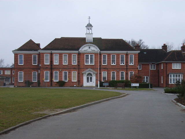
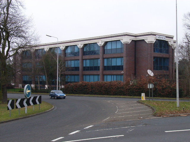
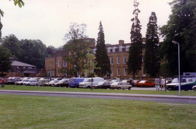
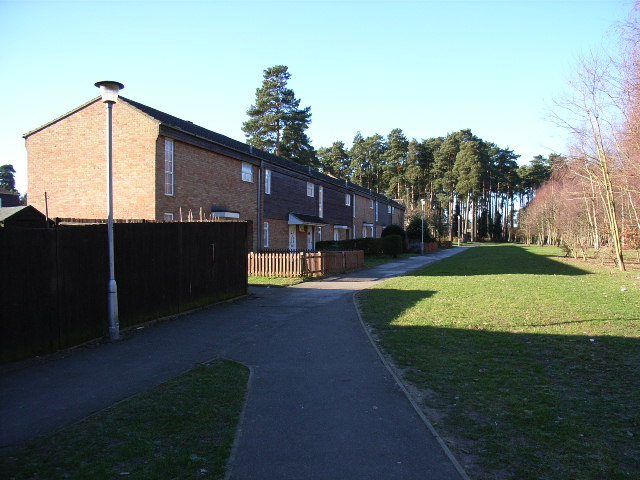
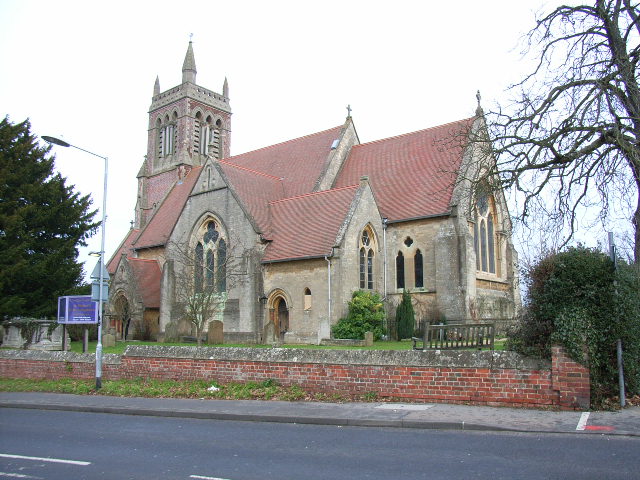
Birch Hill Images

Images are sourced within 2km of 51.394402/-0.74554285 or Grid Reference SU8766. Thanks to Geograph Open Source API. All images are credited.

SU8566 Great Hollands The Great Hollands Recreation Ground, in the east of the square. Great Hollands is part of the huge sprawl called Bracknell.
SU8566 Great Hollands
The Great Hollands Recreation Ground, in the east of the square. Great Hollands is part of the huge sprawl called Bracknell.
Bracknell Forest towards Caesar's Camp
South Hill Park Bracknell "Out There" festival 2004
South Hill Park
Bracknell "Out There" festival 2004
Mill Pond, Look Out Discovery Centre Mill Pond, in the rain, in the heart of the woodland which is part of the Look Out Discovery Centre
Mill Pond, Look Out Discovery Centre
Mill Pond, in the rain, in the heart of the woodland which is part of the Look Out Discovery Centre
Look Out Discovery Centre Vast woodland of the Look Out Discovery Centre
Look Out Discovery Centre
Vast woodland of the Look Out Discovery Centre
St Michael and St Mary Magdalene's, Easthampstead Formerly the centre of Easthampstead village, which was engulfed by the new town of Bracknell.
St Michael and St Mary Magdalene's, Easthampstead
Formerly the centre of Easthampstead village, which was engulfed by the new town of Bracknell.
Great Hollands, Bracknell
Hanworth, Bracknell
Hanworth, Bracknell
Great Hollands, Bracknell Another view of the estate. The shops are on the left.
Great Hollands, Bracknell
Another view of the estate. The shops are on the left.
Hanworth, Bracknell When they built this estate the developers left plenty of pine trees. These make it one of the more pleasant (not saying much) estates in the town.
Hanworth, Bracknell
When they built this estate the developers left plenty of pine trees. These make it one of the more pleasant (not saying much) estates in the town.
Hanworth, Bracknell Another view of the estate, looking from Bucklebury to Ollerton.
Hanworth, Bracknell
Another view of the estate, looking from Bucklebury to Ollerton.
Pine trees, Swinley Park Looking south from the junction of Blane's Lane and Green Ride.
Pine trees, Swinley Park
Looking south from the junction of Blane's Lane and Green Ride.
The Berkshire Golf Club The view from the seventh tee.
The Berkshire Golf Club
The view from the seventh tee.
Ranelagh School, Bracknell Architecture not characteristic of the town.
Ranelagh School, Bracknell
Architecture not characteristic of the town.
Cadence offices, Bracknell Situated on the sports centre roundabout, near the Harmans Water district.
Cadence offices, Bracknell
Situated on the sports centre roundabout, near the Harmans Water district.
The pond, Savernake Park, Bracknell Situated in The Warren district of Bracknell.
The pond, Savernake Park, Bracknell
Situated in The Warren district of Bracknell.
Pines in Swinley Park Taken from Abury Lane, the track that goes from in a southeastery direction through the grid-square.
Pines in Swinley Park
Taken from Abury Lane, the track that goes from in a southeastery direction through the grid-square.
Old Bracknell Lane East The building behind, old by Bracknell standards, is now a children's nursery.
Old Bracknell Lane East
The building behind, old by Bracknell standards, is now a children's nursery.
Show me another place!

Birch Hill is located at Grid Ref: SU8766 (Lat: 51.394402, Lng: -0.74554285)

Unitary Authority: Bracknell Forest

Police Authority: Thames Valley

What 3 Words

///tall.photo.path. Near Bracknell, Berkshire

Nearby Locations

Birch Hill

Related Wikis

Birch Hill

Birch Hill is a southern suburb of Bracknell, originally part of the now-defunct civil parish of Easthampstead, in the English county of Berkshire. Although...

Crown Wood

Crown Wood is a south-eastern estate of Bracknell in the English county of Berkshire, and formerly part of the parish of Winkfield. Crown Wood was built...

Harmans Water

Harmans Water is a suburb of Bracknell, in the English county of Berkshire, formerly part of the parish of Winkfield. It takes its name from Harman's Water...

Hanworth, Bracknell

Hanworth is a southern suburb of Bracknell, originally part of the now-defunct civil parish of Easthampstead, in the English county of Berkshire. The Hanworth...

St Michael and St Mary Magdalene's Church, Easthampstead

The Church of St Michael and St Mary Magdalene, is the Parish Church of Easthampstead, Berkshire. The ethos of the parish is one of traditional worship...

Easthampstead

Easthampstead is a former village and now a southern suburb of the town of Bracknell in the English county of Berkshire, although the old village can still...

The Brakenhale School

The Brakenhale School (simply referred to as Brakenhale and formerly Borough Green City Secondary School) is an 11–18 mixed, secondary school and sixth...

Forest Park, Bracknell Forest

Forest Park is a suburb of Bracknell, in Berkshire, England. It and Crown Wood are in Crown Wood ward and named after the Crown Estate of Swinley Forest...

Nearby Amenities

Located within 500m of 51.394402,-0.74554285
Traffic Signals
Source: Bing
Traffic Signals Direction: forward
Lat/Long: 51.3945689/-0.7407163
Crossing
Crossing Island: yes
Kerb: lowered
Sloped Curb: yes
Source: Bing
Lat/Long: 51.3950213/-0.7397318
Mini Roundabout
Direction: clockwise
Lat/Long: 51.3928026/-0.7420768
Turning Circle
Source: Bing
Lat/Long: 51.3984123/-0.7455659
Turning Circle
Lat/Long: 51.3933707/-0.7462353
Crossing
Crossing: unmarked
Kerb: lowered
Sloped Curb: yes
Source: Bing
Lat/Long: 51.3944233/-0.7520939
Birch Hill
Is In: Bracknell, Berkshire, England
Place: suburb
Wikidata: Q4915660
Lat/Long: 51.3927811/-0.7484648
Recycling
Sainsburys
Recycling Aluminium: yes
Recycling Books: yes
Recycling Clothes: yes
Recycling Foil: yes
Recycling Glass: yes
Recycling Glass Bottles: yes
Recycling Plastic Bags: yes
Lat/Long: 51.393464/-0.740887
Post Box
Collection Times: Mo-Fr 16:00; Sa 11:15
Operator: Royal Mail
Lat/Long: 51.39267/-0.744137
Crossing
Crossing: uncontrolled
Kerb: lowered
Sloped Curb: yes
Source: Bing
Traffic Calming: choker
Lat/Long: 51.3943001/-0.7504965
Crossing
Crossing: unmarked
Crossing Markings: no
Kerb: lowered
Source: Bing
Lat/Long: 51.3985128/-0.745117
Crossing
Crossing: unmarked
Kerb: lowered
Sloped Curb: yes
Lat/Long: 51.3954739/-0.7458886
Traffic Signals
Source: Bing
Traffic Signals Direction: forward
Lat/Long: 51.3941688/-0.7407377
Crossing
Bicycle: yes
Crossing: unmarked
Kerb: lowered
Sloped Curb: yes
Lat/Long: 51.3911559/-0.7435727
Crossing
Bicycle: yes
Crossing: unmarked
Kerb: lowered
Sloped Curb: yes
Lat/Long: 51.3904849/-0.7437542
Crossing
Bicycle: yes
Crossing: unmarked
Kerb: lowered
Sloped Curb: yes
Lat/Long: 51.3950752/-0.7401511
Crossing
Crossing: unmarked
Kerb: lowered
Sloped Curb: yes
Lat/Long: 51.3979204/-0.74116
Crossing
Bicycle: yes
Crossing: unmarked
Kerb: lowered
Sloped Curb: yes
Lat/Long: 51.3956515/-0.7447781
Crossing
Bicycle: yes
Crossing: unmarked
Kerb: lowered
Sloped Curb: yes
Lat/Long: 51.3941568/-0.743155
Post Box
Operator: Royal Mail
Operator Wikidata: Q638098
Post Box Type: pillar
Royal Cypher: EIIR
Lat/Long: 51.3928366/-0.7410895
Atm
Lat/Long: 51.3928733/-0.7410214
Disused Shop: yes
Lat/Long: 51.3924789/-0.7404512
Shelter
Lat/Long: 51.3900498/-0.7438986
Bench
Backrest: yes
Material: wood
Lat/Long: 51.3913561/-0.7491641
Bench
Backrest: yes
Material: wood
Lat/Long: 51.392507/-0.7496887
Crossing
Crossing: unmarked
Kerb: lowered
Sloped Curb: yes
Lat/Long: 51.3972749/-0.7409901
Traffic Signals
Source: Bing
Traffic Signals Direction: forward
Lat/Long: 51.3944423/-0.7416384
Traffic Signals
Source: Bing
Traffic Signals Direction: forward
Lat/Long: 51.394733/-0.7415152
Traffic Signals
Source: Bing
Traffic Signals Direction: forward
Lat/Long: 51.3940804/-0.7419269
Traffic Signals
Source: Bing
Traffic Signals Direction: forward
Lat/Long: 51.3941874/-0.741038
Traffic Signals
Source: Bing
Traffic Signals Direction: forward
Lat/Long: 51.3944339/-0.7417895
Traffic Signals
Source: Bing
Traffic Signals Direction: forward
Lat/Long: 51.3940185/-0.7410354
Traffic Signals
Source: Bing
Traffic Signals Direction: forward
Lat/Long: 51.3944814/-0.7418893
Traffic Signals
Source: Bing
Traffic Signals Direction: forward
Lat/Long: 51.3946567/-0.7416723
Traffic Signals
Source: Bing
Traffic Signals Direction: forward
Lat/Long: 51.3945042/-0.7408946
Traffic Signals
Source: Bing
Traffic Signals Direction: forward
Lat/Long: 51.3939477/-0.7411438
Traffic Signals
Source: Bing
Traffic Signals Direction: forward
Lat/Long: 51.3941953/-0.7408949
Barrier: cycle_barrier
Lat/Long: 51.3912387/-0.7491037
Crossing
Crossing: uncontrolled
Crossing Ref: zebra
Kerb: lowered
Sloped Curb: yes
Source: Bing
Lat/Long: 51.393467/-0.7510332
Crossing
Crossing: uncontrolled
Crossing Ref: zebra
Kerb: lowered
Sloped Curb: yes
Source: Bing
Lat/Long: 51.3934579/-0.7512739
Crossing
Crossing: unmarked
Kerb: lowered
Sloped Curb: yes
Source: Bing
Lat/Long: 51.3938796/-0.7504744
Crossing
Crossing: unmarked
Kerb: lowered
Sloped Curb: yes
Source: Bing
Lat/Long: 51.3940911/-0.7504745
Crossing
Crossing: unmarked
Kerb: lowered
Sloped Curb: yes
Source: Bing
Lat/Long: 51.3940784/-0.7510699
Crossing
Crossing Island: yes
Kerb: lowered
Sloped Curb: yes
Source: Bing
Traffic Calming: table
Lat/Long: 51.3941836/-0.7512597
Crossing
Crossing: unmarked
Kerb: lowered
Sloped Curb: yes
Source: Bing
Lat/Long: 51.3938363/-0.7509811
Crossing
Crossing Island: yes
Kerb: lowered
Sloped Curb: yes
Source: Bing
Traffic Calming: table
Lat/Long: 51.3941851/-0.7513334
Crossing
Crossing: unmarked
Kerb: lowered
Sloped Curb: yes
Lat/Long: 51.3943591/-0.7474313
Crossing
Bicycle: yes
Crossing: unmarked
Kerb: lowered
Sloped Curb: yes
Lat/Long: 51.3911461/-0.7436823
Crossing
Crossing: unmarked
Kerb: lowered
Sloped Curb: yes
Lat/Long: 51.3966165/-0.7405414
Traffic Signals
Source: Bing
Traffic Signals Direction: forward
Lat/Long: 51.3941561/-0.7416949
Crossing
Crossing: unmarked
Kerb: lowered
Sloped Curb: yes
Source: Bing
Lat/Long: 51.3980304/-0.7448027
Crossing
Crossing: unmarked
Kerb: lowered
Sloped Curb: yes
Source: Bing
Lat/Long: 51.3949404/-0.7393994
Crossing
Crossing: unmarked
Kerb: lowered
Sloped Curb: yes
Lat/Long: 51.3950165/-0.7387069
Bus Stop
Bus: yes
Public Transport: platform
Source: Bing
Lat/Long: 51.3906337/-0.743748
Bus Stop
Public Transport: platform
Shelter: yes
Source: Bing
Lat/Long: 51.3929928/-0.7435567
Crossing
Crossing: uncontrolled
Crossing Ref: zebra
Kerb: lowered
Sloped Curb: yes
Source: Mapbox
Tactile Paving: yes
Lat/Long: 51.3930734/-0.7416592
Crossing
Crossing: uncontrolled
Crossing Ref: zebra
Kerb: lowered
Sloped Curb: yes
Source: Mapbox
Tactile Paving: yes
Lat/Long: 51.3928255/-0.7412453
Crossing
Crossing: uncontrolled
Crossing Ref: zebra
Kerb: lowered
Sloped Curb: yes
Source: Mapbox
Tactile Paving: yes
Lat/Long: 51.3933175/-0.7420906
Barrier: cycle_barrier
Lat/Long: 51.3963771/-0.7447011
Entrance: yes
Lat/Long: 51.3927886/-0.7411739
Cafe
Starbucks
Brand: Starbucks
Brand Wikidata: Q37158
Brand Wikipedia: en:Starbucks
Cuisine: coffee_shop
Official Name: Starbucks Coffee
Takeaway: yes
Website: https://www.starbucks.com/store-locator/store/2579/bracknell-sainsburys-ringmead-bracknell-eng-rg-12-7-ss-gb
Lat/Long: 51.3930453/-0.7406753
Shop: yes
Lat/Long: 51.3920615/-0.7516226
Bus Stop
Bench: yes
Bus: yes
Check Date Shelter: 2023-07-22
Naptan AtcoCode: 0380G492J745
Naptan NaptanCode: bknatpg
Public Transport: platform
Shelter: yes
Lat/Long: 51.3930052/-0.7438277
Direction: 190
Generator Method: photovoltaic
Generator Output Electricity: yes
Generator Solar Modules: 18
Generator Source: solar
Generator Type: solar_photovoltaic_panel
Location: roof
Power: generator
Lat/Long: 51.3945046/-0.7388663
Bus Stop
Bus: yes
Naptan AtcoCode: 0380G812J980
Naptan NaptanCode: bknawag
Public Transport: platform
Shelter: yes
Lat/Long: 51.3950803/-0.7392185
Direction: 245
Generator Method: photovoltaic
Generator Output Electricity: yes
Generator Solar Modules: 16
Generator Source: solar
Generator Type: solar_photovoltaic_panel
Location: roof
Power: generator
Lat/Long: 51.3958799/-0.7390227
Direction: 170
Generator Method: photovoltaic
Generator Output Electricity: yes
Generator Solar Modules: 12
Generator Source: solar
Generator Type: solar_photovoltaic_panel
Location: roof
Power: generator
Lat/Long: 51.3972777/-0.7419466
Direction: 165
Generator Method: photovoltaic
Generator Output Electricity: yes
Generator Solar Modules: 16
Generator Source: solar
Generator Type: solar_photovoltaic_panel
Location: roof
Power: generator
Lat/Long: 51.3977883/-0.7408991
Direction: 240
Generator Method: photovoltaic
Generator Output Electricity: yes
Generator Solar Modules: 8
Generator Source: solar
Generator Type: solar_photovoltaic_panel
Location: roof
Power: generator
Lat/Long: 51.3970436/-0.7432476
Turning Circle
Lat/Long: 51.3976291/-0.7433231
Direction: 130
Generator Method: photovoltaic
Generator Output Electricity: yes
Generator Solar Modules: 198
Generator Source: solar
Generator Type: solar_photovoltaic_panel
Location: roof
Power: generator
Lat/Long: 51.3928337/-0.7403628
Traffic Calming: island
Lat/Long: 51.3912148/-0.7438421
Bus Stop
Bus: yes
Naptan AtcoCode: 0380G496J519
Naptan NaptanCode: bknatpj
Public Transport: platform
Shelter: yes
Lat/Long: 51.3909598/-0.7438968
Traffic Calming: island
Lat/Long: 51.3933136/-0.7432126
Traffic Calming: island
Lat/Long: 51.393307/-0.7429011
Traffic Calming: island
Lat/Long: 51.3934936/-0.7432259
Direction: 90
Generator Method: photovoltaic
Generator Output Electricity: yes
Generator Solar Modules: 5
Generator Source: solar
Generator Type: solar_photovoltaic_panel
Location: roof
Power: generator
Lat/Long: 51.3924082/-0.74433
Direction: 270
Generator Method: photovoltaic
Generator Output Electricity: yes
Generator Solar Modules: 5
Generator Source: solar
Generator Type: solar_photovoltaic_panel
Location: roof
Power: generator
Lat/Long: 51.3924069/-0.744366
Direction: 90
Generator Method: photovoltaic
Generator Output Electricity: yes
Generator Solar Modules: 10
Generator Source: solar
Generator Type: solar_photovoltaic_panel
Location: roof
Power: generator
Lat/Long: 51.3928286/-0.7454562
Direction: 270
Generator Method: photovoltaic
Generator Output Electricity: yes
Generator Solar Modules: 10
Generator Source: solar
Generator Type: solar_photovoltaic_panel
Location: roof
Power: generator
Lat/Long: 51.3928269/-0.7455386
Direction: 180
Generator Method: photovoltaic
Generator Output Electricity: yes
Generator Solar Modules: 12
Generator Source: solar
Generator Type: solar_photovoltaic_panel
Location: roof
Power: generator
Lat/Long: 51.392309/-0.7457404
Direction: 90
Generator Method: photovoltaic
Generator Output Electricity: yes
Generator Solar Modules: 10
Generator Source: solar
Generator Type: solar_photovoltaic_panel
Location: roof
Power: generator
Lat/Long: 51.3922253/-0.7462083
Turning Circle
Lat/Long: 51.3947814/-0.7447312
Direction: 150
Generator Method: photovoltaic
Generator Output Electricity: yes
Generator Solar Modules: 18
Generator Source: solar
Generator Type: solar_photovoltaic_panel
Location: roof
Power: generator
Lat/Long: 51.3942327/-0.74647
Direction: 150
Generator Method: photovoltaic
Generator Output Electricity: yes
Generator Solar Modules: 10
Generator Source: solar
Generator Type: solar_photovoltaic_panel
Location: roof
Power: generator
Lat/Long: 51.3941893/-0.7465992
Direction: 240
Generator Method: photovoltaic
Generator Output Electricity: yes
Generator Solar Modules: 13
Generator Source: solar
Generator Type: solar_photovoltaic_panel
Location: roof
Power: generator
Lat/Long: 51.3938551/-0.7468675
Traffic Calming: island
Lat/Long: 51.3944302/-0.747135
Direction: 145
Generator Method: photovoltaic
Generator Output Electricity: yes
Generator Solar Modules: 12
Generator Source: solar
Generator Type: solar_photovoltaic_panel
Location: roof
Power: generator
Lat/Long: 51.3964141/-0.7466385
Direction: 90
Generator Method: photovoltaic
Generator Output Electricity: yes
Generator Solar Modules: 8
Generator Source: solar
Generator Type: solar_photovoltaic_panel
Location: roof
Power: generator
Lat/Long: 51.3936341/-0.7462269
Direction: 230
Generator Method: photovoltaic
Generator Output Electricity: yes
Generator Solar Modules: 8
Generator Source: solar
Generator Type: solar_photovoltaic_panel
Location: roof
Power: generator
Lat/Long: 51.3933453/-0.7460071
Direction: 125
Generator Method: photovoltaic
Generator Output Electricity: yes
Generator Solar Modules: 12
Generator Source: solar
Generator Type: solar_photovoltaic_panel
Location: roof
Power: generator
Lat/Long: 51.3943934/-0.7524731
Building: detached
Lat/Long: 51.3940523/-0.7445865
Village Hotel Bracknell
Addr City: Bracknell
Addr Country: GB
Addr Postcode: RG12 0QJ
Addr Street: Bagshot Road
Fhrs Id: 986362
Tourism: hotel
Lat/Long: 51.3944193/-0.7426636
Communication Mobile Phone: yes
Man Made: mast
Tower Type: communication
Lat/Long: 51.3944876/-0.7410157
Communication Mobile Phone: yes
Man Made: mast
Tower Type: communication
Lat/Long: 51.3944561/-0.7409844
Street Lamp
Lat/Long: 51.3942189/-0.7415181
Entrance: yes
Lat/Long: 51.3943388/-0.7429408
Communication 2G: yes
Communication 3G: yes
Communication 4G: yes
Man Made: antenna
Operator: Vodafone and o2
Lat/Long: 51.3946448/-0.7431202
The data included in this document is from www.openstreetmap.org. The data is made available under ODbL.

Have you been to Birch Hill?

Leave your review of Birch Hill below (or comments, questions and feedback).