Penbryn

Settlement in Cardiganshire

Wales

Penbryn

Houses at Sarnau
Houses at Sarnau Credit: Eirian Evans

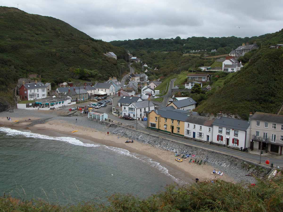
Penbryn is a small village located in the county of Ceredigion, Wales, specifically in the historic region of Cardiganshire. It is situated on the west coast of Wales, approximately 4 miles northeast of the town of Cardigan. Nestled within a picturesque valley, Penbryn offers stunning views of the surrounding countryside and the nearby Cardigan Bay.

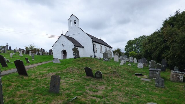
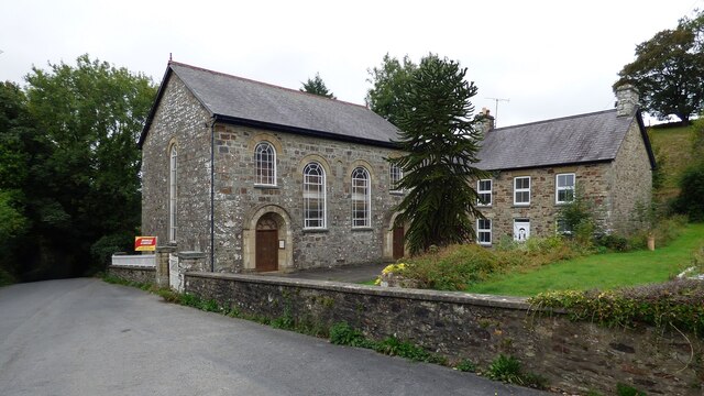
The village has a rich history that can be traced back to medieval times, with evidence of settlements in the area dating back to the 12th century. Today, Penbryn retains its traditional charm, with a scattering of stone-built houses and a quaint village church. The community is known for its close-knit and friendly atmosphere, providing a welcoming environment for residents and visitors alike.

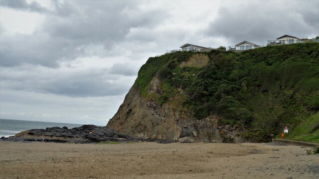
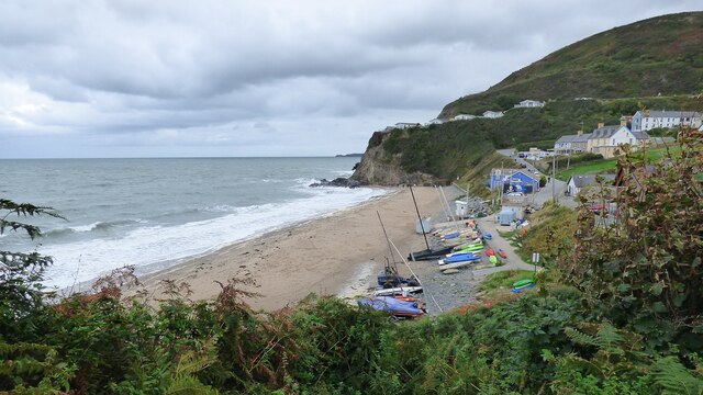
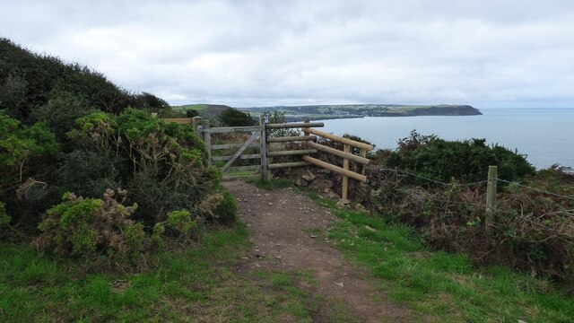
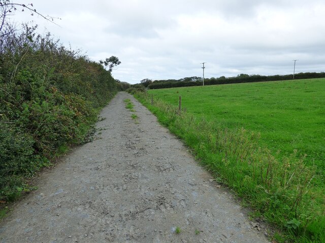
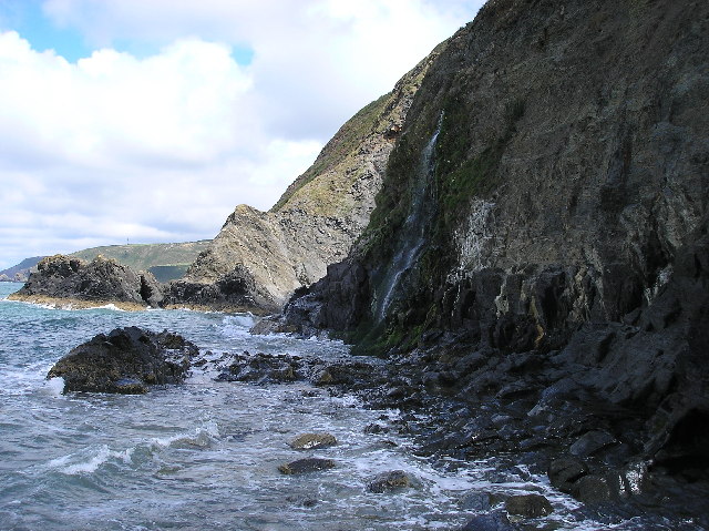
One of the main attractions of Penbryn is its beautiful beach, which stretches for over a mile along the coast. The sandy beach is renowned for its cleanliness and natural beauty, making it a popular destination for both locals and tourists looking to relax, swim, or explore the rock pools. The beach is backed by rolling sand dunes and surrounded by lush countryside, making it an idyllic spot for walkers and nature enthusiasts.

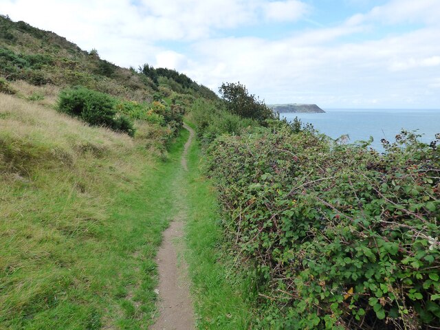
In addition to its natural beauty, Penbryn is also home to a National Trust-managed estate, which includes woodland, farmland, and historic buildings. The estate offers visitors the opportunity to explore the diverse flora and fauna of the area, as well as learn about the history and cultural heritage of Penbryn.

Overall, Penbryn offers a peaceful and charming escape for those seeking a slice of rural Welsh life, with its stunning beach, beautiful countryside, and rich history.

If you have any feedback on the listing, please let us know in the comments section below.

Penbryn Images

Images are sourced within 2km of 52.139867/-4.490189 or Grid Reference SN2951. Thanks to Geograph Open Source API. All images are credited.

Houses at Sarnau
Houses at Sarnau
Tresaith Sands With a caravan park very close to the cliff
Tresaith Sands
With a caravan park very close to the cliff
Tresaith Beach
Tresaith Beach
Corbalengi Stone Standing stone with the Roman inscription 'CORBALENGI IACIT ORDOVS' which translates to here lies Corbalengi the Ordovician. <span class="nowrap"><a title="https://www.megalithic.co.uk/article.php?sid=11054" rel="nofollow ugc noopener" href="https://www.megalithic.co.uk/article.php?sid=11054">Link</a><img style="margin-left:2px;" alt="External link" title="External link - shift click to open in new window" src="https://s1.geograph.org.uk/img/external.png" width="10" height="10"/></span>
Corbalengi Stone
Standing stone with the Roman inscription 'CORBALENGI IACIT ORDOVS' which translates to here lies Corbalengi the Ordovician. LinkExternal link
Ceredigion Coastal Path
The road to Traeth-Penbryn The road on the right takes you to the beach at Penbryn.
The road to Traeth-Penbryn
The road on the right takes you to the beach at Penbryn.
St Michael's Church on the Hill, Penbryn Stands in the centre of a circular graveyard. The church building itself may date to the 12th century, but almost certainly has earlier origins.
St Michael's Church on the Hill, Penbryn
Stands in the centre of a circular graveyard. The church building itself may date to the 12th century, but almost certainly has earlier origins.
Gate on the Ceredigion Coast Path
Approach to Maesglas Caravan Park
Capel Penmorfa <span class="nowrap"><a title="https://coflein.gov.uk/en/site/7397/" rel="nofollow ugc noopener" href="https://coflein.gov.uk/en/site/7397/">Link</a><img style="margin-left:2px;" alt="External link" title="External link - shift click to open in new window" src="https://s1.geograph.org.uk/img/external.png" width="10" height="10"/></span>
Capel Penmorfa
Southern rampart of Castell Bach Promontory Fort <span class="nowrap"><a title="https://coflein.gov.uk/en/site/93914/" rel="nofollow ugc noopener" href="https://coflein.gov.uk/en/site/93914/">Link</a><img style="margin-left:2px;" alt="External link" title="External link - shift click to open in new window" src="https://s1.geograph.org.uk/img/external.png" width="10" height="10"/></span>
Southern rampart of Castell Bach Promontory Fort
Footpath leading towards Eisteddfa
A sweep of the A487 road Between Blaenporth and Sarnau.
A sweep of the A487 road
Between Blaenporth and Sarnau.
A487 at Bwlchcrwys
A487 at Bwlchcrwys
A487 at Temple Bar
A487 at Temple Bar
A487 in Sarnau village
Tresaith Beach Located in Tresaith, Ceredigion, West Wales
The main coast road about 2 miles from the village Tresaith/Tresaith Beach is the A487 which goes 30 miles North to Aberystwyth and 7 miles South to Cardigan/Abertifi.
Tresaith Beach
Located in Tresaith, Ceredigion, West Wales The main coast road about 2 miles from the village Tresaith/Tresaith Beach is the A487 which goes 30 miles North to Aberystwyth and 7 miles South to Cardigan/Abertifi.
Carreg-y-ty and sandy beach From coast path looking down to  Carreg-y-ty and the sandy beach
Carreg-y-ty and sandy beach
From coast path looking down to Carreg-y-ty and the sandy beach
Show me another place!

Penbryn is located at Grid Ref: SN2951 (Lat: 52.139867, Lng: -4.490189)

Unitary Authority: Ceredigion

Police Authority: Dyfed Powys

What 3 Words

///users.slanting.study. Near Aberporth, Ceredigion

Nearby Locations

Penbryn

Related Wikis

Penbryn

Penbryn (grid reference SN296520) is a small coastal village and community in Ceredigion, Wales, about 8 miles (13 km) from Cardigan. == History == �...

St Michael's Church, Penbryn

The Church of St Michael at present (October 2023) holds services every Sunday at 11.15am. It is a Grade I listed church in Penbryn, Ceredigion, Wales...

Penmorfa

Penmorfa is the name of two villages in Wales. One is a small village in the community of Penbryn, Ceredigion, Wales. Penmorfa is represented in the Senedd...

Dyffryn-bern

Dyffryn-bern is a small village in the community of Penbryn, Ceredigion, Wales, which is 72.4 miles (116.5 km) from Cardiff and 191.8 miles (308.6 km...
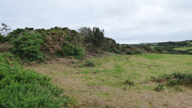
Castell Nadolig

Castell Nadolig ("Christmas Castle") is an Iron Age hillfort, about 2.5 miles (4 km) east of the village of Aberporth and about 1 mile (2 km) south of...

Tresaith

Tresaith (until recently, Treathsaith) is a coastal village in Ceredigion, Wales, between Aberporth and Llangranog. It is linked to the former by a two...

River Hawen

The River Hawen (Welsh: Nant Hawen) is the main stream that flows through Llangrannog, Ceredigion, Wales into Cardigan Bay. It falls as a waterfall near...

Llangrannog

Llangrannog (sometimes spelt as Llangranog) is both a village and a community in Ceredigion, Wales, 6 miles (10 km) southwest of New Quay. It lies in...

Nearby Amenities

Located within 500m of 52.139867,-4.490189
Penbryn
Is In: Ceredigion, Wales, UK
Is In Historic County: Cardiganshire
Name Cy: Penbryn
Place: hamlet
Source: npe
Wikidata: Q7162281
Wikipedia: en:Penbryn
Lat/Long: 52.1400258/-4.4905824
Cafe
Plwymp Tart
Addr Postcode: SA44 6QL
Fhrs Id: 773523
Source Addr Postcode: FHRS Open Data
Lat/Long: 52.1408648/-4.491518
Toilets
Lat/Long: 52.1406606/-4.4911962
Post Box
Post Box Type: lamp
Lat/Long: 52.1399205/-4.4901406
Grit Bin
Lat/Long: 52.1399804/-4.4902296
Fixme: longer than this
Lat/Long: 52.1430065/-4.4872029
The data included in this document is from www.openstreetmap.org. The data is made available under ODbL.

Have you been to Penbryn?

Leave your review of Penbryn below (or comments, questions and feedback).