Peasenhall

Settlement in Suffolk East Suffolk

England

Peasenhall

Peasenhall
Peasenhall Credit: P Gaskell

Peasenhall is a charming village located in the county of Suffolk, England. Situated about 15 miles east of Ipswich, it falls within the Suffolk Coastal district and lies close to the A1120 road. With a population of around 800 residents, Peasenhall offers a peaceful and picturesque setting for its inhabitants.

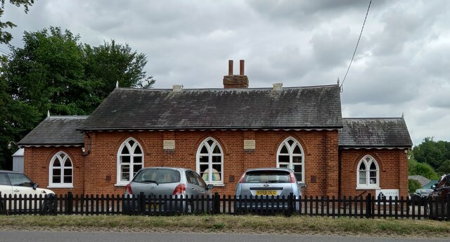
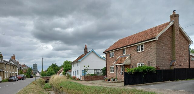
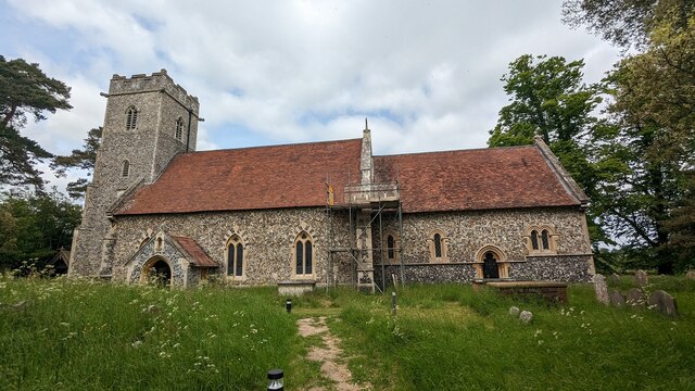
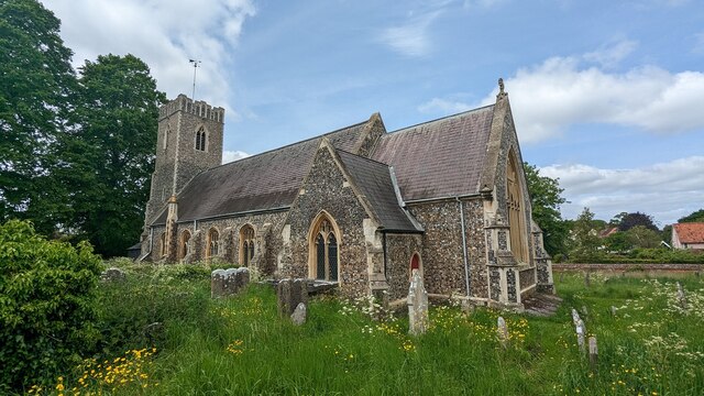
The village dates back to medieval times and still retains much of its historic character. Its most notable feature is the 15th-century church of St. Michael, which showcases beautiful architecture and serves as a reminder of the area's rich history. Peasenhall also boasts several traditional timber-framed houses and cottages, lending a quintessentially English feel to the village.

Despite its small size, Peasenhall offers a number of amenities to its residents and visitors. The village is home to a well-stocked general store, where locals can find everyday essentials and a range of local produce. Additionally, there is a primary school, a post office, and a community center that hosts various events throughout the year, fostering a strong sense of community.

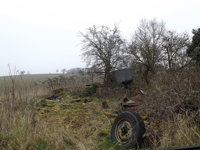
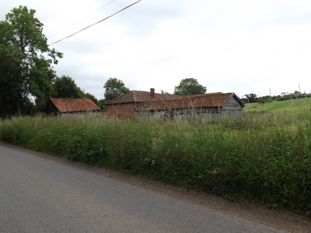
Surrounded by picturesque countryside, Peasenhall is a popular destination for outdoor enthusiasts. The village is located near several walking and cycling paths, offering opportunities to explore the beautiful Suffolk landscape. Additionally, Peasenhall is within easy reach of the Suffolk coast, allowing residents to enjoy the nearby beaches and seaside towns.

Overall, Peasenhall is a delightful village that combines historic charm with a close-knit community and access to stunning natural surroundings.

If you have any feedback on the listing, please let us know in the comments section below.
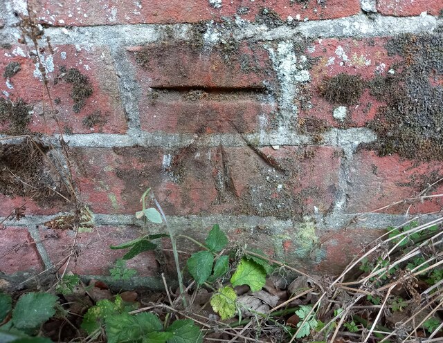
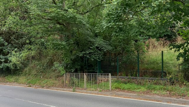
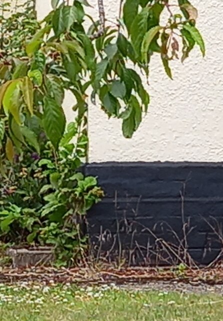
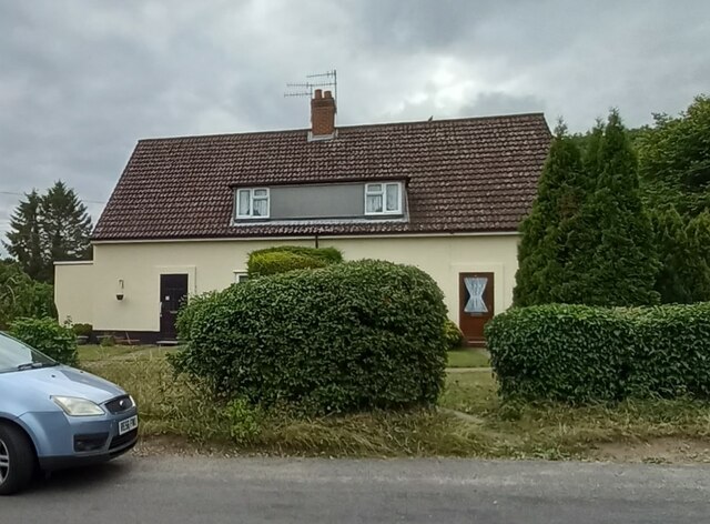
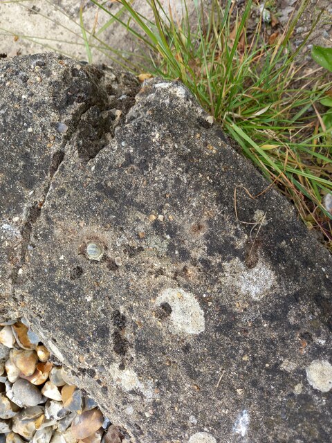
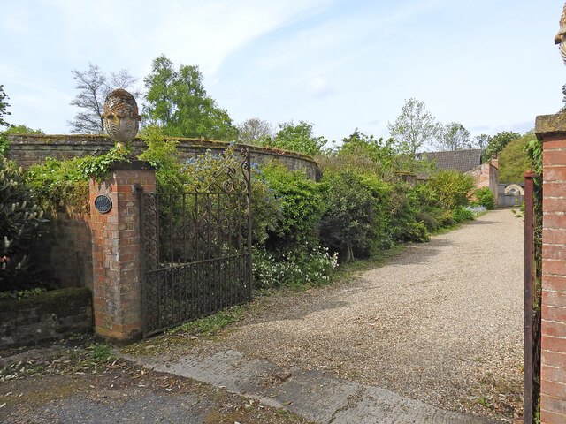
Peasenhall Images

Images are sourced within 2km of 52.269866/1.452203 or Grid Reference TM3569. Thanks to Geograph Open Source API. All images are credited.

Peasenhall
Peasenhall
Peasenhall bridge over River Yox According to the OS benchmark database there is a benchmark cut into the eastern parapet and over the centre of the stream. Nothing was found; the bridge is a relatively new build and the mark may have been destroyed.
Peasenhall bridge over River Yox
According to the OS benchmark database there is a benchmark cut into the eastern parapet and over the centre of the stream. Nothing was found; the bridge is a relatively new build and the mark may have been destroyed.
Sibton Nursery School According to the OS benchmark database there is a benchmark cut into the east facing wall of the school. There was lots of children activity at the school and therefore I didn't make a search. It is unknown if the mark survives.
Sibton Nursery School
According to the OS benchmark database there is a benchmark cut into the east facing wall of the school. There was lots of children activity at the school and therefore I didn't make a search. It is unknown if the mark survives.
Peasenhall, Pine View According to the OS benchmark database the rendered cottage painted white has a benchmark cut into the front of the property. The render has hidden any cutmark on the building.
Peasenhall, Pine View
According to the OS benchmark database the rendered cottage painted white has a benchmark cut into the front of the property. The render has hidden any cutmark on the building.
Peasenhall, St Michael's church The benchmark is cut into a buttress on the north-east face of the church.
Peasenhall, St Michael's church
The benchmark is cut into a buttress on the north-east face of the church.
Peasenhall, St Michael's church There is a benchmark cut into a buttress on the north-east face of the church.
Peasenhall, St Michael's church
There is a benchmark cut into a buttress on the north-east face of the church.
Peasenhall, old entrance to school The benchmark is cut into the brick wall on the right of the old school entrance. A safer entrance has been created to the left.
Peasenhall, old entrance to school
The benchmark is cut into the brick wall on the right of the old school entrance. A safer entrance has been created to the left.
Peasenhall, old school entrance There is a benchmark cut into the brick wall on the right of the old school entrance. A safer entrance has been created to the left.
Peasenhall, old school entrance
There is a benchmark cut into the brick wall on the right of the old school entrance. A safer entrance has been created to the left.
Peasenhall, 11 Oak View The benchmark is cut into the north-east face of the house.
Peasenhall, 11 Oak View
The benchmark is cut into the north-east face of the house.
Peasenhall, 11 Oak View There is a benchmark cut into the north-east face of the house.
Peasenhall, 11 Oak View
There is a benchmark cut into the north-east face of the house.
Peasenhall, electricity sub station The rivet benchmark is cut into the low roadside wall at the left of the entrance to the sub station.
Peasenhall, electricity sub station
The rivet benchmark is cut into the low roadside wall at the left of the entrance to the sub station.
Peasenhall, electricity sub station There is a rivet benchmark cut into the low roadside wall to the left of the entrance to the sub station.
Peasenhall, electricity sub station
There is a rivet benchmark cut into the low roadside wall to the left of the entrance to the sub station.
Serpentine wall at Abbotts Lodge Seen from the road the crinkle-crankle wall is very evident behind the foliage. Although the house is grade II listed, the wall is not.
Serpentine wall at Abbotts Lodge
Seen from the road the crinkle-crankle wall is very evident behind the foliage. Although the house is grade II listed, the wall is not.
Church of St. Peter, Sibton <span class="nowrap"><a title="https://historicengland.org.uk/listing/the-list/list-entry/1283976?section=official-list-entry" rel="nofollow ugc noopener" href="https://historicengland.org.uk/listing/the-list/list-entry/1283976?section=official-list-entry">Link</a><img style="margin-left:2px;" alt="External link" title="External link - shift click to open in new window" src="https://s1.geograph.org.uk/img/external.png" width="10" height="10"/></span>
Church of St. Peter, Sibton
Church of St. Michael and All Angels, Peasenhall <span class="nowrap"><a title="https://historicengland.org.uk/listing/the-list/list-entry/1183300?section=official-list-entry" rel="nofollow ugc noopener" href="https://historicengland.org.uk/listing/the-list/list-entry/1183300?section=official-list-entry">Link</a><img style="margin-left:2px;" alt="External link" title="External link - shift click to open in new window" src="https://s1.geograph.org.uk/img/external.png" width="10" height="10"/></span>
Church of St. Michael and All Angels, Peasenhall
Borehole off Hubbard's Hill <span class="nowrap"><a title="https://en.wikipedia.org/wiki/Peasenhall" rel="nofollow ugc noopener" href="https://en.wikipedia.org/wiki/Peasenhall">Link</a><img style="margin-left:2px;" alt="External link" title="External link - shift click to open in new window" src="https://s1.geograph.org.uk/img/external.png" width="10" height="10"/></span>
Borehole off Hubbard's Hill
Borehole off Hubbard's Hill (Close up)
Borehole off Hubbard's Hill
(Close up)
North Grange Farm, Sibton Off the C209 Halesworth Road
North Grange Farm, Sibton
Off the C209 Halesworth Road
Show me another place!

Peasenhall is located at Grid Ref: TM3569 (Lat: 52.269866, Lng: 1.452203)

Administrative County: Suffolk

District: East Suffolk

Police Authority: Suffolk

What 3 Words

///surveyed.feasts.roughness. Near Cookley, Suffolk

Related Wikis

The Ancient House, Peasenhall

The Ancient House is a grade II* listed house in Peasenhall, Suffolk, England. The house is timber-framed and is not ancient, dating from the mid-sixteenth...

Peasenhall

Peasenhall is a village and civil parish in the East Suffolk district, in the English county of Suffolk. The population of the civil parish at the 2021...
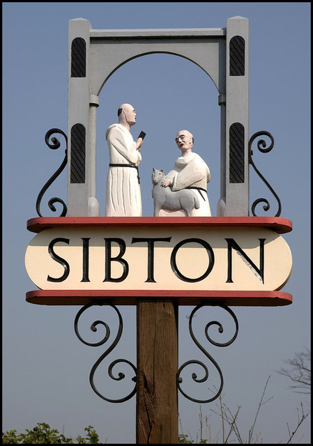
Sibton

Sibton is a village and civil parish on the A1120 road, in the East Suffolk district, in the English county of Suffolk. It is near the towns of Saxmundham...

Sibton Abbey

Sibton Abbey, an early Cistercian abbey located near Yoxford, Suffolk, was founded about 1150 by William de Chesney, High Sheriff of Norfolk and Suffolk...

Wilderness Reserve

Wilderness Reserve is a private estate of 8,000 acres (3,200 ha) in Suffolk's Yox Valley assembled by Jon Hunt since 1995 incorporating estates of Sibton...

Sibton Park

Sibton Park is a Grade II* listed country house in Sibton, Suffolk, England. It was built in 1827 by Decimus Burton and is now part of the 5,000 acre Wilderness...

Bruisyard Abbey

The Abbey of Bruisyard was a house of Minoresses (Poor Clares) at Bruisyard in Suffolk. It was founded from Campsey Priory in Suffolk on the initiative...

Yoxford

Yoxford is a village in East Suffolk, England, close to the Heritage Coast, Minsmere Reserve (RSPB), Aldeburgh and Southwold. It is known for its antique...

Nearby Amenities

Located within 500m of 52.269866,1.452203
Peasenhall
Place: village
Wikidata: Q2988404
Wikipedia: en:Peasenhall
Lat/Long: 52.2701103/1.4509436
Bus Stop
Bus Shelter
Bench: yes
Bin: yes
Bus: yes
Naptan AtcoCode: 390060014
Naptan Bearing: SW
Naptan CommonName: Bus Shelter
Naptan Indicator: o/s
Naptan Landmark: Bus Shelter
Naptan NaptanCode: sufgmjag
Naptan Street: The Street
Naptan Verified: no
Public Transport: platform
Shelter: yes
Source: naptan_import
Lat/Long: 52.2719456/1.4525197
Bus Stop
Bus Shelter
Bus: yes
Naptan AtcoCode: 390060015
Naptan Bearing: NE
Naptan BusStopType: CUS
Naptan CommonName: Bus Shelter
Naptan Indicator: opp
Naptan Landmark: Bus Shelter
Naptan NaptanCode: sufgmjaj
Naptan Street: The Street
Naptan Verified: no
Public Transport: platform
Source: naptan_import
Lat/Long: 52.2719679/1.4523749
Bus Stop
Chapel
Bus: yes
Naptan AtcoCode: 390060016
Naptan Bearing: E
Naptan BusStopType: CUS
Naptan CommonName: Chapel
Naptan Indicator: adj
Naptan Landmark: Chapel
Naptan NaptanCode: sufgmjam
Naptan Street: Chapel Street
Naptan Verified: no
Public Transport: platform
Source: naptan_import
Lat/Long: 52.273288/1.4567444
Bus Stop
Chapel
Bus: yes
Naptan AtcoCode: 390060017
Naptan Bearing: W
Naptan BusStopType: CUS
Naptan CommonName: Chapel
Naptan Indicator: opp
Naptan Landmark: Chapel
Naptan NaptanCode: sufgmjap
Naptan Street: Chapel Street
Naptan Verified: no
Public Transport: platform
Source: naptan_import
Lat/Long: 52.2731876/1.4567952
Cafe
The Weavers Tea Room
Addr Country: GB
Addr Postcode: IP17 2JE
Addr Street: The Knoll
Cuisine: tea
Fhrs Id: 659337
Outdoor Seating: yes
Phone: +44 1728 660548
Source Addr: FHRS Open Data
Lat/Long: 52.2729669/1.4553981
Advertising: board
Board Type: notice
Information: board
Source: survey
Support: wall_mounted
Tourism: information
Lat/Long: 52.2722716/1.453231
Post Box
Collection Times: Mo-Fr 17:00; Sa 10:15
Operator: Royal Mail
Post Box Type: wall
Ref: IP17 4658
Royal Cypher: GR
Royal Cypher Wikidata: Q33102273
Source: survey
Lat/Long: 52.2722666/1.4532164
Peasenhall General Store
Shop: general
Source: survey
Lat/Long: 52.2724186/1.4535799
New Inn
Guest House: hotel
Tourism: guest_house
Wikidata: Q26657640
Lat/Long: 52.2731362/1.4553148
Ollie Platt Events
Craft: caterer
Phone: +44 7585 963963
Website: https://www.ollieplattevents.co.uk/
Lat/Long: 52.2721095/1.4535606
Cafe
The Suffolk Coffee Co
Website: http://www.thesuffolkcoffeecompany.co.uk/
Lat/Long: 52.2721144/1.4526594
My Suffolk Holiday Cottages
Guest House: guest_house
Phone: +44 7973 139676
Tourism: guest_house
Website: https://mysuffolkholidaycottages.co.uk/
Lat/Long: 52.2711001/1.4512164
Board Type: notice
Information: board
Tourism: information
Lat/Long: 52.2710984/1.4500308
Defibrillator
Booth: K6
Covered: booth
Defibrillator Location: In the disused red telephone kiosk, opposite the general store, Peasenhall.
Disused Amenity: telephone
Emergency: defibrillator
Indoor: no
Listed Status: Grade II
Man Made: telephone_box
Ref: illegible
Ref GB The Circuit: 5A5B4556-E78E-4CBD-9782-AE4B011E0CE8
Lat/Long: 52.2721602/1.4532991
Bench
Backrest: yes
Material: wood
Lat/Long: 52.2720962/1.4533152
Waste Basket
Lat/Long: 52.2720847/1.4532777
Post Box
Collection Times: Mo-Fr 09:00; Sa 07:00
Post Box Mounting: brick_pillar
Post Box Type: wall
Ref: IP17 4631D
Royal Cypher: VR
Royal Cypher Wikidata: Q33102356
Lat/Long: 52.271111/1.451401
Power: pole
Lat/Long: 52.2693162/1.4450951
Power: pole
Lat/Long: 52.2686317/1.446974
Power: pole
Lat/Long: 52.2684019/1.4475024
Power: pole
Lat/Long: 52.267729/1.4495248
Power: pole
Lat/Long: 52.2670412/1.4510456
Power: pole
Lat/Long: 52.266621/1.4525127
Power: pole
Lat/Long: 52.2663616/1.4543018
Power: pole
Lat/Long: 52.2660719/1.4561109
Post Office
Addr City: Saxmundham
Addr Postcode: IP17 2HJ
Addr Street: The Street
Addr Village: Peasenhall
Brand: Post Office
Brand Wikidata: Q1783168
Opening Hours Post Office: Mo 09:00-13:00; Tu-Fr 09:00-17:00; Sa 09:00-12:00
Operator: Mace
Operator Wikidata: Q75240338
Ref Pol Id: 8127
Website: https://www.postoffice.co.uk/branch-finder/219130x/peasenhall
Lat/Long: 52.2723309/1.4530608
The data included in this document is from www.openstreetmap.org. The data is made available under ODbL.

Have you been to Peasenhall?

Leave your review of Peasenhall below (or comments, questions and feedback).