Pattingham

Settlement in Staffordshire South Staffordshire

England

Pattingham

Cereal crop and gas pipeline indicator near Wrottesley, Staffordshire The fields around are predominantly arable. Gas pipelines all over the country are not far beneath the surface of the fields.
Cereal crop and gas pipeline indicator near Wrottesley, Staffordshire Credit: Roger D Kidd

Pattingham is a picturesque village located in the South Staffordshire district of Staffordshire, England. Situated approximately 12 miles west of Wolverhampton and 8 miles south-east of Bridgnorth, the village is nestled amidst beautiful countryside, offering residents and visitors a tranquil and idyllic setting.

With a population of around 2,000 people, Pattingham maintains its rural charm while providing essential amenities for its residents. The heart of the village is adorned with historic buildings, including St. Chad's Church, which dates back to the 12th century and is a prominent landmark. The village also boasts a primary school, a village hall, a post office, and a convenience store, ensuring the needs of the community are met.

Pattingham is known for its strong sense of community, with various events and activities organized throughout the year. The annual Pattingham Village Show brings together locals and visitors alike to celebrate the village's horticultural and artistic talents. Additionally, the village hosts regular markets, fairs, and festivals, fostering a vibrant atmosphere.

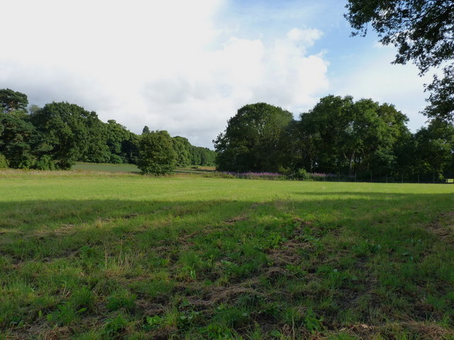
Nature enthusiasts are drawn to Pattingham due to its proximity to the Shropshire Hills Area of Outstanding Natural Beauty. This offers ample opportunities for outdoor pursuits such as hiking, cycling, and horse riding. The village is also intersected by the Staffordshire Way, a long-distance footpath that provides stunning views of the surrounding countryside.

Overall, Pattingham is a charming village that combines natural beauty, a rich history, and a strong community spirit. It is a place where residents can enjoy a peaceful lifestyle while remaining well-connected to nearby towns and cities.

If you have any feedback on the listing, please let us know in the comments section below.

Pattingham Images

Images are sourced within 2km of 52.587685/-2.262129 or Grid Reference SO8298. Thanks to Geograph Open Source API. All images are credited.

Cereal crop and gas pipeline indicator near Wrottesley, Staffordshire The fields around are predominantly arable. Gas pipelines all over the country are not far beneath the surface of the fields.
Cereal crop and gas pipeline indicator near Wrottesley, Staffordshire
The fields around are predominantly arable. Gas pipelines all over the country are not far beneath the surface of the fields.
Woodland reservoir in Wrottesley Old Park, Staffordshire There are two enormous covered "water tanks" hidden in the Wrottesly Park Plantation here. They are recorded as reservoirs on the 1:25000 map.
Woodland reservoir in Wrottesley Old Park, Staffordshire
There are two enormous covered "water tanks" hidden in the Wrottesly Park Plantation here. They are recorded as reservoirs on the 1:25000 map.
Bridleway, Wrottesley Old Park, Staffordshire This bridleway is a beautiful walk. It is wide, "green lane" in appearance, and in several places shows signs of having had the surface strengthened with medium sized rounded stones.
Bridleway, Wrottesley Old Park, Staffordshire
This bridleway is a beautiful walk. It is wide, "green lane" in appearance, and in several places shows signs of having had the surface strengthened with medium sized rounded stones.
Bridleway, Wrottesley Old Park, Staffordshire A thoroughly delightful byway!
Bridleway, Wrottesley Old Park, Staffordshire
A thoroughly delightful byway!
Lane/Public Footpath, near Nurton, Staffordshire This well surfaced (cul-de-sac) lane is actually signposted as a public footpath!
In fact, it acts as a private access road to several seriously desirable detached residences in extensive landscaped gardens.
Lane/Public Footpath, near Nurton, Staffordshire
This well surfaced (cul-de-sac) lane is actually signposted as a public footpath! In fact, it acts as a private access road to several seriously desirable detached residences in extensive landscaped gardens.
Private Garden and Mini Golf Course, near Nurton, Staffordshire The last house on the surfaced part of the lane has extensive gardens including this immaculately presented miniature golf course. Shame about the power lines!!
Private Garden and Mini Golf Course, near Nurton, Staffordshire
The last house on the surfaced part of the lane has extensive gardens including this immaculately presented miniature golf course. Shame about the power lines!!
Pattingham View The View from Nurton Hill Road.
Pattingham View
The View from Nurton Hill Road.
Westbeech Trig Post
Westbeech Trig Post
Lane to Nurton Hill
Lane to Nurton Hill
Trig point on Nurton Hill Unusually, this trig point is not at the top of the hill; that lies 500 yards away in <a href="https://www.geograph.org.uk/gridref/SJ8300">SJ8300</a>, and is occupied by two large tanks forming a water supply reservoir.
Trig point on Nurton Hill
Unusually, this trig point is not at the top of the hill; that lies 500 yards away in SJ8300, and is occupied by two large tanks forming a water supply reservoir.
Bridleway and woods near Nurton
Nurton Reservoir Two huge concrete tanks, marked as a Reservoir, are hidden in this wood. The site is run by Severn Trent Water. A web-search for Nurton Reservoir completely foxes Google, but I would guess that they act as a holding supply for the northern part of Wolverhampton.
Update June 2019 - it transpires that the reservoir is fed by water from a borehole at Neachley, near Junction 3 of the M54, and supplies Perton.
Nurton Reservoir
Two huge concrete tanks, marked as a Reservoir, are hidden in this wood. The site is run by Severn Trent Water. A web-search for Nurton Reservoir completely foxes Google, but I would guess that they act as a holding supply for the northern part of Wolverhampton. Update June 2019 - it transpires that the reservoir is fed by water from a borehole at Neachley, near Junction 3 of the M54, and supplies Perton.
Permissive Path The footpath from the Westbeech Road runs alongside Butts Spinney near Pattingham.
Permissive Path
The footpath from the Westbeech Road runs alongside Butts Spinney near Pattingham.
Gun Dog Training Dogs in the field alongside the Meadleys Farm, Pattingham.
Gun Dog Training
Dogs in the field alongside the Meadleys Farm, Pattingham.
Spring Coppice from the north Much of this grid square consists of open farmland, with a few large coppice/wooded areas. This is a typical view.
Spring Coppice from the north
Much of this grid square consists of open farmland, with a few large coppice/wooded areas. This is a typical view.
Ordnance Survey Cut Mark This OS cut mark can be found on the east face of Monument Lodge. It marks a point 154.646m above mean sea level.
Ordnance Survey Cut Mark
This OS cut mark can be found on the east face of Monument Lodge. It marks a point 154.646m above mean sea level.
Path View The view in Nurton near Pattingham.
Path View
The view in Nurton near Pattingham.
Field Path The view  of the footpath in Nurton near Pattingham.
Field Path
The view of the footpath in Nurton near Pattingham.
Show me another place!

Pattingham is located at Grid Ref: SO8298 (Lat: 52.587685, Lng: -2.262129)

Administrative County: Staffordshire

District: South Staffordshire

Police Authority: Staffordshire

What 3 Words

///sensibly.huddle.stealthier. Near Pattingham, Staffordshire

Nearby Locations

Pattingham

Related Wikis

Pattingham

Pattingham is a village and former civil parish, now in the parish of Pattingham and Patshull, in the South Staffordshire district, in the county of Staffordshire...

Nurton

Nurton is a hamlet in the South Staffordshire District, in the English county of Staffordshire. Nearby settlements include the city of Wolverhampton and...

Rudge, Shropshire

Rudge is a settlement and civil parish about 6 miles east of Bridgnorth, in the Shropshire district, in the ceremonial county of Shropshire, England. In...

St Mary's Church, Patshull

St Mary's Church, Patshull, is a redundant Anglican church in the parish of Pattingham and Patshull, Staffordshire, England, and is situated near Patshull...

Nearby Amenities

Located within 500m of 52.587685,-2.262129
Pattingham
Created By: Potlatch 0.10f
Is In: Staffordshire
Place: village
Wikidata: Q7148590
Lat/Long: 52.5871802/-2.2634572
Pub
The Pigot Arms
Addr Housename: The Pigot Arms
Addr Housenumber: 11
Addr Postcode: WV6 7BQ
Addr Street: High Street
Lat/Long: 52.5890452/-2.2648724
Post Box
Ref: WV6 353
Lat/Long: 52.5899474/-2.2618019
Martin Thomas Traditional Family Butcher
Addr City: Pattingham
Addr Housenumber: 10
Addr Postcode: WV6 7AF
Addr Street: Wolverhampton Road
Contact Phone: +44 1902 700217
Contact Website: http://www.martinthomasbutchers.com/
Shop: butcher
Lat/Long: 52.5897491/-2.262224
Post Box
Post Box Type: pillar
Ref: WV6 489
Lat/Long: 52.5881061/-2.2623106
Post Box
Post Box Type: pillar
Ref: WV6 181
Lat/Long: 52.5889996/-2.2643463
Bicycle Parking
Access: yes
Bicycle Parking: stands
Capacity: 2
Covered: no
Lat/Long: 52.5889848/-2.2644211
Post Box
Collection Times: Mo-Fr 09:00; Sa 07:00
Operator: Royal Mail
Post Box Type: lamp
Ref: WV6 354D
Royal Cypher: EIIR
Royal Cypher Wikidata: Q33102113
Source: survey
Lat/Long: 52.5868375/-2.267462
Pub
The Crown
Addr Housename: The Crown
Addr Housenumber: 15
Addr Postcode: WV6 7BQ
Addr Street: High Street
Website: http://www.crownpattingham.co.uk/
Lat/Long: 52.5889978/-2.265378
Bus Stop
Pattingham Shops
Naptan AtcoCode: 3800C607400
Naptan Bearing: W
Naptan CommonName: Pattingham Shops
Naptan Indicator: Adj
Naptan Landmark: Shops
Naptan Street: High Street
Naptan Verified: no
Public Transport: platform
Source: naptan_import
Lat/Long: 52.5891528/-2.2641309
Bus Stop
Pattingham Shops
Naptan AtcoCode: 3800C607401
Naptan Bearing: NE
Naptan CommonName: Pattingham Shops
Naptan Indicator: Opp
Naptan Landmark: Shops
Naptan Street: High Street
Naptan Verified: no
Public Transport: platform
Source: naptan_import
Lat/Long: 52.589545/-2.2632876
Pub
Pattingham Club
Addr Street: High Street
Old Name: Pattingham Working Mens Club
Phone: +44 1902 70036
Lat/Long: 52.5871346/-2.2671446
Recycling
Description: Village Hall rear car park
Opening Hours: 24/7
Recycling Batteries: no
Recycling Cans: yes
Recycling Cartons: yes
Recycling Clothes: yes
Recycling Electrical Appliances: no
Recycling Glass: yes
Recycling Glass Bottles: yes
Recycling Green Waste: no
Recycling Plastic Bottles: yes
Recycling Small Appliances: no
Recycling Wood: no
Recycling Type: container
Lat/Long: 52.5896508/-2.2647553
Waste Basket
Waste: dog_excrement
Lat/Long: 52.584836/-2.262245
Crossing
Crossing: uncontrolled
Crossing Ref: zebra
Sloped Curb: both
Supervised: no
Lat/Long: 52.5893531/-2.2636152
Entrance: yes
Lat/Long: 52.5906533/-2.2630812
Crossing
Crossing: unmarked
Supervised: yes
Lat/Long: 52.5897273/-2.2627087
Access: yes
Entrance: main
Lat/Long: 52.5895096/-2.2641314
Entrance: main
Lat/Long: 52.5904137/-2.2630278
Playground: swing
Lat/Long: 52.5896228/-2.2635823
Playground: seesaw
Lat/Long: 52.5896823/-2.2634374
Entrance: yes
Lat/Long: 52.590767/-2.2625519
Access: yes
Barrier: kissing_gate
Lat/Long: 52.5907709/-2.2637744
Playground: slide
Lat/Long: 52.5896807/-2.2637164
Playground: climbingframe
Lat/Long: 52.5898371/-2.2632993
Entrance: main
Lat/Long: 52.5889882/-2.2640573
Access: customers
Entrance: main
Lat/Long: 52.5889448/-2.2643235
Cafe
Lychgate Coffee
Addr Housename: 1 Lychgate House
Addr Postcode: WV6 7BQ
Addr Street: High Street
Contact Facebook: https://www.facebook.com/pages/Lychgate-Coffee/411709172266825
Contact Phone: +44 1902 701667
Contact Website: http://lychgatecoffee.com/
Cuisine: coffee_shop
Internet Access: yes
Opening Hours: Mo-Sa 10:00-15:00;Su 10:00-14:00
Lat/Long: 52.5891012/-2.2654985
Access: customers
Entrance: main
Lat/Long: 52.5889742/-2.2641446
Access: yes
Barrier: kissing_gate
Lat/Long: 52.5910364/-2.2639748
Entrance: yes
Lat/Long: 52.5896924/-2.2642475
Access: customers
Entrance: main
Lat/Long: 52.5890034/-2.2639669
Entrance: main
Lat/Long: 52.58981/-2.2646293
Entrance: main
Lat/Long: 52.5896257/-2.2657582
Access: yes
Barrier: kissing_gate
Lat/Long: 52.5910655/-2.2664214
Barrier: stile
Lat/Long: 52.5887146/-2.2684729
Waste Basket
Waste: dog_excrement
Lat/Long: 52.5884839/-2.2661671
Waste Basket
Waste: trash
Lat/Long: 52.5891292/-2.2641474
Entrance: main
Lat/Long: 52.5871343/-2.2672637
Waste Basket
Waste: dog_excrement
Lat/Long: 52.5868276/-2.2674697
Access: customers
Entrance: yes
Lat/Long: 52.5890496/-2.265529
Access: customers
Entrance: main
Lat/Long: 52.5890878/-2.2654685
Pharmacy
Medi-Care Pharmacy
Addr City: Pattingham
Addr Housenumber: 1
Addr Postcode: WV6 7BD
Addr Street: High Street
Dispensing: yes
Phone: +44 1902 700700
Lat/Long: 52.5889916/-2.2638604
Access: customers
Entrance: main
Lat/Long: 52.5890193/-2.2638725
Hair & Beauty by Shelley
Addr City: Pattingham
Addr Housenumber: 2
Addr Postcode: WV6 7BQ
Addr Street: High Street
Contact Email: hairandbeautybyshelley@outlook.com
Contact Facebook: https://www.facebook.com/pages/Hair-And-Beauty-By-Shelley/525419860900997
Opening Hours: Tu 09:00-17:00;We 09:00-14:00;Th 09:00-19:00;Fr 09:00-18:00;Sa 08:30-16:30
Phone: +44 1902 700007
Shop: hairdresser
Lat/Long: 52.588981/-2.2639583
Kenneth Clive
Addr City: Pattingham
Addr Housenumber: 3
Addr Postcode: WV6 7BD
Addr Street: High Street
Contact Email: ken@kennethclive.co.uk
Contact Facebook: https://www.facebook.com/pages/Kenneth-Clive-Menswear-and-Hire/193481424017179
Contact Phone: +44 1902 271621
Contact Website: http://www.kennethclive.co.uk/
Opening Hours: Mo-Sa 09:00-17:00
Shop: clothes
Lat/Long: 52.5889663/-2.2640509
Ann Raymond Florist
Addr City: Pattingham
Addr Housenumber: 4
Addr Postcode: WV6 7BD
Addr Street: High Street
Contact Email: helen@annraymond.co.uk
Contact Facebook: https://www.facebook.com/ann.raymondflorist
Contact Phone: +44 1902 700631
Contact Twitter: https://twitter.com/A_RFlorist
Contact Website: http://www.annraymond.co.uk/
Opening Hours: Mo-Sa 09:00-17:00;We 09:00-13:00
Shop: florist
Lat/Long: 52.5889443/-2.2641313
Your Coop Food
Addr City: Pattingham
Addr Housenumber: 7
Addr Postcode: WV6 7BQ
Addr Street: High Street
Alcohol: yes
Atm: yes
Brand: Your Coop Food
Brand Wikidata: Q121084548
Opening Hours: Mo-Sa 06:00-22:00;Su 07:00-18:00
Operator: Midcounties Co-operative
Operator Wikidata: Q6841138
Shop: convenience
Lat/Long: 52.5889117/-2.2643164
Post Office
Pattingham Post Office
Addr City: Pattingham
Addr Housenumber: 7
Addr Postcode: WV6 7BD
Addr Street: High Street
Brand: Post Office
Brand Wikidata: Q1783168
Check Date: 2023-09-27
Collection Times: Mo-Fr 16:00
Opening Hours: Mo-Sa 06:00-22:00; Su 07:00-18:00
Operator: The Co-operative Food
Ref Pol Id: 19788
Lat/Long: 52.5888905/-2.2643084
Entrance: emergency
Lat/Long: 52.589558/-2.2643195
Barrier: stile
Lat/Long: 52.5859344/-2.2656109
Wooden cross
Lat/Long: 52.5893476/-2.2644372
Waste Basket
Lat/Long: 52.5897872/-2.2643879
Bench
Backrest: yes
Lat/Long: 52.5897856/-2.2644684
Bench
Backrest: yes
Lat/Long: 52.5895526/-2.2647152
Bench
Backrest: yes
Lat/Long: 52.589348/-2.2640211
Bench
Backrest: yes
Lat/Long: 52.5893896/-2.2643101
Waste Basket
Lat/Long: 52.5910563/-2.2663852
Waste Basket
Lat/Long: 52.5901367/-2.2651448
Waste Basket
Lat/Long: 52.5893773/-2.2642991
Waste Basket
Lat/Long: 52.5890045/-2.2643998
Bench
Lat/Long: 52.5890257/-2.2644348
Bench
Lat/Long: 52.589679/-2.2655822
Bench
Lat/Long: 52.5896701/-2.2656347
Bench
Lat/Long: 52.5898961/-2.2651965
Bench
Lat/Long: 52.5894823/-2.2644721
Bench
Lat/Long: 52.5909759/-2.2655691
Bench
Lat/Long: 52.5906684/-2.2653016
Bench
Lat/Long: 52.5908154/-2.2654831
Bench
Lat/Long: 52.5910649/-2.265792
Bench
Lat/Long: 52.5911558/-2.2660276
Bicycle Parking
Lat/Long: 52.5898915/-2.2644076
Waste Basket
Lat/Long: 52.5900276/-2.2643021
Waste Basket
Waste: dog_excrement
Lat/Long: 52.5865904/-2.2627071
Waste Basket
Waste: dog_excrement
Lat/Long: 52.585959/-2.2655971
Generator Method: photovoltaic
Generator Output Electricity: yes
Generator Source: solar
Generator Type: solar_photovoltaic_panel
Location: roof
Power: generator
Lat/Long: 52.5863553/-2.258994
Generator Method: photovoltaic
Generator Output Electricity: yes
Generator Source: solar
Generator Type: solar_photovoltaic_panel
Location: roof
Power: generator
Lat/Long: 52.5849929/-2.2643423
Barrier: stile
Lat/Long: 52.5855464/-2.2677204
Generator Method: photovoltaic
Generator Output Electricity: yes
Generator Source: solar
Generator Type: solar_photovoltaic_panel
Location: roof
Power: generator
Lat/Long: 52.5841813/-2.2649485
Bus Stop
Newgate
Naptan AtcoCode: 3800C627102
Naptan BusStopType: CUS
Naptan Verified: no
Public Transport: platform
Source: naptan
Lat/Long: 52.5900422/-2.262023
Bus Stop
Newgate
Naptan AtcoCode: 3800C627101
Naptan Verified: no
Public Transport: platform
Source: naptan
Lat/Long: 52.5899976/-2.2618456
Power: pole
Lat/Long: 52.5897725/-2.2589398
Power: pole
Lat/Long: 52.5886043/-2.2562972
Power: pole
Lat/Long: 52.5880436/-2.2550004
Charging Station
BP Pulse Pigot Arms
Access: permissive
Authentication App: yes
Authentication Membership Card: yes
Bicycle: no
Capacity: 1
Fee: yes
Maxstay: 90 minutes
Motorcar: yes
Operator: BP Pulse
Parking Fee: no
Ref: 24654
Socket Chademo: 1
Socket Chademo Output: 50 kW
Socket Type2: 1
Socket Type2 Output: 43 kW
Socket Type2 Combo: 1
Socket Type2 Combo Output: 50 kW
Lat/Long: 52.5889755/-2.2644944
The data included in this document is from www.openstreetmap.org. The data is made available under ODbL.

Have you been to Pattingham?

Leave your review of Pattingham below (or comments, questions and feedback).