Bilton

Settlement in Northumberland

England

Bilton

Cattle grazing
Cattle grazing Credit: N Chadwick

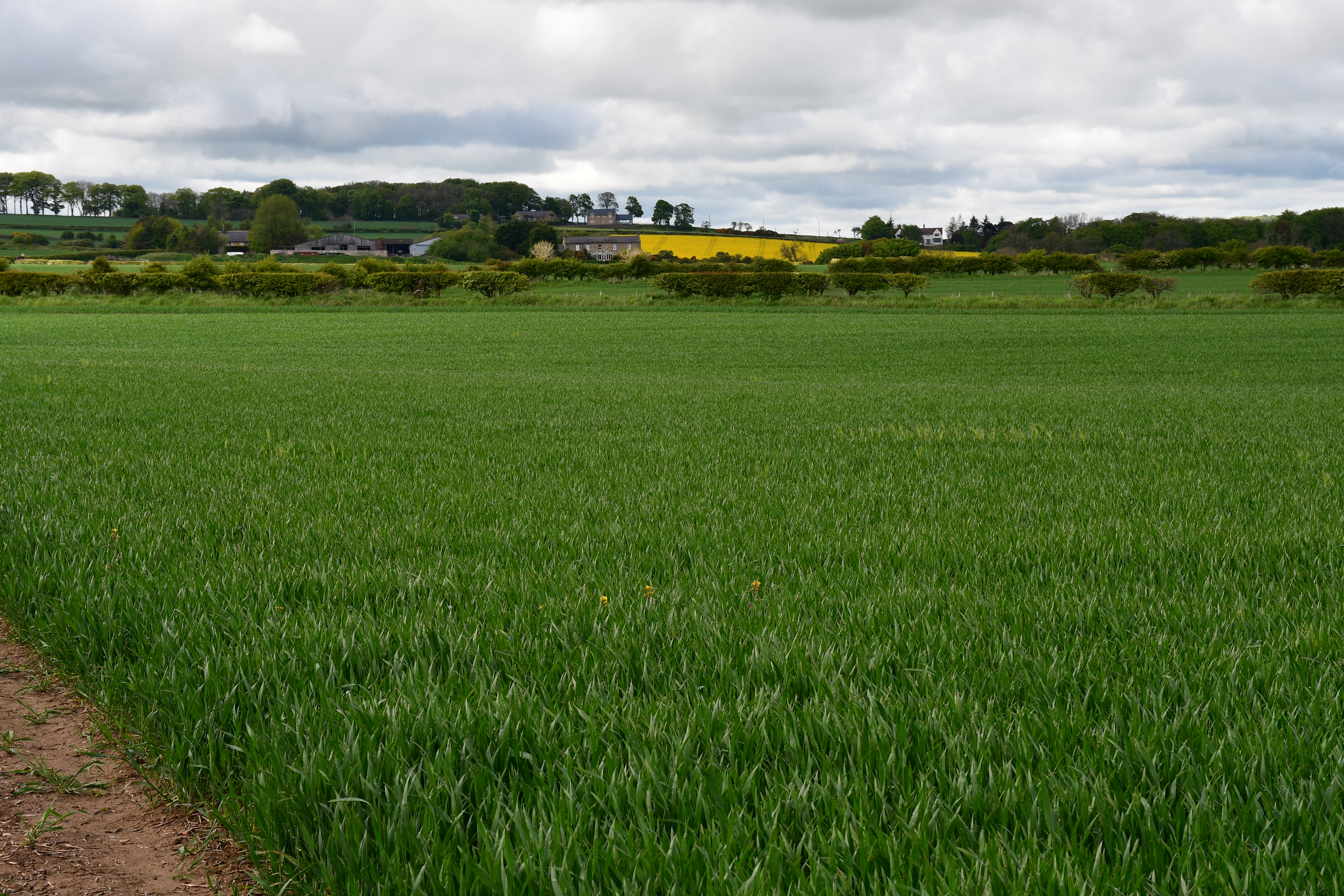
Bilton is a small village located in the county of Northumberland, England. Situated approximately 12 miles north of the market town of Alnwick, Bilton is nestled in a picturesque rural landscape. The village is surrounded by rolling hills, green fields, and meandering streams, making it an idyllic retreat for nature enthusiasts.

With a population of around 200 residents, Bilton boasts a close-knit community that takes pride in its heritage. The village is known for its historic charm, with several well-preserved buildings dating back to the 18th and 19th centuries. These include a Grade II listed church, St. Peter's, which serves as a focal point for the local community.

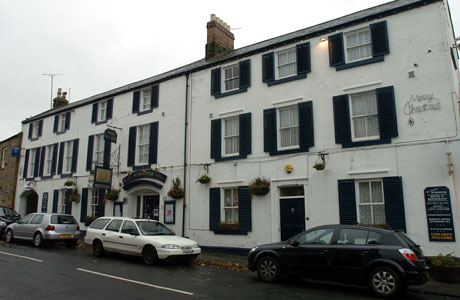
Despite its small size, Bilton offers a range of amenities to its residents. These include a local pub, The Black Horse Inn, where villagers can gather for a drink or a meal. Additionally, the village has a primary school, providing education for children in the area.

The surrounding area offers plenty of opportunities for outdoor activities. Bilton is located near the Northumberland National Park, a vast expanse of natural beauty, perfect for hiking, cycling, and wildlife spotting. The nearby coastline, with its sandy beaches and rugged cliffs, is also easily accessible from the village.

Overall, Bilton, Northumberland, is a charming and peaceful village, offering a close community spirit, beautiful scenery, and a range of amenities. It is a place where residents can enjoy a relaxed rural lifestyle while being within reach of larger towns and natural attractions.

If you have any feedback on the listing, please let us know in the comments section below.

Bilton Images

Images are sourced within 2km of 55.390848/-1.642877 or Grid Reference NU2210. Thanks to Geograph Open Source API. All images are credited.
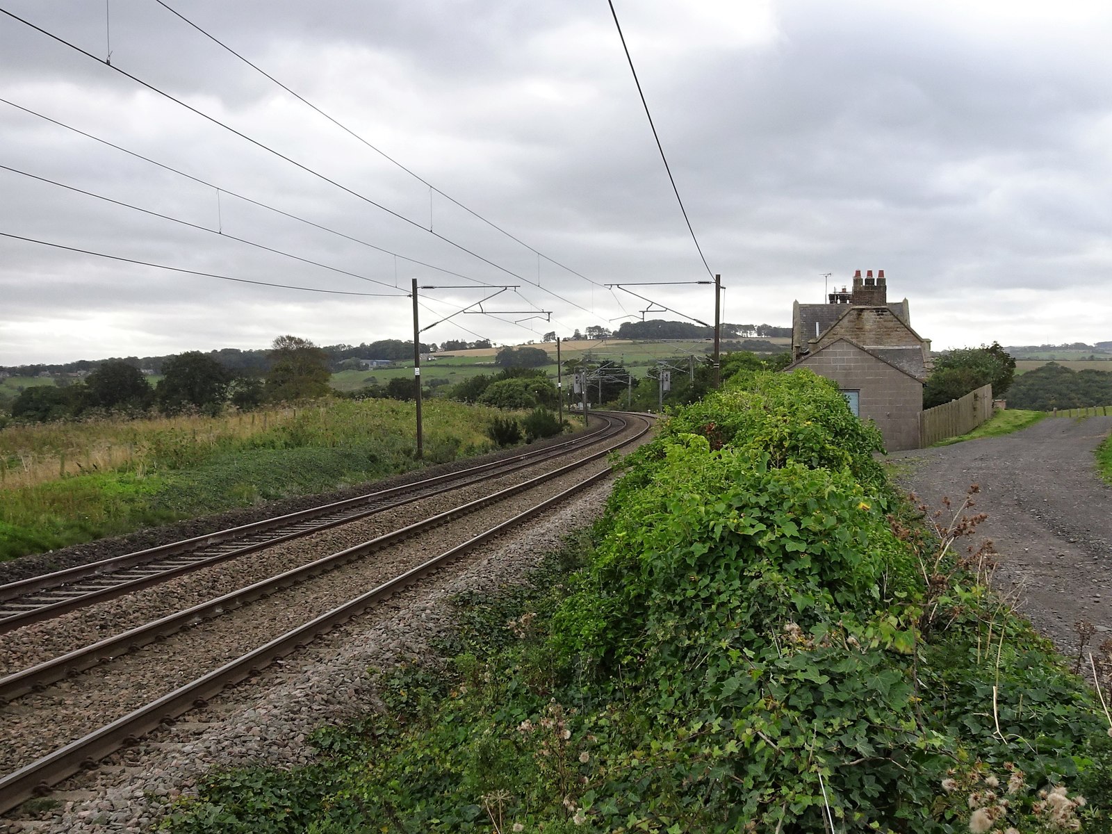
Cattle grazing
Cattle grazing
View towards Alnmouth
Track towards Wooden Farm
Field near Shilbottle Taken from a corner on the lane from Shilbottle to Alnmouth, along a field boundary, towards a shelter-belt plantation.
Field near Shilbottle
Taken from a corner on the lane from Shilbottle to Alnmouth, along a field boundary, towards a shelter-belt plantation.
Lane to Buston A lane with wide verges and ditches crosses the Northumberland countryside, gently sloping towards the sea 3 km away.
Lane to Buston
A lane with wide verges and ditches crosses the Northumberland countryside, gently sloping towards the sea 3 km away.
The road to Wooden Farm Wooden Farm is centre right beyond the trees.
The road to Wooden Farm
Wooden Farm is centre right beyond the trees.
The East Coast Railway Viewed from the level crossing at Wooden Gate.
The East Coast Railway
Viewed from the level crossing at Wooden Gate.
Looking over grazing sheep to Alnmouth Waterside house on the left.
Looking over grazing sheep to Alnmouth
Waterside house on the left.
Looking over field to the salt marches and dunes, near Alnmouth
Passing place? There is room to park about four cars here! Looking towards Alnmouth.
Passing place?
There is room to park about four cars here! Looking towards Alnmouth.
A.1068 near Wooden Farm The main road just south of the junction to Wooden Farm.
A.1068 near Wooden Farm
The main road just south of the junction to Wooden Farm.
Wooden Gate level crossing (1) This level crossing takes a minor no-through-road across the London-Edinburgh east coast mainline near Alnmouth. It takes its name from Wooden Farm which is at the end of the road. The crossing keeper's cottage is now in private ownership but is unoccupied.
Wooden Gate level crossing (1)
This level crossing takes a minor no-through-road across the London-Edinburgh east coast mainline near Alnmouth. It takes its name from Wooden Farm which is at the end of the road. The crossing keeper's cottage is now in private ownership but is unoccupied.
Wooden Gate level crossing (2) Looking in the up direction (south) at Wooden Gate Junction from the level crossing which takes a minor no-through-road across the London-Edinburgh east coast mainline near Alnmouth. It takes its name from Wooden Farm which is at the end of the road.
Wooden Gate level crossing (2)
Looking in the up direction (south) at Wooden Gate Junction from the level crossing which takes a minor no-through-road across the London-Edinburgh east coast mainline near Alnmouth. It takes its name from Wooden Farm which is at the end of the road.
Wooden Gate Junction The railway sign at Wooden Gate Junction [<a title="https://www.geograph.org.uk/photo/1366505" href="https://www.geograph.org.uk/photo/1366505">Link</a>] on the London-Edinburgh east coast mainline near Alnmouth. It takes its name from Wooden Farm which is nearby.
Wooden Gate Junction
The railway sign at Wooden Gate Junction [Link] on the London-Edinburgh east coast mainline near Alnmouth. It takes its name from Wooden Farm which is nearby.
Railway loops at Wooden Gate Looking in the down direction (north) at passing loops on the London-Edinburgh east coast mainline near Alnmouth. The photograph was taken from Wooden Gate level crossing which takes its name from Wooden Farm nearby.
Railway loops at Wooden Gate
Looking in the down direction (north) at passing loops on the London-Edinburgh east coast mainline near Alnmouth. The photograph was taken from Wooden Gate level crossing which takes its name from Wooden Farm nearby.
Relay cabin at Wooden Gate A shed, a portaloo and a relay cabin beside the London-Edinburgh east coast mainline near Alnmouth. The photograph was taken from Wooden Gate level crossing which takes its name from Wooden Farm nearby. Note the sign on the relay cabin bears the name 'Wooden Gates' (plural) whereas the railway junction [<a title="https://www.geograph.org.uk/photo/1366510" href="https://www.geograph.org.uk/photo/1366510">Link</a>] is called Wooden Gate (singular).
Relay cabin at Wooden Gate
A shed, a portaloo and a relay cabin beside the London-Edinburgh east coast mainline near Alnmouth. The photograph was taken from Wooden Gate level crossing which takes its name from Wooden Farm nearby. Note the sign on the relay cabin bears the name 'Wooden Gates' (plural) whereas the railway junction [Link] is called Wooden Gate (singular).
Railway speed sign at Wooden Gate Looking in the down direction (north) at passing loops on the London-Edinburgh east coast mainline near Alnmouth. The speed restriction sign applies to trains diverging from the bi-directional up line on to the passing loop [<a title="https://www.geograph.org.uk/photo/1366517" href="https://www.geograph.org.uk/photo/1366517">Link</a>] . The photograph was taken from Wooden Gate level crossing which takes its name from Wooden Farm nearby.
Railway speed sign at Wooden Gate
Looking in the down direction (north) at passing loops on the London-Edinburgh east coast mainline near Alnmouth. The speed restriction sign applies to trains diverging from the bi-directional up line on to the passing loop [Link] . The photograph was taken from Wooden Gate level crossing which takes its name from Wooden Farm nearby.
Wooden Gate level crossing (3) This level crossing takes a minor no-through-road across the London-Edinburgh east coast mainline near Alnmouth. It takes its name from Wooden Farm which is at the end of the road. 

The train is from Glasgow and is bound for London Kings Cross. It has travelled via Motherwell, Edinburgh and Berwick and is picking up speed after its 08.56 departure from Alnmouth station a mile to the north. Operated by National Express East Coast, the train is still in the livery of the previous operator GNER. Driving van trailer (DVT) 82210 heads the train over the crossing with electric locomotive 91114 (out of shot) propelling from the rear.
Wooden Gate level crossing (3)
This level crossing takes a minor no-through-road across the London-Edinburgh east coast mainline near Alnmouth. It takes its name from Wooden Farm which is at the end of the road. The train is from Glasgow and is bound for London Kings Cross. It has travelled via Motherwell, Edinburgh and Berwick and is picking up speed after its 08.56 departure from Alnmouth station a mile to the north. Operated by National Express East Coast, the train is still in the livery of the previous operator GNER. Driving van trailer (DVT) 82210 heads the train over the crossing with electric locomotive 91114 (out of shot) propelling from the rear.
Show me another place!

Bilton is located at Grid Ref: NU2210 (Lat: 55.390848, Lng: -1.642877)

Unitary Authority: Northumberland

Police Authority: Northumbria

What 3 Words

///mainframe.defers.booklets. Near Lesbury, Northumberland

Nearby Locations

Bilton

Related Wikis

Nearby Amenities

Located within 500m of 55.390848,-1.642877
Alnmouth
Naptan AtcoCode: 9100ALNMOTH
Network: National Rail
Network Website: https://www.nationalrail.co.uk/stations/alm/
Network Wikidata: Q26334
Operator: Northern Rail
Operator Website: https://www.northernrailway.co.uk/stations/alnmouth
Operator Wikidata: Q85789775
Public Transport: station
Railway: station
Ref Crs: ALM
Source: NPE
Train: yes
Wikidata: Q4734063
Wikipedia: en:Alnmouth railway station
Lat/Long: 55.392793/-1.6367716
Alnmouth for Alnwick
Network: National Rail
Note: Explicitly named on NPE
Public Transport: stop_position
Railway: stop
Source: NPE
Train: yes
Lat/Long: 55.3922749/-1.6358652
Bilton
Place: hamlet
Wikidata: Q4913638
Lat/Long: 55.3913661/-1.639887
Power: pole
Source: Bing
Lat/Long: 55.392027/-1.6495766
Power: pole
Source: Bing
Lat/Long: 55.3924948/-1.6464139
Power: pole
Source: Bing
Lat/Long: 55.3923397/-1.6474639
Power: pole
Source: Bing
Lat/Long: 55.3921409/-1.6485095
Bicycle Parking
Bicycle Parking: stands
Capacity: 4
Colour: blue
Covered: no
Fee: no
Lat/Long: 55.392604/-1.6362695
Post Box
Collection Times: Mo-Fr 09:00; Sa 07:00
Ref: NE66 3
Royal Cypher: EIIR
Royal Cypher Wikidata: Q33102113
Lat/Long: 55.3913465/-1.6405456
Power: pole
Lat/Long: 55.3930787/-1.6456476
Power: pole
Lat/Long: 55.3938021/-1.6447043
Power: pole
Lat/Long: 55.3942911/-1.6440541
Power: pole
Lat/Long: 55.3948453/-1.6433318
Alnmouth for Alnwick
Naptan AtcoCode: 9100ALNMOTH
Network: National Rail
Note: Explicitly named on NPE
Public Transport: stop_position
Railway: stop
Source: NPE
Train: yes
Lat/Long: 55.3929459/-1.6370205
Man Made: tower
Tower Type: communication
Lat/Long: 55.3933942/-1.638245
Bicycle Parking
Bicycle Parking: stands
Capacity: 5
Colour: Red
Covered: yes
Fee: no
Lat/Long: 55.3925402/-1.636172
Elevator
Bicycle: yes
Level: 0;1
Wheelchair: yes
Lat/Long: 55.3925317/-1.6365107
Elevator
Bicycle: yes
Level: 0;1
Wheelchair: yes
Lat/Long: 55.3926352/-1.6362514
Entrance: yes
Lat/Long: 55.3927913/-1.6364956
Bicycle Parking
Bicycle Parking: stands
Capacity: 4
Covered: no
Fee: no
Lat/Long: 55.3926599/-1.6366802
Telephone
Payment Cash: yes
Lat/Long: 55.392815/-1.6365931
Vending Machine
Payment Cards: yes
Vending: drinks
Lat/Long: 55.3928688/-1.6366958
Vending Machine
Vending: public_transport_tickets
Lat/Long: 55.3928417/-1.6366582
Alnmouth South Junction
Historic Railway: junction
Railway: site
Wikidata: Q124354323
Lat/Long: 55.3921512/-1.6356962
The data included in this document is from www.openstreetmap.org. The data is made available under ODbL.

Have you been to Bilton?

Leave your review of Bilton below (or comments, questions and feedback).