Par
Settlement in Cornwall
England
Par

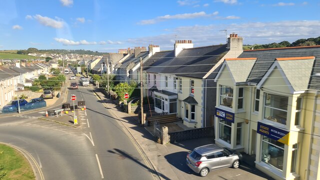
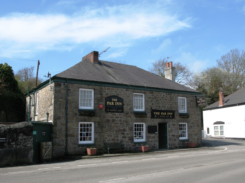
Par is a small village located in Cornwall, England, situated on the south coast near St Austell. It is known for its beautiful beaches, including the popular Par Sands Beach, which offers stunning views of the coastline and is a popular spot for swimming, picnicking, and sunbathing.
The village itself has a mix of traditional Cornish cottages and modern developments, with a range of amenities including shops, cafes, and restaurants. Par is also home to the historic Par Market, a popular indoor market selling a variety of goods including local produce, crafts, and clothing.
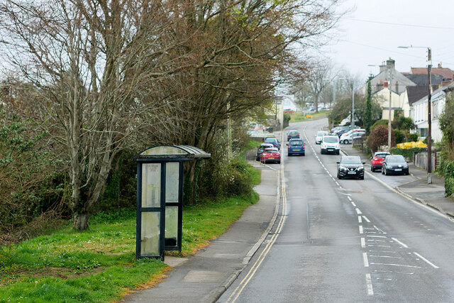
Par is well-connected by road and rail, with the mainline railway station providing easy access to nearby towns and cities such as St Austell and Truro. The village is also close to attractions such as the Eden Project, the Lost Gardens of Heligan, and the South West Coast Path, making it an ideal base for exploring the stunning natural beauty of Cornwall.
Overall, Par offers a peaceful and picturesque setting for visitors looking to enjoy the beauty of the Cornish coast and countryside.
If you have any feedback on the listing, please let us know in the comments section below.
Par Images
Images are sourced within 2km of 50.34854/-4.70732 or Grid Reference SX0753. Thanks to Geograph Open Source API. All images are credited.

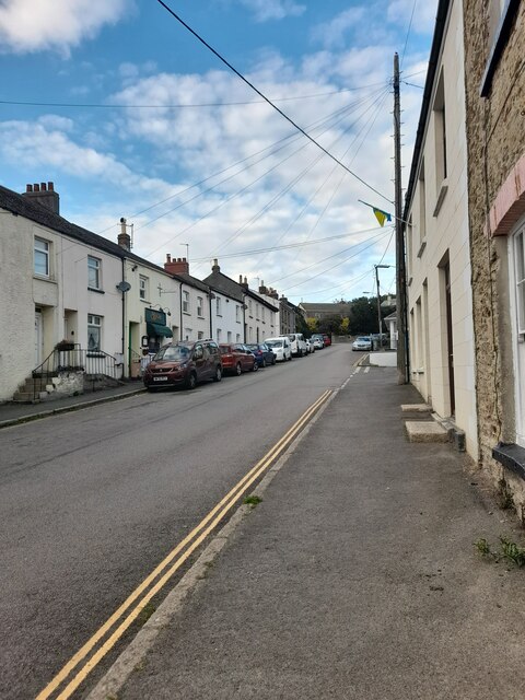


![Bridge Street, St Blazey St Blazey (Cornish: Lanndreth) is a small town in Cornwall, 3 miles (4.8 km) east of St Austell. The town takes its name from the Armenian Saint Blaise who, in Christian tradition, is believed to have "cure[d] toothache, sore throats and cattle diseases".
The local mining industries once dominated the town; historically copper and tin were mined in and around the parish, whilst more recently china clay has been the principal commodity mined. <a href="https://www.geograph.org.uk/photo/1701065">SX0554 : The Eden Project</a> is located about a mile and a half (2 km) from the centre of the town and the large number of visitors this attracts has led to the development of tourism in the town.
St Blazey. (2022, April 23). In Wikipedia. <span class="nowrap"><a title="https://en.wikipedia.org/wiki/St_Blazey" rel="nofollow ugc noopener" href="https://en.wikipedia.org/wiki/St_Blazey">Link</a><img style="margin-left:2px;" alt="External link" title="External link - shift click to open in new window" src="https://s1.geograph.org.uk/img/external.png" width="10" height="10"/></span>](https://s3.geograph.org.uk/geophotos/07/34/75/7347531_986ab475.jpg)
![Rose Hill, St Blazey St Blazey (Cornish: Lanndreth) is a small town in Cornwall, 3 miles (4.8 km) east of St Austell. The town takes its name from the Armenian Saint Blaise who, in Christian tradition, is believed to have &quot;cure[d] toothache, sore throats and cattle diseases&quot;.
The local mining industries once dominated the town; historically copper and tin were mined in and around the parish, whilst more recently china clay has been the principal commodity mined. <a href="https://www.geograph.org.uk/photo/1701065">SX0554 : The Eden Project</a> is located about a mile and a half (2 km) from the centre of the town and the large number of visitors this attracts has led to the development of tourism in the town.
St Blazey. (2022, April 23). In Wikipedia. <span class="nowrap"><a title="https://en.wikipedia.org/wiki/St_Blazey" rel="nofollow ugc noopener" href="https://en.wikipedia.org/wiki/St_Blazey">Link</a><img style="margin-left:2px;" alt="External link" title="External link - shift click to open in new window" src="https://s1.geograph.org.uk/img/external.png" width="10" height="10"/></span>](https://s1.geograph.org.uk/geophotos/07/34/75/7347541_fcb16d1e.jpg)
![Church Hill, St Blazey St Blazey (Cornish: Lanndreth) is a small town in Cornwall, 3 miles (4.8 km) east of St Austell. The town takes its name from the Armenian Saint Blaise who, in Christian tradition, is believed to have &quot;cure[d] toothache, sore throats and cattle diseases&quot;. The church, which was built between 1440 and 1445, is dedicated to Saint Blaise. It is a Grade II* listed building (List Entry Number:
1289700 <span class="nowrap"><a title="https://historicengland.org.uk/listing/the-list/list-entry/1289700" rel="nofollow ugc noopener" href="https://historicengland.org.uk/listing/the-list/list-entry/1289700">Link</a><img style="margin-left:2px;" alt="External link" title="External link - shift click to open in new window" src="https://s1.geograph.org.uk/img/external.png" width="10" height="10"/></span> Historic England).
The local mining industries once dominated the town; historically copper and tin were mined in and around the parish, whilst more recently china clay has been the principal commodity mined. <a href="https://www.geograph.org.uk/photo/1701065">SX0554 : The Eden Project</a> is located about a mile and a half (2 km) from the centre of the town and the large number of visitors this attracts has led to the development of tourism in the town.
St Blazey. (2022, April 23). In Wikipedia. <span class="nowrap"><a title="https://en.wikipedia.org/wiki/St_Blazey" rel="nofollow ugc noopener" href="https://en.wikipedia.org/wiki/St_Blazey">Link</a><img style="margin-left:2px;" alt="External link" title="External link - shift click to open in new window" src="https://s1.geograph.org.uk/img/external.png" width="10" height="10"/></span>](https://s3.geograph.org.uk/geophotos/07/34/75/7347543_38528efc.jpg)
Par is located at Grid Ref: SX0753 (Lat: 50.34854, Lng: -4.70732)
Unitary Authority: Cornwall
Police Authority: Devon and Cornwall
What 3 Words
///tint.depth.pausing. Near Par, Cornwall
Nearby Locations
Related Wikis
Par, Cornwall
Par (Cornish: An Porth, meaning creek or harbour) is a village and fishing port with a harbour on the south coast of Cornwall, England, United Kingdom...
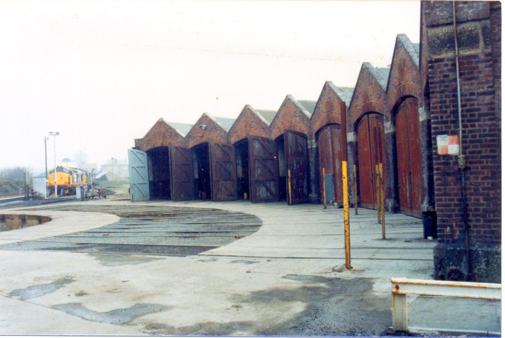
St Blazey engine shed
St Blazey engine shed is located in Par, Cornwall, United Kingdom, although it is named after the adjacent village of St Blazey. It was built in 1874 as...
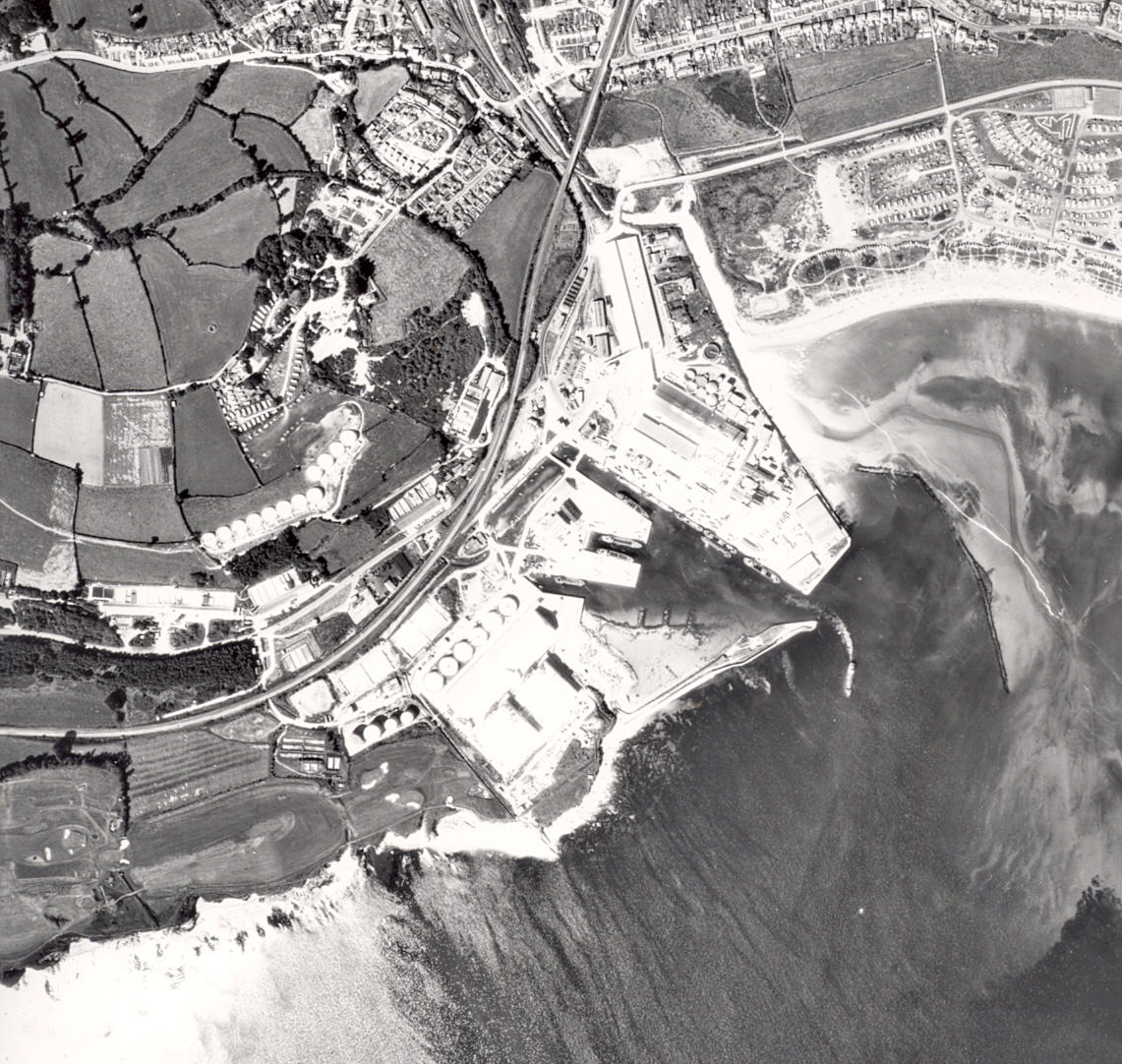
Par Docks
Par Docks is an Imerys-owned harbour in the village of Par, Cornwall, England, United Kingdom, which was used for the export of china clay from the numerous...

Par River, Cornwall
The Par River (Cornish: Dowr Gwernan, meaning alder tree river), also known as the Luxulyan River is a river draining the area north of St Blazey in Cornwall...
Nearby Amenities
Located within 500m of 50.34854,-4.70732Have you been to Par?
Leave your review of Par below (or comments, questions and feedback).