Pant-gwyn

Settlement in Cardiganshire

Wales

Pant-gwyn

Pen Lan Bagged high point in field and reservoir with Alex and Smudge.
Name: Pen Lan
Hill number: 15425
Height:183m / 600ft
Parent (Ma/M): 2221  Rhos Ymryson
Section:31C: South-West Wales
County/UA: Cardiganshire [Ceredigion] (CoU)
Class: Tump (100-199m)
Grid ref:SN252471 (est)
Drop: 36m
Col:147m  SN245459
Pen Lan Credit: Rude Health

The requested URL returned error: 429 Too Many Requests

If you have any feedback on the listing, please let us know in the comments section below.

Pant-gwyn Images

Images are sourced within 2km of 52.083781/-4.571727 or Grid Reference SN2345. Thanks to Geograph Open Source API. All images are credited.

Pen Lan Bagged high point in field and reservoir with Alex and Smudge.
Name: Pen Lan
Hill number: 15425
Height:183m / 600ft
Parent (Ma/M): 2221  Rhos Ymryson
Section:31C: South-West Wales
County/UA: Cardiganshire [Ceredigion] (CoU)
Class: Tump (100-199m)
Grid ref:SN252471 (est)
Drop: 36m
Col:147m  SN245459
Pen Lan
Bagged high point in field and reservoir with Alex and Smudge. Name: Pen Lan Hill number: 15425 Height:183m / 600ft Parent (Ma/M): 2221 Rhos Ymryson Section:31C: South-West Wales County/UA: Cardiganshire [Ceredigion] (CoU) Class: Tump (100-199m) Grid ref:SN252471 (est) Drop: 36m Col:147m SN245459
Scotland Hill Trig has been uprooted and relocated to the SSE gate corner. Up track from SE and cattle pasture gates.to find trig on way to TUMP summit. It doesn't get much better than bagging Scotland Hill in Wales.
Name: Scotland Hill
Hill number: 15420
Height:185m / 607ft
Parent (Ma/M): 2221  Rhos Ymryson
Section:31C: South-West Wales
County/UA: Cardiganshire [Ceredigion] (CoU)
Class: Tump (100-199m)
Grid ref:SN248453 (est)
Drop: 48m
Col:137m  SN270486
Scotland Hill
Trig has been uprooted and relocated to the SSE gate corner. Up track from SE and cattle pasture gates.to find trig on way to TUMP summit. It doesn't get much better than bagging Scotland Hill in Wales. Name: Scotland Hill Hill number: 15420 Height:185m / 607ft Parent (Ma/M): 2221 Rhos Ymryson Section:31C: South-West Wales County/UA: Cardiganshire [Ceredigion] (CoU) Class: Tump (100-199m) Grid ref:SN248453 (est) Drop: 48m Col:137m SN270486
Pen Bryn-Bwa Trig Point Trig has been uprooted from the summit of Scotland Hill and relocated to the SSE gate corner. Up track from SE + cattle pasture gates.to find trig on way to TUMP summit. It doesn't get much better than bagging Scotland Hill in Wales.
Pen Bryn-Bwa Trig Point
Trig has been uprooted from the summit of Scotland Hill and relocated to the SSE gate corner. Up track from SE + cattle pasture gates.to find trig on way to TUMP summit. It doesn't get much better than bagging Scotland Hill in Wales.
Ordnance Survey Cut Mark This OS cut mark can be found at the entrance through the wall to Noyadd Trefawr. It marks a point 136.005m above mean sea level. <a title="https://www.geograph.org.uk/photo/4668540" href="https://www.geograph.org.uk/photo/4668540">Link</a>
Ordnance Survey Cut Mark
This OS cut mark can be found at the entrance through the wall to Noyadd Trefawr. It marks a point 136.005m above mean sea level. Link
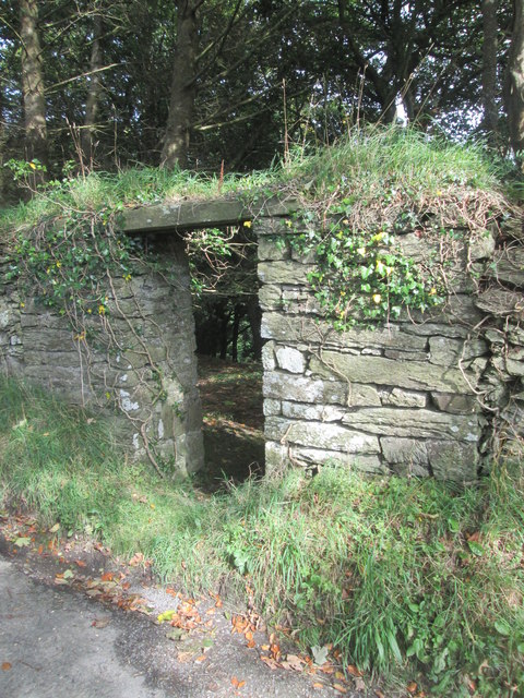
Entrance in Wall There is an OS cut mark to the right of the entrance. <a title="https://www.geograph.org.uk/photo/4668534" href="https://www.geograph.org.uk/photo/4668534">Link</a>
Entrance in Wall
There is an OS cut mark to the right of the entrance. Link
The uprooted and moved Pen Bryn-Bwa Triangulation Pillar This pillar used to stand on the Tumuli at SN 2487 4537 but now stands abandoned in a nearby gateway.
Looking westward.
The uprooted and moved Pen Bryn-Bwa Triangulation Pillar
This pillar used to stand on the Tumuli at SN 2487 4537 but now stands abandoned in a nearby gateway. Looking westward.
War memorial,  Neuadd Cross Memorial on B4570 (foreground) at crossroads; The 'one way' sign detracts from the setting and seems superfluous for a short stretch of road.
War memorial, Neuadd Cross
Memorial on B4570 (foreground) at crossroads; The 'one way' sign detracts from the setting and seems superfluous for a short stretch of road.
Road to Beulah Minor road (direction sign obscured) from Neuadd Cross.
Road to Beulah
Minor road (direction sign obscured) from Neuadd Cross.
Old Milestone by the B4570, Cawrence, Llangoedmor Parish Cardigan tombstone by the B4570, in parish of Llangoedmor (Ceredigion District), entrance to Cawrence, set in wall, West side of road.

Inscription reads:-
TO
CARDIGAN
3 MILES

Grade II listed by Cadw. Reference Number: 14793
<span class="nowrap"><a title="https://cadwpublic-api.azurewebsites.net/reports/listedbuilding/FullReport?lang=&id=14793" rel="nofollow ugc noopener" href="https://cadwpublic-api.azurewebsites.net/reports/listedbuilding/FullReport?lang=&id=14793">Link</a><img style="margin-left:2px;" alt="External link" title="External link - shift click to open in new window" src="https://s1.geograph.org.uk/img/external.png" width="10" height="10"/></span>

Surveyed

Milestone Society National ID: CRD_CALA03
Old Milestone by the B4570, Cawrence, Llangoedmor Parish
Cardigan tombstone by the B4570, in parish of Llangoedmor (Ceredigion District), entrance to Cawrence, set in wall, West side of road. Inscription reads:- TO CARDIGAN 3 MILES Grade II listed by Cadw. Reference Number: 14793 LinkExternal link Surveyed Milestone Society National ID: CRD_CALA03
Old Milestone by the B4570, Neuadd Cross, Beulah parish Cardigan tombstone by the B4570, in parish of Beulah (Ceredigion District), West of Neuadd Cross, opposite Ffynnoncripil, on verge under bracken.

Inscription reads:-
TO
CARDIGAN
5 MILES
{arrow->}
Carved bench mark on centre face.

Grade II listed by Cadw.
Reference Number: 17966 <span class="nowrap"><a title="https://cadwpublic-api.azurewebsites.net/reports/listedbuilding/FullReport?lang=&id=17966" rel="nofollow ugc noopener" href="https://cadwpublic-api.azurewebsites.net/reports/listedbuilding/FullReport?lang=&id=17966">Link</a><img style="margin-left:2px;" alt="External link" title="External link - shift click to open in new window" src="https://s1.geograph.org.uk/img/external.png" width="10" height="10"/></span>

Surveyed

Milestone Society National ID: CRD_CALA05
Old Milestone by the B4570, Neuadd Cross, Beulah parish
Cardigan tombstone by the B4570, in parish of Beulah (Ceredigion District), West of Neuadd Cross, opposite Ffynnoncripil, on verge under bracken. Inscription reads:- TO CARDIGAN 5 MILES {arrow->} Carved bench mark on centre face. Grade II listed by Cadw. Reference Number: 17966 LinkExternal link Surveyed Milestone Society National ID: CRD_CALA05
Old Milestone by the B4570, Llangoedmor parish Cardigan tombstone by the B4570, in parish of Llangoedmor (Ceredigion District), West of Penllwyndu Inn, on verge under hedge, Southeast side of road.

Inscription reads:-
TO
CARDIGAN
4 MILES
Carved benchmark on lower face. 

Grade II listed by Cadw.
Reference Number: 14792 <span class="nowrap"><a title="https://cadwpublic-api.azurewebsites.net/reports/listedbuilding/FullReport?lang=&id=14792" rel="nofollow ugc noopener" href="https://cadwpublic-api.azurewebsites.net/reports/listedbuilding/FullReport?lang=&id=14792">Link</a><img style="margin-left:2px;" alt="External link" title="External link - shift click to open in new window" src="https://s1.geograph.org.uk/img/external.png" width="10" height="10"/></span>

Surveyed

Milestone Society National ID: CRD_CALA04
Old Milestone by the B4570, Llangoedmor parish
Cardigan tombstone by the B4570, in parish of Llangoedmor (Ceredigion District), West of Penllwyndu Inn, on verge under hedge, Southeast side of road. Inscription reads:- TO CARDIGAN 4 MILES Carved benchmark on lower face. Grade II listed by Cadw. Reference Number: 14792 LinkExternal link Surveyed Milestone Society National ID: CRD_CALA04
Ordnance Survey Cut Mark This OS cut mark can be found on the gatepost NW side of the road. It marks a point 133.698m above mean sea level.
Ordnance Survey Cut Mark
This OS cut mark can be found on the gatepost NW side of the road. It marks a point 133.698m above mean sea level.
Ordnance Survey Cut Mark This OS cut mark can be found on Pant-y-Llys. It marks a point 113.016m above mean sea level.
Ordnance Survey Cut Mark
This OS cut mark can be found on Pant-y-Llys. It marks a point 113.016m above mean sea level.
Ordnance Survey Rivet This OS rivet can be found on the step of the Churn Stand east side of the road. It marks a point 75.175m above mean sea level.
Ordnance Survey Rivet
This OS rivet can be found on the step of the Churn Stand east side of the road. It marks a point 75.175m above mean sea level.
Old Stone Gatepost
Old Stone Gatepost
Smartened-up Churn Stand
Blaenwenen Baptist Chapel School Room Built in 1928.
Blaenwenen Baptist Chapel School Room
Built in 1928.
Minor road with tree
Show me another place!

Pant-gwyn is located at Grid Ref: SN2345 (Lat: 52.083781, Lng: -4.571727)

Unitary Authority: Ceredigion

Police Authority: Dyfed Powys

What 3 Words

///folks.thinkers.baffle. Near Aberporth, Ceredigion

Related Wikis

Pant-gwyn, Ceredigion

Pant-gwyn is a small village in the community of Llangoedmor, Ceredigion, Wales, which is 72.8 miles (117.1 km) from Cardiff and 193.9 miles (312.1 km...

Pantinker

Pantinker is a small village in the community of Llangoedmor, Ceredigion, Wales, which is 73.1 miles (117.6 km) from Cardiff and 194.4 miles (312.9 km...

Tynewydd, Ceredigion

Tynewydd, Ceredigion (or Tŷ Newydd) is a hamlet in the community of Y Ferwig, Ceredigion, Wales, which is 73.6 miles (118.5 km) from Cardiff and 194.6...

Neuadd Trefawr

Neuadd Trefawr (sometimes misspelt Noyadd Trefawr) is a small village in the community of Beulah, Ceredigion, Wales, which is 71.9 miles (115.8 km) from...

Nearby Amenities

Located within 500m of 52.083781,-4.571727
Power: pole
Lat/Long: 52.0812846/-4.5659056
Power: pole
Lat/Long: 52.0802346/-4.5674157
Direction: 255
Generator Method: photovoltaic
Generator Output Electricity: yes
Generator Solar Modules: 12
Generator Source: solar
Generator Type: solar_photovoltaic_panel
Location: roof
Power: generator
Lat/Long: 52.0828406/-4.5690505
Man Made: utility_pole
Lat/Long: 52.0811823/-4.5685268
The data included in this document is from www.openstreetmap.org. The data is made available under ODbL.

Have you been to Pant-gwyn?

Leave your review of Pant-gwyn below (or comments, questions and feedback).