Palmarsh

Settlement in Kent Shepway

England

Palmarsh

Kestrel Drive Planning permission has been approved, with conditions, by Folkestone and Hythe District Council under application number Y06/1079/SH for “outline application for mixed use development comprising (1050 dwellings); employment development (use class B1, 15,000 sq m); local centre (500 sq. metres use classes A1/A2, 500 sq metres use classes A3/A4/A5); community centre/community facilities (1,000 sq metres use class D1); public open space (8.5 hectares); structural open space (10.3 hectares); retention and alteration of water bodies (retained area 15.5 hectares); provision of two new access points to Dymchurch Road; and site restoration including raising of land levels”.

The road is part of the Martello Lakes development and this was <a href="https://www.geograph.org.uk/photo/6960216">TR1333 : Kestrel Drive</a> before the fence had been erected.
Kestrel Drive Credit: John Baker

Palmarsh is a small residential area located in the district of Hythe in the county of Kent, England. Situated on the southern coast of the country, it is approximately 3 miles west of the town of Hythe and 60 miles southeast of London. The area is part of the larger urban area known as the Romney Marsh.

Palmarsh is primarily a residential community, consisting mainly of houses and a few local amenities. It is characterized by its quiet and peaceful atmosphere, making it an attractive place for families and retirees. The neighborhood is known for its well-maintained streets and green spaces, providing a pleasant environment for residents to enjoy.

In terms of facilities, Palmarsh has a primary school, Palmarsh Primary School, which serves the local community. Additionally, there are several local shops and small businesses that cater to the daily needs of residents. For more extensive shopping and entertainment options, the nearby town of Hythe offers a wider range of amenities.

The area also benefits from its proximity to the beautiful Kent coast, with stunning beaches just a short distance away. The coastline offers opportunities for outdoor activities such as walking, cycling, and water sports, attracting both locals and visitors alike.

Overall, Palmarsh is a charming residential area in Kent, offering a peaceful and family-friendly environment with easy access to both the countryside and the coast.

If you have any feedback on the listing, please let us know in the comments section below.
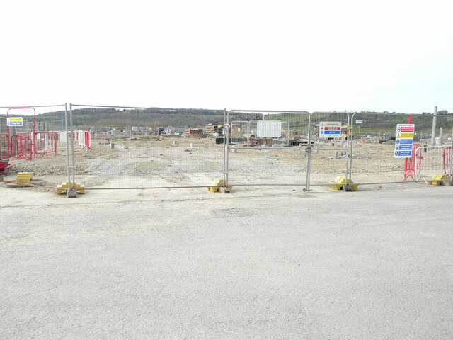
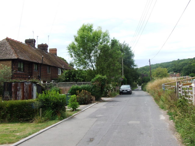
Palmarsh Images

Images are sourced within 2km of 51.061378/1.045113 or Grid Reference TR1333. Thanks to Geograph Open Source API. All images are credited.

Kestrel Drive Planning permission has been approved, with conditions, by Folkestone and Hythe District Council under application number Y06/1079/SH for “outline application for mixed use development comprising (1050 dwellings); employment development (use class B1, 15,000 sq m); local centre (500 sq. metres use classes A1/A2, 500 sq metres use classes A3/A4/A5); community centre/community facilities (1,000 sq metres use class D1); public open space (8.5 hectares); structural open space (10.3 hectares); retention and alteration of water bodies (retained area 15.5 hectares); provision of two new access points to Dymchurch Road; and site restoration including raising of land levels”.

The road is part of the Martello Lakes development and this was <a href="https://www.geograph.org.uk/photo/6960216">TR1333 : Kestrel Drive</a> before the fence had been erected.
Kestrel Drive
Planning permission has been approved, with conditions, by Folkestone and Hythe District Council under application number Y06/1079/SH for “outline application for mixed use development comprising (1050 dwellings); employment development (use class B1, 15,000 sq m); local centre (500 sq. metres use classes A1/A2, 500 sq metres use classes A3/A4/A5); community centre/community facilities (1,000 sq metres use class D1); public open space (8.5 hectares); structural open space (10.3 hectares); retention and alteration of water bodies (retained area 15.5 hectares); provision of two new access points to Dymchurch Road; and site restoration including raising of land levels”. The road is part of the Martello Lakes development and this was TR1333 : Kestrel Drive before the fence had been erected.
Nickolls Road Planning permission has been approved, with conditions, by Folkestone and Hythe District Council under application number Y06/1079/SH for “outline application for mixed use development comprising (1050 dwellings); employment development (use class B1, 15,000 sq m); local centre (500 sq. metres use classes A1/A2, 500 sq metres use classes A3/A4/A5); community centre/community facilities (1,000 sq metres use class D1); public open space (8.5 hectares); structural open space (10.3 hectares); retention and alteration of water bodies (retained area 15.5 hectares); provision of two new access points to Dymchurch Road; and site restoration including raising of land levels”.

The road is part of the Martello Lakes development and this was <a href="https://www.geograph.org.uk/photo/6631241">TR1333 : Nickolls Road</a> in September 2020. This view shows that further development is ongoing.
Nickolls Road
Planning permission has been approved, with conditions, by Folkestone and Hythe District Council under application number Y06/1079/SH for “outline application for mixed use development comprising (1050 dwellings); employment development (use class B1, 15,000 sq m); local centre (500 sq. metres use classes A1/A2, 500 sq metres use classes A3/A4/A5); community centre/community facilities (1,000 sq metres use class D1); public open space (8.5 hectares); structural open space (10.3 hectares); retention and alteration of water bodies (retained area 15.5 hectares); provision of two new access points to Dymchurch Road; and site restoration including raising of land levels”. The road is part of the Martello Lakes development and this was TR1333 : Nickolls Road in September 2020. This view shows that further development is ongoing.
Nickolls Road Planning permission has been approved, with conditions, by Folkestone and Hythe District Council under application number Y06/1079/SH for “outline application for mixed use development comprising (1050 dwellings); employment development (use class B1, 15,000 sq m); local centre (500 sq. metres use classes A1/A2, 500 sq metres use classes A3/A4/A5); community centre/community facilities (1,000 sq metres use class D1); public open space (8.5 hectares); structural open space (10.3 hectares); retention and alteration of water bodies (retained area 15.5 hectares); provision of two new access points to Dymchurch Road; and site restoration including raising of land levels”.

The road is part of the Martello Lakes development and this view of <a href="https://www.geograph.org.uk/photo/7121569">TR1333 : Nickolls Road</a> shows the same excavator, as in this view of the development.
Nickolls Road
Planning permission has been approved, with conditions, by Folkestone and Hythe District Council under application number Y06/1079/SH for “outline application for mixed use development comprising (1050 dwellings); employment development (use class B1, 15,000 sq m); local centre (500 sq. metres use classes A1/A2, 500 sq metres use classes A3/A4/A5); community centre/community facilities (1,000 sq metres use class D1); public open space (8.5 hectares); structural open space (10.3 hectares); retention and alteration of water bodies (retained area 15.5 hectares); provision of two new access points to Dymchurch Road; and site restoration including raising of land levels”. The road is part of the Martello Lakes development and this view of TR1333 : Nickolls Road shows the same excavator, as in this view of the development.
Nickolls Road Planning permission has been approved, with conditions, by Folkestone and Hythe District Council under application number Y06/1079/SH for “outline application for mixed use development comprising (1050 dwellings); employment development (use class B1, 15,000 sq m); local centre (500 sq. metres use classes A1/A2, 500 sq metres use classes A3/A4/A5); community centre/community facilities (1,000 sq metres use class D1); public open space (8.5 hectares); structural open space (10.3 hectares); retention and alteration of water bodies (retained area 15.5 hectares); provision of two new access points to Dymchurch Road; and site restoration including raising of land levels”.

The road is part of the Martello Lakes development and this was <a href="https://www.geograph.org.uk/photo/7121569">TR1333 : Nickolls Road</a> in February 2022. This view shows how the further development is progressing.
Nickolls Road
Planning permission has been approved, with conditions, by Folkestone and Hythe District Council under application number Y06/1079/SH for “outline application for mixed use development comprising (1050 dwellings); employment development (use class B1, 15,000 sq m); local centre (500 sq. metres use classes A1/A2, 500 sq metres use classes A3/A4/A5); community centre/community facilities (1,000 sq metres use class D1); public open space (8.5 hectares); structural open space (10.3 hectares); retention and alteration of water bodies (retained area 15.5 hectares); provision of two new access points to Dymchurch Road; and site restoration including raising of land levels”. The road is part of the Martello Lakes development and this was TR1333 : Nickolls Road in February 2022. This view shows how the further development is progressing.
Nickolls Road Planning permission has been approved, with conditions, by Folkestone and Hythe District Council under application number Y06/1079/SH for “outline application for mixed use development comprising (1050 dwellings); employment development (use class B1, 15,000 sq m); local centre (500 sq. metres use classes A1/A2, 500 sq metres use classes A3/A4/A5); community centre/community facilities (1,000 sq metres use class D1); public open space (8.5 hectares); structural open space (10.3 hectares); retention and alteration of water bodies (retained area 15.5 hectares); provision of two new access points to Dymchurch Road; and site restoration including raising of land levels”.

The road is part of the Martello Lakes development and this was <a href="https://www.geograph.org.uk/photo/7122465">TR1333 : Nickolls Road</a> in February 2022; the view shows how the further development is progressing.
Nickolls Road
Planning permission has been approved, with conditions, by Folkestone and Hythe District Council under application number Y06/1079/SH for “outline application for mixed use development comprising (1050 dwellings); employment development (use class B1, 15,000 sq m); local centre (500 sq. metres use classes A1/A2, 500 sq metres use classes A3/A4/A5); community centre/community facilities (1,000 sq metres use class D1); public open space (8.5 hectares); structural open space (10.3 hectares); retention and alteration of water bodies (retained area 15.5 hectares); provision of two new access points to Dymchurch Road; and site restoration including raising of land levels”. The road is part of the Martello Lakes development and this was TR1333 : Nickolls Road in February 2022; the view shows how the further development is progressing.
Nicholls Road The road is part of the Martello Lakes development and this was <a href="https://www.geograph.org.uk/photo/7163517">TR1333 : Nickolls Road</a> in April 2022. This view shows how the further development is progressing.
Nicholls Road
The road is part of the Martello Lakes development and this was TR1333 : Nickolls Road in April 2022. This view shows how the further development is progressing.
Nicholls Road The road is part of the Martello Lakes development and this was <a href="https://www.geograph.org.uk/photo/7164572">TR1333 : Nickolls Road</a> in April 2022; the view shows how the further development is progressing.
Nicholls Road
The road is part of the Martello Lakes development and this was TR1333 : Nickolls Road in April 2022; the view shows how the further development is progressing.
Nicholls Road The road is part of the Martello Lakes development and this was <a href="https://www.geograph.org.uk/photo/7240839">TR1333 : Nicholls Road</a> in July 2022; the view shows how the further development is progressing. Note the condition of the grass verges – the result of weeks of there being very little rain.
Nicholls Road
The road is part of the Martello Lakes development and this was TR1333 : Nicholls Road in July 2022; the view shows how the further development is progressing. Note the condition of the grass verges – the result of weeks of there being very little rain.
Nicholls Road The road is part of the Martello Lakes development and this was <a href="https://www.geograph.org.uk/photo/7252225">TR1333 : Nicholls Road</a> in July 2022; the view shows how the further development is progressing. The condition of the grass verge seems to have improved slightly.
Nicholls Road
The road is part of the Martello Lakes development and this was TR1333 : Nicholls Road in July 2022; the view shows how the further development is progressing. The condition of the grass verge seems to have improved slightly.
8, Palmarsh Avenue Planning permission has been approved, with conditions, by Folkestone and Hythe District Council under application number 22/0595/FH for the “erection of a first floor extension”. 

Number 8 had three vehicles parked in front of the house.
8, Palmarsh Avenue
Planning permission has been approved, with conditions, by Folkestone and Hythe District Council under application number 22/0595/FH for the “erection of a first floor extension”. Number 8 had three vehicles parked in front of the house.
Nicholls Road The road is part of the Martello Lakes development and this was <a href="https://www.geograph.org.uk/photo/7302012">TR1333 : Nicholls Road</a> in September 2022; this view was taken beyond the hoarding and shows the houses that have been built or are under construction.
Nicholls Road
The road is part of the Martello Lakes development and this was TR1333 : Nicholls Road in September 2022; this view was taken beyond the hoarding and shows the houses that have been built or are under construction.
Rolfe Way Part of the Martello Towers development.

Taken during a photographic outing on New Year's Day afternoon.
Rolfe Way
Part of the Martello Towers development. Taken during a photographic outing on New Year's Day afternoon.
Kestrel Drive Part of the Martello Towers development.

Taken during a photographic outing on New Year's Day afternoon.
Kestrel Drive
Part of the Martello Towers development. Taken during a photographic outing on New Year's Day afternoon.
Maycock Place Part of the Martello Towers development.
Maycock Place
Part of the Martello Towers development.
Rolfe Way A similar view of <a href="https://www.geograph.org.uk/photo/7389142">TR1333 : Rolfe Way</a> taken in January 2023. 

Part of the Martello Towers development.
Rolfe Way
A similar view of TR1333 : Rolfe Way taken in January 2023. Part of the Martello Towers development.
Rolfe Way A similar view of <a href="https://www.geograph.org.uk/photo/7427005">TR1333 : Rolfe Way</a> was taken in February 2023; part of the Martello Towers development.
Rolfe Way
A similar view of TR1333 : Rolfe Way was taken in February 2023; part of the Martello Towers development.
Dymchurch Road Houses on the edge of Hythe.
Dymchurch Road
Houses on the edge of Hythe.
Kestrel Drive Part of the Martello Lakes development.
Kestrel Drive
Part of the Martello Lakes development.
Show me another place!

Palmarsh is located at Grid Ref: TR1333 (Lat: 51.061378, Lng: 1.045113)

Administrative County: Kent

District: Shepway

Police Authority: Kent

What 3 Words

///cowboy.fake.ogre. Near Lympne, Kent

Nearby Locations

Palmarsh Burmarsh

Related Wikis

Palmarsh

Palmarsh is a community (OS grid reference TR1333) in Folkestone and Hythe district, in the County of Kent, England. In origin it was a hamlet on the edge...

The Roughs

The Roughs are an escarpment of the North Downs above Romney Marsh in Kent, on the south coast of England. The term is generally applied to the section...

Prince of Wales Halt railway station

Prince of Wales Halt railway station was a short-lived station on the Romney, Hythe and Dymchurch Railway in Kent, England. About three quarters of a mile...

West Hythe

West Hythe is a hamlet and former civil parish, now in the parish of Hythe, in the Folkestone and Hythe district, in Kent, England, near Palmarsh and a...

Nearby Amenities

Located within 500m of 51.061378,1.045113
Bus Stop
St George's Place
Bus: yes
Local Ref: opp
Naptan AtcoCode: 2400A027080A
Naptan Bearing: SW
Naptan BusStopType: MKD
Naptan CommonName: St George's Place
Naptan Indicator: opp
Naptan Landmark: St George's Place
Naptan NaptanCode: kntdgapa
Naptan PlusbusZoneRef: FLKSTNC
Naptan RevisionNumber: 1
Naptan Status: act
Naptan Street: Dymchurch Road
Naptan Verified: no
Public Transport: platform
Ref: kntdgapa
Source: naptan_import
Source Date: 2007-05-10
Lat/Long: 51.0621855/1.0516984
Bus Stop
Palmarsh Avenue
Bus: yes
Local Ref: opp
Naptan AtcoCode: 2400A027090A
Naptan Bearing: SW
Naptan BusStopType: MKD
Naptan CommonName: Palmarsh Avenue
Naptan Indicator: opp
Naptan Landmark: Palmarsh Avenue
Naptan NaptanCode: kntdgapd
Naptan PlusbusZoneRef: FLKSTNC
Naptan RevisionNumber: 2
Naptan Status: act
Naptan Street: Dymchurch Road
Naptan Verified: no
Public Transport: platform
Ref: kntdgapd
Source: naptan_import
Source Date: 2018-04-13
Lat/Long: 51.0596437/1.0484111
Bus Stop
Palmarsh Avenue
Bus: yes
Local Ref: adj
Naptan AtcoCode: 2400A027240A
Naptan Bearing: NE
Naptan BusStopType: MKD
Naptan CommonName: Palmarsh Avenue
Naptan Indicator: adj
Naptan Landmark: Palmarsh Avenue
Naptan NaptanCode: kntdgawg
Naptan PlusbusZoneRef: FLKSTNC
Naptan RevisionNumber: 2
Naptan Status: act
Naptan Street: Dymchurch Road
Naptan Verified: no
Public Transport: platform
Ref: kntdgawg
Shelter: yes
Source: naptan_import
Source Date: 2018-04-13
Lat/Long: 51.0597823/1.0482996
Bus Stop
Grebe Crescent
Bus: yes
Local Ref: SE-bound
Naptan AtcoCode: 2400A027290A
Naptan Bearing: SE
Naptan BusStopType: MKD
Naptan CommonName: Grebe Crescent
Naptan Indicator: SE-bound
Naptan Landmark: Martin's Way
Naptan NaptanCode: kntdgdad
Naptan PlusbusZoneRef: FLKSTNC
Naptan RevisionNumber: 5
Naptan Status: act
Naptan Street: Grebe Crescent
Naptan Verified: no
Public Transport: platform
Ref: kntdgdad
Source: naptan_import
Source Date: 2018-04-13
Lat/Long: 51.0647692/1.0461922
Post Box
Ref: CT21 145
Source: survey
Lat/Long: 51.0610604/1.0502429
Post Box
Ref: CT21 102
Lat/Long: 51.0643738/1.0478288
Barrier: kissing_gate
Lat/Long: 51.0625373/1.0426838
Railway: level_crossing
Lat/Long: 51.0627634/1.0451888
Railway: level_crossing
Lat/Long: 51.0624956/1.042702
Railway: level_crossing
Lat/Long: 51.0625186/1.0426915
Railway: level_crossing
Lat/Long: 51.0627853/1.045181
Railway: crossing
Lat/Long: 51.0630523/1.0486968
Railway: crossing
Lat/Long: 51.0630693/1.0486942
Martello Lakes
Place: suburb
Lat/Long: 51.0585907/1.0436161
Palmarsh
Place: suburb
Lat/Long: 51.0632932/1.0491002
Generator Method: photovoltaic
Generator Output Electricity: yes
Generator Source: solar
Generator Type: solar_photovoltaic_panel
Location: roof
Power: generator
Lat/Long: 51.0606265/1.045576
Generator Method: photovoltaic
Generator Output Electricity: yes
Generator Source: solar
Generator Type: solar_photovoltaic_panel
Location: roof
Power: generator
Lat/Long: 51.0604839/1.0458946
Generator Method: photovoltaic
Generator Output Electricity: yes
Generator Source: solar
Generator Type: solar_photovoltaic_panel
Location: roof
Power: generator
Lat/Long: 51.0625238/1.0459194
Generator Method: photovoltaic
Generator Output Electricity: yes
Generator Source: solar
Generator Type: solar_photovoltaic_panel
Location: roof
Power: generator
Lat/Long: 51.0630093/1.0452461
Generator Method: photovoltaic
Generator Output Electricity: yes
Generator Source: solar
Generator Type: solar_photovoltaic_panel
Location: roof
Power: generator
Lat/Long: 51.0645399/1.0459998
Generator Method: photovoltaic
Generator Output Electricity: yes
Generator Source: solar
Generator Type: solar_photovoltaic_panel
Location: roof
Power: generator
Lat/Long: 51.0642853/1.0461929
Generator Method: photovoltaic
Generator Output Electricity: yes
Generator Source: solar
Generator Type: solar_photovoltaic_panel
Location: roof
Power: generator
Lat/Long: 51.0655141/1.0451603
Generator Method: photovoltaic
Generator Output Electricity: yes
Generator Source: solar
Generator Type: solar_photovoltaic_panel
Location: roof
Power: generator
Lat/Long: 51.0646338/1.0474274
Generator Method: photovoltaic
Generator Output Electricity: yes
Generator Source: solar
Generator Type: solar_photovoltaic_panel
Location: roof
Power: generator
Lat/Long: 51.0651591/1.0474953
Generator Method: photovoltaic
Generator Output Electricity: yes
Generator Source: solar
Generator Type: solar_photovoltaic_panel
Location: roof
Power: generator
Lat/Long: 51.0651465/1.0475924
Generator Method: photovoltaic
Generator Output Electricity: yes
Generator Source: solar
Generator Type: solar_photovoltaic_panel
Location: roof
Power: generator
Lat/Long: 51.0646321/1.0485379
Generator Method: photovoltaic
Generator Output Electricity: yes
Generator Source: solar
Generator Type: solar_photovoltaic_panel
Location: roof
Power: generator
Lat/Long: 51.0643848/1.0485613
Generator Method: photovoltaic
Generator Output Electricity: yes
Generator Source: solar
Generator Type: solar_photovoltaic_panel
Location: roof
Power: generator
Lat/Long: 51.0644008/1.0486472
Generator Method: photovoltaic
Generator Output Electricity: yes
Generator Source: solar
Generator Type: solar_photovoltaic_panel
Location: roof
Power: generator
Lat/Long: 51.0614937/1.0468737
Generator Method: photovoltaic
Generator Output Electricity: yes
Generator Source: solar
Generator Type: solar_photovoltaic_panel
Location: roof
Power: generator
Lat/Long: 51.0615195/1.0469535
Generator Method: photovoltaic
Generator Output Electricity: yes
Generator Source: solar
Generator Type: solar_photovoltaic_panel
Location: roof
Power: generator
Lat/Long: 51.0606586/1.0482911
Generator Method: photovoltaic
Generator Output Electricity: yes
Generator Source: solar
Generator Type: solar_photovoltaic_panel
Location: roof
Power: generator
Lat/Long: 51.0602312/1.0478023
Generator Method: photovoltaic
Generator Output Electricity: yes
Generator Source: solar
Generator Type: solar_photovoltaic_panel
Location: roof
Power: generator
Lat/Long: 51.0612444/1.0481805
Generator Method: photovoltaic
Generator Output Electricity: yes
Generator Source: solar
Generator Type: solar_photovoltaic_panel
Location: roof
Power: generator
Lat/Long: 51.0598671/1.0475971
Generator Method: photovoltaic
Generator Output Electricity: yes
Generator Source: solar
Generator Type: solar_photovoltaic_panel
Location: roof
Power: generator
Lat/Long: 51.0598705/1.047644
Generator Method: photovoltaic
Generator Output Electricity: yes
Generator Source: solar
Generator Type: solar_photovoltaic_panel
Location: roof
Power: generator
Lat/Long: 51.0606147/1.0458255
Bus Stop
Martello Lakes
Bus: yes
Local Ref: adj
Naptan AtcoCode: 2400107469
Naptan Bearing: NE
Naptan BusStopType: MKD
Naptan CommonName: Martello Lakes
Naptan Indicator: adj
Naptan Landmark: Martello Lakes
Naptan NaptanCode: kntjwjaw
Naptan RevisionNumber: 1
Naptan Status: act
Naptan Street: Dymchurch Road
Naptan Verified: no
Public Transport: platform
Ref: kntjwjaw
Shelter: yes
Source: naptan_import
Source Date: 2018-04-13
Lat/Long: 51.058105/1.0461542
Bus Stop
Martello Lakes
Bus: yes
Local Ref: opp
Naptan AtcoCode: 2400107467
Naptan Bearing: SW
Naptan BusStopType: MKD
Naptan CommonName: Martello Lakes
Naptan Indicator: opp
Naptan Landmark: Martello Lakes
Naptan NaptanCode: kntjwjat
Naptan RevisionNumber: 1
Naptan Status: act
Naptan Street: Dymchurch Road
Naptan Verified: no
Public Transport: platform
Ref: kntjwjat
Shelter: yes
Source: naptan_import
Source Date: 2018-04-13
Lat/Long: 51.0579081/1.0462029
Crossing
Crossing: unmarked
Crossing Markings: no
Lat/Long: 51.0576358/1.0450961
Noexit: yes
Lat/Long: 51.0603879/1.0491128
Noexit: yes
Lat/Long: 51.0605846/1.0493006
Noexit: yes
Lat/Long: 51.0606158/1.0493013
The data included in this document is from www.openstreetmap.org. The data is made available under ODbL.

Have you been to Palmarsh?

Leave your review of Palmarsh below (or comments, questions and feedback).