Pabail Iarach

Settlement in Ross-shire

Scotland

Pabail Iarach

Coastline, Rubh' Dubh, Eye Peninsula, Isle of Lewis Looking towards <a href="https://www.geograph.org.uk/photo/639694">NB5129 : Eilean a Crotaich</a>.
Coastline, Rubh' Dubh, Eye Peninsula, Isle of Lewis Credit: Claire Pegrum

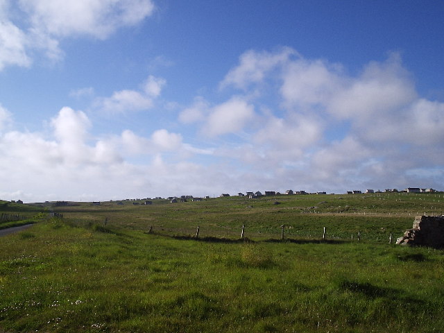
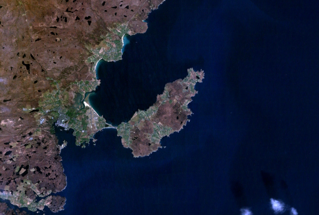
Pabail Iarach is a small township located in the county of Ross-shire, in the Highlands region of Scotland. Situated on the western coast of the Scottish mainland, it is nestled between the rugged mountains and the picturesque Loch Carron. Pabail Iarach is part of the larger community of Applecross, which encompasses several other nearby townships.

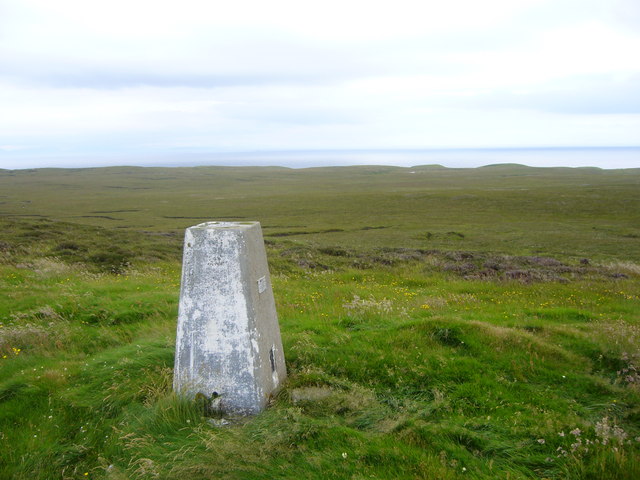
Known for its breathtaking natural beauty, Pabail Iarach offers visitors a tranquil escape from the hustle and bustle of city life. The township is surrounded by stunning landscapes, with hills and moorland dominating the area. The pristine Loch Carron, with its crystal-clear waters, provides a serene backdrop for outdoor enthusiasts and nature lovers.

Pabail Iarach is primarily a rural community, with a small population engaged in traditional activities such as fishing, farming, and crofting. The township is renowned for its rich cultural heritage, with a strong connection to the Gaelic language and traditions. Visitors can immerse themselves in the local culture by attending traditional music sessions or participating in Gaelic language classes.

Despite its remote location, Pabail Iarach is well-connected to the rest of Ross-shire and nearby towns through a network of roads. The township offers limited amenities, including a few local shops and eateries, but for a wider range of services, residents and visitors often travel to the nearby village of Applecross.

Overall, Pabail Iarach is a charming and peaceful township that captivates visitors with its stunning natural surroundings and strong sense of community. It is an ideal destination for those seeking a serene escape in the heart of the Scottish Highlands.

If you have any feedback on the listing, please let us know in the comments section below.

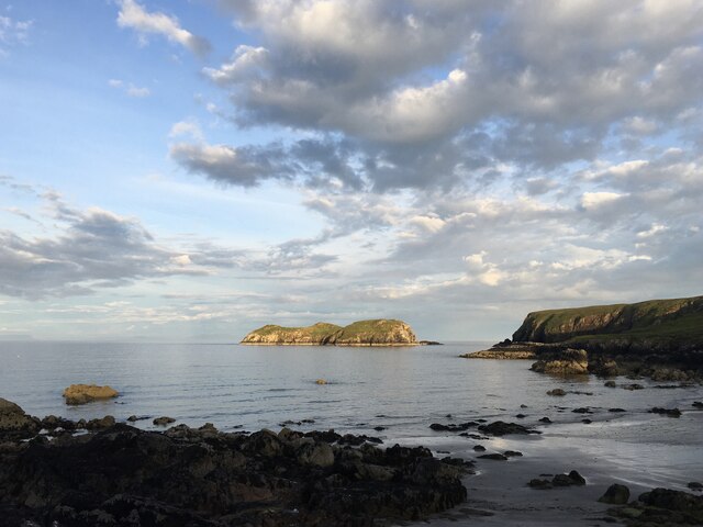
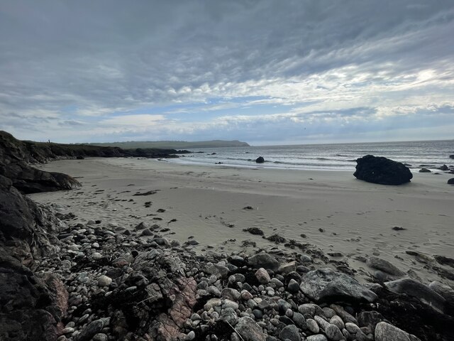
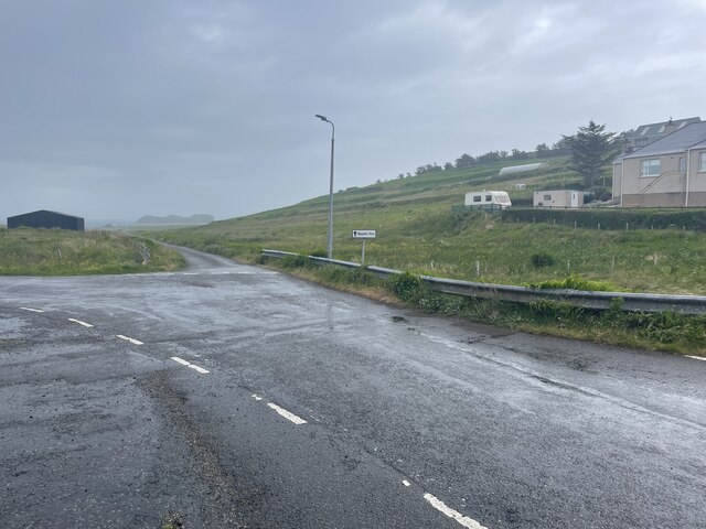
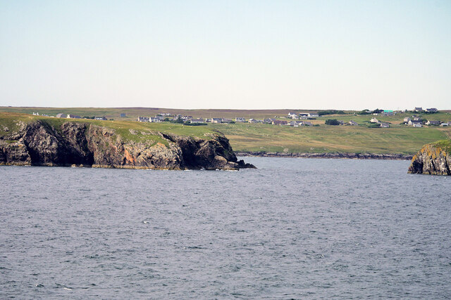
Pabail Iarach Images

Images are sourced within 2km of 58.200274/-6.2242279 or Grid Reference NB5131. Thanks to Geograph Open Source API. All images are credited.

Coastline, Rubh' Dubh, Eye Peninsula, Isle of Lewis Looking towards <a href="https://www.geograph.org.uk/photo/639694">NB5129 : Eilean a Crotaich</a>.
Coastline, Rubh' Dubh, Eye Peninsula, Isle of Lewis
Looking towards NB5129 : Eilean a Crotaich.
Bayble Pier and Beach
Beach at Pabail Looking out to sea from the beach at Pabail near Stornoway.
Beach at Pabail
Looking out to sea from the beach at Pabail near Stornoway.
Cliffs of An Rubha
Cliffs of An Rubha
Bayble Pier Geocaching is a type of global treasure hunt of people looking for caches, or hidden stashes of objects. Geocaching may also be described as a series of hide-and-seek games, where hiders provide online clues for seekers. Seekers use global positioning system (GPS) devices to find hidden caches
Bayble Pier
Geocaching is a type of global treasure hunt of people looking for caches, or hidden stashes of objects. Geocaching may also be described as a series of hide-and-seek games, where hiders provide online clues for seekers. Seekers use global positioning system (GPS) devices to find hidden caches
Bayble Beach Geocaching is a type of global treasure hunt of people looking for caches, or hidden stashes of objects. Geocaching may also be described as a series of hide-and-seek games, where hiders provide online clues for seekers. Seekers use global positioning system (GPS) devices to find hidden caches
Bayble Beach
Geocaching is a type of global treasure hunt of people looking for caches, or hidden stashes of objects. Geocaching may also be described as a series of hide-and-seek games, where hiders provide online clues for seekers. Seekers use global positioning system (GPS) devices to find hidden caches
Eilean  Mòr Phabail
Eilean Mòr Phabail
Roads of An Rubha
Roads of An Rubha
Roads of An Rubha
Roads of An Rubha
Roads of An Rubha
Roads of An Rubha
Isle of Lewis, Eye Peninsula Rubha na Strianaich
Eilean Mòr Phabail Bayble Island (Scottish Gaelic: Eilean Phabail) is an uninhabited island off the south coast of the Eye Peninsula of Lewis. It lies at the southern end of Bayble Bay (Pabail Bay) and actually consists of two islands (Eilean Mòr Phabaill and Eilean Beag Phabail), but these appear as a single island from most directions. The hamlets of Upper and Lower Bayble overlook the island and bay.
Wikipedia  <span class="nowrap"><a title="https://en.wikipedia.org/wiki/Bayble_Island" rel="nofollow ugc noopener" href="https://en.wikipedia.org/wiki/Bayble_Island">Link</a><img style="margin-left:2px;" alt="External link" title="External link - shift click to open in new window" src="https://s1.geograph.org.uk/img/external.png" width="10" height="10"/></span>
Eilean Mòr Phabail
Bayble Island (Scottish Gaelic: Eilean Phabail) is an uninhabited island off the south coast of the Eye Peninsula of Lewis. It lies at the southern end of Bayble Bay (Pabail Bay) and actually consists of two islands (Eilean Mòr Phabaill and Eilean Beag Phabail), but these appear as a single island from most directions. The hamlets of Upper and Lower Bayble overlook the island and bay. Wikipedia LinkExternal link
Eilean Mor Phabail Off the south coast of the Eye Peninsula of Lewis, in the Outer Hebrides.
Eilean Mor Phabail
Off the south coast of the Eye Peninsula of Lewis, in the Outer Hebrides.
Beach at Pabail A little beach facing southeast on the south coast of the Eye peninsula, Lewis
Beach at Pabail
A little beach facing southeast on the south coast of the Eye peninsula, Lewis
Looking north towards Pabail The crofts and houses of Pabail Iarach and Pabail Uarach are spread out over the land in Lewis's Eye peninsula
Looking north towards Pabail
The crofts and houses of Pabail Iarach and Pabail Uarach are spread out over the land in Lewis's Eye peninsula
Bayble Hill trig
Bayble Hill trig
Red roof on a blackhouse This old blackhouse in Lower Bayble (Pabail Iaraich) has had its traditional thatch replaced by corrugated iron and has obviously not been used as a dwelling for many years.  This view looks south-west from the road through the village, and on a clear day such as this was, the hazy outline of the hills of Wester Ross on the mainland can be made out on the horizon.
Red roof on a blackhouse
This old blackhouse in Lower Bayble (Pabail Iaraich) has had its traditional thatch replaced by corrugated iron and has obviously not been used as a dwelling for many years. This view looks south-west from the road through the village, and on a clear day such as this was, the hazy outline of the hills of Wester Ross on the mainland can be made out on the horizon.
Track across the moor This track, probably a peat road, takes off to the south from the road leading to Lower Bayble (Pabail Iarach).  The gridsquare, almost entirely featureless moorland, looked a poor possibility for a photo until this puddle obligingly offered a reflection of the sky.
Track across the moor
This track, probably a peat road, takes off to the south from the road leading to Lower Bayble (Pabail Iarach). The gridsquare, almost entirely featureless moorland, looked a poor possibility for a photo until this puddle obligingly offered a reflection of the sky.
Show me another place!

Pabail Iarach is located at Grid Ref: NB5131 (Lat: 58.200274, Lng: -6.2242279)

Unitary Authority: Na h-Eileanan an Iar

Police Authority: Highlands and Islands

Also known as: Lower Bayble

What 3 Words

///suckle.bulbs.remembers. Near Stornoway, Na h-Eileanan Siar

Related Wikis

Bayble

Bayble (Scottish Gaelic: Pabail) is a village in Point (An Rubha), on the Isle of Lewis, 6 miles (10 kilometres) east of Stornoway. Bayble is also within...

Bayble Island

Bayble Island lies at the southern end of Bayble Bay (Pabail Bay). It consists of two islands (Eilean Mòr Phabaill and Eilean Beag Phabaill), but these...

Garrabost

Garrabost (Scottish Gaelic: Garrabost) is a village in the Point (An Rubha) peninsula isthmus on the east coast of the Isle of Lewis, in the Outer Hebrides...

Point, Lewis

Point (Scottish Gaelic: An Rubha), also known as the Eye Peninsula, is a peninsula some 11 km long in the Outer Hebrides (or Western Isles), Scotland....

Nearby Amenities

Located within 500m of 58.200274,-6.2242279
Bus Stop
Bayble
Bus: yes
Naptan AtcoCode: 6010731545
Naptan Bearing: NE
Naptan CommonName: Bayble
Naptan Indicator: Lower Bayble
Naptan Landmark: road junction
Naptan NaptanCode: 94723792
Naptan Street: Lower Bayble
Naptan Verified: no
Public Transport: platform
Shelter: yes
Source: naptan_import
Lat/Long: 58.202129/-6.2204065
Passing Place
Lat/Long: 58.2042532/-6.2217546
Turning Circle
Lat/Long: 58.1970351/-6.2278614
Passing Place
Lat/Long: 58.2009712/-6.2270636
Passing Place
Lat/Long: 58.2014523/-6.2291048
Pabail Iarach
Name En: Lower Bayble
Name Gd: Pabail Iarach
Place: village
Wikidata: Q4874382
Wikipedia: en:Bayble
Lat/Long: 58.1995714/-6.2217409
Turning Circle
Turning Circle: hammer
Lat/Long: 58.2016165/-6.2237669
Passing Place
Lat/Long: 58.1997487/-6.2246628
Passing Place
Lat/Long: 58.1985826/-6.224632
Passing Place
Lat/Long: 58.1978031/-6.2243121
Passing Place
Lat/Long: 58.197254/-6.2240392
Passing Place
Lat/Long: 58.1968412/-6.2238273
Passing Place
Lat/Long: 58.201724/-6.2302378
Passing Place
Lat/Long: 58.200442/-6.224939
Passing Place
Lat/Long: 58.2018666/-6.2308789
Power: pole
Lat/Long: 58.2041164/-6.22002
Power: pole
Lat/Long: 58.2037147/-6.2211261
Power: pole
Lat/Long: 58.2032854/-6.2224093
Power: pole
Lat/Long: 58.202867/-6.2236409
Power: pole
Lat/Long: 58.2024551/-6.2248749
Power: pole
Lat/Long: 58.2020445/-6.2260745
Power: pole
Lat/Long: 58.2014824/-6.2265661
Power: pole
Lat/Long: 58.2009233/-6.2270454
Power: pole
Lat/Long: 58.2001598/-6.2268365
Power: pole
Lat/Long: 58.1993619/-6.2266226
Power: pole
Lat/Long: 58.1986922/-6.2264604
Power: pole
Lat/Long: 58.1980432/-6.2262687
Power: pole
Lat/Long: 58.197402/-6.2260818
Power: pole
Lat/Long: 58.1966635/-6.225887
Power: pole
Lat/Long: 58.1961811/-6.2257638
Power: pole
Lat/Long: 58.1966529/-6.2247271
Power: pole
Lat/Long: 58.1966354/-6.223945
Post Box
Collection Times: Mo-Sa 10:30
Operator: Royal Mail
Post Box Mounting: pole
Post Box Type: lamp
Ref: HS2 94
Royal Cypher: scottish_crown
Lat/Long: 58.1972015/-6.2241052
Barrier: cattle_grid
Lat/Long: 58.2014199/-6.2236687
Street Lamp
Lamp Type: electric
Lat/Long: 58.2022942/-6.2206301
Street Lamp
Lamp Type: electric
Lat/Long: 58.2025599/-6.2208085
Street Lamp
Lamp Type: electric
Lat/Long: 58.2028871/-6.2210083
Street Lamp
Lamp Type: electric
Lat/Long: 58.2032341/-6.2211853
Street Lamp
Lamp Type: electric
Lat/Long: 58.2035605/-6.2213798
Street Lamp
Lamp Type: electric
Lat/Long: 58.2039336/-6.2215823
Street Lamp
Lamp Type: electric
Lat/Long: 58.2042389/-6.2217982
Street Lamp
Lamp Type: electric
Lat/Long: 58.2045647/-6.2220463
Street Lamp
Lamp Type: electric
Lat/Long: 58.2019812/-6.2203967
Street Lamp
Lamp Type: electric
Lat/Long: 58.2021345/-6.2200346
Street Lamp
Lamp Type: electric
Lat/Long: 58.1997227/-6.2245865
Street Lamp
Lamp Type: electric
Lat/Long: 58.1993446/-6.2246871
Street Lamp
Lamp Type: electric
Lat/Long: 58.1989891/-6.2246965
Street Lamp
Lamp Type: electric
Lat/Long: 58.1986393/-6.2245677
Street Lamp
Lamp Type: electric
Lat/Long: 58.1982958/-6.2244564
Street Lamp
Lamp Type: electric
Lat/Long: 58.1979439/-6.2243009
Street Lamp
Lamp Type: electric
Lat/Long: 58.1976626/-6.2241855
Passing Place
Lat/Long: 58.1959033/-6.2233494
Street Lamp
Lamp Type: electric
Lat/Long: 58.1958793/-6.2234071
Street Lamp
Lamp Type: electric
Lat/Long: 58.1961253/-6.2235211
Street Lamp
Lamp Type: electric
Lat/Long: 58.2020415/-6.2315743
Street Lamp
Lamp Type: electric
Lat/Long: 58.201932/-6.2310231
Street Lamp
Lamp Type: electric
Lat/Long: 58.2018019/-6.2304491
Street Lamp
Lamp Type: electric
Lat/Long: 58.201655/-6.2298375
Street Lamp
Lamp Type: electric
Lat/Long: 58.2012168/-6.2282255
Bus Stop
Bus: yes
Public Transport: platform
Shelter: yes
Lat/Long: 58.2014592/-6.2287747
Street Lamp
Lamp Type: electric
Lat/Long: 58.2014658/-6.2287223
Street Lamp
Lamp Type: electric
Lat/Long: 58.2017273/-6.2284839
Street Lamp
Lamp Type: electric
Lat/Long: 58.2019463/-6.2282838
Street Lamp
Lamp Type: electric
Lat/Long: 58.2020921/-6.2280388
Access: private
Addr Housenumber: 12
Addr Street: Rathad Ùr
Entrance: yes
Lat/Long: 58.2021277/-6.2279269
Access: private
Addr Housenumber: 11
Addr Street: Rathad Ùr
Entrance: yes
Lat/Long: 58.2021012/-6.2278205
Access: private
Addr Housenumber: 10
Addr Street: Rathad Ùr
Entrance: yes
Lat/Long: 58.2020253/-6.2277314
Access: private
Addr Housenumber: 9
Addr Street: Rathad Ùr
Entrance: yes
Lat/Long: 58.2019627/-6.2277875
Access: private
Addr Housenumber: 8
Addr Street: Rathad Ùr
Entrance: yes
Lat/Long: 58.2018984/-6.2278814
Access: private
Addr Housenumber: 7
Addr Street: Rathad Ùr
Entrance: yes
Lat/Long: 58.2018029/-6.2280761
Access: private
Addr Housenumber: 6
Addr Street: Rathad Ùr
Entrance: yes
Lat/Long: 58.2017284/-6.2281248
Access: private
Addr Housenumber: 5
Addr Street: Rathad Ùr
Entrance: yes
Lat/Long: 58.2015948/-6.2281462
Access: private
Addr Housenumber: 4
Addr Street: Rathad Ùr
Entrance: yes
Lat/Long: 58.201514/-6.2280882
Access: private
Addr Housenumber: 3
Addr Street: Rathad Ùr
Entrance: yes
Lat/Long: 58.201443/-6.2281475
Access: private
Addr Housenumber: 2
Addr Street: Rathad Ùr
Entrance: yes
Lat/Long: 58.2014292/-6.2283002
Access: private
Addr Housenumber: 1
Addr Street: Rathad Ùr
Entrance: yes
Lat/Long: 58.2014516/-6.2283956
Street Lamp
Lamp Type: electric
Lat/Long: 58.201024/-6.2270846
Street Lamp
Lamp Type: electric
Lat/Long: 58.2008466/-6.2264114
Material: wood
Power: pole
Lat/Long: 58.2007131/-6.2262639
Street Lamp
Lamp Type: electric
Lat/Long: 58.2003767/-6.2245539
Street Lamp
Lamp Type: electric
Lat/Long: 58.2005269/-6.2251836
Street Lamp
Lamp Type: electric
Lat/Long: 58.2006756/-6.2257569
The data included in this document is from www.openstreetmap.org. The data is made available under ODbL.

Have you been to Pabail Iarach?

Leave your review of Pabail Iarach below (or comments, questions and feedback).