Ovingdean

Settlement in Sussex

England

Ovingdean

Slipway into sea off Undercliff Walk
Slipway into sea off Undercliff Walk Credit: Tom Page

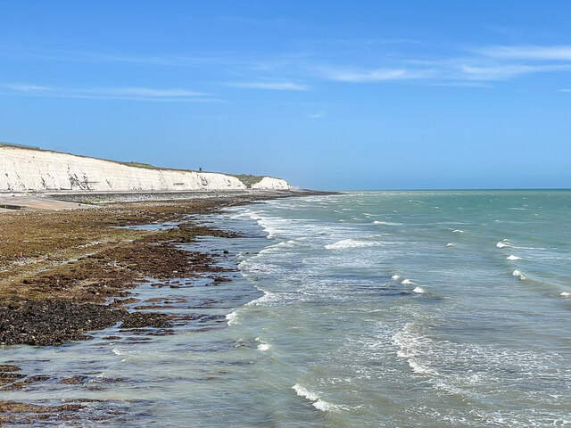
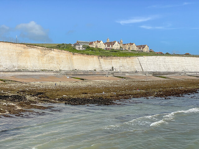
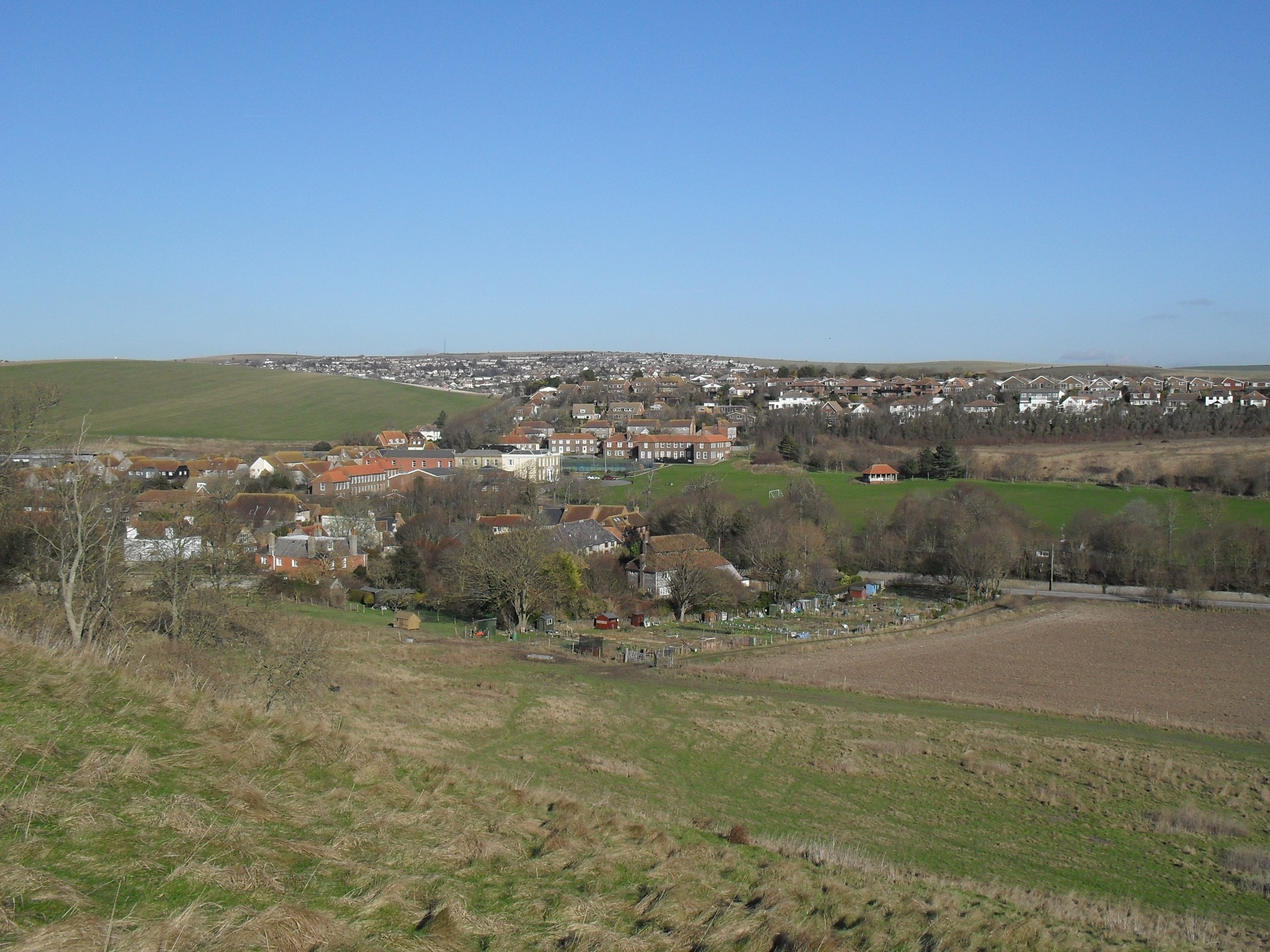
Ovingdean is a small village located in the county of Sussex, England. Situated on the outskirts of the vibrant city of Brighton and Hove, Ovingdean offers a peaceful and picturesque setting for its residents. The village is nestled between the South Downs National Park and the English Channel, providing stunning views and easy access to the countryside and the coast.

Ovingdean's history can be traced back to the Domesday Book of 1086 when it was recorded as a small agricultural settlement. Over the years, the village has retained its rural charm, with a mix of traditional cottages and modern homes. The community is tight-knit, with a population of approximately 1,500 people.

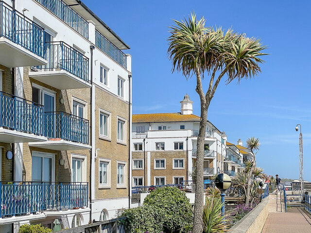
Despite its small size, Ovingdean offers a range of amenities and facilities for its residents. The village has a local primary school, a community center, and a small selection of shops and pubs. For those seeking outdoor activities, there are numerous walking and cycling routes that provide opportunities to explore the surrounding countryside.

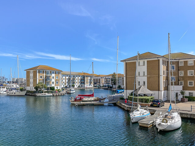
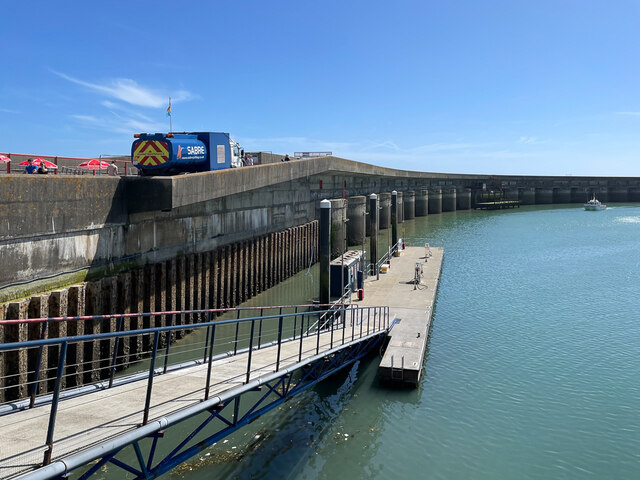
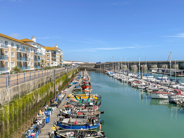
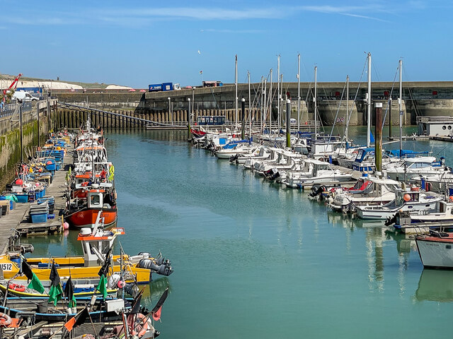
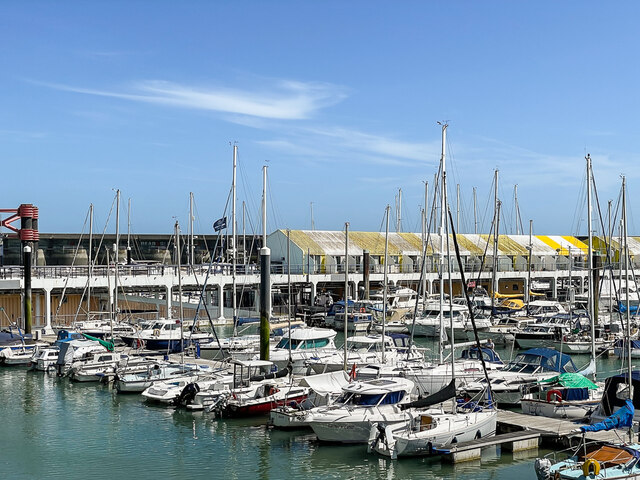
One of the notable features of Ovingdean is its proximity to the famous Brighton Marina, which is just a short distance away. The marina offers a wide range of leisure and entertainment options, including restaurants, bars, shops, and a cinema. Residents of Ovingdean also benefit from excellent transport links, with regular bus services connecting the village to Brighton and other nearby towns.

In summary, Ovingdean is a charming village in Sussex that offers a peaceful and scenic setting, with easy access to both the countryside and the coast. Its close proximity to Brighton and Hove ensures that residents can enjoy the amenities and attractions of a vibrant city while still enjoying the tranquility of village life.

If you have any feedback on the listing, please let us know in the comments section below.

Ovingdean Images

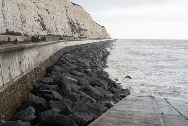
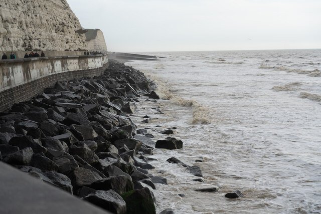
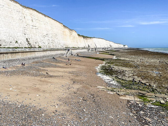
Images are sourced within 2km of 50.811301/-0.06886 or Grid Reference TQ3603. Thanks to Geograph Open Source API. All images are credited.

Slipway into sea off Undercliff Walk
Undercliff walk near Rottingdean, facing east
Undercliff walk facing east
Beach at Rottingdean facing east
Victory Mews and The Strand Waterside flats and townhouses in Victory Mews (on the right) and The Strand (in the left background) in Brighton Marina.
Victory Mews and The Strand
Waterside flats and townhouses in Victory Mews (on the right) and The Strand (in the left background) in Brighton Marina.
Roedean Beach Beach below Roedean Cliffs, seen from the eastern breakwater of Brighton Marina.
Roedean Beach
Beach below Roedean Cliffs, seen from the eastern breakwater of Brighton Marina.
Roedean Beach Beach below Roedean Cliffs, seen from the eastern breakwater of Brighton Marina.  On the clifftop in the background can be seen Rottingdean Windmill on Beacon Hill above Rottingdean.
Roedean Beach
Beach below Roedean Cliffs, seen from the eastern breakwater of Brighton Marina. On the clifftop in the background can be seen Rottingdean Windmill on Beacon Hill above Rottingdean.
Roedean Beach Beach below Roedean Cliffs, seen from the eastern breakwater of Brighton Marina.  On the clifftop is Roedean School.
Roedean Beach
Beach below Roedean Cliffs, seen from the eastern breakwater of Brighton Marina. On the clifftop is Roedean School.
Brighton Marina The eastern breakwater of Brighton Marina.
Brighton Marina
The eastern breakwater of Brighton Marina.
Brighton Marina Fishing boats moored to the quayside at Brighton maria, with other craft on the right.
Brighton Marina
Fishing boats moored to the quayside at Brighton maria, with other craft on the right.
Brighton Marina Fishing boats moored to the quayside at Brighton maria, with other craft on the right.
Brighton Marina
Fishing boats moored to the quayside at Brighton maria, with other craft on the right.
Sovereign Court and Britannia Court Housing in Sovereign Court (in the left) and Britannia Court (beyond) in Brighton Marina.
Sovereign Court and Britannia Court
Housing in Sovereign Court (in the left) and Britannia Court (beyond) in Brighton Marina.
 Brighton Marina Moored boats in Brighton Marina.
Brighton Marina
Moored boats in Brighton Marina.
Founthill Avenue, Saltdean Founthill Avenue is a residential road in Saltdean, on the Sussex coast near Brighton.
Founthill Avenue, Saltdean
Founthill Avenue is a residential road in Saltdean, on the Sussex coast near Brighton.
Founthill Avenue, Saltdean Founthill Avenue is a residential road in Saltdean, on the Sussex coast near Brighton.
Founthill Avenue, Saltdean
Founthill Avenue is a residential road in Saltdean, on the Sussex coast near Brighton.
'Do Not Climb, Falling Rocks Image of part of the chalk cliffs along the Undercliff Path, near Brighton Marina.
Showing the 'lean' on the cliffs to the right, in relation to the concrete path.
The almost converging 'lines' the kerb alongside the path and cliff top.
'Do Not Climb, Falling Rocks
Image of part of the chalk cliffs along the Undercliff Path, near Brighton Marina. Showing the 'lean' on the cliffs to the right, in relation to the concrete path. The almost converging 'lines' the kerb alongside the path and cliff top.
The eastern breakwater of Brighton Marina Brighton Marina is a large, man-made marina. The construction of the marina itself took place between 1971 and 1979, although developments within it have continued ever since. The marina covers an area of approximately 127 acres.
<span class="nowrap"><a title="http://en.wikipedia.org/wiki/Brighton_Marina" rel="nofollow ugc noopener" href="http://en.wikipedia.org/wiki/Brighton_Marina">Link</a><img style="margin-left:2px;" alt="External link" title="External link - shift click to open in new window" src="https://s1.geograph.org.uk/img/external.png" width="10" height="10"/></span>
The eastern breakwater of Brighton Marina
Brighton Marina is a large, man-made marina. The construction of the marina itself took place between 1971 and 1979, although developments within it have continued ever since. The marina covers an area of approximately 127 acres. LinkExternal link
Cafe at the Ovingdean Gap In 1928, Rottingdean parish was absorbed by Brighton and in order to protect the coastline an impressive sea wall at the base of the cliffs was erected, initially from Black Rock (the former boundary of Brighton parish) to Rottingdean.

The Undercliff Walk, as it became known, was designed by borough engineer David Edwards and opened in July 1933. It was extended to Saltdean Gap in July 1935 when the Rottingdean swimming-pool was built to replace bathing facilities lost to the wall.

A final short addition to the wall taking it to the very end of the borough boundary was made later in 1935. The Undercliff Walk is now 3.35 miles long and forms part of a 7.5 mile promenade from Portslade to Saltdean.  <span class="nowrap"><a title="http://www.mybrightonandhove.org.uk/page_id__6824.aspx" rel="nofollow ugc noopener" href="http://www.mybrightonandhove.org.uk/page_id__6824.aspx">Link</a><img style="margin-left:2px;" alt="External link" title="External link - shift click to open in new window" src="https://s1.geograph.org.uk/img/external.png" width="10" height="10"/></span>
Cafe at the Ovingdean Gap
In 1928, Rottingdean parish was absorbed by Brighton and in order to protect the coastline an impressive sea wall at the base of the cliffs was erected, initially from Black Rock (the former boundary of Brighton parish) to Rottingdean. The Undercliff Walk, as it became known, was designed by borough engineer David Edwards and opened in July 1933. It was extended to Saltdean Gap in July 1935 when the Rottingdean swimming-pool was built to replace bathing facilities lost to the wall. A final short addition to the wall taking it to the very end of the borough boundary was made later in 1935. The Undercliff Walk is now 3.35 miles long and forms part of a 7.5 mile promenade from Portslade to Saltdean. LinkExternal link
Show me another place!

Ovingdean is located at Grid Ref: TQ3603 (Lat: 50.811301, Lng: -0.06886)

Unitary Authority: Brighton and Hove

Police Authority: Sussex

What 3 Words

///simulates.final.flaking. Near Rottingdean, East Sussex

Nearby Locations

Ovingdean Rottingdean

Related Wikis

Rottingdean

Rottingdean is a village in the city of Brighton and Hove, on the south coast of England. It borders the villages of Saltdean, Ovingdean and Woodingdean...

Ovingdean

Ovingdean is a small, formerly agricultural village and former civil parish on the eastern edge of the city of Brighton and Hove in the ceremonial county...

Beacon Mill, Rottingdean

Beacon Mill or New Mill is a grade II listed smock mill at Rottingdean, Sussex, England which has been restored as a seamark. It sits within the boundary...

Ovingdean Grange

Ovingdean Grange is a Grade II listed manor house situated on the south coast of England in the village of Ovingdean, east of Brighton. One of the oldest...

Nearby Amenities

Located within 500m of 50.811301,-0.06886
Bus Stop
St Dunstan's
Bus: yes
Public Transport: platform
Lat/Long: 50.8081276/-0.0707922
Beacon Hill
Place: locality
Lat/Long: 50.8112435/-0.0659977
Barrier: kissing_gate
Lat/Long: 50.8094447/-0.0635684
Turning Circle
Lat/Long: 50.8139066/-0.0638497
Bus Stop
Court Ord Road
Public Transport: platform
Lat/Long: 50.8123881/-0.0620157
Barrier: kissing_gate
Foot: yes
Lat/Long: 50.8084532/-0.0676207
Barrier: kissing_gate
Foot: yes
Lat/Long: 50.8084577/-0.0705845
Noexit: yes
Lat/Long: 50.8127423/-0.0665651
Post Box
Collection Times: Mo-Fr 09:00; Sa 07:00
Operator: Royal Mail
Post Box Type: lamp
Ref: BN2 219D
Royal Cypher: GR
Royal Cypher Wikidata: Q33102273
Lat/Long: 50.8146823/-0.0655358
Post Box
Collection Times: Mo-Fr 16:30; Sa 11:15
Operator: Royal Mail
Post Box Type: pillar
Ref: BN2 218
Royal Cypher: GR
Royal Cypher Wikidata: Q33102273
Lat/Long: 50.8127813/-0.0639439
Post Box
Brand: Royal Mail
Brand Wikidata: Q638098
Collection Plate: CP1
Collection Times: Mo-Fr 09:00, Sa 07:00
Note: Collection plate states Mo-Fr 16:30, Sa 11:15, but label overrides stating "the last collection from this postbox will be made no earlier than 9am Monday to Friday and 7am on Saturday".
Operator: Royal Mail
Operator Wikidata: Q638098
Post Box Type: pillar
Ref: BN2 220
Royal Cypher: EIIR
Royal Cypher Wikidata: Q33102113
Source: survey
Survey Date: 2022-03-30
Lat/Long: 50.812194/-0.0621481
Bus Stop
Greenways
Bench: no
Bus: yes
Public Transport: platform
Shelter: no
Tactile Paving: no
Lat/Long: 50.8116958/-0.0714413
Post Box
Brand: Royal Mail
Brand Wikidata: Q638098
Collection Plate: CP1D
Collection Times: Mo-Fr 09:00; Sa 07:00
Last Checked: 2022-05-07
Operator: Royal Mail
Operator Wikidata: Q638098
Post Box Type: pillar
Ref: BN2 214D
Royal Cypher: GR
Royal Cypher Wikidata: Q33102273
Source: survey
Lat/Long: 50.8129113/-0.0678183
Bus Stop
St Dunstan's
Public Transport: platform
Lat/Long: 50.8080173/-0.070638
Bus Stop
Greenways
Naptan AtcoCode: 149000006730
Naptan NaptanCode: brijdtp
Public Transport: platform
Lat/Long: 50.8112753/-0.0709871
Bus Stop
Longhill Close
Bench: no
Bin: no
Lit: yes
Public Transport: platform
Shelter: no
Tactile Paving: no
Lat/Long: 50.8151209/-0.0700386
Bus Stop
Longhill Road
Bench: yes
Bin: yes
Bus: yes
Description: This bench is a red plastic bench.
Lit: yes
Public Transport: platform
Shelter: yes
Source: survey
Tactile Paving: no
Lat/Long: 50.8128643/-0.0677328
Description: This is not a public garden but "Garden" is the nearest OSM description I could see for a small plant bed.
Leisure: garden
Source: survey
Lat/Long: 50.8129869/-0.067702
Waste Basket
Ashtray: yes
Colour: black
Covered: yes
Source: survey
Lat/Long: 50.8128529/-0.0676718
Grit Bin
Colour: yellow
Source: survey
Lat/Long: 50.8129598/-0.0677243
Ovingdean Shaft
Man Made: shaft
Note: 8 m diameter, 16 m deep
Lat/Long: 50.8072824/-0.0714754
Street Lamp
Lat/Long: 50.8146859/-0.0661191
The data included in this document is from www.openstreetmap.org. The data is made available under ODbL.

Have you been to Ovingdean?

Leave your review of Ovingdean below (or comments, questions and feedback).