Overton Bridge

Settlement in Flintshire

Wales

Overton Bridge

Dead-end road above the River Dee
Dead-end road above the River Dee Credit: John H Darch

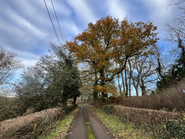
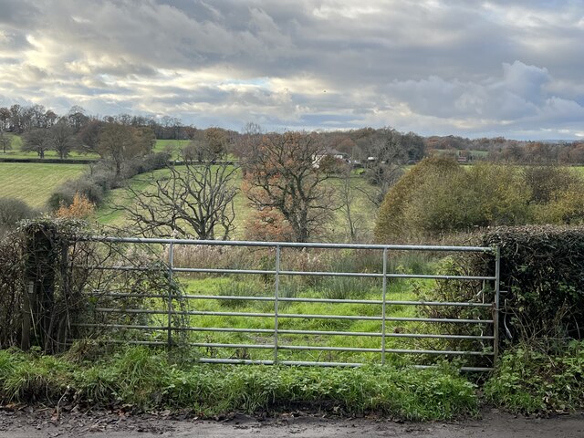
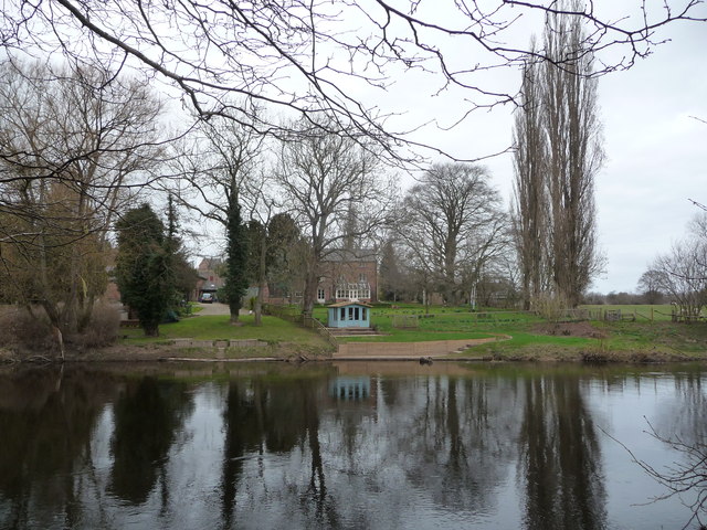
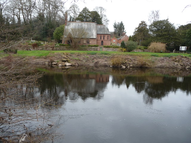
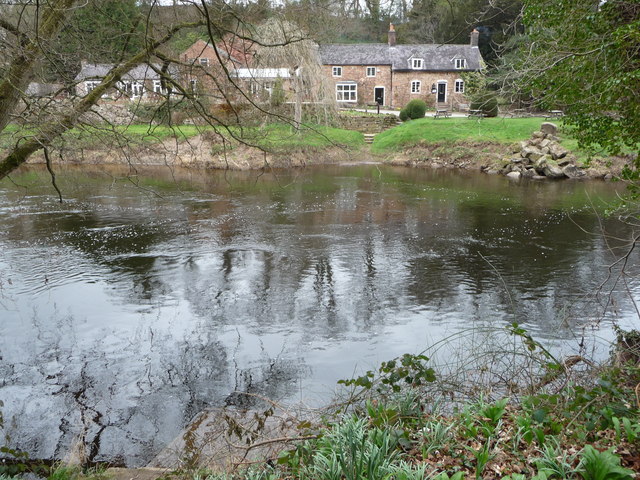
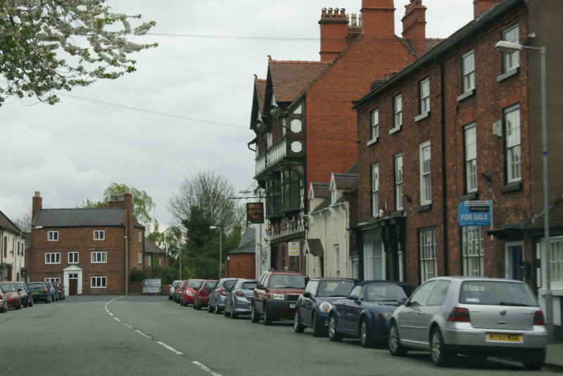
Overton Bridge is a picturesque village located in Flintshire, Wales. Situated on the banks of the River Dee, it is known for its charming countryside views and historical significance. The village is home to a population of around 1,500 residents.

One of the standout features of Overton Bridge is its namesake, a stunning stone bridge that spans the River Dee. Built in the 19th century, the bridge is an iconic landmark and a popular spot for visitors to enjoy the scenic beauty of the area. It is a Grade II listed structure, highlighting its architectural significance.

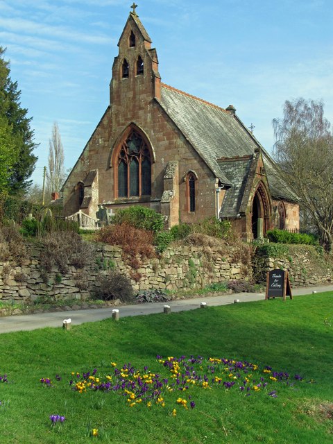
The village itself boasts a range of amenities, including quaint shops, local pubs, and restaurants that serve delicious traditional Welsh cuisine. The community is close-knit and welcoming, creating a friendly atmosphere for both residents and visitors.

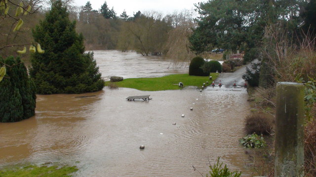
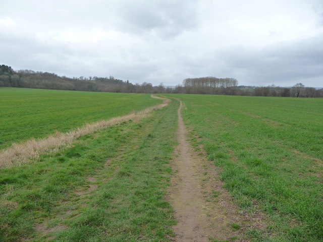
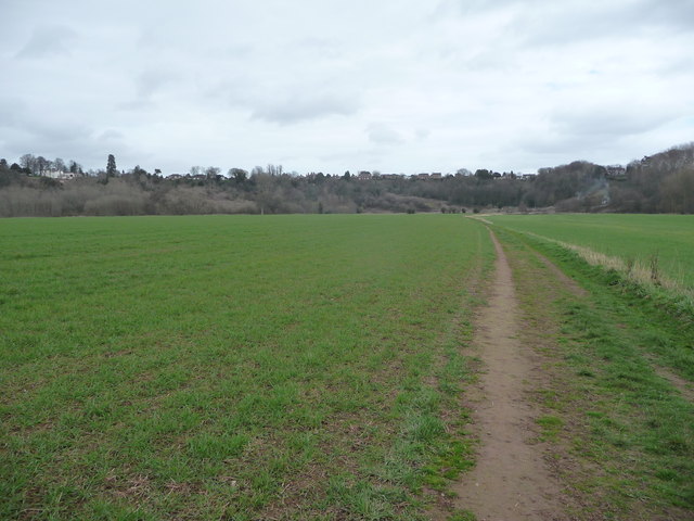
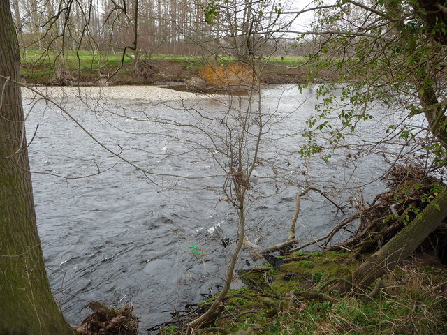
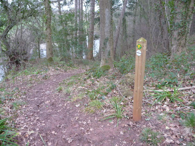
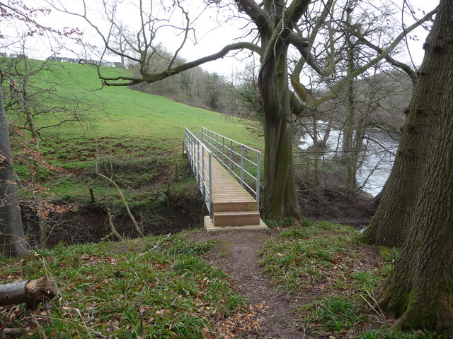
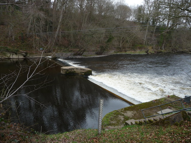
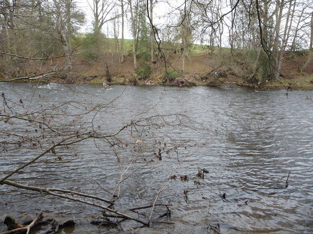
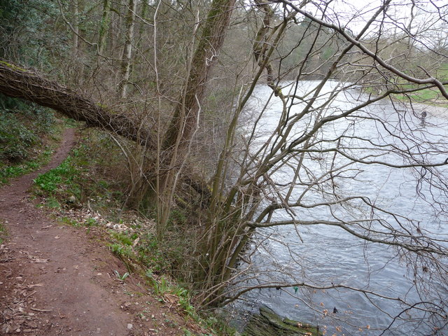
Nature enthusiasts will appreciate the natural beauty surrounding Overton Bridge. The River Dee offers opportunities for fishing and boating, while the nearby countryside provides ample trails for hiking and biking. The area is also rich in wildlife, with various species of birds and animals making their home in the lush green landscape.

Overton Bridge is conveniently located just a short distance from the town of Wrexham, offering easy access to additional amenities and services. Its tranquil setting and historic charm make it an ideal destination for those seeking a peaceful retreat or a glimpse into Wales' rich history.

If you have any feedback on the listing, please let us know in the comments section below.

Overton Bridge Images

Images are sourced within 2km of 52.971397/-2.969346 or Grid Reference SJ3542. Thanks to Geograph Open Source API. All images are credited.

Dead-end road above the River Dee
Gate with a view Though the River Dee, in the valley, is hidden from view.
Gate with a view
Though the River Dee, in the valley, is hidden from view.
River Dee flood Flood waters at their highest looking West outside St Hilary's Church, Erbistock on the road to the Boat Inn on the 6 February 2011. The sundial pillar is on the right. Compare this to the normal river level shown in older picture "The River Dee near the church at Erbistock" by Eirian Evans.
River Dee flood
Flood waters at their highest looking West outside St Hilary's Church, Erbistock on the road to the Boat Inn on the 6 February 2011. The sundial pillar is on the right. Compare this to the normal river level shown in older picture "The River Dee near the church at Erbistock" by Eirian Evans.
St Hilary's church Erbistock in spring
Part of the Maelor Way between Overton-on-Dee and the River Dee The path crosses water meadows on the floodplain of the mighty river.
Part of the Maelor Way between Overton-on-Dee and the River Dee
The path crosses water meadows on the floodplain of the mighty river.
Part of the Maelor Way below Overton Houses in Overton can be seen high above the old floodplain of the river.
Part of the Maelor Way below Overton
Houses in Overton can be seen high above the old floodplain of the river.
Part of the River Dee / Afon Dyfrdwy near Overton A typical section of river bank in this area with the river licking past at quite a rate. In early spring it is already busy with pairs of ducks and waterfowl. I also saw some fish jumping.
Part of the River Dee / Afon Dyfrdwy near Overton
A typical section of river bank in this area with the river licking past at quite a rate. In early spring it is already busy with pairs of ducks and waterfowl. I also saw some fish jumping.
Stile and footbridge on the Maelor Way near Erbistock Nice newish bit of work.
Stile and footbridge on the Maelor Way near Erbistock
Nice newish bit of work.
Riverside property in Erbistock People like to live next to water, and what a spot this is, with a lovely riverside setting including an optimistically sited summerhouse.
Riverside property in Erbistock
People like to live next to water, and what a spot this is, with a lovely riverside setting including an optimistically sited summerhouse.
St. Hilary's church, Erbistock beside the River Dee / Afon Dyfrdwy A small village church for this small village.
St. Hilary's church, Erbistock beside the River Dee / Afon Dyfrdwy
A small village church for this small village.
The line of the old ferry at Erbistock on the River Dee / Afon Dyfrdwy The old winch can be seen on the far bank. I daresay that you would welcome a drink after crossing, or need one beforehand...
The line of the old ferry at Erbistock on the River Dee / Afon Dyfrdwy
The old winch can be seen on the far bank. I daresay that you would welcome a drink after crossing, or need one beforehand...
Cave in a crag above the River Dee / Afon Dyfrdwy opposite Erbistock The rocky outcrop here has a cave or two in it and here the cave or overhang roof has collapsed in one big slab. It's probably around the size of a grand piano (with the lid down).
Cave in a crag above the River Dee / Afon Dyfrdwy opposite Erbistock
The rocky outcrop here has a cave or two in it and here the cave or overhang roof has collapsed in one big slab. It's probably around the size of a grand piano (with the lid down).
Footpath waymarker post in woodland above the River Dee / Afon Dyfrdwy Both the Maelor Way and the Wat's Dyke Path follow this line through a wood on the steep bank of the river.
Footpath waymarker post in woodland above the River Dee / Afon Dyfrdwy
Both the Maelor Way and the Wat's Dyke Path follow this line through a wood on the steep bank of the river.
Newish footbridge beside the River Dee / Afon Dyfrdwy near Erbistock Shiny newish footbridge across the Shell Brook. Carrying the Maelor Way.
Newish footbridge beside the River Dee / Afon Dyfrdwy near Erbistock
Shiny newish footbridge across the Shell Brook. Carrying the Maelor Way.
Weir on the River Dee / Afon Dyfrdwy near Manley Hall I bet this is quite a spot to watch fish migrate upstream.
Weir on the River Dee / Afon Dyfrdwy near Manley Hall
I bet this is quite a spot to watch fish migrate upstream.
Part of the River Dee / Afon Dyfrdwy near Manley Hall A fly-fisherman concentrates on his sport in the river. I sat and watched him casting his chosen fly into pools and eddies near and far. A fish was taking downstream but wasn't ready to be caught just yet.

What a great sport this is. When I retire one of my many ambitions is to fly-fish the Usk, the Dee, the Wye, the Tywi....
Part of the River Dee / Afon Dyfrdwy near Manley Hall
A fly-fisherman concentrates on his sport in the river. I sat and watched him casting his chosen fly into pools and eddies near and far. A fish was taking downstream but wasn't ready to be caught just yet. What a great sport this is. When I retire one of my many ambitions is to fly-fish the Usk, the Dee, the Wye, the Tywi....
Not by strength, by guile...(fly-fisherman on the Dee) This chap's focus and concentration was matched only by his guile as he cast and watched, cast and remembered, cast and thought, moved a little into midstream, cast further, watched, worked one pool with patience and a mix of intuition, optimism and method, part science, part art and part silent prayer to the gods and spirits of this old river....
Not by strength, by guile...(fly-fisherman on the Dee)
This chap's focus and concentration was matched only by his guile as he cast and watched, cast and remembered, cast and thought, moved a little into midstream, cast further, watched, worked one pool with patience and a mix of intuition, optimism and method, part science, part art and part silent prayer to the gods and spirits of this old river....
Part of the Maelor Way above the River Dee / Afon Dyfrdwy near Erbistock A fallen tree means that walkers have to duck under it here. A fly-fisherman casts over the river from near the far bank.
Part of the Maelor Way above the River Dee / Afon Dyfrdwy near Erbistock
A fallen tree means that walkers have to duck under it here. A fly-fisherman casts over the river from near the far bank.
Show me another place!

Overton Bridge is located at Grid Ref: SJ3542 (Lat: 52.971397, Lng: -2.969346)

Unitary Authority: Wrexham

Police Authority: North Wales

What 3 Words

///trying.rural.pints. Near Overton, Wrexham

Related Wikis

Erbistock

Erbistock (Welsh: Erbistog) is a village and community in Wrexham County Borough, Wales. The village lies on the banks of the River Dee. The community...

Shellbrook Hill

Shellbrook Hill is a grade II listed house in Ellesmere Rural, Shropshire, England, less than a quarter of a mile from part of the Wales border. The house...

Pen-y-Lan Hall

Pen-y-Lan Hall is a Grade II-listed Tudor-Gothic Revival country house located near the village of Ruabon in Wrexham County Borough, Wales. The building...

Overton-on-Dee

Overton (Welsh: Owrtyn) or Overton-on-Dee is a village and community in Wrexham County Borough, Wales. It is situated close to the Welsh-English border...

River Ceiriog

The River Ceiriog (Welsh: Afon Ceiriog) is an 18 miles (29 km) long river in north east Wales, whose name may derive from a term meaning "favoured one...

Wrexham Maelor

Wrexham Maelor (Welsh: Wrecsam Maelor) was a local government district with borough status, being one of six districts in the county of Clwyd, north-east...

Bangor-on-Dee racecourse

Bangor-on-Dee Racecourse (Welsh: Cae Rasio Bangor-is-y-coed) is a thoroughbred horse racing venue located in Bangor-on-Dee near Wrexham, Wales, United...

Overton-on-Dee railway station

Overton-on-Dee railway station was a station to the southeast of Overton-on-Dee, Wrexham, Wales at Lightwood Green. The station was opened on 2 November...

Nearby Amenities

Located within 500m of 52.971397,-2.969346
Erbistock
Is In: Wales
Name Cy: Erbistog
Name En: Erbistock
Place: village
Source: npe
Wikidata: Q5385173
Wikipedia: en:Erbistock
Lat/Long: 52.9684995/-2.9665061
Source: npe
Lat/Long: 52.9726271/-2.9630235
Waterway: weir
Lat/Long: 52.9729588/-2.9628087
Place: farm
Lat/Long: 52.9669929/-2.9692062
Building: yes
Lat/Long: 52.9697972/-2.9712662
Building: yes
Lat/Long: 52.9706242/-2.9726395
Give Way
Direction: forward
Lat/Long: 52.9709595/-2.9649772
The data included in this document is from www.openstreetmap.org. The data is made available under ODbL.

Have you been to Overton Bridge?

Leave your review of Overton Bridge below (or comments, questions and feedback).