Abbeytown

Settlement in Cumberland Allerdale

England

Abbeytown

Course of disused railway near Raby Cote Looking south west on the former line to Silloth.
Course of disused railway near Raby Cote Credit: Clive Nicholson

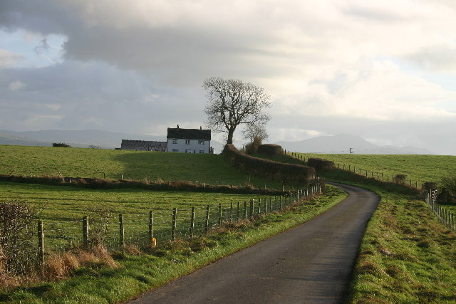
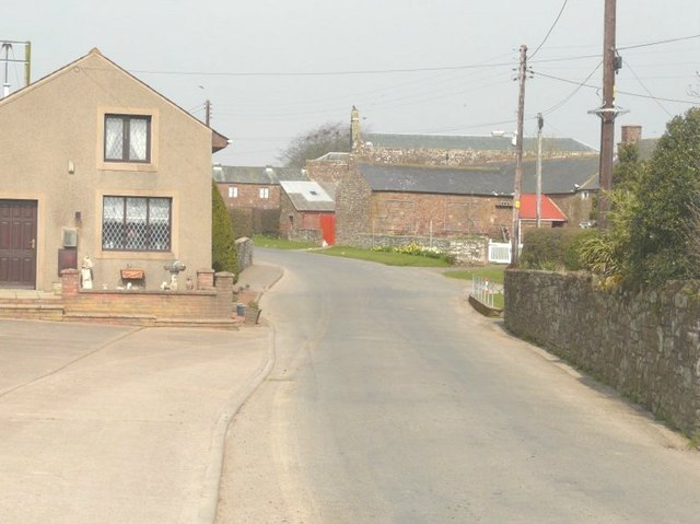
Abbeytown is a small village located in the district of Allerdale, in the county of Cumbria, England. Situated near the Solway Firth, it lies approximately 10 miles west of Carlisle and 7 miles east of Silloth. With a population of around 500 residents, Abbeytown is a close-knit community with a rich history.

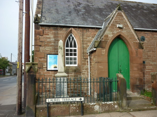
The village takes its name from the nearby Holme Cultram Abbey, a Cistercian abbey founded in the 12th century. The abbey was dissolved during the reign of Henry VIII, and only ruins remain today. However, its influence is still felt in the village, as many of the buildings and street names reflect its past.

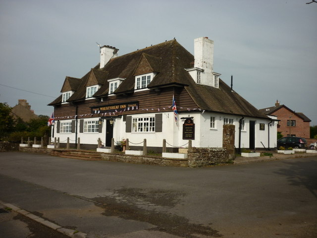
Abbeytown has a range of amenities to cater to its residents, including a primary school, a village hall, and a post office. The village also boasts a cricket ground, where matches are held during the summer months. Additionally, there are several pubs and local businesses that serve the community.

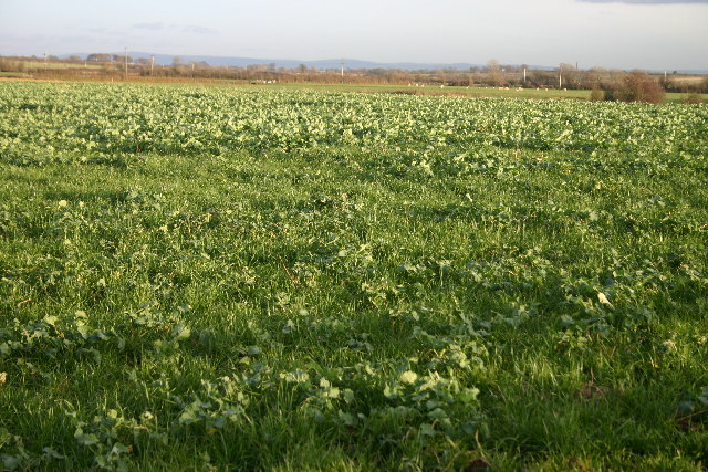
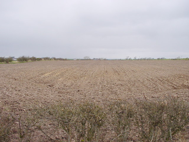
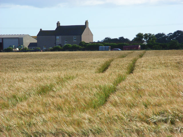
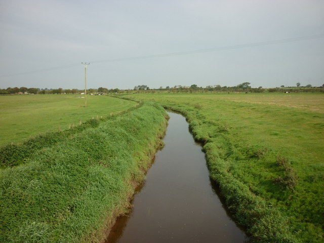
The surrounding countryside offers picturesque views and opportunities for outdoor activities, such as walking and cycling. The Solway Coast Area of Outstanding Natural Beauty is nearby, providing nature lovers with a stunning landscape to explore.

Overall, Abbeytown is a charming village with a strong sense of community and a historical past. Its peaceful location and range of amenities make it an attractive place to live for those seeking a quieter way of life.

If you have any feedback on the listing, please let us know in the comments section below.
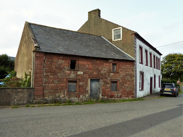
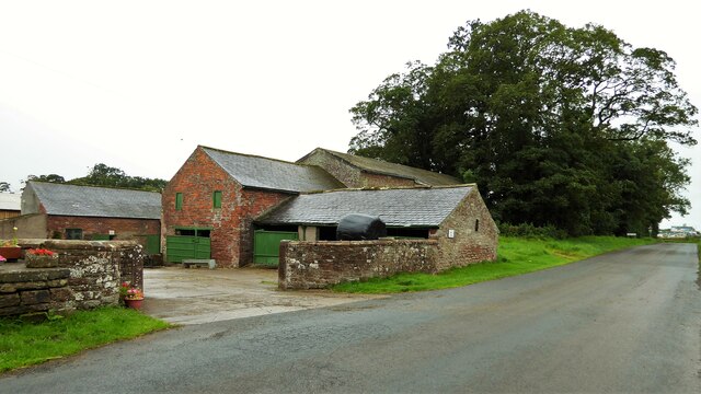
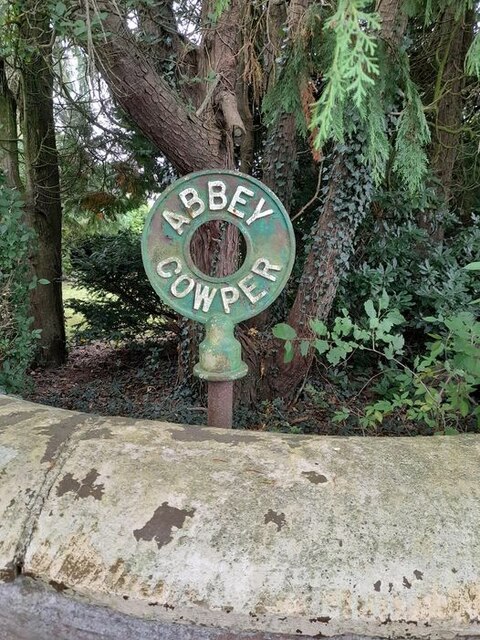
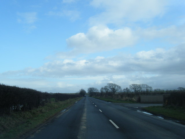
Abbeytown Images

Images are sourced within 2km of 54.844663/-3.289704 or Grid Reference NY1750. Thanks to Geograph Open Source API. All images are credited.

Course of disused railway near Raby Cote Looking south west on the former line to Silloth.
Course of disused railway near Raby Cote
Looking south west on the former line to Silloth.
Old building by Abbey Farmhouse Does this building contain masonry from the nearby former Holme Cultram Abbey?
Old building by Abbey Farmhouse
Does this building contain masonry from the nearby former Holme Cultram Abbey?
Farm buildings at Applegarth On the B5307 road
Farm buildings at Applegarth
On the B5307 road
River Waver Appearing more like a drainage ditch than a river at New Bridge on the B5307
River Waver
Appearing more like a drainage ditch than a river at New Bridge on the B5307
Direction Sign – Signpost on the B5307 near Raby Grange Located beside the parapet of Grange Bridge on the west side of the junction on the B5307 near Raby Grange. Holme East Waver parish. 3 arms and broken annulus finial.

Milestone Society National ID: CU_NY1852
Direction Sign – Signpost on the B5307 near Raby Grange
Located beside the parapet of Grange Bridge on the west side of the junction on the B5307 near Raby Grange. Holme East Waver parish. 3 arms and broken annulus finial. Milestone Society National ID: CU_NY1852
Direction Sign - Signpost at Abbey Cowper Farm Located behind the flanking wall to the left of the entrance to Abbey Cowper Farm, on the north side of the road, in Holme Abbey parish. Annulus only, perhaps recovered from the junction east of the farm.

Milestone Society National ID: CU_NY1550
Direction Sign - Signpost at Abbey Cowper Farm
Located behind the flanking wall to the left of the entrance to Abbey Cowper Farm, on the north side of the road, in Holme Abbey parish. Annulus only, perhaps recovered from the junction east of the farm. Milestone Society National ID: CU_NY1550
B5302 near Kelsickhouse Farm
Southerfield Hall More like a farmhouse....
Southerfield Hall
More like a farmhouse....
Crops in Field
Crops in Field
Ploughed Field
Ploughed Field
Barley, Abbeytown A view of Kelsickhouse Farm from the B5302.
Barley, Abbeytown
A view of Kelsickhouse Farm from the B5302.
Holme Cultram Abbey, Abbeytown As viewed from a minor road between the B5302 and B5307.
Holme Cultram Abbey, Abbeytown
As viewed from a minor road between the B5302 and B5307.
The former rail line
The River Weaver from New Bridge
Buildings at Knowehill
St Mary the Virgin, Abbeytown
The Wheatsheaf Inn, Abbeytown
The War Memorial at Abbeytown
Show me another place!

Abbeytown is located at Grid Ref: NY1750 (Lat: 54.844663, Lng: -3.289704)

Administrative County: Cumbria

District: Allerdale

Police Authority: Cumbria

What 3 Words

///regress.loaning.tactical. Near Silloth, Cumbria

Nearby Locations

Abbeytown

Related Wikis

Abbeytown

Abbeytown, also known as Holme Abbey, is a village and civil parish in the Allerdale borough of Cumbria, England. The name Abbeytown dates to the mid-17th...

Solway Plain

The Solway Plain or Solway Basin is a coastal plain located mostly in northwest Cumbria in England, extending just over the Scottish border to the low...

Abbey Town railway station

Abbey Town railway station was on the branch line off the Solway Junction Railway in the English county of Cumberland (later Cumbria). The first station...

Holmcultram Abbey

Holmcultram Abbey (alternatively Holm Cultram Abbey or Holme Cultram Abbey) was a Cistercian monastery in what is now the village of Abbeytown in Cumbria...

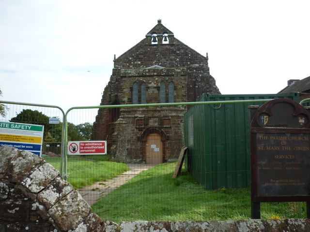
St Mary's Church, Abbeytown

St Mary's Church is in the village of Abbeytown, Cumbria, England. It is an active Anglican parish church in the deanery of Solway, the archdeaconry of...

Abbey Junction railway station

Abbey Junction railway station was the railway junction where the branch line to Silloth on the Solway Firth divided from the Solway Junction Railway...

Raby, Cumbria

Raby is a small hamlet in the civil parish of Holme East Waver in Cumbria, United Kingdom. == See also == Listed buildings in Holme East Waver == References... ==
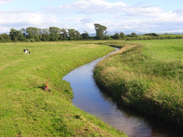
River Waver

The River Waver is a river in Cumbria, England. The river rises at Wavergillhead (as Townthwaite Beck). It is fed by the northwards flowing Thornthwaite...

Nearby Amenities

Located within 500m of 54.844663,-3.289704
Abbey Town
End Date: 1964
Historic Railway: station
Railway: site
Source: NLS - OS 1:25k 1st Series 1937-61
Wikidata: Q4664062
Wikipedia: en:Abbey Town railway station
Lat/Long: 54.845839/-3.2877325
Bus Stop
Swinsty Corner (N bound)
Naptan AtcoCode: 090002321686
Naptan Bearing: N
Naptan CommonName: Swinsty Corner (N bound)
Naptan Indicator: Near
Naptan Landmark: East View
Naptan NaptanCode: cumadwaw
Naptan Street: B5302
Naptan Verified: no
Source: naptan_import
Lat/Long: 54.8417624/-3.2852878
Bus Stop
Swinsty Corner (S bound)
Naptan AtcoCode: 090002321687
Naptan Bearing: S
Naptan CommonName: Swinsty Corner (S bound)
Naptan Indicator: near
Naptan Landmark: Crummock Place
Naptan NaptanCode: cumadwda
Naptan Street: B5302
Naptan Verified: no
Source: naptan_import
Lat/Long: 54.841284/-3.2846341
Bus Stop
Western Terrace
Naptan AtcoCode: 090002321850
Naptan Bearing: W
Naptan CommonName: Western Terrace
Naptan Indicator: opp
Naptan Landmark: junction with Western Terrace
Naptan NaptanCode: cumadwdg
Naptan Street: B5302
Naptan Verified: no
Source: naptan_import
Lat/Long: 54.8446058/-3.2900503
Bus Stop
Fairstead
Local Ref: AT
Naptan AtcoCode: 090002321908
Naptan Bearing: W
Naptan CommonName: Fairstead
Naptan Indicator: at
Naptan Landmark: Western edge of village
Naptan NaptanCode: cumadwdj
Naptan Street: B5302
Naptan Verified: no
Source: naptan_import
Lat/Long: 54.8445327/-3.2969161
Bus Stop
Waver Terrace
Naptan AtcoCode: 090002322241
Naptan Bearing: E
Naptan CommonName: Waver Terrace
Naptan Indicator: Near
Naptan Landmark: centre of village
Naptan NaptanCode: cumadwdm
Naptan Street: Waver Terrace
Naptan Verified: no
Source: naptan_import
Lat/Long: 54.8447317/-3.2887007
Bus Stop
Oakville
Local Ref: AT
Naptan AtcoCode: 090002322701
Naptan Bearing: E
Naptan CommonName: Oakville
Naptan Indicator: at
Naptan Landmark: Western edge of village
Naptan NaptanCode: cumadwga
Naptan Street: B5302
Naptan Verified: no
Source: naptan_import
Lat/Long: 54.8446463/-3.2963746
Post Box
Ref: CA7 128
Lat/Long: 54.8448392/-3.2871994
War Memorial
Historic: memorial
Memorial: obelisk
Lat/Long: 54.8447303/-3.2898241
Waste Basket
Lat/Long: 54.8447249/-3.2898696
Bench
Lat/Long: 54.844594/-3.2902455
Entrance: yes
Lat/Long: 54.8448368/-3.2872085
Abbeytown
Place: village
Wikidata: Q2170405
Lat/Long: 54.8445862/-3.2864576
Information: guidepost
Tourism: information
Lat/Long: 54.8466625/-3.2836453
Power: pole
Lat/Long: 54.842809/-3.2878077
Power: pole
Lat/Long: 54.8427753/-3.2893653
Power: pole
Lat/Long: 54.8427613/-3.2908362
Power: pole
Lat/Long: 54.8418621/-3.2912478
Power: pole
Lat/Long: 54.8434154/-3.2905598
Power: pole
Lat/Long: 54.8440056/-3.2902592
Power: pole
Lat/Long: 54.8404574/-3.2885684
Power: pole
Lat/Long: 54.8411603/-3.289898
Power: pole
Lat/Long: 54.8425476/-3.2925734
Power: pole
Lat/Long: 54.8432365/-3.293907
Power: pole
Lat/Long: 54.8440253/-3.2944942
Power: pole
Lat/Long: 54.8430076/-3.2955716
Power: pole
Lat/Long: 54.8474396/-3.2927852
Power: pole
Lat/Long: 54.8462582/-3.296193
Power: pole
Lat/Long: 54.8454705/-3.2955877
Power: pole
Lat/Long: 54.8450442/-3.2952508
The data included in this document is from www.openstreetmap.org. The data is made available under ODbL.

Have you been to Abbeytown?

Leave your review of Abbeytown below (or comments, questions and feedback).