Olney

Settlement in Buckinghamshire

England

Olney

A509 towards Wellingborough
A509 towards Wellingborough Credit: Robin Webster

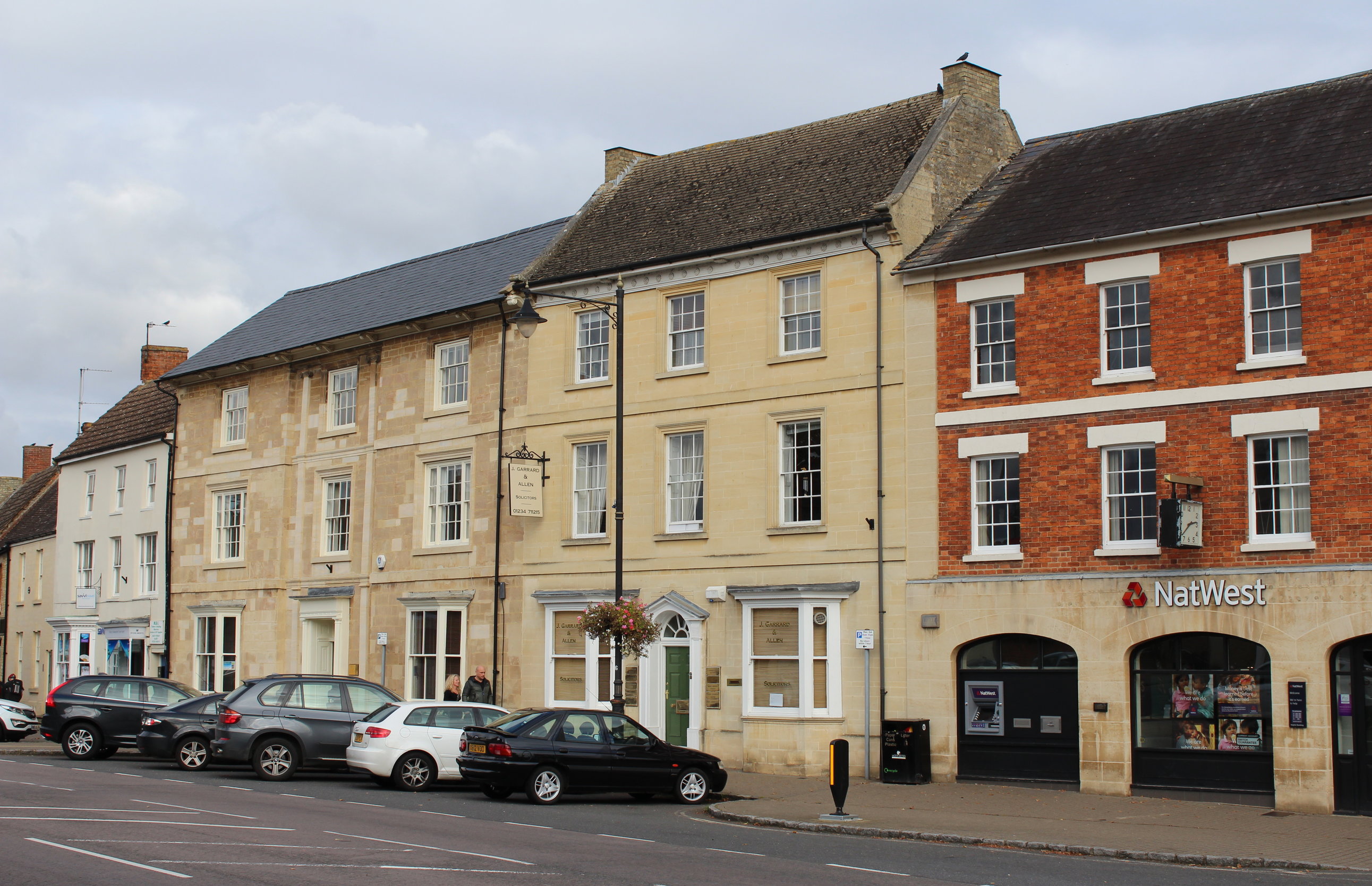
Olney is a historic market town located in Buckinghamshire, England. Situated on the River Great Ouse, the town has a population of around 6,000 residents. Olney is known for its picturesque setting, with charming Georgian architecture, cobbled streets, and green spaces.

The town has a rich history dating back to medieval times, with several historic buildings and landmarks such as the Olney Market Place, St Peter and St Paul's Church, and the Olney Bridge. Olney is also famous for its annual pancake race, which has been held since 1445 and attracts visitors from around the world.

In terms of amenities, Olney offers a range of shops, cafes, restaurants, and pubs, as well as schools, healthcare facilities, and recreational activities. The town has a strong sense of community, with various events and festivals held throughout the year.

Overall, Olney is a charming and vibrant town that offers a mix of history, culture, and natural beauty, making it a popular destination for tourists and residents alike.

If you have any feedback on the listing, please let us know in the comments section below.
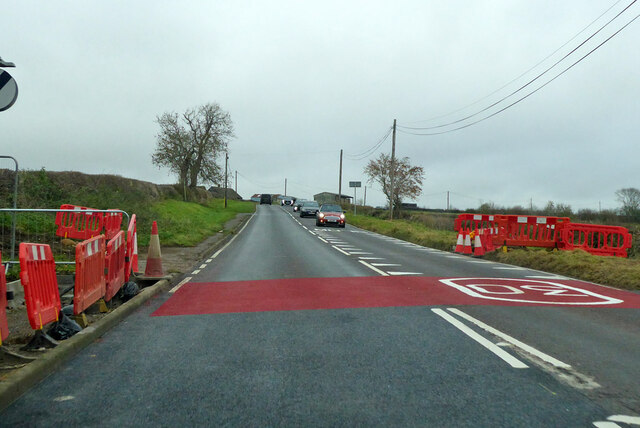
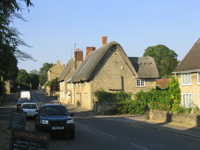
Olney Images

Images are sourced within 2km of 52.158022/-0.702176 or Grid Reference SP8851. Thanks to Geograph Open Source API. All images are credited.

A509 towards Wellingborough
A509 Warrington Road towards Wellingborough Leaving the Olney 30 limit. On the left is the corner of greenfield land being developed for mixed commercial purposes.
A509 Warrington Road towards Wellingborough
Leaving the Olney 30 limit. On the left is the corner of greenfield land being developed for mixed commercial purposes.
A509 Wellingborough Road, Olney Heading north out of town.
A509 Wellingborough Road, Olney
Heading north out of town.
A509 at start of Ouse bridging into Olney There is a lengthy bridging of flood channels, the main river and a mill stream before reaching the town.
A509 at start of Ouse bridging into Olney
There is a lengthy bridging of flood channels, the main river and a mill stream before reaching the town.
Shops, High Street South, Olney The town was extraordinarily busy on this first Sunday in December. There is a farmer's market on the first Sunday of every month, there may have been something special about this last one before Christmas.
Shops, High Street South, Olney
The town was extraordinarily busy on this first Sunday in December. There is a farmer's market on the first Sunday of every month, there may have been something special about this last one before Christmas.
Savvi Travel,  High Street, Olney
Savvi Travel, High Street, Olney
The Swan Inn and Bistro, Olney
The Church of St Peter and St Paul, Olney
Yardley Road at the end of Winterbottom Way The estate on the left was a field until fairly recently.
Yardley Road at the end of Winterbottom Way
The estate on the left was a field until fairly recently.
Industrial unit on Yardley Road, Olney
The entrance to Olney Green Burial Park
Yardley Road north of Olney
Flats on Yardley Road, Olney
Yardley Road north of Olney
Field by Yardley Road
Farm track off Olney Road
House on Swallow Close, Olney At the corner of Yardley Road.
House on Swallow Close, Olney
At the corner of Yardley Road.
Moores Hill, Olney
Moores Hill, Olney
Show me another place!

Olney is located at Grid Ref: SP8851 (Lat: 52.158022, Lng: -0.702176)

Unitary Authority: Milton Keynes

Police Authority: Thames Valley

What 3 Words

///alas.dumplings.disposal. Near Olney, Buckinghamshire

Nearby Locations

Olney

Related Wikis

Olney Town F.C.

Olney Town Football Club was a football club based in Olney, Buckinghamshire, England. == History == They were established in 1903 and were founder members...

Olney railway station (England)

Olney was a railway station on the former Bedford to Northampton Line and Stratford-upon-Avon and Midland Junction Railway which served the town of Olney...

Olney, Buckinghamshire

Olney (, rarely OW-nee, rarely OLL-nee) is a market town and civil parish in the unitary authority area of the City of Milton Keynes, Buckinghamshire...

Weston Underwood, Buckinghamshire

Weston Underwood is a village and civil parish in the unitary authority area of the City of Milton Keynes, Buckinghamshire, England. It is located about...

Nearby Amenities

Located within 500m of 52.158022,-0.702176
Olney
Name Ru: Олни
Place: town
Lat/Long: 52.1539597/-0.7017409
Crossing
Crossing: zebra
Kerb: lowered
Tactile Paving: yes
Lat/Long: 52.1621697/-0.7004935
Restaurant
Maya
Addr City: Olney
Addr Country: GB
Addr Postcode: MK46 5DX
Addr Street: Yardley Road
Fhrs Authority: Milton Keynes
Fhrs Id: 115229
Fhrs Local Authority Id: 44380
Lat/Long: 52.1584642/-0.702574
Crossing
Lat/Long: 52.1561715/-0.7062768
Turning Circle
Turning Circle: knuckle
Lat/Long: 52.1570945/-0.7086006
Turning Circle
Turning Circle: square
Lat/Long: 52.1570679/-0.7077415
Turning Circle
Turning Circle: knuckle
Lat/Long: 52.1587234/-0.7081879
Turning Circle
Turning Circle: oval
Lat/Long: 52.1593772/-0.7059676
Turning Circle
Turning Circle: knuckle
Lat/Long: 52.1620423/-0.7039534
Turning Circle
Turning Circle: knuckle
Lat/Long: 52.1621698/-0.7048119
Turning Circle
Turning Circle: knuckle
Lat/Long: 52.1604379/-0.7029623
Turning Circle
Lat/Long: 52.1583136/-0.6956538
Turning Circle
Turning Circle: knuckle
Lat/Long: 52.1574946/-0.6979883
Turning Circle
Turning Circle: knuckle
Lat/Long: 52.1578203/-0.6967378
Turning Circle
Turning Circle: knuckle
Lat/Long: 52.1584732/-0.6982541
Turning Circle
Lat/Long: 52.1582089/-0.6992964
Turning Circle
Turning Circle: square
Lat/Long: 52.155859/-0.7069677
Turning Circle
Turning Circle: knuckle
Lat/Long: 52.1619079/-0.7031299
Turning Circle
Turning Circle: knuckle
Lat/Long: 52.1611957/-0.7026778
Library
Olney Library
Email: Olney.Library@milton-keynes.gov.uk
Fax: +44 1234 711474
Opening Hours: Tu 14:00-19:30; Th 10:00-13:00,14:00-17:00; Fr 14:00-19:30; Sa 10:00-13:00
Operator: Milton Keynes County
Phone: +44 1234 711474
Wikidata: Q55183713
Lat/Long: 52.1572187/-0.7023216
Bus Stop
High Street
Bus: yes
Naptan AtcoCode: 049002569711
Naptan Bearing: S
Naptan CommonName: High Street
Naptan Indicator: o/s 56
Naptan Landmark: N
Naptan NaptanCode: mltawja
Naptan Street: High Street
Naptan Verified: no
Public Transport: platform
Source: naptan_import
Lat/Long: 52.1556321/-0.7013759
Bus Stop
Holes Lane
Bus: yes
Naptan AtcoCode: 049002579062
Naptan Bearing: N
Naptan CommonName: Holes Lane
Naptan Indicator: opp
Naptan Landmark: Holes Lane
Naptan NaptanCode: mltagagj
Naptan Street: High Street
Naptan Verified: no
Public Transport: platform
Source: naptan_import
Lat/Long: 52.1577892/-0.7020842
Bus Stop
Olney School
Bus: yes
Naptan AtcoCode: 049002579231
Naptan Bearing: NW
Naptan CommonName: Olney School
Naptan Indicator: o/s
Naptan Landmark: Olney County Middle School
Naptan NaptanCode: mltawjd
Naptan Street: Yardley Road
Naptan Verified: no
Public Transport: platform
Source: naptan_import
Lat/Long: 52.160861/-0.7053887
Bus Stop
Dartmouth Road
Bus: yes
Naptan AtcoCode: 049002579241
Naptan Bearing: N
Naptan CommonName: Dartmouth Road
Naptan Indicator: opp 38
Naptan Landmark: N
Naptan NaptanCode: mltawjg
Naptan Street: Dartmouth Road
Public Transport: platform
Shelter: yes
Lat/Long: 52.159324/-0.7025644
Bus Stop
Holes Lane
Bus: yes
Naptan AtcoCode: 049002579721
Naptan Bearing: S
Naptan CommonName: Holes Lane
Naptan Indicator: o/s
Naptan Landmark: Holes Lane
Naptan NaptanCode: mltawjt
Naptan Street: High Street
Naptan Verified: no
Public Transport: platform
Source: naptan_import
Lat/Long: 52.157925/-0.7019543
Bus Stop
Olney School
Bus: yes
Naptan AtcoCode: 049002579731
Naptan Bearing: SE
Naptan CommonName: Olney School
Naptan Indicator: opp
Naptan Landmark: Olney County Middle School
Naptan NaptanCode: mltawjw
Naptan Street: Yardley Road
Naptan Verified: no
Public Transport: platform
Shelter: no
Source: naptan_import
Lat/Long: 52.1604519/-0.7046858
Bus Stop
Dartmouth Road
Bus: yes
Naptan AtcoCode: 049002579741
Naptan Bearing: S
Naptan CommonName: Dartmouth Road
Naptan Indicator: o/s Kensington Place
Naptan Landmark: N
Naptan NaptanCode: mltawma
Naptan Street: Wellingborough Road
Naptan Verified: no
Public Transport: platform
Source: naptan_import
Lat/Long: 52.1600461/-0.7021246
Turning Circle
Turning Circle: square
Lat/Long: 52.1587563/-0.7061905
Turning Circle
Turning Circle: hammer
Lat/Long: 52.1587532/-0.7072092
Crossing
Crossing: uncontrolled
Crossing Ref: zebra
Kerb: flush
Tactile Paving: yes
Lat/Long: 52.1570489/-0.7016035
Traffic Signals
Crossing: traffic_signals
Crossing Ref: pelican
Kerb: lowered
Tactile Paving: yes
Lat/Long: 52.1598596/-0.7023177
Turning Circle
Turning Circle: knuckle
Lat/Long: 52.1558615/-0.707938
Crossing
Crossing: unmarked
Crossing Island: yes
Crossing Markings: no
Supervised: no
Lat/Long: 52.1536722/-0.7018525
Turning Circle
Turning Circle: square
Lat/Long: 52.1577184/-0.7080643
Turning Circle
Turning Circle: knuckle
Lat/Long: 52.1577863/-0.7065782
Barrier: bollard
Lat/Long: 52.1561902/-0.7063626
Bicycle Parking
Bicycle Parking: stands
Capacity: 8
Covered: no
Shelter: no
Lat/Long: 52.1536651/-0.7019341
Closed Amenity: police
Lat/Long: 52.1537038/-0.702136
Olney Colts Football Club
Building: yes
Lat/Long: 52.1557774/-0.6978169
One Stop
Addr City: Olney
Addr Country: GB
Addr Housenumber: 99
Addr Postcode: MK46 4EF
Addr Street: High Street
Brand: One Stop
Brand Wikidata: Q65954217
Contact Website: https://www.onestop.co.uk/store/?store=9f7eaa65-f38f-43db-8188-931ee2d563e7
Fhrs Authority: Milton Keynes
Fhrs Id: 199176
Fhrs Local Authority Id: 68473
Shop: convenience
Lat/Long: 52.1568838/-0.701796
Kindergarten
Olney Pre-School
Addr City: Olney
Addr Country: GB
Addr Postcode: MK46 4EF
Addr Street: High Street
Fhrs Authority: Milton Keynes
Fhrs Id: 114803
Fhrs Local Authority Id: 43961
Lat/Long: 52.1570524/-0.7024758
Bank
Nationwide
Atm: yes
Brand: Nationwide
Brand Wikidata: Q846735
Brand Wikipedia: en:Nationwide Building Society
Contact Website: https://locations.nationwidebranches.co.uk/olney/14-high-street
Lat/Long: 52.1539423/-0.70157
Atm
Nationwide
Brand: Nationwide
Brand Wikidata: Q846735
Brand Wikipedia: en:Nationwide Building Society
Operator: Nationwide
Operator Wikidata: Q846735
Lat/Long: 52.1539747/-0.7016416
Atm
Operator: Link
Lat/Long: 52.1568569/-0.7020447
Post Box
Brand: Royal Mail
Brand Wikidata: Q638098
Brand Wikipedia: en:Royal Mail
Collection Times: Mo-Fr 17:00; Sa 10:00
Operator: Royal Mail
Operator Wikidata: Q638098
Post Box Type: lamp
Ref: MK46 405
Royal Cypher: EIIR
Royal Cypher Wikidata: Q33102113
Source: survey
Survey Date: 2015-10-17
Lat/Long: 52.1562067/-0.7063946
Post Box
Brand: Royal Mail
Brand Wikidata: Q638098
Brand Wikipedia: en:Royal Mail
Collection Times: Mo-Fr 17:00; Sa 10:30
Operator: Royal Mail
Operator Wikidata: Q638098
Post Box Type: wall
Ref: MK46 30
Royal Cypher: GR
Royal Cypher Wikidata: Q33102273
Source: survey
Survey Date: 2015-10-17
Lat/Long: 52.157303/-0.7031546
Post Box
Brand: Royal Mail
Brand Wikidata: Q638098
Brand Wikipedia: en:Royal Mail
Collection Times: Mo-Fr 17:00; Sa 09:15
Operator: Royal Mail
Operator Wikidata: Q638098
Post Box Type: pillar
Ref: MK46 401
Royal Cypher: EIIR
Royal Cypher Wikidata: Q33102113
Source: survey
Survey Date: 2015-10-17
Lat/Long: 52.1579934/-0.701981
Post Box
Brand: Royal Mail
Brand Wikidata: Q638098
Brand Wikipedia: en:Royal Mail
Collection Times: Mo-Fr 16:45; Sa 09:30
Operator: Royal Mail
Operator Wikidata: Q638098
Post Box Type: pillar
Ref: MK46 29
Royal Cypher: EIIR
Royal Cypher Wikidata: Q33102113
Source: survey
Survey Date: 2015-10-17
Lat/Long: 52.1607537/-0.7053689
Fast Food
Enzo's Fish Bar
Addr City: Olney
Addr Country: GB
Addr Housenumber: 12
Addr Postcode: MK46 4BB
Addr Street: High Street
Cuisine: fish_and_chips
Delivery: no
Drive Through: no
Fhrs Authority: Milton Keynes
Fhrs Id: 131883
Fhrs Local Authority Id: 63484
Outdoor Seating: no
Smoking: no
Takeaway: yes
Lat/Long: 52.1538839/-0.7016243
The Deli At Harvest
Addr City: Olney
Addr Country: GB
Addr Housenumber: 5
Addr Postcode: MK46 4DG
Addr Street: Fountain Court
Cuisine: coffee_shop
Fhrs Authority: Milton Keynes
Fhrs Id: 138289
Fhrs Local Authority Id: 73575
Operator: Harvest
Shop: deli
Lat/Long: 52.1541004/-0.7010547
Cafe
Sandwich Land
Addr City: Olney
Addr Country: GB
Addr Housenumber: 84-87
Addr Postcode: MK46 4EF
Addr Street: High Street
Cuisine: sandwich
Fhrs Authority: Milton Keynes
Fhrs Id: 114861
Fhrs Local Authority Id: 44006
Internet Access: no
Lat/Long: 52.1566247/-0.7017517
Stephen Oakley & Co
Addr City: Olney
Addr Housenumber: 35
Addr Postcode: MK46 4EB
Addr Street: High Street
Office: estate_agent
Lat/Long: 52.1548409/-0.7018656
Fast Food
Pizzamax
Addr City: Olney
Addr Country: GB
Addr Housenumber: 16-18
Addr Postcode: MK46 4BB
Addr Street: High Street
Cuisine: pizza
Fhrs Authority: Milton Keynes
Fhrs Id: 131737
Fhrs Local Authority Id: 63273
Lat/Long: 52.154019/-0.7011983
Fast Food
Jasmine Cottage
Addr City: Olney
Addr Country: GB
Addr Postcode: MK46 4BB
Addr Street: High Street
Addr Unit: Unit 3 Fountain Court
Cuisine: chinese
Lat/Long: 52.1540848/-0.7011956
Dentist
Moodley Dental Practice
Healthcare: dentist
Lat/Long: 52.1537795/-0.7020199
The Nest at No 9
Shop: houseware
Lat/Long: 52.1538618/-0.7020045
Boo Gallery
Addr City: Olney
Addr Housenumber: 100a
Addr Postcode: MK46 4BE
Addr Street: High Street
Contact Phone: +44 1234 717020
Shop: jewelry
Lat/Long: 52.1568905/-0.701335
Restaurant
4 Pillars
Addr City: Olney
Addr Country: GB
Addr Housenumber: 60
Addr Postcode: MK46 4BE
Addr Street: High Street
Alt Name: The Four Pillars Tandoori
Cuisine: indian
Fhrs Id: 129080
Fhrs Local Authority Id: 59483
Lat/Long: 52.1558355/-0.7012721
Davis Optician
Shop: optician
Lat/Long: 52.1557424/-0.7012892
JS Designs
Shop: kitchen
Lat/Long: 52.1558917/-0.7012601
Restaurant
Jade Garden
Addr City: Olney
Addr Country: GB
Addr Housenumber: 48-50
Addr Postcode: MK46 4BE
Addr Street: High Street
Cuisine: chinese
Fhrs Authority: Milton Keynes
Fhrs Id: 93269
Fhrs Local Authority Id: 2672
Lat/Long: 52.1555236/-0.7013163
Salon at 46
Shop: hairdresser
Lat/Long: 52.1554774/-0.7013245
Restaurant
Old Shanghai
Addr City: Olney
Addr Country: GB
Addr Housenumber: 17a
Addr Postcode: MK46 4EB
Addr Street: High Street
Cuisine: chinese
Fhrs Authority: Milton Keynes
Fhrs Id: 132609
Fhrs Local Authority Id: 64661
Lat/Long: 52.1543019/-0.7019595
Mercy In Action
Shop: charity
Lat/Long: 52.1543571/-0.7019434
Barrier: bollard
Lat/Long: 52.1541546/-0.7000216
The Hair Rooms of Olney
Addr City: Olney
Addr Housenumber: 4
Addr Postcode: MK46 4BH
Addr Street: Dartmouth Road
Phone: +44 1234 711412
Shop: hairdresser
Website: https://www.facebook.com/thehairroomsolney/
Lat/Long: 52.1581812/-0.702055
Traffic Calming: bump
Lat/Long: 52.1564096/-0.7003615
Light Source: floodlight
Man Made: mast
Tower Type: lighting
Lat/Long: 52.1559848/-0.6982383
Light Source: floodlight
Man Made: mast
Tower Type: lighting
Lat/Long: 52.1558969/-0.6998625
Light Source: floodlight
Man Made: mast
Tower Type: lighting
Lat/Long: 52.1554098/-0.6981242
Light Source: floodlight
Man Made: mast
Tower Type: lighting
Lat/Long: 52.1553212/-0.6997522
Light Source: floodlight
Man Made: mast
Tower Type: lighting
Lat/Long: 52.155963/-0.6991228
Light Source: floodlight
Man Made: mast
Tower Type: lighting
Lat/Long: 52.1553369/-0.698927
Thomson & Lamb Hairdressing
Shop: hairdresser
Lat/Long: 52.1558175/-0.7016712
Peter Hatter
Addr City: Olney
Addr Housenumber: 43
Addr Postcode: MK46 4EB
Addr Street: High Street
Shop: hairdresser
Lat/Long: 52.1551601/-0.7017664
The Laundry Basket
Shop: laundry
Lat/Long: 52.1594837/-0.7019798
Dentist
Cobbs Garden Dental Practice
Addr City: Olney
Addr Housenumber: 5
Addr Postcode: MK46 5QE
Addr Street: Cobbs Garden
Healthcare: dentist
Lat/Long: 52.1567302/-0.7028777
Olney
Historic Railway: station
Railway: site
Wikidata: Q7088463
Wikipedia: en:Olney railway station (England)
Lat/Long: 52.1593644/-0.6973564
Bus Stop
Lavendon Road
Bus: yes
Naptan AtcoCode: 049000009212
Naptan Bearing: E
Naptan Indicator: opp
Naptan Landmark: Sainsbury
Naptan NaptanCode: mltagwap
Operator: Redline
Public Transport: platform
Shelter: yes
Lat/Long: 52.1620449/-0.7000476
Bus Stop
Lavendon Road
Bus: yes
Naptan AtcoCode: 049000009222
Naptan Bearing: W
Naptan Indicator: adj
Naptan Landmark: Sainsburys
Naptan NaptanCode: mltagwat
Operator: Redline
Public Transport: platform
Shelter: yes
Lat/Long: 52.1620987/-0.6998657
Crossing
Lat/Long: 52.161982/-0.7010669
Crossing
Lat/Long: 52.1619924/-0.701191
Parking Space
Capacity: 1
Lat/Long: 52.1616627/-0.6988541
Charging Station
Access: yes
Brand: BP Pulse
Brand Wikidata: Q39057719
Capacity: 1
Operator: BP Pulse
Operator Wikidata: Q39057719
Lat/Long: 52.1595003/-0.7022745
Crossing
Lat/Long: 52.1617322/-0.698545
Parking Space
Capacity: 1
Lat/Long: 52.1617318/-0.6992017
Parking Space
Capacity: 2
Lat/Long: 52.1617979/-0.6995015
Addr City: Olney
Addr Housenumber: 7
Addr Postcode: MK46 5HL
Addr Street: Long Lane
Ref GB Uprn: 25077431
Lat/Long: 52.1558056/-0.7048282
Surface: paving_stones
Traffic Calming: island
Lat/Long: 52.1619896/-0.7011132
Atm
Operator: Sainsbury‘s Bank
Lat/Long: 52.1623061/-0.7001586
Charging Station
Access: yes
Capacity: 1
Operator: Connected Kerb
Operator Wikidata: Q113579669
Lat/Long: 52.1583648/-0.7025188
Charging Station
Access: yes
Capacity: 2
Operator: Connected Kerb
Operator Wikidata: Q113579669
Lat/Long: 52.1583174/-0.7024971
Charging Station
Access: yes
Capacity: 2
Operator: Connected Kerb
Operator Wikidata: Q113579669
Lat/Long: 52.1582842/-0.7024812
Charging Station
Access: yes
Capacity: 2
Operator: Connected Kerb
Operator Wikidata: Q113579669
Lat/Long: 52.1582455/-0.7024638
Addr City: Olney
Addr Housenumber: 2
Addr Postcode: MK46 4BB
Addr Street: Fountain Court
Note: Amazing Grains has announced they will not be reopening
Shop: vacant
Lat/Long: 52.1540115/-0.7007899
Charging Station
Access: yes
Capacity: 2
Operator: Connected Kerb
Operator Wikidata: Q113579669
Lat/Long: 52.1555283/-0.701458
Charging Station
Access: yes
Capacity: 2
Operator: Connected Kerb
Operator Wikidata: Q113579669
Lat/Long: 52.1554945/-0.7014647
Generator Method: photovoltaic
Generator Output Electricity: small_installation
Generator Source: solar
Generator Type: solar_photovoltaic_panel
Location: roof
Power: generator
Lat/Long: 52.1621135/-0.6993568
Generator Method: photovoltaic
Generator Output Electricity: small_installation
Generator Source: solar
Generator Type: solar_photovoltaic_panel
Location: roof
Power: generator
Lat/Long: 52.1620805/-0.6992549
Grit Bin
Lat/Long: 52.1621015/-0.7023629
Defibrillator
Access: yes
Defibrillator Location: Outside the toilets at Olney Recreation Ground.
Emergency: defibrillator
Indoor: no
Operator: Olney Town Council
Ref GB The Circuit: A19B8EF9-4353-4BA5-8A8C-AD9C00C6F389
Lat/Long: 52.1553936/-0.6972497
Defibrillator
Emergency: defibrillator
Indoor: no
Ref GB The Circuit: D7F86879-6819-4B71-A70E-AD9C00C448D1
Lat/Long: 52.1571818/-0.7022969
Direction: 175
Generator Method: photovoltaic
Generator Output Electricity: yes
Generator Solar Modules: 16
Generator Source: solar
Generator Type: solar_photovoltaic_panel
Location: roof
Power: generator
Lat/Long: 52.1565984/-0.701977
Scott Brown
Addr City: Olney
Addr Housenumber: 8
Addr Postcode: MK46 4DG
Addr Street: Fountain Court
Currency GBP: yes
Phone: +44 1234 711108
Shop: hairdresser
Unisex: yes
Lat/Long: 52.1541102/-0.7009054
Direction: 270
Generator Method: photovoltaic
Generator Output Electricity: yes
Generator Solar Modules: 8
Generator Source: solar
Generator Type: solar_photovoltaic_panel
Location: roof
Power: generator
Lat/Long: 52.1570138/-0.7088139
Direction: 90
Fixme: survey for panel count
Generator Method: photovoltaic
Generator Output Electricity: yes
Generator Solar Modules: 7
Generator Source: solar
Generator Type: solar_photovoltaic_panel
Location: roof
Power: generator
Lat/Long: 52.1570114/-0.708767
Direction: 180
Fixme: survey for panel count
Generator Method: photovoltaic
Generator Output Electricity: yes
Generator Solar Modules: 14
Generator Source: solar
Generator Type: solar_photovoltaic_panel
Location: roof
Power: generator
Lat/Long: 52.1563811/-0.7084357
Turning Circle
Turning Circle: knuckle
Lat/Long: 52.1568449/-0.7059028
Direction: 185
Fixme: survey for panel count
Generator Method: photovoltaic
Generator Output Electricity: yes
Generator Solar Modules: 8
Generator Source: solar
Generator Type: solar_photovoltaic_panel
Location: roof
Power: generator
Lat/Long: 52.1566827/-0.7055772
Direction: 270
Fixme: survey for panel count
Generator Method: photovoltaic
Generator Output Electricity: yes
Generator Solar Modules: 6
Generator Source: solar
Generator Type: solar_photovoltaic_panel
Location: roof
Power: generator
Lat/Long: 52.1559445/-0.7072493
Direction: 90
Fixme: survey for panel count
Generator Method: photovoltaic
Generator Output Electricity: yes
Generator Solar Modules: 6
Generator Source: solar
Generator Type: solar_photovoltaic_panel
Location: roof
Power: generator
Lat/Long: 52.1559458/-0.7071823
Direction: 180
Generator Method: photovoltaic
Generator Output Electricity: yes
Generator Solar Modules: 10
Generator Source: solar
Generator Type: solar_photovoltaic_panel
Location: roof
Power: generator
Lat/Long: 52.1557418/-0.7066386
Turning Circle
Turning Circle: knuckle
Lat/Long: 52.1553464/-0.7079043
Turning Circle
Turning Circle: knuckle
Lat/Long: 52.1577243/-0.7086003
Turning Circle
Turning Circle: knuckle
Lat/Long: 52.1586939/-0.7092134
Direction: 190
Generator Method: photovoltaic
Generator Output Electricity: yes
Generator Solar Modules: 12
Generator Source: solar
Generator Type: solar_photovoltaic_panel
Location: roof
Power: generator
Lat/Long: 52.158776/-0.708919
Direction: 195
Fixme: survey for panel count
Generator Method: photovoltaic
Generator Output Electricity: yes
Generator Solar Modules: 14
Generator Source: solar
Generator Type: solar_photovoltaic_panel
Location: roof
Power: generator
Lat/Long: 52.1601485/-0.7079449
Direction: 105
Generator Method: photovoltaic
Generator Output Electricity: yes
Generator Solar Modules: 16
Generator Source: solar
Generator Type: solar_photovoltaic_panel
Location: roof
Power: generator
Lat/Long: 52.1590557/-0.7073305
Direction: 195
Fixme: survey for panel count
Generator Method: photovoltaic
Generator Output Electricity: yes
Generator Solar Modules: 14
Generator Source: solar
Generator Type: solar_photovoltaic_panel
Location: roof
Power: generator
Lat/Long: 52.1589322/-0.7067459
Turning Circle
Turning Circle: knuckle
Lat/Long: 52.154613/-0.7067672
Direction: 180
Generator Method: photovoltaic
Generator Output Electricity: yes
Generator Solar Modules: 8
Generator Source: solar
Generator Type: solar_photovoltaic_panel
Location: roof
Power: generator
Lat/Long: 52.1552448/-0.706416
Direction: 180
Generator Method: photovoltaic
Generator Output Electricity: yes
Generator Solar Modules: 18
Generator Source: solar
Generator Type: solar_photovoltaic_panel
Location: roof
Power: generator
Lat/Long: 52.155221/-0.705716
Direction: 180
Fixme: survey for panel count
Generator Method: photovoltaic
Generator Output Electricity: yes
Generator Solar Modules: 18
Generator Source: solar
Generator Type: solar_photovoltaic_panel
Location: roof
Power: generator
Lat/Long: 52.1555042/-0.7058611
Direction: 180
Generator Method: photovoltaic
Generator Output Electricity: yes
Generator Solar Modules: 14
Generator Source: solar
Generator Type: solar_photovoltaic_panel
Location: roof
Power: generator
Lat/Long: 52.1554964/-0.705557
Direction: 180
Generator Method: photovoltaic
Generator Output Electricity: yes
Generator Solar Modules: 10
Generator Source: solar
Generator Type: solar_photovoltaic_panel
Location: roof
Power: generator
Lat/Long: 52.1554935/-0.7050961
Turning Circle
Turning Circle: knuckle
Lat/Long: 52.1550977/-0.7047396
Direction: 180
Generator Method: photovoltaic
Generator Output Electricity: yes
Generator Solar Modules: 15
Generator Source: solar
Generator Type: solar_photovoltaic_panel
Location: roof
Power: generator
Lat/Long: 52.1542381/-0.7042422
Generator Source: solar
Power: generator
Lat/Long: 52.1550902/-0.7019636
Turning Circle
Turning Circle: knuckle
Lat/Long: 52.1556174/-0.7025916
Fixme: solar panels? Nope - velux type windows
Lat/Long: 52.1552704/-0.7028842
Turning Circle
Turning Circle: knuckle
Lat/Long: 52.156868/-0.7049483
Direction: 185
Generator Method: photovoltaic
Generator Output Electricity: yes
Generator Solar Modules: 6
Generator Source: solar
Generator Type: solar_photovoltaic_panel
Location: roof
Power: generator
Lat/Long: 52.1567557/-0.7025937
Direction: 180
Generator Method: photovoltaic
Generator Output Electricity: yes
Generator Solar Modules: 10
Generator Source: solar
Generator Type: solar_photovoltaic_panel
Location: roof
Power: generator
Lat/Long: 52.1583763/-0.7043548
Direction: 180
Generator Method: photovoltaic
Generator Output Electricity: yes
Generator Solar Modules: 15
Generator Source: solar
Generator Type: solar_photovoltaic_panel
Location: roof
Power: generator
Lat/Long: 52.1573298/-0.7057361
Direction: 180
Generator Method: photovoltaic
Generator Output Electricity: yes
Generator Solar Modules: 10
Generator Source: solar
Generator Type: solar_photovoltaic_panel
Location: roof
Power: generator
Lat/Long: 52.1573372/-0.7060178
Direction: 265
Generator Method: photovoltaic
Generator Output Electricity: yes
Generator Solar Modules: 10
Generator Source: solar
Generator Type: solar_photovoltaic_panel
Location: roof
Power: generator
Lat/Long: 52.1577379/-0.7063551
Direction: 180
Generator Method: photovoltaic
Generator Output Electricity: yes
Generator Solar Modules: 15
Generator Source: solar
Generator Type: solar_photovoltaic_panel
Location: roof
Power: generator
Lat/Long: 52.1580086/-0.7067768
Direction: 265
Generator Method: photovoltaic
Generator Output Electricity: yes
Generator Solar Modules: 8
Generator Source: solar
Generator Type: solar_photovoltaic_panel
Location: roof
Power: generator
Lat/Long: 52.1586197/-0.7064663
Direction: 100
Generator Method: photovoltaic
Generator Output Electricity: yes
Generator Solar Modules: 6
Generator Source: solar
Generator Type: solar_photovoltaic_panel
Location: roof
Power: generator
Lat/Long: 52.1600898/-0.7058279
Crossing
Crossing: uncontrolled
Lat/Long: 52.161599/-0.7061098
Direction: 260
Generator Method: photovoltaic
Generator Output Electricity: yes
Generator Solar Modules: 14
Generator Source: solar
Generator Type: solar_photovoltaic_panel
Location: roof
Power: generator
Lat/Long: 52.1543332/-0.6998205
Direction: 185
Generator Method: photovoltaic
Generator Output Electricity: yes
Generator Solar Modules: 16
Generator Source: solar
Generator Type: solar_photovoltaic_panel
Location: roof
Power: generator
Lat/Long: 52.1561434/-0.7005648
Turning Circle
Turning Circle: square
Lat/Long: 52.1580829/-0.7001168
Direction: 180
Generator Method: photovoltaic
Generator Output Electricity: yes
Generator Solar Modules: 1214
Generator Source: solar
Generator Type: solar_photovoltaic_panel
Location: roof
Power: generator
Lat/Long: 52.1579903/-0.699624
Direction: 270
Fixme: survey for panel count
Generator Method: photovoltaic
Generator Output Electricity: yes
Generator Solar Modules: 8
Generator Source: solar
Generator Type: solar_photovoltaic_panel
Location: roof
Power: generator
Lat/Long: 52.1582019/-0.6995657
Direction: 90
Fixme: survey for panel count
Generator Method: photovoltaic
Generator Output Electricity: yes
Generator Solar Modules: 8
Generator Source: solar
Generator Type: solar_photovoltaic_panel
Location: roof
Power: generator
Lat/Long: 52.1582019/-0.6994866
Direction: 220
Generator Method: photovoltaic
Generator Output Electricity: yes
Generator Solar Modules: 11
Generator Source: solar
Generator Type: solar_photovoltaic_panel
Location: roof
Power: generator
Lat/Long: 52.1585744/-0.6989358
Fixme: solar panels?
Generator Source: solar
Power: generator
Lat/Long: 52.1586741/-0.7004951
Direction: 215
Generator Method: photovoltaic
Generator Output Electricity: yes
Generator Solar Modules: 10
Generator Source: solar
Generator Type: solar_photovoltaic_panel
Location: roof
Power: generator
Lat/Long: 52.1588864/-0.6993873
Direction: 180
Generator Method: photovoltaic
Generator Output Electricity: yes
Generator Solar Modules: 13
Generator Source: solar
Generator Type: solar_photovoltaic_panel
Location: roof
Power: generator
Lat/Long: 52.1590127/-0.6987283
Fixme: solar panels?
Lat/Long: 52.1608328/-0.7004189
Direction: 205
Generator Method: photovoltaic
Generator Output Electricity: yes
Generator Solar Modules: 20
Generator Source: solar
Generator Type: solar_photovoltaic_panel
Location: roof
Power: generator
Lat/Long: 52.1616671/-0.7028627
Turning Circle
Turning Circle: knuckle
Lat/Long: 52.1615406/-0.7034058
Turning Circle
Turning Circle: knuckle
Lat/Long: 52.1617477/-0.7055334
Better Vape Than Never
Shop: e-cigarette
Lat/Long: 52.1554127/-0.7013262
Crossing
Crossing: unmarked
Crossing Island: no
Crossing Markings: no
Tactile Paving: yes
Lat/Long: 52.1553267/-0.7015304
Direction: 270
Generator Method: photovoltaic
Generator Output Electricity: yes
Generator Source: solar
Generator Type: solar_photovoltaic_panel
Location: roof
Power: generator
Lat/Long: 52.156103/-0.7084334
Waste Basket
Waste: dog_excrement
Lat/Long: 52.1562211/-0.707039
Direction: 180
Generator Method: photovoltaic
Generator Output Electricity: yes
Generator Solar Modules: 15
Generator Source: solar
Generator Type: solar_photovoltaic_panel
Location: roof
Power: generator
Lat/Long: 52.1540798/-0.7032391
Direction: 180
Generator Method: photovoltaic
Generator Output Electricity: yes
Generator Solar Modules: 15
Generator Source: solar
Generator Type: solar_photovoltaic_panel
Location: roof
Power: generator
Lat/Long: 52.1543415/-0.7027361
Direction: 180
Generator Method: photovoltaic
Generator Output Electricity: yes
Generator Solar Modules: 8
Generator Source: solar
Generator Type: solar_photovoltaic_panel
Location: roof
Power: generator
Lat/Long: 52.1552457/-0.7069392
Charging Station
Access: yes
Capacity: 2
Operator: Connected Kerb
Operator Wikidata: Q113579669
Lat/Long: 52.1555672/-0.7014528
Grit Bin
Lat/Long: 52.1569186/-0.706692
Generator Method: photovoltaic
Generator Output Electricity: yes
Generator Source: solar
Generator Type: solar_photovoltaic_panel
Location: roof
Power: generator
Lat/Long: 52.1579247/-0.703738
Waste Basket
Waste: dog_excrement
Lat/Long: 52.155368/-0.6999596
Waste Basket
Waste: dog_excrement
Lat/Long: 52.1559028/-0.7000427
Waste Basket
Waste: dog_excrement
Lat/Long: 52.1620696/-0.7015777
Grit Bin
Lat/Long: 52.1577145/-0.7077743
Direction: 270
Fixme: survey for panel count
Generator Method: photovoltaic
Generator Output Electricity: yes
Generator Solar Modules: 8
Generator Source: solar
Generator Type: solar_photovoltaic_panel
Location: roof
Power: generator
Lat/Long: 52.1575981/-0.700345
Generator Source: solar
Power: generator
Lat/Long: 52.1585088/-0.7002377
Grit Bin
Lat/Long: 52.1565908/-0.7032905
ICE
Addr City: Olney
Addr Housenumber: 10
Addr Postcode: MK46 4DG
Addr Street: Fountain Court
Healthcare: physiotherapist
Operator: ICE Clinic
Lat/Long: 52.1541062/-0.7007785
Generator Source: solar
Power: generator
Lat/Long: 52.1576704/-0.6968594
Generator Source: solar
Power: generator
Lat/Long: 52.1576631/-0.696905
Barrier: bollard
Lat/Long: 52.1561327/-0.7063933
Bench
Lat/Long: 52.1554722/-0.699962
Waste Basket
Waste: dog_excrement
Lat/Long: 52.1562066/-0.7036122
Bench
Lat/Long: 52.160502/-0.7049836
Waste Basket
Waste: dog_excrement
Lat/Long: 52.1606404/-0.7051618
Waste Basket
Lat/Long: 52.1605221/-0.7050185
Waste Basket
Waste: dog_excrement
Lat/Long: 52.1536067/-0.7021588
Waste Basket
Waste: dog_excrement
Lat/Long: 52.1597743/-0.6991389
Waste Basket
Waste: dog_excrement
Lat/Long: 52.1560504/-0.697666
Waste Basket
Waste: dog_excrement
Lat/Long: 52.1555374/-0.6970461
Waste Basket
Waste: dog_excrement
Lat/Long: 52.1572369/-0.6978073
Waste Basket
Waste: dog_excrement
Lat/Long: 52.1579268/-0.7059077
The data included in this document is from www.openstreetmap.org. The data is made available under ODbL.

Have you been to Olney?

Leave your review of Olney below (or comments, questions and feedback).