Ollerton

Settlement in Cheshire

England

Ollerton

Booths Hall Roundabout Taken from Goughs lane where it joins the A537.The house on right is one of the lodges to Booths Hall
Booths Hall Roundabout Credit: Ian Warburton

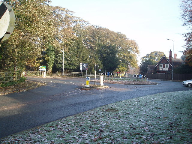
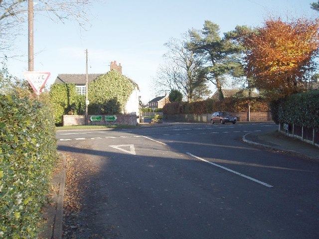
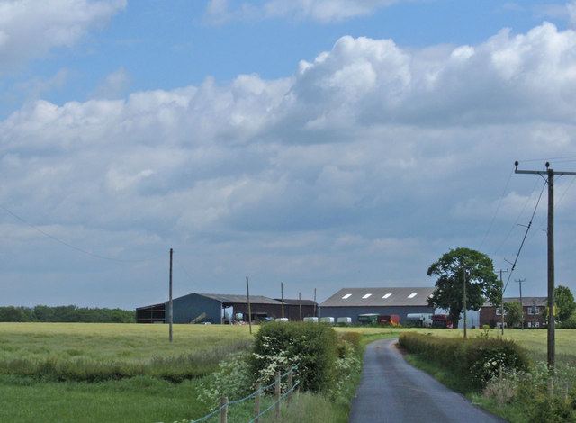
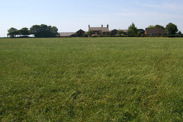
Ollerton is a small village located in the county of Cheshire, England. Situated in the picturesque area of the Cheshire Plain, the village lies approximately 5 miles east of the town of Knutsford and 8 miles west of the city of Macclesfield. Ollerton is part of the civil parish of Marthall, which also includes the nearby villages of Marthall and Bate Mill.

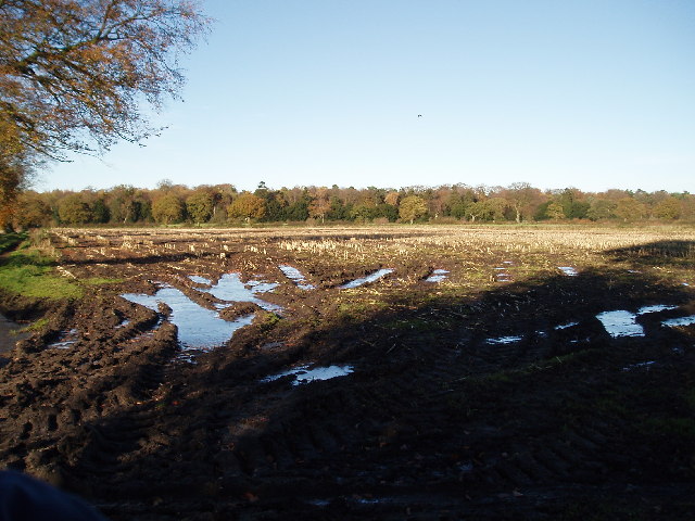
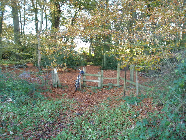
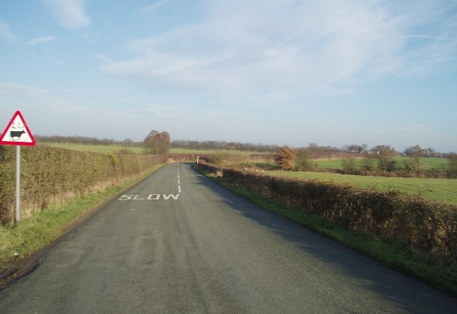
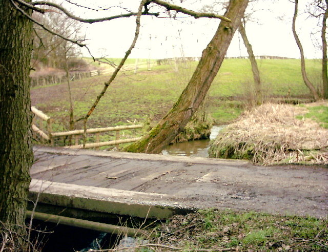
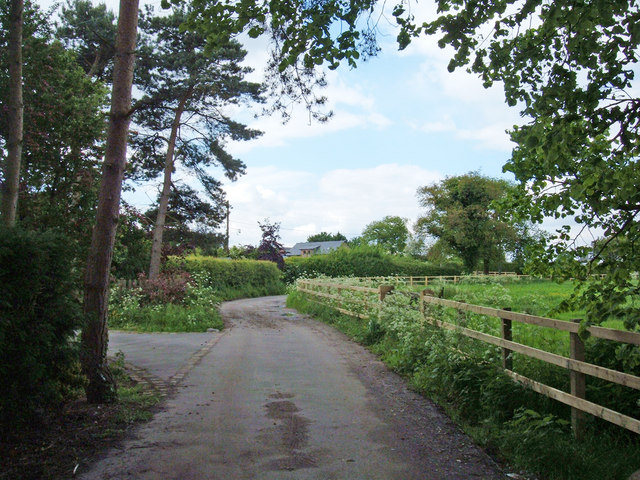
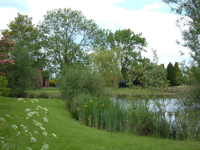
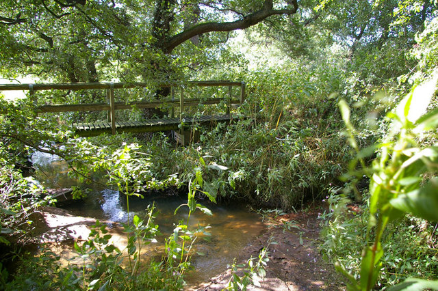
The village is known for its charming rural setting, surrounded by lush green fields and rolling countryside. It offers a peaceful and idyllic escape from the hustle and bustle of city life, making it a popular destination for nature lovers and those seeking a tranquil retreat.

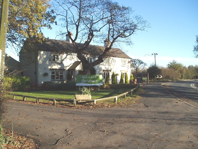
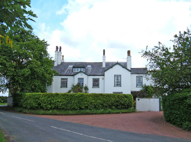
Ollerton is home to a close-knit community with a population of around 300 residents. The village features a range of housing, including traditional cottages, farmhouses, and modern homes. It also boasts a local pub, The Swan, which serves as a social hub for villagers and visitors alike.

The surrounding area provides ample opportunities for outdoor activities, including walking, cycling, and horse riding. Ollerton is in close proximity to several nature reserves and country parks, such as Tatton Park and Alderley Edge, where visitors can enjoy stunning scenery and wildlife.

Although small in size, Ollerton benefits from its strategic location, with easy access to major transportation routes. The village is conveniently located near the A537 road, providing a direct link to nearby towns and cities.

In conclusion, Ollerton is a charming village nestled in the heart of the Cheshire countryside, offering a peaceful and scenic retreat for residents and visitors alike.

If you have any feedback on the listing, please let us know in the comments section below.

Ollerton Images

Images are sourced within 2km of 53.288305/-2.3325819 or Grid Reference SJ7776. Thanks to Geograph Open Source API. All images are credited.

Booths Hall Roundabout Taken from Goughs lane where it joins the A537.The house on right is one of the lodges to Booths Hall
Booths Hall Roundabout
Taken from Goughs lane where it joins the A537.The house on right is one of the lodges to Booths Hall
Booths Mere In the Grounds of Booths Hall
Booths Mere
In the Grounds of Booths Hall
Windmill Wood Taken from the footpath between Goughs lane and Seven Sisters Lane looking N
Windmill Wood
Taken from the footpath between Goughs lane and Seven Sisters Lane looking N
Kerfield House On the A537 SW of Knutsford. A difficult one to pin point on the map,(is it top right of SJ7676 or top left of 7776 ??)
Kerfield House
On the A537 SW of Knutsford. A difficult one to pin point on the map,(is it top right of SJ7676 or top left of 7776 ??)
Moss Wood, Seven Sisters Lane (Looking S) The end of the Goughs lane to Seven Sisters lane footpath is about 50m from this stile.
Moss Wood, Seven Sisters Lane (Looking S)
The end of the Goughs lane to Seven Sisters lane footpath is about 50m from this stile.
The Crossroads at Ollerton Photo taken from Seven Sisters Lane, looking NW towards Marthall Lane. The Main road is Chelford road (A537)
The Crossroads at Ollerton
Photo taken from Seven Sisters Lane, looking NW towards Marthall Lane. The Main road is Chelford road (A537)
Dun Cow Inn, Ollerton On the A537 just 150 yds from Ollerton
Dun Cow Inn, Ollerton
On the A537 just 150 yds from Ollerton
Ollerton Grange About 1/2km west of Dun Cow Inn on A537
Ollerton Grange
About 1/2km west of Dun Cow Inn on A537
Booths Hall
Booths Hall
Marthall Lane  Looking NE The small bridge on the bend crosses Marthall Brook
Marthall Lane Looking NE
The small bridge on the bend crosses Marthall Brook
Boundary Bridge The bridge over Pedley Brook on Pavement Lane, Mobberley (top left background) leads to Springwood Farm, Marthall.
Boundary Bridge
The bridge over Pedley Brook on Pavement Lane, Mobberley (top left background) leads to Springwood Farm, Marthall.
Three Parishes Where Pedley Brook (right) joins Marthall Brook (left) to form Birkin Brook (top). Mobberley on the right, Marthall bottom middle, and Knutsford on the left.
Three Parishes
Where Pedley Brook (right) joins Marthall Brook (left) to form Birkin Brook (top). Mobberley on the right, Marthall bottom middle, and Knutsford on the left.
Ash Farm, near Knutsford Looking SE down the bridleway-cum-farm track. Photo taken from near the junction with Seven Sisters Lane.
Ash Farm, near Knutsford
Looking SE down the bridleway-cum-farm track. Photo taken from near the junction with Seven Sisters Lane.
Ollerton Hall, Knutsford An impressive house just south of the A537, Chelford Road. It is inscribed with the date 1728 and initials PTH.
Ollerton Hall, Knutsford
An impressive house just south of the A537, Chelford Road. It is inscribed with the date 1728 and initials PTH.
Bridleway near Knutsford At the end of Percival Lane this track leading to a farm is signposted as a bridleway (fairly new looking sign). However, on the map it is shown as a footpath.
Bridleway near Knutsford
At the end of Percival Lane this track leading to a farm is signposted as a bridleway (fairly new looking sign). However, on the map it is shown as a footpath.
Endfield House, Marthall View of part of the attractive private garden belonging to Endfield House. Looking north from a gap in the hawthorn hedge at the corner of Pinfold Lane and Kell Green Lane.
Endfield House, Marthall
View of part of the attractive private garden belonging to Endfield House. Looking north from a gap in the hawthorn hedge at the corner of Pinfold Lane and Kell Green Lane.
Boundary Bridge Footbridge over Pedley Brook. Mobberley Footpath No.20 to the right and Marthall Footpath No. ? to the left.
Boundary Bridge
Footbridge over Pedley Brook. Mobberley Footpath No.20 to the right and Marthall Footpath No. ? to the left.
Gleavehouse Farm
Gleavehouse Farm
Show me another place!

Ollerton is located at Grid Ref: SJ7776 (Lat: 53.288305, Lng: -2.3325819)

Unitary Authority: Cheshire East

Police Authority: Cheshire

What 3 Words

///chambers.heaven.pinging. Near Knutsford, Cheshire

Nearby Locations

Ollerton

Related Wikis

Ollerton, Cheshire

Ollerton is a village in the Borough of Cheshire East and the ceremonial county of Cheshire, England. It is approximately 2 miles (3.2 km) south east of...
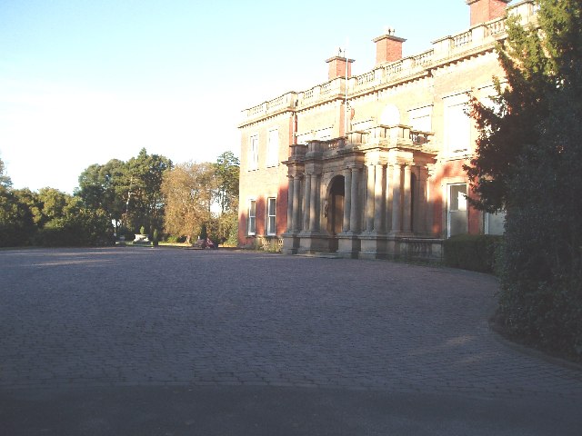
Ollerton Hall

Ollerton Hall is a country house in the village of Ollerton, Cheshire, England. Its nucleus dates from the 17th century, originally on an H-plan, followed...
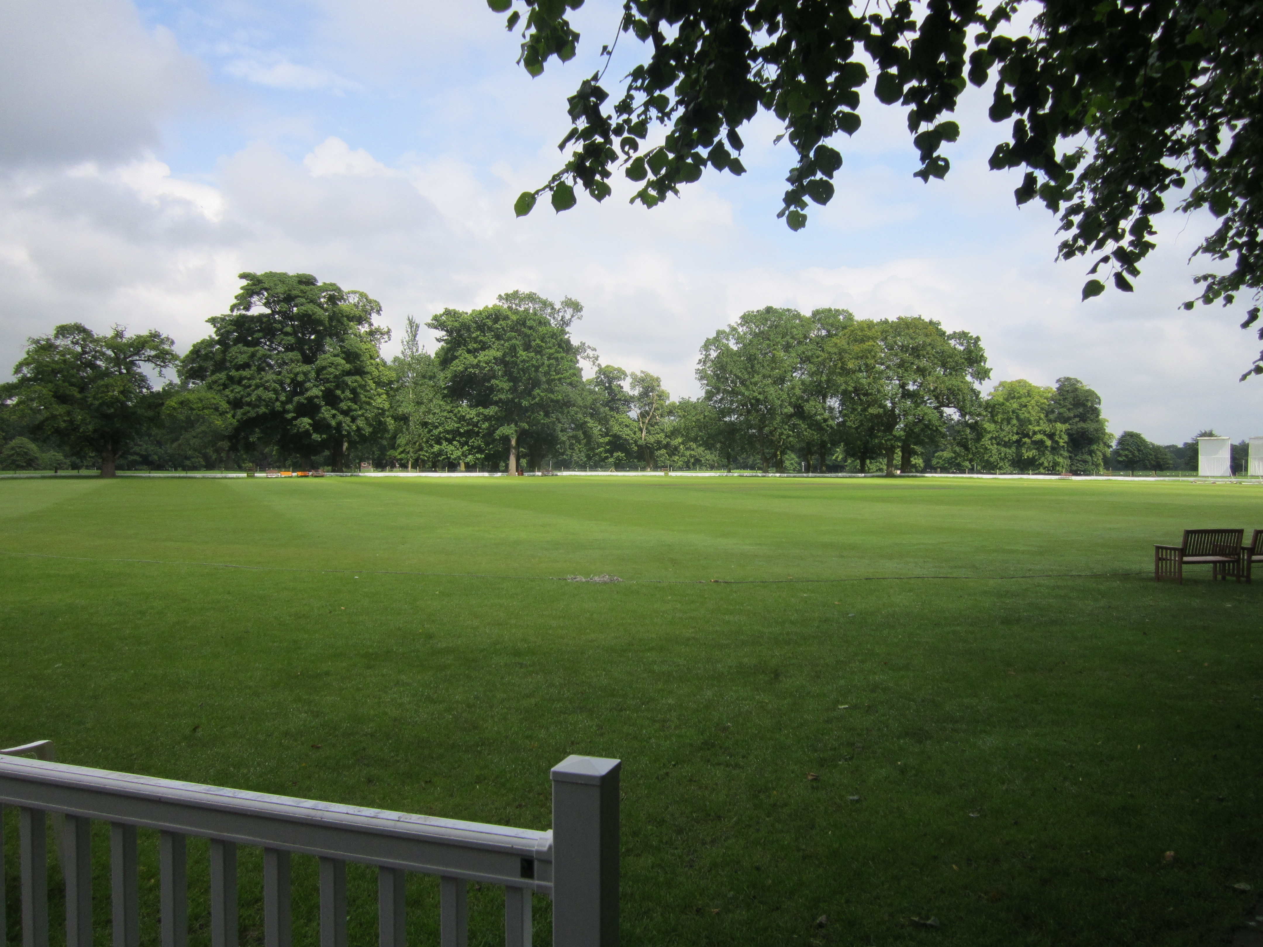
Booth Park

Booth Park is a cricket ground in Chelford Road, Toft, Cheshire. The ground lies within the grounds of Booths Park, which surrounds the east and south...

St John the Evangelist's Church, Toft

St John the Evangelist's Church is in Toft Road, Toft, Cheshire, England. It is an active Anglican parish church in the deanery of Knutsford, the archdeaconry...

Nearby Amenities

Located within 500m of 53.288305,-2.3325819
Turning Circle
Lat/Long: 53.2871387/-2.3346736
Turning Circle
Lat/Long: 53.2874774/-2.3338324
Turning Circle
Lat/Long: 53.2878519/-2.3331458
Ollerton
Is In: Cheshire, England, United Kingdom
Place: village
Lat/Long: 53.2869794/-2.3349966
Bus Stop
Ollerton, Chelford Road / Seven Sisters Lane
Bus: yes
Naptan AtcoCode: 0600MA0238
Naptan Bearing: NW
Naptan CommonName: Seven Sisters Lane
Naptan Crossing: Seven Sisters Lane
Naptan Indicator: cnr
Naptan Landmark: Old Post Office
Naptan LocalityName: Ollerton
Naptan NaptanCode: cheawad
Naptan ShortCommonName: Seven Sisters Lane
Naptan Street: Chelford Road
Naptan Verified: no
Network: Cheshire East Council
Operator: Ansa Transport
Public Transport: platform
Source: naptan_import
Lat/Long: 53.2873206/-2.3368236
Bus Stop
Ollerton, Marthall Lane / Beech Close
Bus: yes
Naptan AtcoCode: 0600MA17251
Naptan Bearing: NE
Naptan BusStopType: CUS
Naptan CommonName: Beech Close
Naptan Crossing: Beech Close
Naptan Indicator: opp
Naptan Landmark: Beech Close
Naptan LocalityName: Ollerton
Naptan NaptanCode: chewjpm
Naptan ShortCommonName: Beech Close
Naptan Street: Marthall Lane
Naptan Verified: no
Network: Cheshire East Council
Operator: Ansa Transport
Public Transport: platform
Source: naptan_import
Lat/Long: 53.2874948/-2.3355949
Bus Stop
Ollerton, Chelford Road / Seven Sisters Lane
Bus: yes
Naptan AtcoCode: 0600MA6138
Naptan Bearing: SE
Naptan BusStopType: CUS
Naptan CommonName: Seven Sisters Lane
Naptan Crossing: Seven Sisters Lane
Naptan Indicator: opp
Naptan Landmark: Crossroads
Naptan LocalityName: Ollerton
Naptan NaptanCode: chegpaw
Naptan ShortCommonName: Seven Sisters Lane
Naptan Street: Chelford Road
Naptan Verified: no
Network: Cheshire East Council
Operator: Ansa Transport
Public Transport: platform
Source: naptan_import
Lat/Long: 53.287414/-2.33652
Barrier: stile
Lat/Long: 53.2892687/-2.3290799
Barrier: stile
Lat/Long: 53.2880041/-2.3283027
Barrier: stile
Lat/Long: 53.2884146/-2.3289035
Pub
Dun Cow
Addr City: Knutsford
Addr Postcode: WA16 8RH
Addr Street: Chelford Road
Fhrs Id: 891587
Source: OS_OpenData_StreetView
Lat/Long: 53.2889232/-2.3391007
Post Box
Operator: Royal Mail
Operator Wikidata: Q638098
Post Box Type: lamp
Ref: WA16 25
Royal Cypher: EIIR
Lat/Long: 53.2872243/-2.336549
The data included in this document is from www.openstreetmap.org. The data is made available under ODbL.

Have you been to Ollerton?

Leave your review of Ollerton below (or comments, questions and feedback).