Oldbury

Settlement in Warwickshire North Warwickshire

England

Oldbury

Ridge Lane Methodist Church This Methodist church was built in 1931 and serves the village of Ridge Lane both as a place of worship and as a community centre. It is used, among other things, for regular meetings of the Women's Institute, a youth club and a ladies' group.
Ridge Lane Methodist Church Credit: Stephen McKay

Oldbury is a small village located in Warwickshire, England. Situated approximately 7 miles north of the town of Warwick, Oldbury lies within the administrative district of Stratford-on-Avon. The village is nestled amidst picturesque countryside, with rolling green hills and charming rural landscapes.

With a population of around 400 residents, Oldbury retains a close-knit community feel. The village boasts a traditional English village aesthetic, with several historic buildings and cottages constructed from local limestone. The centerpiece of Oldbury is the village church, St. Mary's, a beautiful medieval building that dates back to the 13th century.

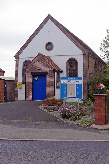
Despite its small size, Oldbury offers a range of amenities for its residents. The village is home to a well-regarded primary school, providing education for local children. Additionally, there is a community hall that hosts various events and gatherings, allowing residents to come together and socialize.

For those seeking outdoor activities, Oldbury is surrounded by stunning countryside, offering ample opportunities for walking, hiking, and cycling. The nearby Warwickshire countryside is dotted with charming villages and historic landmarks, providing a wealth of exploration options. Moreover, the village is conveniently located near major road networks, allowing for easy access to nearby towns and cities.

Overall, Oldbury is a serene and idyllic village that offers a tranquil escape from the hustle and bustle of urban life. Its rich history, natural beauty, and sense of community make it an appealing place to reside.

If you have any feedback on the listing, please let us know in the comments section below.
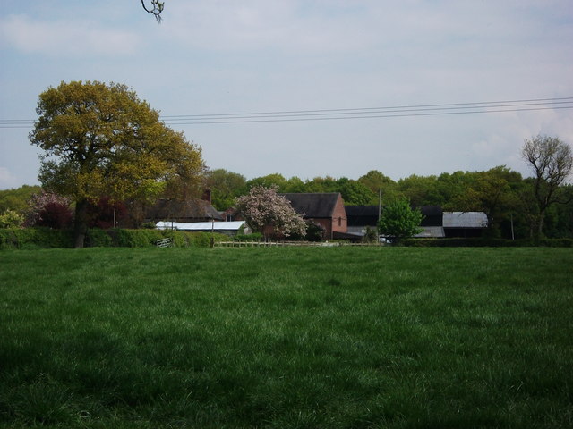
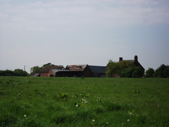
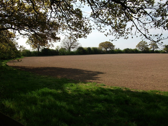
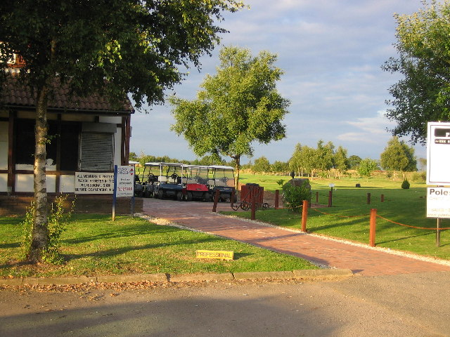
Oldbury Images

Images are sourced within 2km of 52.548778/-1.540732 or Grid Reference SP3194. Thanks to Geograph Open Source API. All images are credited.

Ridge Lane Methodist Church This Methodist church was built in 1931 and serves the village of Ridge Lane both as a place of worship and as a community centre. It is used, among other things, for regular meetings of the Women's Institute, a youth club and a ladies' group.
Ridge Lane Methodist Church
This Methodist church was built in 1931 and serves the village of Ridge Lane both as a place of worship and as a community centre. It is used, among other things, for regular meetings of the Women's Institute, a youth club and a ladies' group.
Track into the woods from Monks Park Lane
Looking uphill on Monks Park Lane towards Ridge Lane Monks Park Wood is on the right of the lane. Ridge Lane is a hamlet just up the lane, which is a bit confusing as there is a lane called Ridge Lane in Ridge Lane.
Looking uphill on Monks Park Lane towards Ridge Lane
Monks Park Wood is on the right of the lane. Ridge Lane is a hamlet just up the lane, which is a bit confusing as there is a lane called Ridge Lane in Ridge Lane.
Ridge Lane from the White Hart car park
Path in Bratts Waste With a fallen tree's roots.
Path in Bratts Waste
With a fallen tree's roots.
Church End Brewery  This somewhat uninspiring building, tucked away down a narrow driveway between houses in Ridge Lane, houses both the Church End Brewery and a bar selling a range of its beers. There is a large car park and beer garden. Church End Brewery was originally established in 1994, although not on this site; as well as the brewery tap here the company owns another pub at Stoke Golding in Leicestershire.
Church End Brewery
This somewhat uninspiring building, tucked away down a narrow driveway between houses in Ridge Lane, houses both the Church End Brewery and a bar selling a range of its beers. There is a large car park and beer garden. Church End Brewery was originally established in 1994, although not on this site; as well as the brewery tap here the company owns another pub at Stoke Golding in Leicestershire.
Houses at Ridge Lane near Nuneaton
Postbox and houses at Ridge Lane
Field and cows next to Purley Chase Lane The houses in the distance are at Ridge Lane.
Field and cows next to Purley Chase Lane
The houses in the distance are at Ridge Lane.
Looking towards Ridgelane
Radio Masts at Ridge Lane Ridge Lane is a one-street (a lane I guess) hamlet to the North West of Nuneaton.
Radio Masts at Ridge Lane
Ridge Lane is a one-street (a lane I guess) hamlet to the North West of Nuneaton.
Ridge Lane main/only street A view down the one road that makes up Ridge Lane, North West of Nuneaton.
Ridge Lane main/only street
A view down the one road that makes up Ridge Lane, North West of Nuneaton.
Ox Hayes Farm, Church End A zoom view of Ox Hayes Farm near Church End. I would have got closer but it was a bit muddy and I had on my nice shoes (my wife would kill me!)
Ox Hayes Farm, Church End
A zoom view of Ox Hayes Farm near Church End. I would have got closer but it was a bit muddy and I had on my nice shoes (my wife would kill me!)
Lady Wood Farm, Ridge Lane
The rear of Ox Hayes Farm Seen from the path to Ridge Lane.
The old barns here are in a very derelict condition.
The rear of Ox Hayes Farm
Seen from the path to Ridge Lane. The old barns here are in a very derelict condition.
Distant view of Ridge Lane masts View from the Centenary Way footpath.
The Birchleys wood is on the left of the field, and Bentley woods in the far distance.
Distant view of Ridge Lane masts
View from the Centenary Way footpath. The Birchleys wood is on the left of the field, and Bentley woods in the far distance.
Cows and Ridge Lane transmission masts
Field near Ox Hayes Farm On the edge of the gridsquare, a view towards Ox Hayes Farm from a footbridge over the stream. The public footpath turns left here and goes along the field boundary on the left.
Field near Ox Hayes Farm
On the edge of the gridsquare, a view towards Ox Hayes Farm from a footbridge over the stream. The public footpath turns left here and goes along the field boundary on the left.
Show me another place!

Oldbury is located at Grid Ref: SP3194 (Lat: 52.548778, Lng: -1.540732)

Administrative County: Warwickshire

District: North Warwickshire

Police Authority: Warwickshire

What 3 Words

///snipped.clarifies.token. Near Hartshill, Warwickshire

Related Wikis

Oldbury, Warwickshire

Oldbury is a hamlet and former civil parish about 2 miles from Atherstone, now in the parish of Hartshill, in the North Warwickshire district, in the county...
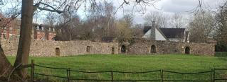
Hartshill Castle

Hartshill Castle is a ruined castle in the village of Hartshill on the outskirts of Nuneaton, Warwickshire (grid reference SP325942). It is on Historic...
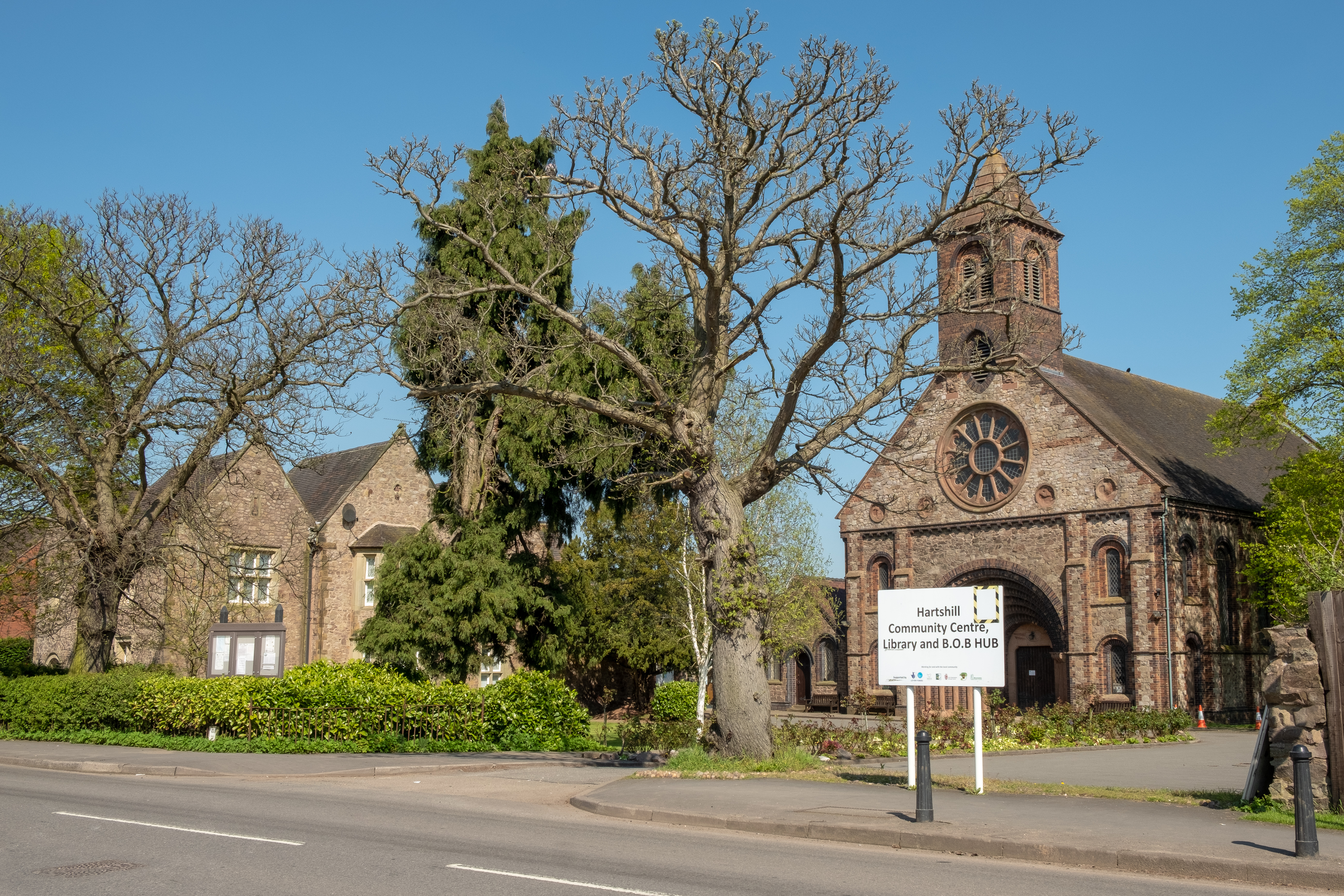
Hartshill

Hartshill is a large village and civil parish in North Warwickshire, England, 2.5 miles (4 km) north-west of the town of Nuneaton. The parish borders the...

Hartshill Academy

Hartshill Academy (formerly Hartshill School) is a mixed secondary school located in Hartshill area of Nuneaton in the English county of Warwickshire.Feeder...

Jee's Harts Hill Granite and Brick Company's works railways

Jee's Harts Hill Granite and Brick Company's works railways consisted of a narrow gauge light railway and a standard gauge works railway at Hartshill station...

Mancetter

Mancetter is a village and civil parish in North Warwickshire, England at the crossing of Watling Street over the River Anker. The population had reduced...

Atherstone Rural District

Atherstone Rural District was located in the administrative county of Warwickshire, England, from 1894 to 1974. It was named after its main town and administrative...

Manduessedum

Manduessedum or Manduesedum was a Roman fort and later a civilian small town in the Roman Province of Britannia. It was located on and immediately to the...

Nearby Amenities

Located within 500m of 52.548778,-1.540732
Post Box
Postal Code: CV10
Ref: CV10 85
Lat/Long: 52.5478822/-1.5395965
Barrier: kissing_gate
Foot: yes
Lat/Long: 52.5484041/-1.5434093
Barrier: kissing_gate
Foot: yes
Lat/Long: 52.5473657/-1.5421745
Barrier: kissing_gate
Source: survey
Lat/Long: 52.5460026/-1.5384824
Source: survey
Tourism: viewpoint
Lat/Long: 52.5482727/-1.5364405
Barrier: kissing_gate
Source: survey
Lat/Long: 52.5476038/-1.5375687
Barrier: kissing_gate
Lat/Long: 52.547703/-1.5342958
Oldbury
Place: hamlet
Lat/Long: 52.5481331/-1.539594
Bench
Backrest: yes
Material: wood
Lat/Long: 52.5477276/-1.5350907
Bench
Backrest: yes
Material: wood
Lat/Long: 52.5481523/-1.5358624
Bench
Backrest: yes
Material: wood
Lat/Long: 52.5483763/-1.5362371
Bench
Backrest: yes
Material: wood
Lat/Long: 52.5485954/-1.5366038
The data included in this document is from www.openstreetmap.org. The data is made available under ODbL.

Have you been to Oldbury?

Leave your review of Oldbury below (or comments, questions and feedback).